
Mori Atlas logo
Protected areaIJsselmeer

Understanding the mapped landscape, ecological function, and engineered history of this expansive freshwater reservoir

IJsselmeer: A Detailed Geographic Study of Dutch Hydraulic Engineering and Protected Wetlands

IJsselmeer represents one of the most ambitious feats of water engineering in northwestern Europe, transforming a former saltwater inlet into a massive freshwater lake. This protected landscape serves as a critical wetland habitat for migratory waterbirds while functioning as a central hydrological hub for the Dutch polder systems. The region offers unique insight into the intersection of human-made infrastructure, such as the Afsluitdijk, and the evolution of reclaimed coastal ecosystems.

freshwater lakeartificial lakewetlandimportant bird areaNatura 2000water engineering
An illustration showing a mountain range with a cascading waterfall flowing into a lake, surrounded by a coniferous forest under a soft sun.

IJsselmeer

Protected area

Park overview

Structured park overview, official facts, and landscape profile for IJsselmeer

IJsselmeer park facts, protected area profile, and essential visitor context

Review the core facts for IJsselmeer, including designation, size, terrain, visitor scale, habitats, and operating context in one park-focused overview.

About IJsselmeer

The IJsselmeer occupies a central place in both Dutch geography and the long historical narrative of Dutch water management. The lake is bordered by the old mainland coast of North Holland from Den Oever to Enkhuizen, the Frisian coast between roughly Cornwerd and Lemmer, and the dikes of Flevoland's polder landscapes: the Noordoostpolder, Oostelijk Flevoland, and the Houtribdijk, which separates the IJsselmeer from the adjacent Markermeer to the south.

Although the lake is large in extent, it is comparatively shallow, with a sandy bottom shaped in part by the former tidal channels of the Zuiderzee, deposited sediments brought in by the river IJssel, and ongoing dredging for sand and shipping channels. The deepest point lies off the coast of Lelystad and is only about nine meters below sea level. Despite being artificial in origin, the IJsselmeer has over decades acquired a rich ecological character, with marshy fringes, shallow under-water banks, and artificial islands that together support a large and diverse bird community.

Today the lake serves as a multifunctional landscape: it supplies freshwater to surrounding provinces, supports inland shipping toward the northern Netherlands and Germany, hosts recreational boating and sailing, and is increasingly used for wind energy generation, with major onshore and offshore wind farms along both the Flevoland and Frisian shores. At the same time, its ecological function remains central, with ambitious fish migration projects and continuous management aimed at preserving its bird populations and aquatic habitats amid shifting climate conditions.

Quick facts and research context for IJsselmeer

The IJsselmeer is the largest freshwater lake in the Netherlands and lies in the center of the country, bordered by the historic coastal regions of North Holland and Friesland and the reclaimed polder province of Flevoland. Its surface area of about 1,133 square kilometers makes it one of the largest enclosed lakes in Europe, although it is notably shallow, averaging only a few meters in depth.

Because it was created by damming a former arm of the sea, the lake exists within a managed water system defined by polders, dikes, sluices, and pumping stations. It is also a Natura 2000 site, part of a wider Dutch network of protected nature areas, and holds formal recognition as an Important Bird Area under BirdLife International.

Protection and recognition

Documented terrestrial conservation boundaries and Ramsar site records

IJsselmeer Protection Status and International Wetland Recognition

Terrestrial conservation frameworks define the protected area designation for IJsselmeer across recognized international databases. Official Ramsar site records establish the baseline for formal wetland recognition and administrative management scope.

International recognition

Protection details

Protection scope
Terrestrial
Transboundary protection
No
Park context

Deeper park guide and search-rich context for IJsselmeer

IJsselmeer history, landscape, wildlife, and travel context

Explore IJsselmeer through its history, landscape character, ecosystems, wildlife, conservation priorities, cultural context, and seasonal travel timing in a structured park guide built for atlas discovery and search intent.

Why IJsselmeer stands out

The IJsselmeer is best known as a textbook example of large-scale Dutch water engineering, where the construction of the Afsluitdijk converted a former inlet of the North Sea into one of Europe's largest artificial freshwater lakes. It is equally renowned as a wetland of international importance for waterbirds, hosting large seasonal populations of ducks, geese, swans, and shorebirds that depend on its open water, fringed shoals, and newly created bird islands. The lake's combination of engineered hydrology, ecological richness, and cultural symbolism of Dutch land-making gives it a distinctive identity among European lake landscapes.
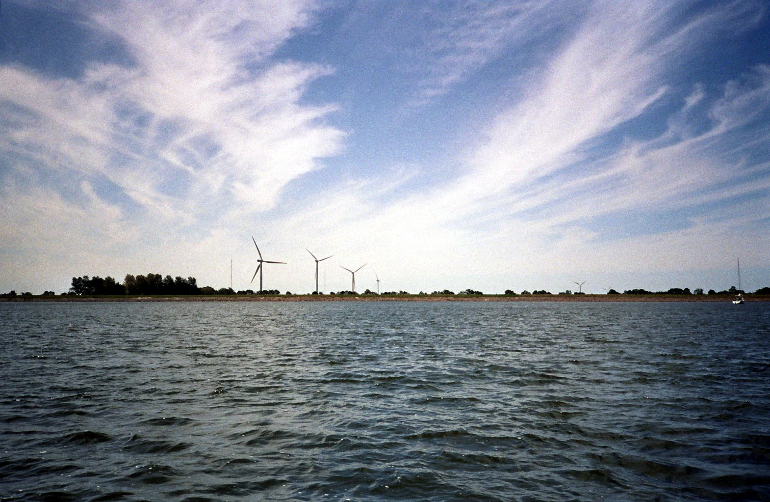
A wide shot of the IJsselmeer lake with a line of wind turbines on the distant shoreline under a bright, wispy-clouded sky.
A view of the IJsselmeer shoreline near Medemblik, featuring wind turbines along the coast.

IJsselmeer history and protected-area timeline

The story of the IJsselmeer begins long before the lake itself existed. In the early Middle Ages the inland body that later became the Zuiderzee was known as the Almere, a freshwater lake recognized by the Romans under the name Flevomeer. Beginning in the early 1200s, repeated storm surges opened up connections to the North Sea, gradually transforming the Almere into the brackish Zuiderzee, an opening tidal sea with deep scour channels caused by ebb and flow currents.

The idea of closing off the Zuiderzee and reclaiming parts of its seabed as agricultural land took shape at the end of the 19th and the early 20th centuries, formalized in the Zuiderzee Act of 1918 under the guidance of engineer Cornelis Lely. After earlier interim works such as the Amsteldiepdijk (1920 to 1925) and the experimental polder at Andijk (1927), the Afsluitdijk, the defining dam linking North Holland to Friesland, was completed on 28 May 1932. The official renaming of the newly enclosed waters as IJsselmeer took place on 20 September 1932, while the remaining tidal sea to the north became the Waddenzee.

Once isolated from the North Sea, the lake's salinity fell rapidly, becoming virtually fresh by 1934 and reaching a new biological equilibrium by around 1939. A later major milestone came in 1976, when the Houtribdijk between Lelystad and Enkhuizen split off the southern portion as the Markermeer. Further modifications followed, including fish-passage facilities and a fish migration river at Kornwerderzand, alongside adaptation projects at the Afsluitdijk that anticipate a future of rising sea levels.

IJsselmeer landscape and geographic character

The IJsselmeer is a strikingly open, low-horizon landscape. Most of its perimeter is defined not by natural shoreline but by engineered dikes: the long arc of the Afsluitdijk to the north, the Houtribdijk to the south, and the straight lines of polder dikes on the Flevoland side. The surrounding land is itself a patchwork of reclaimed polders and old coastal towns, with little natural elevation to break the view across the water.

The lake's bed holds visible traces of its marine past. Former tidal channels, deeper slenken, were carved into the seabed at the time the area was still part of the Zuiderzee, and after the closure of the Afsluitdijk these deeper zones have been slowly filling in with finer sediments carried down by the IJssel. The substrate is mostly sandy, with clay and loam in the deeper former channels and occasional patches of glacial till near the surface.

Small islands add texture to an otherwise expansive surface. Notably, De Kreupel, a roughly seventy-hectare artificial island near Andijk, was constructed as a bird sanctuary with sheltered mooring facilities, while IJsseloog in the Ketelmeer serves as an environmental containment island. Other planned islands include a work island connected to the construction of Windpark Fryslân near Kornwerderzand, designed to be transformed into a nature reserve after construction.

In winter the lake sometimes freezes over, transforming the IJsselmeer into a vast ice-skating surface and a scene deeply embedded in Dutch cultural imagination. The flat, open, sky-dominated setting, with its small harbor towns and historic Hanseatic cities, gives the lake its recognizable hybrid character of engineered nature and lived-in landscape.
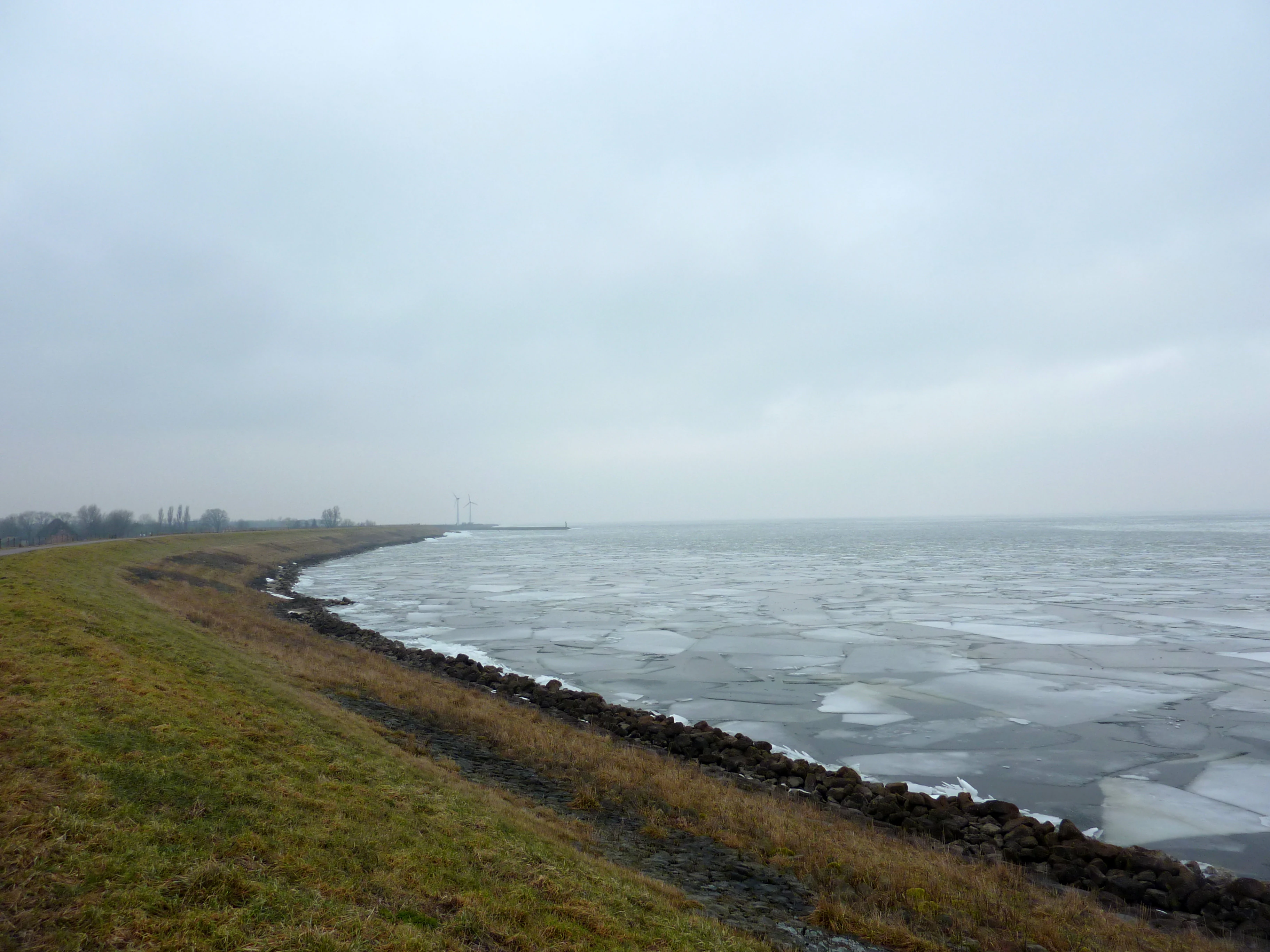
A wide landscape view of a partially frozen lake with ice floes covering the water, viewed from a grassy embankment under a cloudy, overcast sky.
The frozen surface of the IJsselmeer near Enkhuizen, Netherlands.

IJsselmeer ecosystems, habitats, and plant life

Ecologically, the IJsselmeer is a freshwater wetland of considerable scale and importance. Its shallow waters support submerged aquatic plants, benthic communities that thrive on the sandy and muddy bottom, and an open-water habitat that, combined with reed-fringed shores and newly constructed islands, attracts huge numbers of waterbirds throughout the year.

The lake's ecological story is one of transformation. Once it was part of the brackish tidal Zuiderzee, a habitat dominated by saltwater invertebrates and tidal flats. After enclosure, the rapid loss of salinity was a profound ecological shock, and the maturing of a new biological balance took several years. The freshwater phase brought different fish species into dominance, while ornithological interest shifted toward species that favor calm, rich shallow lakes and their fringes.

The lake is part of the Natura 2000 network, classified as site number 72 in the Dutch Natura 2000 register, and it operates under formal European nature protection frameworks alongside surrounding protected waters such as the Ketelmeer and Vossemeer (75), Markermeer and IJmeer (73), and Zwarte Meer (74). The combination of artificial islands, reed buffers, and open water creates a mosaic of habitats that together produce the lake's distinctive ecological character.

IJsselmeer wildlife and species highlights

The IJsselmeer is internationally recognized as an Important Bird Area, a designation that places it among the most significant sites in northwestern Europe for waterbird populations. Its open waters, shallow margins, and protected islands support large numbers of species across several seasons.

The birdlife includes breeding and wintering populations of species such as great cormorant, brent goose, whooper swan, tundra swan, black-tailed godwit, ruff, black-headed gull, gadwall, tufted duck, Eurasian spoonbill, common goldeneye, smew, northern pintail, common pochard, greater scaup, common tern, black tern, black-headed gull, curlew, and many other waterbirds. The lake also supports genetic pools of emblematic species such as the black-tailed godwit, the national bird of the Netherlands, and large winter flocks of white-fronted and bean geese.

Fish stocks too have been central to the lake's identity. The fisheries historically focused on species such as smelt (spiering), flounder (bot), and eel (paling), and modern management efforts, including the fish migration river at Kornwerderzand and fish-friendly sluice management, are specifically aimed at restoring migratory fish runs that were lost after the lake was closed off from the sea.

IJsselmeer conservation status and protection priorities

Conservation significance is fundamental to the IJsselmeer's identity. Within the European Natura 2000 network the lake is recognized as a designated site because of its importance for specific bird populations and its broader ecological character. Its status as an Important Bird Area further reinforces its conservation profile.

Ongoing ecological management addresses both long-standing shifts and emerging climate-driven pressures. The conversion from salt to fresh water in the 1930s changed the lake's biology permanently, and decades later, the construction of the Houtribdijk changed the hydrology of the southern part of the original lake by isolating the Markermeer. Climate change is now a central driver of future conservation planning: rising sea levels mean that natural discharge through the existing sluice complexes at Den Oever and Kornwerderzand will eventually be insufficient, and additional pumping capacity in the Afsluitdijk is being prepared for that future scenario.

Fish migration has received particular attention. After the closure of the Zuiderzee, saltwater migratory species such as smelt, flounder, and eel were largely cut off from their inland feeding grounds. A fish passage at Den Oever, a fish migration river at Kornwerderzand, and fish-friendly sluice operations have been introduced specifically to reopen these routes and to reconnect IJsselmeer ecology with the Waddenzee ecosystem to the north.

IJsselmeer cultural meaning and human context

The IJsselmeer is deeply woven into Dutch cultural identity, in large part because its creation is a defining chapter in the broader history of the Zuiderzee Works. The imagination of an entire nation reclaiming land and water is embodied in the lake, in the Afsluitdijk, and in the surrounding polder landscapes that still feel very much like a deliberate national project.

The towns around the lake carry rich histories: the former Zuiderzee ports of Enkhuizen, Medemblik, and Hindeloopen bear the memory of an era when this water was open sea, with saltwater trade, fishing, and shipbuilding. These places still define the cultural identity of the IJsselmeer shore, with their historic architecture, harbor museums, and coastal festivals.

The lake also plays a role in Dutch leisure culture. Recreational sailing, swimming, kite and windsurfing, and in cold winters, ice skating have long drawn visitors to its shores, building an intimate connection between the population and this vast body of water. The literary imagination of the Dutch inland sea has been documented in modern works such as Ronald Nijboer's exploration of the transition from the Zuiderzee era to the present-day IJsselmeer.

Top sights and standout views in IJsselmeer

The IJsselmeer's profile is shaped by four distinct features that together explain why it stands out among European lake landscapes. First, its origin as an enclosed former sea, marked by the Afsluitdijk, makes it a tour de force of practical hydrology. Second, its scale and openness give it a distinctive sense of landscape: a body of water stretching to the horizon, framed by human-made dikes rather than by mountains or forest.

Third, its ecological importance is internationally recognized, with both a Natura 2000 designation and BirdLife Important Bird Area status placing it firmly on the European conservation map. And fourth, its cultural and recreational value to the Netherlands, from Hanseatic coastal towns to windsurfing beaches, makes it a place where engineering, ecology, and everyday life converge.

Best time to visit IJsselmeer

The character of the IJsselmeer changes appreciably with the seasons. Spring and autumn bring the lake's most visible bird activity, as migratory waterbirds pass through or settle in large numbers, and the lakescape is at its most dynamic ornithologically. Summer offers calm, open water ideal for sailing, swimming, and visits to the surrounding coastal towns, with long daylight hours and typically mild weather.

Winter is the lake's most distinctive season. When frost is sustained, the lake can ice over and historically becomes a vast natural skating surface, an event deeply embedded in Dutch culture. Frigid weather also gives the lake its starkest, most austere beauty, with low light over the dikes, frozen harbor towns, and occasional views all the way to the Afsluitdijk.
Monthly climate preview

Measured monthly weather variations and representative climatology for IJsselmeer

IJsselmeer Climate Normals, Long-Term Temperature and Precipitation Patterns

Representative coordinate records show average monthly temperatures ranging from 4.04 degrees to 17.89 degrees Celsius alongside steady daily precipitation patterns across the year. Reviewing the complete twelve-month climatology profile provides deeper insight into measured long-term environmental rhythms.
Annual mean11 °C
4 °C18 °C
Jan
Feb
Mar
Apr
May12°
Jun15°
Jul17°
Aug18°
Sep16°
Oct12°
Nov
Dec
Warmest month
August

17.9 °C

Coolest month
February

4 °C

Wettest month
October

2.8 mm/day

Driest month
April

1.4 mm/day

Park location guide

Geography guide, regional context, and park location map for IJsselmeer

IJsselmeer park geography, regions, and map view in Netherlands

Understand where IJsselmeer sits in Netherlands through a broader geographic reading of the surrounding landscape, nearby location context, and its mapped position within the national park landscape.

How IJsselmeer fits into Netherlands

The Netherlands is a low-lying coastal country in Northwestern Europe, famous for its extensive dike and canal systems that reclaim land from the sea. It consists of twelve provinces and is known for tulips, windmills, and cycling culture. The country is a founding member of the European Union with Amsterdam as its capital and The Hague as the seat of government.

Wider geography shaping IJsselmeer in Netherlands

The Netherlands is located in Northwestern Europe along the North Sea coastline to the north and west. It borders Germany to the east and Belgium to the south. The country is notably flat, with a significant portion of its territory lying below sea level, protected by dikes and dune systems. It consists of twelve provinces and also includes overseas municipalities in the Caribbean.

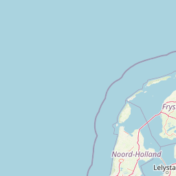
Map view of IJsselmeer

Use this park location map to pinpoint IJsselmeer in Netherlands, understand its exact geographic position, and read its mapped placement within the surrounding landscape more clearly.

Pigeon | © OpenStreetMap contributors
Recorded earthquake history

Explore the Historical Earthquake Records for the IJsselmeer Region

Examine the technical dataset of seismic events recorded in the vicinity of the IJsselmeer. This MoriAtlas collection offers a transparent view of historical activity, allowing for a structured comparison of event data across this major Dutch freshwater landscape and its surrounding polder geography.

IJsselmeer Earthquake History

Catalogued events

4 events

Strongest magnitude

Magnitude 3.8

Most recent event

Jun 21, 2004

This history includes earthquakes recorded inside the park or within 50 km of its borders

Explore the open waters, engineered dikes, and wetland habitats of Europe's largest artificial freshwater lake.

IJsselmeer Photos, Landscapes, and Protected-Area Scenery Visualized

Visual records capture the striking low-horizon terrain, engineered shoreline dikes, and expansive freshwater expanses that define the IJsselmeer region. Examining these protected wetland habitats reveals the unique visual character of Dutch water management and international bird sanctuaries.

A wide shot of the IJsselmeer lake with a line of wind turbines on the distant shoreline under a bright, wispy-clouded sky.

A lone sailboat with a white sail moving across the vast, calm, blue water of the IJsselmeer, with a distant flat shoreline visible on the horizon under a clear sky.

A wide landscape view of a partially frozen lake with ice floes covering the water, viewed from a grassy embankment under a cloudy, overcast sky.

Park atlas

Compare adjacent wetland reserves and connected Dutch landscape geography

Parks Near IJsselmeer and Related Protected Areas in the Surrounding Region

Explore protected areas and wetland habitats situated around the IJsselmeer basin to compare regional conservation networks. Extending the view beyond this artificial freshwater lake reveals broader ecological patterns across neighboring polder landscapes.
Protected areaFlevoland
0 km away#1 closest

Southeast

Ketelmeer & Vossemeer: Protected Area Geography, Boundaries, and Landscape Context

Mapping freshwater lake dynamics in the Flevoland and Overijssel border region.

Ketelmeer & Vossemeer constitutes a significant Natura 2000 wetland complex where riverine floodplains meet engineered polder landscapes. This analysis provides insights into the site's role as a critical Important Bird Area and its position within the broader IJssel delta network of lakes and water channels.

Area
38.43 km²
Established
2013
Relief
Lowland
Climate
Temperate
National parkFlevoland
0 km away#2 closest

South

Nieuw Land National Park: Mapped Wetland Landscape on Flevoland's Reclaimed Land

Protected area geography and ecological discovery in the Netherlands

Nieuw Land National Park offers a distinctive protected landscape forged on land recently reclaimed from the sea in the Dutch province of Flevoland. This national park is characterized by its vast expanse of wetlands, artificial islands like the Marker Wadden, and critical importance for migratory bird populations. Delve into the park's geographic context and mapped features to understand its unique conservation value and role within the wider European atlas of protected areas.

Area
289 km²
Established
2018
IUCN
II
Relief
Lowland
A horizontal watercolor painting depicting a wetland landscape with grassy foreground, bare skeletal trees, and rolling green hills under a soft, pale sky.
Nature reserveFlevoland
5.3 km away#3 closest

South

Oostvaardersplassen Nature Reserve: Mapped Geography and Protected Area Context

Explore the marshland and polder terrain in Flevoland, Netherlands

Oostvaardersplassen represents a landmark in modern Dutch conservation, covering a 5,600-hectare mosaic of mudflats, reed beds, and willow thickets. This nature reserve, located between Almere and Lelystad, demonstrates the evolution of a young reclaimed landscape. It provides an essential habitat for marsh birds and large herbivores within the Nationaal Park Nieuw Land region, offering a distinct study in polder-based ecological management and wetland geography.

Area
56 km²
Established
1974
Relief
Lowland
Climate
Temperate
Nature reserveOverijssel
13 km away#4 closest

Southeast

Zwarte Meer Nature Reserve: Exploring the Wetland Geography of the Dutch Border Lakes

A vital protected freshwater habitat in the province of Overijssel.

Zwarte Meer stands as a cornerstone of the Dutch border lake system, offering a vast expanse of open water and protected reed marshes. This nature reserve provides essential ecological continuity within the regional landscape of Overijssel, serving as a sanctuary for waterbirds and a prime example of managed wetland terrain within the European protected area network.

Area
21.62 km²
Established
1940
Relief
Lowland
Climate
Temperate
Watercolor painting of a wetland scene with a winding river, grassy areas, and distant hills
National parkOverijssel
15 km away#5 closest

East

Weerribben-Wieden National Park: A Premier Lowland Peat Bog National Park in Overijssel

Explore mapped protected wetlands and unique hydrological landscapes.

Weerribben-Wieden National Park stands as a remarkable example of a large-scale lowland peat bog ecosystem, recognized as the most extensive and well-preserved in Northwestern Europe. Located in the Overijssel province, this protected area showcases a complex mosaic of interconnected waterways, expansive reed beds, and marshy woodlands. Our platform provides structured geographic context, enabling detailed map-based discovery of the park's unique terrain and ecological significance as a vital conservation landscape.

Area
105 km²
Established
1992
IUCN
II
Relief
Lowland
Watercolor painting of a coastal landscape featuring dunes, a lake, and distant mountains
National parkNorth Holland
19 km away#6 closest

Northwest

Duinen van Texel National Park: Protected Coastal Dune and Wetland Atlas

Explore the mapped geography and protected landscape of North Holland.

The Duinen van Texel National Park offers a rich exploration of protected coastal dunes and dynamic wetland environments on Texel Island. This atlas-focused page details the park's unique landscape features, including active dune formation at De Hors and the tidal Slufter valley. Understanding its geographic context within North Holland provides a crucial aspect of its protected area status and ecological significance for regional mapped terrain.

Area
43 km²
Established
2002
IUCN
II
Visitors
265K annual
Nature reserveFlevoland
19 km away#7 closest

South

Lepelaarplassen Nature Reserve: Protected Polder Wetlands and Marshland Geography

Ecologically significant wetland habitats in Flevoland

Lepelaarplassen is a protected wetland reserve situated on the edge of the young Flevoland polder. Featuring a blend of excavated lakes, willow marshes, and expansive reed fringes, the area provides essential habitat for colonial breeding birds and migratory species. This detailed look covers the landscape structure and regional geography of one of the most vital wetland zones along the Oostvaardersdijk.

Area
5 km²
Established
1971
Relief
Lowland
Access
Moderate access
Protected areaNetherlands
26 km away#8 closest

Southeast

Veluwe: A Comprehensive Geographic Atlas of the Central Netherlands Protected Area

Glacial moraines, heathlands, and inland sand systems

Investigate the Veluwe, a premier protected area in the Gelderland province characterized by its historic push moraines and extensive ecological zones. The region encompasses significant sand drift complexes, dense woodlands, and vital spring-fed streams, offering a clear view of the diverse natural terrain found throughout the central Netherlands.

Area
1,000 km²
Relief
Upland
Climate
Temperate
Access
Easy access

Common questions about visiting, size, designation, and location context for IJsselmeer

IJsselmeer FAQs for park facts, access, geography, and protected area context

Find quick answers about IJsselmeer, including protected-area facts, park geography, trail and visitor context, and how the park fits into its surrounding country and regional landscape.
MoriAtlas Explorer

Continue Your Protected Areas Search Across the Global Atlas

Deepen your exploration by continuing the structured search for national parks and protected areas worldwide. Utilize the comprehensive filtering capabilities to compare different conservation landscapes and refine your understanding of global park geography. Discover more about the distribution and characteristics of protected natural areas.

Global natural geography