
Mori Atlas logo
Protected areaVeluwe

Analyzing the glacial push moraine topography, inland sand drifts, and protected forest mosaics of the Gelderland region

Veluwe Protected Area: A Geographic and Mapped Analysis of the Central Netherlands Landscape

The Veluwe stands as the most significant protected region in the central Netherlands, defined by its complex mosaic of Saalian push moraines, vast heathlands, and the largest active inland sand drifts in Western Europe. This geographic entity spans over 1,000 square kilometers, hosting a distinct topography of ice-age ridges that reach elevations like the Signaal Imbosch. Within these protected boundaries, the terrain transitions from dense deciduous and coniferous forests to spring-fed stream valleys and open fens, creating a unique wilderness habitat within the Dutch lowlands.

sand driftsheathlanddeciduous forestconiferous forestpush moraineglacial landscape
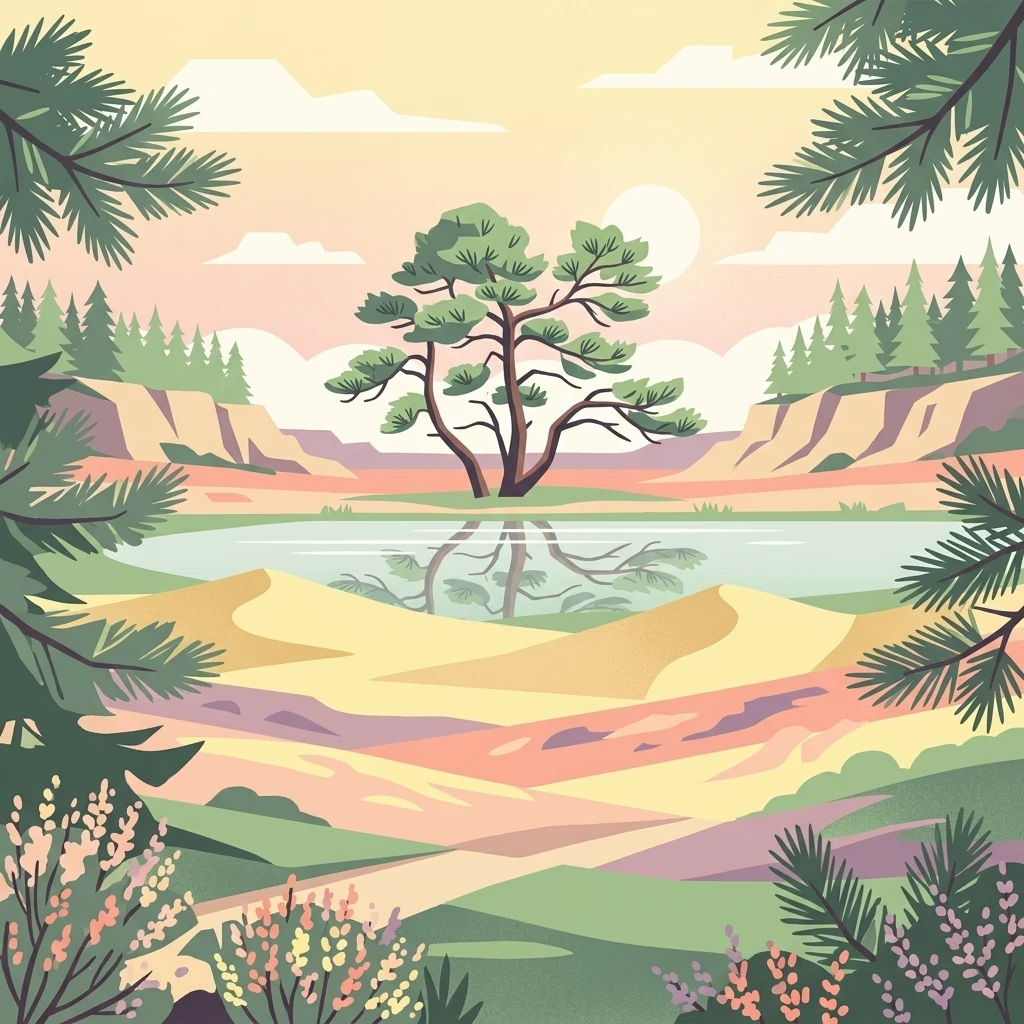
A digital illustration depicting a calm pond reflecting a solitary tree, set amidst sandy dunes and rolling hills under a soft sunset sky, framed by evergreen boughs.

Veluwe

Protected area

Park overview

Structured park overview, official facts, and landscape profile for Veluwe

Veluwe park facts, protected area profile, and essential visitor context

Review the core facts for Veluwe, including designation, size, terrain, visitor scale, habitats, and operating context in one park-focused overview.

About Veluwe

The Veluwe is the largest natural region in the central Netherlands, stretching across much of the province of Gelderland. Bounded by the IJssel valley to the north, the Veluwerandmeren to the east, the Nederrijn to the south, and the Gelderse Vallei to the west, the region forms a clearly demarcated block of woodland, heath, and sand drift that feels almost like an enclave of wilderness in a densely populated country.

Geologically, the Veluwe is defined by the push moraines deposited by glaciers during the Saalian glaciation some 150,000 years ago. These ridges of compressed sand and gravel form the highest natural elevations in the Netherlands outside of South Limburg, with the Signaal Imbosch near Rheden reaching 110 meters. During the subsequent Weichselian glaciation, although the ice itself did not reach this far, permafrost and strong winds reshaped the surface, depositing layers of coversand and carving the dry valleys that still mark the landscape today.

Ecologically, the Veluwe is extraordinarily diverse for such a small area. About 70 percent of the surface is forested, with both deciduous woods dominated by oak and beech and extensive plantations of Scots pine that were established between 1895 and 1920 to stabilize drift sands. Heathland covers around 15,000 hectares, making it by far the largest such complex in the country. Inland sand dunes, including the Kootwijkerzand, the Harskampse Zand, the Hulshorsterzand, and the Wekeromse Zand, represent one of the rarest habitat types in northwestern Europe. Scattered fens, brooks, and spring streams (sprengen) add further variety to the biotope mosaic.

The Veluwe's spiritual and cultural weight is significant. Prehistoric raatakkers (Celtic fields) and burial mounds dot the landscape, and medieval deforestation led to catastrophic soil erosion that turned hundreds of square kilometers into shifting sand. The 20th-century reforestation campaigns, supported by national and provincial programs, restored the woodland and laid the foundation for today's protected area. Major estates such as Kroondomein Het Loo and the Kröller-Müller estate form large green cores within the region, while three national parks, Hoge Veluwe, Veluwezoom, and the broader Veluwe Natura 2000 zone, anchor modern conservation policy. The result is a region that feels both geologically ancient and culturally layered, with continuous human presence stretching back thousands of years.

Quick facts and research context for Veluwe

The Veluwe occupies a roughly 1,000 square kilometer area in the province of Gelderland, central Netherlands, and is bordered by the IJssel river valley, the Randmeren, the Nederrijn, and the Gelderse Vallei. An area of about 912 square kilometers is formally protected as a Natura 2000 site. The landscape features glacial push moraines from the Saalian ice age, with the Signaal Imbosch at 110 meters forming the highest point in the Netherlands apart from South Limburg and the Caribbean Netherlands.

Ecologically, the Veluwe hosts more than 15,000 hectares of heathland, the largest active inland sand drift in Western Europe (Kootwijkerzand), and extensive deciduous and coniferous forest. It is a key area for red deer, wild boar, and recently the returning wolf. The sparsely populated interior contrasts with surrounding cities like Arnhem, Apeldoorn, Ede, and Harderwijk, and three national parks sit within its boundaries.

Protection and recognition

Terrestrial conservation scope and official Natura 2000 network sources for Veluwe

Veluwe Protection Status and Documented International Recognition

Veluwe maintains a terrestrial protection scope backed by documented Natura 2000 network records and formal administrative boundaries. Official recognition data details the administrative designation framework assigned to this protected natural area.
Park context

Deeper park guide and search-rich context for Veluwe

Veluwe history, landscape, wildlife, and travel context

Explore Veluwe through its history, landscape character, ecosystems, wildlife, conservation priorities, cultural context, and seasonal travel timing in a structured park guide built for atlas discovery and search intent.

Why Veluwe stands out

The Veluwe is best known for its mix of ice-age push moraine landscapes, the largest inland sand drifts in northwestern Europe, and the most extensive heathland complex in the Netherlands. The Kootwijkerzand sand drift, the Oldebroekse Heide, and the Signaal Imbosch summit are among the most iconic features. The region is also a stronghold of large mammal wildlife within the Netherlands, with free-roaming red deer, wild boar, and mouflon, and recent recolonization by the European wolf. Its combination of forest, heath, fen, and shifting sand, all easily reachable from major Dutch cities, gives it a unique character unmatched elsewhere in the lowlands.
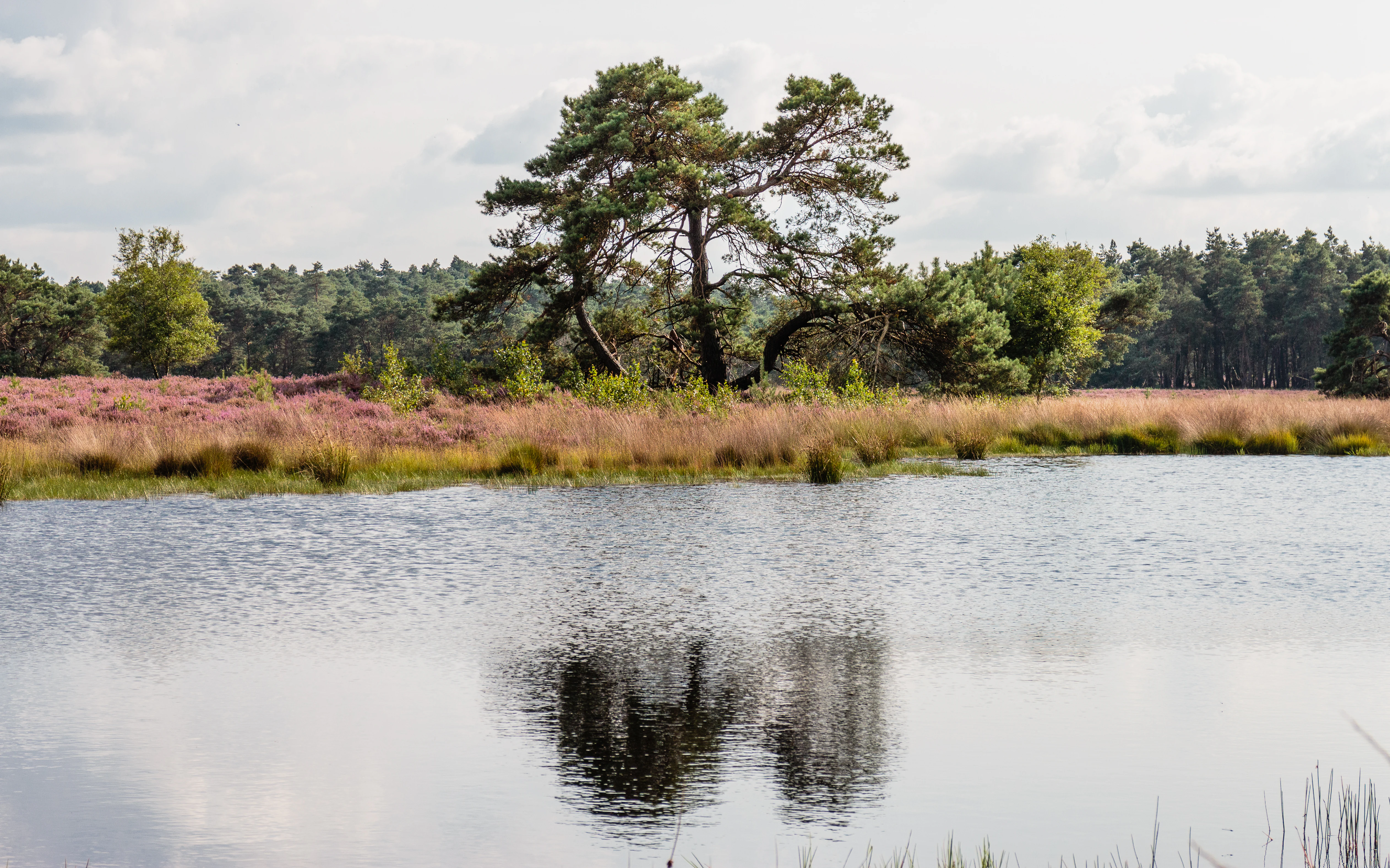
A serene pond in the foreground with a reflection of a large pine tree; background features purple blooming heather and a forest line under a cloudy sky.
A reflective pond at the edge of the heather-covered heathland in the Veluwe region.

Veluwe history and protected-area timeline

The Veluwe has been inhabited since prehistoric times, with Celtic fields (raatakkers) and burial mounds scattered across the landscape. In 2010, archaeologists unexpectedly discovered traces of a 12th-century settlement amid the drift sands of what is now Nationaal Park De Hoge Veluwe, suggesting persistent occupation even in the most exposed, formerly degraded parts of the region.

In the Middle Ages, widespread deforestation for charcoal production to feed the iron industry, combined with intensive agriculture on the poor sandy soils, stripped the land of its protective vegetation. Wind erosion took over, and an estimated one-third of the Veluwe was reduced to active drift sand during this period. Soil and population both collapsed; residents abandoned the area, leaving behind a near-desert of inland dunes. No true primeval forest survived; today nearly all of the Veluwe's woodland is either replanted or historically managed.

A dramatic reversal began in the late 19th century and accelerated after 1895. Large-scale reforestation campaigns, often using Scots pine for its ability to stabilize loose sand, gradually reclaimed the dunes. Around mid-century, large parts of the Veluwe were fenced off for hunting estates, leading to the introduction of various species including wild boar in 1907, European red deer replacements from Eastern Europe, mouflon from the Mediterranean, and even kangaroos from Australia brought in by Anton Kröller of De Hoge Veluwe. Following the year 2000, the province of Gelderland has progressively removed many of these fences and shifted toward a more natural management approach, allowing wildlife populations to mingle more freely.

Reintroduction efforts have continued into recent decades. Wisent (European bison) were released on the central Veluwe heathland from 2015 onward, following earlier successful reintroductions such as the raven. In 2019, wolves were confirmed on the Veluwe for the first time in over 150 years, with a litter of pups later that year. The provincial 'Veluwe 2010' program invested heavily in ecological connection zones to allow isolated populations to expand their gene pools, linking the Veluwe with neighboring reserves in the Netherlands and beyond.

Veluwe landscape and geographic character

The Veluwe landscape is the visible result of two ice ages and centuries of human intervention. The dominant features are the Saalian push moraines, long ridges of compressed river sand and gravel that were shoved upward by advancing glaciers roughly 150,000 years ago. These moraines form the backbone of the region, including the highest point at the Signaal Imbosch (110 meters) near Rheden, followed closely by the Torenberg (107 meters) near Apeldoorn.

Covering and softening these ridges is a younger layer of Weichselian coversand, deposited by persistent cold winds during the last ice age. In many places this sand has been reworked into inland dune systems, most famously the Kootwijkerzand at around 350 hectares, the largest active drift sand area in western Europe. The Kootwijkerzand, Harskampse Zand, Mosselse Zand, Hulshorsterzand, and Wekeromse Zand together create an almost desert-like mosaic of bare sand and recolonizing vegetation, a habitat that has disappeared from most of the surrounding European lowlands.

Water features are subtler but ecologically important. During the Saalian glaciation, glacial lakes formed between the ice and the moraines near Harderwijk and Nunspeet, leaving behind fine-grained deposits. Today the Veluwe is laced with dozens of brooks, including the famous spring-fed streams known as sprengen, which were historically used to power paper mills. Small fens (vennen) dot the terrain, hosting specialized bog vegetation and invertebrates. The overall effect is a landscape of subtle hills, quiet valleys, open heath, and slender streams, an unusual combination for such a densely populated country.
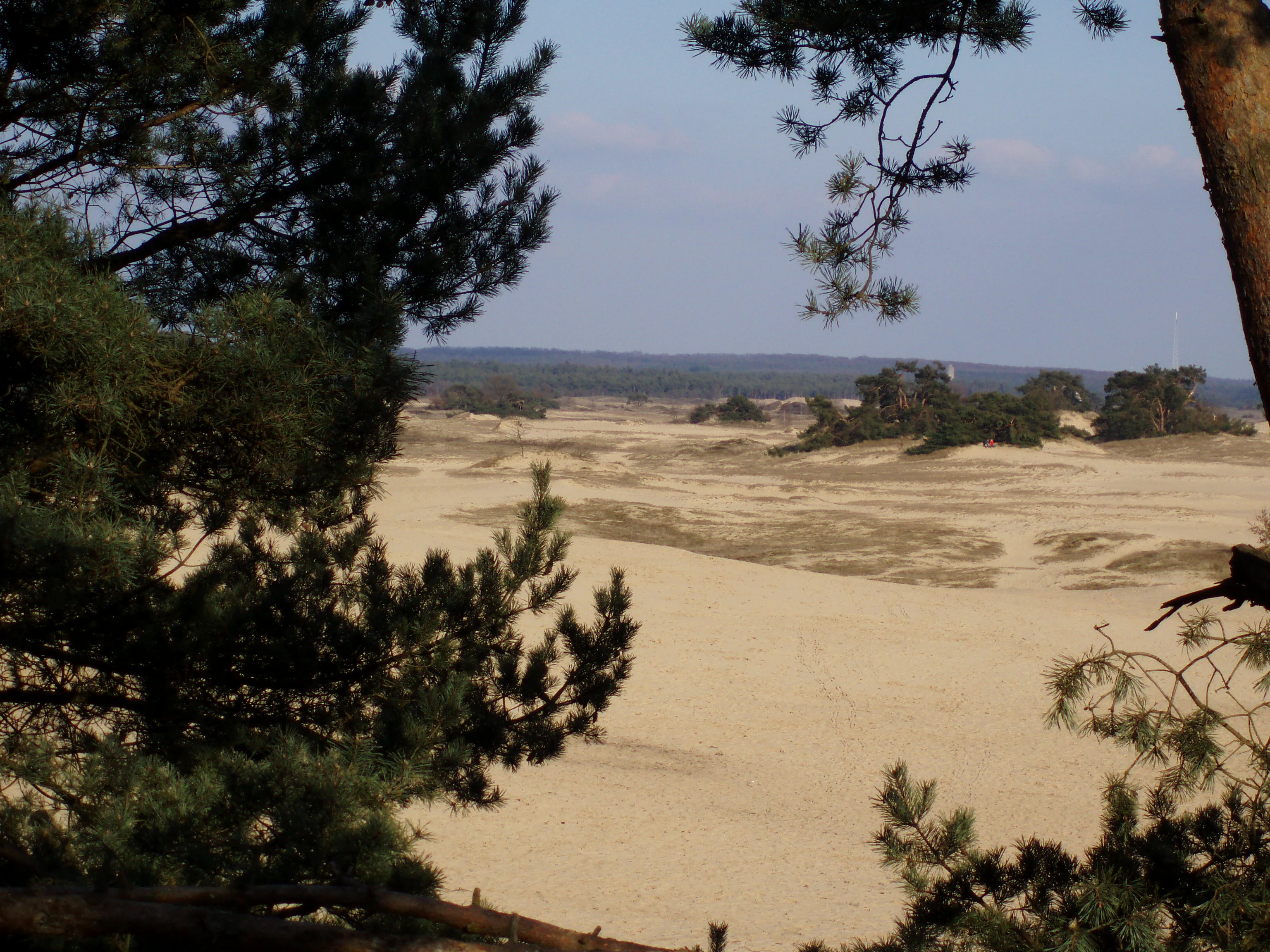
A sandy, desert-like clearing known as Kootwijkerzand, surrounded by pine trees, viewed from a slightly elevated position through pine branches.
The shifting sands of Kootwijkerzand, a prominent landscape feature within the Veluwe region.

Veluwe ecosystems, habitats, and plant life

The ecological character of the Veluwe is shaped by a striking mosaic of habitats packed into a relatively small area. The flagship biotope is heathland, with around 15,000 hectares of dry and wet heath, dominated by common heather (Calluna vulgaris) but including grasses, gorse, broom, and locally common juniper. The heathlands are home to characteristic birds such as the northern wheatear, nightjar, yellowhammer, woodlark, European stonechat, and wryneck, as well as reptiles such as the smooth snake and rare invertebrates like the sand lizard spider.

The inland sand drifts support a specialized community of lichens, including boreal cup lichen and Stereocaulon condensatum, together with insects such as the blue-winged grasshopper and rare butterflies like the tree grayling (Hipparchia statilinus). The fens harbor sundews and various Sphagnum moss species, some of which are actively developing into raised bog conditions, with associated liverworts and dragonflies like the alderfly.

Forest covers roughly 70 percent of the Veluwe and divides into several distinct communities. Old deciduous woods, often on former marke grounds historically managed as coppice, are dominated by oak and beech and shelter woodland flowers like wood anemone and bitter vetch. The pine plantations, established during the early 20th-century reforestation campaigns, support rich communities of fungi and liverworts, while the mixed forests provide edge habitats used by the impressive stag beetle (Lucanus cervus). Scattered spring-fed brooks with their clean, oxygen-rich water support the European bullhead, brook lamprey, and protected amphibians such as the crested newt and alpine newt.
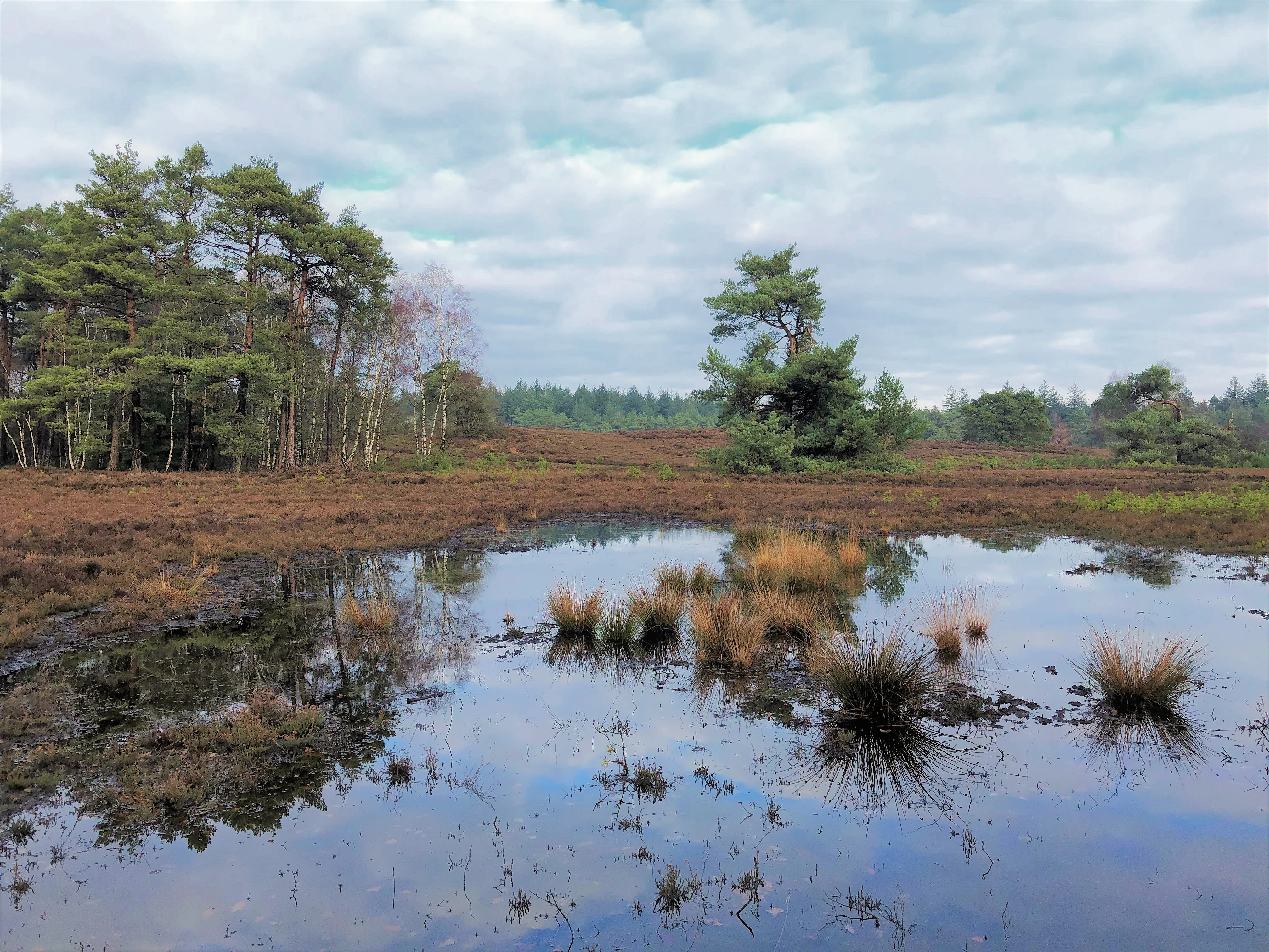
A serene heathland scene with a small, dark pond in the foreground reflecting a cloudy sky and surrounding pine trees.
A small, reflective pond nestled within the characteristic heathland and forest landscape of the Veluwe, Epe, Netherlands.

Veluwe wildlife and species highlights

The Veluwe is the most significant area for large mammals in the Netherlands. Red deer are abundant and traditionally the symbol of the region. Wild boar, originally introduced by Prince Hendrik in 1907 for hunting on the Kroondomein Het Loo, now form self-sustaining populations. The mouflon, introduced for hunting in the mid-20th century, still roams parts of the heathland. In 2019, European wolves were confirmed back on the Veluwe for the first time in over 150 years, with a litter of pups later that year; their presence marks a major milestone for Dutch wildlife recovery.

Larger herbivores are supplemented by the European bison (wisent), which have been gradually reintroduced on the central Veluwe heathland from 2015 onward under the management of Staatsbosbeheer. The raven, a species that had vanished, has been successfully reestablished and now numbers in the dozens, often ranging beyond the original release areas.

Birdlife is equally impressive. Heath specialists such as the black grouse have largely disappeared, though rare attempts at reintroduction continue. The dry heaths still host tree pipits, woodlarks, stonechats, and the increasingly rare wryneck, while pine forests support black woodpeckers and honey buzzards. Deciduous woodlands harbor lesser spotted woodpeckers, tawny owls, and a healthy bat fauna including the rare Leisler's bat. The spring-fed brooks, with their clean water, support the alpine newt, crested newt, and an endemic population of stream bullheads discovered in recent years.
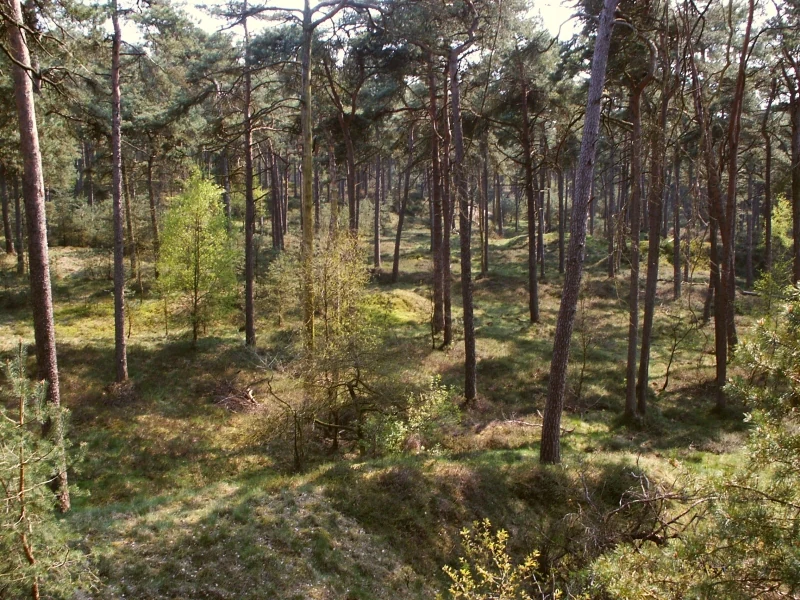
A wide shot looking down into a forest with tall, slender pine trees scattered across a gentle, uneven terrain covered in grass and light green undergrowth.
A woodland scene in the Veluwe region of the Netherlands, featuring tall pine trees and a grassy forest floor.

Veluwe conservation status and protection priorities

The Veluwe holds a central place in Dutch nature conservation. Approximately 912 square kilometers of the region are protected as a Natura 2000 site, formally recognizing its exceptional habitat diversity and the presence of multiple rare and threatened species. Three national parks sit within its boundaries: Hoge Veluwe, Veluwezoom, and other large estates such as Kroondomein Het Loo, managed as continuous conservation areas.

Key conservation achievements include the dramatic reduction of active drift sand from roughly one-third of the Veluwe in 1850 to around one percent today, accomplished primarily through pine reforestation programs between 1895 and 1920. Since 2000, the province of Gelderland has actively removed many of the old fences that once fragmented the landscape, allowing wildlife populations to mix more freely than at any time in the past century.

Future conservation priorities focus on ecological connectivity. The 'Veluwe 2010' program invested in habitat corridors connecting isolated heathland patches and brooks, with the broader ambition of linking Veluwe wildlife populations to those in the Oostvaardersplassen and across the German border. The success of recent reintroductions, ranging from the raven to the wisent and the natural return of the wolf, has made the Veluwe a flagship site for large mammal recovery in the Netherlands.

Veluwe cultural meaning and human context

The Veluwe carries a strong regional identity shaped by its sparse interior population, contrasting sharply with the bustling cities of Arnhem, Apeldoorn, Ede, and Barneveld that ring its edges. The interior of the Veluwe is exceptionally low-density for the Netherlands, with about 13,900 residents on roughly 912 square kilometers, giving it a sense of remoteness that is rare in the country.

Religiously, the Veluwe is part of the Dutch Bible Belt. The northern and western halves of the region are predominantly orthodox Protestant, while the eastern and southern portions tend toward secular or moderate Protestant traditions. This cultural division is one of the most distinctive in the Dutch lowlands.

The Veluwe also has a notable artistic legacy. Between 1870 and 1950, the North Veluwe attracted painters drawn to the heath, sand drifts, and historic fishing villages such as Elburg and Harderwijk; Nunspeet in particular became an artists' colony whose memory is preserved in the Noord-Veluws Museum. Earlier, around 1860, Oosterbeek was briefly known as the Dutch Barbizon for its plein air landscape painters. The cultural program of the Kröller-Müller Museum, founded in the former hunting estate of the Kröller family, is a major example of the link between nature and culture on the Veluwe.

Top sights and standout views in Veluwe

The Veluwe stands out for the unusual combination of ice-age glacial ridges, active inland sand dunes, broad heathland, and ecologically valuable spring brooks within a single region. Within its boundaries, visitors can encounter the largest active drift sand area in Western Europe, the highest point in the Netherlands outside of South Limburg, and some of the country's most significant populations of large mammals, including the recently returned wolf.

Three national parks anchor the conservation of the Veluwe and offer different perspectives on its landscape: the heath- and sand-dominated Hoge Veluwe, the wooded slopes and river-meeting forests of Veluwezoom, and the broader Veluwerandmeren buffer along the lakes. Together with estates such as Kroondomein Het Loo, they form a continuous protected zone visible across much of central Gelderland.

Best time to visit Veluwe

The Veluwe can be visited year-round, though the experience shifts significantly with the seasons. Spring brings fresh green foliage and active birdlife, including woodlarks and tree pipits on the heath. Summer highlights the full bloom of common heather, typically peaking in late August into early September, when the purple heathlands reach their most iconic visual state and are accompanied by active reptiles and insects.

Autumn transforms the deciduous woodlands of the southern Veluwe into warm ochres and reds, and is the rutting season for red deer, when males can be heard and occasionally seen across much of the region, particularly in the Hoge Veluwe and Kroondomein Het Loo. Winter, especially after a dry cold spell, opens up the otherwise enclosed landscape, with frost and occasional snow transforming the sand drifts and heathland into striking open vistas, while the bare trees allow easier wildlife viewing and broader vistas across the ridges.

Monthly climate preview

Track monthly precipitation rhythm and average temperature records across the landscape

Veluwe Climate Normals and Long-Term Temperature Patterns

Long-term NASA measurements establish the representative annual temperature and precipitation rhythm across Veluwe. Examining the complete twelve-month record clarifies monthly variations in thermal ranges and moisture patterns.
Annual mean10 °C
2 °C18 °C
Jan
Feb
Mar
Apr
May13°
Jun16°
Jul18°
Aug18°
Sep15°
Oct10°
Nov
Dec
Warmest month
July

18.1 °C

Coolest month
January

2.1 °C

Wettest month
December

2.6 mm/day

Driest month
April

1.4 mm/day

Park location guide

Geography guide, regional context, and park location map for Veluwe

Veluwe park geography, regions, and map view in Netherlands

Understand where Veluwe sits in Netherlands through a broader geographic reading of the surrounding landscape, nearby location context, and its mapped position within the national park landscape.

How Veluwe fits into Netherlands

The Netherlands is a low-lying coastal country in Northwestern Europe, famous for its extensive dike and canal systems that reclaim land from the sea. It consists of twelve provinces and is known for tulips, windmills, and cycling culture. The country is a founding member of the European Union with Amsterdam as its capital and The Hague as the seat of government.

Wider geography shaping Veluwe in Netherlands

The Netherlands is located in Northwestern Europe along the North Sea coastline to the north and west. It borders Germany to the east and Belgium to the south. The country is notably flat, with a significant portion of its territory lying below sea level, protected by dikes and dune systems. It consists of twelve provinces and also includes overseas municipalities in the Caribbean.

Map view of Veluwe

Use this park location map to pinpoint Veluwe in Netherlands, understand its exact geographic position, and read its mapped placement within the surrounding landscape more clearly.

Pigeon | © OpenStreetMap contributors
Recorded earthquake history

Explore the Historical Record of Earthquake Activity near the Veluwe

Access a structured collection of recorded seismic events associated by proximity to the Veluwe. This MoriAtlas dataset allows for the examination of historical earthquake data including magnitudes and epicentre locations, providing a precise look at the documented seismic past of this central Netherlands protected area.

Veluwe Earthquake History Records

Catalogued events

4 events

Strongest magnitude

Magnitude 4.2

Most recent event

Sep 8, 2011

This history includes earthquakes recorded inside the park or within 50 km of its borders

Explore protected area views, terrain characteristics, and regional habitats across the Netherlands

Veluwe Landscape Photography: Visualizing Forests, Heathlands, and Sand Dunes

Visual records reveal the distinctive push moraines, shifting sand drifts, and extensive heathland ecosystems defining the Veluwe protected region. Examining national park photography provides a deeper understanding of glacial topography, wildlife habitats, and forest environments across central Gelderland.

A serene pond in the foreground with a reflection of a large pine tree; background features purple blooming heather and a forest line under a cloudy sky.

A wide view of rolling heathland under a blue sky, featuring a single prominent birch tree in the midground and a narrow sandy trail winding through the brown, low-lying vegetation.

A sandy, desert-like clearing known as Kootwijkerzand, surrounded by pine trees, viewed from a slightly elevated position through pine branches.

A serene heathland scene with a small, dark pond in the foreground reflecting a cloudy sky and surrounding pine trees.

A wide shot looking down into a forest with tall, slender pine trees scattered across a gentle, uneven terrain covered in grass and light green undergrowth.

A group of deciduous trees with multiple trunks originating from a single base in a forest setting during late winter or early spring.

Park atlas

Compare nearby national parks and regional conservation areas across Gelderland

Parks Near Veluwe and Related Protected Landscapes in the Surrounding Region

Browse nearby national parks and protected areas sharing the glacial moraines and heathlands of the Veluwe. Comparing these adjacent natural reserves reveals the broader ecological spread of the central Netherlands.
Watercolor painting of rolling hills, green trees, and a winding path
National parkGelderland
Park boundaries overlap#1 closest

Southwest

De Hoge Veluwe National Park: Mapped Protected Landscape & Geographic Atlas Context

Explore Gelderland's unique heathland, sand dune, and woodland terrain.

De Hoge Veluwe National Park represents a distinctive protected area within the Gelderland region of the Netherlands. Its landscape is characterized by a unique mosaic of heathlands, sand dunes, and woodlands, shaped by ice age processes and historical land use. This page offers an atlas-focused exploration of its geographic setting, mapped boundaries, and the specific terrain that defines this significant natural and cultural heritage site.

Area
55 km²
Established
1935
IUCN
II
Visitors
629.4K annual
Watercolor illustration of a park landscape with a winding stream, grassy fields, and distant hills
National parkGelderland
Park boundaries overlap#2 closest

South

Veluwezoom National Park: Protected Landscape Atlas and Gelderland Geography

Explore oldest Dutch national park, heathlands, and glacial terrain.

Veluwezoom National Park is the Netherlands' inaugural national park, located in Gelderland. This page provides an atlas-driven exploration of its protected landscape, characterized by rolling heathlands, ancient forests, and dramatic glacial push moraines. Users can discover the park's geographical features, mapped boundaries, and its significance as a conserved natural area within the Veluwe region.

Area
50 km²
Established
1930
IUCN
II
Relief
Upland
Nature reserveGelderland
2.2 km away#3 closest

East

Landgoederen Brummen Nature Reserve: Protected Landscape and Geographic Atlas Entry

Ecological transition zone in the Gelderland province

Landgoederen Brummen showcases a rare geological intersection in the Netherlands where Veluwe sand ridges meet IJssel river clays. This protected area features a unique concentration of seepage-fed pools, blue grasslands, and alluvial alder forests, demonstrating how centuries of estate management coexist with preserved wild habitat remnants.

Area
6.77 km²
Established
2013
Relief
Lowland
Climate
Temperate
Nature reserveNetherlands
5 km away#4 closest

West

Arkemheen Nature Reserve: Geography and Protected Landscape Context in the Netherlands

Mapping medieval polder patterns and wetland bird habitats.

Arkemheen is a significant nature reserve in the Netherlands characterized by a flat, open polder landscape and historic fourteenth-century agricultural patterns. The area offers a distinct ecological profile, integrating freshwater border lakes with saline-influenced grasslands that support an internationally recognized population of meadow and wetland birds.

Area
14.3 km²
Established
1356
Relief
Lowland
Climate
Temperate
A watercolor painting showing a soft, idyllic landscape with rolling hills in the background, a winding path or stream in the middle ground, and grasses and trees in the foreground.
Nature reserveGelderland
About 6.6 km away#5 closest

Southwest

Binnenveld Nature Reserve: Protected Wetland and Meadowland in Gelderland

Rare blue grasslands and stream valley quaking bogs

Located in the Gelderse Vallei, Binnenveld stands as a vital nature reserve representing the complex history of Dutch polder landscapes. The area combines traditional meadowland with strictly protected habitats like the Bennekomse Meent, serving as a haven for meadow birds and an important site for ecological restoration and wetland preservation.

Area
1.11 km²
Established
2014
Relief
Lowland
Climate
Temperate
Protected areaFlevoland
13 km away#6 closest

North

Ketelmeer & Vossemeer: Protected Area Geography, Boundaries, and Landscape Context

Mapping freshwater lake dynamics in the Flevoland and Overijssel border region.

Ketelmeer & Vossemeer constitutes a significant Natura 2000 wetland complex where riverine floodplains meet engineered polder landscapes. This analysis provides insights into the site's role as a critical Important Bird Area and its position within the broader IJssel delta network of lakes and water channels.

Area
38.43 km²
Established
2013
Relief
Lowland
Climate
Temperate
Watercolor landscape showing green hills, forests, and a small stream with grassy patches
National parkUtrecht Province
About 15 km away#7 closest

Southwest

Utrechtse Heuvelrug National Park: Mapped Protected Landscape and Geographic Atlas

Discover Utrecht Province's glacial ridge and diverse natural terrain.

Utrechtse Heuvelrug National Park is a significant protected natural area located in Utrecht Province, renowned for its unique glacial ridge topography. This entry provides detailed information about its mapped boundaries, diverse landscapes including heathlands and forests, and its importance as an ecological corridor within the Netherlands. Explore the park's distinct geography and its role in regional conservation through our structured atlas view.

Area
100 km²
Established
2003
IUCN
II
Visitors
1M annual
Nature reserveNorth Rhine-Westphalia
16 km away#8 closest

Southeast

Unterer Niederrhein Nature Reserve: Geographic Atlas and Floodplain Landscape Mapping

Riverine wetland ecosystems in North Rhine-Westphalia

Uncover the protected landscape of Unterer Niederrhein, an expansive bird protection area along the German Lower Rhine. The region features a mosaic of sand banks, oxbow lakes, and seasonally flooded grasslands, creating a highly interconnected riverine ecosystem that spans across the districts of Kleve and Wesel.

Area
258.094 km²
Established
1983
Relief
Lowland
Climate
Temperate

Common questions about visiting, size, designation, and location context for Veluwe

Veluwe FAQs for park facts, access, geography, and protected area context

Find quick answers about Veluwe, including protected-area facts, park geography, trail and visitor context, and how the park fits into its surrounding country and regional landscape.
MoriAtlas Explorer

Continue Your Protected Areas Search Across the Global Atlas

Deepen your exploration by continuing the structured search for national parks and protected areas worldwide. Utilize the comprehensive filtering capabilities to compare different conservation landscapes and refine your understanding of global park geography. Discover more about the distribution and characteristics of protected natural areas.

Global natural geography