Why Isangano National Park stands out
Isangano National Park is best known for its position within the Bangweulu Swamps system, one of Zambia's largest and most ecologically significant wetland complexes. The park protects a transitional landscape where floodplain ecosystems meet swampy forest habitats and open grasslands, creating a diverse environmental mosaic. Its wildlife includes notable antelope species such as the black lechwe, a species particularly associated with wetland environments, along with reedbuck, oribi, and the elusive sitatunga. The area also serves as a habitat for migratory bird species and diverse waterfowl populations that utilize the seasonal flooding patterns. The park's conservation challenges and recent revival efforts have also drawn attention as an example of wetland protection and restoration in southern Africa.
Isangano National Park history and protected-area timeline
Isangano National Park was first established as a protected reserve in 1957, reflecting Zambia's early efforts to conserve its natural heritage during the colonial and immediate post-independence period. The area was elevated to full national park status in 1972 through statutory order number 42, formalizing its protection under Zambia's national parks legislation. Following its designation as a national park, the protected area experienced significant decline attributable to multiple factors including insufficient financial support for management and infrastructure, persistent poaching activities, and the establishment of illegal human settlements within the park boundaries. These pressures resulted in depletion of wildlife populations and degradation of the park's ecological integrity. In July 2007, the Zambian government initiated concerted efforts to address these longstanding challenges through the Provincial Development Coordinating Committee, approving measures to evict illegal settlers and facilitate the park's restoration. These revival efforts aimed to enable restocking with wildlife and the reestablishment of effective conservation management, reflecting ongoing commitment to recovering the park's ecological value within the Bangweulu Swamps system.
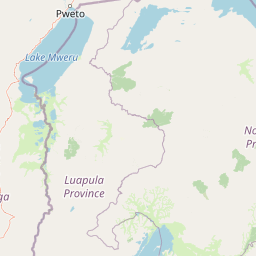
Isangano National Park landscape and geographic character
The landscape of Isangano National Park is defined by its position within the Bangweulu Swamps system, characterized by extensive floodplain terrain that undergoes seasonal inundation patterns. The park's terrain consists primarily of flat to gently undulating floodplain areas interspersed with swampy forest patches and open grassland expanses. The eastern boundary of the park is marked by the Chambeshi River, one of Zambia's major river systems that contributes to the hydrological regime sustaining the wider Bangweulu wetlands. To the west, the park borders the Bangweulu Flats, a vast expanse of seasonal wetlands that extend the ecological continuum of the protected area. The combination of river influence, seasonal flooding, and the underlying geology creates a landscape where aquatic and terrestrial habitats intermingle in complex patterns. At approximately 1100 meters elevation, the park sits within the elevated plateau regions of northern Zambia, though the floodplain nature of much of the area results in relatively low relief across most of the protected territory.
Isangano National Park ecosystems, habitats, and plant life
The ecological character of Isangano National Park reflects its position within the Bangweulu Swamps, a wetland system of significant ecological importance in southern Africa. The park encompasses a gradient of habitat types from permanently saturated swamp forests through to seasonally flooded grasslands, each supporting distinct ecological communities. The floodplain ecosystems receive water from the Chambeshi River and from seasonal rainfall, creating dynamic hydrological conditions that shape vegetation patterns and wildlife distribution. The swampy forest areas feature tree species adapted to periodic inundation, while the grassland zones provide foraging habitat for various herbivorous species. The Bangweulu system as a whole is recognized for its biodiversity value, supporting populations of water-associated species and serving as important habitat for migratory bird populations. The seasonal flooding cycle influences nutrient cycling and maintains the productivity of these wetland ecosystems, supporting the food web upon which the park's wildlife depends.
Isangano National Park wildlife and species highlights
Isangano National Park supports several notable wildlife species, though populations have been affected by historical human pressures within the protected area. The black lechwe represents one of the characteristic large mammal species, a wetland-adapted antelope particularly associated with floodplain and swamp edge habitats where it feeds on grasses and aquatic vegetation. The park also maintains populations of reedbuck, a medium-sized antelope that inhabits reed beds and grassland areas near water, along with oribi, a small antelope species preferring grassland environments. The sitatunga, a specialized swamp-dwelling antelope with partially webbed feet adapted for moving through flooded terrain, occurs in the swampy forest areas of the park. Beyond these antelope species, the park provides habitat for various water bird species and migratory birds that utilize the wetlands during seasonal movements. The Bangweulu Swamps system generally supports significant bird diversity, with the wetland habitats offering important feeding and nesting areas for species adapted to aquatic environments.
Isangano National Park conservation status and protection priorities
Isangano National Park represents an important component of Zambia's protected area network, particularly within the context of wetland conservation in southern Africa. The park's inclusion within the Bangweulu Swamps system connects it to a larger ecological landscape of significant conservation value, where wetland protection contributes to biodiversity preservation, water resource management, and support for local communities. The establishment of the park in 1972 reflected recognition of the need to protect this wetland environment, though subsequent challenges including human settlement and wildlife depletion demonstrate the difficulties of maintaining protected area integrity without adequate resources and enforcement capacity. The 2007 intervention to address illegal settlements and initiate restoration represents an important effort to recover the park's conservation value, though the success of these efforts continues to depend on sustained management commitment and resource allocation. The park's conservation significance is heightened by its role in protecting transitional wetland habitats that support species with specific ecological requirements, particularly the wetland-adapted antelope species that depend on the floodplain environment.
Top sights and standout views in Isangano National Park
Isangano National Park's defining highlight lies in its integration with the Bangweulu Swamps, one of Zambia's most extensive and ecologically significant wetland systems. The park protects critical floodplain, swamp forest, and grassland habitats that support characteristic wetland wildlife including the black lechwe, sitatunga, and diverse water bird populations. The Chambeshi River forms a natural boundary and hydrological lifeline, connecting the protected area to broader ecological processes affecting the entire Bangweulu basin. The park's history of conservation challenges and recent revival efforts provide important context for understanding the complexities of protected area management in wetland environments where human settlement pressures and ecological restoration needs must be balanced. The elevation of approximately 1100 meters places the park within the northern Zambian highlands, while its position within the Luwingu and Kasama districts places it at the heart of a region known for its ecological diversity.
Best time to visit Isangano National Park
The optimal time to visit Isangano National Park depends on seasonal conditions that affect both landscape character and wildlife viewing opportunities. The dry season, typically from May to October, generally offers easier access to park areas as flood waters recede and vegetation becomes less dense, potentially improving visibility of wildlife congregating around remaining water sources. However, the wet season brings the floodplain to life with seasonal water levels transforming the landscape and attracting migratory bird species, creating a different but equally compelling visitor experience. The timing of visits should be planned with awareness that the park has faced management challenges and that visitor infrastructure may be limited compared to more established national parks in Zambia. Wildlife viewing may be most productive during the dry season when animals concentrate near water bodies, though the park's wildlife populations remain limited compared to historical levels due to past pressures.