Mori Atlas logo
Park earthquake history

Review historical epicentre data, event magnitudes, and depth measurements for seismic events mapped within this region

Recorded Seismic Activity and Earthquake History Near Junkerdal National Park in Nordland, Norway

This historical catalogue provides a record of seismic events associated by geographic proximity to Junkerdal National Park. Users can explore individual earthquake records, including event dates, magnitude ratings, and precise depth calculations, derived from geological data. These records offer a technical perspective on the regional seismic environment without indicating current conditions or potential future activity.

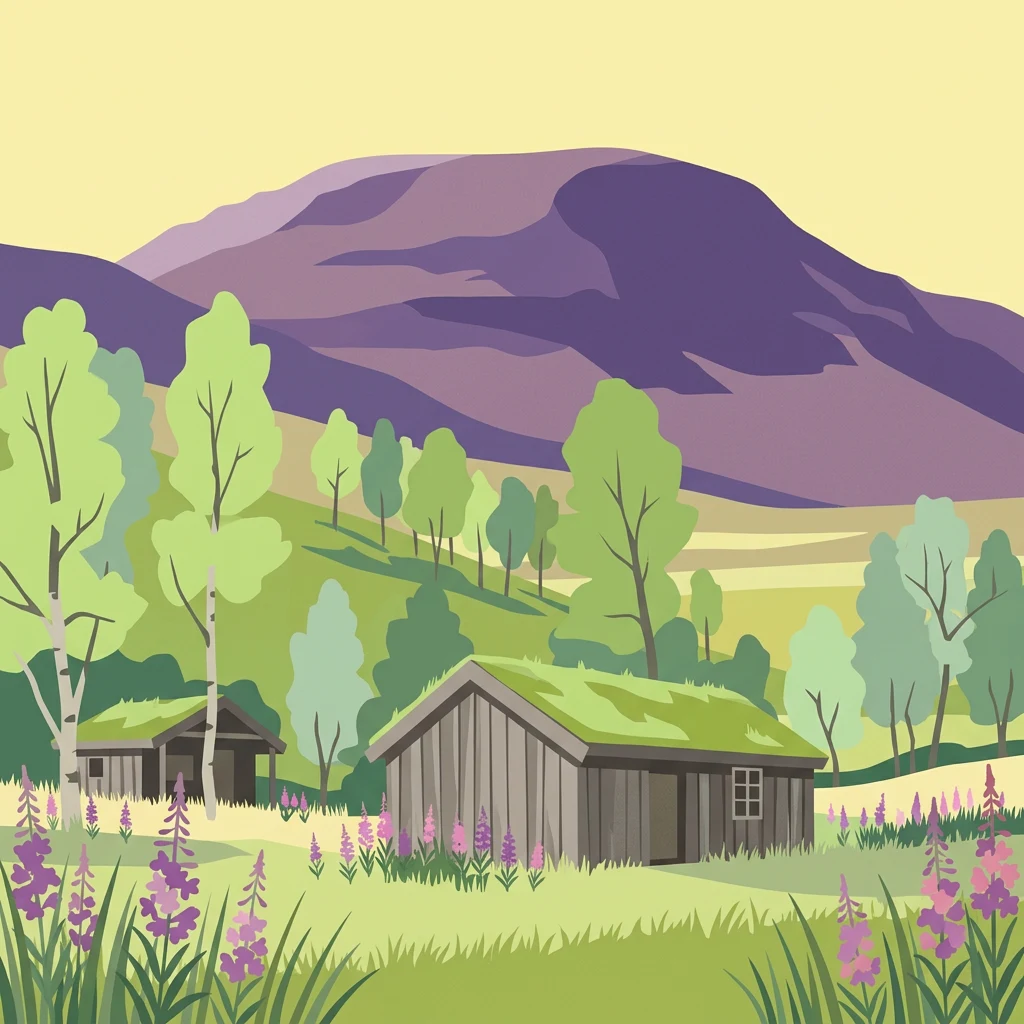
Illustration of a mountain landscape with two wooden cabins with green roofs, trees, and purple wildflowers

Arctic-alpine wilderness with rare flora on Europe's northern edge

Junkerdal National Park

Junkerdal National Park is a 682-square-kilometre protected wilderness area in northern Norway, straddling the border between Saltdal Municipality and Fauske Municipality in Nordland county. Established in 2004, the park occupies a dramatic landscape of mountain valleys, alpine plateaus, and forested lower elevations along the frontier with Sweden. The park is distinguished by its remarkable botanical diversity, supporting plant species that reach their southernmost geographical limits within its boundaries. Its varied terrain shelters significant populations of large mammals including wolverines, lynx, brown bears, moose, and reindeer, while its wetlands provide critical nesting habitat for rare bird species such as gerfalcons, golden eagles, and various loon species.

Location
Norway
Park type
National park
Established
2004
Area
682 km²
Junkerdal National Park Protected Landscape

Compare Junkerdal National Park dates, depths, places, and distances

Explore historical earthquake records around Junkerdal National Park

Use Junkerdal National Park’s 682 km² mountain and forest setting in Nordland as the anchor for reported earthquake research; search published dates and localities, compare magnitude with depth, and inspect the calculated distance to the park plus its source. The tool does not establish an epicentre within the boundary or supply causal, damage or hazard conclusions.

Sort by
Magnitude
Location

This page describes catalogued earthquakes associated with the park by epicentre location and distance. It does not establish causation, assess current danger, or predict future earthquakes.

No earthquake records match the current filters

Park atlas

Continue beyond Junkerdal National Park earthquake history

Discover other protected parks after Junkerdal National Park

Once earthquake browsing around Junkerdal National Park concludes, discovery shifts from its northern Norwegian Arctic-alpine mountains into a wider collection of protected destinations. Their presence does not indicate shared park status, mountain environment, biodiversity, distance, geology, seismic records, hazard, risk, or the same documentation depth.
Watercolor illustration showing mountains, a river, and colorful landscape regions
National parkNorway
4.5 km away#1 closest

Southwest

Saltfjellet, Svartisen National Park: Glacial Terrain & Protected Arctic Wilderness

Norway's vast national park with Svartisen glacier and unique flora.

Saltfjellet, Svartisen National Park spans over 2,100 square kilometers of diverse protected wilderness in Northern Norway. Renowned for Svartisen, Scandinavia's second-largest glacier, its landscape transitions from coastal influences to alpine plateaux. The park's calcareous bedrock supports a rich flora, rare in the region, contributing to its distinct geographic identity. Explore the mapped boundaries and natural terrain of this significant protected landscape.

Area
2,192 km²
Established
1989
IUCN
II
Relief
Mixed relief
Watercolor illustration of a winding river through a green landscape with distant mountains
National parkNorrbotten County
17 km away#2 closest

Northeast

Padjelanta National Park: Sweden's Largest National Park Protected Plateau Landscape

Explore subarctic terrain, large lakes, and Laponia World Heritage Site geography.

Padjelanta National Park, situated in Norrbotten County, is Sweden's largest national park. It features a distinctive subarctic plateau ecosystem centered around two vast lakes, offering a starkly open landscape compared to adjacent alpine areas. This protected area is renowned for its exceptional botanical and lichen diversity, a vital part of the Laponia World Heritage Site. Users can explore its mapped geography, unique terrain, and the cultural significance of this expansive arctic wilderness.

Area
1,984 km²
Established
1963
IUCN
II
Relief
Highland
Watercolor illustration showing mountains, a river, and forests in a landscape
National parkNordland
28 km away#3 closest

North

Rago National Park: Northern Norway's Protected Mountain Wilderness and Transboundary Atlas

Explore the mapped terrain and unique landscape context of this significant protected area.

Rago National Park is a protected national park in Nordland, Norway, recognized for its challenging mountainous terrain and its crucial role as part of a vast transboundary protected area complex spanning into Sweden. The park's landscape features alpine lakes and glaciers, offering a stark representation of northern Scandinavian mountain wilderness. Understanding Rago National Park provides insight into regional conservation efforts and the geographic significance of large-scale protected lands in Europe.

Area
171 km²
Established
1971
IUCN
II
Relief
Mountain
Watercolor illustration of a landscape with rolling hills, forests, and distant mountains
National parkNordland
33 km away#4 closest

Northwest

Sjunkhatten National Park: Norway's Protected National Park Identity and Geographic Atlas

Mapped landscape context and regional geography details.

Explore the structured geographic data and protected landscape context for Sjunkhatten National Park, a significant national park in Nordland, Norway. This page provides detailed insights into its mapped boundaries and regional setting, offering an atlas-driven view of its natural terrain. Understand how this protected area contributes to the broader geography of Norway through factual, map-oriented discovery.

Area
417.5 km²
Established
2010
IUCN
II
Relief
Mountain
Watercolor illustration of a mountainous landscape with a river, grass, and distant hills
National parkNorrbotten County
37 km away#5 closest

Northeast

Sarek National Park: Mapping Sweden's Rugged Alpine Wilderness and Glacial Terrain

Explore the mapped geography of Norrbotten County's largest alpine national park.

Sarek National Park represents the heart of Sweden's alpine wilderness, a protected landscape defined by its towering mountain peaks, expansive glaciers, and deeply carved glacial valleys. Situated in Norrbotten County, the park's geography is characterized by a remote and rugged terrain, making it a prime destination for understanding high-altitude natural environments through mapped context. Discover the unique contours of this iconic national park and its place within the broader regional geography of Swedish Lapland.

Area
1,970 km²
Established
1909
IUCN
II
Relief
Mountain
National parkNorrbotten County
47 km away#6 closest

Southeast

Pieljekaise National Park: Ancient Birch Woodland and Glacial Terrain in Norrbotten

Explore Sweden's protected landscape and mapped geography.

Pieljekaise National Park, a historic protected area in Norrbotten County, showcases one of Scandinavia's most intact boreal birch woodlands. Its landscape is shaped by ancient glacial activity, featuring a U-shaped valley, rolling hills covered in primeval-like birch forests, and distinctive twin peaks. Positioned along the renowned Kungsleden trail, this national park serves as a vital point for understanding the mapped geography and protected natural heritage of Sweden's Lapland region.

Area
153.4 km²
Established
1909
IUCN
II
Relief
Upland
Marine protected areaNordland
About 50 km away#7 closest

Northwest

Saltstraumen Marine Protected Area: Geographic Mapping and Tidal Landscape Features

Coastal fjord passage and protected marine terrain in Nordland

Located in Nordland, Saltstraumen represents a critical marine protected area where extreme tidal forces carve a dramatic, narrow passage between fjord systems. Explore the intersection of tidal currents, island geography, and protected marine habitat through a focused look at this Northern Norwegian natural wonder and its surrounding coastal topography.

Visitors
150K annual
Access
Easy access
Scope
Marine
Water
Water-dominated
National parkNorway
About 51 km away#8 closest

West

Láhko National Park: Northern Norway's Protected Arctic Landscape and Geographic Atlas Entry

Mapped boundaries and terrain of a key Finnmark national park.

Láhko National Park is a significant protected area within Norway's Finnmark region, representing a vast expanse of sub-Arctic wilderness and characteristic tundra ecosystems. This park serves as a crucial element in the atlas of northern European protected lands, offering insights into the geographic features and ecological integrity of high-latitude environments. Explore Láhko National Park through MoriAtlas to understand its landscape context, mapped terrain, and its role in preserving Nordic wilderness.

IUCN
II
MoriAtlas Explorer

Continue Exploring Junkerdal National Park's Mapped Terrain and Regional Geography

Deepen your understanding of Junkerdal National Park by continuing your exploration of its specific protected landscape, its unique botanical significance, and its role within the broader regional geography of Nordland. MoriAtlas provides structured data to navigate this park's mapped terrain and discover its place in the Scandinavian atlas, offering factual context for its conservation value and geographic importance.