Mori Atlas logo
National parkJunkerdal National Park

Discover the mapped boundaries and unique geographic context of this Nordland protected area.

Junkerdal National Park: Protected Landscape with Remarkable Arctic-Alpine Flora

(Junkerdal nasjonalpark)

Junkerdal National Park in Nordland, Norway, stands as a testament to protected arctic-alpine environments, renowned for its exceptional botanical diversity and significant populations of large mammals. This 682-square-kilometre national park offers a dramatic landscape of mountain valleys and plateaus, showcasing plant species at their southernmost European limits. Explore its unique terrain, from forested lower elevations to exposed alpine heights, and understand its place within the regional geography through detailed mapping and structured atlas data.

National ParkNorwayArctic-Alpine EnvironmentMountain LandscapeBiodiversity HotspotRare Flora
Illustration of a mountain landscape with two wooden cabins with green roofs, trees, and purple wildflowers

Junkerdal National Park

National park

Park overview

Structured park overview, official facts, and landscape profile for Junkerdal National Park

Junkerdal National Park park facts, protected area profile, and essential visitor context
Review the core facts for Junkerdal National Park, including designation, size, terrain, visitor scale, habitats, and operating context in one park-focused overview.

About Junkerdal National Park

Junkerdal National Park occupies a mountainous frontier landscape in the far north of Norway, where the Scandinavian Peninsula narrows toward its meeting point with Sweden. The park's 682 square kilometres encompass a vertical gradient from forested valley floors through alpine zones to exposed mountain summits and windswept highlands. This topographic diversity creates a mosaic of habitats that support both boreal and arctic species within a single protected area.

The park's establishment in 2004 reflected Norway's commitment to preserving its northern wilderness heritage and protecting the ecological corridor that connects Scandinavian mountain ecosystems with the broader circumboreal landscape. Its position along the Swedish border places it within a transboundary conservation context, reinforcing the ecological connectivity that allows wildlife to move across national boundaries in search of seasonal resources.

Visitors to Junkerdal encounter a landscape characterized by rugged peaks such as Sjurfjellet and Storfjellet, broad valleys carved by ancient glaciers, and vast alpine heaths that bloom with Arctic flora during the short summer season. The marked hiking routes that traverse the park provide access to some of the most botanically significant terrain in northern Europe, where specialized plants cling to rocky outcrops and meadow pockets that represent southern outposts of Arctic biodiversity.

Quick facts and research context for Junkerdal National Park

Junkerdal National Park covers 682 square kilometres in Nordland county, Norway, near the town of Fauske and along the Swedish border. Established in January 2004, it protects a landscape transitioning from boreal forest at lower elevations to arctic-alpine tundra on mountain summits and high plateaus. The park is notable for botanical rarity, with several plant species found nowhere else in Norway or at their southernmost European range limits within its boundaries. It forms part of a larger contiguous protected-area network that includes the adjacent Junkerdalsura nature reserve.

Park context

Deeper park guide and search-rich context for Junkerdal National Park

Junkerdal National Park history, landscape, wildlife, and travel context
Explore Junkerdal National Park through its history, landscape character, ecosystems, wildlife, conservation priorities, cultural context, and seasonal travel timing in a structured park guide built for atlas discovery and search intent.

Why Junkerdal National Park stands out

Junkerdal National Park is best known for its exceptional arctic-alpine flora and its role as a southernmost refuge for plant species that are typically found much further north in Scandinavia or on other continents. The white mountain saxifrage (Saxifraga paniculata) occurs in only three locations throughout Norway, with its strongest populations in this park. The park also protects significant populations of wolverines, lynx, and brown bears, species that are rare and conservation-sensitive across Europe, and provides nesting grounds for birds of prey including gerfalcons and golden eagles.

Panoramic view from Storfjelltoppen peak showing mountain ranges, valleys, and snow-capped peaks under a partly cloudy sky with two people in the foreground
Panoramic view from Storfjelltoppen peak

Junkerdal National Park history and protected-area timeline

Junkerdal National Park was established on 9 January 2004 through the Norwegian government's designation process managed by the Directorate for Nature Management. The park was created to protect the outstanding natural values of the Junkerdal valley and surrounding mountain landscapes, which had already received partial protection through the adjacent Junkerdalsura nature reserve.

The name Junkerdal derives from the Norwegian words 'junker' (meaning nobleman) and 'dal' (meaning valley), with the valley allegedly named after Preben von Ahlen (1606-1675), a figure known as 'the junker' who traversed the valley in 1658 during a raid against the Swedish Nasa silver mine. This historical reference connects the landscape to the region's human history, when the valley served as a passage between Norwegian and Swedish territories.

The creation of the park represented a continuation of Norway's systematic approach to national park establishment, which accelerated in the late twentieth and early twenty-first centuries as the country sought to formalize protection for its most significant wilderness areas.

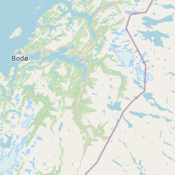
Junkerdal National Park landscape and geographic character

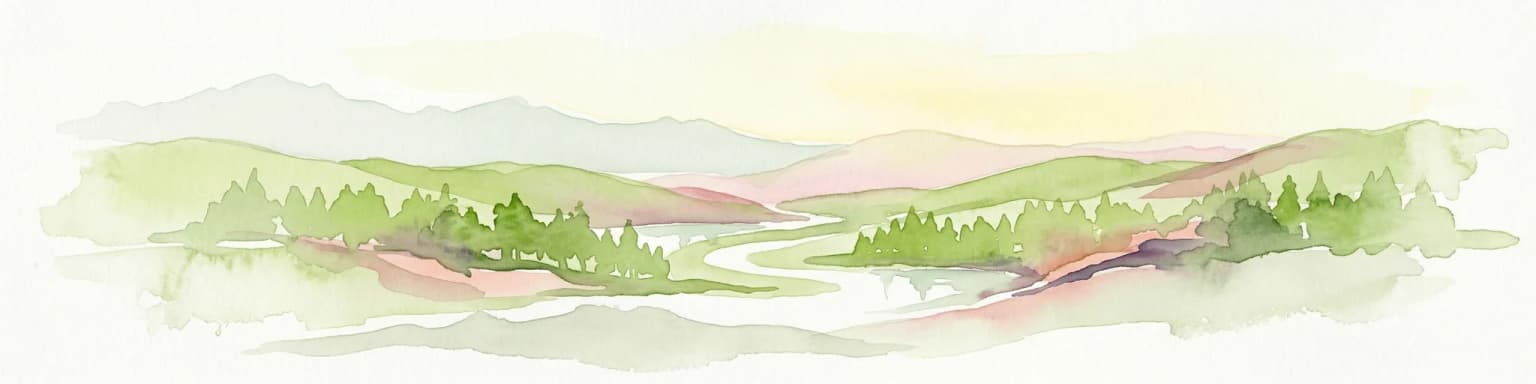
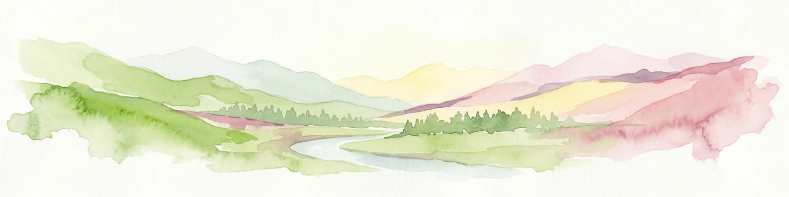
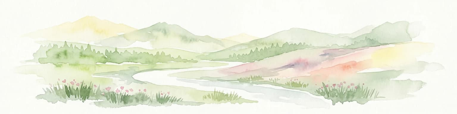
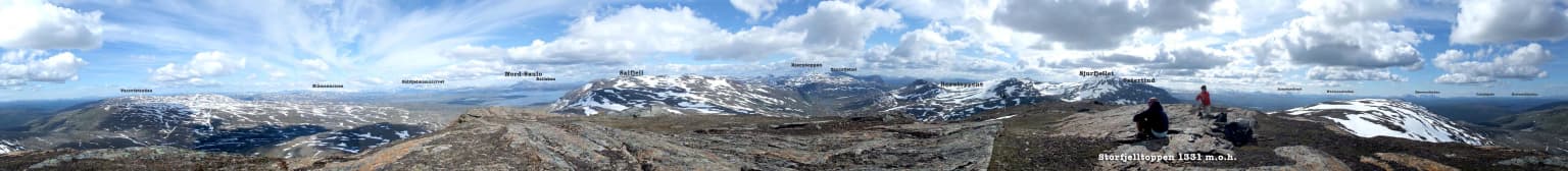
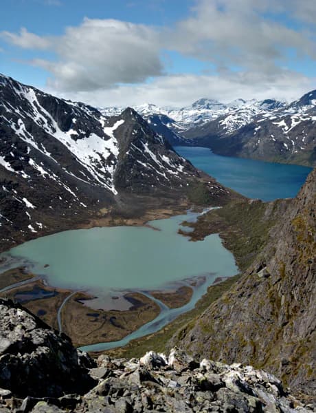
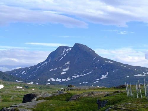
Junkerdal National Park presents a landscape of pronounced topographic contrast, where forested valleys give way abruptly to steep mountain walls and open alpine plateaus. The terrain was shaped by Pleistocene glaciations, which carved the broad U-shaped valleys and accumulated moraines that now characterize the park's lower elevations. Sjurfjellet, Storfjellet, and Solvagtind rise as prominent peaks within the park, their ridges and summits exposed to the harsh climatic conditions that prevent tree growth above the alpine zone.

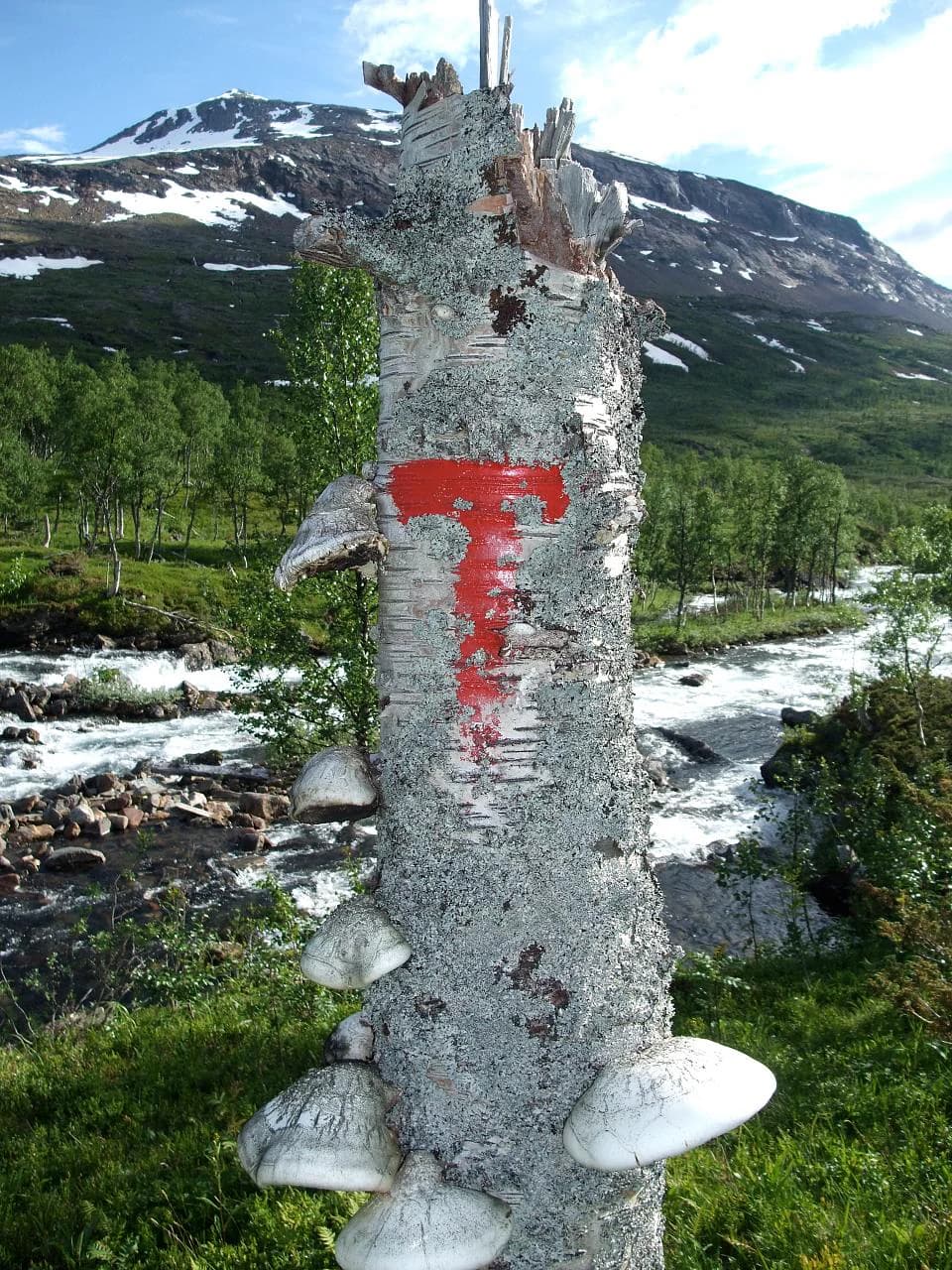
The park's elevation range creates distinct landscape zones: the lower valley floors support continuous forest cover, while the transition zone features scattered birch woodland that gives way to open alpine heath. Above this, rock outcrops, talus slopes, and permanent snow patches define the high-mountain environment. The interplay between the forested valleys and the exposed alpine heights creates the visual drama that defines the park's character.

Wide landscape view featuring a turquoise lake between rocky mountain slopes with patches of snow under a partly cloudy sky
Panoramic view of a turquoise lake surrounded by snow-capped mountains in a mountainous landscape

Junkerdal National Park ecosystems, habitats, and plant life

The ecological significance of Junkerdal National Park derives from its position at the southern margin of the Arctic, where species adapted to cold climates reach the southernmost points of their ranges. The park's varied topography generates numerous microhabitats, from windswept ridge tops to sheltered snow beds, each supporting distinct plant communities.

The arctic-alpine flora of the park includes several species of notable rarity. White Arctic mountain heather (Cassiope tetragona) forms distinctive cushion-like growths on exposed sites, while white mountain saxifrage (Saxifraga paniculata) anchors itself in rocky crevices. The latter species occurs in only three locations throughout Norway, with its most robust populations found within Junkerdal, making the park critically important for the species' continued presence in the country.

Plants such as bullrush sedge (Carex scirpoidea), snow fleabane (Erigeron humilis), and alpine arnica (Arnica angustifolia) reach their southernmost known limits within the park, representing the trailing edges of distributions that are centered in the high Arctic or on other continents. Arctic bellflower (Campanula uniflora), upright lousewort (Pedicularis flammea), and hairy lousewort (Pedicularis hirsuta) add to the assemblage of specialized Arctic flora that distinguishes this park from other Norwegian protected areas.

Wooden suspension bridge over a calm river surrounded by forested hills
River with suspension bridge in Junkerdal National Park

Junkerdal National Park wildlife and species highlights

Junkerdal National Park supports a significant community of large mammals that depend on its varied terrain for shelter and foraging. Wolverines, the largest member of the weasel family, maintain populations in the park's remote alpine areas, utilizing the terrain's inaccessibility to avoid human disturbance. Lynx, the elusive Eurasian lynx, hunts within the park's forested zones, preying primarily on reindeer and other ungulates. Brown bears, though rarely encountered by visitors, occupy the park as part of a broader Scandinavian population that ranges across the Norway-Sweden border.

Moose and reindeer are both common within the park, their presence reflected in the tracks and signs that hikers encounter along trail routes. Reindeer, both wild and semi-domesticated, move through the park's seasonal ranges, while moose favor the willow-covered valley bottoms and forest edges.

The park's wetlands and water bodies provide breeding habitat for a suite of rare and threatened bird species. Gerfalcons and golden eagles nest on cliff ledges, their predatory activities shaping the avian community throughout the park. Red-throated loons and Arctic loons nest on lake margins, while long-tailed ducks occupy the freshwater bodies that dot the landscape. These species depend on the park's relatively undisturbed conditions for successful reproduction.

Wooden cabin with grass-covered roof surrounded by green vegetation and wildflowers, with mountains in the background
Traditional wooden cabin with grass roof in Junkerdal National Park, Norway

Junkerdal National Park conservation status and protection priorities

Junkerdal National Park represents a critical conservation area within Norway's protected-area network, safeguarding both botanical and faunal values that are of national and international significance. The park's role in protecting the southernmost populations of several Arctic plant species makes it essential for maintaining the geographic continuity of circumboreal flora, ensuring that these species have room to shift their ranges in response to changing climatic conditions.

The presence of large carnivores—wolverines, lynx, and brown bears—places the park within Europe's ecological core areas, where predator populations can maintain viable numbers without the fragmentation effects that constrain carnivore conservation elsewhere on the continent. The park's position along the Swedish border further strengthens its conservation value by enabling transboundary movements that support genetic exchange between populations.

Protection of wetland bird habitats adds another dimension to the park's conservation significance, as these areas provide nesting and foraging resources for species that are declining across much of their ranges. The combination of botanical rarity, carnivore populations, and bird diversity makes Junkerdal one of Norway's most ecologically significant protected areas.

Junkerdal National Park cultural meaning and human context

The Junkerdal valley carries historical significance as a passage between Norway and Sweden, a route that was used both for legitimate trade and for military operations during the seventeenth century. The valley's name reflects this history, deriving from 'junker' (a German-derived term for nobleman) and referencing the figure of Preben von Ahlen, who traversed the valley in 1658 during a raid against Swedish silver mining operations at Nasa.

This historical layer adds cultural depth to the landscape, though the park itself is fundamentally defined by its natural values rather than by significant archaeological sites or ongoing traditional land-use practices. The valley's use as a transit route represents the broader pattern of human movement through northern Scandinavian landscapes, where national boundaries were drawn across terrain that had long served as communal ground for indigenous and local populations.

Mountain summit with patches of snow, grassy terrain, and a clear blue sky
Summit of Solvagtind in Junkerdal National Park, Norway

Top sights and standout views in Junkerdal National Park

Junkerdal National Park offers exceptional botanical exploration opportunities, with trails providing access to some of Norway's most significant Arctic-alpine plant communities. The rare white mountain saxifrage, found in only three Norwegian locations, reaches its most robust populations here, while the southernmost European occurrences of arctic species like bullrush sedge and alpine arnica occur within the park. Wildlife viewing opportunities include the possibility of encountering wolverines, lynx, and brown bears in their natural habitat, though these species are elusive and sightings cannot be guaranteed. The dramatic mountain scenery of Sjurfjellet and Storfjellet provides stunning backdrops for hikers, while the park's position near the Swedish border offers a sense of frontier wilderness that distinguishes it from more accessible Norwegian protected areas.

Tree trunk with red trail marker and white mushrooms growing on it, river flowing in background, mountains with snow patches under clear sky
Trail marker (red 'T') on a tree trunk with mountain landscape in background

Best time to visit Junkerdal National Park

The optimal season for visiting Junkerdal National Park runs from mid-June through mid-September, when hiking trails are snow-free and the alpine flora is in bloom. July and August offer the warmest conditions and the best opportunities for observing the park's botanical diversity, as the short Arctic summer brings the subalpine and alpine meadows into peak flowering. Autumn (September to early October) provides another window for visitation, with changing foliage colors adding visual interest to the landscape, though earlier snowfalls may close higher-elevation routes. Winter visits require specialized skills and equipment, as the park receives substantial snowfall and experiences extreme cold, making the backcountry inaccessible to all but experienced winter explorers.

Park location guide

Geography guide, regional context, and park location map for Junkerdal National Park

Junkerdal National Park park geography, regions, and map view in Norway
Understand where Junkerdal National Park sits in Norway through a broader geographic reading of the surrounding landscape, nearby location context, and its mapped position within the national park landscape.

How Junkerdal National Park fits into Norway

Norway, officially the Kingdom of Norway, is a Nordic country in Northern Europe located on the Scandinavian Peninsula. It encompasses mainland Norway, the Arctic islands of Svalbard and Jan Mayen, and maintains dependencies including Bouvet Island and Antarctic claims. The country has a population of about 5.6 million and is bordered by Sweden, Finland, and Russia. Norway is a unitary parliamentary constitutional monarchy with Oslo as its capital and largest city.

Wider geography shaping Junkerdal National Park in Norway

Norway occupies the western and northern portions of the Scandinavian Peninsula in Northern Europe. The country shares a long eastern border with Sweden, and borders Finland and Russia to the northeast. Norway has an extensive coastline facing the Skagerrak, North Sea, Norwegian Sea, and Barents Sea. The terrain is predominantly mountainous with numerous fjords along the coastline.

Map view of Junkerdal National Park

Use this park location map to pinpoint Junkerdal National Park in Norway, understand its exact geographic position, and read its mapped placement within the surrounding landscape more clearly.

Pigeon | © OpenStreetMap contributors

Location context for Junkerdal National Park

Nordland

Visualize Norway's Junkerdal National Park, its dramatic mountain valleys, alpine plateaus, and unique habitats.

Junkerdal National Park Photography: Explore Arctic-Alpine Landscapes and Protected Wilderness Scenery
Browse high-quality photographs showcasing Junkerdal National Park's distinctive Arctic-alpine landscapes, vast mountain terrain, and diverse plant and animal habitats. These images provide an essential visual reference, allowing for a deeper understanding of the park's dramatic topography and its unique conservation environment.

Panoramic view from Storfjelltoppen peak showing mountain ranges, valleys, and snow-capped peaks under a partly cloudy sky with two people in the foreground

Grassy field with trees and a mountain range in the background under a clear blue sky

Wide landscape view featuring a turquoise lake between rocky mountain slopes with patches of snow under a partly cloudy sky

Wooden suspension bridge over a calm river surrounded by forested hills

Wooden cabin with grass-covered roof surrounded by green vegetation and wildflowers, with mountains in the background

Snow-covered mountains with sparse trees in a landscape under a clear blue sky.

Mountain summit with patches of snow, grassy terrain, and a clear blue sky

Tree trunk with red trail marker and white mushrooms growing on it, river flowing in background, mountains with snow patches under clear sky

Park atlas

Browse protected landscapes across Nordland, comparing terrain and conservation zones near Junkerdal National Park's Arctic-alpine environment.

Explore Other National Parks and Protected Areas Near Junkerdal National Park in Nordland, Norway
Explore a curated list of national parks and protected areas located near Junkerdal National Park, tracing the Arctic-alpine flora and dramatic mountain scenery across Nordland county. This geographic overview helps compare diverse conservation landscapes, from forested valleys to high alpine plateaus, providing essential context for regional park discovery.
Watercolor illustration showing mountains, a river, and forests in a landscape
National parkNordland

Rago National Park: Northern Norway's Protected Mountain Wilderness and Transboundary Atlas

Explore the mapped terrain and unique landscape context of this significant protected area.

Rago National Park is a protected national park in Nordland, Norway, recognized for its challenging mountainous terrain and its crucial role as part of a vast transboundary protected area complex spanning into Sweden. The park's landscape features alpine lakes and glaciers, offering a stark representation of northern Scandinavian mountain wilderness. Understanding Rago National Park provides insight into regional conservation efforts and the geographic significance of large-scale protected lands in Europe.

Area
171 km²
Established
1971
IUCN
II
Relief
Mountain
National parkNordland

Sjunkhatten National Park: Norway's Protected National Park Identity and Geographic Atlas

Mapped landscape context and regional geography details.

Explore the structured geographic data and protected landscape context for Sjunkhatten National Park, a significant national park in Nordland, Norway. This page provides detailed insights into its mapped boundaries and regional setting, offering an atlas-driven view of its natural terrain. Understand how this protected area contributes to the broader geography of Norway through factual, map-oriented discovery.

Area
417.5 km²
Established
2010
IUCN
II
Relief
Mountain
National park

Láhko National Park: Northern Norway's Protected Arctic Landscape and Geographic Atlas Entry

Mapped boundaries and terrain of a key Finnmark national park.

Láhko National Park is a significant protected area within Norway's Finnmark region, representing a vast expanse of sub-Arctic wilderness and characteristic tundra ecosystems. This park serves as a crucial element in the atlas of northern European protected lands, offering insights into the geographic features and ecological integrity of high-latitude environments. Explore Láhko National Park through MoriAtlas to understand its landscape context, mapped terrain, and its role in preserving Nordic wilderness.

Watercolor illustration of a winding river through a green landscape with distant mountains
National parkNorrbotten County

Padjelanta National Park: Sweden's Largest National Park Protected Plateau Landscape

Explore subarctic terrain, large lakes, and Laponia World Heritage Site geography.

Padjelanta National Park, situated in Norrbotten County, is Sweden's largest national park. It features a distinctive subarctic plateau ecosystem centered around two vast lakes, offering a starkly open landscape compared to adjacent alpine areas. This protected area is renowned for its exceptional botanical and lichen diversity, a vital part of the Laponia World Heritage Site. Users can explore its mapped geography, unique terrain, and the cultural significance of this expansive arctic wilderness.

Area
1,984 km²
Established
1963
IUCN
II
Relief
Highland
National parkNorrbotten County

Pieljekaise National Park: Ancient Birch Woodland and Glacial Terrain in Norrbotten

Explore Sweden's protected landscape and mapped geography.

Pieljekaise National Park, a historic protected area in Norrbotten County, showcases one of Scandinavia's most intact boreal birch woodlands. Its landscape is shaped by ancient glacial activity, featuring a U-shaped valley, rolling hills covered in primeval-like birch forests, and distinctive twin peaks. Positioned along the renowned Kungsleden trail, this national park serves as a vital point for understanding the mapped geography and protected natural heritage of Sweden's Lapland region.

Area
153.4 km²
Established
1909
IUCN
II
Relief
Upland
Watercolor illustration showing mountains, a river, and colorful landscape regions
National park

Saltfjellet, Svartisen National Park: Glacial Terrain & Protected Arctic Wilderness

Norway's vast national park with Svartisen glacier and unique flora.

Saltfjellet, Svartisen National Park spans over 2,100 square kilometers of diverse protected wilderness in Northern Norway. Renowned for Svartisen, Scandinavia's second-largest glacier, its landscape transitions from coastal influences to alpine plateaux. The park's calcareous bedrock supports a rich flora, rare in the region, contributing to its distinct geographic identity. Explore the mapped boundaries and natural terrain of this significant protected landscape.

Area
2,192 km²
Established
1989
IUCN
II
Relief
Mixed relief
Watercolor illustration of a mountainous landscape with a river, grass, and distant hills
National parkNorrbotten County

Sarek National Park: Mapping Sweden's Rugged Alpine Wilderness and Glacial Terrain

Explore the mapped geography of Norrbotten County's largest alpine national park.

Sarek National Park represents the heart of Sweden's alpine wilderness, a protected landscape defined by its towering mountain peaks, expansive glaciers, and deeply carved glacial valleys. Situated in Norrbotten County, the park's geography is characterized by a remote and rugged terrain, making it a prime destination for understanding high-altitude natural environments through mapped context. Discover the unique contours of this iconic national park and its place within the broader regional geography of Swedish Lapland.

Area
1,970 km²
Established
1909
IUCN
II
Relief
Mountain
Watercolor painting of a landscape featuring a body of water, green fields, a single tree, and distant mountains under a light sky
National parkNorrbotten County

Stora Sjöfallet National Park: Protected Arctic Landscape in Norrbotten County

Explore mapped terrain and regional geography.

Stora Sjöfallet National Park stands as a significant protected landscape within Norrbotten County, Sweden, renowned for its striking Arctic mountain scenery centered on the Áhkká massif. As a key component of the Laponian Area UNESCO World Heritage Site, its vast expanse of over 1,278 square kilometers offers critical insights into subarctic ecosystems, glacial terrain, and the mapped boundaries of a protected natural territory. Discover the unique geographic features and ecological value of this expansive national park.

Area
1,278 km²
Established
1909
IUCN
II
Relief
Mountain

Common questions about visiting, size, designation, and location context for Junkerdal National Park

Junkerdal National Park FAQs for park facts, access, geography, and protected area context
Find quick answers about Junkerdal National Park, including protected-area facts, park geography, trail and visitor context, and how the park fits into its surrounding country and regional landscape.
MoriAtlas Explorer

Continue Your Protected Areas Search Across the Global Atlas

Deepen your exploration by continuing the structured search for national parks and protected areas worldwide. Utilize the comprehensive filtering capabilities to compare different conservation landscapes and refine your understanding of global park geography. Discover more about the distribution and characteristics of protected natural areas.

Global natural geography