
Reservoirs
Park geography
A detailed assessment of land area, hydrological features, and arid landscape characteristics.
Kinchega National Park Geographic Profile, Mapped Boundaries, and Regional Environment
The geographic footprint of Kinchega National Park spans a recorded area of 442.59 square kilometers within the New South Wales region of Australia. This structured profile delineates the park boundaries alongside its primary natural landscape features, including the Darling River and various creek systems that define the local arid terrain.
Related tags
Riparian ecosystemsDarling RiverAboriginal heritage sitesOutback landscapesSemi-arid environments
Outback riverside heritage park on the Darling River in far-western New South Wales
Kinchega National Park
Kinchega National Park is a protected area in the Far West region of New South Wales, Australia, situated along the eastern bank of the Darling River near the township of Menindee. The park covers approximately 44,259 hectares and was established on October 1, 1967, managed by the NSW National Parks and Wildlife Service. This semi-arid outback landscape features the Darling River as its defining geographic feature, with the river's floodplains and channels creating a distinctive environment within the broader arid interior of eastern Australia. The park holds IUCN Category II protected area status, recognizing its national significance for conservation and heritage preservation. Located about 840 kilometres west of Sydney and 111 kilometres southeast of Broken Hill, Kinchega represents one of the significant protected areas in this remote corner of New South Wales.
- Location
- Australia
- Park type
- National park
- Established
- 1967
- Area
- 442.6 km²
Location overview
Analyzing the regional placement within New South Wales
Geographic Setting of Kinchega National Park in Australia
Kinchega National Park is situated within the state of New South Wales in Australia. Standard geographic records detail its continental positioning as an entirely inland, non-transboundary protected area.
- Countries
- Australia
- Regions
- New South Wales
- Primary location
- New South Wales
- Geographic setting
- Inland
Boundary and coordinates
Interactive spatial geometry and area measurements for Kinchega
Kinchega National Park Boundary Map and Geographic Extent
Mapped park outlines provide clear spatial context for analyzing protected terrain boundaries. Accompanying measurements detail total area coverage alongside coordinate limits and geographic spans.
- Boundary area
- 445.8 km²
- Boundary perimeter
- 295.1 km
- Northernmost point
- 32.273° S
- Southernmost point
- 32.6247° S
- Easternmost point
- 142.4125° E
- Westernmost point
- 142.0982° E
- Geographic centre
- 32.5126° S, 142.2718° E
- North–south span
- 39 km
- East–west span
- 29.6 km
Terrain and natural features
Explore recorded streams, reservoirs, and waterways located within the park boundary.
Kinchega National Park Terrain, Rivers, and Natural Features
Recorded geographic records within Kinchega National Park include named rivers, streams, and reservoirs situated inside the protected area. Structured cards document specific feature names, types, and spatial relationships for atlas navigation.
Selected named natural features
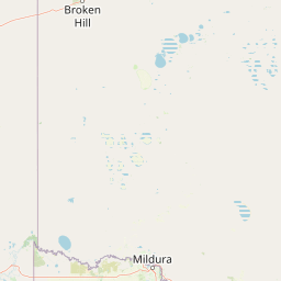
Reservoirs
Woolshed Tank
Streams
Yancowinna Creek
Streams
Cawndilla Creek
Streams
Charlie Stones Creek
Rivers
Talyawalka Creek
Environmental setting
Arid climate profiles, major water presence, and river landscapes
Kinchega National Park Environmental Setting and Landscape Classifications
Stored environmental classifications interpret the physical setting through arid climate zones, river features, and major water presence. Linked atlas categories connect these recorded attributes to broader geographic destinations.
- Climate
- Arid
- Water
- Major water bodies
Landscape features
Rivers
Park atlas
Trace the broader regional geography and compare protected areas across the diverse outback and riverine landscapes surrounding Kinchega National Park.
Explore More National Parks and Protected Areas Beyond Kinchega National Park
Browse other national parks and protected areas geographically related to Kinchega National Park, extending your exploration into the diverse semi-arid outback and Darling River landscapes of New South Wales, Australia. This allows for direct comparison of park features, conservation approaches, and mapped terrain, deepening your understanding of the broader regional protected area network.
National parkNew South Wales
80 km away#1 closest
Southeast

Mungo National Park: Protected Landscape Atlas and Geographic Context
Explore mapped boundaries and regional terrain within New South Wales.
Mungo National Park offers a distinct focus for atlas exploration, presenting itself as a key protected landscape within the state of New South Wales, Australia. This entry details the park's geographic positioning and mapped boundaries, allowing for a clear understanding of its terrain and regional context. Engage with the park's identity as a protected area, uncovering the specifics of its natural landscape for a richer geographic discovery experience.
- Area
- 1,109.67 km²
- Established
- 1979
- IUCN
- II
- Relief
- Lowland
Nature reserveNew South Wales
104 km away#2 closest
Southwest
Scotia Sanctuary: Protected Nature Reserve and Mallee Landscape Geography in New South Wales
Arid zone conservation and dune-swale mapping.
Scotia Sanctuary serves as a primary example of arid-zone conservation in south-western New South Wales. This reserve protects vast tracts of intact eucalypt mallee shrubland and sheoak woodland, set across a distinctive landscape of parallel sand dunes and calcareous swales. Its geographic position within the Murray-Darling Depression makes it a critical site for understanding the intersection of land management, habitat restoration, and regional ecological patterns.
- Area
- 650 km²
- Established
- 1994
- Relief
- Lowland
- Climate
- Arid
National parkNew South Wales
104 km away#3 closest
North
Mutawintji National Park: New South Wales Protected Area for Atlas Exploration
Mapping rugged outback terrain, gorges, and ancient rock art.
Mutawintji National Park in New South Wales offers a profound exploration of Australia's outback geography, significant Indigenous heritage, and protected landscapes. Discover the park's unique terrain, defined by the Byngnano Range, vibrant gorges, and river red gum-lined creeks, all rich with ancient Aboriginal rock art. This national park is a prime example of mapped protected area discovery, highlighting both natural beauty and critical conservation achievements.
- Area
- 689.12 km²
- Established
- 1998
- IUCN
- II
- Relief
- Mountain
Nature reserveSouth Australia
About 156 km away#4 closest
West
Boolcoomatta Reserve Nature Reserve: Geography and Protected Landscape Mapping in South Australia
Arid outback landscapes and conservation terrain in South Australia.
Boolcoomatta Reserve represents a significant protected area within the arid South Australian interior, featuring a mosaic of rocky ridges, open saltbush plains, and tussock grasslands. Once managed as a sheep station, this nature reserve now serves as a dedicated site for habitat restoration and the protection of native wildlife. This atlas entry provides essential geographic context on its terrain, vegetation zones, and role within the regional outback ecosystem.
- Area
- 644.57 km²
- Established
- 2006
- IUCN
- II
- Relief
- Mixed relief
Nature reserveSouth Australia
About 158 km away#5 closest
Southwest
Danggali Conservation Park: Semi-Arid Protected Land and Murray-Mallee Geography
Nature reserve geography and inland landscape context in South Australia.
Danggali Conservation Park preserves a substantial inland landscape north of the Riverland, characterised by open mallee scrubland, sandy dune systems, and dry eucalypt woodlands. This protected area acts as a crucial ecological bridge, showcasing the distinct shift from river-influenced environments to the arid interior of South Australia.
- Area
- 484.16 km²
- Established
- 1976
- IUCN
- Ia
- Relief
- Upland
National parkAustralia
165 km away#6 closest
Northeast
Paroo-Darling National Park: Mapped Boundaries and Protected Landscape Geography
Explore the geographic context of this Australian national park.
Paroo-Darling National Park is a protected national park offering insights into Australia's natural geography. This section provides details on its mapped protected area, highlighting the landscape and regional context. Understand the park's geographic footprint and its importance as a conservation landscape within the Australian continent.
- Area
- 1,780.53 km²
- Established
- 2000
- IUCN
- II
- Relief
- Upland
National parkAustralia
170 km away#7 closest
South
Murray-Sunset National Park: Iconic Pink Lakes and Mallee Wilderness in Victoria's Semi-Arid Interior
Explore its unique landscape, mapped boundaries, and regional geography.
Murray-Sunset National Park offers a compelling glimpse into Australia's semi-arid heart, featuring a dramatic landscape of salt lakes, gypsum plains, extensive sand dunes, and dense mallee woodlands. This vast protected area is renowned for the vibrant pink hue of its salt lakes, a phenomenon created by microscopic algae that flourishes in the hypersaline conditions during warmer months. The park's rich biodiversity and unique ecosystem make it a significant conservation asset, providing crucial habitat for numerous species adapted to this challenging yet beautiful environment.
- Area
- 6,330 km²
- Established
- 1991
- IUCN
- II
- Relief
- Lowland
Biosphere reserveNew South Wales
About 172 km away#8 closest
South
Barkindji Biosphere Reserve: Geography and Protected Landscapes in New South Wales
Mapping riverine wetlands and semi-arid dune systems
Barkindji Biosphere Reserve sits within the Murray-Darling Basin, creating a critical conservation area that spans river floodplains, sand plains, and semi-arid forest. This protected entity documents the transition between aquatic river environments and inland dryland terrain, highlighting complex soil and habitat variability across its vast, managed regional footprint.
- Area
- 1,918.23 km²
- Established
- 2005
- Visitors
- 133 annual
- Relief
- Mixed relief
MoriAtlas Explorer
Continue Exploring Kinchega National Park's Protected Landscape and Geography
Delve deeper into the geographic context and mapped features of Kinchega National Park. Understanding its place within New South Wales and the broader Australian outback, through its protected area boundaries and unique terrain, offers a rich atlas-driven discovery experience. This exploration highlights the park's conservation value and its role as a significant protected landscape for understanding regional geography.
Browse next
Global natural geography
Explore related park routes
Explore MoriAtlas Global ParksBrowse All MoriAtlas ParksGlobal Park Map DiscoveryMoriAtlas: Browse All CountriesBrowse All MoriAtlas ContinentsNational Park Environment AtlasGrand Canyon National Park AtlasYellowstone National Park AtlasYosemite National Park Atlas and GeographySerengeti National Park AtlasGalápagos National Park Protected LandscapeBanff National Park Geography and AtlasKruger National Park Atlas EntryUluṟu-Kata Tjuṯa National Park AtlasExplore Uluru-Kata Tjuta National Park GeographyPlitvice Lakes National Park AtlasFiordland National Park Protected LandscapeGreat Smoky Mountains National Park AtlasAfghanistan National Parks and Protected AreasAlbania National Parks and Protected AreasAlgeria National Parks and Protected AreasAmerican Samoa National Parks and Protected AreasAndorra National Parks and Protected AreasAngola National Parks and Protected AreasAntarctica National Parks and Protected AreasAntigua and Barbuda Park List