
Straits
Park geography
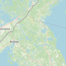
Mapped boundaries, physical landscape features, and regional area classifications
Detailed Geographic Profile of Ладожские шхеры National Park and Surrounding Terrain
This geographic profile details the structured extent of Ладожские шхеры. It encompasses key landscape data including boreal forest cover, lacustrine networks, coastal cliffs, and island clusters. The dataset highlights administrative positioning within the region, total area measurements, and significant natural features found within the protected boundary.
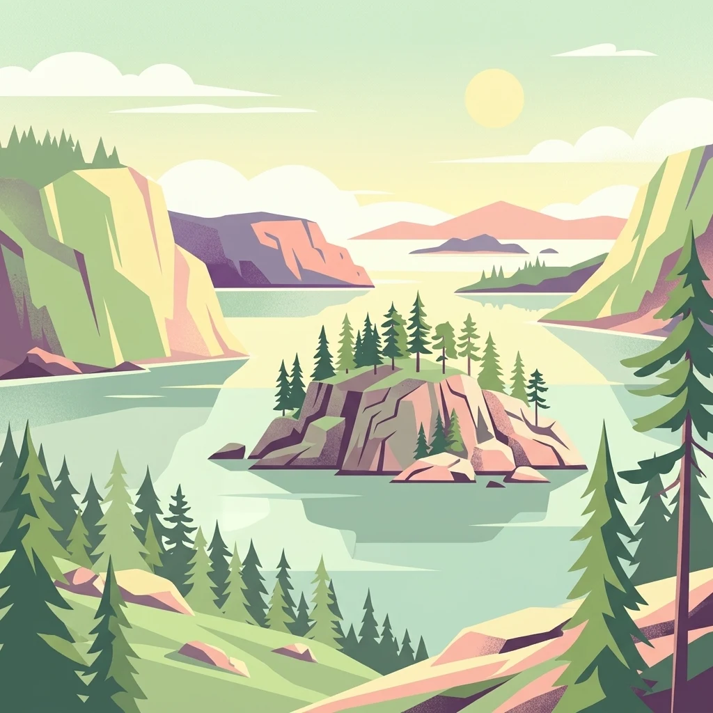
A vast protected archipelago of rocky islands along the northern shore of Europe's largest lake.
Ladoga Skerries National Park
Ladoga Skerries National Park protects a remarkable archipelago on the northern and northwestern coast of Lake Ladoga, the largest freshwater lake in Europe. Located in the Republic of Karelia in northwestern Russia, the park spans the districts of Lakhdenpokhsky, Sortavalsky, and Pitkyarantsky and covers a substantial area that includes both rocky islands and a large share of surrounding lake waters. The protected landscape is a classic skerry formation: a maze of narrow inlets, steep rocky shores, and approximately 650 small forested islands grouped close to the mainland. The park was established on 28 December 2017 through a decree of the Government of the Russian Federation, concluding decades of planning that began in the 1990s. It was created with the purpose of preserving unique natural complexes of lake skerries while also supporting regulated recreation and tourism. Because of its distinctive geology, its relatively undisturbed taiga forests, and its ecological importance for the endemic Ladoga ringed seal, the area is considered one of the most biologically diverse and ecologically significant protected landscapes in the Republic of Karelia. Beyond its conservation role, the park is a destination for experiencing the wild character of Lake Ladoga: granite outcrops sculpted by ice, pine-dominated forests, crystal-clear water, and remote island scenery. It forms an important part of the broader Green Belt of Fennoscandia and represents a type of Scandinavian-style skerry landscape that has almost no counterpart elsewhere in European Russia.
- Location
- Russia
- Park type
- National park
- Established
- 2017
- Area
- 1,220.1 km²
Location overview
Recorded country memberships and regional administrative data
Geographic Overview and Location Profile for Ладожские шхеры
Ладожские шхеры is situated within Russia and the regional territory of Ямало-Ненецкий автономный округ. Administrative records confirm coastal and island status within the protected area network.
- Countries
- Russia
- Regions
- Ямало-Ненецкий автономный округ
- Primary location
- Ямало-Ненецкий автономный округ
- Geographic setting
- Coastal · Island
Boundary and coordinates
Mapped protected boundary geometry and spatial dimensions
Ладожские шхеры Boundary Map and Geographic Extent
Interactive mapped boundaries establish clear spatial context for the protected landscape. Derived area measurements and coordinate spans accompany the visual outline without implying legal-survey precision.
- Boundary area
- 1,168.6 km²
- Boundary perimeter
- 2,688.1 km
- Northernmost point
- 61.8625° N
- Southernmost point
- 61.145° N
- Easternmost point
- 31.2623° E
- Westernmost point
- 29.7687° E
- Geographic centre
- 61.4896° N, 30.5055° E
- North–south span
- 80 km
- East–west span
- 79.5 km
Terrain and natural features
Mapped islands, bays, and water bodies across the lowland terrain landscape
Terrain Classifications and Named Natural Features in Ладожские шхеры
Stored lowland relief classifications organize the terrain while linked cards display recorded islands, bays, lakes, and straits situated within the protected area. Each feature entry preserves verified spatial relationships and types for detailed geographical browsing.
Selected named natural features
Islands
остров Эвасари
Lakes
Кантолампи
Islands
остров Кархулуото
Islands
остров Ристисаари
Islands
острова Вилькамайссарет
Environmental setting
Boreal climate zones, dominant water systems, and forest lowland relief
Ладожские шхеры Environmental Classifications and Physical Setting
Stored landscape features and habitat types frame the physical setting of Ладожские шхеры through boreal forest and lacustrine categories. Recorded classifications connect directly to relevant atlas destinations across the protected area.
- Relief
- Lowland
- Climate
- Boreal
- Water
- Water-dominated
- Forest cover
- Mostly forested
- Seasonality
- Year-round
Landscape features
Cliffs · Forest · Lakes · Coast · Islands
Habitat types
Boreal forest · Wetland · Lacustrine habitat
Park atlas
Compare surrounding regional geography, lake archipelagos, and northern taiga landscapes
Other Parks Near Ладожские Шхеры and Related Protected Areas to Explore
Visitors exploring Ладожские шхеры can browse adjacent national parks and protected areas sharing similar glacial terrain and taiga ecosystems. Comparing these regional reserves provides deeper context on Scandinavian-style skerry formations and Fennoscandian conservation lands.
National parkRepublic of Karelia
Park boundaries overlap#1 closest

Ladoga Skerries National Park: National Park Protected Landscape & Geography
Mapped boundaries and regional context in the Republic of Karelia.
Discover Ladoga Skerries National Park, a key protected area recognized as a national park within the Republic of Karelia. This page provides essential context for understanding its mapped boundaries, the natural terrain it encompasses, and its geographical significance within the broader regional landscape. Utilize this information for structured atlas exploration of protected natural environments, focusing on the distinct identity of Ladoga Skerries National Park.
- Area
- 1,220 km²
- Established
- 2017
- IUCN
- II
- Relief
- Lowland
National parkNorth Karelia
About 83 km away#2 closest
North

Petkeljärvi National Park: Distinct Protected Landscape and Esker Formations in North Karelia
Discover Finland's unique esker ridges and boreal forests.
Petkeljärvi National Park represents a distinctive protected landscape in North Karelia, Finland, celebrated for its prominent esker formations that define its topography. The park showcases light Scots pine forests growing on sandy soils, creating an open forest character that sets it apart. Visitors can explore the mapped geography, including winding ridges, wetlands, and lake scenery, alongside preserved historical fortifications from the Continuation War, offering a rich blend of natural and cultural heritage within this compact national park.
- Area
- 7 km²
- Established
- 1956
- IUCN
- II
- Visitors
- 17.3K annual
National parkSouth Savo
94 km away#3 closest
Northwest
Linnansaari National Park: South Savo's Protected Landscape and Geography
Explore the mapped boundaries of this Finnish national park.
Discover Linnansaari National Park, a distinct national park located in South Savo, Finland. This page provides detailed information focused on its protected landscape identity, mapped geography, and atlas context. Understand its significance as a conservation area and how its boundaries contribute to the regional natural landscape. Explore the geographic positioning of Linnansaari National Park within South Savo, offering insights for structured map-based discovery.
- Area
- 38 km²
- Established
- 1956
- IUCN
- II
- Visitors
- 31.6K annual
National parkEtelä-Savo
About 109 km away#4 closest
Northwest
Kolovesi National Park: Mapped Protected Landscape in Etelä-Savo, Finland
Explore its geographic identity and mapped park boundaries.
Kolovesi National Park is a significant protected area located in the Etelä-Savo region of Finland, characterized by its presence within the Finnish lake district. This detailed page provides an atlas-centric view, emphasizing the park's mapped geographic features and its status as a protected natural landscape. Users engaging with MoriAtlas can understand Kolovesi National Park's unique landscape context and its precise location within the regional geography of southeastern Finland.
- Area
- 61 km²
- Established
- 1990
- IUCN
- II
- Visitors
- 17.2K annual
National parkNorth Karelia
128 km away#5 closest
North
Patvinsuo National Park: Protected Landscape Geography and Map Context
National park exploration in North Karelia, Finland.
Patvinsuo National Park stands as a vital protected area within North Karelia, Finland. This page serves as an atlas entry point, detailing the park's geographic scope, mapped boundaries, and its significance as a protected landscape. Users can explore the regional context and understand the natural terrain that characterizes this important Finnish national park, facilitating structured geographic discovery.
- Area
- 105 km²
- Established
- 1982
- IUCN
- II
- Visitors
- 18.6K annual
National parkNorth Karelia
133 km away#6 closest
North
Koli National Park: Protected National Park in North Karelia, Finland
Explore mapped landscape and regional geography.
Koli National Park represents a significant protected area within the eastern Finnish region of North Karelia. This page offers detailed geographic context and insight into the park's mapped landscape, essential for understanding its place within the broader atlas of Finland's natural terrain. Discover the protected boundaries and regional setting of this key national park.
- Area
- 30 km²
- Established
- 1991
- IUCN
- II
- Visitors
- 249.8K annual
National parkFinland
151 km away#7 closest
West
Repovesi National Park: Finland's Boreal Wilderness and Protected Landscape
Explore mapped terrain and regional geography.
Repovesi National Park represents a significant protected natural area in southeastern Finland, showcasing a landscape characterized by dense boreal forests, rolling hills, and numerous lakes. As one of Finland's most visited national parks, it offers a compelling example of conserved wilderness and natural terrain. This page details the park's protected landscape identity, its geographic setting within Finland, and the atlas-driven insights available for exploring its mapped boundaries and natural features.
- Area
- 15 km²
- Established
- 2003
- IUCN
- II
- Visitors
- 100.9K annual
Natural monumentRepublic of Karelia
About 165 km away#8 closest
Northeast
Mount Vottovaara Natural Monument: Explore Protected Landscape and Geographic Context in Karelia
Mapped protected area boundaries and regional terrain in the Republic of Karelia.
Mount Vottovaara represents a significant natural monument within the Republic of Karelia, offering a focal point for structured geographic exploration. This protected landscape's mapped boundaries and its setting within the region's broader geography are key to understanding its atlas value. MoriAtlas provides the framework to examine the specific identity of Mount Vottovaara as a protected area, encouraging detailed study of its natural features and regional context.
- Area
- 15 km²
- Established
- 2011
- IUCN
- III
- Relief
- Mixed relief
MoriAtlas Explorer
Continue Exploring the Protected Landscapes of Ладожские шхеры
Deepen your understanding of the skerry architecture and geographic significance of Ладожские шхеры National Park. MoriAtlas provides detailed insight into the park boundaries, glacial terrain features, and the unique island geography that makes this protected area a cornerstone of Lake Ladoga's northern natural heritage.
Browse next
Global natural geography
Explore related park routes
Explore MoriAtlas Global ParksBrowse All MoriAtlas ParksGlobal Park Map DiscoveryMoriAtlas: Browse All CountriesBrowse All MoriAtlas ContinentsNational Park Environment AtlasGrand Canyon National Park AtlasYellowstone National Park AtlasYosemite National Park Atlas and GeographySerengeti National Park AtlasGalápagos National Park Protected LandscapeBanff National Park Geography and AtlasKruger National Park Atlas EntryUluṟu-Kata Tjuṯa National Park AtlasExplore Uluru-Kata Tjuta National Park GeographyPlitvice Lakes National Park AtlasFiordland National Park Protected LandscapeGreat Smoky Mountains National Park AtlasAfghanistan National Parks and Protected AreasAlbania National Parks and Protected AreasAlgeria National Parks and Protected AreasAmerican Samoa National Parks and Protected AreasAndorra National Parks and Protected AreasAngola National Parks and Protected AreasAntarctica National Parks and Protected AreasAntigua and Barbuda Park List