
Mori Atlas logo
National parkЛадожские шхеры

Understanding the geography, protected island clusters, and Baltic Shield terrain

Ладожские шхеры National Park: An Atlas of Glacial Skerries and Lake Ladoga Landscapes

(National Park "Ladoga Skerries" (Ладожские шхеры))

Ладожские шхеры National Park encompasses a remarkable archipelago along the northern reaches of Lake Ladoga, forming a labyrinth of approximately 650 forested islands and narrow, deep inlets. This protected area represents a unique geological intersection of granite outcrops, pine-dominated taiga, and glacial whaleback formations that define the region's complex shoreline. The geography provides critical habitats for the endemic Ladoga ringed seal, anchoring the northern stretch of the Green Belt of Fennoscandia within a singular, water-bound landscape.

skerriesrocky islandsLake Ladogataiga forestspine forestsgranite outcrops
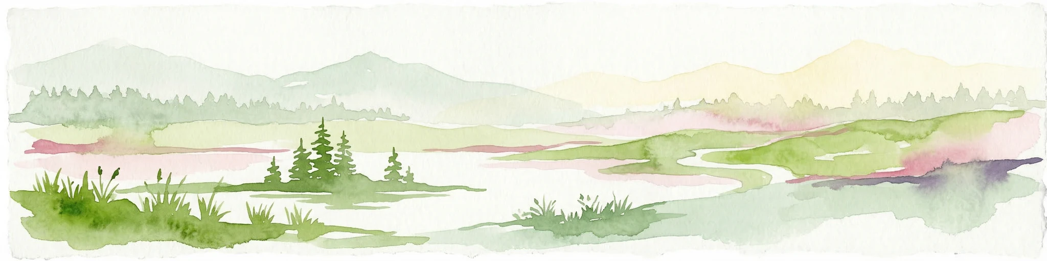
An illustration showing a calm waterway with rocky islands, coniferous forests, and distant cliffs under a soft sun.

Ладожские шхеры

National park

Park overview

Structured park overview, official facts, and landscape profile for Ladoga Skerries National Park

Ladoga Skerries National Park park facts, protected area profile, and essential visitor context

Review the core facts for Ladoga Skerries National Park, including designation, size, terrain, visitor scale, habitats, and operating context in one park-focused overview.

About Ladoga Skerries National Park

Ladoga Skerries National Park is one of the younger national parks in Russia, but also one of the most distinctive in terms of its physical setting. The park stretches across a long section of the northern coast of Lake Ladoga, encompassing a deeply indented mainland shore and a dense cluster of small rocky islands. The skerry landscape, the term used in Northern European geography for broken coastlines of glacial origin, is what gives the park its name and its character. The terrain is shaped by ancient crystalline bedrock, sculpted by ice-age glaciers and further modified by waves, frost, and time into rounded whaleback outcrops locally known as "lamb's foreheads," vertical cliffs, and narrow channels.

The forests of the park are primarily pine-dominated, growing on the thin soils that cap the rocky ridges. Although much of the woodland is secondary, originating from historical logging, fires, and former agricultural land, large tracts have been left to recover naturally since the mid to late twentieth century, giving the present forest cover a maturing, increasingly natural character. The low level of large-scale habitat conversion within the park boundaries has allowed the area to retain much of its ecological integrity.

Lake Ladoga itself, the largest lake in Europe, is the defining feature of the park and contributes significantly to its ecological value. Despite its size, the lake's water remains relatively clean with only weak signs of eutrophication, and the open waters and sheltered channels between the skerries provide habitat, feeding grounds, and breeding sites for fish, waterbirds, and the endemic Ladoga subspecies of the ringed seal. Together, the lake, the islands, and the rocky mainland shore form a single integrated system that the national park was created to protect.

For visitors, the park represents a landscape that combines accessibility with a strong sense of wilderness. The proximity of major Karelian towns such as Sortavala and Pitkyaranta makes the park approachable, while the interior islands, channels, and rocky shores retain a remote and largely undeveloped atmosphere. Hiking, boating, fishing, and nature observation are among the main ways to experience the area, and the park's management structure is designed to balance conservation with recreation in designated zones.

Quick facts and research context for Ladoga Skerries National Park

Ladoga Skerries is a national park in the Republic of Karelia, Russia, situated on the northern and northwestern shores of Lake Ladoga. It covers a substantial combined land and water area, of which a large portion is open lake water. The park stretches along about 130 km of coastline from the area near Beryozovo in the west to the town of Pitkyaranta in the east, and includes about 650 rocky islands.

The protected area is administered by a dedicated federal institution and was formally established in late 2017 after an extensive planning process that involved regional government proposals, federal ecological review, and the exclusion of certain developed and agricultural parcels from its boundaries. It is classified as an IUCN Category II protected area, corresponding to a national park. The territory holds some of the highest biodiversity and conservation value in Karelia and includes habitat that is critical for the endemic Ladoga subspecies of the ringed seal.

Protection and recognition

Explore documented protection history and management scope for Ладожские шхеры.

Ладожские шхеры Protection Status and Designated Area Records

Historical protected area designation records for Ладожские шхеры outline a mixed conservation scope established in 2017. Structured factual details provide a transparent reference for international recognition frameworks and protected territory management.

Protection details

Protection scope
Mixed
Designated year
2017
Transboundary protection
No
Park context

Deeper park guide and search-rich context for Ladoga Skerries National Park

Ladoga Skerries National Park history, landscape, wildlife, and travel context

Explore Ladoga Skerries National Park through its history, landscape character, ecosystems, wildlife, conservation priorities, cultural context, and seasonal travel timing in a structured park guide built for atlas discovery and search intent.

Why Ladoga Skerries National Park stands out

The park is best known for its skerry landscape: a labyrinth of about 650 small rocky islands and deeply indented mainland shoreline along the northern reaches of Lake Ladoga. These formations are unrivaled elsewhere in European Russia and represent a geomorphological pattern more commonly associated with the Scandinavian coast and the Baltic shield. Equally important is the ecological richness tied to this landscape. The park contains the highest level of biodiversity in Karelia and protects habitats for the endemic Ladoga ringed seal, whose breeding and feeding grounds lie within the skerry zone. The combination of clean lake water, pine-dominated taiga on thin rocky soils, and a long history of limited industrial pressure gives the area a distinctive wild character that defines the park's identity.
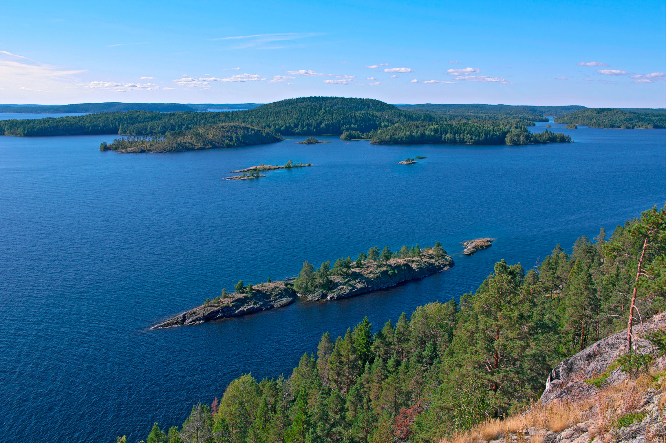
A high angle panoramic view overlooking calm blue water dotted with multiple small rocky islands covered in green pine forests under a clear blue sky.
Panoramic view of the rocky islands and dense forests typical of the Ladoga Skerries.

Ladoga Skerries National Park history and protected-area timeline

The idea of protecting the Ladoga skerry landscape emerged in the 1990s, when regional authorities and environmental planners began calling for a dedicated protected area on the northern shore of Lake Ladoga. Initial proposals were developed by the Karelian design organization Karelgrazhdanproekt in 1995 and revisited in 2000 under the TASIC programme, with the goal of gaining formal recognition under Russian environmental law.

The boundary of the future park was shaped through a long process of negotiation. A state ecological review concluded in early 2016 that the area qualified for protection at the federal level, but this was followed by a decision to excise roughly 3,750 hectares of land from the proposed boundaries. These exclusions removed settlement lands, dacha cooperatives, and certain agricultural parcels from the park, ensuring that the core of the protected area would remain in a more natural condition. The formal decree creating the national park was signed by the Government of the Russian Federation on 28 December 2017, giving the park its current legal status. The park's official regulations were subsequently approved by the Ministry of Natural Resources and Environment in January 2020.

Administrative responsibility evolved alongside the park's formal establishment. Initially managed under the framework of the Kivach Nature Reserve, the park gained its own dedicated managing institution on 28 April 2023, when the federal institution "National Park 'Ladoga Skerries'" took over direct oversight. This marked a transition from reserve-supervised management to fully independent park administration, completed by updated fee and service regulations in 2025.

Ladoga Skerries National Park landscape and geographic character

The landscape of Ladoga Skerries is defined by its geological foundation and its glacial history. The bedrock of the region belongs to the ancient Baltic Shield, composed largely of hard crystalline rocks that emerged from the Pleistocene glaciations already shaped and smoothed. Continental ice sheets carved broad channels into the rock and left an uneven surface of resistant outcrops, basins, and fracture lines that later filled with water to form the deepest parts of Lake Ladoga.

As the heavy ice cover retreated and the land rebounded, the shallow coastal margins of the lake were left exposed as a necklace of low, rocky islands separated from the mainland and from each other by narrow, often deep straits. Today, the park contains approximately 650 of these islands, ranging from tiny rock outcrops to larger forested landmasses such as Kilpola, Kuhka, Sorolansaari, Lauvatsaari, Putsari, Riekkalansaari, and Koyonsaari. Between the islands and the mainland lies a web of sheltered bays, long narrow fjords, and wave-polished granite surfaces.

Among the most distinctive features of the landscape are the so-called "lamb's foreheads" (бараньи лбы), glacially rounded whaleback rock formations that emerge from the water and line the shorelines. These smooth, sloping domes of bare stone are a signature feature of the northern Ladoga coast and define much of the park's visual character. Steep cliff sections alternate with lower, gentler stretches, while thin pockets of soil on the island summits support pine forests, and the deeper channels create an unusually indented shoreline by any European standard.
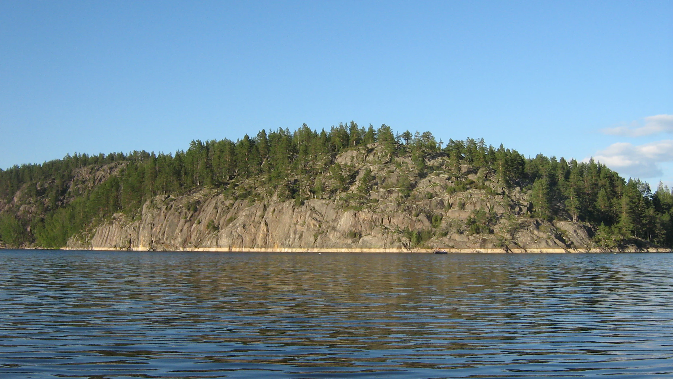
A low, rocky island covered in pine forest rises from the surface of calm water under a clear blue sky, illustrating the skerry geography of Lake Ladoga.
The rocky Baranyi Lby formation rising from the waters of Lake Ladoga in Ladozhskiye Shkhery National Park.

Ladoga Skerries National Park ecosystems, habitats, and plant life

The park lies within the middle-taiga zone and represents one of the cleanest and most ecologically significant parts of the Republic of Karelia. Its unusually high biodiversity reflects the convergence of several habitat types in a relatively small area: open lake water, sheltered channels between islands, rocky outcrops, thin-soiled pine forest, and small mires scattered across low-lying pockets.

The forests are predominantly pine, shaped by the dry, rocky, thin-soiled conditions that prevail across the islands and ridges. Although many of these forests are secondary in origin, regenerated after historical logging and fires, they have been developing naturally for several decades and now show a maturing structure with a layered understory. Combined with the many exposed rock surfaces, this creates a habitat mosaic of forest patches, bare rock communities, cliff vegetation, and shore-zone plant communities that has no real equivalent elsewhere in European Russia.

Lake Ladoga itself is a major ecological asset. Despite being heavily used over the past century, the lake retains relatively clear water with only mild signs of nutrient enrichment. Its cold, oxygen-rich depths and clean shoreline environments support a diverse fish community, waterbirds, and an endemic subspecies of seal. The overall wetland cover of the park, including swampy forests, remains modest compared to other parts of Karelia, which contributes to the open, dry, sun-exposed character of much of the terrain.
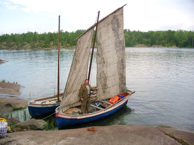
A person stands on a blue, traditional wooden boat with sails moored against a rocky shoreline on a lake, with a second similar boat visible behind it.
A person standing on a traditional wooden boat equipped with sails in the Ladozhskiye Shkhery national park.

Ladoga Skerries National Park wildlife and species highlights

The Ladoga skerry zone is the breeding and feeding ground for the endemic Ladoga subspecies of the ringed seal (Pusa hispida ladogensis), a freshwater seal found nowhere else in the world. Listed in the Red Books of the IUCN, the Russian Federation, and the Republic of Karelia, this subspecies depends almost entirely on the northern parts of Lake Ladoga, and a significant share of its reproductive population, roughly one-fifth, is concentrated within the waters of the national park. The sheltered channels, ice cover in winter, and rocky haul-out sites of the skerries are essential to its life cycle.

Beyond the seal, the park's wildlife is shaped by the interface of taiga forest, open rock, and lake. The fauna documented within the park includes a range of mammals, breeding and migratory birds, and an unusually rich assemblage of rare plants, mosses, and lichens. Species recorded in the park's Red Book lists reflect the overlap of Scandinavian, Baltic, and taiga biogeographic influences, with some vascular plants found in the park being extremely rare or otherwise absent from both Karelia and the broader Green Belt of Fennoscandia.

The combination of undisturbed forest patches, large lake surface, varied shoreline, and rocky islands makes the park an important area for waterbird breeding and seasonal migration. Intricate shore vegetation along the islands provides nesting habitat for lake-associated species, while the forest interior supports typical taiga mammals and ground-nesting birds. The overall wild character and low level of human development give the park a particular importance as a refuge for species sensitive to disturbance.

Ladoga Skerries National Park conservation status and protection priorities

The conservation significance of the park rests on three intertwined elements: a unique physical landscape, exceptional botanical diversity, and irreplaceable habitat for an endemic mammal. The skerry topography is considered a one-of-a-kind geomorphological formation in European Russia, making its preservation a matter of reference-value as well as species protection.

The park holds the highest biodiversity and conservation value of any protected area in Karelia. Numerous species of vascular plants, mosses, and lichins found here are listed in both the Red Book of the Russian Federation and the Red Book of the Republic of Karelia. Several plant species recorded in the park, including rare vascular plants such as Jasione montana, Minuartia verna, and Spergula morisonii, are otherwise very rare in the region and represent important elements of the broader Fennoscandian Green Belt flora.

Conservation management faces ongoing pressures. Before the park's establishment, growth of dacha cooperatives and unregulated tourism posed the most serious threats, including forest fires, littering, and unauthorized construction near attractive sites. With protection status in place, the principal current concern is fire, particularly fires caused by tourists along the shoreline and on the islands. Management plans address these threats through regulated access, recreational zoning, and a focus on prevention and rapid response in the most vulnerable areas.

Ladoga Skerries National Park cultural meaning and human context

The Ladoga Skerries region has a long cultural history shaped by its position between Finnish, Karelian, and Russian traditions. The northern shores of Lake Ladoga have been inhabited for centuries, with coastal villages, seasonal fishing settlements, and small-scale agriculture leaving an imprint on parts of the landscape. Many localities along the coast carry Finnish, Karelian, and Russian names reflecting this layered heritage.

Traditional land use has shaped the park's present appearance in subtle ways. Historical selective logging, slash-and-burn cultivation, and small-scale farming created the open and semi-open patches that later returned to forest, and the remnants of old agricultural plots now show signs of natural overgrowth and paludification. Today, settlements and developed land are deliberately excluded from the park boundaries, concentrating human land use along the outer edges while the protected core preserves the wilder character of the skerries.

Top sights and standout views in Ladoga Skerries National Park

The park's standout features include its approximately 650 glacially formed rocky islands, the smooth whaleback granite outcrops that line the shorelines, and the deep indented channels that together create a landscape unlike any other in European Russia. Its biodiversity record, the highest in Karelia, and its critical role as breeding habitat for the endemic Ladoga ringed seal give the park a conservation profile far beyond its modest size in the national system.

For travelers and naturalists, the highlights lie in the contrast between accessibility and wilderness: short distances from towns like Sortavala and Pitkyaranta open into a maze of islands, cliffs, and pine forests with remarkably clean water and a strong sense of solitude. The combination of lake, forest, rock, and seal habitat defines a place that is simultaneously a working protected area and an evocative landscape of Northern Europe.

Best time to visit Ladoga Skerries National Park

The most rewarding time to experience the park is during the warm season, roughly from late spring to early autumn, when the lake is free of ice and the islands and mainland shore are accessible by boat and on foot. Summer brings long daylight hours, stable weather windows for exploring the channels between islands, and the most comfortable conditions for hiking and boat-based travel. The pine forests and exposed rock communities are at their most active, and waterbird breeding is in full swing along the shores.

Shoulder seasons, including late spring and early autumn, offer quieter conditions and a chance to see the landscape transition. The clear water of Lake Ladoga, the changing colors of the birch and pine forests, and the lower density of visitors can make these periods especially attractive for photography and nature observation. Winter brings its own character, with ice covering the lake and snow cloaking the islands, but access becomes more restricted and requires appropriate preparation.
Monthly climate preview

Measured annual temperature progression and monthly precipitation patterns

Ладожские шхеры Climate Normals and Long-Term Weather by Month

Representative coordinate records show average monthly temperatures ranging from severe winter lows to warm summer peaks alongside steady precipitation totals. Examining the full twelve-month profile reveals detailed baseline climate normals for comprehensive geographic evaluation.
Annual mean3 °C
-11 °C19 °C
Jan-11°
Feb-10°
Mar-4°
Apr
May10°
Jun16°
Jul19°
Aug17°
Sep11°
Oct
Nov-4°
Dec-8°
Warmest month
July

18.6 °C

Coolest month
January

-11.2 °C

Wettest month
August

3.3 mm/day

Driest month
March

1.6 mm/day

Park location guide

Geography guide, regional context, and park location map for Ladoga Skerries National Park

Ladoga Skerries National Park park geography, regions, and map view in Russia

Understand where Ladoga Skerries National Park sits in Russia through a broader geographic reading of the surrounding landscape, nearby location context, and its mapped position within the national park landscape.

How Ladoga Skerries National Park fits into Russia

Russia is a transcontinental nation spanning eleven time zones, bordered by fourteen countries. It is the world's largest country by area, covering 17,098,246 km². Moscow is the capital and largest city, while Saint Petersburg is the second-largest and a major cultural centre.

Wider geography shaping Ladoga Skerries National Park in Russia

Russia spans Eastern Europe and North Asia, covering 17,098,246 km². It shares land borders with fourteen countries, more than any other nation, and spans eleven time zones. The landscape includes vast plains, mountain ranges such as the Urals and Caucasus, and extensive coastlines along the Arctic Ocean, Pacific Ocean, Baltic Sea, Black Sea, and Caspian Sea.

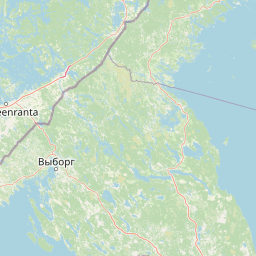
Map view of Ladoga Skerries National Park

Use this park location map to pinpoint Ladoga Skerries National Park in Russia, understand its exact geographic position, and read its mapped placement within the surrounding landscape more clearly.

Pigeon | © OpenStreetMap contributors

Location context for Ladoga Skerries National Park

Ямало-Ненецкий автономный округ
Natural feature types

Explore the Natural Landmark and Feature Index for Ладожские шхеры

Navigate the specialized collection of natural features identified within the Ладожские шхеры National Park. This resource helps clarify the complex geography of the Ladoga skerries and supports a deeper understanding of the individual landmarks that compose this protected archipelago landscape.

Explore photographic records of rocky islands, ancient granite shores, and taiga habitats.

Visualizing Ладожские шхеры: Landscape Photography and Protected Skerry Scenery

Visual documentation captures the intricate skerry labyrinth, granite outcrops, and forested shorelines defining the regional ecosystem of Ладожские шхеры. Photographic records reveal the complex geological formations and protected natural habitats characterizing the northern lake environment.

A high angle panoramic view overlooking calm blue water dotted with multiple small rocky islands covered in green pine forests under a clear blue sky.

A scenic landscape view of the Ladozhskiye Shkhery National Park showing rocky, pine-covered cliffs bordering calm, reflective water under a sky with scattered clouds.

A low, rocky island covered in pine forest rises from the surface of calm water under a clear blue sky, illustrating the skerry geography of Lake Ladoga.

A person stands on a blue, traditional wooden boat with sails moored against a rocky shoreline on a lake, with a second similar boat visible behind it.

Park atlas

Compare surrounding regional geography, lake archipelagos, and northern taiga landscapes

Other Parks Near Ладожские Шхеры and Related Protected Areas to Explore

Visitors exploring Ладожские шхеры can browse adjacent national parks and protected areas sharing similar glacial terrain and taiga ecosystems. Comparing these regional reserves provides deeper context on Scandinavian-style skerry formations and Fennoscandian conservation lands.
Watercolor illustration showing a lake with forested shores and mountains in the background
National parkRepublic of Karelia
Park boundaries overlap#1 closest

Ladoga Skerries National Park: National Park Protected Landscape & Geography

Mapped boundaries and regional context in the Republic of Karelia.

Discover Ladoga Skerries National Park, a key protected area recognized as a national park within the Republic of Karelia. This page provides essential context for understanding its mapped boundaries, the natural terrain it encompasses, and its geographical significance within the broader regional landscape. Utilize this information for structured atlas exploration of protected natural environments, focusing on the distinct identity of Ladoga Skerries National Park.

Area
1,220 km²
Established
2017
IUCN
II
Relief
Lowland
Watercolor illustration of a river flowing through a wetland area with grassy banks, trees, and distant hills
National parkNorth Karelia
About 83 km away#2 closest

North

Petkeljärvi National Park: Distinct Protected Landscape and Esker Formations in North Karelia

Discover Finland's unique esker ridges and boreal forests.

Petkeljärvi National Park represents a distinctive protected landscape in North Karelia, Finland, celebrated for its prominent esker formations that define its topography. The park showcases light Scots pine forests growing on sandy soils, creating an open forest character that sets it apart. Visitors can explore the mapped geography, including winding ridges, wetlands, and lake scenery, alongside preserved historical fortifications from the Continuation War, offering a rich blend of natural and cultural heritage within this compact national park.

Area
7 km²
Established
1956
IUCN
II
Visitors
17.3K annual
Watercolor illustration showing a lake with islands and forested shores, distant hills, and soft pastel colors
National parkSouth Savo
94 km away#3 closest

Northwest

Linnansaari National Park: South Savo's Protected Landscape and Geography

Explore the mapped boundaries of this Finnish national park.

Discover Linnansaari National Park, a distinct national park located in South Savo, Finland. This page provides detailed information focused on its protected landscape identity, mapped geography, and atlas context. Understand its significance as a conservation area and how its boundaries contribute to the regional natural landscape. Explore the geographic positioning of Linnansaari National Park within South Savo, offering insights for structured map-based discovery.

Area
38 km²
Established
1956
IUCN
II
Visitors
31.6K annual
National parkEtelä-Savo
About 109 km away#4 closest

Northwest

Kolovesi National Park: Mapped Protected Landscape in Etelä-Savo, Finland

Explore its geographic identity and mapped park boundaries.

Kolovesi National Park is a significant protected area located in the Etelä-Savo region of Finland, characterized by its presence within the Finnish lake district. This detailed page provides an atlas-centric view, emphasizing the park's mapped geographic features and its status as a protected natural landscape. Users engaging with MoriAtlas can understand Kolovesi National Park's unique landscape context and its precise location within the regional geography of southeastern Finland.

Area
61 km²
Established
1990
IUCN
II
Visitors
17.2K annual
Watercolor illustration of a bog landscape with green trees, a body of water, and rolling hills in the background
National parkNorth Karelia
128 km away#5 closest

North

Patvinsuo National Park: Protected Landscape Geography and Map Context

National park exploration in North Karelia, Finland.

Patvinsuo National Park stands as a vital protected area within North Karelia, Finland. This page serves as an atlas entry point, detailing the park's geographic scope, mapped boundaries, and its significance as a protected landscape. Users can explore the regional context and understand the natural terrain that characterizes this important Finnish national park, facilitating structured geographic discovery.

Area
105 km²
Established
1982
IUCN
II
Visitors
18.6K annual
Watercolor illustration of a landscape featuring green vegetation, rolling hills, and a body of water under a pastel sky
National parkNorth Karelia
133 km away#6 closest

North

Koli National Park: Protected National Park in North Karelia, Finland

Explore mapped landscape and regional geography.

Koli National Park represents a significant protected area within the eastern Finnish region of North Karelia. This page offers detailed geographic context and insight into the park's mapped landscape, essential for understanding its place within the broader atlas of Finland's natural terrain. Discover the protected boundaries and regional setting of this key national park.

Area
30 km²
Established
1991
IUCN
II
Visitors
249.8K annual
Watercolor illustration showing a landscape with mountains, a winding river, and patches of green vegetation and trees
National parkFinland
151 km away#7 closest

West

Repovesi National Park: Finland's Boreal Wilderness and Protected Landscape

Explore mapped terrain and regional geography.

Repovesi National Park represents a significant protected natural area in southeastern Finland, showcasing a landscape characterized by dense boreal forests, rolling hills, and numerous lakes. As one of Finland's most visited national parks, it offers a compelling example of conserved wilderness and natural terrain. This page details the park's protected landscape identity, its geographic setting within Finland, and the atlas-driven insights available for exploring its mapped boundaries and natural features.

Area
15 km²
Established
2003
IUCN
II
Visitors
100.9K annual
Natural monumentRepublic of Karelia
About 165 km away#8 closest

Northeast

Mount Vottovaara Natural Monument: Explore Protected Landscape and Geographic Context in Karelia

Mapped protected area boundaries and regional terrain in the Republic of Karelia.

Mount Vottovaara represents a significant natural monument within the Republic of Karelia, offering a focal point for structured geographic exploration. This protected landscape's mapped boundaries and its setting within the region's broader geography are key to understanding its atlas value. MoriAtlas provides the framework to examine the specific identity of Mount Vottovaara as a protected area, encouraging detailed study of its natural features and regional context.

Area
15 km²
Established
2011
IUCN
III
Relief
Mixed relief

Common questions about visiting, size, designation, and location context for Ladoga Skerries National Park

Ladoga Skerries National Park FAQs for park facts, access, geography, and protected area context

Find quick answers about Ladoga Skerries National Park, including protected-area facts, park geography, trail and visitor context, and how the park fits into its surrounding country and regional landscape.
MoriAtlas Explorer

Continue Your Protected Areas Search Across the Global Atlas

Deepen your exploration by continuing the structured search for national parks and protected areas worldwide. Utilize the comprehensive filtering capabilities to compare different conservation landscapes and refine your understanding of global park geography. Discover more about the distribution and characteristics of protected natural areas.

Global natural geography