

Mori Atlas logo
Nature reserveLion Island Nature Reserve

Analyzing the protected island terrain and its critical ecological role within the Hawkesbury River estuary.

Lion Island Nature Reserve: Mapped Protected Landscapes and Coastal Geography in New South Wales

Lion Island Nature Reserve occupies a strategic position at the mouth of the Hawkesbury River within Broken Bay, representing a highly protected island sanctuary on the New South Wales coast. The reserve is distinguished by its unique sandstone geology and its function as a predator free habitat for significant seabird colonies. By examining its boundaries and environmental context, researchers gain insight into the conservation of small, island based protected areas and their integration into the wider coastal geography of the Australian east coast.

island reservestrict nature reserveseabird breeding habitatlittle penguin colonyshearwater habitatcentral coast NSW

Lion Island Nature Reserve

Nature reserve

Park overview

Structured park overview, official facts, and landscape profile for Lion Island Nature Reserve

Lion Island Nature Reserve park facts, protected area profile, and essential visitor context

Review the core facts for Lion Island Nature Reserve, including designation, size, terrain, visitor scale, habitats, and operating context in one park-focused overview.

About Lion Island Nature Reserve

Lion Island Nature Reserve is a compact island protected area in Broken Bay, on the Central Coast of New South Wales, positioned where the Hawkesbury River meets the Tasman Sea. Located just off Pearl Beach and administratively connected to the Brisbane Water National Park system, the reserve protects the entirety of the island under a strict nature reserve designation.

The island derives its present name from its resemblance to a crouching lion and was originally called Mount Elliott Island by Governor Arthur Phillip in 1789, evoking the Rock of Gibraltar and commemorating a British naval figure. The reserve was formally established in 1956 as a fauna reserve and upgraded to nature reserve status in 1977, reflecting its growing recognition as a biodiversity hotspot rather than a simple local landmark.

Ecologically, the reserve is notable for supporting significant seabird populations. The island hosts the largest known colony of Australian little penguins on the Central Coast, with breeding pairs documented in surveys, alongside shearwater colonies. The absence of feral cats and foxes creates conditions favorable for ground-nesting seabirds, though the presence of water rats and weed infestations involving species such as Bitou Bush and Lantana present ongoing management challenges.

Access to the reserve is tightly controlled, with entry permitted only for conservation, education, and research activities. This restricted access reflects both the island's fragility and the priority placed on protecting its breeding fauna, particularly the penguin colony, which has shown signs of decline in recent decades.

Geologically, the island features Hawkesbury Sandstone at its eastern end and older Narrabeen Group sandstones and shales along its shores, contributing to its distinctive coastal landforms. Its recognition on the Australian National Heritage List further confirms its broader natural and ecological significance.

Quick facts and research context for Lion Island Nature Reserve

Lion Island Nature Reserve lies just offshore from Pearl Beach on the Central Coast of New South Wales, at the entrance to Broken Bay where the Hawkesbury River reaches the sea. The reserve covers approximately 8 hectares and encompasses the entire island.

It was first protected as a fauna reserve in 1956 and reclassified as a nature reserve in 1977, and is now managed by the NSW National Parks and Wildlife Service as a strict nature reserve with permit-only access. The island is free of feral cats and foxes and was added to the Australian National Heritage List in December 2006.

Protection and recognition

Documented terrestrial protection scope and official conservation designations

Lion Island Nature Reserve Protection Status and International Recognition

Lion Island Nature Reserve holds documented terrestrial protection status within its managed boundaries. Official records outline the governing designation scope and conservation framework assigned to the protected landscape.

Protection details

Protection scope
Terrestrial
Transboundary protection
No
Park context

Deeper park guide and search-rich context for Lion Island Nature Reserve

Lion Island Nature Reserve history, landscape, wildlife, and travel context

Explore Lion Island Nature Reserve through its history, landscape character, ecosystems, wildlife, conservation priorities, cultural context, and seasonal travel timing in a structured park guide built for atlas discovery and search intent.

Why Lion Island Nature Reserve stands out

Lion Island Nature Reserve is best known for being home to the largest population of Australian little penguins on the Central Coast of New South Wales, with a noted breeding colony on the island. It is also recognized for its role as a breeding habitat for shearwaters and for its position as an ecologically significant island within the Hawkesbury River estuary. The reserve's strict protection status, absence of feral predators, and recognition on the Australian National Heritage List underscore its standing as a small but ecologically meaningful protected area in the region.

A wide view of Lion Island silhouetted against a vibrant pink and purple sunset sky over the water, with distant city lights visible on the horizon.
Lion Island at sunset

Lion Island Nature Reserve history and protected-area timeline

The island's documented history begins in 1789, when Governor Arthur Phillip named it Mount Elliott Island, comparing its appearance to Gibraltar in honor of General Elliott. This name persisted in cartographic records into the twentieth century before gradually being replaced by the descriptive name Lion Island, which references the island's resemblance to a crouching lion.

The modern conservation history of the island began in 1956 with the establishment of the Lion Island Fauna Reserve. In 1977, the area was reclassified and formally designated the Lion Island Nature Reserve under New South Wales wildlife protection legislation, placing it under the administration of the NSW National Parks and Wildlife Service.

Recognition of the reserve's broader national significance came in December 2006, when it was added to the Australian National Heritage List. Since then, the reserve has remained subject to active ecological management, including efforts to manage invasive plants and respond to environmental disturbances such as the 2018 wildfire that affected the island.

Lion Island Nature Reserve landscape and geographic character

Lion Island sits at the mouth of the Hawkesbury River within Broken Bay, forming part of the coastal scenery of the New South Wales Central Coast. The island is a small but visually distinctive landmass, recognizable from the mainland and from nearby beaches such as Iron Ladder Beach, and contributes to the broader coastal landscape of the Hawkesbury estuary.

Geologically, the island displays a clear contrast in rock formations. The cap at its eastern end is composed of Hawkesbury Sandstone, while the surrounding shores are formed of older Narrabeen Group sandstones and shales. This geological layering contributes to the island's variable coastal profile and rocky shoreline character.

The surrounding waters of Broken Bay and the Hawkesbury River estuary define the broader landscape context, with the island exposed to both river and oceanic influences. This transitional coastal setting shapes the island's vegetation, its exposure to weather and storms, and its ecological character.

Lion Island Nature Reserve ecosystems, habitats, and plant life

The nature reserve protects the full ecological profile of Lion Island, which despite its small area supports ecologically important habitats linked to its coastal and estuarine setting. The island provides breeding habitat for seabirds, including shearwaters, in an environment largely free from feral predators such as cats and foxes.

The reserve's vegetated landscape is, however, affected by invasive plant species, notably Bitou Bush and Lantana, which have been identified as weed infestation problems. Managing these invasive species forms part of the ongoing ecological work on the island.

The combination of restricted public access, absence of major feral predators, and protected status allows the reserve to function as a relatively undisturbed refuge for native fauna, particularly ground-nesting and burrow-breeding seabirds. The island's ecological value was formally recognized through its addition to the Australian National Heritage List in 2006, underscoring its importance at a national scale.

Lion Island Nature Reserve wildlife and species highlights

The wildlife significance of Lion Island Nature Reserve centers on its seabird populations, particularly the breeding colony of Australian little penguins found there. The island hosts the largest known population of this species on the Central Coast, with around 300 breeding pairs recorded in 2007, though more recent research suggests a steep population decline since the 1990s without a clearly identified cause.

Beyond the penguin colony, the island supports breeding shearwaters, taking advantage of the predator-free environment. Mammalian fauna on the island includes water rats, observed running along the water's edge at night, and these native predators are known in other regions to have an impact on penguin breeding success through nest depredation.

The reserve's wildlife values are reinforced by its strict protection status and absence of feral cats and foxes, which distinguishes it from many surrounding mainland areas and makes it a regionally important refuge for seabird breeding populations.

Lion Island Nature Reserve conservation status and protection priorities

Lion Island Nature Reserve is managed as a strict nature reserve under IUCN Category Ia, reflecting a high level of protection oriented primarily toward ecosystem and species conservation rather than public recreation. The reserve is administered by the NSW National Parks and Wildlife Service, and access is restricted to permit holders engaged in conservation, education, or research activities.

The island's conservation significance was formally acknowledged in December 2006, when the area was added to the Australian National Heritage List, recognizing its outstanding natural heritage values at a national scale. The absence of feral cats and foxes supports breeding populations of seabirds, particularly shearwaters and little penguins, that would otherwise face significant predation pressure on the mainland.

Ongoing conservation challenges include invasive weed species such as Bitou Bush and Lantana, broader uncertainties about penguin colony trends, and recovery efforts following environmental disturbances such as the 2018 wildfire that affected the island. The 2021 effort to clear storm debris ahead of penguin breeding season illustrates the active, responsive management applied to the reserve.

Top sights and standout views in Lion Island Nature Reserve

Lion Island Nature Reserve stands out for combining exceptionally high protection status with a small land area, producing a tightly protected refuge for regionally significant seabird populations. The little penguin colony is the reserve's most distinctive ecological feature, alongside its shearwater breeding habitat and its role as part of the broader Brisbane Water National Park system.

Recognition on the Australian National Heritage List, pristine predator-free conditions, and ongoing active management of invasive weeds and storm impacts further mark the reserve as a notable example of small-scale, high-value island conservation in New South Wales.

Monthly climate preview

Long-term temperature ranges and monthly precipitation averages for New South Wales

Lion Island Nature Reserve Climate Normals and Annual Weather Patterns

Historical monitoring data records mean monthly temperatures from 11.81 degrees Celsius to 23.17 degrees Celsius alongside daily precipitation rates for Lion Island Nature Reserve. Examining the full twelve-month profile provides complete insight into long-term climate variations across the protected area.
Annual mean18 °C
12 °C23 °C
Jan23°
Feb23°
Mar21°
Apr18°
May15°
Jun13°
Jul12°
Aug13°
Sep16°
Oct18°
Nov20°
Dec22°
Warmest month
January

23.2 °C

Coolest month
July

11.8 °C

Wettest month
February

4.5 mm/day

Driest month
July

1.6 mm/day

Park location guide

Geography guide, regional context, and park location map for Lion Island Nature Reserve

Lion Island Nature Reserve park geography, regions, and map view in Australia

Understand where Lion Island Nature Reserve sits in Australia through a broader geographic reading of the surrounding landscape, nearby location context, and its mapped position within the national park landscape.

How Lion Island Nature Reserve fits into Australia

Australia is a constitutional monarchy and federal parliamentary democracy comprising six states and ten territories. With a population of nearly 28 million, it is one of the world's most urbanised countries, with most people concentrated on the eastern seaboard. The country has a high Human Development Index and is known for its cultural diversity, ancient Aboriginal heritage, and unique wildlife.

Wider geography shaping Lion Island Nature Reserve in Australia

Australia occupies the entire Australian continent, the island of Tasmania, and numerous smaller islands. It is the world's flattest and driest inhabited continent, featuring vast deserts in the interior (the Outback), tropical rainforests along the eastern coast, and a coastline bordering the Indian and Pacific Oceans.

Map view of Lion Island Nature Reserve

Use this park location map to pinpoint Lion Island Nature Reserve in Australia, understand its exact geographic position, and read its mapped placement within the surrounding landscape more clearly.

Pigeon | © OpenStreetMap contributors

Location context for Lion Island Nature Reserve

New South Wales

Visual exploration of coastal terrain, sandstone formations, and seabird habitats

Lion Island Nature Reserve Photos and Landscape Scenery

Visual records reveal the rugged sandstone terrain, rocky shorelines, and coastal environment of Lion Island Nature Reserve. Examining field photographs helps researchers and visitors understand the protected landscape and seabird habitats of the Hawkesbury River estuary.

A wide view of Lion Island silhouetted against a vibrant pink and purple sunset sky over the water, with distant city lights visible on the horizon.

Park atlas

Compare nearby coastal reserves and regional protected areas across the New South Wales coast.

Exploring Parks Near Lion Island Nature Reserve and Surrounding Protected Landscapes

Browse protected areas and coastal nature reserves located near Lion Island Nature Reserve in the Hawkesbury River estuary. Comparing adjacent regional park geography provides broader context for coastal conservation landscapes.
National parkNew South Wales
About 0.8 km away#1 closest

North

Brisbane Water National Park: A Protected Landscape in New South Wales' Sydney Basin Bioregion

Explore mapped terrain, endangered ecosystems, and coastal waterway geography.

Brisbane Water National Park, located in New South Wales, Australia, is a vital protected area safeguarding critical ecosystems within the Sydney Basin bioregion. This national park features a diverse landscape encompassing rugged escarpments, fertile valleys, and important coastal waterways. Its protected status makes it a crucial conservation refuge, offering insights into unique natural terrain and regional geography for those seeking detailed, map-centric exploration.

Area
115.06 km²
Established
1959
IUCN
II
Relief
Mixed relief
National parkNew South Wales
About 2.2 km away#2 closest

Southwest

Ku-ring-gai Chase National Park: Hawkesbury Sandstone Protected Landscape and Ria Coastline

New South Wales National Park with mapped Aboriginal heritage.

Ku-ring-gai Chase National Park in New South Wales is renowned for its striking Hawkesbury Sandstone geology, defining its rugged plateau and steep, flooded ria valleys that shape a dramatic coastline. As Australia's third oldest national park, it preserves over 800 Aboriginal heritage sites, including rock engravings and art, set within a landscape perfect for geographic exploration and understanding protected areas. Examine its unique mapped terrain, from volcanic intrusions to tessellated pavements, all contributing to its distinct protected landscape identity.

Area
149.77 km²
Established
1894
IUCN
II
Visitors
2M annual
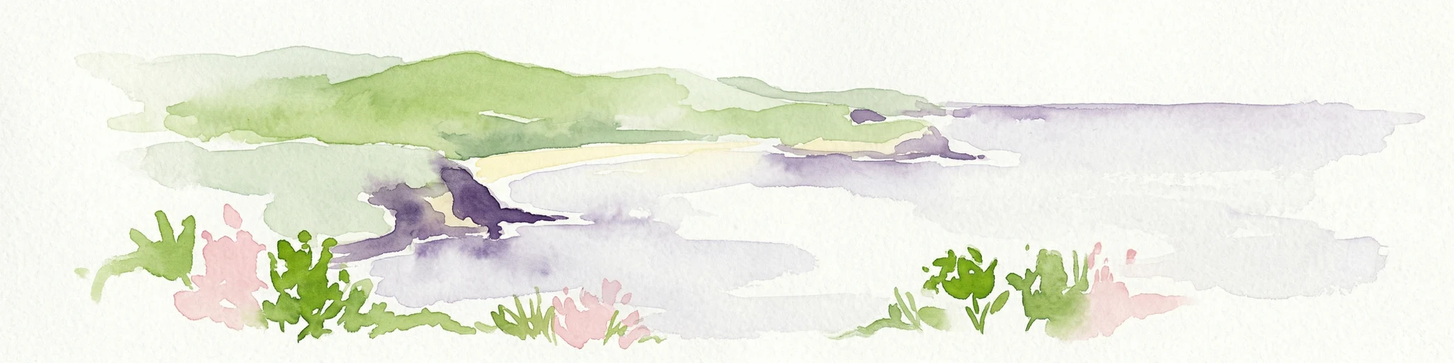
Watercolor painting depicting a coastal landscape with green hills, sandy beach, and pink and green plants in the foreground
National parkNew South Wales
About 2.7 km away#3 closest

Northeast

Bouddi National Park: Coastal National Park with Temperate Rainforest & Marine Atlas

Discover unique sandstone landscapes and protected marine geography in New South Wales.

Bouddi National Park in New South Wales stands out for its rare mix of coastal headlands, ancient temperate rainforests, and a comprehensive marine protected area. Its landscape is defined by dramatic Hawkesbury sandstone geology, featuring spectacular tessellated pavements and laterite plateaus. The park's protected marine zone significantly enhances local biodiversity, making it a key area for understanding coastal and oceanic protected landscapes within the Australian atlas.

Area
15.32 km²
Established
1967
IUCN
II
Relief
Lowland
National parkNew South Wales
About 12 km away#4 closest

Northwest

Popran National Park National Park: A Protected Landscape Atlas in New South Wales

Explore the valley terrain and Aboriginal heritage of this protected natural area.

Popran National Park in New South Wales is a significant protected national park offering rich insights into Australia's natural and cultural heritage. This park preserves the unique valley landscapes of the Popran Creek catchment and the historically important Glenworth Valley. Its geography reflects the broader Sydney basin, with terrain averaging 135 metres in elevation, showcasing riparian ecosystems and eucalyptus forests. The park's protected status ensures the conservation of this distinctive landscape, making it a key point of interest for geographic discovery and understanding regional Australian protected areas.

Area
39.7 km²
Established
1994
IUCN
II
Relief
Upland
Nature reserveNew South Wales
About 12 km away#5 closest

West

Muogamarra Nature Reserve: Geography, Sandstone Terrain, and Protected Land Boundaries

Exploration of a sandstone wilderness in the Sydney region.

Spanning over 2,200 hectares between Cowan and the Hawkesbury River, Muogamarra Nature Reserve represents a strictly managed protected area known for its distinctive dry sclerophyll forest and sandstone geology. This atlas entry focuses on the interplay between elevated rocky outcrops and tidal river boundaries, offering a detailed perspective on one of the most culturally and ecologically significant reserves in New South Wales.

Area
22.74 km²
Established
1960
IUCN
Ia
Relief
Upland
National parkNew South Wales
About 15 km away#6 closest

Southwest

Garigal National Park: National Park Protected Landscape and Geographic Exploration

Mapped boundaries and regional natural terrain context in New South Wales.

Garigal National Park is a designated national park offering a specific focus for geographic and protected-area exploration. This detail page provides an atlas-oriented view of its mapped natural landscape and its role within the broader protected areas of New South Wales. Understand the park's identity through its geographic features and protected boundaries, enabling structured discovery of its unique landscape context.

Area
22.02 km²
Established
1991
IUCN
II
Relief
Mixed relief
National parkSydney
About 15 km away#7 closest

West

Marramarra National Park: Sydney's Protected Landscape and National Park Atlas

Explore mapped boundaries and regional geography near Sydney.

Marramarra National Park stands as a key protected natural landscape near Sydney, Australia. This entry facilitates detailed atlas exploration, focusing on its geographic setting and identity as a national park. Understand the park's mapped borders, its regional context within the Sydney area, and the unique natural landscape it preserves. MoriAtlas provides structured data to comprehend Marramarra National Park's place in the Australian protected areas network and its distinct geographic characteristics.

Area
117.85 km²
Established
1979
IUCN
II
Relief
Upland
National parkNew South Wales
About 17 km away#8 closest

Southwest

Berowra Valley National Park: A National Park in New South Wales with Detailed Geographic Mapping

Explore its mapped boundaries and regional landscape context.

Delve into Berowra Valley National Park, a protected area situated in New South Wales, Australia. This entry provides essential geographic context, focusing on its mapped boundaries and the specific natural landscape it encompasses. It serves as a key resource for understanding the park's role within the broader regional atlas and its distinct protected terrain.

Area
38.84 km²
Established
2012
IUCN
II
Relief
Upland

Common questions about visiting, size, designation, and location context for Lion Island Nature Reserve

Lion Island Nature Reserve FAQs for park facts, access, geography, and protected area context

Find quick answers about Lion Island Nature Reserve, including protected-area facts, park geography, trail and visitor context, and how the park fits into its surrounding country and regional landscape.
MoriAtlas Explorer

Continue Your Protected Areas Search Across the Global Atlas

Deepen your exploration by continuing the structured search for national parks and protected areas worldwide. Utilize the comprehensive filtering capabilities to compare different conservation landscapes and refine your understanding of global park geography. Discover more about the distribution and characteristics of protected natural areas.

Global natural geography