Why Mae Wong National Park stands out
Mae Wong National Park is best known for its dramatic mountain landscape within the Dawna Range, which represents one of Thailand's most significant highland forest ecosystems. The park protects extensive areas of rugged terrain that remain relatively undeveloped compared to other Thai national parks, offering a sense of wilderness and natural isolation. Its waterfall systems, particularly Mae Rewa Falls, provide accessible natural attractions for visitors, while the summit of Mu Ko Chu mountain offers a notable vantage point for experiencing the park's scale and topographic character.
Mae Wong National Park history and protected-area timeline
Mae Wong National Park was formally declared on 14 September 1987, becoming the 54th national park established in Thailand. Prior to its designation as a protected area, the region was inhabited by various hill tribe communities, including the Hmong, Yao, Muzer (Lahu), and Karen peoples, who maintained traditional settlements and land use patterns within what is now the park boundary. Following national park establishment, these communities were relocated or their activities restricted as part of the transition to formal protected area management. In 2012, the park became the focus of significant environmental controversy when Thailand's cabinet approved a large-scale dam project on the Mae Wong River. The proposed 13 billion baht Mae Wong Dam was intended to address water shortages during dry seasons and flooding during wet seasons. Environmental opponents raised concerns about the potential loss of approximately 1,760 hectares of lowland forest and significant habitat disruption for wildlife within the national park. The controversy prompted substantial public protest, including a 388-kilometre walk to Bangkok by environmental campaigner Sasin Chalermlap in September 2013. Government positions on the project have fluctuated, with officials indicating at various points that the dam would proceed, that alternatives would be studied, and that the project was being reconsidered, reflecting the ongoing tension between infrastructure development and environmental conservation priorities in the region.
Mae Wong National Park landscape and geographic character
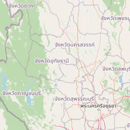
The physical landscape of Mae Wong National Park is defined by its position within the Dawna Range, a major mountainous system in western Thailand that forms part of a broader highland corridor extending through mainland Southeast Asia. The park's terrain is characterized as rugged and hilly, with the most pronounced topographic complexity occurring in the northern and western sectors where steep slopes and deep valleys create a dramatic mountain environment. The highest elevation in the park is found at Khao Mo Ko Chu, also known as Khao Mokochu, which rises to 1,964 metres above sea level, making this one of the highest points in Thailand's national park system. The drainage pattern is organized around three principal river systems that flow through the park, with the Mae Wong River serving as the dominant watercourse. The combination of elevation change, steep terrain, and perennial water flow has created favourable conditions for waterfall formation, with Mae Krasa, Mae Rewa, and Mae Ki Falls representing notable hydrological features. The landscape supports a transition from lowerelevation forest types through montane forest zones as elevation increases, with the higher peaks offering distinct ecological conditions from the valley bottoms.
Mae Wong National Park ecosystems, habitats, and plant life
The ecological character of Mae Wong National Park reflects its location within the Dawna Range, an area that supports diverse forest ecosystems ranging from tropical lowland evergreen forest through mixed deciduous forest to montane forest communities at higher elevations. The protected area encompasses a significant watershed function, with the three major river systems draining the park and providing water resources for downstream communities and agricultural areas. Forest cover within the park includes both evergreen and semi-evergreen forest types, with species composition varying according to elevation, aspect, and moisture availability. The relative remoteness and rugged nature of the terrain has allowed for the maintenance of more extensive forest cover compared to lowerelevation areas in central Thailand that have undergone substantial land use conversion. The park's ecological significance is enhanced by its position within a mountainous region that serves as a biogeographic corridor connecting forest ecosystems across wider geographic areas.
Mae Wong National Park conservation status and protection priorities
Mae Wong National Park represents an important conservation designation within Thailand's protected area network, preserving a substantial tract of mountainous forest habitat in a region where development pressures have reduced natural forest cover in many surrounding areas. The national park status provides formal legal protection under Thai law, with management responsibility assigned to the Department of National Parks, Wildlife and Plant Conservation. The protected area serves multiple conservation functions including watershed protection, biodiversity maintenance, and preservation of scenic natural landscapes. The controversy surrounding the proposed Mae Wong Dam illustrates the ongoing tension between development pressures and conservation values in Thailand, with the proposed infrastructure project raising significant concerns about habitat loss and ecosystem disruption within the national park boundary. The dam proposal has highlighted questions about the appropriate balance between water resource development and the maintenance of protected forest areas that provide ecological services beyond their immediate boundaries.
Mae Wong National Park cultural meaning and human context
The cultural history of Mae Wong National Park includes the presence of hill tribe communities, particularly the Hmong, Yao, Lahu, and Karen peoples, who maintained traditional settlements within the area prior to its designation as a national park. These communities practiced shifting cultivation and maintained cultural connections to the highland landscape that now falls within the protected area. The establishment of the national park required transitions in land use and settlement patterns, reflecting broader Thai government policies regarding the management of highland areas and the relationship between conservation objectives and the rights of indigenous communities. The ongoing dam controversy has also involved local communities, with reports indicating that some local residents have expressed support for the project while others have opposed it, reflecting the complex perspectives among populations living in proximity to the protected area and dependent on its natural resources.
Top sights and standout views in Mae Wong National Park
Mae Wong National Park offers visitors access to some of Thailand's most significant mountain forest landscapes, with the Dawna Range providing a backdrop of rugged peaks and forested slopes that differ substantially from the lowland terrain more typical of Thai protected areas. The park's waterfall systems, particularly Mae Rewa Falls, provide accessible natural attractions, while the climb to Mokochu Peak offers hikers panoramic views from one of Thailand's higher viewpoints within a national park. The park's relative remoteness and the challenging terrain contribute to a sense of wilderness that distinguishes it from more accessible protected areas. The proposed dam controversy has brought international attention to the park, highlighting its ecological significance and the broader questions surrounding development in Thailand's remaining forest areas.