

Mori Atlas logo
National parkNamtok Pha Charoen National Park

Discover the mapped boundaries and regional geography of this significant national park.

Namtok Pha Charoen National Park: Protected Landscape and Geographic Context in Tak Province

Namtok Pha Charoen National Park represents a significant protected landscape within Tak Province, Thailand. Situated in a region known for its extensive forest coverage and mountainous terrain, this national park offers a unique point of study for its geographic identity and mapped boundaries. Users can delve into its specific location within Western Thailand, understanding its role as a protected natural area and its contribution to the regional geography.

National ParkMountainsWaterfallsTropical ForestWildlife ConservationThailand

Namtok Pha Charoen National Park

National park

Park overview

Structured park overview, official facts, and landscape profile for Namtok Pha Charoen National Park

Namtok Pha Charoen National Park park facts, protected area profile, and essential visitor context
Review the core facts for Namtok Pha Charoen National Park, including designation, size, terrain, visitor scale, habitats, and operating context in one park-focused overview.

About Namtok Pha Charoen National Park

Namtok Pha Charoen National Park protects a substantial tract of mountainous wilderness in northwestern Thailand's Tak Province, an region of considerable ecological and topographic diversity. The park's terrain is characterized by complex mountain formations that reach elevations of 1,765 meters, creating a landscape of steep ridges, deep valleys, and cascading watercourses that flow down from the highland core. These mountains form part of the natural boundary zone between Thailand and Myanmar, with the Doi Kia Viewpoint marking one of the highest points along this international border. The park's forest ecosystems are notable for their composition, blending mixed deciduous woodland with coniferous forest in a pattern that reflects the elevation gradient and local climate conditions. The namesake Namtok Pha Charoen waterfall represents the park's most celebrated natural feature, its ninety-seven tiers descending through limestone formations in a display of cascading water that attracts both local and international visitors. Beyond the main waterfall, the park contains several additional waterfalls including Namtok Pa Wai, Namtok Sai Fa, and Namtok Sai Rung, each with distinctive characters ranging from year-round flows to seasonal displays enhanced by monsoon rains. The geothermal feature at Bo Nam Ron Huai Nam Nak provides another dimension to the park's natural attractions, with its hot spring waters offering a different kind of visitor experience.

Quick facts and research context for Namtok Pha Charoen National Park

Namtok Pha Charoen National Park occupies approximately 770 square kilometers in Tak Province, northwestern Thailand, within the Phop Phra District. The park's mountainous terrain reaches elevations of 1,765 meters and features a mix of deciduous and coniferous forest cover. The climate is influenced by the southwestern monsoon, resulting in three distinct seasons with annual rainfall between 1,500 and 2,000 millimeters. The park received approximately 152,539 visitors in 2019 and is managed by Thailand's Department of National Parks, Wildlife and Plant Conservation. The namesake waterfall, Namtok Pha Charoen, is a ninety-seven-tiered cascade fed by mountain creeks.

Park context

Deeper park guide and search-rich context for Namtok Pha Charoen National Park

Namtok Pha Charoen National Park history, landscape, wildlife, and travel context
Explore Namtok Pha Charoen National Park through its history, landscape character, ecosystems, wildlife, conservation priorities, cultural context, and seasonal travel timing in a structured park guide built for atlas discovery and search intent.

Why Namtok Pha Charoen National Park stands out

Namtok Pha Charoen National Park is best known for its namesake waterfall, a dramatic ninety-seven-tiered limestone cascade that flows continuously throughout the year. The park's elevated mountain environment supports a distinctive mix of deciduous and coniferous forests, creating a landscape of considerable ecological and scenic value along the Thailand-Myanmar border. The Doi Kia Viewpoint, rising to approximately 512 meters, offers sweeping views across the international boundary into Myanmar's forested territories. The park also features natural hot springs at Bo Nam Ron Huai Nam Nak, where water reaches temperatures of 60 degrees Celsius, adding to the area's geothermal interest.

Namtok Pha Charoen National Park history and protected-area timeline

Namtok Pha Charoen National Park was established as part of Thailand's national park system, protected under the national park designation to preserve its mountainous landscapes, forest ecosystems, and watershed values. The park falls under the administrative jurisdiction of the Department of National Parks, Wildlife and Plant Conservation, which manages Thailand's protected area network. The park's location along the Thailand-Myanmar border places it within a region that has historical significance for both countries, though the protected area itself was formally designated in the modern conservation era. The area's natural features, particularly the prominent waterfall that gives the park its name, have long been recognized as locally significant, with the ninety-seven-tiered cascade serving as a reference point for the surrounding region.

Namtok Pha Charoen National Park landscape and geographic character

The landscape of Namtok Pha Charoen National Park is dominated by complex mountain terrain with elevations ranging from lower valleys up to 1,765 meters at the highest points. The mountain systems form part of the broader highlands that extend along the Thailand-Myanmar border, creating a landscape of considerable topographic relief with steep slopes, ridgelines, and intervening valleys. The limestone geological character of the region is evident in the waterfall formations, particularly the multi-tiered Namtok Pha Charoen cascade where water descends over rock steps formed from carbonate rock. The Doi Kia Viewpoint provides an elevated vantage point from which visitors can observe the extent of the mountainous terrain extending into Myanmar. The park's water features include both perennial streams fed by mountain springs and seasonal watercourses that respond to monsoon rainfall patterns. The natural hot spring at Bo Nam Ron Huai Nam Nak represents a geothermal manifestation within the park's landscape, with water emerging from underground sources at elevated temperatures.

Namtok Pha Charoen National Park ecosystems, habitats, and plant life

The ecological character of Namtok Pha Charoen National Park is defined by its forest cover, which transitions from mixed deciduous woodland in the lower elevations through to coniferous forest associations at higher altitudes. This forest composition reflects the park's location in a climatic zone influenced by the southwestern monsoon, with annual rainfall between 1,500 and 2,000 millimeters supporting substantial vegetation growth. The landscape's complexity, with its multiple elevation zones and varied aspect, creates diverse microhabitats that support the park's biodiversity. A particularly notable floral feature is the curcuma, commonly known as Siam tulip, which produces vibrant orange flowers during the July to October period, adding seasonal color to the park's natural office area. The forest ecosystem provides habitat structure for numerous animal species and plays a significant role in watershed protection for downstream communities.

Namtok Pha Charoen National Park wildlife and species highlights

The wildlife community within Namtok Pha Charoen National Park encompasses several notable mammal species, including gaur, various deer species, Muntjac, wild boars, and the endangered Indochinese tiger. Smaller mammals present in the park include masked palm civets, gibbons, monkeys, mouse deer, and porcupines. The bird population is represented by species including red junglefowl and pheasants, which inhabit the forest understory and surrounding areas. The reptilian community includes various snake species. This assemblage of wildlife reflects the park's diverse habitat types, from forest floor to canopy, and the protection afforded by the national park designation contributes to maintaining these populations within a relatively intact ecosystem.

Namtok Pha Charoen National Park conservation status and protection priorities

Namtok Pha Charoen National Park functions as a protected area within Thailand's national park system, receiving IUCN Category II designation that recognizes its national park status and conservation mandate. The park's conservation significance derives from its substantial forest cover, which provides ecosystem services including watershed protection, soil conservation, and biodiversity preservation. The mountainous terrain, with its complex topography, creates diverse ecological niches that support species including the Indochinese tiger, a endangered population whose presence indicates the ecological integrity of the area. The protection of this mountain landscape also contributes to maintaining connectivity for wildlife movement along the Thailand-Myanmar border region, an area of considerable conservation importance in Southeast Asia.

Namtok Pha Charoen National Park cultural meaning and human context

Namtok Pha Charoen National Park is located in the Phop Phra District of Tak Province, an area in northwestern Thailand that lies adjacent to the international border with Myanmar. The region has historical connections to trade and movement between the two countries, though the park itself is designated as a modern protected area. The local communities in the surrounding area maintain connections to the land use patterns of the broader region. The park's Thai name, อุทยานแห่งชาติน้ำตกพาเจริญ, directly translates to indicate its identity as a national park centered on the Pha Charoen waterfall, with the name reflecting local linguistic conventions.

Top sights and standout views in Namtok Pha Charoen National Park

Namtok Pha Charoen National Park offers several standout features that distinguish it within Thailand's protected area network. The ninety-seven-tiered Namtok Pha Charoen waterfall represents the park's primary attraction, a year-round cascade of significant visual impact descending through limestone formations. The Doi Kia Viewpoint provides access to panoramic mountain scenery and views extending into Myanmar's territory. The natural hot springs at Bo Nam Ron Huai Nam Nak offer visitor amenities including gazebos provided by the Phop Phra District administration. Additional waterfalls including Namtok Pa Wai, Namtok Sai Fa, and Namtok Sai Rung expand the park's waterfall inventory, with the latter two featuring spray effects that create rainbow appearances in sunlight. The park's elevation and forest environment create a distinct mountainous character within Thailand's western border region.

Best time to visit Namtok Pha Charoen National Park

The optimal time to visit Namtok Pha Charoen National Park depends on seasonal conditions shaped by the southwestern monsoon influence. The winter season from November through February offers generally comfortable temperatures, with the lowest temperatures around 6 degrees Celsius, making this period suitable for visitors seeking mild conditions. The summer months from March to May bring warmer weather, though the park's elevation and breezy conditions prevent extreme heat. The rainy season from June through October delivers heavy and continuous rainfall, which sustains the waterfall flows but may limit some visitor activities. The Siam tulip bloom from July to October provides a seasonal floral display particularly at the natural park office area. Visitors interested in wildlife viewing may find different opportunities across seasons, while those prioritizing waterfall scenery should note that the wet season maintains strong flow rates at the cascade features.
Park location guide

Geography guide, regional context, and park location map for Namtok Pha Charoen National Park

Namtok Pha Charoen National Park park geography, regions, and map view in Thailand
Understand where Namtok Pha Charoen National Park sits in Thailand through a broader geographic reading of the surrounding landscape, nearby location context, and its mapped position within the national park landscape.

How Namtok Pha Charoen National Park fits into Thailand

Thailand is a Southeast Asian nation formerly called Siam, located in mainland Southeast Asia. It operates as a unitary parliamentary constitutional monarchy under King Vajiralongkorn. The country borders Myanmar, Laos, Cambodia, and Malaysia, with maritime boundaries involving Vietnam, Indonesia, and India. Thailand has a population of nearly 66 million and covers approximately 513,120 km². Historically, the Sukhothai Kingdom marks the beginning of Thai history, followed by the powerful Ayutthaya Kingdom.

Wider geography shaping Namtok Pha Charoen National Park in Thailand

Thailand occupies mainland Southeast Asia with borders to Myanmar (west/northwest), Laos (east/northeast), Cambodia (southeast), and Malaysia (south). The country has coastline along the Gulf of Thailand to the southeast and the Andaman Sea to the southwest. The territory covers approximately 513,120 km².

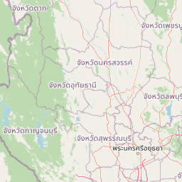
Map view of Namtok Pha Charoen National Park

Use this park location map to pinpoint Namtok Pha Charoen National Park in Thailand, understand its exact geographic position, and read its mapped placement within the surrounding landscape more clearly.

Pigeon | © OpenStreetMap contributors

Location context for Namtok Pha Charoen National Park

Tak Province
Park atlas

Trace the regional geography and protected landscapes adjacent to Namtok Pha Charoen National Park, comparing diverse ecosystems.

Discover Other National Parks and Protected Areas Surrounding Namtok Pha Charoen National Park
Expand your geographic discovery from Namtok Pha Charoen National Park to explore other national parks and protected areas found within Thailand's mountainous western border region, including diverse forest and waterfall landscapes. This view provides essential context for comparing adjacent conservation areas, tracing regional geographic connections, and understanding the spread of protected natural environments.
National parkTak Province

Taksin Maharat National Park: National Park with Mapped Boundaries in Tak Province

Discover its protected landscape and regional geography.

Taksin Maharat National Park is a designated national park offering a focused point for geographic discovery. Located within Tak Province, a region characterized by significant forest cover and mountainous geography in western Thailand, this park contributes to the understanding of protected land distribution. Exploring its mapped terrain and landscape identity provides insight into the natural features that define this specific Thai protected area.

Area
149 km²
Established
1981
IUCN
II
Visitors
30.2K annual
National parkTak Province

Lan Sang National Park: Mapped Protected Landscape and Waterfall Atlas

Discover the geography and natural features of this national park.

Lan Sang National Park presents a rich protected landscape within Tak Province, Thailand, renowned for its striking tiered waterfalls cascading through the mountainous Dawna Range. This national park offers a detailed look at its mapped terrain, including multiple named waterfalls like Namtok Pha Lat and Namtok Tha Le, alongside scenic viewpoints. Its diverse forest environments contribute to a unique natural setting, making it a significant area for understanding regional geography and protected natural land patterns.

Area
104 km²
Established
1979
IUCN
II
Visitors
38.9K annual
National parkKamphaeng Phet Province

Khlong Wang Chao National Park: Thailand's Distinct Mountainous Protected Landscape in Kamphaeng Phet

Explore mapped boundaries and terrain of this significant national park.

Khlong Wang Chao National Park is a key protected area in western Thailand, recognized for its impressive mountainous geography within the Thanon Thong Chai Range. Spanning 747 square kilometers, the park features complex ridges, valleys, and Yen Mountain, its highest peak. Its designation as a national park highlights the importance of its dense teak forests and unique central valley formations, offering a rich subject for geographic and landscape exploration.

Area
747 km²
Established
1990
IUCN
II
Visitors
33.4K annual
National parkTak Province

Khun Phawo National Park: Protected National Park in Tak Province, Thailand

Mapped geography and protected area context for Khun Phawo.

Khun Phawo National Park stands as a designated national park within Tak Province, western Thailand. This page facilitates a deeper atlas-driven understanding of the park's protected landscape, its mapped terrain, and its regional geographic significance. It is an essential entry point for exploring the park's boundaries and its place within the broader conservation atlas.

Area
397 km²
Established
2009
IUCN
II
Visitors
10.3K annual
National parkKamphaeng Phet Province

Khlong Lan National Park: National Park Protected Landscape and Geography

Explore mapped boundaries and regional context in Kamphaeng Phet Province.

Delve into the specifics of Khlong Lan National Park, a protected area designated as a national park in Thailand's Kamphaeng Phet Province. This page offers a structured view of its geographic scope, emphasizing mapped park boundaries and the surrounding natural terrain. Understand its role as a significant protected landscape within the regional geography.

Area
300 km²
Established
1985
IUCN
II
Visitors
206.4K annual
National parkNakhon Sawan Province

Mae Wong National Park: National Park Protected Area and Geographic Setting

Mapped boundaries and regional landscape of Mae Wong.

Investigate Mae Wong National Park, a designated national park offering insights into its protected landscape identity. This entry provides structured geographic data, focusing on the park's mapped boundaries and its position within the broader regional context of Nakhon Sawan Province. Examine its role as a significant protected area for atlas-based discovery and geographic understanding.

Area
894 km²
Established
1987
IUCN
II
Visitors
51.8K annual
National parkSukhothai Province

Ramkhamhaeng National Park: National Park Atlas and Protected Landscape Geography

Mapped boundaries and regional context within Sukhothai Province.

Ramkhamhaeng National Park serves as a vital national park, offering a unique perspective on Thailand's natural protected areas. Explore its mapped boundaries and understand its integration into the regional geography of Sukhothai Province. This page provides detailed atlas-style insights into the park's landscape, facilitating a deeper appreciation of its protected status and geographic significance.

Area
341 km²
Established
1980
IUCN
II
Visitors
23.4K annual
National parkTak Province

Mae Wa National Park: Protected Landscape and Geographic Context in Tak Province, Thailand

Explore the park's mapped boundaries and regional landscape identity.

Mae Wa National Park represents a vital protected natural landscape within Tak Province, Thailand. This entry facilitates a deeper understanding of its geographic placement and its role as a national park. Users can explore the park's specific terrain, its boundaries as mapped within the region, and its contribution to the broader atlas of protected areas in western Thailand, offering a factual basis for landscape discovery.

Area
582 km²
Established
2000
IUCN
II
Visitors
5.9K annual

Common questions about visiting, size, designation, and location context for Namtok Pha Charoen National Park

Namtok Pha Charoen National Park FAQs for park facts, access, geography, and protected area context
Find quick answers about Namtok Pha Charoen National Park, including protected-area facts, park geography, trail and visitor context, and how the park fits into its surrounding country and regional landscape.
MoriAtlas Explorer

Continue Your Protected Areas Search Across the Global Atlas

Deepen your exploration by continuing the structured search for national parks and protected areas worldwide. Utilize the comprehensive filtering capabilities to compare different conservation landscapes and refine your understanding of global park geography. Discover more about the distribution and characteristics of protected natural areas.

Global natural geography