

Mori Atlas logo
Nature reserveMamungari Conservation Park

Mapping the desert dunes, salt lakes, and protected landscapes of the Great Victoria Desert

Mamungari Conservation Park: Geographic Atlas of South Australia's Arid Wilderness Areas

Mamungari Conservation Park represents a vast, 21,000 square kilometre protected territory in the far west of South Australia. This nature reserve bridges the southern Great Victoria Desert and the edge of the Nullarbor Plain, preserving an arid ecosystem defined by sandplains, dune ridges, and the prominent Serpentine Lakes. Jointly managed by traditional owners and state authorities, the area stands as a significant case study in Australian wilderness conservation and mapped regional geography.

arid desertstrict nature reserveUNESCO Biosphere ReserveAboriginal joint managementGreat Victoria DesertNullarbor Plain
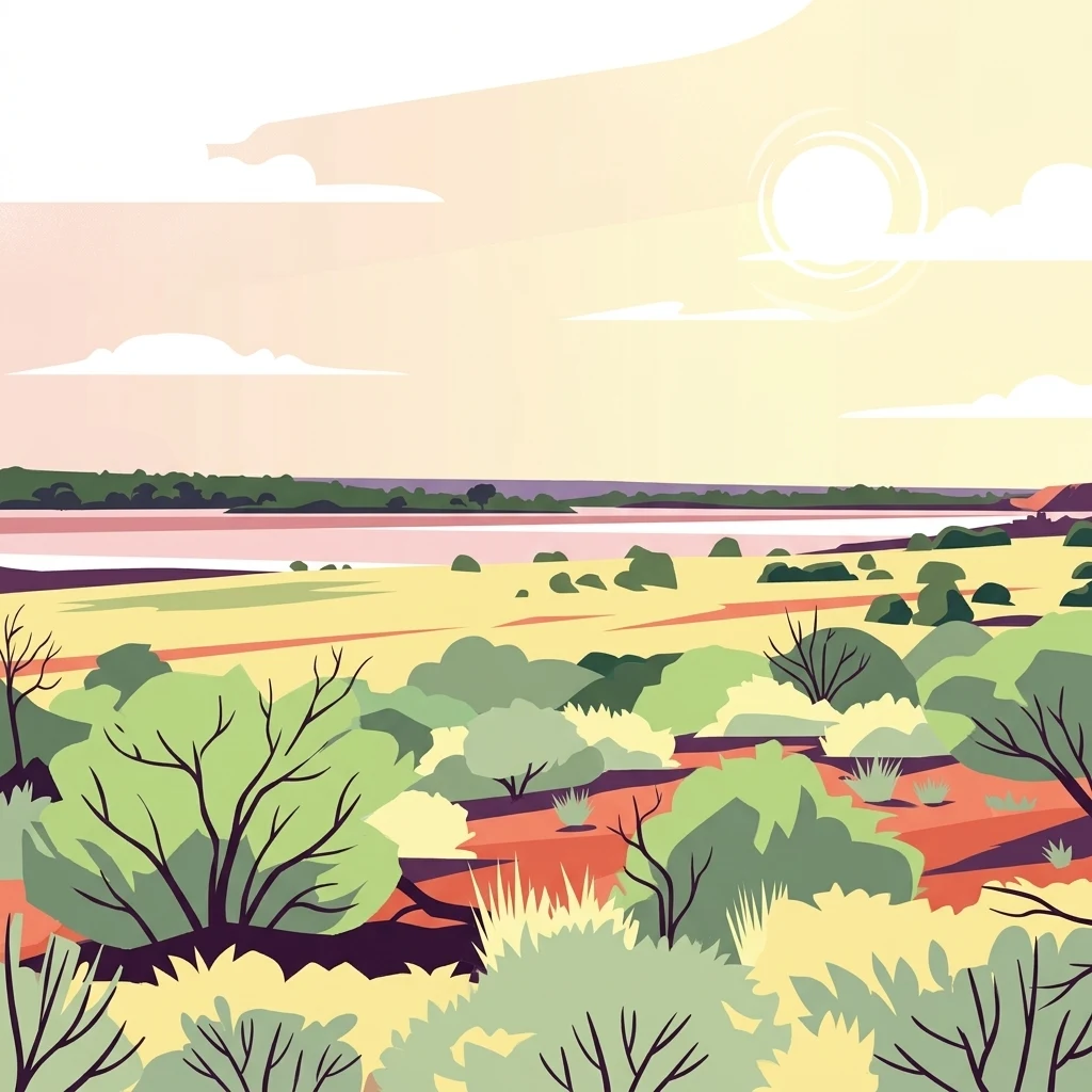
A flat-style digital illustration depicting an arid desert landscape with sparse shrubs, bushes, and a pale horizon under a soft sky.

Mamungari Conservation Park

Nature reserve

Park overview

Structured park overview, official facts, and landscape profile for Mamungari Conservation Park

Mamungari Conservation Park park facts, protected area profile, and essential visitor context

Review the core facts for Mamungari Conservation Park, including designation, size, terrain, visitor scale, habitats, and operating context in one park-focused overview.

About Mamungari Conservation Park

Mamungari Conservation Park occupies a vast stretch of arid landscape in the far west of South Australia, hundreds of kilometres from the nearest significant settlements. It spans the southern portion of the Great Victoria Desert and extends into the northernmost reaches of the Nullarbor Plain, forming a continuous expanse of remote desert country that reaches to the Western Australian border. The park's distance from population centres, along with the limited road infrastructure that passes through it, has kept it one of the least disturbed large protected areas in southern Australia.

The conservation park is a place of major ecological value within the arid zone. Its landscapes include sandplains, dune systems, gibber plains, and chains of salt lakes, of which the Serpentine Lakes are the most recognised feature. Vegetation is characteristically sparse and drought-adapted, with arid woodland, mulga, and chenopod shrublands framing an environment shaped by extreme temperatures, low rainfall, and long periods of dryness. These conditions create a fragile yet resilient ecosystem that has been protected through the park's status as a strict nature reserve.

Mamungari is equally significant as a cultural landscape. The park lies within the traditional country of the Maralinga Tjarutja and Pila Nguru people, whose deep connection to this desert environment stretches back many generations. The park's history reflects the evolving relationship between Aboriginal custodianship, South Australian government policy, and international conservation frameworks. The 2004 land return was a defining moment, securing Aboriginal ownership and partnership in managing the area alongside the Department for Environment and Water.

As one of only fourteen UNESCO Biosphere Reserves in Australia, Mamungari sits within a global network of sites recognised for balancing biodiversity conservation with sustainable human relationships to the land. Its combination of wilderness protection, cultural stewardship, and recognition on both national and international stages makes it a distinctive and important part of Australia's protected-area system.

Quick facts and research context for Mamungari Conservation Park

Mamungari Conservation Park lies in the remote far west of South Australia, extending across the southern Great Victoria Desert and the northern margin of the Nullarbor Plain. It is one of the larger protected areas in arid Australia, occupying roughly 21,000 square kilometres of desert terrain. The park is classified as an IUCN Category Ia strict nature reserve and has been a UNESCO Biosphere Reserve since 1977. It is jointly managed by the Maralinga Tjarutja and Pila Nguru traditional owners and the Department for Environment and Water, reflecting its significance both ecologically and culturally.

Protection and recognition

Terrestrial conservation scope, designation year, and international recognition data

Mamungari Conservation Park Protection Status and Designated History

Mamungari Conservation Park maintains a documented terrestrial protection status established in two thousand and six. Structured conservation records outline the designated scope and international recognition history for this protected area.

Protection details

Protection scope
Terrestrial
Designated year
2006
Transboundary protection
No
Park context

Deeper park guide and search-rich context for Mamungari Conservation Park

Mamungari Conservation Park history, landscape, wildlife, and travel context

Explore Mamungari Conservation Park through its history, landscape character, ecosystems, wildlife, conservation priorities, cultural context, and seasonal travel timing in a structured park guide built for atlas discovery and search intent.

Why Mamungari Conservation Park stands out

Mamungari is best known for its sheer scale, its role as a UNESCO Biosphere Reserve within Australia's arid interior, and its rare joint management arrangement with Aboriginal traditional owners. The park is associated with two of Australia's most iconic desert regions, the Great Victoria Desert and the Nullarbor Plain, and includes features such as the Serpentine Lakes, a culturally and ecologically important chain of salt lakes in the desert landscape. Its legacy also includes a remarkable political and cultural moment: the 2004 return of more than 21,000 square kilometres of land to the Maralinga Tjarutja and Pila Nguru people, which transformed how Mamungari is governed and recognised.
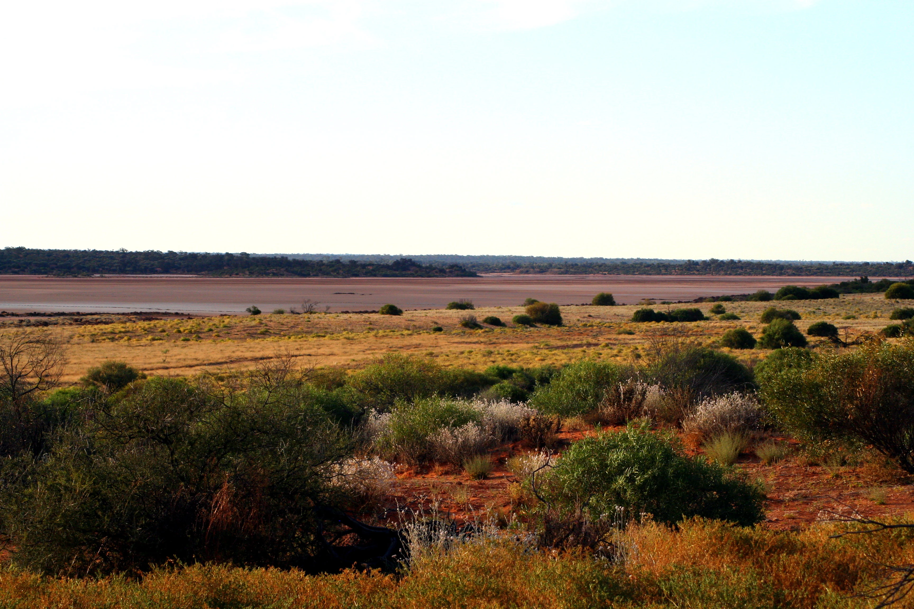
A wide view of a dry, brownish salt lake bed surrounded by sparse shrubs and arid desert vegetation under a pale sky.
The Serpentine Lakes, a series of salt lakes in the Great Victoria Desert within Mamungari Conservation Park.

Mamungari Conservation Park history and protected-area timeline

Mamungari Conservation Park was proclaimed in 1970 as a national park under South Australia's National Parks Act 1966, with the original purpose of conserving the environments of the Great Victoria Desert and safeguarding its wilderness values. At the time of proclamation, the park was not given a formal name. Under the National Parks and Wildlife Act 1972, the area became known as the Unnamed Conservation Park, a designation it carried for decades while continuing to function as a formal state protected area.

The park's international significance was recognised early. In 1977, it was designated as a UNESCO Biosphere Reserve under the name Unnamed Biosphere Reserve, becoming one of fourteen such reserves in Australia. Its listing on the now-defunct Register of the National Estate in 1980 added another layer of heritage recognition. For many years, the park's identifying anonymity stood in contrast to its conservation importance.

The political and cultural history of Mamungari took a major turn in 2004. Following special legislation, South Australian Premier Mike Rann handed back title to approximately 21,000 square kilometres of land to the Maralinga Tjarutja and Pila Nguru people, including the conservation park and the Serpentine Lakes area. This fulfilled a pledge made by Rann as Aboriginal Affairs Minister in 1991 to Maralinga leader Archie Barton, and marked the largest return of land under native title in South Australia since Premier John Bannon's handover of the Maralinga lands in 1984.

In recognition of this new custodial arrangement and the renewed cultural significance of the area, the park was officially renamed Mamungari Conservation Park on 30 November 2006, replacing the long-standing Unnamed designation and affirming the identity of the place today.

Mamungari Conservation Park landscape and geographic character

The landscape of Mamungari Conservation Park is shaped by the deep, slow geology of Australia's arid interior. The park covers a vast tract of desert country where shifting sandplains give way to dune ridges, broad claypans, scattered rocky outcrops, and chains of salt lakes. Topography is generally subdued, but the sheer scale of the terrain produces an environment of striking visual openness, with horizons that stretch uninterrupted for vast distances.

In the southern sections, the park transitions into the northern fringe of the Nullarbor Plain, where flat limestone country contrasts with the more undulating desert terrain of the Great Victoria Desert to the north. Between these two major landscapes lies a transitional zone of mixed sand and stone, typical of the southern Australian arid zone.

The Serpentine Lakes are the most widely recognised landform within the park. These chains of salt lakes, located along the southern portion of the conservation park, have long held importance as a landmark for travellers crossing the desert, including those on the Anne Beadell Highway. The lakes, now dry for much of the time, still define the surrounding landscape with their pale salt margins and the subtle vegetation patterns that follow them across the desert floor.

Mamungari Conservation Park ecosystems, habitats, and plant life

Mamungari sits within the Australian arid biome, where ecosystems are defined by heat, drought, and the rhythms of highly variable rainfall. The park's habitats include open desert sandplains, dune fields strewn with spinifex and low shrubs, patches of arid woodland, and open chenopod shrublands that thrive in the heavier soils of claypans and drainage lines. The variable terrain produces a mosaic of plant communities, each adapted to different soil types and moisture regimes.

Vegetation cover is typically sparse but resilient. Hardy species dominate, including mulga and other acacias, saltbush, bluebush, and a range of small desert shrubs and grasses. Around the salt lakes and drainage corridors, plant life becomes slightly more concentrated, creating narrow but ecologically important vegetated zones that support both terrestrial wildlife and transient bird species.

As an IUCN Category Ia strict nature reserve, the conservation park is managed with the primary goal of preserving ecological processes and wilderness character with minimal intervention. This high level of protection recognises the ecological significance of an arid environment that remains largely unmodified and that sustains biological communities adapted to one of Australia's harshest climates.

Mamungari Conservation Park wildlife and species highlights

Wildlife in Mamungari Conservation Park is shaped by the demands of desert survival, with species ranging widely across the landscape in search of food, water, and shelter. The park supports typical arid-zone fauna, including kangaroos and other macropods that move across the open sandplains and dune country. Reptiles are especially prominent, given the warm climate and abundance of shaded refuge sites among rocks, fallen timber, and desert shrubs. Lizards and snakes are integral parts of the desert food web.

Bird life varies with conditions across the year. The park supports a range of arid-adapted bird species that move through the landscape in response to rainfall and seasonal change. Around the Serpentine Lakes and other temporary water features, birds concentrate during and after rain events, offering some of the park's most visible displays of life in the desert.

The conservation value of Mamungari lies significantly in the ability of its wildlife populations to function within a largely intact and unmodified habitat. With minimal infrastructure and strict protective status, the park offers a rare example of an Australian desert ecosystem whose ecological relationships have not been substantially disrupted by human development, allowing predator and prey dynamics, dispersal patterns, and seasonal movements to operate as they have for thousands of years.

Mamungari Conservation Park conservation status and protection priorities

Mamungari Conservation Park holds a particularly high place within Australia's conservation framework. Its designation as an IUCN Category Ia strict nature reserve places it among the most strictly protected categories of land on the continent, set aside primarily for the preservation of ecosystems and wilderness values rather than for public recreation. This level of protection reflects both the ecological fragility of the arid zone and the importance of maintaining large, intact landscapes where ecological processes can continue with minimal interference.

The park's status as a UNESCO Biosphere Reserve since 1977 underscores its global significance. Biosphere Reserves are recognised for their importance to biodiversity conservation and for their role in supporting sustainable relationships between people and the environment. Mamungari's inclusion reflects the international value of its desert ecosystems and the cultural traditions that continue to shape how the land is cared for.

Beyond formal designations, the conservation significance of Mamungari is reinforced by its joint management arrangement. The partnership between the Department for Environment and Water and the Maralinga Tjarutja and Pila Nguru traditional owners recognises that ecological protection in this landscape is inseparable from the cultural responsibilities of its Aboriginal custodians. The 2004 land return embedded Aboriginal governance directly into the park's conservation framework, creating a model in which ecological and cultural continuity reinforce one another. This combination of strict legal protection, international recognition, and Indigenous-led stewardship gives Mamungari a distinctive and enduring conservation profile.

Mamungari Conservation Park cultural meaning and human context

Mamungari Conservation Park lies within the traditional country of the Maralinga Tjarutja and Pila Nguru people, Aboriginal groups with longstanding connections to the southern Great Victoria Desert and the northern Nullarbor Plain. The desert landscape, including features such as the Serpentine Lakes, has long held cultural significance, and Aboriginal knowledge of the region's water sources, seasonal patterns, and resources continues to shape how the land is understood and cared for.

The 2004 handback of more than 21,000 square kilometres to the Maralinga Tjarutja and Pila Nguru people was a defining cultural moment for the area, restoring formal recognition of Aboriginal ownership over land that had been progressively alienated through earlier policies, including the history of nuclear testing in the broader Maralinga region. Today, Mamungari is governed through a model in which Aboriginal people hold title and act as co-managers alongside state authorities.

The renaming of the park in 2006, moving from the long-used Unnamed designation to Mamungari, itself reflects a process of cultural re-identification. The name change, combined with joint management, has helped anchor the park's contemporary identity in the cultural and linguistic heritage of the region rather than in its former anonymous administrative status.

Best time to visit Mamungari Conservation Park

Mamungari Conservation Park is a remote and strictly protected area, and visiting it is only possible by permit and with demonstrated experience in low-impact desert travel. Because of these access constraints, the most relevant seasonal considerations relate to the conditions of the desert itself rather than typical tourism patterns.

The cooler months between late autumn and early spring offer the most comfortable conditions for desert travel, with lower daytime temperatures and safer conditions for traversing the open landscapes of the Great Victoria Desert and the northern Nullarbor Plain. Rainfall in the region is infrequent and unpredictable, but when it does arrive it can transform the park temporarily, encouraging wildflowers, fresh vegetation growth, and animal activity around the salt lakes and drainage lines.

Summer in this part of South Australia brings extreme heat, making travel both more dangerous and less comfortable. Those considering an extended visit should also recognise that the park's cultural and ecological sensitivities require careful planning, respect for traditional owners, and an emphasis on minimal impact on both the environment and the communities connected to it.

Monthly climate preview

Long-term monthly temperature averages and precipitation patterns for Mamungari Conservation Park in South Australia

Mamungari Conservation Park Climate Normals, Annual Temperature, and Precipitation Rhythm

Mamungari Conservation Park records sustained seasonal temperature variation alongside consistent low daily precipitation across a representative coordinate. Reviewing the complete twelve-month climatology reveals detailed shifts in average minimum and maximum temperatures throughout the year.
Annual mean21 °C
12 °C28 °C
Jan28°
Feb28°
Mar25°
Apr21°
May16°
Jun13°
Jul12°
Aug14°
Sep18°
Oct21°
Nov24°
Dec27°
Warmest month
January

28.2 °C

Coolest month
July

12.1 °C

Wettest month
February

0.7 mm/day

Driest month
September

0.4 mm/day

Park location guide

Geography guide, regional context, and park location map for Mamungari Conservation Park

Mamungari Conservation Park park geography, regions, and map view in Australia

Understand where Mamungari Conservation Park sits in Australia through a broader geographic reading of the surrounding landscape, nearby location context, and its mapped position within the national park landscape.

How Mamungari Conservation Park fits into Australia

Australia is a constitutional monarchy and federal parliamentary democracy comprising six states and ten territories. With a population of nearly 28 million, it is one of the world's most urbanised countries, with most people concentrated on the eastern seaboard. The country has a high Human Development Index and is known for its cultural diversity, ancient Aboriginal heritage, and unique wildlife.

Wider geography shaping Mamungari Conservation Park in Australia

Australia occupies the entire Australian continent, the island of Tasmania, and numerous smaller islands. It is the world's flattest and driest inhabited continent, featuring vast deserts in the interior (the Outback), tropical rainforests along the eastern coast, and a coastline bordering the Indian and Pacific Oceans.

Map view of Mamungari Conservation Park

Use this park location map to pinpoint Mamungari Conservation Park in Australia, understand its exact geographic position, and read its mapped placement within the surrounding landscape more clearly.

Pigeon | © OpenStreetMap contributors

Location context for Mamungari Conservation Park

South Australia

Visual exploration of remote wilderness habitats, sandplains, and salt lakes

Mamungari Conservation Park Photos, Desert Landscapes, and Scenery

Examine detailed national park photography capturing the sweeping dune fields, sparse vegetation, and striking geological terrain of Mamungari Conservation Park. Visual reference imagery reveals the remote character of arid Australian protected areas, illustrating vast desert horizons and distinct salt lake networks.

A wide view of a dry, brownish salt lake bed surrounded by sparse shrubs and arid desert vegetation under a pale sky.

Park atlas

Compare surrounding desert reserves and connected arid wilderness landscapes

Other Parks Near Mamungari Conservation Park and Regional Protected Areas

Browse protected areas near Mamungari Conservation Park to evaluate related desert environments and remote terrain across southern Australia. Continuing into adjacent regional reserves provides broader context for arid zone conservation and unique desert landforms.
National parkSouth Australia
About 264 km away#1 closest

South

Nullarbor National Park: Mapped Boundaries and Geographic Context in South Australia

Explore the protected landscape and terrain of this South Australian national park.

Nullarbor National Park is a key protected area offering valuable insights into Australia's natural landscapes. This page facilitates a detailed atlas-style exploration of the park's geographic setting and mapped boundaries within South Australia, highlighting its role as a national park and a component of regional conservation efforts.

Area
323.1 km²
Established
1979
IUCN
VI
Relief
Lowland
Marine protected areaSouth Australia
About 277 km away#2 closest

Southeast

Great Australian Bight Marine National Park: Marine Protected Area Atlas and Geographic Context

Mapping the protected marine landscape of South Australia.

Delve into the geography and mapped boundaries of Great Australian Bight Marine National Park, a critical marine protected area located off the coast of South Australia. This resource provides an atlas-style view of the park, highlighting its geographic setting and significance as a protected marine environment. Understand the scope of this marine protected area and its place within the Australian geography, offering rich context for discovery and map exploration.

Area
1,233.22 km²
Established
1996
IUCN
II
Access
Access unknown
National parkWestern Australia
About 278 km away#3 closest

South

Eucla National Park: Remote Coastal Protected Landscape in Western Australia

Explore limestone cliffs, sand dunes, and historic sites.

Eucla National Park showcases the dramatic interface of the Great Australian Bight with Western Australia's coastline. This protected area features striking limestone cliffs, vast migrating sand dune systems like the Delisser sandhills, and undulating mallee scrub. Discover the atmospheric ruins of the historic Eucla Telegraph Station, partially engulfed by dunes, and understand the unique geographic context and protected landscape identity of this remote national park.

Area
35.6 km²
IUCN
II
Access
Remote access
Water
Major water bodies
A pale, minimalist watercolor painting showing soft green and pink abstract shapes, suggestive of distant hills or a shoreline against a white background.
Marine protected areaSouth Australia
About 287 km away#4 closest

South

Great Australian Bight Marine Park: Mapping South Australia Marine Conservation

Coastal cliffs, continental shelf, and marine whale sanctuaries

Examine the geographic framework of the Great Australian Bight Marine Park, where arid southern coastlines meet the deep, productive waters of the Southern Ocean. This protected marine region features a tiered design connecting state-managed coastal areas with extensive offshore commonwealth reserves, providing a comprehensive look at regional marine geography.

Access
Access unknown
Scope
Marine
Water
Water-dominated
Forest
No forest cover
Nature reserveSouth Australia
About 426 km away#5 closest

Southeast

Boondina Conservation Park: Protected Landscapes and Regional Geography in South Australia

A remote nature reserve within the Yellabinna mallee woodland network.

Boondina Conservation Park is a 125 square kilometre nature reserve in far western South Australia. It forms part of the expansive Yellabinna Reserves, buffering semi-arid mallee woodland environments and supporting regional ecological processes. This IUCN Category VI area stands out for its co-management with the Far West Coast Aboriginal Corporation and its role as a preserved natural landscape where traditional land use continues.

Area
125.55 km²
Established
1993
IUCN
VI
Relief
Lowland
Nature reserveSouth Australia
About 427 km away#6 closest

Southeast

Fowlers Bay Conservation Park: Coastal Protected Area and Regional Geography

A remote conservation landscape on the Great Australian Bight

Fowlers Bay Conservation Park stands as a vital protected area in South Australia, where vertical limestone cliffs meet horizontal chenopod plains. The park provides an essential look at the interaction between Southern Ocean maritime forces and the arid western Eyre Peninsula, offering a rare window into the transition zones of the Great Australian Bight coast.

Area
87.27 km²
Established
1993
IUCN
VI
Relief
Lowland
National parkAustralia
About 436 km away#7 closest

Northeast

Uluṟu-Kata Tjuṯa National Park: Geological Formations and Desert Geography in Australia

Exploration of central Australian protected natural terrain.

Uluṟu-Kata Tjuṯa National Park is defined by its massive sandstone monolith and conglomerate rock domes set within a stark desert plain. This protected area offers deep insights into arid landscape evolution, ancient geological processes, and the environmental factors that shape central Australia's unique natural terrain.

Area
1,333.72 km²
Established
1958
IUCN
II
Visitors
400K annual
Nature reserveSouth Australia
About 453 km away#8 closest

Southeast

Chadinga Conservation Park: Coastal Dunes and Salt Lake Geography in South Australia

Remote protected dune systems and arid saline landscapes

Chadinga Conservation Park protects a significant stretch of coastal dune country west of Lake MacDonnell. This arid landscape, defined by salt lakes and mallee scrub, serves as a crucial habitat for rare species, offering a raw and undisturbed look at the coastal geography of the South Australian coastline.

Area
118.54 km²
Established
1993
IUCN
VI
Relief
Lowland

Common questions about visiting, size, designation, and location context for Mamungari Conservation Park

Mamungari Conservation Park FAQs for park facts, access, geography, and protected area context

Find quick answers about Mamungari Conservation Park, including protected-area facts, park geography, trail and visitor context, and how the park fits into its surrounding country and regional landscape.
MoriAtlas Explorer

Continue Your Protected Areas Search Across the Global Atlas

Deepen your exploration by continuing the structured search for national parks and protected areas worldwide. Utilize the comprehensive filtering capabilities to compare different conservation landscapes and refine your understanding of global park geography. Discover more about the distribution and characteristics of protected natural areas.

Global natural geography