Mori Atlas logo
Marine protected areaMan of War Shoal National Marine Park

A detailed look at the coral reef structures, underwater topography, and conservation boundaries across the Anguilla Bank.

Man of War Shoal National Marine Park: Mapping the Protected Marine Landscapes of Sint Maarten

Man of War Shoal National Marine Park covers roughly 3,100 hectares of coastal sea off the southern shores of Sint Maarten. This protected marine zone spans the edge of the Anguilla Bank, featuring a complex mosaic of patch reefs, seagrass meadows, and sandy bottom habitats. The underwater terrain transitions from shallow reef flats to dramatic vertical walls and submerged cavern systems, providing critical foraging and migratory corridors for diverse marine species.

marine parkcoral reefpatch reefseagrass meadowshipwreck divingCaribbean

Man of War Shoal National Marine Park

Marine protected area

Park overview

Structured park overview, official facts, and landscape profile for Man of War Shoal National Marine Park

Man of War Shoal National Marine Park park facts, protected area profile, and essential visitor context

Review the core facts for Man of War Shoal National Marine Park, including designation, size, terrain, visitor scale, habitats, and operating context in one park-focused overview.

About Man of War Shoal National Marine Park

The Man of War Shoal National Marine Park lies just off the southern shore of Sint Maarten, the Dutch-administered southern part of the Caribbean island of St. Martin. Covering around 3,100 hectares of coastal sea, it represents the first and only specially protected marine area in Sint Maarten and demonstrates the territory's commitment to preserving its coastal natural heritage within the Kingdom of the Netherlands.

The protected area centers on the Man of War Shoal itself, a submerged shoal on the edge of the Anguilla Bank where wide coastal shallows meet the deeper waters of an undersea plateau reaching about 36 meters. This setting has produced a varied underwater landscape: shallow patch reefs dominated by fire corals and boulder star corals alternate with seagrass meadows, sandy flats, and steep underwater walls and small caves where depth can change rapidly by as much as 20 meters. The clarity of the water is exceptional for the Caribbean, with underwater visibility typically between 15 and 30 meters, supporting an unusually diverse and well-structured reef community.

The reef and its surroundings support more than 150 documented fish species using the coral framework as habitat, including blue tangs, ocean surgeonfish, bluehead wrasses, sergeant majors, spotted goatfish, and Caribbean reef sharks. Larger visitors such as manta rays, southern stingrays, and spotted eagle rays are regularly encountered at the dive sites, and four species of Caribbean sea turtles, green, hawksbill, leatherback, and the less common loggerhead, can occasionally be observed in the area. The seagrass meadows, formed mainly by turtle grass and manatee grass, host queen conch, sea cucumbers, starfish, sea urchins, and an invasive seagrass now spreading through the Caribbean from the Indo-Pacific.

Beyond the reefs, the open water above Man of War Shoal is rich with phytoplankton that supports a wide food web. Migratory pelagic species such as tuna, dolphinfish, wahoo, blue marlin, and swordfish move through the area, along with whales and dolphins that periodically visit the shoal. Seabirds, including laughing gulls, terns, and cormorants, use the waters and the island as a roosting and breeding ground. Together these ecosystems give the park a remarkably complete profile of Caribbean coastal and marine biodiversity.

Quick facts and research context for Man of War Shoal National Marine Park

Man of War Shoal National Marine Park is a marine protected area of approximately 3,100 hectares lying off the southern coast of Sint Maarten in the eastern Caribbean. It was established in 2010 as the first specially protected area of Sint Maarten and was added to the UN SPAW Protocol in December 2014.

The park sits on the edge of the Anguilla Bank, an undersea plateau reaching depths of around 36 meters, and encompasses a mosaic of patch reefs, seagrass meadows, sandy bottoms, and open water. The site includes the Proselyte Reef, named after the British frigate HMS Proselyte that sank there in 1801, as well as shallow features like Spanish Rock, where depth drops to only about three meters. The Nature Foundation Sint Maarten manages the park, supported by seven locally elected overseers and a team of around 40 park rangers.

Protection and recognition

Explore documented marine conservation metrics and formal designation records.

Man of War Shoal National Marine Park Protection Status and Management Scope

Marine protection status and management frameworks define the conservation boundaries of Man of War Shoal National Marine Park. Documented recognition records provide baseline facts for examining international protected area designations.

Protection details

Protection scope
Marine
Transboundary protection
No
Park context

Deeper park guide and search-rich context for Man of War Shoal National Marine Park

Man of War Shoal National Marine Park history, landscape, wildlife, and travel context

Explore Man of War Shoal National Marine Park through its history, landscape character, ecosystems, wildlife, conservation priorities, cultural context, and seasonal travel timing in a structured park guide built for atlas discovery and search intent.

Why Man of War Shoal National Marine Park stands out

The park is best known for protecting one of the most intact coral reef ecosystems in the Lesser Antilles, including the Proselyte Reef with its submerged 19th-century shipwreck. It shelters large populations of reef fish, reef sharks, sea turtles, rays including manta and spotted eagle rays, and migratory open-water species such as tuna, mahi-mahi, wahoo, blue marlin, and swordfish. Its clear Caribbean waters, with visibility often exceeding 30 meters, combined with dramatic underwater topography featuring walls and small caves, make it a regionally important dive destination. The park also serves as a key foraging and migration area for whales, dolphins, and seabirds such as laughing gulls, terns, and cormorants that breed and rest on the island.
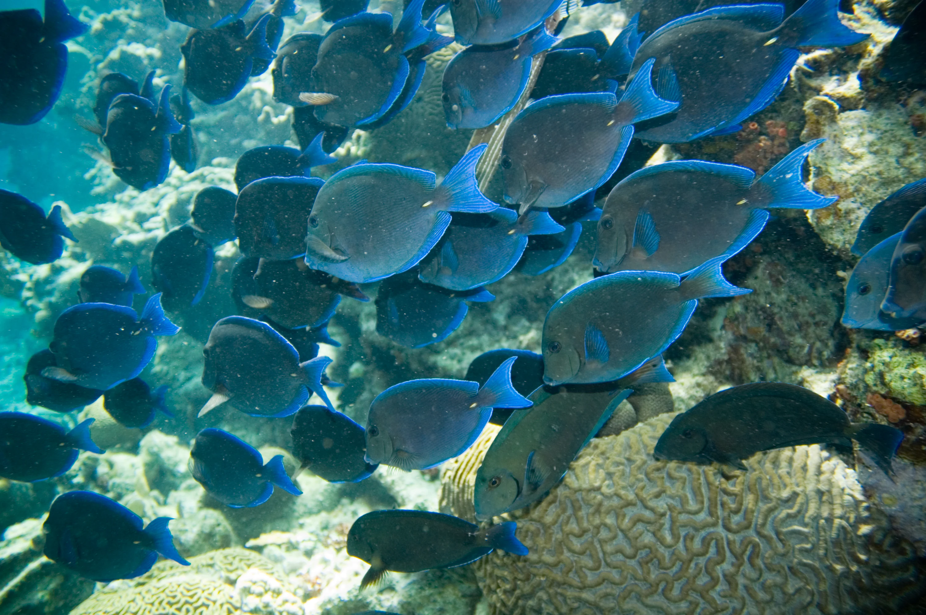
A large school of dark blue tang fish swimming underwater over textured coral reef formations.
A large school of blue tang fish swimming over a coral reef in Man of War Shoal National Marine Park.

Man of War Shoal National Marine Park history and protected-area timeline

The Man of War Shoal National Marine Park was formally established in December 2010, becoming Sint Maarten's first officially designated specially protected area. Its creation was driven by the recognition that the southern coastal waters held exceptionally intact reef structures and a wide diversity of marine life worth preserving from unregulated fishing, anchoring damage, and reef degradation.

The park's identity is also shaped by deep historical layers. The central Proselyte Reef takes its name from HMS Proselyte, a British Royal Navy frigate lost on 4 September 1801 at the same shallow spot. The wreck was never raised and, together with elements of its cargo, has remained on the seabed ever since, becoming one of the park's signature dive sites.

In December 2014 the site's significance was further recognized when it was inscribed under the SPAW Protocol, the regional United Nations framework for specially protected areas and wildlife in the wider Caribbean region. The park has since been managed by the Nature Foundation Sint Maarten, a volunteer-supported organization that has also built a sizeable local workforce of around 40 park rangers dedicated to marine monitoring and protection. Seven elected island residents form an oversight body that supervises the foundation's work, embedding the park deeply in the civic life of Sint Maarten.

Man of War Shoal National Marine Park landscape and geographic character

The underwater landscape of the park is the result of a coastal shelf meeting the edge of the Anguilla Bank, an undersea plateau whose depths reach up to around 36 meters. In places the seabed rises sharply to form shoals and patch reefs, while in others it falls away into sudden canyons where elevation differences of about 20 meters can occur over short horizontal distances. The combination of shallow flats, vertical reef drops, and small diveable caves gives the area a strikingly varied topography.

The shallowest sections, such as the feature known as Spanish Rock on the Proselyte Reef, reach depths of only around three meters, while nearby zones descend much deeper. Coral-encrusted rocky outcrops are interspersed with open seagrass fields and sandy flats, and the mosaic shifts in composition as one moves offshore. On the surface, the area appears simply as open sea off the south coast of Sint Maarten, closest to the town of Philipsburg, with the island's coastline forming the backdrop to the park's waters.

Water conditions reinforce the sense of clarity and openness. Caribbean-typical water temperatures range between roughly 25 and 29 degrees Celsius across the year, and underwater visibility is commonly between 15 and more than 30 meters, giving divers and snorkelers a vivid view of the reef structures, walls, and seabed features.

Man of War Shoal National Marine Park ecosystems, habitats, and plant life

Ecologically, the park can be read as four interconnected habitats that together form a near-complete Caribbean coastal ecosystem. Patch reefs built of fire corals, boulder star corals, soft corals, sponges, and sea fans form the structural backbone, supporting dense fish populations and providing sheltered habitat for invertebrates such as Caribbean spiny lobster, flame helmet snails, and cushion sea stars.

The seagrass meadows, dominated by turtle grass and manatee grass, act as nurseries and feeding grounds for invertebrates, juvenile fish, and a heavily depleted local queen conch population threatened by historical overharvesting. Halimeda algae within the meadows contribute further habitat complexity. Sandy plains, although less studied, host populations of starfish, shrimp, and nudibranchs, together with scattered patches of seagrass and algae. Above all of these, the open water column is rich with phytoplankton that fuels the food web for pelagic fish and visiting marine mammals.

The arrangements of reef, meadow, sand, and open water create corridors for movement and migration that connect reef residents with the wider Caribbean marine environment. The arrival of Halophila stipulacea, an Indo-Pacific seagrass now spreading invasively through Caribbean waters, reflects the dynamic and changing nature of these habitats.

Man of War Shoal National Marine Park wildlife and species highlights

The wildlife profile of the park is dominated by life associated with coral reefs. Reef fish are particularly diverse, with the most frequently recorded species including blue tang, ocean surgeonfish, bluehead wrasse, sergeant major, and spotted goatfish. Larger reef predators are also part of the reserve's character: Caribbean reef sharks are regulars at the dive sites, while manta rays, southern stingrays, and spotted eagle rays pass through the area and attract divers from around the region.

The reef framework is shared with Caribbean spiny lobsters, flame helmet snails, and cushion sea stars, while the adjoining seagrass meadows shelter queen conch, sea cucumbers, sea stars, sea urchins, and jellyfish. Sandy-bottom habitats support additional populations of starfish, shrimp, and nudibranchs.

In the open water above the shoal, migratory pelagic species such as tuna, dolphinfish, wahoo, blue marlin, and swordfish are part of a seasonal cycle of visitors. The area is also regularly visited by whales and dolphins, including species known to pass through Caribbean waters. Four species of sea turtles, green, hawksbill, leatherback, and occasional loggerheads, can be encountered in the park.

Above the surface, seabirds tied to the marine environment, including laughing gulls, terns, and cormorants, use the waters around the park and the island itself as a roosting and breeding habitat, adding an avian layer to the park's broader wildlife identity.

Man of War Shoal National Marine Park conservation status and protection priorities

The park is Sint Maarten's primary marine conservation instrument and represents the territory's only formally designated specially protected natural area. Its designation reflects recognition that the reef structures, coral communities, and associated ecosystems of the Man of War Shoal remain remarkably intact, providing a baseline of healthy Lesser Antilles marine biodiversity that is increasingly rare in the region.

In conservation terms, the park hosts at least 54 species assessed on the IUCN Red List, alongside species listed in the appendices of CITES, including ten species in Appendix I and 89 in Appendix II. This concentration of protected and threatened species underlines the importance of the area for regional biodiversity preservation.

The park's SPAW Protocol inscription in December 2014 placed it within an international network of specially protected areas and wildlife in the wider Caribbean region, broadening its conservation framing beyond Sint Maarten's national borders. Day-to-day management is carried out by the Nature Foundation Sint Maarten, which supports monitoring, enforcement, education, and community engagement, and which oversees a team of around 40 local park rangers. The foundation is supervised by a board of seven elected island residents, tying conservation governance directly into local civic representation.

Man of War Shoal National Marine Park cultural meaning and human context

The cultural and human connection to the park is intertwined with the broader maritime and ecological identity of Sint Maarten. The Proselyte Reef, named after the British frigate HMS Proselyte that sank there in 1801, carries a tangible historical layer that blends European naval history with Caribbean marine heritage. The unrestored wreck and its cargo have become a shared cultural landmark for the islands' dive community.

The park is also a source of local employment and civic engagement. It supports around 40 park ranger positions drawn from the island's residents, and the Nature Foundation that manages it is overseen by seven locally elected representatives. This integration of conservation, employment, and local governance reflects how the park has become part of Sint Maarten's evolving sense of place and territorial identity within the Kingdom of the Netherlands.

Top sights and standout views in Man of War Shoal National Marine Park

A standout feature of the park is the Proselyte Reef complex, a series of intact Caribbean patch reefs named for a British warship lost on the shoal in 1801. Its clear waters and dramatic underwater topography, with shallow reef tops, steep walls dropping by as much as 20 meters, and small diveable caves, set it apart as a destination for experienced divers.

The area is also notable for supporting such a wide range of marine life in a single protected zone: from rare coral species and queen conch populations, to reef sharks, manta and eagle rays, four species of sea turtles, and migratory pelagic fish, whales, and dolphins. Layered over all of this is its role as Sint Maarten's first and only protected marine area, recognized under the UN SPAW Protocol and managed by a foundation deeply rooted in the local community.

Best time to visit Man of War Shoal National Marine Park

Because the park lies in the southern Caribbean, water temperatures remain warm throughout the year, generally between 25 and 29 degrees Celsius, so conditions for diving and snorkeling are broadly favorable in any season. The clearest underwater visibility, often reaching well above 30 meters, tends to coincide with the calmer, drier months, while the wetter and more Atlantic-influenced periods can bring somewhat reduced visibility and surfier surface conditions.

Wildlife viewing patterns shift with the seasons. Pelagic visitors such as tuna, wahoo, marlin, and swordfish move through the area on migratory cycles, and sightings of manta rays, whale sharks, and larger rays may be more likely at particular times of year. Sea turtles, reef sharks, and resident reef fish are present year-round. Visitors seeking calmer surface conditions, steady visibility for reef viewing, and a focus on reef and turtle encounters generally prefer the calmer dry season, while those interested in peak pelagic action may time visits around broader Caribbean migratory windows. Deciding on the best period ultimately depends on whether the priority is the reefs themselves or the open-water encounters above them.

Monthly climate preview

Examine the long-term temperature progression and precipitation rhythm recorded at a representative coordinate.

Man of War Shoal National Marine Park Climate Normals and Weather by Month

Representative coordinate measurements record twelve-month temperature patterns alongside shifting precipitation rates across the marine environment. Opening the complete monthly climate profile reveals detailed thermal ranges and multi-year averages for further geographic study.
Annual mean27 °C
25 °C28 °C
Jan26°
Feb25°
Mar25°
Apr26°
May27°
Jun28°
Jul28°
Aug28°
Sep28°
Oct28°
Nov27°
Dec26°
Warmest month
September

28.3 °C

Coolest month
February

25.4 °C

Wettest month
October

3.1 mm/day

Driest month
March

0.5 mm/day

Park location guide

Geography guide, regional context, and park location map for Man of War Shoal National Marine Park

Man of War Shoal National Marine Park park geography, regions, and map view in Sint Maarten

Understand where Man of War Shoal National Marine Park sits in Sint Maarten through a broader geographic reading of the surrounding landscape, nearby location context, and its mapped position within the national park landscape.

How Man of War Shoal National Marine Park fits into Sint Maarten

Sint Maarten is a Caribbean island country and constituent territory of the Kingdom of the Netherlands. It covers 34 km² on the southern half of Saint Martin island, making it one of the smallest countries in the world by area. The country has a population of approximately 58,000 residents and uses the Caribbean guilder as its official currency, though US dollars and euros are widely accepted.

Wider geography shaping Man of War Shoal National Marine Park in Sint Maarten

Sint Maarten occupies the southern portion of the island of Saint Martin in the Caribbean, sharing a land border with the French collectivity of Saint Martin to the north. The island has a maximum elevation of 383 meters. The capital Philipsburg is located on the southern coast.

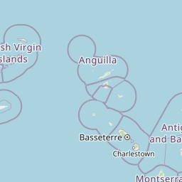
Map view of Man of War Shoal National Marine Park

Use this park location map to pinpoint Man of War Shoal National Marine Park in Sint Maarten, understand its exact geographic position, and read its mapped placement within the surrounding landscape more clearly.

Pigeon | © OpenStreetMap contributors

Location context for Man of War Shoal National Marine Park

Sint Maarten

Visual exploration of coral reef habitats, marine scenery, and underwater topography

Man of War Shoal National Marine Park Photos and Underwater Landscapes

Visual records capture the complex underwater terrain, vibrant patch reefs, and protected marine habitats of Man of War Shoal National Marine Park. Detailed photography reveals the unique coastal shelf topography and diverse Caribbean ecosystems preserved within the territory.

A large school of dark blue tang fish swimming underwater over textured coral reef formations.

Park atlas

Compare regional protected areas and connected marine conservation zones across the Caribbean.

Other Parks Near Man of War Shoal National Marine Park and Related Marine Reserves

Browsing other parks near Man of War Shoal National Marine Park reveals connected marine habitats and shared coastal ecosystems across the region. Expanding protected-area research supports comprehensive geographic comparison and deepens understanding of island marine reserves.
Marine protected areaFrance
About 5.2 km away#1 closest

Southeast

Sanctuaire Agoa: Exploring the Marine Protected Landscapes of the French Antilles

Regional marine mammal sanctuary and Caribbean oceanic geography

Sanctuaire Agoa represents a significant marine protected area spanning 143,000 square kilometers across the Caribbean. The sanctuary provides vital protection for humpback whales, dolphins, and various marine mammals while serving as a hub for regional cooperation in the Lesser Antilles. Mapping the sanctuary reveals a complex maritime space that stretches from shallow reef-fringed volcanic islands to deep ocean pelagic waters.

Area
143,256 km²
Established
2010
Climate
Tropical
Access
Access unknown
Marine protected areaSint Eustatius
About 53 km away#2 closest

South

Sint Eustatius National Marine Park: Protected Marine Geography and Atlas

Volcanic foundations, shipwreck reefs, and marine conservation zones

Sint Eustatius National Marine Park protects a diverse Caribbean marine ecosystem defined by its volcanic origins. The area features reefs growing on submerged lava flows and colonial shipwrecks, integrated with designated no-take reserves that safeguard critical sea turtle nesting sites and migratory corridors for cetaceans.

Area
27.5 km²
Established
1996
Climate
Tropical
Access
Access unknown
Protected areaAntigua and Barbuda
About 158 km away#3 closest

Southeast

Fort Barrington Protected Area: Historic Coastal Ruins and Mapping in Antigua and Barbuda

Coastal hilltop ruins and strategic Caribbean maritime defense geography

Fort Barrington occupies a commanding vantage point above St. John's Harbour in Antigua and Barbuda. The site preserves stone ruins from an 18th century battery, illustrating the strategic importance of this elevated coastal landscape. Our data mapping highlights the fort's relationship to the harbor entrance, providing clear context for its role in colonial maritime defense and its ongoing environmental exposure within the Lesser Antilles.

Established
1779
Relief
Upland
Access
Easy access
Scope
Terrestrial
National parkAntigua and Barbuda
About 165 km away#4 closest

Southeast

Green Castle Hill National Park: Volcanic Landscapes and Archaeological Sites in Antigua

A preserved hilltop ridge within the Shekerley Mountains of Antigua.

Green Castle Hill preserves a significant volcanic landscape in the southwest of Antigua. Renowned for its circle of ancient standing stones and its status as the first national park within the Shekerley range, the site offers a unique intersection of cultural heritage and mountain geography. Access map-driven insights into the protected boundaries and regional terrain that define this Caribbean hilltop.

Established
2008
Relief
Mountain
Climate
Tropical
Scope
Terrestrial
National parkUnited States of America
About 175 km away#5 closest

West

Virgin Islands National Park: Protected Landscape Atlas and Geographic Context

Explore volcanic terrain, tropical rainforests, and protected marine ecosystems.

Virgin Islands National Park offers an atlas-style view of protected Caribbean landscapes. The park encompasses volcanic uplands, dense tropical rainforests, and extensive coral reef systems surrounding Saint John island. Discover the mapped boundaries and geographic features that define this significant national park, providing crucial context for its unique ecosystems and historical significance.

Area
59.64 km²
Established
1956
IUCN
V
Visitors
112.3K annual
Watercolor painting of a coastal landscape with green hills, trees in the foreground, and a calm sea, featuring a light and airy artistic style.
National parkAntigua and Barbuda
About 177 km away#6 closest

Southeast

Nelson's Dockyard National Park: Protected Maritime Heritage and Caribbean Coastal Geography

Mapped terrain, historical dockyards, and Antiguan coastal trails

Nelson's Dockyard National Park preserves a critical maritime hub in Antigua and Barbuda, defined by the interplay between a natural hurricane-shelter harbour and the rugged hills of the south coast. The protected site encompasses substantial stone naval architecture from the Georgian era alongside a network of trails that trace the dry forest ridges above English Harbour. This geography offers a distinct perspective on how human historical impact and natural tropical landscape preservation coexist in the Caribbean Lesser Antilles.

Relief
Lowland
Scope
Mixed
Water
Major water bodies
Watercolor painting of mountains, a lake, and green hills
National parkGuadeloupe
About 227 km away#7 closest

Southeast

Guadeloupe National Park: Volcanic Rainforest and Protected Landscape Identity

Explore mapped boundaries and regional geography.

Guadeloupe National Park stands as a significant protected landscape, primarily defined by the dramatic volcanic terrain of Basse-Terre. This atlas entry focuses on the park's vital role in preserving one of the Caribbean's most extensive tropical rainforest ecosystems, centered around the active La Soufrière volcano. Understand its mapped boundaries, unique geographic setting within the Lesser Antilles, and its importance as a national park and UNESCO biosphere reserve.

Area
173 km²
Established
1989
IUCN
II
Relief
Mountain
Wildlife reserveFederal Dependencies
About 265 km away#8 closest

South

Isla de Aves Wildlife Reserve: Map, Regional Geography, and Protected Island Landscape

A remote Venezuelan coral cay and essential marine wildlife sanctuary

Isla de Aves serves as a pivotal wildlife reserve, concentrating intense ecological activity within a tiny, fragile landmass. This protected area stands as a unique case study in maritime geography, featuring a shifting sand and coral terrain that supports globally significant turtle nesting and seabird roosting populations in the southeastern Caribbean.

Area
0.045 km²
Established
1972
Relief
Lowland
Climate
Tropical

Common questions about visiting, size, designation, and location context for Man of War Shoal National Marine Park

Man of War Shoal National Marine Park FAQs for park facts, access, geography, and protected area context

Find quick answers about Man of War Shoal National Marine Park, including protected-area facts, park geography, trail and visitor context, and how the park fits into its surrounding country and regional landscape.
MoriAtlas Explorer

Continue Your Protected Areas Search Across the Global Atlas

Deepen your exploration by continuing the structured search for national parks and protected areas worldwide. Utilize the comprehensive filtering capabilities to compare different conservation landscapes and refine your understanding of global park geography. Discover more about the distribution and characteristics of protected natural areas.

Global natural geography