Mori Atlas logo
Protected areaFort Barrington

Analyzing the hilltop terrain and historic harbor defense landscape on the Antigua coastline

Fort Barrington Protected Area: Strategic Coastal Ruins and Island Geography in Antigua and Barbuda

Fort Barrington stands as a significant colonial fortification perched atop Goat Hill at the entrance to St. John's Harbour. This protected area reveals the historic British military layout, including stone batteries and barracks, set within a dry, rocky coastal environment overlooking the Caribbean Sea. Understanding the geographic relationship between this site and the opposite harbor entrance provides context for 18th century defensive planning across the Antigua and Barbuda maritime landscape.

colonial fortCaribbean historyharbor defensestone ruinsBritish colonial heritagecoastal hilltop

Fort Barrington

Protected area

Park overview

Structured park overview, official facts, and landscape profile for Fort Barrington

Fort Barrington park facts, protected area profile, and essential visitor context

Review the core facts for Fort Barrington, including designation, size, terrain, visitor scale, habitats, and operating context in one park-focused overview.

About Fort Barrington

Fort Barrington occupies one of the most strategically significant points along the coast of Antigua. Built atop Goat Hill in the small community of Yeptons, just to the west of the capital region, the fort looks out over the narrow entrance to St. John's Harbour, where ships approaching the island's main port had to pass within close range of its guns. Together with Fort James, which guards the opposite side of the harbor entrance, Fort Barrington formed part of a paired defensive system designed to control maritime access to Antigua's most important anchorage.

The present stone fort dates from 1779, a period when British colonial defenses in the Caribbean were being reshaped in response to wider imperial conflicts. It was constructed under the authority of General William Mathew Burt, governor of the Leeward Islands between 1776 and 1781, and it played an active role during both the American Revolutionary War and the War of 1812. Its hilltop position, broad arcs of fire across the water, and proximity to the harbor made it one of the more important fortifications guarding Antigua during this turbulent era.

What remains at the site today is a set of atmospheric ruins rather than a fully preserved fortification. Visitors can trace the outlines of a circular battery, a small powder magazine, and barracks built from local stone. The interpretation of the fort is enhanced by the active maritime setting around it, as cruise ships and other vessels regularly pass close to Goat Hill when entering or leaving St. John's Harbour. This combination of colonial military heritage and ongoing seafaring activity makes Fort Barrington a distinctive stop for travelers interested in Antigua's layered history.

Quick facts and research context for Fort Barrington

Fort Barrington is a ruined British colonial fort on Goat Hill in Yeptons, Antigua, at the southwestern entrance to St. John's Harbour. It was completed in 1779 under the administration of General William Mathew Burt, governor of the Leeward Islands, and was named for Admiral Samuel Barrington. The fort served as a key defensive position during the American Revolutionary War and the War of 1812. Surviving structures include a circular battery, a small magazine, and barracks built in stone.

Protection and recognition

Examine the official terrestrial protection framework and status records for Fort Barrington.

Fort Barrington Protection Status and Documented Conservation Scope

Terrestrial protection records for Fort Barrington outline the documented conservation scope and management context. Official designation parameters provide verified baseline data regarding the protected area boundary.

Protection details

Protection scope
Terrestrial
Park context

Deeper park guide and search-rich context for Fort Barrington

Fort Barrington history, landscape, wildlife, and travel context

Explore Fort Barrington through its history, landscape character, ecosystems, wildlife, conservation priorities, cultural context, and seasonal travel timing in a structured park guide built for atlas discovery and search intent.

Why Fort Barrington stands out

Fort Barrington is best known as the historic guardian of the western entrance to St. John's Harbour in Antigua. Its commanding hilltop position above the harbor mouth made it a strategic counterpart to Fort James on the opposite side of the bay. The combination of colonial ruin and dramatic seascape, often framed by the passage of large cruise ships sailing into St. John's, gives the site its distinctive visual identity among Antigua's historic landmarks.

Fort Barrington history and protected-area timeline

The history of Fort Barrington begins in the 17th century, when the British established a battery on Goat Hill in Yeptons to guard the most southwestern point of St. John's Harbour. The position was chosen for its commanding view over both the harbor entrance and the anchorage lying just outside it. Over the following decades the battery saw repeated attacks and was frequently described as being in disrepair. It was eventually abandoned in the aftermath of Queen Anne's War.

In 1779, a new and more substantial fort was constructed on the same strategic hill, replacing the earlier, worn-down battery. The project was completed under the administration of General William Mathew Burt, governor of the Leeward Islands from 1776 to 1781. Its purpose was to work alongside Fort James on the opposite side of the harbor entrance to control maritime access to St. John's, and it became a major British defensive position during both the American Revolutionary War and the War of 1812.

Before receiving its current name, the fort was known at various times as Goat Hill Fort, Cripplegate Battery, and Queen's Battery. It was ultimately renamed Fort Barrington in honor of Admiral Samuel Barrington, the royal navy commander in chief of the Leeward Islands station during the period of its construction. Although the fort is no longer in active military use, its ruins remain a tangible link to Antigua's colonial defensive history.

Fort Barrington landscape and geographic character

Fort Barrington is defined above all by its coastal hilltop setting. Goat Hill rises above the southwestern approaches to St. John's Harbour, giving the fort an open and elevated vantage point over the sea and the harbor mouth. The terrain is characteristically Caribbean: dry and rocky near the fort itself, sloping down toward the shoreline where small inlets, headlands, and the harbor's narrow entrance shape the views. From the ruins, the horizon opens out across the Caribbean Sea, with the opposite harbor entrance near Fort James visible across the water.

The combination of underlying stone, low island vegetation, and the sweeping arc of the coastline gives the site a striking sense of exposure to weather and sea. The surrounding area remains a working maritime landscape, where the historic fortification sits in the same view as modern vessels entering one of the Caribbean's busiest cruise harbors.

Fort Barrington cultural meaning and human context

Fort Barrington holds an important place within the broader heritage landscape of Antigua, alongside Fort James and other British colonial fortifications that ring the coast. Its repeated renaming, from Goat Hill Fort to Cripplegate Battery and Queen's Battery before becoming Fort Barrington, reflects the shifting political and military identities of the island across the 17th and 18th centuries. The site is also woven into the everyday rhythm of modern Antigua, since cruise ships and other vessels still pass close to Goat Hill when entering St. John's Harbour, linking the island's contemporary tourism economy with its layered colonial past.

Top sights and standout views in Fort Barrington

Fort Barrington offers a compact but evocative cluster of highlights. The circular battery, small magazine, and barracks remain recognizable in the ruins, and their hilltop placement makes them a tangible expression of 18th-century British defensive planning in the Caribbean. The paired relationship with Fort James across the harbor entrance gives the site a clear strategic context, while its earlier incarnation as Goat Hill Fort and Cripplegate Battery adds historical depth. Above all, the juxtaposition of weathered colonial stone with the active maritime scene of St. John's Harbour gives Fort Barrington its most memorable character.

Best time to visit Fort Barrington

Fort Barrington is an outdoor ruin set on a coastal hill, so conditions are most comfortable during the drier, cooler parts of the Caribbean dry season. Visiting in the morning tends to offer clearer skies and softer light over the harbor, and coincides with the arrival window of many cruise ships, which adds to the visual drama of the site. Rainy periods can make the rocky slopes around Goat Hill slippery and reduce views out across the harbor, making drier stretches of the year generally preferable for both comfort and photography.
Monthly climate preview

Measured monthly weather patterns and annual temperature rhythms for Antigua and Barbuda

Fort Barrington Climate Normals, Long Term Temperature and Precipitation Records

Representative coordinate records outline sustained long term temperature ranges alongside gradual shifts in monthly precipitation totals across the protected landscape. Examining the full twelve month profile reveals detailed variations in climate normals for comparative analysis.
Annual mean27 °C
26 °C28 °C
Jan26°
Feb26°
Mar26°
Apr26°
May27°
Jun28°
Jul28°
Aug28°
Sep28°
Oct28°
Nov27°
Dec27°
Warmest month
September

28.3 °C

Coolest month
February

25.5 °C

Wettest month
October

5.1 mm/day

Driest month
March

1.1 mm/day

Park location guide

Geography guide, regional context, and park location map for Fort Barrington

Fort Barrington park geography, regions, and map view in Antigua and Barbuda

Understand where Fort Barrington sits in Antigua and Barbuda through a broader geographic reading of the surrounding landscape, nearby location context, and its mapped position within the national park landscape.

How Fort Barrington fits into Antigua and Barbuda

Antigua and Barbuda is a small island nation in the Caribbean Lesser Antilles, consisting of two main inhabited islands (Antigua and Barbuda) and several smaller islands. The country gained independence in 1981 and operates as a constitutional monarchy within the Commonwealth. It is known for its beaches, tourism economy, and strategic location between the Atlantic Ocean and Caribbean Sea.

Wider geography shaping Fort Barrington in Antigua and Barbuda

Antigua and Barbuda is located in the Caribbean Sea within the Leeward Islands of the Lesser Antilles. The country is bounded by the Atlantic Ocean to the east and the Caribbean Sea to the west. Antigua is mostly flat with the Shekerley Mountains in the southeast, while Barbuda is relatively flat with the Barbuda Highlands in the northwest. The Central Plain stretches from St. John's to English Harbour on Antigua. The country shares maritime borders with Anguilla, Saint Barthélemy, Saint Kitts and Nevis, Montserrat, and Guadeloupe.

Map view of Fort Barrington

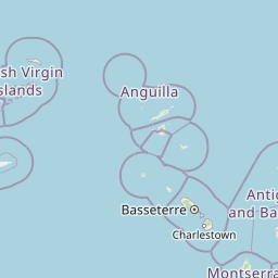
Use this park location map to pinpoint Fort Barrington in Antigua and Barbuda, understand its exact geographic position, and read its mapped placement within the surrounding landscape more clearly.

Pigeon | © OpenStreetMap contributors
Park atlas

Compare surrounding coastal terrain and related historical protected areas

Explore Parks Near Fort Barrington and Connected Regional Protected Landscapes

Browse nearby national parks and protected areas to compare the maritime geography surrounding Fort Barrington. Expanding into regional park profiles reveals broader coastal landscapes and connected defensive sites across the territory.
National parkAntigua and Barbuda
About 7.3 km away#1 closest

Southeast

Green Castle Hill National Park: Volcanic Landscapes and Archaeological Sites in Antigua

A preserved hilltop ridge within the Shekerley Mountains of Antigua.

Green Castle Hill preserves a significant volcanic landscape in the southwest of Antigua. Renowned for its circle of ancient standing stones and its status as the first national park within the Shekerley range, the site offers a unique intersection of cultural heritage and mountain geography. Access map-driven insights into the protected boundaries and regional terrain that define this Caribbean hilltop.

Established
2008
Relief
Mountain
Climate
Tropical
Scope
Terrestrial
Watercolor painting of a coastal landscape with green hills, trees in the foreground, and a calm sea, featuring a light and airy artistic style.
National parkAntigua and Barbuda
About 19 km away#2 closest

Southeast

Nelson's Dockyard National Park: Protected Maritime Heritage and Caribbean Coastal Geography

Mapped terrain, historical dockyards, and Antiguan coastal trails

Nelson's Dockyard National Park preserves a critical maritime hub in Antigua and Barbuda, defined by the interplay between a natural hurricane-shelter harbour and the rugged hills of the south coast. The protected site encompasses substantial stone naval architecture from the Georgian era alongside a network of trails that trace the dry forest ridges above English Harbour. This geography offers a distinct perspective on how human historical impact and natural tropical landscape preservation coexist in the Caribbean Lesser Antilles.

Relief
Lowland
Scope
Mixed
Water
Major water bodies
Marine protected areaFrance
About 49 km away#3 closest

Southeast

Sanctuaire Agoa: Exploring the Marine Protected Landscapes of the French Antilles

Regional marine mammal sanctuary and Caribbean oceanic geography

Sanctuaire Agoa represents a significant marine protected area spanning 143,000 square kilometers across the Caribbean. The sanctuary provides vital protection for humpback whales, dolphins, and various marine mammals while serving as a hub for regional cooperation in the Lesser Antilles. Mapping the sanctuary reveals a complex maritime space that stretches from shallow reef-fringed volcanic islands to deep ocean pelagic waters.

Area
143,256 km²
Established
2010
Climate
Tropical
Access
Access unknown
Watercolor painting of mountains, a lake, and green hills
National parkGuadeloupe
About 84 km away#4 closest

South

Guadeloupe National Park: Volcanic Rainforest and Protected Landscape Identity

Explore mapped boundaries and regional geography.

Guadeloupe National Park stands as a significant protected landscape, primarily defined by the dramatic volcanic terrain of Basse-Terre. This atlas entry focuses on the park's vital role in preserving one of the Caribbean's most extensive tropical rainforest ecosystems, centered around the active La Soufrière volcano. Understand its mapped boundaries, unique geographic setting within the Lesser Antilles, and its importance as a national park and UNESCO biosphere reserve.

Area
173 km²
Established
1989
IUCN
II
Relief
Mountain
Marine protected areaSint Eustatius
About 118 km away#5 closest

West

Sint Eustatius National Marine Park: Protected Marine Geography and Atlas

Volcanic foundations, shipwreck reefs, and marine conservation zones

Sint Eustatius National Marine Park protects a diverse Caribbean marine ecosystem defined by its volcanic origins. The area features reefs growing on submerged lava flows and colonial shipwrecks, integrated with designated no-take reserves that safeguard critical sea turtle nesting sites and migratory corridors for cetaceans.

Area
27.5 km²
Established
1996
Climate
Tropical
Access
Access unknown
Marine protected areaSint Maarten
About 158 km away#6 closest

Northwest

Man of War Shoal National Marine Park: Mapping the Protected Waters of Sint Maarten

A vital marine protected area on the edge of the Anguilla Bank.

Man of War Shoal National Marine Park represents a significant Caribbean marine sanctuary covering 3,100 hectares of coastal sea. The area is defined by its intact patch reefs, submerged 19th-century shipwrecks, and varied seabed topography, including vertical walls and expansive seagrass fields that support diverse pelagic and reef-dwelling marine life.

Area
31 km²
Established
2010
Relief
Lowland
Access
Easy access
National parkDominica
About 177 km away#7 closest

South

Cabrits National Park: Protected Landscape and Geographic Context in Dominica

Explore Dominica's volcanic terrain and mapped protected areas.

Delve into the protected landscape of Cabrits National Park, a key component of Dominica's natural heritage. This entry provides an atlas-focused view of the park, detailing its geographic setting and mapped boundaries within the island nation. Understand how Cabrits National Park contributes to the regional geography of the Lesser Antilles and appreciate its significance as a protected natural area for structured discovery.

Area
5.3 km²
Established
1986
IUCN
II
Relief
Upland
National parkDominica
About 188 km away#8 closest

South

Morne Diablotin National Park: Dominica National Park Geographic Atlas Exploration

Mapped protected areas and regional landscape context.

Morne Diablotin National Park serves as a vital national park within Dominica, offering specific insights into its protected terrain and geographic setting. Explore its mapped boundaries and understand its role as a distinct natural landscape within the island's atlas, providing focused discovery for those interested in protected areas and their regional context.

Area
33.35 km²
Established
2000
Relief
Mountain
Climate
Tropical

Common questions about visiting, size, designation, and location context for Fort Barrington

Fort Barrington FAQs for park facts, access, geography, and protected area context

Find quick answers about Fort Barrington, including protected-area facts, park geography, trail and visitor context, and how the park fits into its surrounding country and regional landscape.
MoriAtlas Explorer

Continue Your Protected Areas Search Across the Global Atlas

Deepen your exploration by continuing the structured search for national parks and protected areas worldwide. Utilize the comprehensive filtering capabilities to compare different conservation landscapes and refine your understanding of global park geography. Discover more about the distribution and characteristics of protected natural areas.

Global natural geography