Mori Atlas logo
National parkMorne Diablotin National Park

Discover the mapped geography and protected boundaries of this significant national park.

Morne Diablotin National Park: Dominica's Protected Landscape and Geographic Atlas Entry

Morne Diablotin National Park represents a key protected area within Dominica, offering a focused lens for understanding the island's natural geography. This atlas entry details the park's specific geographic scope, its boundaries as a national park, and its context within the broader natural landscape of the Caribbean nation.

Caribbean national parksVolcanic mountain parksBird conservation areasEndemic species habitatsProtected forest areasMountain hiking destinations

Morne Diablotin National Park

National park

Park overview

Structured park overview, official facts, and landscape profile for Morne Diablotin National Park

Morne Diablotin National Park park facts, protected area profile, and essential visitor context

Review the core facts for Morne Diablotin National Park, including designation, size, terrain, visitor scale, habitats, and operating context in one park-focused overview.

About Morne Diablotin National Park

Morne Diablotin National Park occupies the northern mountain ranges of Dominica, an island nation known for its rugged volcanic terrain and exceptional natural diversity in the Caribbean. The park's centerpiece, Morne Diablotins, rises to 1,447 meters and represents both the highest point on Dominica and the largest volcanic formation on the island, making it a prominent geographic feature throughout the Lesser Antilles. The establishment of this national park in January 2000 marked a significant milestone in Dominica's conservation history, coming nearly twenty-five years after the passage of the National Parks Act of 1975. The park was created through a partnership between the Dominican government and the Rare Species Conservation Foundation, combining previously protected lands including the former Northern Forest Reserve, the Syndicate Parrot Preserve, and two private inholdings within the forest reserve. This consolidation created a coherent protected area that could effectively safeguard the critical habitat needed by the island's endemic species. The park's hiking infrastructure includes two main trails: the Syndicate Nature Trail, a shorter loop suitable for general visitors, and the more demanding Morne Diablotin Ascent trail that leads to the summit, requiring several hours of climbing through changing vegetation zones.

Quick facts and research context for Morne Diablotin National Park

Morne Diablotin National Park is located in the northern mountain ranges of Dominica, protecting the island's highest volcanic peak at 1,447 meters. The park covers 8,242 acres (3,335 hectares) and was established in January 2000 through a partnership with the Rare Species Conservation Foundation. It encompasses terrain from the former Northern Forest Reserve and Syndicate Parrot Preserve. The park is governed by Dominica's Forestry, Wildlife and Parks Division and supports exceptional biodiversity, particularly endemic bird species including the Sisserou and Jaco parrots.

Protection and recognition

Verifying terrestrial boundaries and documented conservation management scope

Morne Diablotin National Park Protection Status and Designation Framework

Explorers can trace the official terrestrial protection status and documented conservation boundaries established for Morne Diablotin National Park. Reviewing documented designation details helps geographers understand the formal framework safeguarding regional mountain forests.

Protection details

Protection scope
Terrestrial
Transboundary protection
No
Park context

Deeper park guide and search-rich context for Morne Diablotin National Park

Morne Diablotin National Park history, landscape, wildlife, and travel context

Explore Morne Diablotin National Park through its history, landscape character, ecosystems, wildlife, conservation priorities, cultural context, and seasonal travel timing in a structured park guide built for atlas discovery and search intent.

Why Morne Diablotin National Park stands out

Morne Diablotin National Park is best known for protecting Dominica's highest mountain and largest volcano, Morne Diablotins, which dominates the park's landscape and offers challenging hiking to its summit. The park is globally significant as a refuge for two endemic parrot species, the Sisserou parrot (Imperial amazon) and the Jaco parrot (Red-necked amazon), both of which are endangered and found nowhere else on Earth. The mountain's steep volcanic slopes support diverse forest habitats that host over fifty bird species, making the park a premier destination for birdwatching in the Caribbean. The presence of multiple waterfalls and the dramatic contrast between the lush forest-covered slopes and the summit's volcanic terrain further distinguish this park.

Morne Diablotin National Park history and protected-area timeline

The land now within Morne Diablotin National Park has long carried human significance. Before European colonization, the indigenous peoples of Dominica utilized the mountain's resources for materials and traditional practices. During the eighteenth century, the forested slopes provided refuge for escaped enslaved people, with historical records indicating at least six different encampments of maroons established in the area. The modern protected area history began with Dominica's National Parks Act of 1975, which established the legal framework for national park designation. The actual creation of Morne Diablotin National Park came in January 2000, when the government formally designated the area as a national park under this legislation. The establishment process involved consolidating land from the former Northern Forest Reserve, the Syndicate Parrot Preserve, and two inholdings within the forest reserve, creating a unified protected landscape. Partnership with the Rare Species Conservation Foundation was central to the park's creation, reflecting international collaboration in conservation. In 2007, BirdLife International recognized the park's international importance by designating it an Important Bird Area, citing its significance for breeding populations of restricted-range bird species and the endangered Sisserou and Jaco parrots.

Morne Diablotin National Park landscape and geographic character

Morne Diablotin National Park showcases the dramatic volcanic landscape that defines Dominica's terrain. The park encompasses Morne Diablotins, a steep-sided volcanic peak that dominates the northern part of the island and represents the highest elevation in Dominica and the second-highest mountain in the Lesser Antilles. The mountain's slopes descend through distinct elevation zones, transitioning from lower hillsides through increasingly lush forest to the summit area. The park contains numerous streams that have carved pathways down the volcanic slopes, creating several waterfalls that add to the landscape's scenic value. The terrain reflects the island's volcanic origin, with rugged slopes, rocky outcrops, and the deep valleys carved by water flowing down from the highland areas. The combination of the imposing central peak, the network of watercourses descending through forest, and the overall steep relief creates a landscape of considerable visual impact and ecological significance.

Morne Diablotin National Park ecosystems, habitats, and plant life

The park's ecological significance stems from its diverse habitats that support exceptional biodiversity, particularly in the Caribbean context. The mountain's elevational gradient creates multiple vegetation zones, from lower broadleaf forests through increasingly humid forest types to the summit areas. These habitats together support over fifty bird species, with at least thirty of these species breeding on the island. The park's designation as an Important Bird Area in 2007 by BirdLife International reflects its global significance for bird conservation. The forests provide critical habitat for Dominica's two endemic parrot species, the Sisserou parrot and the Jaco parrot, both of which are endangered. Beyond birds, the park supports diverse wildlife including mammals such as agouti, opossum, feral pigs, and at least eleven species of bats. The amphibian fauna includes two species of tree frogs, one of which, Eleutherodactylus amplinympha, is endemic to Dominica and locally known as Gounouji. Streams within the park support crustaceans and freshwater fish, while the insect diversity includes at least twenty-four species of butterflies.

Morne Diablotin National Park wildlife and species highlights

Morne Diablotin National Park supports remarkable wildlife diversity, with particular significance for endemic species. The park is most renowned for its population of the Sisserou parrot, also known as the Imperial amazon, which is Dominica's national bird and remains endangered. The Jaco parrot, or Red-necked amazon, represents another endangered endemic species that relies on the park's forest habitats. These two parrot species are found nowhere else in the world, making the park globally important for their conservation. The bird community includes over fifty species, with at least thirty breeding on the island, including the Lesser Antillean flycatcher, bananaquit, black-throated blue warbler, and hooded warbler. Mammalian residents include the agouti, the common opossum, and feral pigs, along with at least eleven bat species. The park's amphibian fauna features the endemic Gounouji tree frog and the Tink Frog, while reptile diversity includes the Lesser Antillean iguana, tree lizards, pigmy geckos, and the boa constrictor. Stream ecosystems support crustaceans and freshwater fish, and the area hosts at least twenty-four butterfly species.

Morne Diablotin National Park conservation status and protection priorities

Morne Diablotin National Park represents a cornerstone of Dominica's conservation estate, protecting both the island's highest mountain and critical habitat for endangered endemic species. The park was specifically established to safeguard the populations of the Sisserou and Jaco parrots, both of which face significant threats from habitat loss and other pressures. The designation as an Important Bird Area by BirdLife International in 2007 further elevated the park's conservation profile, recognizing its global significance for breeding populations of restricted-range bird species. The park's creation through the consolidation of previously protected lands, including the Northern Forest Reserve and the Syndicate Parrot Preserve, reflects a thoughtful approach to creating an effective protected area. The partnership with the Rare Species Conservation Foundation demonstrates the international dimension of conservation efforts for this Caribbean park. With the park covering approximately 4.4 percent of Dominica's total land area, it represents a substantial portion of the island's protected landscape and plays a vital role in maintaining the ecological integrity of Dominica's northern highlands.

Morne Diablotin National Park cultural meaning and human context

The lands within Morne Diablotin National Park carry historical human significance that predates modern conservation. Before European contact, the indigenous peoples of Dominica utilized the mountain's resources for materials essential to their daily lives and cultural practices. During the eighteenth century, following the establishment of plantation slavery on the island, the forested slopes of what is now the park became a refuge for people who had escaped from enslavement. Historical accounts record at least six different maroon encampments established in the area, representing the resistance of enslaved people to colonial oppression. This history adds cultural depth to the landscape, connecting the mountain to stories of survival and freedom. The park's creation in 2000 represents a continuation of the tradition of protecting this mountainous area, evolving from indigenous use through maroon refuge to modern conservation designation.

Top sights and standout views in Morne Diablotin National Park

Morne Diablotin National Park offers visitors the opportunity to explore Dominica's highest and most dramatic mountain terrain while encountering endemic species found nowhere else on Earth. The ascent to Morne Diablotins summit provides a challenging but rewarding hiking experience through changing forest environments. The park's two trails accommodate different experience levels, from the accessible Syndicate Nature Trail loop to the demanding summit climb. The chance to observe the endangered Sisserou and Jaco parrots in their natural habitat represents a unique wildlife experience in the Caribbean. The numerous waterfalls throughout the park add to its scenic appeal, while the overall biodiversity, including over fifty bird species and numerous reptiles, amphibians, and insects, ensures rich natural encounters throughout the protected area.

Best time to visit Morne Diablotin National Park

Morne Diablotin National Park can be visited throughout the year, as Dominica's tropical climate maintains relatively stable conditions. The dry season typically runs from approximately November to May, offering more consistent conditions for hiking and outdoor exploration. The wet season, from June through October, brings increased rainfall that sustains the park's lush vegetation and flowing waterfalls but may make some trails more challenging. Temperature decreases with elevation, so visitors climbing to the summit should expect cooler conditions than at lower elevations. The forest environment remains green year-round due to the consistent moisture, though visitor transparency regarding current trail conditions at the park's visitor center is advisable when planning hikes. The park's higher elevations may experience fog and reduced visibility at times, adding to the atmospheric character of the mountain environment.

Monthly climate preview

Long-term average temperature and precipitation rhythm measured across twelve distinct monthly intervals

Morne Diablotin National Park Climate Normals and Monthly Weather Records

Representative coordinate records for Morne Diablotin National Park show continuous monthly temperature variations alongside shifting precipitation rates from 1991 through 2020. Reviewing the complete twelve-month climate profile provides deeper statistical context regarding historical temperature ranges and precipitation trends.
Annual mean27 °C
25 °C28 °C
Jan26°
Feb25°
Mar25°
Apr26°
May27°
Jun27°
Jul27°
Aug28°
Sep28°
Oct28°
Nov27°
Dec26°
Warmest month
September

27.8 °C

Coolest month
February

25.3 °C

Wettest month
September

5.9 mm/day

Driest month
March

1.6 mm/day

Park location guide

Geography guide, regional context, and park location map for Morne Diablotin National Park

Morne Diablotin National Park park geography, regions, and map view in Dominica

Understand where Morne Diablotin National Park sits in Dominica through a broader geographic reading of the surrounding landscape, nearby location context, and its mapped position within the national park landscape.

How Morne Diablotin National Park fits into Dominica

Dominica is an island nation in the Caribbean Sea, part of the Lesser Antilles. It achieved independence from Britain in 1978 and is renowned for its mountainous rainforests, geothermal-volcanic activity, and the Boiling Lake hot spring. The capital is Roseau.

Wider geography shaping Morne Diablotin National Park in Dominica

Dominica is situated in the Caribbean Sea, part of the Windward Islands in the Lesser Antilles archipelago. The island lies between Guadeloupe to the northwest and Martinique to the southeast. It has mountainous terrain with the highest point being Morne Diablotins at 1,448 meters.

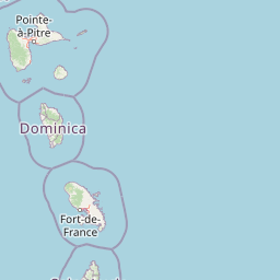
Map view of Morne Diablotin National Park

Use this park location map to pinpoint Morne Diablotin National Park in Dominica, understand its exact geographic position, and read its mapped placement within the surrounding landscape more clearly.

Pigeon | © OpenStreetMap contributors
Park atlas

Compare protected landscapes across Dominica's volcanic highlands and the broader Lesser Antilles, tracing park geography and regional conservation efforts.

Explore Parks Near Morne Diablotin National Park: Discover Other Protected Areas in Dominica's Volcanic Highlands

Explore other national parks and protected areas in Dominica and the broader Caribbean Lesser Antilles, discovering volcanic mountain terrain and rich conservation landscapes. Compare these nearby park entities to understand the regional spread of protected habitats and their unique ecological significance beyond Morne Diablotin National Park.
National parkDominica
About 12 km away#1 closest

Northwest

Cabrits National Park: Protected Landscape and Geographic Context in Dominica

Explore Dominica's volcanic terrain and mapped protected areas.

Delve into the protected landscape of Cabrits National Park, a key component of Dominica's natural heritage. This entry provides an atlas-focused view of the park, detailing its geographic setting and mapped boundaries within the island nation. Understand how Cabrits National Park contributes to the regional geography of the Lesser Antilles and appreciate its significance as a protected natural area for structured discovery.

Area
5.3 km²
Established
1986
IUCN
II
Relief
Upland
National parkDominica
About 15 km away#2 closest

Southeast

Morne Trois Pitons National Park: Dominica's Volcanic Protected Area Atlas

Explore its unique geothermal terrain and mapped natural boundaries.

Morne Trois Pitons National Park represents a core protected area within Dominica, renowned for its dramatic volcanic landscapes and rich geothermal activity. This national park features steep volcanic cones, deep canyons, and diverse terrain shaped by intense geological forces. The park's mapped boundaries encompass unique natural wonders, offering a focused study of volcanic geography and protected ecosystems. Discover the contours of this significant Caribbean landscape and its inherent natural value.

Area
68.57 km²
Established
1975
IUCN
II
Relief
Mountain
Marine protected areaFrance
About 27 km away#3 closest

Southeast

Sanctuaire Agoa: Exploring the Marine Protected Landscapes of the French Antilles

Regional marine mammal sanctuary and Caribbean oceanic geography

Sanctuaire Agoa represents a significant marine protected area spanning 143,000 square kilometers across the Caribbean. The sanctuary provides vital protection for humpback whales, dolphins, and various marine mammals while serving as a hub for regional cooperation in the Lesser Antilles. Mapping the sanctuary reveals a complex maritime space that stretches from shallow reef-fringed volcanic islands to deep ocean pelagic waters.

Area
143,256 km²
Established
2010
Climate
Tropical
Access
Access unknown
Watercolor painting of mountains, a lake, and green hills
National parkGuadeloupe
About 61 km away#4 closest

Northwest

Guadeloupe National Park: Volcanic Rainforest and Protected Landscape Identity

Explore mapped boundaries and regional geography.

Guadeloupe National Park stands as a significant protected landscape, primarily defined by the dramatic volcanic terrain of Basse-Terre. This atlas entry focuses on the park's vital role in preserving one of the Caribbean's most extensive tropical rainforest ecosystems, centered around the active La Soufrière volcano. Understand its mapped boundaries, unique geographic setting within the Lesser Antilles, and its importance as a national park and UNESCO biosphere reserve.

Area
173 km²
Established
1989
IUCN
II
Relief
Mountain
Nature reserveMartinique
About 78 km away#5 closest

South

Réserve naturelle régionale marine du Prêcheur - Albert Falco: Martinique Marine Protected Area Atlas

Coastal habitat protection and seabed geography in the French Caribbean.

This protected area encompasses over 600 hectares of seabed and water column along the Le Prêcheur coastline. It represents a significant conservation effort within the Lesser Antilles, preserving coral reefs and nearshore marine structures situated beneath the volcanic terrain of northern Martinique. Named after the oceanographer Albert Falco, the reserve maintains a distinct connection to the maritime heritage of the island.

Area
6.03 km²
Established
2014
IUCN
IV
Scope
Marine
Nature reserveMartinique
About 98 km away#6 closest

Southeast

Réserve naturelle nationale de la presqu'île de la Caravelle: Geography and Protected Area Atlas

Explore ancient Atlantic coastal landscapes and protected habitats in Martinique.

Located on the eastern tip of Martinique, the Réserve naturelle nationale de la presqu'île de la Caravelle stands as a critical protected landscape. This atlas entry details its unique geological history, dating back twenty-five million years, alongside its complex network of mangrove-fringed bays, dramatic Atlantic cliffs, and specialized island ecosystems. It serves as an essential reference for understanding the distinctive biogeography of the French Caribbean.

Area
3.88 km²
Established
1976
IUCN
IV
Visitors
400K annual
National parkAntigua and Barbuda
About 171 km away#7 closest

North

Nelson's Dockyard National Park: Protected Maritime Heritage and Caribbean Coastal Geography

Mapped terrain, historical dockyards, and Antiguan coastal trails

Nelson's Dockyard National Park preserves a critical maritime hub in Antigua and Barbuda, defined by the interplay between a natural hurricane-shelter harbour and the rugged hills of the south coast. The protected site encompasses substantial stone naval architecture from the Georgian era alongside a network of trails that trace the dry forest ridges above English Harbour. This geography offers a distinct perspective on how human historical impact and natural tropical landscape preservation coexist in the Caribbean Lesser Antilles.

Relief
Lowland
Scope
Mixed
Water
Major water bodies
National parkAntigua and Barbuda
About 181 km away#8 closest

North

Green Castle Hill National Park: Volcanic Landscapes and Archaeological Sites in Antigua

A preserved hilltop ridge within the Shekerley Mountains of Antigua.

Green Castle Hill preserves a significant volcanic landscape in the southwest of Antigua. Renowned for its circle of ancient standing stones and its status as the first national park within the Shekerley range, the site offers a unique intersection of cultural heritage and mountain geography. Access map-driven insights into the protected boundaries and regional terrain that define this Caribbean hilltop.

Established
2008
Relief
Mountain
Climate
Tropical
Scope
Terrestrial

Common questions about visiting, size, designation, and location context for Morne Diablotin National Park

Morne Diablotin National Park FAQs for park facts, access, geography, and protected area context

Find quick answers about Morne Diablotin National Park, including protected-area facts, park geography, trail and visitor context, and how the park fits into its surrounding country and regional landscape.
MoriAtlas Explorer

Continue Your Protected Areas Search Across the Global Atlas

Deepen your exploration by continuing the structured search for national parks and protected areas worldwide. Utilize the comprehensive filtering capabilities to compare different conservation landscapes and refine your understanding of global park geography. Discover more about the distribution and characteristics of protected natural areas.

Global natural geography