Mori Atlas logo
Nature reserveRéserve naturelle régionale marine du Prêcheur - Albert Falco

A regional nature reserve safeguarding volcanic-influenced coastal seabed and coral reef habitats along the French Caribbean coastline.

Réserve naturelle régionale marine du Prêcheur - Albert Falco: Mapping Protected Marine Landscapes in Martinique

The Réserve naturelle régionale marine du Prêcheur - Albert Falco protects approximately 603 hectares of nearshore marine environment off the commune of Le Prêcheur. Positioned along the dramatic northwestern coast of Martinique, this protected area spans an underwater domain defined by coral reefs and seagrass beds. It serves as a vital element of the regional conservation network, managing biodiversity and maritime interactions adjacent to the volcanic slopes of Mount Pelée.

marine reserveCaribbeanMartiniqueLesser Antillesregional nature reservecoral reef

Réserve naturelle régionale marine du Prêcheur - Albert Falco

Nature reserve

Park overview

Structured park overview, official facts, and landscape profile for Réserve naturelle régionale marine du Prêcheur - Albert Falco

Réserve naturelle régionale marine du Prêcheur - Albert Falco park facts, protected area profile, and essential visitor context

Review the core facts for Réserve naturelle régionale marine du Prêcheur - Albert Falco, including designation, size, terrain, visitor scale, habitats, and operating context in one park-focused overview.

About Réserve naturelle régionale marine du Prêcheur - Albert Falco

The Réserve naturelle régionale marine du Prêcheur - Albert Falco is a marine regional nature reserve located in Martinique, one of France's overseas departments in the Lesser Antilles arc of the Caribbean. It lies along the northwestern coast of the island, on the commune of Le Prêcheur, where the volcanic slopes of Mount Pelée's region meet the sea. Classified in October 2014, the reserve spans roughly 603 hectares of maritime public domain, protecting a continuous stretch of nearshore waters, seabed, and coastal marine habitats.

As a regional nature reserve (réserve naturelle régionale), it is part of the French network of protected areas managed under the framework of regional councils, rather than the national framework of the state. Its designation as IUCN Category IV signals a focus on the protection of habitats and species through active management of the marine environment, which is consistent with the conservation challenges typical of populated Caribbean coastlines where fishing, tourism, and coastal development pressures coexist.

The reserve's geographic setting, on the edge of Saint-Pierre Bay and near the dramatic volcanic landscapes of northern Martinique, gives it a distinctive context within the French Caribbean. It overlaps with one of the most historically and scenically significant regions of the island, where the legacy of the eruptions of Mount Pelée shapes both the coastline and the surrounding communities. Protecting this marine corridor contributes to broader efforts to maintain ecological connectivity and to safeguard the reef and seabed habitats that support fisheries, coastal water quality, and marine biodiversity.

The reserve's name is a meaningful element of its identity. Albert Falco was born in Le Prêcheur in 1927 and went on to become the chief diver of Jacques-Yves Cousteau's Calypso, participating in decades of pioneering underwater exploration and documentary work. The decision to honor Falco by naming the reserve after him reflects the deep connection between the local community and the sea, and links the conservation of Martinique's marine environment to a long tradition of human engagement with the ocean.

Quick facts and research context for Réserve naturelle régionale marine du Prêcheur - Albert Falco

The Réserve naturelle régionale marine du Prêcheur - Albert Falco is classified as IUCN Category IV in the World Database on Protected Areas and carries the national identifier FR9300183 in the Inventaire national du patrimoine naturel. It was created on 14 October 2014 by a deliberation of the regional council of Martinique, making it one of the regional nature reserves (réserves naturelles régionales) of France.

The reserve covers roughly 603 hectares of maritime public domain along the coast of Le Prêcheur, a commune on the northwest of Martinique. Its identifying reference RNR291 indicates its position within the French regional nature reserve system. The reserve is named after Albert Falco, the locally born diver who became famous for his decades of work with the Cousteau oceanographic team.

Protection and recognition

Examine documented marine protection status, management scope, and verified records for this conservation area.

Protection Status and International Recognition for Réserve naturelle régionale marine du Prêcheur - Albert Falco

Marine protection status records outline the documented management scope and official administrative framework governing Réserve naturelle régionale marine du Prêcheur - Albert Falco. Verified database entries supply essential reference metrics for tracking protected area designations across global conservation inventories.

Protection details

Protection scope
Marine
WDPA ID
555597232
Park context

Deeper park guide and search-rich context for Réserve naturelle régionale marine du Prêcheur - Albert Falco

Réserve naturelle régionale marine du Prêcheur - Albert Falco history, landscape, wildlife, and travel context

Explore Réserve naturelle régionale marine du Prêcheur - Albert Falco through its history, landscape character, ecosystems, wildlife, conservation priorities, cultural context, and seasonal travel timing in a structured park guide built for atlas discovery and search intent.

Why Réserve naturelle régionale marine du Prêcheur - Albert Falco stands out

The reserve is best known as a regional marine protected area on the Caribbean coast of Martinique, focused on the conservation of nearshore marine biodiversity along the commune of Le Prêcheur. Its habitats include reef and seabed environments characteristic of the Lesser Antilles, which are central to the reserve's ecological identity and to the regional marine conservation network of the French Caribbean. It is also recognized for its tribute to Albert Falco, the diver born in Le Prêcheur who became one of the most prominent French ocean explorers of the twentieth century. Naming the reserve after him connects the site to Martinique's maritime heritage and to the global legacy of Cousteau-era ocean exploration, giving the protected area both an ecological and a strong local-cultural identity.
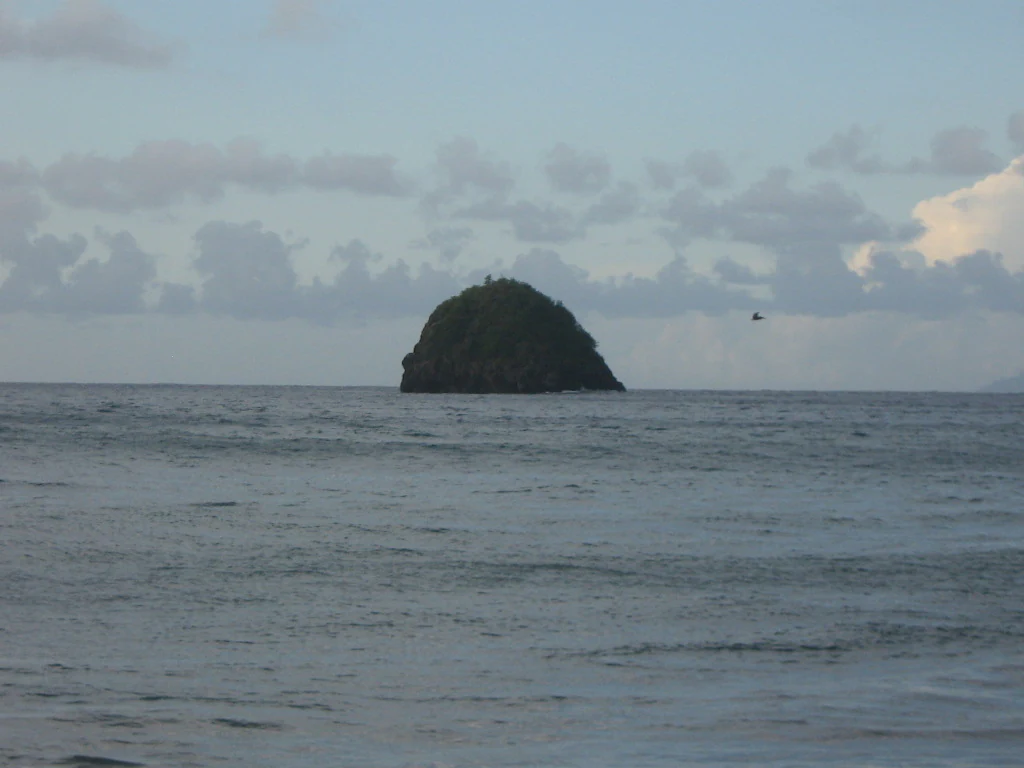
A distant view of a small, steep-sided, vegetated rocky island rising out of the open ocean under a cloudy sky.
The small rocky islet known as Ilet la Perle off the coast of Le Precheur, Martinique.

Réserve naturelle régionale marine du Prêcheur - Albert Falco history and protected-area timeline

The reserve was formally created on 14 October 2014 by a deliberation of the regional council of Martinique. Its establishment was preceded by a detailed preparatory study examining the ecological, socio-economic, and usage characteristics of the area, including an analysis of pressures and conservation issues affecting the coastal waters off Le Prêcheur.

The history of the reserve is closely tied to its namesake, Albert Falco, a native of Le Prêcheur who joined Jacques-Yves Cousteau's team and spent decades aboard the Calypso exploring and documenting the world's oceans. Falco's connection to the commune and to marine exploration provided a cultural anchor for the project, and the decision to name the protected area after him gives the reserve a notable human and historical dimension that links local identity to global oceanographic heritage.

Beyond its establishment, the reserve's administrative history continues as part of the regional nature reserve system of France, with management activities, monitoring, and regulatory measures developed for the marine environment under the authority of the regional council.

Réserve naturelle régionale marine du Prêcheur - Albert Falco landscape and geographic character

The reserve occupies the nearshore marine environment along the northwestern coast of Martinique, in the commune of Le Prêcheur. This stretch of coastline opens onto the waters of the northern Caribbean Sea and the bay area between Le Prêcheur and Saint-Pierre, a region defined by the proximity of Mount Pelée's volcanic massif and the steep green slopes that tumble down toward the sea.

Above the waterline, the reserve's landscape context is shaped by one of the most dramatic coastal settings in the Lesser Antilles: rugged volcanic shores, deep bays, and the proximity of tropical rainforest-clad mountains. While the reserve itself focuses on the marine domain, it sits within a coastal and orographic context that is unusually striking, with elevations rising sharply from the shoreline and the coastline curving between cliffs, bays, and historical maritime landmarks.

Below the waterline, the protected area encompasses the seabed and water column within its perimeter, including reef structures and associated marine substrates that form part of the broader Caribbean reef system. The interplay above and below the surface volcanic topography of Martinique, broken and occasionally visible from the sea, is part of what makes this coastline distinctive.

Réserve naturelle régionale marine du Prêcheur - Albert Falco ecosystems, habitats, and plant life

The reserve's ecological value lies in its protection of a continuous nearshore marine area on the Caribbean coast of Martinique. The waters off Le Prêcheur feature the typical range of habitats encountered along the Lesser Antilles reef arc, including coral and rocky reef formations, sandy and rubble seabeds, and seagrass areas that serve as nursery and feeding grounds for a variety of marine species.

Because the reserve sits within the Martinique coastal marine environment, its ecological character is shaped by both tropical Atlantic and Caribbean influences. The cleanliness, complexity, and connectivity of these nearshore habitats are core reasons for protection, and the area contributes to maintaining the broader ecological functioning of the Saint-Pierre Bay region and the northern Martinique coastline.

The marine habitats within the reserve benefit from protection against certain extractive and disruptive pressures, supporting the long-term resilience of reef-associated communities and the species that rely on them, including fish, invertebrates, and the broader reef food web typical of Caribbean ecosystems.

Réserve naturelle régionale marine du Prêcheur - Albert Falco wildlife and species highlights

Within the broader context of Martinique's marine ecosystem, the waters of Le Prêcheur support reef-associated fish, invertebrates, and the typical Caribbean reef community. The reserve's protected status offers these populations a refuge from excessive extractive pressures, contributing to healthier age structures and more complete trophic balances within the coastal zone.

Seabirds typical of the northern Caribbean coastline may also be observed in or above the reserve area, and the proximity of pelagic waters means occasional presence of larger marine species characteristic of the open tropical Atlantic. The combination of nearshore reef habitats with adjacent pelagic environments gives the area a wide ecological gradient for wildlife observation.

The reserve's wildlife significance is less about charismatic flagship species and more about maintaining the integrity and connectivity of the coastal reef ecosystem on which commercial and artisanal fisheries, as well as tourism, ultimately depend.

Réserve naturelle régionale marine du Prêcheur - Albert Falco conservation status and protection priorities

From a conservation perspective, the reserve is an important component of the French regional marine protected area network in the Caribbean. Its IUCN Category IV designation underlines a management approach aimed at preserving habitats, species, and ecological processes through targeted regulation and active oversight of human activities.

The reserve plays a role in balancing the multiple uses of the Martinique coastline, including artisanal and traditional fishing, recreational boating, and tourism. By designating a clearly defined zone along Le Prêcheur's coast, it helps reduce conflict between these activities and provides an institutional framework for monitoring marine conditions, restricting harmful practices, and supporting the recovery of reef ecosystems.

The preparatory study that preceded its creation highlighted ecological, socio-economic, and pressure-related dimensions of the area, giving the reserve a strong evidence-based foundation. Subsequent management actions within the regional nature reserve framework continue to address fishing impacts, water quality concerns, and the long-term resilience of the reef environment in the face of regional and global pressures on Caribbean marine systems.

Réserve naturelle régionale marine du Prêcheur - Albert Falco cultural meaning and human context

The reserve's identity is inseparably linked to the cultural heritage of Le Prêcheur and to the figure of Albert Falco. Born in this commune in 1927, Falco grew up along the same coastline that the reserve now protects, and went on to become one of the most recognized French ocean explorers of the twentieth century as the chief diver of Jacques-Yves Cousteau's Calypso.

Naming the reserve after Falco is a way of anchoring marine conservation in local memory. It connects contemporary environmental protection to a broader Caribbean French tradition of engagement with the sea, including fishing livelihoods, maritime navigation, and oceanographic exploration. The reserve therefore carries not only ecological but also symbolic importance for the community of Le Prêcheur.

The reserve also sits within a region of Martinique deeply marked by the history of Saint-Pierre, the former cultural and economic capital of the island that was destroyed by the 1902 eruption of Mount Pelée. This broader historical context adds a layer of regional identity to the protected area, situating it within a landscape shaped by both natural forces and human history.

Top sights and standout views in Réserve naturelle régionale marine du Prêcheur - Albert Falco

A regional marine nature reserve on the Caribbean coast of Martinique, protecting about 603 hectares of nearshore seabed and water along Le Prêcheur.

Named in honor of Albert Falco, the locally born diver who served as chief diver of Jacques-Yves Cousteau's Calypso.

Classified in October 2014 by the regional council of Martinique and recognized as IUCN Category IV within the World Database on Protected Areas.

Located on a dramatic volcanic coastline adjoining the Saint-Pierre Bay area and Mount Pelée region, one of the most iconic landscapes in the French Caribbean.

Part of the French network of réserves naturelles régionales, contributing to marine biodiversity conservation and to the regulation of fishing and recreational uses along the Martinique coast.

Best time to visit Réserve naturelle régionale marine du Prêcheur - Albert Falco

Because the reserve is a marine protected area on a tropical Caribbean coast, conditions for visiting or observing the surrounding environment are generally favorable throughout the year. The dry season, roughly from December to May, tends to bring calmer seas, clearer underwater visibility, and more stable weather, which is typically well suited to coastal excursions and reef-related activities.

The wetter and warmer months, roughly from June to November, coincide with the Atlantic hurricane season. While the area remains attractive outside of storm events, sea conditions can be more variable and some marine activities can be affected by weather. Visitors interested in the most consistent marine conditions generally favor the drier part of the year.
Monthly climate preview

Long term representative point averages for temperature and monthly precipitation rhythm

Annual Climate Normals and Monthly Temperature Patterns for Réserve naturelle régionale marine du Prêcheur - Albert Falco

Representative coordinates document steady thermal ranges alongside shifting monthly precipitation volumes across the marine protected area. Detailed twelve month climate statistics provide complete analytical context for regional temperature and rainfall variation.
Annual mean27 °C
25 °C28 °C
Jan25°
Feb25°
Mar26°
Apr26°
May27°
Jun27°
Jul27°
Aug28°
Sep28°
Oct27°
Nov27°
Dec26°
Warmest month
September

27.8 °C

Coolest month
February

25.4 °C

Wettest month
September

5.7 mm/day

Driest month
February

1.5 mm/day

Park location guide

Geography guide, regional context, and park location map for Réserve naturelle régionale marine du Prêcheur - Albert Falco

Réserve naturelle régionale marine du Prêcheur - Albert Falco park geography, regions, and map view in France

Understand where Réserve naturelle régionale marine du Prêcheur - Albert Falco sits in France through a broader geographic reading of the surrounding landscape, nearby location context, and its mapped position within the national park landscape.

How Réserve naturelle régionale marine du Prêcheur - Albert Falco fits into France

France is a unitary semi-presidential republic and one of the world's largest economies. It borders Belgium, Luxembourg, Germany, Switzerland, Italy, Monaco, Andorra, and Spain, with a maritime border to the United Kingdom. The country is known for its cultural influence, art, cuisine, and political history spanning centuries.

Wider geography shaping Réserve naturelle régionale marine du Prêcheur - Albert Falco in France

France is located in Western Europe. Metropolitan France extends from the Rhine to the Atlantic Ocean and from the Mediterranean Sea to the English Channel and North Sea. The country borders Belgium, Luxembourg, Germany, Switzerland, Italy, Monaco, Andorra, Spain, and has a maritime border with the United Kingdom.

Map view of Réserve naturelle régionale marine du Prêcheur - Albert Falco

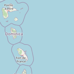
Use this park location map to pinpoint Réserve naturelle régionale marine du Prêcheur - Albert Falco in France, understand its exact geographic position, and read its mapped placement within the surrounding landscape more clearly.

Pigeon | © OpenStreetMap contributors

Location context for Réserve naturelle régionale marine du Prêcheur - Albert Falco

Martinique

Visual exploration of coastal habitats, volcanic shorelines, and marine protected areas

Réserve naturelle régionale marine du Prêcheur - Albert Falco Photos and Landscape Scenery

Photographic collections reveal the nearshore marine habitats, coral reef formations, and volcanic coastal terrain defining the protected waters of Réserve naturelle régionale marine du Prêcheur - Albert Falco. Visual documentation helps researchers and visitors analyze the distinctive Lesser Antilles seascape and regional conservation environments along Martinique.

A distant view of a small, steep-sided, vegetated rocky island rising out of the open ocean under a cloudy sky.

Park atlas

Compare nearby marine reserves and coastal protected landscapes across the surrounding region

Parks Near Réserve naturelle régionale marine du Prêcheur - Albert Falco and Surrounding Protected Areas

Browse other protected areas and marine reserves situated near Réserve naturelle régionale marine du Prêcheur - Albert Falco. Comparing adjacent coastal habitats provides broader context on regional conservation efforts and volcanic shoreline ecosystems.
Marine protected areaFrance
Mapped location lies within the park boundary#1 closest

East

Sanctuaire Agoa: Exploring the Marine Protected Landscapes of the French Antilles

Regional marine mammal sanctuary and Caribbean oceanic geography

Sanctuaire Agoa represents a significant marine protected area spanning 143,000 square kilometers across the Caribbean. The sanctuary provides vital protection for humpback whales, dolphins, and various marine mammals while serving as a hub for regional cooperation in the Lesser Antilles. Mapping the sanctuary reveals a complex maritime space that stretches from shallow reef-fringed volcanic islands to deep ocean pelagic waters.

Area
143,256 km²
Established
2010
Climate
Tropical
Access
Access unknown
A soft, artistic watercolor painting of a calm landscape with rolling green hills, lush vegetation, and a winding waterway, presented on a white background.
Nature reserveMartinique
About 37 km away#2 closest

East

Réserve naturelle nationale de la presqu'île de la Caravelle: Geography and Protected Area Atlas

Explore ancient Atlantic coastal landscapes and protected habitats in Martinique.

Located on the eastern tip of Martinique, the Réserve naturelle nationale de la presqu'île de la Caravelle stands as a critical protected landscape. This atlas entry details its unique geological history, dating back twenty-five million years, alongside its complex network of mangrove-fringed bays, dramatic Atlantic cliffs, and specialized island ecosystems. It serves as an essential reference for understanding the distinctive biogeography of the French Caribbean.

Area
3.88 km²
Established
1976
IUCN
IV
Visitors
400K annual
National parkDominica
About 50 km away#3 closest

North

Morne Trois Pitons National Park: Dominica's Volcanic Protected Area Atlas

Explore its unique geothermal terrain and mapped natural boundaries.

Morne Trois Pitons National Park represents a core protected area within Dominica, renowned for its dramatic volcanic landscapes and rich geothermal activity. This national park features steep volcanic cones, deep canyons, and diverse terrain shaped by intense geological forces. The park's mapped boundaries encompass unique natural wonders, offering a focused study of volcanic geography and protected ecosystems. Discover the contours of this significant Caribbean landscape and its inherent natural value.

Area
68.57 km²
Established
1975
IUCN
II
Relief
Mountain
National parkDominica
About 78 km away#4 closest

North

Morne Diablotin National Park: Dominica National Park Geographic Atlas Exploration

Mapped protected areas and regional landscape context.

Morne Diablotin National Park serves as a vital national park within Dominica, offering specific insights into its protected terrain and geographic setting. Explore its mapped boundaries and understand its role as a distinct natural landscape within the island's atlas, providing focused discovery for those interested in protected areas and their regional context.

Area
33.35 km²
Established
2000
Relief
Mountain
Climate
Tropical
National parkDominica
About 89 km away#5 closest

North

Cabrits National Park: Protected Landscape and Geographic Context in Dominica

Explore Dominica's volcanic terrain and mapped protected areas.

Delve into the protected landscape of Cabrits National Park, a key component of Dominica's natural heritage. This entry provides an atlas-focused view of the park, detailing its geographic setting and mapped boundaries within the island nation. Understand how Cabrits National Park contributes to the regional geography of the Lesser Antilles and appreciate its significance as a protected natural area for structured discovery.

Area
5.3 km²
Established
1986
IUCN
II
Relief
Upland
Watercolor painting of mountains, a lake, and green hills
National parkGuadeloupe
About 139 km away#6 closest

North

Guadeloupe National Park: Volcanic Rainforest and Protected Landscape Identity

Explore mapped boundaries and regional geography.

Guadeloupe National Park stands as a significant protected landscape, primarily defined by the dramatic volcanic terrain of Basse-Terre. This atlas entry focuses on the park's vital role in preserving one of the Caribbean's most extensive tropical rainforest ecosystems, centered around the active La Soufrière volcano. Understand its mapped boundaries, unique geographic setting within the Lesser Antilles, and its importance as a national park and UNESCO biosphere reserve.

Area
173 km²
Established
1989
IUCN
II
Relief
Mountain
Watercolor painting of a coastal landscape with green hills, trees in the foreground, and a calm sea, featuring a light and airy artistic style.
National parkAntigua and Barbuda
About 250 km away#7 closest

North

Nelson's Dockyard National Park: Protected Maritime Heritage and Caribbean Coastal Geography

Mapped terrain, historical dockyards, and Antiguan coastal trails

Nelson's Dockyard National Park preserves a critical maritime hub in Antigua and Barbuda, defined by the interplay between a natural hurricane-shelter harbour and the rugged hills of the south coast. The protected site encompasses substantial stone naval architecture from the Georgian era alongside a network of trails that trace the dry forest ridges above English Harbour. This geography offers a distinct perspective on how human historical impact and natural tropical landscape preservation coexist in the Caribbean Lesser Antilles.

Relief
Lowland
Scope
Mixed
Water
Major water bodies
National parkAntigua and Barbuda
About 259 km away#8 closest

North

Green Castle Hill National Park: Volcanic Landscapes and Archaeological Sites in Antigua

A preserved hilltop ridge within the Shekerley Mountains of Antigua.

Green Castle Hill preserves a significant volcanic landscape in the southwest of Antigua. Renowned for its circle of ancient standing stones and its status as the first national park within the Shekerley range, the site offers a unique intersection of cultural heritage and mountain geography. Access map-driven insights into the protected boundaries and regional terrain that define this Caribbean hilltop.

Established
2008
Relief
Mountain
Climate
Tropical
Scope
Terrestrial

Common questions about visiting, size, designation, and location context for Réserve naturelle régionale marine du Prêcheur - Albert Falco

Réserve naturelle régionale marine du Prêcheur - Albert Falco FAQs for park facts, access, geography, and protected area context

Find quick answers about Réserve naturelle régionale marine du Prêcheur - Albert Falco, including protected-area facts, park geography, trail and visitor context, and how the park fits into its surrounding country and regional landscape.
MoriAtlas Explorer

Continue Your Protected Areas Search Across the Global Atlas

Deepen your exploration by continuing the structured search for national parks and protected areas worldwide. Utilize the comprehensive filtering capabilities to compare different conservation landscapes and refine your understanding of global park geography. Discover more about the distribution and characteristics of protected natural areas.

Global natural geography