Mori Atlas logo
National parkCabrits National Park

Discover the mapped boundaries and natural terrain of this significant Caribbean protected area.

Cabrits National Park: Dominica's Protected National Park Landscape and Geography

Cabrits National Park represents a vital protected natural landscape situated within the island nation of Dominica, a jewel of the Lesser Antilles. As a designated national park, its geographic identity is intrinsically linked to the island's volcanic terrain and lush rainforests. This page offers an atlas-oriented perspective, detailing the park's mapped boundaries and providing context for its place within Dominica's broader natural geography, facilitating a deeper understanding of this significant protected area.

Caribbean islandsVolcanic landscapesHistorical sitesNational parksWetlandsCoral reefs

Cabrits National Park

National park

Park overview

Structured park overview, official facts, and landscape profile for Cabrits National Park

Cabrits National Park park facts, protected area profile, and essential visitor context
Review the core facts for Cabrits National Park, including designation, size, terrain, visitor scale, habitats, and operating context in one park-focused overview.

About Cabrits National Park

Cabrits National Park occupies a peninsula of exceptional geographic and historical significance on the Caribbean island of Dominica. The park's dual mandate to preserve both cultural heritage and natural environments makes it distinctive among Caribbean protected areas. The Cabrits Peninsula, rising from the sea as a dramatic volcanic remnant, was formed approximately one million years ago when the volcano Morne au Diable created the twin peaks of East Cabrit and West Cabrit. Over time, sediment accumulation from Douglas Bay and Prince Rupert Bay connected this former island to the main island of Dominica, creating the peninsula that now supports the park. The park's marine protected area extends between Prince Rupert Bay and Toucar Bay, encompassing coral reef ecosystems that contribute to the island's marine biodiversity. The terrestrial landscape transitions from wetland marshes and mangroves at lower elevations through tropical forest to drier scrub vegetation on the upper slopes of the volcanic peaks. This environmental gradient supports diverse habitats within a relatively compact area, contributing to the park's ecological significance within the Eastern Caribbean.

Quick facts and research context for Cabrits National Park

Cabrits National Park is located on the Cabrits Peninsula in northern Dominica, approximately 1,313 acres in size with an additional 421 hectares of marine protected area. The park features two volcanic peaks forming a peninsula that was once an island. Established in 1986, it protects tropical forest, coral reef ecosystems, and wetlands alongside the remains of Fort Shirley, a Georgian-era British military outpost. The name derives from the French word for goats, referring to feral goats introduced by sailors. The park serves as the northern terminus of the Waitukubuli Trail, Dominica's long-distance hiking route.

Park context

Deeper park guide and search-rich context for Cabrits National Park

Cabrits National Park history, landscape, wildlife, and travel context
Explore Cabrits National Park through its history, landscape character, ecosystems, wildlife, conservation priorities, cultural context, and seasonal travel timing in a structured park guide built for atlas discovery and search intent.

Why Cabrits National Park stands out

Cabrits National Park is best known for its combination of colonial military heritage and ecological diversity. The restored Fort Shirley complex represents one of the finest examples of 18th-century British military architecture in the Caribbean, notable also for the 1802 revolt of the 8th West India Regiment of African slave soldiers. The park's marine component protects significant coral reef habitat, while its terrestrial landscapes encompass wetlands, dry forest, and volcanic terrain supporting remarkable biodiversity including 162 bird species and endemic plant species. The peninsula's dramatic setting, formed by an extinct volcano now connected to the mainland, provides scenic hiking trails to both peaks and the fort ruins.

Cabrits National Park history and protected-area timeline

Cabrits National Park's history reflects the broader colonial and military dynamics of the Caribbean. Fort Shirley was established in 1765 on the orders of Governor Thomas Shirley as a British garrison to defend the northern approach to Dominica. The Georgian-style outpost grew to comprise over 50 buildings housing more than 600 soldiers, making it one of the most substantial military installations in the Eastern Caribbean at the time. The fort was expanded during French occupation of Dominica from 1778 to 1784. The site achieved particular historical significance in 1802 when soldiers of the 8th West India Regiment, comprised of African enslaved men, staged a revolt that would contribute to the liberation of all slave soldiers on the island by 1807. The fort was abandoned in 1854 and fell into ruin over subsequent decades. Restoration efforts began in 1982 under the direction of Dr. Lennox Honychurch, coinciding with the establishment of Cabrits National Park in 1986. Today, several buildings have been fully restored while ruins of others remain scattered across the peninsula, providing a tangible connection to this layered colonial and military history.

Cabrits National Park landscape and geographic character

The landscape of Cabrits National Park is defined by its volcanic origins and peninsula configuration. The two peaks, East Cabrit at 140 meters and West Cabrit at 171 meters, form the mountainous core of the peninsula, their slopes descending to coastal areas and wetlands. The terrain reflects the park's volcanic geology, with the peaks representing the remnants of Morne au Diable, an extinct volcano that last erupted approximately one million years ago. The transition from mountain to sea creates varied topography including rocky coastal fringes, wetland areas, and the marine environment of the surrounding bays. The peninsula's unique formation as a former island, now connected to mainland Dominica by sedimentary deposition, contributes to its distinctive character. Hiking trails traverse this terrain, providing access to the summit peaks and the historic fort complex, while the marine environment of Prince Rupert Bay and Toucar Bay offers underwater exploration opportunities.

Cabrits National Park ecosystems, habitats, and plant life

The ecological diversity of Cabrits National Park is notable for the range of habitats contained within its relatively compact area. The park encompasses three primary wetland ecotypes: mangroves, swamp forest, and marshlands, representing one of the two largest wetland systems in the Portsmouth area and covering over 35 hectares. Above the wetlands, tropical forest transitions to drier forest and scrub vegetation on the upper slopes where lower precipitation supports deciduous species. The marine component protects coral reef habitat in the waters between Prince Rupert Bay and Toucar Bay. The park supports remarkable botanical diversity, including three tree species endemic to the area: Annona glabra (Kachiman kochon), Pterocarpus officinalis (medal mangrove), and Laguncularia racemosa (white mangrove). Additionally, more than 30 endemic herbs and shrubs are recognized for medicinal use in Dominican traditional practices. The coastal fringe features coconut palms, sea grapes, catalpas, almond trees, and other species, while a forest plantation established in the 1960s introduced mahogany, teak, Caribbean pine, and pink poui.

Cabrits National Park wildlife and species highlights

Cabrits National Park supports significant wildlife diversity within its terrestrial and marine environments. The park records 162 bird species, making it an important avian habitat in Dominica. Mammal diversity includes 18 species, five of which are introduced. The park is home to two amphibian species, at least two scorpion species, and 20 crab species. The Antilles Racer snake (Alsophis antillensis) is among the notable reptile species found within the park. This biodiversity exists within the context of the park's varied habitats, from wetland areas supporting aquatic and semi-aquatic species to forest environments and the marine protected area with its coral reef communities. The combination of terrestrial and marine protection within a single managed area supports ecological connectivity and contributes to the conservation of species populations within the Northern Dominican landscape.

Cabrits National Park conservation status and protection priorities

Cabrits National Park represents an integrated approach to conservation, protecting both cultural heritage and natural environments within a single protected area. The park's establishment in 1986 created an IUCN Category II protected area that safeguards the volcanic peninsula landscape alongside the historic Fort Shirley complex. The marine protected area of 421 hectares between Prince Rupert Bay and Toucar Bay contributes to coastal and marine ecosystem preservation. The wetland systems, among the largest in the Portsmouth area, represent important hydrological and biodiversity features. The presence of endemic plant species, including three tree species found only within the park, underscores its botanical significance. The conservation framework addresses both terrestrial and marine habitats, providing comprehensive protection for the peninsula's ecological integrity while preserving the historical structures that reflect Dominica's colonial past.

Cabrits National Park cultural meaning and human context

The cultural context of Cabrits National Park is deeply shaped by its colonial history and the broader Caribbean experience. The park's name derives from the French word for goats, reflecting the peninsula's naming after feral goats introduced by sailors who released them to ensure a source of fresh meat upon their return. The Fort Shirley garrison represents the colonial military presence that characterized much of Caribbean history, with the 1802 revolt of the 8th West India Regiment holding particular significance in the regional narrative of armed resistance and eventual emancipation. The restoration of the fort, led by Dominican historian Dr. Lennox Honychurch beginning in 1982, represents efforts to preserve and interpret the island's colonial heritage within a protected area framework. This integration of cultural preservation with natural conservation reflects contemporary approaches to heritage management that recognize the intertwined relationship between human history and landscape.

Top sights and standout views in Cabrits National Park

The defining highlights of Cabrits National Park include the restored Fort Shirley garrison with its Georgian architecture and historical significance, the dramatic volcanic peaks of East Cabrit and West Cabrit offering hiking opportunities, the marine protected coral reef areas in Prince Rupert Bay and Toucar Bay supporting diving activities, and the significant wetland ecosystems supporting diverse wildlife. The park serves as the northern terminus of the Waitukubuli Trail, Dominica's national hiking trail, connecting it to the island's broader outdoor recreation network. The 1802 revolt of the 8th West India Regiment at Fort Shirley represents a pivotal moment in Caribbean military and social history. The endemic plant species and 162 recorded bird species contribute to the park's ecological significance within the Eastern Caribbean.

Best time to visit Cabrits National Park

Cabrits National Park can be visited year-round given Dominica's tropical climate, though the dry season from approximately November to May typically offers more favorable conditions for hiking and outdoor exploration. The park's trails are accessible throughout the year, with the drier months generally providing more comfortable conditions for hiking to the peaks and exploring the fort complex. The marine environment is accessible for diving and snorkeling during much of the year, though conditions may vary with seasonal weather patterns. Visitors interested in wildlife viewing may find the dry season months particularly productive, though the wetland areas and forest environments support wildlife throughout the year. The shoulder periods of late spring and early autumn may offer a balance of favorable weather and fewer visitors, though Dominica's position outside the primary hurricane belt generally allows for year-round access to the park.

Park location guide

Geography guide, regional context, and park location map for Cabrits National Park

Cabrits National Park park geography, regions, and map view in Dominica
Understand where Cabrits National Park sits in Dominica through a broader geographic reading of the surrounding landscape, nearby location context, and its mapped position within the national park landscape.

How Cabrits National Park fits into Dominica

Dominica is an island nation in the Caribbean Sea, part of the Lesser Antilles. It achieved independence from Britain in 1978 and is renowned for its mountainous rainforests, geothermal-volcanic activity, and the Boiling Lake hot spring. The capital is Roseau.

Wider geography shaping Cabrits National Park in Dominica

Dominica is situated in the Caribbean Sea, part of the Windward Islands in the Lesser Antilles archipelago. The island lies between Guadeloupe to the northwest and Martinique to the southeast. It has mountainous terrain with the highest point being Morne Diablotins at 1,448 meters.

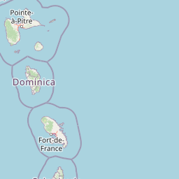
Map view of Cabrits National Park

Use this park location map to pinpoint Cabrits National Park in Dominica, understand its exact geographic position, and read its mapped placement within the surrounding landscape more clearly.

Pigeon | © OpenStreetMap contributors
Park atlas

Trace the regional geography of protected areas, comparing diverse volcanic landscapes, marine reserves, and historical sites surrounding Cabrits National Park.

Continue Your Discovery: Other National Parks and Protected Areas Near Cabrits National Park
Browse other national parks and protected areas, identifying sites with shared volcanic landscapes, marine environments, or historical significance across the broader Caribbean. Utilize structured atlas views to compare their geographic features, ecological profiles, and conservation efforts, enhancing your understanding of regional protected area distribution.
National parkDominica

Morne Trois Pitons National Park: Dominica's Volcanic Protected Area Atlas

Explore its unique geothermal terrain and mapped natural boundaries.

Morne Trois Pitons National Park represents a core protected area within Dominica, renowned for its dramatic volcanic landscapes and rich geothermal activity. This national park features steep volcanic cones, deep canyons, and diverse terrain shaped by intense geological forces. The park's mapped boundaries encompass unique natural wonders, offering a focused study of volcanic geography and protected ecosystems. Discover the contours of this significant Caribbean landscape and its inherent natural value.

Area
68.57 km²
Established
1975
IUCN
II
Relief
Mountain
Watercolor painting of mountains, a lake, and green hills
National parkGuadeloupe

Guadeloupe National Park: Volcanic Rainforest and Protected Landscape Identity

Explore mapped boundaries and regional geography.

Guadeloupe National Park stands as a significant protected landscape, primarily defined by the dramatic volcanic terrain of Basse-Terre. This atlas entry focuses on the park's vital role in preserving one of the Caribbean's most extensive tropical rainforest ecosystems, centered around the active La Soufrière volcano. Understand its mapped boundaries, unique geographic setting within the Lesser Antilles, and its importance as a national park and UNESCO biosphere reserve.

Area
173 km²
Established
1989
IUCN
II
Relief
Mountain
National park

Virgin Islands National Park: Protected Landscape Atlas and Geographic Context

Explore volcanic terrain, tropical rainforests, and protected marine ecosystems.

Virgin Islands National Park offers an atlas-style view of protected Caribbean landscapes. The park encompasses volcanic uplands, dense tropical rainforests, and extensive coral reef systems surrounding Saint John island. Discover the mapped boundaries and geographic features that define this significant national park, providing crucial context for its unique ecosystems and historical significance.

Area
59.64 km²
Established
1956
IUCN
V
Visitors
112.3K annual
National parkSucre

Península de Paria National Park: Venezuela's Protected Landscape Geography and Atlas Context

Explore mapped park boundaries and regional geographic setting.

Discover Península de Paria National Park, a vital protected area within the Sucre region of Venezuela. This page offers a detailed look at the park's geographic identity, focusing on its mapped boundaries and its significance as a national park for atlas-based exploration. Understand its landscape context and its contribution to Venezuela's network of protected lands, providing a clear geographic overview for researchers and explorers.

Area
375 km²
Established
1978
IUCN
II
Relief
Mountain
National parkNueva Esparta

Cerro El Copey National Park: Mapped Protected Area in Nueva Esparta

Explore the geographic context and landscape of this national park.

Cerro El Copey National Park offers a distinct protected landscape within Nueva Esparta, Venezuela. This page details the park's geographic identity, its mapped boundaries, and its significance as a national park. Investigate the terrain and regional context to understand the protected area's ecological and geographical footprint, providing essential data for atlas-driven exploration.

Area
71 km²
Established
1974
IUCN
II
Relief
Mountain
National parkSucre State

Turuépano National Park: National Park Protected Landscape and Geographic Context

Explore the mapped boundaries and natural terrain of Sucre State's national park.

Investigate Turuépano National Park, a protected national park situated within Sucre State, Venezuela. This entry provides detailed geographic context and information on its mapped protected-area boundaries, essential for understanding its role in the region's natural landscape atlas. Explore the specific terrain and protected land features that define this significant Venezuelan park.

Area
726 km²
Established
1991
IUCN
II
Relief
Lowland
National parkMonagas

Cueva del Guácharo National Park: Venezuela's Protected Natural Landscape

Mapping protected areas and natural terrain in Monagas.

Cueva del Guácharo National Park represents a distinct protected landscape within Venezuela's Monagas region. This entry provides essential context for understanding the park's geographic scope, mapped boundaries, and role as a national park. It is designed to facilitate detailed atlas exploration of protected natural areas and their regional landscape context, offering a foundation for understanding Venezuela's conservation geography.

Area
627 km²
Established
1975
IUCN
II
Relief
Mountain
Watercolor painting of a lagoon surrounded by green vegetation and mountains in the background
National parkMiranda State

Laguna de Tacarigua National Park: Protected Area and Miranda State Geography

Mapped natural landscape and park boundaries in Venezuela.

Laguna de Tacarigua National Park is a designated national park offering critical protected landscape features within Miranda State. This park provides essential context for understanding Venezuela's protected areas, with a focus on its mapped boundaries and regional geographic setting. Dive into the atlas-style details to comprehend its place in the natural landscape.

Area
391 km²
Established
1974
IUCN
II
Relief
Lowland

Common questions about visiting, size, designation, and location context for Cabrits National Park

Cabrits National Park FAQs for park facts, access, geography, and protected area context
Find quick answers about Cabrits National Park, including protected-area facts, park geography, trail and visitor context, and how the park fits into its surrounding country and regional landscape.
MoriAtlas Explorer

Continue Your Protected Areas Search Across the Global Atlas

Deepen your exploration by continuing the structured search for national parks and protected areas worldwide. Utilize the comprehensive filtering capabilities to compare different conservation landscapes and refine your understanding of global park geography. Discover more about the distribution and characteristics of protected natural areas.

Global natural geography