

Mori Atlas logo
National parkMinerva Hills National Park

Discover the mapped boundaries and regional context of this national park in northeastern Australia.

Minerva Hills National Park: Queensland National Park Geography and Protected Landscape Atlas

Minerva Hills National Park represents a significant protected area within Queensland's diverse geography. This page serves as a gateway to understanding its mapped landscape, unique natural terrain, and its role as a national park within the northeastern Australian region. Explore the park's distinct geographic identity and its place within the broader atlas of protected lands.

Volcanic LandscapeCentral QueenslandNational ParkOligocene GeologyDry RainforestOpen Woodland

Minerva Hills National Park

National park

Park overview

Structured park overview, official facts, and landscape profile for Minerva Hills National Park

Minerva Hills National Park park facts, protected area profile, and essential visitor context
Review the core facts for Minerva Hills National Park, including designation, size, terrain, visitor scale, habitats, and operating context in one park-focused overview.

About Minerva Hills National Park

Minerva Hills National Park occupies a distinctive position in Central Queensland's landscape, protecting a cluster of volcanic peaks and ridges that rise prominently above the surrounding terrain near the town of Springsure. The park was established in 1994 to preserve both the geological significance of the Minerva Hills Volcanics and the diverse habitats they create. The landscape presents a dramatic contrast to the more typical flat or undulating terrain of the Queensland interior, with volcanic plugs, domes, and steep-sided valleys creating complex topography.

The park lies within the Brigalow Belt bioregion, a recognized area of significant biodiversity and ecological variation in eastern Australia. Water from the park's heights flows into both the Comet River and Nogoa River systems, connecting the protected landscape to broader catchment management across Central Queensland. The mix of open woodlands on the exposed ridges with more sheltered dry rainforest in the gorges demonstrates how microclimate and aspect create ecological variety within a relatively small area.

Visitor facilities are modest but functional, with four lookouts providing interpretation of the landscape and a picnic area offering a rest stop. The prohibition on camping encourages day-use exploration rather than extended stays, reflecting both management philosophy and the park's relatively small size. The proximity to Springsure, visible from several lookouts, provides a convenient base for visitors and connects the protected area to the local community.

Quick facts and research context for Minerva Hills National Park

Minerva Hills National Park covers 27.90 square kilometers in Central Queensland, established in 1994 under management by Queensland Parks and Wildlife Service. The park sits at coordinates 24°04′50″S 148°03′51″E, approximately 626 kilometers northwest of Brisbane with Springsure as the nearest town. The landscape is defined by Oligocene volcanic geology dating from 33 to 27 million years ago, part of the Cosgrove Hot Spot track. Visitors access four lookouts and a picnic area, with camping prohibited. The park falls within both the Comet River and Nogoa River catchment areas and within the Brigalow Belt bioregion.

Park context

Deeper park guide and search-rich context for Minerva Hills National Park

Minerva Hills National Park history, landscape, wildlife, and travel context
Explore Minerva Hills National Park through its history, landscape character, ecosystems, wildlife, conservation priorities, cultural context, and seasonal travel timing in a structured park guide built for atlas discovery and search intent.

Why Minerva Hills National Park stands out

Minerva Hills National Park is best known for its dramatic volcanic landscape dominated by ancient Oligocene peaks, sheer cliffs, and sheltered gorges. The geology represents a rare exposed section of the Cosgrove Hot Spot, the longest continental hot spot track on Earth, with volcanic rocks ranging from mafic lavas to trachyte and rhyolite formations approximately 33 to 27 million years old. The park's combination of volcanic peaks, dry rainforest pockets, and open woodlands creates a visually distinctive landscape not commonly found in Queensland's protected areas. The four lookouts provide panoramic views of both the volcanic terrain and the surrounding rural landscape around Springsure.

Minerva Hills National Park history and protected-area timeline

Minerva Hills National Park was formally established in 1994 through the protection of lands that had previously been under various tenure arrangements in Central Queensland. The declaration of the area as a national park recognized both the geological significance of the volcanic formations and the ecological value of the diverse habitats they support. Management responsibility was assigned to the Queensland Parks and Wildlife Service, aligning with the standard administrative framework for Queensland's national parks.

The geological story of the site extends far deeper than its national park history. The Minerva Hills Volcanics represent Oligocene-era volcanic activity approximately 33 to 27 million years ago, part of a hot spot track that created a chain of volcanic features across the Australian continent. The Cosgrove Hot Spot, which produced these formations, is recognized as creating the longest continental hot spot track on Earth, making the Minerva Hills site part of a significant geological feature of international scientific interest. The park preserves the most accessible and visually prominent exposure of this volcanic activity.

Minerva Hills National Park landscape and geographic character

The landscape of Minerva Hills National Park is defined by its volcanic origins, with steep volcanic peaks, ridges, and domes rising sharply from the surrounding Central Queensland terrain. The Oligocene Minerva Hills Volcanics have been carved by erosion into a complex terrain of sheer cliffs, rocky outcrops, and sheltered valleys. The basal sequence of mafic lavas, reaching some 70 meters in thickness, forms the foundation upon which interleaved layers of felsic volcanic rocks including trachyte and rhyolite have been built.

The pyroclastic materials associated with the volcanic complex have been shaped into plugs and domes that create the most distinctive landmarks within the park. These volcanic features contrast sharply with the more typical flat or gently undulating landscapes of the Brigalow Belt, making the Minerva Hills a prominent visual landmark visible from considerable distances across the Central Queensland plains. The sheltered gorges between the peaks create microenvironments with different vegetation and moisture conditions compared to the exposed ridge tops and surrounding plains.

Minerva Hills National Park ecosystems, habitats, and plant life

Minerva Hills National Park sits within the Brigalow Belt bioregion, a landscape of significant ecological diversity in eastern Australia. The park's varied topography creates multiple habitat types within a relatively limited area, from exposed rocky ridges supporting open woodland to sheltered, moisture-retaining gorges where dry rainforest persists. This ecological variety reflects the interaction between aspect, soil depth, moisture availability, and the protection from wind and sun that the steep volcanic terrain provides.

The waterways flowing from the park connect to both the Comet River and Nogoa River systems, contributing to broader catchment health across Central Queensland. The vegetation communities within the park reflect the transitional nature of the Brigalow Belt between more tropical and more arid ecological zones, incorporating species from multiple floristic influences. While the source material provides limited detail on specific flora, the combination of open woodlands and dry rainforest patches indicates a mosaic of habitats supporting diverse plant communities.

Minerva Hills National Park wildlife and species highlights

While the source material does not provide detailed wildlife species lists for Minerva Hills National Park, the park's location within the Brigalow Belt bioregion and its variety of habitats suggest reasonable biodiversity. The mix of open woodland environments, rocky outcrop areas, sheltered gorges with more humid conditions, and the proximity to water catchments creates multiple niche environments for fauna. The dry rainforest patches in sheltered valleys particularly provide habitat conditions distinct from the surrounding woodlands, potentially supporting different species assemblages.

The significance of the Brigalow Belt as a bioregion indicates broader ecological value, with the protected landscape serving to preserve habitat connectivity within a region that has experienced extensive land clearing for agriculture and pastoral use. The national park status provides protection for whatever wildlife communities persist in this volcanic landscape, though specific notable species would require more detailed source information.

Minerva Hills National Park conservation status and protection priorities

Minerva Hills National Park contributes to the protection of Central Queensland's natural heritage by preserving a distinctive volcanic landscape that would otherwise face pressures from surrounding land use. The Brigalow Belt bioregion has experienced significant modification through agricultural development, making protected areas like Minerva Hills important refuges for native vegetation and associated wildlife. The park's catchments feeding into the Comet and Nogoa rivers also connect its conservation value to broader waterway health across the region.

The geological significance of the Minerva Hills Volcanics adds a scientific dimension to the conservation rationale. As a visible exposure of the Cosgrove Hot Spot track, the park preserves an important record of Australia's volcanic history and the geological processes that have shaped the continent. This combination of landscape, ecological, and geological values justifies the national park protection established in 1994.

Minerva Hills National Park cultural meaning and human context

The source material does not provide specific information about indigenous cultural connections to the Minerva Hills area. The park's proximity to Springsure suggests traditional association with local Aboriginal peoples, though no detailed cultural information is preserved in the available sources. The volcanic peaks and distinctive landscape would likely have held significance for local Indigenous communities, as volcanic formations often feature in Aboriginal cultural landscapes across Australia.

The broader Brigalow Belt region contains evidence of Aboriginal occupation and connection spanning tens of thousands of years, though the specific cultural history of the Minerva Hills site would require additional research beyond the provided source material. Visitors to the park should be aware that the landscape likely holds cultural meaning beyond its geological and ecological values.

Top sights and standout views in Minerva Hills National Park

The four lookouts scattered throughout Minerva Hills National Park provide the primary visitor experience, offering panoramic views of the volcanic peaks, surrounding plains, and the town of Springsure in the valley below. The rugged volcanic landscape with its steep peaks, sheer cliffs, and ancient rock formations represents the park's most distinctive visual feature. The geological significance of the Minerva Hills Volcanics as part of the world's longest continental hot spot track offers educational value for visitors interested in geological processes. The contrast between open woodlands on exposed slopes and the sheltered dry rainforest in the gorges demonstrates how topographic variation creates ecological diversity. Day-use facilities including the picnic area provide basic visitor amenities without the distraction of camping infrastructure, encouraging appreciation of the landscape through shorter visits.

Best time to visit Minerva Hills National Park

Minerva Hills National Park can be visited throughout the year, though the Queensland climate means summer months can be very hot with temperatures potentially uncomfortable for walking and outlook visits. The winter months from May through September typically offer milder daytime temperatures and lower humidity, making this the most comfortable season for exploring the park's lookouts and tracks. Spring and autumn provide transitional conditions with moderate temperatures, though spring may bring increased insect activity. Visitors should note that the park does not offer camping facilities, making it best suited for day trips from Springsure or as part of a broader Central Queensland itinerary. The lookouts provide different visual experiences depending on light conditions, with early morning and late afternoon offering softer light for photography.
Park location guide

Geography guide, regional context, and park location map for Minerva Hills National Park

Minerva Hills National Park park geography, regions, and map view in Australia
Understand where Minerva Hills National Park sits in Australia through a broader geographic reading of the surrounding landscape, nearby location context, and its mapped position within the national park landscape.

How Minerva Hills National Park fits into Australia

Australia is a constitutional monarchy and federal parliamentary democracy comprising six states and ten territories. With a population of nearly 28 million, it is one of the world's most urbanised countries, with most people concentrated on the eastern seaboard. The country has a high Human Development Index and is known for its cultural diversity, ancient Aboriginal heritage, and unique wildlife.

Wider geography shaping Minerva Hills National Park in Australia

Australia occupies the entire Australian continent, the island of Tasmania, and numerous smaller islands. It is the world's flattest and driest inhabited continent, featuring vast deserts in the interior (the Outback), tropical rainforests along the eastern coast, and a coastline bordering the Indian and Pacific Oceans.

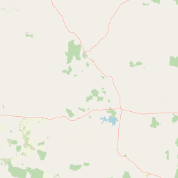
Map view of Minerva Hills National Park

Use this park location map to pinpoint Minerva Hills National Park in Australia, understand its exact geographic position, and read its mapped placement within the surrounding landscape more clearly.

Pigeon | © OpenStreetMap contributors

Location context for Minerva Hills National Park

Queensland
Park atlas

Trace the regional geography of Central Queensland's protected areas and compare the diverse landscapes surrounding Minerva Hills.

Discover Other National Parks Near Minerva Hills National Park, Explore Queensland's Protected Landscapes
After exploring Minerva Hills National Park's unique volcanic terrain, browse other national parks and protected areas across Central Queensland to understand their geographic spread and conservation context. Compare diverse protected landscapes, trace ecological variations, and discover adjacent regions that complement the distinct geology of Minerva Hills National Park.
National parkQueensland

Snake Range National Park: Queensland Protected Area and Landscape Mapping

Explore the geographic boundaries and natural terrain.

Snake Range National Park is a significant protected national park entity within Queensland, Australia. This detailed entry provides essential geographic context, focusing on the park's mapped boundaries, its role as a conservation landscape, and its integration into the wider regional geography. For users interested in atlas exploration, understanding the specific natural terrain and protected area distribution of Snake Range National Park is paramount.

Area
26.88 km²
Established
1972
IUCN
II
Relief
Mountain
National parkMaranoa Region

Carnarvon National Park: Mapped Geography and Protected Landscape Identity

Explore the sandstone gorges and ancient sites of Queensland's natural heritage.

Carnarvon National Park represents a significant protected area within the Maranoa Region of Queensland, Australia. This national park encompasses a vast expanse of approximately 2,980 square kilometers, primarily celebrated for its dramatic sandstone gorges, particularly Carnarvon Gorge, and its globally significant Aboriginal rock art sites. Positioned across the Great Dividing Range, the park's landscape features a compelling mix of deep valleys, sandy plains, and basalt-capped tablelands, offering rich cartographic and geographic context. Its designation as a national park underscores its importance for preserving these unique natural and cultural landscapes for atlas-based discovery.

Area
2,980 km²
Established
1932
IUCN
II
Visitors
65K annual
National parkQueensland

Blackdown Tableland National Park: National Park Protected Landscape Discovery

Explore mapped terrain and regional geography in Queensland.

Blackdown Tableland National Park offers a distinct protected landscape for geographic exploration within Queensland, Australia. As a designated national park, its mapped boundaries and surrounding natural terrain provide crucial context for understanding regional geography. This entry serves as a vital point for atlas-based discovery, detailing the park's identity and its contribution to the diverse natural landscapes of northeastern Australia.

Area
320 km²
Established
1991
IUCN
II
Relief
Highland
National parkQueensland

Nuga Nuga National Park: Protected Landscape Exploration in Queensland

Mapped terrain and regional park geography.

Gain a structured understanding of Nuga Nuga National Park, a designated national park situated within Queensland. This detailed view focuses on its geographic setting, mapped boundaries, and the natural landscape context it offers for atlas-based exploration. Discover the park's identity as a protected area and its contribution to the regional geography of northeastern Australia.

Area
28.6 km²
Established
1993
IUCN
II
Access
Access unknown
National parkQueensland

Taunton National Park: Queensland's Vital National Park and Endangered Species Refuge

Mapped brigalow landscapes and semi-arid woodland terrain.

Taunton National Park in Central Queensland is a protected area of immense conservation value, serving as the last known natural habitat for the endangered bridled nail-tail wallaby. This national park protects representative ecosystems of the Northern Brigalow Belt, featuring distinct brigalow vegetation communities and poplar box woodlands across its cracking clay and texture-contrast soils. Understand the park's geographic setting, its mapped terrain, and the critical role it plays in preserving Australia's unique marsupial populations and diverse flora within the wider regional context.

Area
116 km²
Established
1986
IUCN
II
Relief
Lowland
National parkQueensland

Expedition National Park: A Dramatic Sandstone Mountain Landscape in Central Queensland

Explore protected areas, mapped ridgelines, and Robinson Gorge geography.

Expedition National Park represents a significant protected landscape in Queensland, distinguished by the striking Expedition Range. This mountainous terrain, characterized by rugged sandstone cliffs, deep gorges like Robinson Gorge, and dry eucalyptus forests, offers a unique geographic contrast to the surrounding plains. As a national park, it plays a crucial role in conserving biodiversity within the Brigalow Belt bioregion, providing an essential reference point for understanding regional protected areas and natural terrain.

Area
1,080 km²
Established
1991
IUCN
II
Relief
Mountain
National parkQueensland

Palmgrove National Park: Queensland's Remote Protected Landscape for Scientific Conservation

Rugged sandstone terrain and unique eucalypt woodlands define this park.

Palmgrove National Park is a significant scientific reserve in south-central Queensland, Australia, characterized by its dissected sandstone terrain and dry eucalypt woodlands. Designated as a strict nature reserve, its primary value lies in protecting vulnerable species and threatened ecosystems, notably serving as a crucial breeding habitat for the black-breasted buttonquail. The park's isolated geography and limited public access underscore its importance as a sanctuary for avian conservation and ecological research within Australia's protected areas network.

Area
256 km²
Established
1991
IUCN
Ia
Relief
Upland
National parkQueensland

Narrien Range National Park: Queensland's Protected Landscape for Geographic Exploration

Understand its mapped terrain and regional park context.

Narrien Range National Park represents a vital protected landscape within Queensland, Australia, offering a deep dive into regional geography and conservation lands. As a designated national park, it serves as a crucial point for atlas-based exploration, detailing its specific mapped boundaries and ecological context. Understanding Narrien Range National Park means appreciating its contribution to the diverse natural geography of northeastern Australia, providing a concrete example of protected land within the Sunshine State.

Area
40.2 km²
IUCN
II
Access
Access unknown
Scope
Terrestrial

Common questions about visiting, size, designation, and location context for Minerva Hills National Park

Minerva Hills National Park FAQs for park facts, access, geography, and protected area context
Find quick answers about Minerva Hills National Park, including protected-area facts, park geography, trail and visitor context, and how the park fits into its surrounding country and regional landscape.
MoriAtlas Explorer

Continue Your Protected Areas Search Across the Global Atlas

Deepen your exploration by continuing the structured search for national parks and protected areas worldwide. Utilize the comprehensive filtering capabilities to compare different conservation landscapes and refine your understanding of global park geography. Discover more about the distribution and characteristics of protected natural areas.

Global natural geography