

Mori Atlas logo
National parkNuga Nuga National Park

Discover the mapped terrain and natural context of this national park in northeastern Australia.

Nuga Nuga National Park: Queensland's Protected Landscape and Regional Geography

Nuga Nuga National Park stands as a significant protected area within the diverse geography of Queensland, Australia. This page provides an atlas-style exploration of its mapped boundaries and natural landscape context. Understand its role as a national park and its place within the broader regional geography of northeastern Australia, offering a foundation for detailed discovery.

wetlandsBrigalow BeltQueenslandlake ecosystemreptile conservationprotected area

Nuga Nuga National Park

National park

Park overview

Structured park overview, official facts, and landscape profile for Nuga Nuga National Park

Nuga Nuga National Park park facts, protected area profile, and essential visitor context
Review the core facts for Nuga Nuga National Park, including designation, size, terrain, visitor scale, habitats, and operating context in one park-focused overview.

About Nuga Nuga National Park

Nuga Nuga National Park occupies a distinctive ecological position within the Brigalow Belt bioregion of central Queensland. The Brigalow Belt is characterized by a mix of open woodland, grassland, and increasingly fragmented wetland environments that have undergone substantial modification since European settlement. Nuga Nuga National Park, established in 1993, preserves a relatively intact example of this landscape around Lake Nuga Nuga, a natural freshwater lake that serves as a focal point for the park's ecological values. The park's proximity to the lake and its position within the Comet River catchment creates hydrological connections that sustain the wetland ecosystems within the reserve. While the protected area is small compared to many Australian national parks, its wetland habitats represent increasingly rare environments in the Brigalow Belt, where drainage, agriculture, and development have eliminated much of the original wetland extent. The Queensland Parks and Wildlife Service manages the park to protect these ecological values while providing limited public recreation opportunities.

Quick facts and research context for Nuga Nuga National Park

Nuga Nuga National Park is located in central Queensland near the community of Rolleston. The park was established in 1995 and protects an area of approximately 28.6 square kilometers around Lake Nuga Nuga within the Brigalow Belt bioregion. The park is managed by Queensland Parks and Wildlife Service and is classified as IUCN Category II (national park). The primary ecological significance lies in its wetland habitats, including lacustrine and riverine wetlands that provide sanctuary for specialized species. The park is notably home to Denisonia maculata, a rare and threatened reptile species.

Park context

Deeper park guide and search-rich context for Nuga Nuga National Park

Nuga Nuga National Park history, landscape, wildlife, and travel context
Explore Nuga Nuga National Park through its history, landscape character, ecosystems, wildlife, conservation priorities, cultural context, and seasonal travel timing in a structured park guide built for atlas discovery and search intent.

Why Nuga Nuga National Park stands out

Nuga Nuga National Park is most notably recognized for its wetland habitats and the presence of Denisonia maculata, a rare venomous snake species that has been identified within the park boundaries. The park protects small but significant areas of lacustrine and riverine wetlands adjacent to Lake Nuga Nuga, representing isolated pockets of aquatic habitat within the broader semi-arid Brigalow Belt landscape. These wetland environments support ecological communities that are both limited in distribution and vulnerable to environmental changes, making the protected area an important conservation site for specialized wetland-dependent species.

Nuga Nuga National Park history and protected-area timeline

Nuga Nuga National Park was officially established in 1993 through the proclamation of land under Queensland protected area legislation. The creation of the park reflected growing recognition during the late twentieth century of the ecological significance of the Brigalow Belt's remaining natural habitats, particularly wetland environments that had been substantially reduced across the region. Prior to formal protection, the Lake Nuga Nuga area and surrounding lands had experienced varying levels of pastoral use and environmental modification, though the wetland characteristics of the site provided some inherent constraints on intensive development. The park's establishment was part of a broader Queensland strategy to protect representative examples of the state's diverse bioregions and their characteristic ecosystems. Management responsibility was assigned to the Queensland Parks and Wildlife Service, which continues to oversee conservation activities, visitor services, and ecological monitoring within the reserve.

Nuga Nuga National Park landscape and geographic character

The landscape of Nuga Nuga National Park centers on Lake Nuga Nuga and its associated wetland environments. The lake forms a natural depression within the Comet River catchment, filling primarily through seasonal runoff and groundwater inputs from the surrounding catchment. Around the lake margins, the terrain transitions from open water through emergent wetland vegetation to adjacent woodlands and grasslands of the broader Brigalow Belt. The lacustrine wetlands occupy the shallow, periodically inundated zones around the lake's edge, while riverine wetlands follow drainage lines that connect the lake to the broader water system. The surrounding terrain is generally flat to gently undulating, with soils typical of the Brigalow Belt region supporting vegetation dominated by briggrass (Acacia harpophylla) and various eucalyptus species in the woodland areas. The visual character combines the open waters of the lake with the more dense wetland vegetation and the more open woodland beyond, creating a landscape of varied textures and tonal range.

Nuga Nuga National Park ecosystems, habitats, and plant life

The ecological character of Nuga Nuga National Park is defined by its wetland habitats within the Brigalow Belt bioregion. The lacustrine and riverine wetlands represent distinct habitat types that support specialized plant and animal communities adapted to periodic flooding, waterlogging, and the seasonal fluctuations of water availability that characterize these environments. Within the Brigalow Belt, which extends across large areas of central Queensland, wetlands of this type have become increasingly uncommon as agricultural development, water resource extraction, and infrastructure construction have modified drainage patterns and eliminated many former wetland areas. The protected status of Nuga Nuga National Park therefore preserves habitats that are both ecologically significant and increasingly rare in the regional context. The wetland communities provide habitat for waterbirds, amphibians, and aquatic invertebrates, while the surrounding woodlands support terrestrial fauna species typical of the Brigalow Belt.

Nuga Nuga National Park wildlife and species highlights

The wildlife of Nuga Nuga National Park is particularly notable for the presence of Denisonia maculata, a rare venomous snake species that has been recorded within the park. This reptile, commonly known as the ornate desert snake or spotted desert snake, is a member of the Elapidae family and is found in isolated populations across central Queensland. The species favors wetland and riparian habitats where it preys on small vertebrates including frogs, lizards, and small mammals. Within Nuga Nuga National Park, the wetland environments provide suitable habitat for this species, which depends on moisture levels and prey availability that these environments support. The broader park also supports other reptile species, birdlife associated with wetland and woodland habitats, and various mammals that inhabit the Brigalow Belt woodland communities. While comprehensive species inventories are limited, the presence of Denisonia maculata establishes the park's significance for reptile conservation.

Nuga Nuga National Park conservation status and protection priorities

Nuga Nuga National Park contributes to conservation of the Brigalow Belt bioregion by protecting significant wetland habitats that have been reduced across much of this region. The Brigalow Belt has experienced extensive vegetation clearing for agriculture, grazing, and development since European settlement, resulting in the loss of substantial proportions of original woodland and wetland environments. The wetlands within Nuga Nuga National Park, though small in absolute area, represent important remnants of habitat types that support specialized species including the threatened Denisonia maculata. The park's protection status (IUCN Category II) provides a framework for ongoing conservation management that limits potentially damaging activities within the reserve. Conservation values are maintained through management activities that protect water quality, maintain wetland hydrology, and preserve the vegetation communities that support the park's biodiversity.

Nuga Nuga National Park cultural meaning and human context

The Lake Nuga Nuga area holds significance in the cultural landscape of central Queensland. The traditional lands of the Indigenous peoples of the Brigalow Belt region include areas around Lake Nuga Nuga, where Aboriginal communities historically utilized the wetland resources for food gathering, ceremony, and cultural activities. While detailed documentation of Indigenous cultural connections to the specific area is limited in available sources, the broader Brigalow Belt region contains numerous sites of Aboriginal cultural heritage, and the lake and wetlands would have provided important resources for local Indigenous communities. European settlement of the region brought pastoral activities that modified much of the landscape, and the establishment of the national park in 1993 recognized the ecological values of the area while providing for ongoing connection to Country for Indigenous stakeholders.

Top sights and standout views in Nuga Nuga National Park

Nuga Nuga National Park preserves a rare example of wetland habitat within the Brigalow Belt bioregion, offering protection to the threatened Denisonia maculata and the ecological communities dependent on Lake Nuga Nuga's wetland environments. The park provides a compact but meaningful example of Australian inland wetland conservation, where lacustrine and riverine habitats support biodiversity values not readily found in the surrounding modified landscape. Visitors to the park can experience the tranquil setting of Lake Nuga Nuga and observe wetland environments that contrast with the more typical woodland and grassland character of the broader region.

Best time to visit Nuga Nuga National Park

The best time to visit Nuga Nuga National Park is during the cooler months of autumn and winter (April to September) when temperatures are moderate and outdoor exploration is comfortable. Summer months (December to February) can bring high temperatures and occasional rainfall that may affect visit conditions. The wetland environment is influenced by seasonal rainfall patterns, with water levels in Lake Nuga Nuga varying between wet and dry periods. Wildlife viewing, particularly for species like Denisonia maculata, may be more productive during cooler months when reptiles are more active during daylight hours. Visitors should note that the park is relatively remote and facilities are limited, requiring self-sufficiency and appropriate preparation for the semi-arid conditions of the region.
Park location guide

Geography guide, regional context, and park location map for Nuga Nuga National Park

Nuga Nuga National Park park geography, regions, and map view in Australia
Understand where Nuga Nuga National Park sits in Australia through a broader geographic reading of the surrounding landscape, nearby location context, and its mapped position within the national park landscape.

How Nuga Nuga National Park fits into Australia

Australia is a constitutional monarchy and federal parliamentary democracy comprising six states and ten territories. With a population of nearly 28 million, it is one of the world's most urbanised countries, with most people concentrated on the eastern seaboard. The country has a high Human Development Index and is known for its cultural diversity, ancient Aboriginal heritage, and unique wildlife.

Wider geography shaping Nuga Nuga National Park in Australia

Australia occupies the entire Australian continent, the island of Tasmania, and numerous smaller islands. It is the world's flattest and driest inhabited continent, featuring vast deserts in the interior (the Outback), tropical rainforests along the eastern coast, and a coastline bordering the Indian and Pacific Oceans.

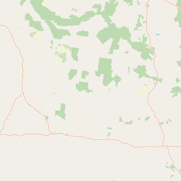
Map view of Nuga Nuga National Park

Use this park location map to pinpoint Nuga Nuga National Park in Australia, understand its exact geographic position, and read its mapped placement within the surrounding landscape more clearly.

Pigeon | © OpenStreetMap contributors

Location context for Nuga Nuga National Park

Queensland
Park atlas

Trace the regional spread of protected wetlands and diverse landscapes beyond Nuga Nuga National Park, comparing adjacent conservation areas.

Discover More National Parks Near Nuga Nuga, Queensland, and the Brigalow Belt Region
Browse other national parks and protected areas in the region surrounding Nuga Nuga National Park, focusing on Queensland's Brigalow Belt bioregion. Compare their unique wetland ecosystems, woodland terrains, and conservation values to gain a broader understanding of Australia's protected landscapes.
National parkQueensland

Expedition National Park: A Dramatic Sandstone Mountain Landscape in Central Queensland

Explore protected areas, mapped ridgelines, and Robinson Gorge geography.

Expedition National Park represents a significant protected landscape in Queensland, distinguished by the striking Expedition Range. This mountainous terrain, characterized by rugged sandstone cliffs, deep gorges like Robinson Gorge, and dry eucalyptus forests, offers a unique geographic contrast to the surrounding plains. As a national park, it plays a crucial role in conserving biodiversity within the Brigalow Belt bioregion, providing an essential reference point for understanding regional protected areas and natural terrain.

Area
1,080 km²
Established
1991
IUCN
II
Relief
Mountain
National parkQueensland

Palmgrove National Park: Queensland's Remote Protected Landscape for Scientific Conservation

Rugged sandstone terrain and unique eucalypt woodlands define this park.

Palmgrove National Park is a significant scientific reserve in south-central Queensland, Australia, characterized by its dissected sandstone terrain and dry eucalypt woodlands. Designated as a strict nature reserve, its primary value lies in protecting vulnerable species and threatened ecosystems, notably serving as a crucial breeding habitat for the black-breasted buttonquail. The park's isolated geography and limited public access underscore its importance as a sanctuary for avian conservation and ecological research within Australia's protected areas network.

Area
256 km²
Established
1991
IUCN
Ia
Relief
Upland
National parkMaranoa Region

Carnarvon National Park: Mapped Geography and Protected Landscape Identity

Explore the sandstone gorges and ancient sites of Queensland's natural heritage.

Carnarvon National Park represents a significant protected area within the Maranoa Region of Queensland, Australia. This national park encompasses a vast expanse of approximately 2,980 square kilometers, primarily celebrated for its dramatic sandstone gorges, particularly Carnarvon Gorge, and its globally significant Aboriginal rock art sites. Positioned across the Great Dividing Range, the park's landscape features a compelling mix of deep valleys, sandy plains, and basalt-capped tablelands, offering rich cartographic and geographic context. Its designation as a national park underscores its importance for preserving these unique natural and cultural landscapes for atlas-based discovery.

Area
2,980 km²
Established
1932
IUCN
II
Visitors
65K annual
National parkQueensland

Minerva Hills National Park: Queensland National Park Atlas and Mapped Landscape

Explore its protected boundaries and geographic setting in northeastern Australia.

Minerva Hills National Park is a distinct protected area offering valuable insights into Queensland's natural geography. This detail page provides essential context for understanding the park's landscape character, its mapped natural terrain, and its significance as a national park within the northeastern Australian region. Engage with its geography to understand its place in the larger atlas of protected lands.

Area
27.9 km²
Established
1994
IUCN
II
Relief
Mountain
National parkQueensland

Isla Gorge National Park: A Protected Landscape within Queensland's Geography

Explore mapped park boundaries and regional natural terrain.

Isla Gorge National Park represents a significant protected area within the vast geographic expanse of Queensland, Australia. As a designated national park, it offers a unique lens through which to view the region's natural landscapes and mapped terrain. This entry focuses on the park's specific geographic attributes and its importance within Queensland's broader natural atlas, providing detailed context for understanding its protected boundaries and ecological setting.

Area
78.5 km²
Established
1964
IUCN
II
Relief
Highland
National parkQueensland

Blackdown Tableland National Park: National Park Protected Landscape Discovery

Explore mapped terrain and regional geography in Queensland.

Blackdown Tableland National Park offers a distinct protected landscape for geographic exploration within Queensland, Australia. As a designated national park, its mapped boundaries and surrounding natural terrain provide crucial context for understanding regional geography. This entry serves as a vital point for atlas-based discovery, detailing the park's identity and its contribution to the diverse natural landscapes of northeastern Australia.

Area
320 km²
Established
1991
IUCN
II
Relief
Highland
National parkQueensland

Precipice National Park National Park: Queensland Protected Landscape and Geographic Exploration

Mapped boundaries and regional context for this Australian national park.

Precipice National Park is an important protected area situated within Queensland, Australia. As a national park, it contributes to the region's tapestry of natural landscapes, offering distinct geographic features and mapped boundaries. This MoriAtlas entry focuses on understanding its identity as a protected landscape and its placement within the wider geographical atlas of Queensland, facilitating a structured approach to exploring Australia's natural heritage.

Area
105 km²
Established
1998
IUCN
II
Access
Access unknown
National parkQueensland

Snake Range National Park: Queensland Protected Area and Landscape Mapping

Explore the geographic boundaries and natural terrain.

Snake Range National Park is a significant protected national park entity within Queensland, Australia. This detailed entry provides essential geographic context, focusing on the park's mapped boundaries, its role as a conservation landscape, and its integration into the wider regional geography. For users interested in atlas exploration, understanding the specific natural terrain and protected area distribution of Snake Range National Park is paramount.

Area
26.88 km²
Established
1972
IUCN
II
Relief
Mountain

Common questions about visiting, size, designation, and location context for Nuga Nuga National Park

Nuga Nuga National Park FAQs for park facts, access, geography, and protected area context
Find quick answers about Nuga Nuga National Park, including protected-area facts, park geography, trail and visitor context, and how the park fits into its surrounding country and regional landscape.
MoriAtlas Explorer

Continue Your Protected Areas Search Across the Global Atlas

Deepen your exploration by continuing the structured search for national parks and protected areas worldwide. Utilize the comprehensive filtering capabilities to compare different conservation landscapes and refine your understanding of global park geography. Discover more about the distribution and characteristics of protected natural areas.

Global natural geography