
Capes
Park geography
Detailed analysis of terrain, riverine systems, and forest landscape classification
Comprehensive Geographic Profile and Mapped Boundaries of Mitchell River National Park
This geographic profile details the physical scope of Mitchell River National Park, spanning 142.5 square kilometers within the Australian landscape. The data includes documented natural features such as the Wentworth River, Roaring Mag Falls, and various creek systems contained within the protected area, alongside classifications for temperate forest and riverine habitats.
Related tags
National ParksVictoriaRiparian EcosystemsWarm-Temperate RainforestGippsland
Victoria's largest unregulated river flowing through ancient gorges and rare warm-temperate rainforest
Mitchell River National Park
Mitchell River National Park is a significant protected area located in the Gippsland region of Victoria, Australia, approximately 320 kilometres east of Melbourne and 25 kilometres northwest of Bairnsdale. The park encompasses 14,250 hectares of diverse landscapes centered around the Mitchell River, which is the largest unregulated river in Victoria and provides a unique example of riparian ecology in southeastern Australia. The park features dramatic gorges and high cliffs where the river has carved its way through ancient rock strata, creating a landscape of exceptional natural beauty and ecological importance. A notable feature of the park is the presence of warm-temperate rainforest in some of the gorges, representing the southernmost occurrence of this forest type anywhere in the world, surviving due to the protective nature of the steep gorge walls that shield the vegetation from drying summer winds and periodic bushfires.
- Location
- Australia
- Park type
- National park
- Established
- 1962
- Area
- 142.5 km²
Location overview
National park location memberships and administrative status records in Australia
Geographic Overview and Location Settings for Mitchell River National Park
Mitchell River National Park is located within Australia according to recorded national memberships. Protected area records outline the official country placement and high-level geographic status for this protected landscape.
- Countries
- Australia
- Primary location
- Australia
- Geographic setting
- Inland
Boundary and coordinates
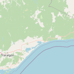
Mitchell River National Park maps a 142.5 km² extent
Mitchell River National Park mapped boundary and 142.5 km² area
Mitchell River National Park’s mapped outline represents a documented 142.5 km². It helps readers understand the park’s spatial form and reach while remaining distinct from official survey records.
- Boundary area
- 143.8 km²
- Boundary perimeter
- 101.3 km
- Northernmost point
- 37.5522° S
- Southernmost point
- 37.7471° S
- Easternmost point
- 147.4315° E
- Westernmost point
- 147.2754° E
- Geographic centre
- 37.6355° S, 147.357° E
- North–south span
- 21.6 km
- East–west span
- 13.8 km
Terrain and natural features
Explore recorded rivers, creeks, viewpoints, and terrain classifications
Mitchell River National Park Terrain and Named Natural Features
Mitchell River National Park contains mixed relief across diverse protected terrain and recorded natural features. Linked feature cards supply names, types, measurements, and spatial relationships.
Selected named natural features
Streams
Long Gully Creek
Rivers
Wentworth River
Streams
Stony Creek
Viewpoints
Bluff's Lookout
Streams
Wattle Creek
Environmental setting
Temperate climate zones, mixed relief terrain, and partial forest cover records
Mitchell River National Park Environmental Classifications and Physical Settings
Stored landscape features, habitat types, and water presence classifications provide complementary perspectives on the physical setting of Mitchell River National Park. Recorded categories connect directly to relevant atlas destinations and regional environmental contexts.
- Relief
- Mixed relief
- Climate
- Temperate
- Water
- Major water bodies
- Forest cover
- Partial forest
- Seasonality
- Year-round
Landscape features
Valleys · Cliffs · Forest · Rivers · Waterfalls · Cave
Habitat types
Temperate broadleaf forest · Riverine habitat · Wetland
Park atlas
Compare regional river gorges and protected natural areas across Victoria
Parks Near Mitchell River National Park and Surrounding Protected Landscapes
Browse nearby national parks and protected areas sharing the rugged terrain of the Gippsland region. Extending your geographical comparison reveals how regional river systems and sheltered valley ecosystems connect across southeastern Australia.
National parkAustralia
11 km away#1 closest
Northwest

Alpine National Park: Victoria's Expansive National Park in the Great Dividing Range
Mapping significant alpine, subalpine, and mountain wilderness landscapes.
Alpine National Park represents Victoria's largest protected area, safeguarding critical alpine and subalpine environments across the Great Dividing Range. This national park encompasses vast mountainous terrain, including Victoria's highest peaks like Mount Bogong, and the expansive Bogong High Plains known for their unique grassland and woodland ecosystems. The park's protected landscape offers rich opportunities for geographic discovery and understanding its place within Australia's significant mountain wilderness regions.
- Area
- 6,474 km²
- Established
- 1989
- IUCN
- II
- Relief
- Mountain
Wildlife reserveVictoria
29 km away#2 closest
West
Avon Wilderness Park: Protected Mountain Landscapes and Geography in Victoria
A remote wilderness reserve in the Victorian Alps highlands.
Avon Wilderness Park spans forty thousand hectares of continuous, roadless mountain forest and sub-alpine woodland. Serving as a crucial link in the Australian Alps conservation network, the reserve is characterized by steep, dissected terrain and tall eucalyptus canopy, preserved in an entirely undeveloped state without internal roads or infrastructure.
- Area
- 395.58 km²
- Established
- 1987
- IUCN
- Ib
- Relief
- Mountain
National parkAustralia
35 km away#3 closest
Southeast
The Lakes National Park: Coastal Wetland Protected Area in Gippsland
Discover unique island habitats and mapped paperbark forests.
The Lakes National Park offers a unique exploration of coastal wetlands and their mapped geographic features. Situated within the Gippsland Lakes, this protected area showcases diverse island habitats and fringing paperbark forests. As a designated national park, its conservation legacy is evident in the preserved wetland systems and the ecological significance of areas like Rotamah Island, providing a distinct regional landscape for atlas discovery.
- Area
- 23.9 km²
- Established
- 1956
- IUCN
- II
- Relief
- Lowland
Marine protected areaAustralia
73 km away#4 closest
South
Ninety Mile Beach Marine National Park: Victoria's Coastal Marine Protected Area
Mapped boundaries and temperate marine landscape context.
Ninety Mile Beach Marine National Park represents a significant commitment to marine conservation along the eastern Victorian coast. This protected area safeguards the underwater ecosystems adjacent to the celebrated Ninety Mile Beach, a nearly 100-kilometer stretch of continuous sandy shoreline. Its establishment in 2002 preserves the marine biodiversity and coastal landscape character of this region, forming an integral part of Victoria's network of protected coastal environments and offering a distinct view of Australia's marine geography.
- Area
- 27.5 km²
- Established
- 2002
- IUCN
- II
- Scope
- Marine
National parkAustralia
73 km away#5 closest
East
Snowy River National Park: A Deep Gorge Protected Landscape in Victoria, AU
Explore mapped terrain and vital alpine wilderness boundaries.
Snowy River National Park showcases Victoria's rugged natural geography with its dramatic mountain terrain and the spectacular Little River Gorge, the state's deepest. This national park, classified as a wilderness area for much of its expanse, protects critical habitats and diverse ecosystems across its mapped boundaries. Its significance as a protected landscape within the Australian Alps National Parks makes it a key destination for understanding regional geography and conservation efforts.
- Area
- 987 km²
- Established
- 1979
- IUCN
- II
- Relief
- Mountain
National parkAustralia
75 km away#6 closest
West
Baw Baw National Park: Subalpine Granite Landscapes and Protected Area Geography
Discover Victoria's southernmost alpine wilderness.
Baw Baw National Park offers a rare glimpse into Australia's subalpine environment, characterized by striking granite boulder formations and iconic snow gum forests. As a protected national park, it safeguards unique ecosystems and habitats, including those for critically endangered species. This atlas entry details the park's distinctive landscape, its mapped boundaries, and its geographic significance as the southern edge of mainland alpine terrain.
- Area
- 135.3 km²
- Established
- 1979
- IUCN
- II
- Relief
- Mountain
National parkAustralia
94 km away#7 closest
Northwest
Mount Buffalo National Park: Historic Granite Plateau in Victoria's Alpine Region
Mapped Protected Landscape and Geographic Context
Mount Buffalo National Park represents a significant protected area within Victoria, Australia, celebrated for its distinctive granite plateau. This national park, one of Australia's oldest, features dramatic rock formations, tors, and the iconic summit of The Horn, offering panoramic vistas across the alpine landscape. Its elevation of approximately 1,723 meters supports a variety of ecosystems, from forested slopes to alpine grasslands. The park's unique geology and its role as a protected landscape make it a key destination for understanding regional Australian geography and conservation history.
- Area
- 310 km²
- Established
- 1898
- IUCN
- II
- Visitors
- 200K annual
National parkAustralia
98 km away#8 closest
West
Yarra Ranges National Park: Victoria's Towering Mountain Ash Forests and Protected Landscape Geography
Explore mapped boundaries and vital water catchment landscapes.
Yarra Ranges National Park in Victoria, Australia, represents a significant protected landscape within the Great Dividing Range. It is renowned for its exceptionally tall mountain ash forests, which are vital carbon stores and habitats, and its critical function as a water catchment area for Melbourne. This park offers a deep dive into a unique geographic setting defined by diverse mountain terrain, temperate rainforests, and subalpine environments, all preserved for their ecological and water security importance.
- Area
- 760 km²
- Established
- 1995
- IUCN
- II
- Visitors
- 800K annual
MoriAtlas Explorer
Continue Exploring Mitchell River National Park and Its Protected Victorian Landscapes
Trace the course of the Mitchell River through its deep gorges and ancient rock formations. MoriAtlas provides a structured look at the ecological significance and mapped boundaries of this unique protected area, helping you understand the complex relationship between the region's climate, topography, and native forest ecosystems.
Browse next
Global natural geography
Explore related park routes
Explore MoriAtlas Global ParksBrowse All MoriAtlas ParksGlobal Park Map DiscoveryMoriAtlas: Browse All CountriesBrowse All MoriAtlas ContinentsNational Park Environment AtlasGrand Canyon National Park AtlasYellowstone National Park AtlasYosemite National Park Atlas and GeographySerengeti National Park AtlasGalápagos National Park Protected LandscapeBanff National Park Geography and AtlasKruger National Park Atlas EntryUluṟu-Kata Tjuṯa National Park AtlasExplore Uluru-Kata Tjuta National Park GeographyPlitvice Lakes National Park AtlasFiordland National Park Protected LandscapeGreat Smoky Mountains National Park AtlasAfghanistan National Parks and Protected AreasAlbania National Parks and Protected AreasAlgeria National Parks and Protected AreasAmerican Samoa National Parks and Protected AreasAndorra National Parks and Protected AreasAngola National Parks and Protected AreasAntarctica National Parks and Protected AreasAntigua and Barbuda Park List