Mori Atlas logo
National parkMount Palung National Park

Discover the mapped boundaries and regional geography of this Indonesian national park.

Mount Palung National Park: Protected Landscape and Volcanic Terrain in Indonesia

Mount Palung National Park represents a significant protected natural area on the island of Borneo, within Indonesia's West Kalimantan province. Centered around the volcanic peak of Mount Palung, this national park preserves extensive tropical forest ecosystems crucial for Borneo's unique biodiversity. Its protected status ensures the conservation of lowland and montane forest habitats, offering a vital refuge for regional wildlife and contributing to the mapped conservation landscape of Indonesian Borneo.

BorneoIndonesiaVolcanic MountainTropical ForestProtected AreaWest Kalimantan

Mount Palung National Park

National park

Park overview

Structured park overview, official facts, and landscape profile for Mount Palung National Park

Mount Palung National Park park facts, protected area profile, and essential visitor context

Review the core facts for Mount Palung National Park, including designation, size, terrain, visitor scale, habitats, and operating context in one park-focused overview.

About Mount Palung National Park

Mount Palung National Park is a protected natural area located in the Indonesian portion of Borneo, in the province of West Kalimantan. The park encompasses significant tropical forest ecosystems and is centered around Mount Palung, a prominent volcanic peak in the region. The protected area serves as a refuge for Borneo's diverse wildlife and preserves important habitats within the island's montane and lowland forest zones. While the park is relatively lesser-known compared to other Bornean protected areas, it plays a role in the broader conservation landscape of Indonesian Borneo.

Quick facts and research context for Mount Palung National Park

Mount Palung National Park is situated in West Kalimantan, Indonesian Borneo, protecting forest ecosystems around the Mount Palung volcanic area. The park contributes to the conservation of Borneo's unique biodiversity, which includes numerous endemic species found nowhere else on Earth. The region features both lowland and montane forest habitats.

Protection and recognition

Verifying the documented conservation status and terrestrial boundary details of this reserve.

Mount Palung National Park Protected Area Designation and Recognition Profile

Documented records for Mount Palung National Park outline its terrestrial protection scope, official boundaries, and formal designation history. Analyzing these standardized conservation details helps explorers and researchers contextualize the legal frameworks safeguarding regional ecological zones.

Protection details

Protection scope
Terrestrial
Transboundary protection
No
Park context

Deeper park guide and search-rich context for Mount Palung National Park

Mount Palung National Park history, landscape, wildlife, and travel context

Explore Mount Palung National Park through its history, landscape character, ecosystems, wildlife, conservation priorities, cultural context, and seasonal travel timing in a structured park guide built for atlas discovery and search intent.

Why Mount Palung National Park stands out

The park is known for its volcanic mountain landscape and the tropical forest ecosystems that surround Mount Palung. It protects portions of Borneo's distinctive biodiversity, with habitats ranging from lowland rainforest to montane forest zones.

Monthly climate preview

Long-term representative temperature ranges and monthly precipitation data

Mount Palung National Park Climate Normals and Annual Weather Patterns

Representative coordinate records show consistent monthly mean temperatures between 25 and 27 degrees Celsius alongside varying daily precipitation volumes throughout the year. Reviewing the complete twelve-month climate profile provides deeper analytical insight into long-term environmental patterns across the protected landscape.
Annual mean26 °C
26 °C27 °C
Jan26°
Feb26°
Mar26°
Apr27°
May27°
Jun26°
Jul26°
Aug26°
Sep26°
Oct26°
Nov26°
Dec26°
Warmest month
May

26.8 °C

Coolest month
January

25.9 °C

Wettest month
November

12.5 mm/day

Driest month
August

4.2 mm/day

Park location guide

Geography guide, regional context, and park location map for Mount Palung National Park

Mount Palung National Park park geography, regions, and map view in Indonesia

Understand where Mount Palung National Park sits in Indonesia through a broader geographic reading of the surrounding landscape, nearby location context, and its mapped position within the national park landscape.

How Mount Palung National Park fits into Indonesia

Indonesia is a vast archipelagic nation in Southeast Asia and Oceania, spanning over 17,000 islands between the Indian and Pacific Oceans. As the world's fourth-most populous country with 288 million people, it features extraordinary cultural and biological diversity, withJavanese and Sundanese being the largest ethnic groups. The country gained independence from the Netherlands in 1945 and operates as a unitary presidential republic.

Wider geography shaping Mount Palung National Park in Indonesia

Indonesia is situated in Southeast Asia and Oceania, spanning the equatorial region between the Indian Ocean to the west and the Pacific Ocean to the east. The archipelago includes major islands such as Sumatra, Java, Sulawesi, and parts of Borneo and New Guinea. It borders Papua New Guinea, Timor-Leste, and Malaysia by land, with extensive maritime boundaries throughout the region.

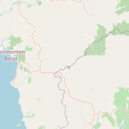
Map view of Mount Palung National Park

Use this park location map to pinpoint Mount Palung National Park in Indonesia, understand its exact geographic position, and read its mapped placement within the surrounding landscape more clearly.

Pigeon | © OpenStreetMap contributors

Location context for Mount Palung National Park

West Kalimantan
Park atlas

Discover other volcanic mountains and tropical forest reserves across West Kalimantan and broader Indonesian Borneo.

Explore Other National Parks and Protected Areas Near Mount Palung in Borneo

Continue your geographic exploration beyond Mount Palung National Park by browsing other significant protected areas, national parks, and forest reserves across the surrounding West Kalimantan region and broader Indonesian Borneo. Compare similar volcanic mountain terrain and tropical forest ecosystems, tracing the regional spread of conservation landscapes and understanding Borneo's diverse protected-area geography.
National parkCentral Kalimantan
About 269 km away#1 closest

East

Bukit Baka Bukit Raya National Park: Central Kalimantan's Protected Montane Rainforest Landscape

Explore the geographic core of Borneo's Schwaner mountain range.

Bukit Baka Bukit Raya National Park is a critical national park situated in Central Kalimantan, Indonesia, recognized for its extensive montane tropical rainforests and rugged topography. The park's landscape is dominated by the Schwaner mountain range, featuring prominent peaks like Bukit Raya, and functions as a vital watershed and biodiversity corridor. This protected area offers a rich subject for understanding regional geography, mapped landscapes, and the significance of Borneo's natural heritage within an atlas context.

Area
1,810 km²
Established
1992
IUCN
II
Relief
Mountain
National parkKalimantan
About 276 km away#2 closest

Southeast

Tanjung Puting National Park: A Detailed Protected Landscape Atlas View

Mapped boundaries and regional geography for this Indonesian national park.

Delve into the protected landscape identity of Tanjung Puting National Park, a designated national park situated in Kalimantan. This resource provides a detailed atlas perspective, focusing on its geographic scope, mapped park boundaries, and contribution to the regional geography of Indonesia. Understand its significance as a protected natural area through structured discovery.

National parkIndonesia
About 310 km away#3 closest

Northeast

Lake Sentarum National Park: Mapped Wetland Ecosystems and Protected Landscape in Indonesia

Explore the geographic context and protected area boundaries.

Lake Sentarum National Park represents a vital protected landscape within Indonesia, celebrated for its extensive lake ecosystems and wetland terrain. As a designated national park, it offers a rich area for geographic study, showcasing unique ecological features mapped within the Indonesian archipelago. Understanding its protected boundaries and the surrounding natural landscapes provides essential context for appreciating Indonesia's biodiversity and conservation efforts through an atlas-driven lens.

Area
1,320 km²
Established
1999
IUCN
VI
Relief
Lowland
National parkSarawak
About 314 km away#4 closest

North

Kubah National Park: National Park Status and Mapped Landscape in Sarawak

Explore its protected boundaries and geographic context within Borneo.

Kubah National Park is a protected national park located in Sarawak, Malaysia, representing a crucial element of the region's conservation landscape. This detailed entry focuses on its identity as a national park, its specific geographic placement within Sarawak, and its significance for map-based exploration. Users can investigate the mapped boundaries and understand how Kubah National Park fits into the larger atlas of protected areas in East Malaysia, providing a factual foundation for geographic discovery without travel advice.

Area
22.3 km²
Established
1989
IUCN
II
Visitors
45K annual
National parkSri Aman Division
About 320 km away#5 closest

Northeast

Batang Ai National Park: National Park Landscape and Geographic Discovery

Explore the protected terrain and mapped boundaries of Sri Aman Division.

Batang Ai National Park serves as a distinct national park entity, vital for understanding the protected landscape and regional geography of Malaysia's Sri Aman Division. This resource offers detailed insights into the park's geographic scope, its mapped boundaries, and the natural terrain it encompasses, enabling structured exploration for atlas enthusiasts and geography researchers.

Area
24 km²
Established
1991
IUCN
II
Relief
Lowland
National parkMalaysia
About 323 km away#6 closest

North

Maludam National Park: Southeast Asian Protected Landscape and National Park Geography

Mapped boundaries and natural terrain in Malaysia.

Maludam National Park offers a focused exploration of protected landscape identity and geographic context within Malaysia. As a designated national park, it serves as a vital component for understanding the distribution of protected areas and their mapped terrain. This detailed entry allows for an appreciation of the park's specific environmental character and its contribution to the broader atlas of natural landscapes in Southeast Asia, facilitating structured discovery for researchers and explorers.

Area
432 km²
Established
2000
IUCN
II
Relief
Lowland
National parkSarawak
About 323 km away#7 closest

North

Kuching Wetlands National Park: Sarawak's Protected National Park Landscape and Geography

Explore the mapped wetland boundaries and regional context.

Gain a structured understanding of Kuching Wetlands National Park, a key protected area in Sarawak, Malaysia. This detailed entry provides insights into its specific geographic identity, mapped park boundaries, and its significance as a national park within the Borneo region's extensive natural landscapes. Discover the atlas value of this protected wetland environment for comprehensive geographic exploration.

Area
84.95 km²
Established
1992
IUCN
II
Relief
Lowland
Watercolor illustration of a coastal landscape with a distinctive rock formation, green vegetation, and calm water under a soft sky with distant mountains
National parkKuching Division
About 325 km away#8 closest

North

Bako National Park: Sarawak's Oldest National Park and Coastal Protected Landscape

Explore diverse ecosystems and dramatic mapped geology near Kuching Division.

Bako National Park, the oldest national park in Sarawak, Malaysia, offers a profound study in ecological concentration and geological drama. Covering a mere 27 square kilometers on the Muara Tebas peninsula, it encapsulates seven distinct ecosystem types, from coastal heath forest to mangrove areas, supporting significant biodiversity. The park's protected landscape is defined by its stunning sandstone coastline, carved by the sea into cliffs, arches, and seastacks, providing a unique geographic context. This makes Bako an essential destination for understanding Borneo's environmental diversity and the mapped boundaries of its conservation areas.

Area
27.27 km²
Established
1957
IUCN
II
Relief
Mixed relief

Common questions about visiting, size, designation, and location context for Mount Palung National Park

Mount Palung National Park FAQs for park facts, access, geography, and protected area context

Find quick answers about Mount Palung National Park, including protected-area facts, park geography, trail and visitor context, and how the park fits into its surrounding country and regional landscape.
MoriAtlas Explorer

Continue Your Protected Areas Search Across the Global Atlas

Deepen your exploration by continuing the structured search for national parks and protected areas worldwide. Utilize the comprehensive filtering capabilities to compare different conservation landscapes and refine your understanding of global park geography. Discover more about the distribution and characteristics of protected natural areas.

Global natural geography