
Mori Atlas logo
Marine protected areaMounts Bay Marine Conservation Zone

Tracing the subtidal reefs and seagrass meadow boundaries along the South Cornwall coastline.

Mounts Bay Marine Conservation Zone: A Detailed Geographic Study of Cornish Marine Protected Landscapes

The Mounts Bay Marine Conservation Zone encompasses twelve square kilometres of protected sea stretching between Long Rock and Cudden Point off the South Cornwall coast. This marine protected area is defined by a complex mosaic of high-energy rocky shores, tidal reefs, and extensive Zostera marina seagrass meadows that serve as essential nursery grounds. By examining the seabed transitions from exposed rock to sheltered sandy sediments, the geography of this site provides a critical view of inshore ecological resilience in the English Channel.

marine conservation zoneseagrass meadowstidal reefsCornwall coastEnglish Channelcoally marine habitat
A graphic illustration showing a waterfall flowing into a river, surrounded by steep cliffs and pine trees under a pink sky.

Mounts Bay Marine Conservation Zone

Marine protected area

Park overview

Structured park overview, official facts, and landscape profile for Mounts Bay Marine Conservation Zone

Mounts Bay Marine Conservation Zone park facts, protected area profile, and essential visitor context

Review the core facts for Mounts Bay Marine Conservation Zone, including designation, size, terrain, visitor scale, habitats, and operating context in one park-focused overview.

About Mounts Bay Marine Conservation Zone

The Mounts Bay Marine Conservation Zone occupies a sheltered section of Cornwall's southern coastline, where the half-moon sweep of Mount's Bay meets the English Channel. Designated on 29 January 2016, the zone covers about 12 square kilometres of inshore water from Long Rock through to Cudden Point and encircles the tidal island of St Michael's Mount, one of the most recognisable landmarks on the Cornish coast.

The protected area reflects the broader ecological richness of Mount's Bay, Cornwall's largest bay and a natural harbour long valued by sailors and fishermen. Within its relatively compact footprint, the MCZ contains an unusually varied range of marine habitats for an inshore English site. The shoreline edge includes exposed high-energy rocky coast, while the subtidal zone features tidal reefs, seagrass meadows, and patches of sand and muddy sand. This habitat diversity is the main reason the area was chosen for conservation status in the third tranche of English Marine Conservation Zone designations.

The zone plays an important ecological role in the wider south-west marine environment. Its seagrass beds of Zostera marina have been highlighted as particularly significant for the functioning of the local marine ecosystem, providing feeding and nursery areas that support fish, shellfish, and seabirds. The MCZ also protects notable species records, including stalked jellyfish typically associated with undisturbed seagrass and the giant goby, a fish of conservation interest in the region. Together these qualities make the Mounts Bay Marine Conservation Zone an important component of the network of protected marine areas around the Cornish coastline.

Quick facts and research context for Mounts Bay Marine Conservation Zone

The Mounts Bay Marine Conservation Zone was designated on 29 January 2016, making it part of the UK government's programme to establish a network of Marine Conservation Zones under the Marine and Coastal Access Act. The site covers roughly 12 square kilometres of inshore sea on Cornwall's south coast, between Long Rock and Cudden Point, and includes the waters encircling St Michael's Mount.

The zone protects a range of habitats including exposed high-energy rocky coastline, subtidal reefs, sand, and muddy sand sediments. Seagrass beds of Zostera marina are a key feature, functioning as fish nursery habitat and supporting rich marine biodiversity. Notable species recorded in the zone include stalked jellyfish such as Lucernariopsis campanulata and Lucernariopsis cruxmelitensis, and the giant goby. The protected waters overlap with Mount's Bay, the largest bay in Cornwall and a regionally important natural harbour along the English Channel coast.

Protection and recognition

Documented protection scope, establishment year, and formal recognition records

Mounts Bay Marine Conservation Zone Protection Status and Designation History

Mounts Bay Marine Conservation Zone features documented marine protection status established in the year 2016. Official records outline the formal designation history and management scope for this protected area.

Protection details

Protection scope
Marine
Designated year
2016
Transboundary protection
No
Park context

Deeper park guide and search-rich context for Mounts Bay Marine Conservation Zone

Mounts Bay Marine Conservation Zone history, landscape, wildlife, and travel context

Explore Mounts Bay Marine Conservation Zone through its history, landscape character, ecosystems, wildlife, conservation priorities, cultural context, and seasonal travel timing in a structured park guide built for atlas discovery and search intent.

Why Mounts Bay Marine Conservation Zone stands out

The Mounts Bay Marine Conservation Zone is best known for its extensive seagrass meadows of Zostera marina, which form one of the defining subtidal features of the protected area. These underwater plants support the entire marine food web of the bay by providing nursery habitat for juvenile fish and shellfish and feeding areas for coastal birds, giving the zone substantial ecological value beyond its relatively compact footprint. Equally distinctive is the presence of subtidal tidal reefs such as the Greeb near Perranuthnoe and the reef off Long Rock. Together with the mix of exposed high-energy rocky shore and quieter sand and muddy seabed, these reef features concentrate biodiversity and help define the character of the protected sea off the Mount's Bay coast.
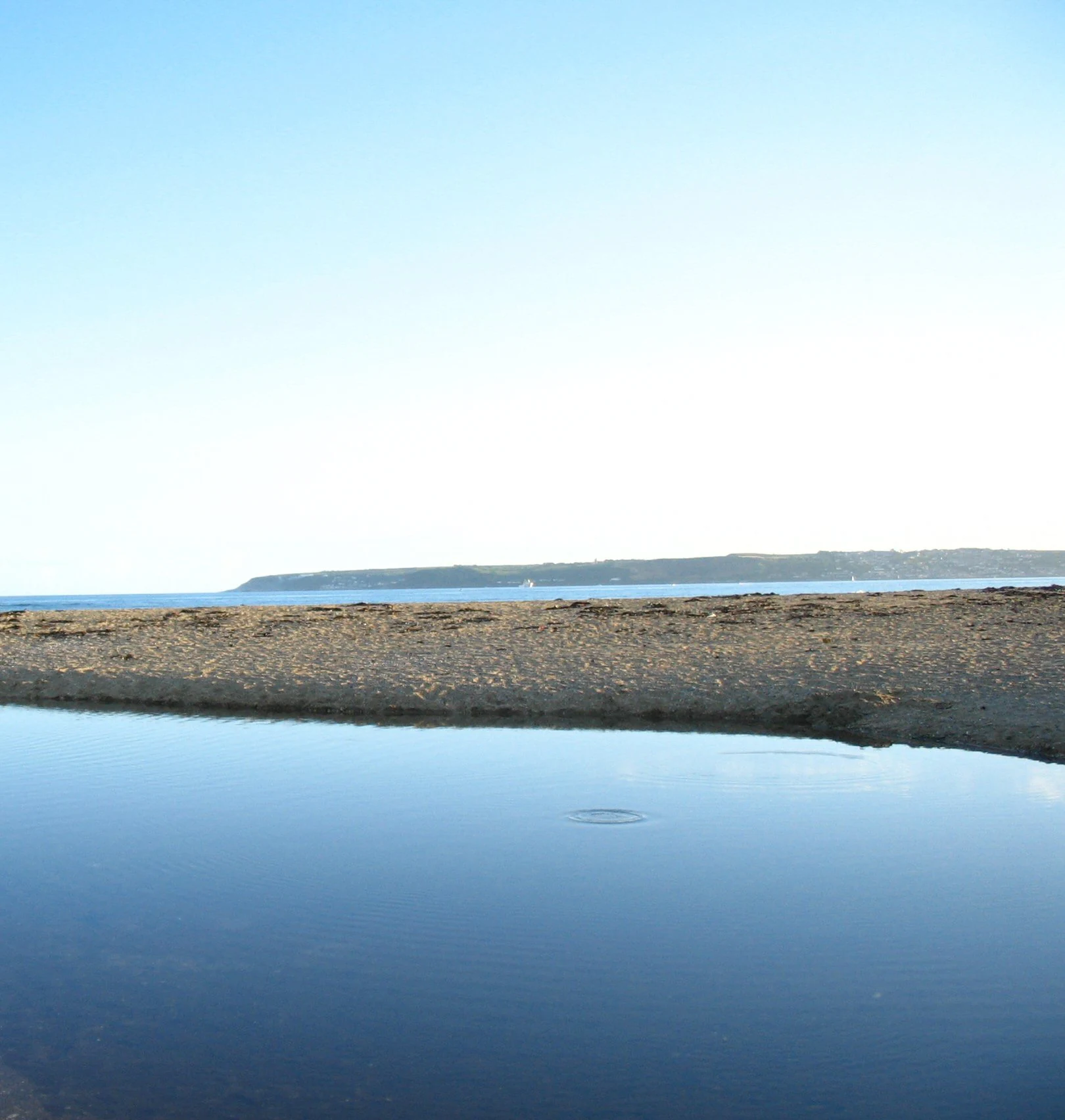
A wide coastal landscape showing a still tidal pool in the foreground with a sandy beach and a distant shoreline across the sea under a clear sky.
A calm coastal view featuring a tidal pool and the shoreline of Mounts Bay.

Mounts Bay Marine Conservation Zone history and protected-area timeline

The Mounts Bay Marine Conservation Zone was designated on 29 January 2016 as part of the third tranche of Marine Conservation Zones created under the UK's Marine and Coastal Access Act framework. The designation brought formal protection to a stretch of inshore sea that had long been recognised for its ecological richness but had previously lacked any dedicated conservation status.

The wider bay of Mount's Bay has a long human and maritime history, including a brief Spanish raid in 1595 and the arrival of a tsunami caused by the 1755 Lisbon earthquake. While these events are not part of the Marine Conservation Zone's conservation history, they illustrate how the bay's sheltered geometry has shaped centuries of activity along this coastline. The 2016 designation marks the modern step of converting that long-standing environmental significance into a formal marine protected area.

Mounts Bay Marine Conservation Zone landscape and geographic character

The marine landscape of the Mounts Bay Marine Conservation Zone mirrors the dramatic scenery of the surrounding Cornish coast. Above the waterline, cliffs and headlands enclose a sheltered half-moon bay, while below the surface the seabed transitions from hard rock at the coast to softer sediments further offshore.

Within the protected area the dominant underwater features are subtidal tidal reefs, patches of sand and muddy sand, and seagrass meadows that grow across parts of the subtidal zone. The reefs themselves, including the Greeb near Perranuthnoe and the Long Rock reef, are formed by geological structures that rise from the seabed and create localised biodiversity hotspots. The combination of these varied seabed types within a small inshore area is a defining physical characteristic of the Mounts Bay MCZ.

Mounts Bay Marine Conservation Zone ecosystems, habitats, and plant life

The Mounts Bay MCZ protects a compact but ecologically rich mosaic of marine habitats along the Cornish coast. Its seagrass meadows of Zostera marina are the most ecologically significant element, providing habitat structure, stabilising sediment, and supporting the broader food web of the bay.

Seabed habitats within the zone range from exposed high-energy rocky substrates near the shore to quieter sand and muddy sand further out, with subtidal reefs adding localised hard-substrate habitat in between. These varied environments support a wide range of marine life including small invertebrates, fish, and the birdlife that feeds over the shallow waters. The diversity of habitats within a relatively small area is a key ecological feature of the protected site.

Mounts Bay Marine Conservation Zone wildlife and species highlights

The waters of the Mounts Bay Marine Conservation Zone are inhabited by a range of species that reflect the variety of habitats protected within its boundaries. Seagrass beds shelter juvenile fish and shellfish as well as serving as feeding areas for seabirds, making the zone functionally important for both marine and coastal wildlife.

Among the notable species recorded within the site are stalked jellyfish such as Lucernariopsis campanulata and Lucernariopsis cruxmelitensis, which are associated with seagrass habitats and are of conservation interest. The giant goby, Gobius cobitis, is also documented in the zone and is part of the broader assemblage of small fish that depend on the reef and seagrass habitat. Outside the MCZ but within Mount's Bay, occasional records of harbour porpoise, including a rare white individual seen in August 2018, highlight the wider marine mammal interest around the area.

Mounts Bay Marine Conservation Zone conservation status and protection priorities

The Mounts Bay Marine Conservation Zone contributes to the UK network of Marine Conservation Zones, established to protect representative examples of the nation's marine habitats and species. Its 2016 designation reflects recognition of the ecological value of the area, particularly its seagrass beds and subtidal reefs, which would otherwise continue to face pressures from human activity in the bay.

The conservation significance of the zone lies in its role as a nursery and feeding area for fish and shellfish, and as habitat for species of conservation interest such as stalked jellyfish and the giant goby. There is also concern about physical damage to seagrass from boat moorings, with anchors and chains identified as a potential threat to the beds. By giving the area formal protection, the MCZ aims to safeguard these habitats and the broader ecological function they support along Cornwall's south coast.

Mounts Bay Marine Conservation Zone cultural meaning and human context

Mount's Bay has a strong cultural identity on Cornwall's south coast, with its name long associated with the tidal island monastery and castle of St Michael's Mount. The bay's communities, including Penzance, Marazion, Newlyn, and Mousehole, have shaped centuries of Cornish maritime life and continue to be closely tied to the sea.

The Marine Conservation Zone itself is a relatively modern addition to this cultural landscape, formalising protection for waters that are deeply embedded in local identity. Nearby places such as Paul carry a powerful connection to the Cornish language through the 1860 monument traditionally associated with Dolly Pentreath, while the bay serves as the namesake for institutions including Mounts Bay Academy in nearby Heamoor. Together these layers of heritage show that the waters now protected by the MCZ sit at the heart of a region with a long and distinctive cultural character.

Top sights and standout views in Mounts Bay Marine Conservation Zone

The standout qualities of the Mounts Bay Marine Conservation Zone include its dense seagrass meadows, its unusual subtidal tidal reefs, and the protection it gives to a relatively rich but geographically compact inshore area. The zone's location around St Michael's Mount adds one of the most photographed coastal landmarks in southwest Britain to its profile.

It is also notable as part of the broader Mount's Bay, Cornwall's largest bay and a long-celebrated natural harbour on the English Channel. The presence of species such as stalked jellyfish and the giant goby, alongside the ecological importance of its seagrass nursery habitat, makes the Mounts Bay MCZ a small but ecologically significant protected area within the UK's Marine Conservation Zone network.

Best time to visit Mounts Bay Marine Conservation Zone

The condition of the Mounts Bay Marine Conservation Zone changes with the seasons, as warmer summer months typically bring calmer waters and more stable conditions for observing marine life along the shoreline, while autumn and winter bring stronger onshore winds and rougher seas. These colder months are also when the bay's maritime risks are greatest, even though the long human history of the area is intertwined with storms and wrecks.

For general interest in the surrounding coastline and habitats, late spring and summer tend to offer the most accessible conditions for shoreline observation, while any visit focused on the marine environment should consider the seasonal changes in weather and sea state that characterise Cornwall's south coast.

Monthly climate preview

Long-term average temperature and precipitation metrics for Cornwall protected waters

Mounts Bay Marine Conservation Zone Climate Normals and Annual Weather Patterns

NASA POWER climatology data from 1991 to 2020 records measured monthly temperature ranges and precipitation rates for a representative coordinate within Mounts Bay Marine Conservation Zone. Exploring the full twelve-month profile reveals detailed baseline climate normals across every recorded period.
Annual mean12 °C
9 °C17 °C
Jan
Feb
Mar
Apr10°
May12°
Jun14°
Jul16°
Aug17°
Sep16°
Oct14°
Nov12°
Dec10°
Warmest month
August

16.7 °C

Coolest month
February

8.8 °C

Wettest month
November

3.9 mm/day

Driest month
May

2 mm/day

Park location guide

Geography guide, regional context, and park location map for Mounts Bay Marine Conservation Zone

Mounts Bay Marine Conservation Zone park geography, regions, and map view in United Kingdom

Understand where Mounts Bay Marine Conservation Zone sits in United Kingdom through a broader geographic reading of the surrounding landscape, nearby location context, and its mapped position within the national park landscape.

How Mounts Bay Marine Conservation Zone fits into United Kingdom

The United Kingdom is a parliamentary constitutional monarchy located in northwestern Europe, consisting of four constituent countries: England, Scotland, Wales, and Northern Ireland. As a major global power with over 69 million residents, it maintains significant international influence in politics, economics, and culture.

Wider geography shaping Mounts Bay Marine Conservation Zone in United Kingdom

The United Kingdom is an island nation located in northwestern Europe, surrounded by the Atlantic Ocean, North Sea, English Channel, Celtic Sea, and Irish Sea. It shares a land border with the Republic of Ireland to the west. The territory includes the island of Great Britain, the northeastern portion of Ireland, and most of the smaller British Isles islands.

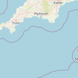
Map view of Mounts Bay Marine Conservation Zone

Use this park location map to pinpoint Mounts Bay Marine Conservation Zone in United Kingdom, understand its exact geographic position, and read its mapped placement within the surrounding landscape more clearly.

Pigeon | © OpenStreetMap contributors

Location context for Mounts Bay Marine Conservation Zone

Cornwall

Visual reference guide to marine habitats, tidal reefs, and coastal terrain

Mounts Bay Marine Conservation Zone Photos and Protected Landscape Scenery

Visual documentation of Mounts Bay Marine Conservation Zone reveals the intricate seabed morphology and sheltered coastal waters of Cornwall. Detailed imagery captures expansive seagrass meadows and subtidal tidal reefs that define the ecological character of this protected marine area.

A wide coastal landscape showing a still tidal pool in the foreground with a sandy beach and a distant shoreline across the sea under a clear sky.

Aerial view of a coastal stretch with a sandy beach meeting the ocean, a railway track running parallel to the shore, and inland development.

Park atlas

Compare nearby coastal habitats and protected marine landscapes across southwest England

Other Parks Near Mounts Bay Marine Conservation Zone and Regional Protected Areas

Browsing other parks near Mounts Bay Marine Conservation Zone reveals connected coastal habitats and marine reserves across the surrounding region. Comparing adjacent protected areas provides broader geographic context for inshore ecosystems, tidal reefs, and regional conservation networks.
A pale, minimalist watercolor painting showing soft green hills and a gentle shoreline against a white background.
Protected landscapeCornwall
About 19 km away#1 closest

West

Gwennap Head Protected Landscape: Coastal Geography and Granite Cliffs in Cornwall

Mapped Atlantic terrain and regional maritime boundaries

Located at the western edge of the Penwith peninsula, Gwennap Head defines a harsh yet productive coastal environment. This protected landscape features vertical granite cliffs, the treacherous Runnel Stone reef, and open maritime heath. Its geography serves as a vital watchpoint for migratory seabirds and a nexus of historic maritime activity, offering a well defined study of Cornwall's exposed Atlantic coastline.

Relief
Upland
Climate
Temperate
Access
Easy access
Scope
Mixed
Marine protected areaCornwall
About 27 km away#2 closest

East

The Manacles Marine Protected Area: Coastal Geography and Underwater Reef Map

Detailed geographic analysis of the Lizard Peninsula marine environment

The Manacles serves as a critical marine protected area featuring an intricate layout of jagged rock clusters, maerl beds, and historical shipwreck sites. This atlas entry provides a structured look at the reef geography, submerged terrain characteristics, and the environmental significance of this landmark formation within the waters of Falmouth Bay.

Area
3.5 km²
Established
2013
Relief
Lowland
Climate
Temperate
A watercolor illustration featuring soft, abstracted layers of green hills, a light blue horizon, and subtle pink and earthy tones representing land and water.
Protected areaCornwall
About 45 km away#3 closest

Northeast

River Gannel Protected Area: Cornwall Coastal Estuary and Marine Conservation Zone

Mapped tidal channels and coastal landscape geography in Cornwall

River Gannel provides a focal point for understanding the tidal geography of northern Cornwall. From its inland source to the dynamic estuary separating Newquay and Crantock, the area features protected marine habitats, sand dunes, and deep-rooted industrial heritage. This record details the physical boundaries and ecological significance of this coastal landscape as it drains into the Celtic Sea.

Established
2016
Relief
Lowland
Climate
Temperate
Access
Easy access
Watercolor illustration of Dartmoor moorland landscape with rolling hills, grassy vegetation, a stream, and distant mountains.
National parkDevon
About 103 km away#4 closest

Northeast

Dartmoor National Park: Granite Tors and Prehistoric Landscape in Devon

Mapped protected area with significant Bronze Age remains.

Dartmoor National Park represents a distinctive granite upland in Devon, England, characterized by its dramatic tors and expansive moorland. This protected landscape is globally significant for its dense concentration of prehistoric archaeological sites, including stone circles, standing stones, and ancient settlements. Exploring Dartmoor offers a unique insight into Britain's regional geography, mapped terrain, and enduring connection to ancient human history.

Area
954 km²
Established
1951
IUCN
V
Visitors
11M annual
A soft watercolor illustration featuring rolling hills in the background, a tree line in the midground, and a winding waterway in the foreground.
Biosphere reserveDevon
About 135 km away#5 closest

Northeast

North Devon's Biosphere Reserve: Protected Landscapes and Geographic Map Exploration

Coastal dunes, estuaries, and marine habitats in North Devon

An extensive overview of North Devon's Biosphere Reserve, highlighting its role as a protected landscape in South West England. Analyze the distribution of its diverse terrain, including Britain's largest sand dune system, river catchments, and offshore coral reefs, through detailed geographic and habitat mapping.

Area
5,262 km²
Established
1976
Visitors
4M annual
Relief
Lowland
Watercolor painting of a coastline with rolling green cliffs meeting the sea, with small pink flowers in the foreground.
Protected landscapeUnited Kingdom
About 157 km away#6 closest

Northeast

Jurassic Coast Protected Landscape: Geological Mapping and Coastal Atlas

A comprehensive look at sedimentary formations in the United Kingdom

Trace the 96-mile stretch of the Jurassic Coast, a protected landscape revealing Triassic, Jurassic, and Cretaceous rock layers. The terrain serves as a vital record of Earth history, featuring distinctive geomorphological landmarks like Chesil Beach and the towering cliffs of Golden Cap, all defined by the dynamic interaction of land and sea.

Established
2001
Relief
Upland
Climate
Temperate
Access
Easy access
Watercolor painting depicting a landscape with rolling hills, a winding road, and distant mountains
National parkUnited Kingdom
About 160 km away#7 closest

Northeast

Exmoor National Park: A Premier Protected Landscape in South West England for Atlas Exploration

Mapped terrain, moorland, and dramatic coastal geography.

Discover Exmoor National Park, a vast protected area in South West England celebrated for its sweeping heather moorland, dramatic coastline with the highest sea cliffs on mainland Britain, and deep, ancient wooded valleys. This national park offers a unique landscape for atlas-based exploration, revealing its distinct geography, mapped boundaries, and rich terrain shaped by centuries of natural processes and human activity.

Area
692 km²
Established
1954
IUCN
V
Visitors
1.4M annual
A soft, painterly watercolor illustration of a winding river flowing through green marshlands, coastal dunes, and gentle rolling hills under a bright, open sky.
Nature reserveFinistère
About 174 km away#8 closest

Southeast

Réserve naturelle régionale des marais, dunes et baies de Guissény: Protected Atlas Detail

Coastal reserve geography and maritime landscape mapping

Located in Finistère, this protected area features an intricate network of reedbeds, dune ridges, and coastal lagoons. The reserve provides a critical refuge for over 200 bird species and serves as a prime example of the land-and-sea ecological transition characteristic of the northern Breton coastline.

Area
6.083 km²
Established
2025
IUCN
IV
Relief
Lowland

Common questions about visiting, size, designation, and location context for Mounts Bay Marine Conservation Zone

Mounts Bay Marine Conservation Zone FAQs for park facts, access, geography, and protected area context

Find quick answers about Mounts Bay Marine Conservation Zone, including protected-area facts, park geography, trail and visitor context, and how the park fits into its surrounding country and regional landscape.
MoriAtlas Explorer

Continue Your Protected Areas Search Across the Global Atlas

Deepen your exploration by continuing the structured search for national parks and protected areas worldwide. Utilize the comprehensive filtering capabilities to compare different conservation landscapes and refine your understanding of global park geography. Discover more about the distribution and characteristics of protected natural areas.

Global natural geography