
Mori Atlas logo
Nature reserveMulanje Mountain Forest Reserve

Discover the high plateaus, dramatic cliffs, and unique Afromontane ecosystems within this Malawian nature reserve

Mulanje Mountain Forest Reserve: Exploring the Geography and Protected Landscape of the Mulanje Massif

Mulanje Mountain Forest Reserve protects a massive, isolated granite and syenite massif that rises abruptly from the lowlands of southern Malawi. As a UNESCO biosphere reserve, the area encompasses a high plateau, jagged peaks reaching over 3,000 meters at Sapitwa Peak, and deeply incised valleys. This landscape supports rare endemic biodiversity, including the unique Mulanje Cedar, and stands as a vital ecological island surrounded by densely populated regional plains.

Afromontane forestinselbergbiosphere reservemontane biodiversityendemic speciesMulanje Cedar
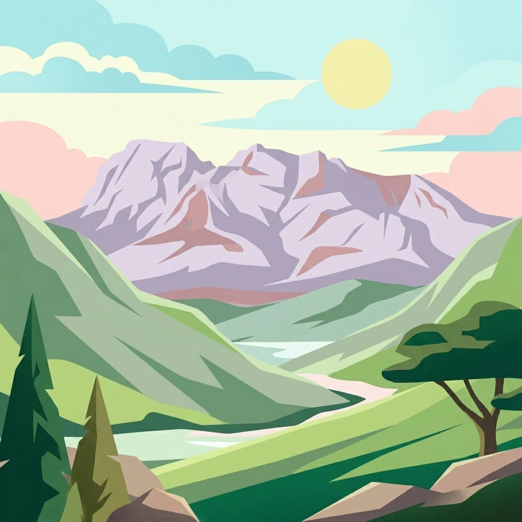
Digital illustration of a large mountain range with jagged peaks, rolling green foothills, a central valley, and a stylized sun in a soft pastel sky.

Mulanje Mountain Forest Reserve

Nature reserve

Park overview

Structured park overview, official facts, and landscape profile for Mulanje Mountain Forest Reserve

Mulanje Mountain Forest Reserve park facts, protected area profile, and essential visitor context

Review the core facts for Mulanje Mountain Forest Reserve, including designation, size, terrain, visitor scale, habitats, and operating context in one park-focused overview.

About Mulanje Mountain Forest Reserve

Mulanje Mountain Forest Reserve protects one of the most striking mountain landscapes in southeastern Africa. The reserve lies in southern Malawi and centers on the Mulanje Massif, an isolated block of igneous rock that emerges from the lowland plains without surrounding foothills. This abrupt rise, combined with the massif’s considerable size, creates one of the most recognizable natural landmarks in the region.

The reserve contains an unusually wide elevation range, from the surrounding plains at a few hundred meters to Sapitwa Peak, Malawi’s highest point at 3,002 meters above sea level. Above the lower slopes, the massif transitions into a high plateau roughly 1,800 to 1,900 meters in elevation, which is then broken by rocky peaks and ridges. This dramatic vertical structure supports a layered system of habitats, from drier lowland edges through moist forested slopes to alpine-like summit zones.

Ecologically, the reserve functions as an island of Afromontane environment isolated within a sea of lowland Malawi. The mountain receives heavy seasonal rainfall fueled by moisture-laden winds from the Indian Ocean, and its higher slopes are regularly wrapped in fog, producing moist conditions that sustain extensive evergreen and cedar-dominated forests as well as tea plantations on parts of the lower flanks. This combination of altitude, moisture, and isolation has produced a suite of endemic and threatened species, particularly among trees, birds, reptiles, and amphibians.

Established in 1927 and later recognized as a UNESCO biosphere reserve in 2000, Mulanje Mountain Forest Reserve is managed by the Mulanje Mountain Conservation Trust. It serves both as a stronghold for endemic biodiversity and as a buffer against growing pressures from surrounding human populations, including forest clearing, fuelwood collection, and invasive species. The reserve is thus not only a natural landmark but also a cornerstone of regional conservation in Malawi.

Quick facts and research context for Mulanje Mountain Forest Reserve

Mulanje Mountain Forest Reserve is a protected nature reserve in southern Malawi, established in 1927 and designated a UNESCO biosphere reserve in 2000. It covers a substantial area on and around the Mulanje Massif, an isolated mountain block of syenite, quartz-syenite, and granite that rises sharply from the surrounding lowlands.

The massif reaches well above 3,000 meters at Sapitwa Peak, the highest point in Malawi, and includes a central plateau around 1,800 to 1,900 meters in elevation. The reserve is operated by the Mulanje Mountain Conservation Trust and is best known for its Afromontane forests, endemic Mulanje Cedar, and rich highland biodiversity.

Protection and recognition

Documented terrestrial protection scope, establishment year, and management details

Mulanje Mountain Forest Reserve Protection Status and Designation History

Mulanje Mountain Forest Reserve maintains a documented terrestrial protection status established in the year 2000. Verified records outline the baseline conservation scope, administrative designation timeline, and associated management context for the protected area.

Protection details

Protection scope
Terrestrial
Designated year
2000
Transboundary protection
No
Park context

Deeper park guide and search-rich context for Mulanje Mountain Forest Reserve

Mulanje Mountain Forest Reserve history, landscape, wildlife, and travel context

Explore Mulanje Mountain Forest Reserve through its history, landscape character, ecosystems, wildlife, conservation priorities, cultural context, and seasonal travel timing in a structured park guide built for atlas discovery and search intent.

Why Mulanje Mountain Forest Reserve stands out

Mulanje Mountain Forest Reserve is best known for the Mulanje Massif itself, a dramatic inselberg-like mountain block that rises abruptly out of the southern Malawian plains and reaches more than 3,000 meters at Sapitwa Peak, the highest point in Malawi. The reserve’s most distinctive biological signature is its Afromontane flora and fauna, including endemic tree species such as the Mulanje Cedar (Widdringtonia whytei), whose last surviving stands are protected within the reserve. It is also recognized for its high level of endemism among birds, reptiles, and amphibians, including several species restricted to the massif’s montane forests. Together with its UNESCO biosphere status, these qualities make the reserve a major center of biodiversity and one of the most ecologically distinctive protected areas in southeastern Africa.
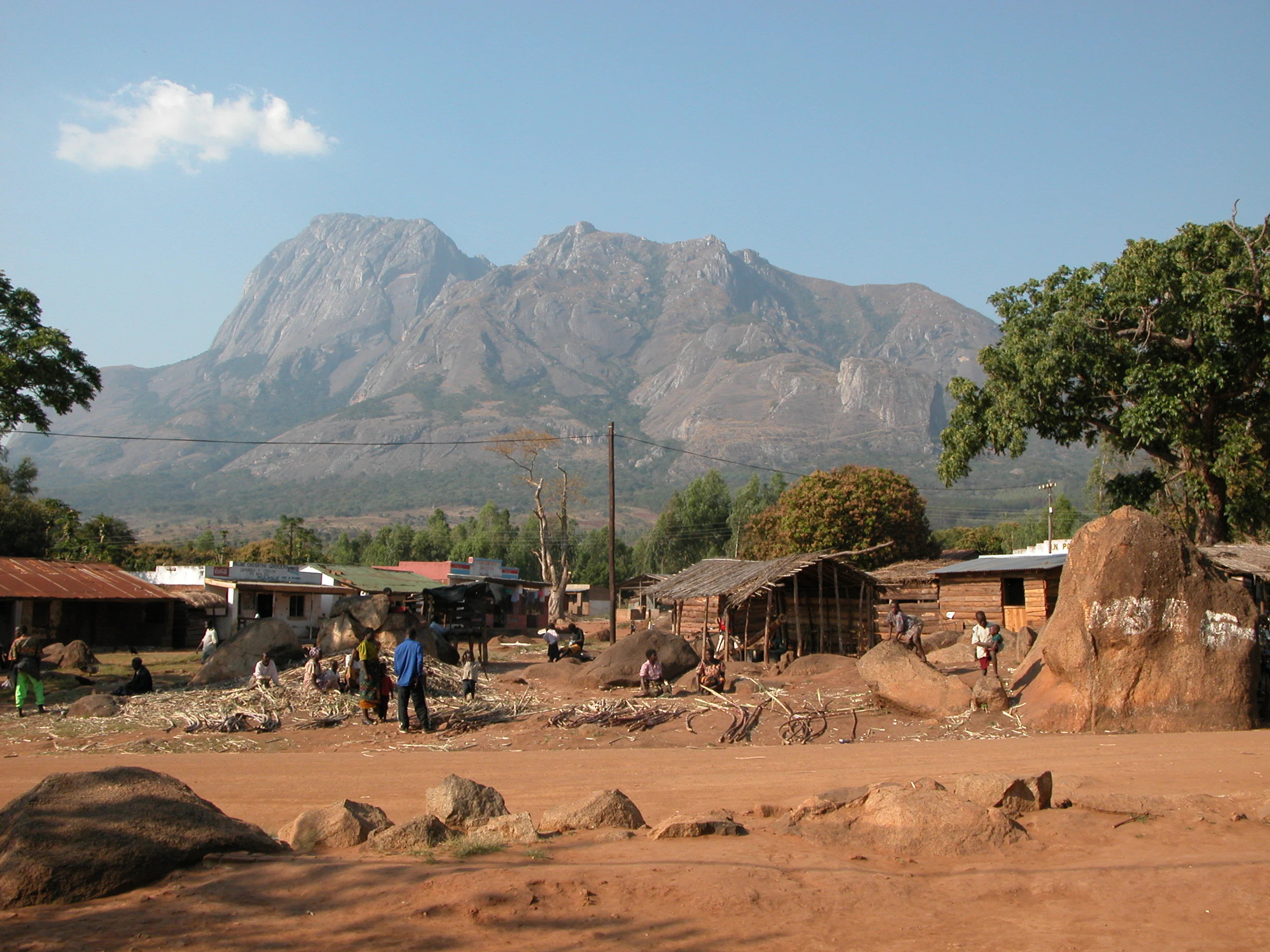
A wide shot of the rugged granite slopes of Chambe Peak in the Mulanje Massif looming over a village with small huts, dirt paths, and scattered trees.
Chambe Peak rising above the village at the base of the Mulanje Massif.

Mulanje Mountain Forest Reserve history and protected-area timeline

Mulanje Mountain Forest Reserve was formally established in 1927, making it one of the older protected natural areas in Malawi. Its creation reflected early recognition of the massif’s exceptional ecological character and the need to safeguard its forested slopes at a time when plantation forestry and timber exploitation were active in the region.

In the decades following its establishment, the reserve became particularly associated with efforts to protect the Mulanje Cedar, an endemic tree species whose timber value led to extensive historical logging. By the late twentieth century, pressures from surrounding populations, including land clearing, fuelwood collection, and invasive species, were increasingly affecting the reserve’s margins.

A major institutional milestone came in 2000, when the area was designated a UNESCO biosphere reserve, recognizing both its outstanding biodiversity and its role as a protected landscape with surrounding human communities. Day-to-day management is now carried out by the Mulanje Mountain Conservation Trust, which coordinates conservation work, community engagement, and protection of the massif’s ecological values. Despite these efforts, ongoing challenges include encroachment, invasive plants such as Mexican Pine and Himalayan raspberry, and the need to secure the remaining stands of Mulanje Cedar.

Mulanje Mountain Forest Reserve landscape and geographic character

The Mulanje Massif is one of the most visually conspicuous landforms in southern Malawi. It consists of an isolated block of syenite, quartz-syenite, and granite covering roughly 500 square kilometers, rising abruptly from surrounding plains that sit at about 600 to 700 meters above sea level. Unlike many mountains, the massif emerges without transitional foothills, producing sheer cliffs and steep walls that give the mountain a fortress-like profile visible from kilometers away.

Above this abrupt rise, the massif flattens into a high plateau at roughly 1,800 to 1,900 meters in elevation, which is then broken by rocky peaks, bluffs, and exposed rock faces. The highest of these is Sapitwa Peak at 3,002 meters, which is also the highest point in Malawi. The combination of a high plateau and jagged summits creates a varied terrain of ridges, valleys, gorges, and boulder fields across the upper mountain.

Streams, waterfalls, and deeply incised valleys cut through the massif as rainfall drains off the high ground. The lower slopes support patches of plantation, including tea estates, while the middle and upper elevations remain heavily forested. The dramatic vertical relief, isolation, and bare rocky summits together define the massif’s distinctive landscape character.

Mulanje Mountain Forest Reserve ecosystems, habitats, and plant life

The vegetation of Mulanje Mountain Forest Reserve reflects its status as an enclave of Afromontane flora set within a lowland matrix. Afromontane ecosystems, which occur in high-altitude regions of Africa, are distinct from the surrounding savannas and woodlands, and Mulanje represents one of the more isolated examples of this ecological zone in southeastern Africa.

The mountain’s moist slopes support montane forests that include evergreen tree species, with the Mulanje Cedar (Widdringtonia whytei) being particularly significant due to its extreme local endemism. Cedar-dominated forests are found especially on the upper slopes and plateau, where conditions favor this species despite its severe historical decline. The lower slopes grade into drier woodland and plantation forest, while the highest exposed rock zones support sparse, hardy vegetation.

Moisture plays a central role in shaping the reserve’s ecology. Moisture-laden winds from the Indian Ocean rise along the southern slopes, producing reliable seasonal rains between November and April, along with persistent fog at higher elevations. This consistent moisture is critical for sustaining the closed-canopy forests, epiphyte diversity, and highland moss layers that characterize the massif and contribute to its rich biodiversity.

Mulanje Mountain Forest Reserve wildlife and species highlights

Mulanje Mountain Forest Reserve supports a distinctive highland fauna associated with Afromontane environments. Because the massif is isolated from similar high-altitude habitats, several species found here occur nowhere else, making the reserve a key area for threatened and endemic wildlife.

Among the most notable inhabitants are birds restricted to the mountain’s forests. The Thyolo alethe and the White-winged Apalis are both highland specialists strongly associated with Mulanje’s forested habitats, and their presence reflects the reserve’s importance for conservation of eastern African montane birdlife. These species are emblematic of the broader pattern of endemism found across the massif.

The reserve is also home to a range of distinctive reptiles and amphibians, including the endemic Mount Mulanje Pygmy Chameleon and Mulanje Chameleon, the limbless burrowing skink, and the Ruo River Screeching Frog. Together with the Mulanje Cedar and highland birdlife, these species highlight the massif’s role as a refuge for narrowly endemic fauna and underscore why the area is considered one of the high-priority sites for biodiversity conservation in Malawi.

Mulanje Mountain Forest Reserve conservation status and protection priorities

Mulanje Mountain Forest Reserve is recognized internationally as a UNESCO biosphere reserve, a designation reflecting both its ecological importance and the need to integrate conservation with the well-being of surrounding communities. Within Malawi, the reserve is a cornerstone of biodiversity protection, particularly for Afromontane species that depend on the massif’s unique combination of altitude, moisture, and isolation.

The reserve’s most urgent conservation concern is the survival of the Mulanje Cedar, an endemic tree that has been severely reduced by historic logging. The remaining stands within the reserve represent a critical genetic reservoir for the species, and their protection is a central focus of management efforts. Conservation work is carried out by the Mulanje Mountain Conservation Trust, which coordinates activities across the massif.

Beyond its biological value, the reserve faces significant pressures from the densely populated lowlands surrounding it. Threats include forest clearing for agriculture, fuelwood collection, and the spread of invasive species such as Mexican Pine and Himalayan raspberry, both of which can alter forest composition and displace native flora. Protecting the reserve therefore requires not only internal management but also active engagement with neighboring communities to reduce pressure on the mountain’s forests and water sources.

Mulanje Mountain Forest Reserve cultural meaning and human context

Mulanje Mountain is a defining geographical and cultural landmark of southern Malawi, towering above the surrounding Shire Highlands and visible across a wide region. The mountain has long been central to the identity and livelihoods of communities living in its shadow, with the surrounding plains supporting dense rural populations, agriculture, and plantation forestry, including tea cultivation on the lower slopes.

Local communities have historically interacted with the mountain through small-scale farming, grazing, fuelwood collection, and use of mountain streams. While these activities support local livelihoods, they also create some of the most important conservation challenges facing the reserve. The Mulanje Mountain Conservation Trust, which manages the protected area, has worked to balance traditional land use with the need to safeguard endemic forests and water catchments.

The massif’s striking profile and ecological significance have also made it a symbol of Malawian natural heritage, featured prominently in regional tourism, hiking culture, and conservation awareness. Sapitwa Peak, Malawi’s highest point, carries particular cultural and symbolic weight, and reaching it is regarded as a meaningful experience within the country’s outdoor tradition.

Top sights and standout views in Mulanje Mountain Forest Reserve

Mulanje Mountain Forest Reserve protects an isolated Afromontane massif that rises sharply out of southern Malawi’s lowlands and reaches more than 3,000 meters at Sapitwa Peak, the country’s highest point. Its dramatic granite and syenite cliffs, high plateau, and deeply incised valleys create one of the most visually distinctive mountain landscapes in southeastern Africa.

The reserve is a stronghold for endemic biodiversity, particularly the Mulanje Cedar, whose last surviving stands are found here, alongside a suite of endemic birds, chameleons, and frogs found nowhere else. Its UNESCO biosphere reserve status underscores both its ecological value and its role as a protected landscape embedded within a densely populated region, making it one of Malawi’s most important natural treasures.

Best time to visit Mulanje Mountain Forest Reserve

The natural rhythm of Mulanje Mountain Forest Reserve is shaped by a strongly seasonal climate. The wet season, running roughly from November to April, delivers most of the massif’s rainfall, brought by moisture-laden winds from the Indian Ocean that rise against the southern slopes. During this period, the mountain is at its greenest, with full flowing streams, lush forests, and frequent mists and fogs on the higher slopes.

The dry season brings clearer skies, cooler temperatures on the plateau, and more accessible trails, though lower slopes can become noticeably drier. Hiking to Sapitwa Peak and other high points is most commonly undertaken during the drier, cooler months, when visibility is better and weather is more predictable. Birdwatching and wildlife observation remain rewarding year-round thanks to the reserve’s evergreen forests, though the wet season accentuates the mountain’s dramatic scenery and runoff.
Monthly climate preview

Long-term monthly temperature averages and precipitation patterns measured at a representative coordinate

Mulanje Mountain Forest Reserve Climate Normals, Annual Temperature and Precipitation Rhythm

Historical data records the annual temperature and precipitation rhythm across twelve measured months for Mulanje Mountain Forest Reserve in Malawi. Analyzing the complete monthly climate profile reveals specific long-term averages for temperature ranges and daily rainfall.
Annual mean21 °C
17 °C25 °C
Jan23°
Feb22°
Mar22°
Apr20°
May19°
Jun17°
Jul17°
Aug19°
Sep22°
Oct24°
Nov25°
Dec23°
Warmest month
November

25 °C

Coolest month
July

16.5 °C

Wettest month
January

10.9 mm/day

Driest month
September

0.4 mm/day

Park location guide

Geography guide, regional context, and park location map for Mulanje Mountain Forest Reserve

Mulanje Mountain Forest Reserve park geography, regions, and map view in Malawi

Understand where Mulanje Mountain Forest Reserve sits in Malawi through a broader geographic reading of the surrounding landscape, nearby location context, and its mapped position within the national park landscape.

How Mulanje Mountain Forest Reserve fits into Malawi

Malawi is a landlocked country in Southeastern Africa. Formerly known as Nyasaland under British colonial rule, it gained independence in 1964 and became a multi-party democracy in 1994. The country is known for Lake Malawi, which comprises about one-fifth of its territory, and is governed as a unitary presidential republic with Lilongwe as its capital.

Wider geography shaping Mulanje Mountain Forest Reserve in Malawi

Malawi is located in Southeastern Africa within the Great Rift Valley. It is bordered by Zambia to the west, Tanzania to the north and northeast, and Mozambique to the east, south, and southwest. The country features highlands and plateaus in the northern and central areas, with the Great Rift Valley system running through the territory.

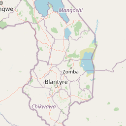
Map view of Mulanje Mountain Forest Reserve

Use this park location map to pinpoint Mulanje Mountain Forest Reserve in Malawi, understand its exact geographic position, and read its mapped placement within the surrounding landscape more clearly.

Pigeon | © OpenStreetMap contributors

Visual reference of granite cliffs, high plateaus, and endemic Afromontane habitats.

Mulanje Mountain Forest Reserve Photos and Scenery: Exploring the Landscape

Visual documentation captures the sheer granite walls, rugged high plateaus, and deep gorges that define the isolated massif. Examining protected area imagery reveals the stark contrast between lowland plains and the forested mountain environment.

A wide shot of the rugged granite slopes of Chambe Peak in the Mulanje Massif looming over a village with small huts, dirt paths, and scattered trees.

Park atlas

Compare regional mountain masses, high plateaus, and protected reserves

Parks Near Mulanje Mountain Forest Reserve and Surrounding Protected Landscapes

Browsing other protected areas near Mulanje Mountain Forest Reserve reveals broader ecological patterns across the surrounding region. Comparing these nearby natural landscapes provides essential geographic context for regional conservation terrain.
Nature reserveChiradzulu District
About 49 km away#1 closest

Northwest

Chiradzulu Mountain Forest Reserve: Geography and Protected Area Profile

A rugged mountain landmark in the Shire Highlands of southern Malawi

Located in the heart of Chiradzulu District, this nature reserve protects a prominent mountain massif known for its unique silhouette and ecological importance. The site provides a vital reference point for understanding the mountainous terrain, regional reforestation progress, and the broader natural landscapes of the Shire Highlands.

Area
7.74 km²
Established
1924
Relief
Mountain
Scope
Terrestrial
A watercolor painting showing a wide, panoramic view of a lake shore with marshy green grasses in the foreground and soft purple hills in the background.
Protected areaZomba District
About 70 km away#2 closest

North

Lake Chilwa Protected Area: Geography, Map, and Seasonal Wetland Landscape Analysis

Understanding the endorheic basin and floodplain dynamics in Malawi.

Lake Chilwa stands as a significant protected area and Ramsar wetland in Zomba District. This detail covers its unique closed-basin geography, the influence of seasonal rainfall on surface extent, and the distinct characteristics of its shallow open water and flooded grasslands. Explore the intersection of river inflows and basin drainage that defines this critical ecosystem.

Established
1996
Relief
Lowland
Scope
Terrestrial
Water
Water-dominated
Nature reserveMalawi
About 70 km away#3 closest

North

Zomba Plateau Nature Reserve: Geographic Overview and Mapped Mountain Terrain

Protected montane landscapes in southern Malawi

Zomba Plateau stands as a significant granitic intrusion within the Shire Highlands, featuring high-altitude terrain and diverse forested patches. This record provides essential geographic context on its geological structure, forest reserves, and surrounding vistas across the southern Malawi landscape.

Area
130 km²
Established
1913
Relief
Mountain
Climate
Tropical
Wildlife reserveMalawi
About 87 km away#4 closest

West

Majete Wildlife Reserve: Geographic Atlas and Protected Area Map of Southern Malawi

Savanna landscapes and Shire River valley ecology

Majete Wildlife Reserve represents a premier example of habitat restoration in the Shire River valley. Spanning 700 square kilometers of varied terrain, the reserve protects a mosaic of riparian forest and savanna that has been carefully managed to sustain Big Five wildlife. Gain insight into the regional geography, protected landscape boundaries, and conservation history of this essential Malawian wildlife sanctuary.

Area
700 km²
Established
1955
IUCN
IV
Visitors
7K annual
National parkMalawi
About 95 km away#5 closest

Southwest

Lengwe National Park: Malawi's Protected Landscape Atlas and Geographic Context

Mapped natural terrain and protected area boundaries in Malawi.

Lengwe National Park offers a focused look into Malawi's protected natural areas. As a designated national park, its geographic significance is highlighted through mapped boundaries and an understanding of the surrounding regional terrain. This entry provides essential context for exploring its identity as a protected landscape within southeastern Africa, contributing to a broader atlas of conservation areas.

Area
887 km²
Established
1970
IUCN
II
Climate
Tropical
Wildlife reserveNsanje District
About 103 km away#6 closest

Southwest

Mwabvi Wildlife Reserve: Mapping the Protected Landscapes of the Nsanje District

Geography, woodland terrain, and regional biodiversity.

Located in the southernmost Nsanje District of Malawi, Mwabvi Wildlife Reserve encompasses a unique convergence of dry Brachystegia woodland, sandstone hills, and open savanna grasslands. This protected area offers a deep look into the varied topographies of the Lower Shire region, providing a comprehensive understanding of the reserve's historic ecological importance and its current role in regional conservation.

Area
135 km²
Established
1953
IUCN
IV
Relief
Upland
National parkSouthern Region
About 123 km away#7 closest

North

Liwonde National Park: National Park in Malawi's Southern Region

Mapped Protected Area Boundaries and Geographic Context

Liwonde National Park is a designated national park situated in Malawi's Southern Region. This entry provides detailed geographic information, focusing on the park's mapped boundaries and its role within the broader atlas of protected landscapes. Explore the unique regional geography and conservation context that defines this protected area.

Area
548 km²
Established
1973
Relief
Upland
Climate
Tropical
National parkMalawi
About 189 km away#8 closest

North

Lake Malawi National Park: UNESCO Protected Landscape and Endemic Fish Habitat

Discover mapped terrain, island geography, and evolutionary wonders.

Lake Malawi National Park offers unparalleled insight into freshwater biodiversity and landscape dynamics within Malawi's Great Rift Valley. As a UNESCO World Heritage Site, it is celebrated for its spectacular evolutionary radiation of cichlid fish, a phenomenon studied globally. The park's protected territory includes the mountainous Nankumbu Peninsula and thirteen islands, providing a rich context for understanding the interplay between aquatic ecosystems, terrestrial terrain, and unique island geography.

Area
94 km²
Established
1980
IUCN
II
Relief
Mountain

Common questions about visiting, size, designation, and location context for Mulanje Mountain Forest Reserve

Mulanje Mountain Forest Reserve FAQs for park facts, access, geography, and protected area context

Find quick answers about Mulanje Mountain Forest Reserve, including protected-area facts, park geography, trail and visitor context, and how the park fits into its surrounding country and regional landscape.
MoriAtlas Explorer

Continue Your Protected Areas Search Across the Global Atlas

Deepen your exploration by continuing the structured search for national parks and protected areas worldwide. Utilize the comprehensive filtering capabilities to compare different conservation landscapes and refine your understanding of global park geography. Discover more about the distribution and characteristics of protected natural areas.

Global natural geography