
Mori Atlas logo
Nature reserveZomba Plateau

Analyzing the geographic boundaries, montane terrain, and forest landscape of this southern mountain massif.

Zomba Plateau Nature Reserve: Mapping the Granitic Massif of Southern Malawi Highlands

The Zomba Plateau forms a prominent granitic massif rising from the Shire Highlands in southern Malawi. This nature reserve, characterized by its pear-shaped geography and elevation reaching 2,087 metres, encompasses a complex mix of Mexican pine plantations, remnant montane forests, and miombo woodland. Our detailed atlas record traces the geological composition of the plateau and its spatial relationship to surrounding landmarks including Liwonde National Park and the Mulanje Massif.

plateaugranitic massifShire Highlandspine plantationmontane forestmiombo woodland
A flat-style digital illustration depicting a mountain valley with a central waterfall, a calm lake in the foreground, coniferous forests on the slopes, and a small boat at the water's edge, all rendered in a soft, pastel color palette.

Zomba Plateau

Nature reserve

Park overview

Structured park overview, official facts, and landscape profile for Zomba Plateau

Zomba Plateau park facts, protected area profile, and essential visitor context

Review the core facts for Zomba Plateau, including designation, size, terrain, visitor scale, habitats, and operating context in one park-focused overview.

About Zomba Plateau

The Zomba Plateau is one of the most recognizable upland landscapes in southern Malawi. Set within the Shire Highlands, the massif rises above the surrounding country as a roughly pear-shaped block of granitic terrain, climbing to a highest point of around 2,087 metres. Two informal names describe its halves: the southern section is generally known as Zomba Mountain, while the northern portion is called Malosa, with the east-west Domasi Valley separating the two.

Its geology is a defining element of its character. The plateau is largely composed of granitic syenite, an igneous rock that intruded into the older metamorphic rocks of the Shire Highlands during the late Jurassic and Cretaceous, roughly 150 to 65 million years ago. The nearby Mulanje Massif shares this composition and origin, and the two together are regarded as a paired system of isolated highland inselbergs within Malawi's southern landscape. Quartz and other semi-precious stones have been found within the massif, adding another layer to its geological identity.

The vegetation of the plateau reflects a long history of human use. Zomba and Malosa forest reserves were formally established in 1913, and much of the plateau has since been converted to plantations of Mexican pine, originally planted to supply the Zomba Sawmill on the southern slopes. Where indigenous forest persists, in small patches of montane forest and miombo woodland, it offers a glimpse of the original vegetation; elsewhere, pressure from local firewood demand has contributed to ongoing deforestation.

As a destination, the Zomba Plateau functions as the principal scenic and recreational mountain for the region. A paved all-weather road climbs from the city of Zomba, providing access to viewpoints, picnic areas like the Williams Falls and Mulunguzi Dam, and accommodations such as the Sunbird KuChawe Inn and several camping grounds. From the plateau's edges, scenery extends outward: Blantyre and the Mulanje Massif can be seen on clear days, while the western edge overlooks the Shire River and Liwonde National Park. The combination of working timber landscape, remnant natural forest, panoramic views, and proximity to Zomba gives the plateau a unique position among Malawi's protected natural areas.

Quick facts and research context for Zomba Plateau

The Zomba Plateau covers roughly 130 square kilometres and rises to about 2,087 metres, making it one of the most prominent features of Malawi's Shire Highlands. Its core is built from granitic syenite intruded during the late Jurassic to Cretaceous periods, with quartz crystals among the minerals reported in the area.

The protected forest reserves of Zomba and Malosa date from 1913. While much of the plateau is now covered by pine plantations tied to the historic Zomba Sawmill, fragments of native montane forest and miombo woodland remain, and the massif is recognized as part of a proposed regional ecoregion called the South East Africa Montane Archipelago.

Protection and recognition

Examine documented conservation designations and administrative frameworks.

Zomba Plateau Protection Status and International Recognition Records

Zomba Plateau brings together official conservation records, management frameworks, and international designation metrics in one structured reference. Protected area registers supply foundational administrative facts without assuming specific ecological outcomes.

Protection details

Transboundary protection
No
Park context

Deeper park guide and search-rich context for Zomba Plateau

Zomba Plateau history, landscape, wildlife, and travel context

Explore Zomba Plateau through its history, landscape character, ecosystems, wildlife, conservation priorities, cultural context, and seasonal travel timing in a structured park guide built for atlas discovery and search intent.

Why Zomba Plateau stands out

The Zomba Plateau is known for its combination of elevated scenery in the Shire Highlands, its role as a plantation landscape of Mexican pine threaded with remnant native forest, and its commanding vistas across southern Malawi. Visitors prize the plateau for the contrast between working timber plantations and the surviving patches of indigenous montane vegetation, as well as the views from the plateau edges toward Liwonde National Park, the Shire River, and the distant Mulanje Massif. It is also valued as a recreational mountain close to the old colonial capital of Zomba, where a single paved road climbs from the town through pine forest to viewpoints and accommodation. The massif's long-established forest reserves and its geological kinship with Mulanje give it a distinctive identity within Malawi's montane landscapes.
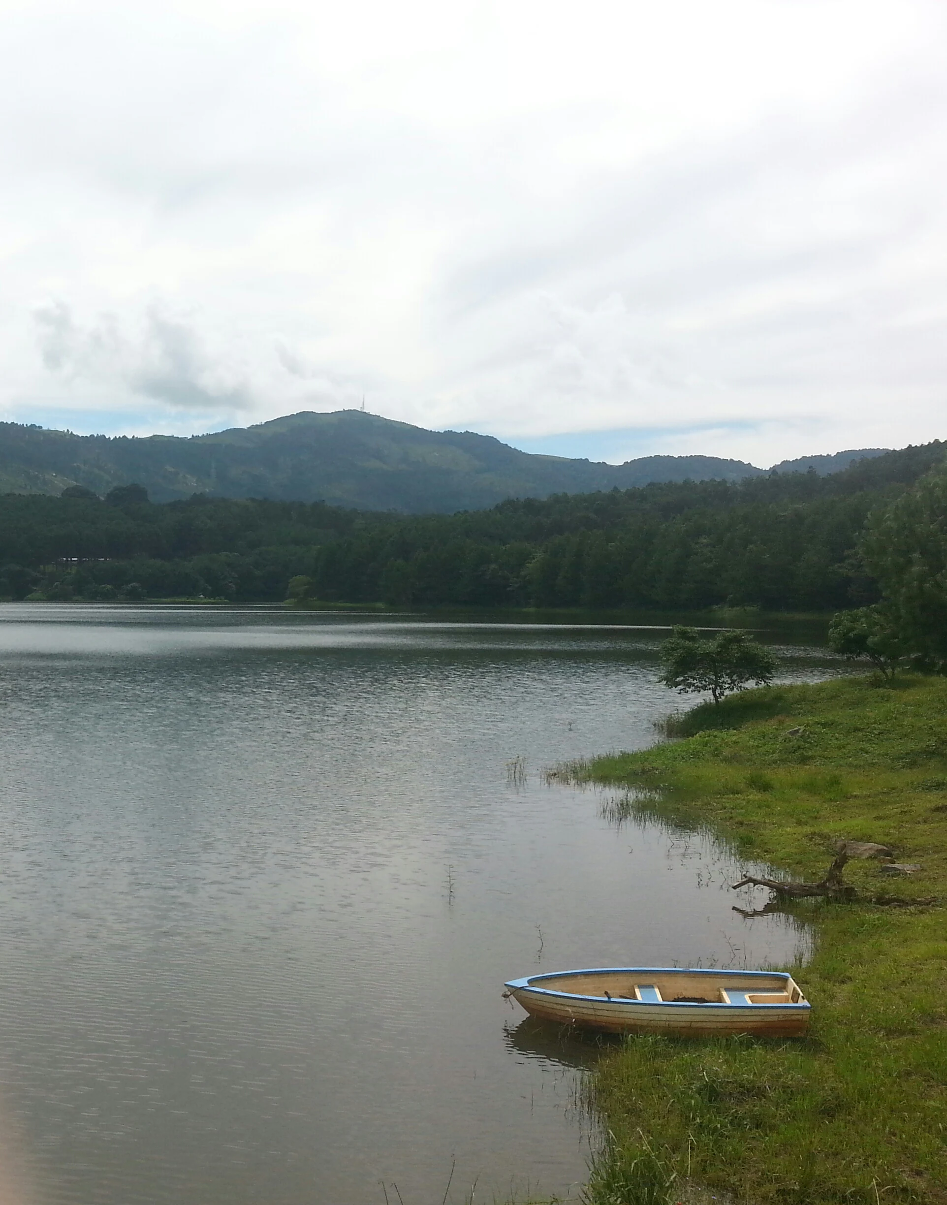
A small, light-colored boat rests in the calm water at the grassy edge of a reservoir with forested hills in the background.
A small boat moored at the shore of Mulunguzi Dam on Zomba Plateau.

Zomba Plateau history and protected-area timeline

The forest reserves of Zomba and Malosa were formally established in 1913, marking the plateau's entry into formal conservation management during the colonial period. Shortly afterward, much of the plateau was brought into production through large-scale planting of Mexican pine, intended to supply the Zomba Sawmill on the mountain's southern slopes. This timber-oriented plantation history has shaped the plateau's vegetation pattern ever since, with pine dominating the slopes and only small pockets of indigenous forest remaining.

In 2000, the Mulunguzi Dam was opened on the plateau, providing a water reservoir for the city of Zomba and reinforcing the massif's role as an infrastructure and recreation resource for the surrounding region. Meanwhile, recognition of the plateau's broader ecological value has grown, and it has been included in proposals for a regional ecoregion to be known as the South East Africa Montane Archipelago.

Zomba Plateau landscape and geographic character

The Zomba Plateau forms a prominent highland block rising from the Shire Highlands of southern Malawi. Its highest point reaches around 2,087 metres, and the overall massif spans roughly 130 square kilometres of elevated terrain. The plateau's outline is roughly pear-shaped, with the southern portion known as Zomba Mountain and the northern portion referred to as Malosa, separated by the deeply incised east-west Domasi Valley.

The massif is composed mainly of granitic syenite, an igneous rock of late Jurassic to Cretaceous origin that has shaped the plateau's bold relief and exposed ridgelines. Quartz and other semi-precious stones can be found within the rock. The overall scenery combines open plantation slopes, rocky highland terrain, forested valleys, and dramatic edge views. From the western edge of the plateau, the landscape drops toward the Shire River valley and the floodplains of what is now Liwonde National Park. On clear days, the Mulanje Massif is visible to the southeast, and Blantyre can be seen in the distance. The Mulunguzi Dam and Williams Falls add a water-based focal point within the plateau's interior.
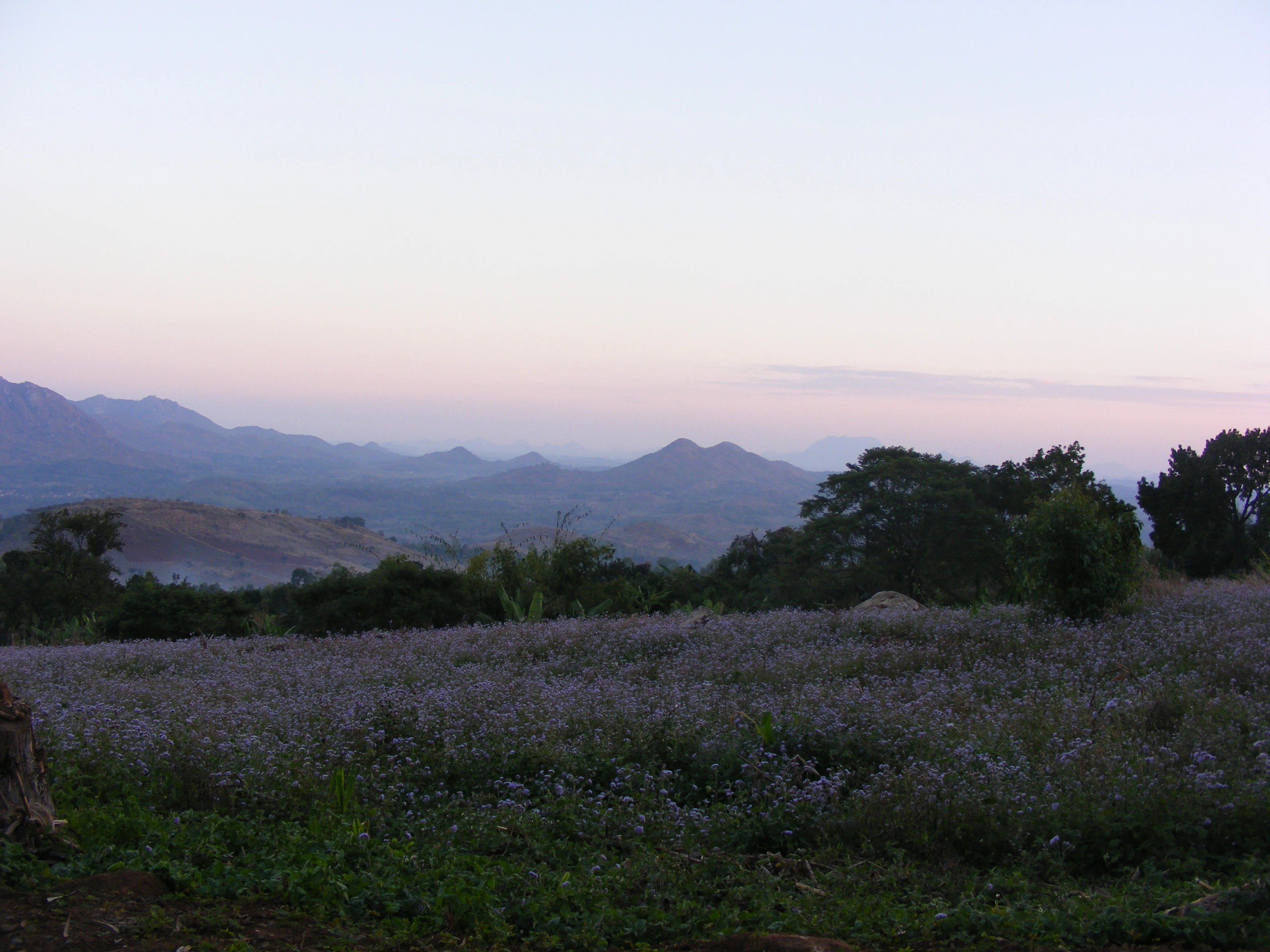
A wide view of rolling mountains and hills under a soft, early morning sky, viewed from a high vantage point overlooking a field of low-lying vegetation.
A view looking out from the slopes of the Zomba Plateau across the landscape of southern Malawi.

Zomba Plateau ecosystems, habitats, and plant life

Ecologically, the Zomba Plateau sits at the transitional zone of southern Malawi's highland vegetation. Its indigenous vegetation pattern includes patches of native montane forest along with surrounding miombo woodland, but the dominant cover across much of the massif is plantation forest of Mexican pine, planted in the early twentieth century for timber production.

Where the original vegetation has survived, typically in small patches within the older Zomba and Malosa forest reserves established in 1913, the habitat supports a mixture of montane and woodland species typical of the Shire Highlands. These remnant indigenous patches are ecologically significant because they represent the original vegetation communities that once extended across the broader highland landscape. Outside the reserves, pressure from local firewood demand continues to drive deforestation of remaining native vegetation, particularly in areas where indigenous trees have been left standing. The plateau's ecological role is also being reinterpreted at a regional scale through the proposed South East Africa Montane Archipelago ecoregion, which would group it together with the nearby Mulanje Massif and other isolated southern African inselbergs on the basis of shared geology and biological character. Agricultural land use is also present on the plateau, with fruits such as strawberries, yellow-berries, and blackberries grown for the local market.

Zomba Plateau wildlife and species highlights

The Zomba Plateau is not primarily known as a wildlife reserve in the sense of a large mammal sanctuary, and most accounts of the plateau emphasize its forest character, plantations, and views rather than charismatic animal populations. Its wildlife interest is therefore most closely tied to the surviving patches of native montane forest and miombo woodland within the older Zomba and Malosa forest reserves, which support birdlife and smaller forest species typical of southern Malawi's highland habitats. These remnant forest patches function as islands of indigenous biodiversity within the surrounding plantation matrix. The broader Shiré Highlands context also gives the plateau a role in the regional mosaic of habitats that connect to lowland areas such as the Shire River and Liwonde National Park, whose wildlife can be observed from the plateau's western edge.

Zomba Plateau conservation status and protection priorities

Formally, the Zomba Plateau has been under protection since 1913, when the Zomba and Malosa forest reserves were established. These reserves were central to shaping the plateau's modern character, both preserving some indigenous forest and providing the framework for the later plantation program that dominates today's landscape.

Conservation on the plateau faces a clear tension between timber production and indigenous habitat protection. Much of the area is managed as Mexican pine plantation for the historic Zomba Sawmill, while only small fragments of native montane forest and miombo woodland remain. Outside the strict reserves, severe deforestation linked to firewood demand in surrounding communities remains a recognized challenge for indigenous vegetation. At a regional scale, the plateau's inclusion in the proposed South East Africa Montane Archipelago ecoregion reflects growing recognition of its importance as part of a network of isolated montane systems in southern Africa, alongside the geologically similar Mulanje Massif. In addition to its ecological values, the plateau also hosts water infrastructure such as the Mulunguzi Dam, opened in 2000 to supply the city of Zomba.

Zomba Plateau cultural meaning and human context

The Zomba Plateau is a long-established recreational and provisioning landscape for southern Malawi. The city of Zomba, the country's former colonial capital, lies at its foot, and the plateau has historically been tied to town life through timber from the Zomba Sawmill, water supply from the Mulunguzi Dam, and visitor use. A number of organizations, including church institutions such as the CCAP Church, alongside private individuals, maintain cottages on the plateau, giving it an additional dimension as a place of long-standing community and institutional memory beyond its formal reserve status. Local agricultural traditions also extend onto the plateau, with cultivation of strawberries, yellow-berries, and blackberries for nearby markets.

Top sights and standout views in Zomba Plateau

The plateau stands out for the unusual pairing of a working pine plantation landscape with surviving patches of native montane forest and miombo woodland, an arrangement that traces back to the 1913 forest reserves and subsequent afforestation.

It also draws attention for its panoramic highland views across the Shire Highlands, from the Shire River and Liwonde National Park to the distant Mulanje Massif and Blantyre, and for features such as the Williams Falls and Mulunguzi Dam. Its shared geology with Mulanje, expressed through the proposed South East Africa Montane Archipelago ecoregion, gives it an identity as a key piece of a regionally significant montane system.

Best time to visit Zomba Plateau

Seasonal information for the Zomba Plateau centers on the contrast between the dry and rainy seasons across southern Malawi. During the rainy season, water features such as Mulunguzi Dam and Williams Falls are at their fullest, the slopes are at their greenest, and the pine plantations appear more lush, though mist and rain can obscure views from the plateau edges.

In the dry season, visibility is typically better for the long-distance views toward Blantyre, the Mulanje Massif, the Shire River, and Liwonde National Park. Hiking, mountain biking, and rock climbing are more comfortable under drier conditions, while the surrounding Shire Highlands countryside is more accessible. As with any southern Malawian highland, cooler temperatures and the chance of mist at higher elevations are a consideration at any time of year.
Monthly climate preview

Long-term representative point measurements tracking weather by month

Zomba Plateau Climate Normals, Annual Temperature and Precipitation Rhythm

Zomba Plateau exhibits a measured annual temperature and precipitation rhythm spanning long-term averages from NASA data. Reviewing the complete twelve-month profile provides deeper context for monthly climate variations across this protected area.
Annual mean23 °C
18 °C27 °C
Jan24°
Feb24°
Mar23°
Apr22°
May20°
Jun19°
Jul18°
Aug20°
Sep24°
Oct26°
Nov27°
Dec25°
Warmest month
November

27 °C

Coolest month
July

18.2 °C

Wettest month
January

10.7 mm/day

Driest month
September

0.3 mm/day

Park location guide

Geography guide, regional context, and park location map for Zomba Plateau

Zomba Plateau park geography, regions, and map view in Malawi

Understand where Zomba Plateau sits in Malawi through a broader geographic reading of the surrounding landscape, nearby location context, and its mapped position within the national park landscape.

How Zomba Plateau fits into Malawi

Malawi is a landlocked country in Southeastern Africa. Formerly known as Nyasaland under British colonial rule, it gained independence in 1964 and became a multi-party democracy in 1994. The country is known for Lake Malawi, which comprises about one-fifth of its territory, and is governed as a unitary presidential republic with Lilongwe as its capital.

Wider geography shaping Zomba Plateau in Malawi

Malawi is located in Southeastern Africa within the Great Rift Valley. It is bordered by Zambia to the west, Tanzania to the north and northeast, and Mozambique to the east, south, and southwest. The country features highlands and plateaus in the northern and central areas, with the Great Rift Valley system running through the territory.

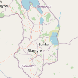
Map view of Zomba Plateau

Use this park location map to pinpoint Zomba Plateau in Malawi, understand its exact geographic position, and read its mapped placement within the surrounding landscape more clearly.

Pigeon | © OpenStreetMap contributors

Protected area imagery highlighting granitic terrain and montane forest habitats

Zomba Plateau Photos and Landscape Scenery Visual Exploration

Visual records capture the rugged topography and mixed vegetation zones spanning the granitic massif. Field photography illustrates the distinct contrast between pine plantations and surviving indigenous forest patches across the highland terrain.

A small, light-colored boat rests in the calm water at the grassy edge of a reservoir with forested hills in the background.

A wide shot of a calm reservoir lake surrounded by dense, lush forest and mountains, with a small waterfall visible in the distance.

A wide view of rolling mountains and hills under a soft, early morning sky, viewed from a high vantage point overlooking a field of low-lying vegetation.

Park atlas

Compare adjacent highland terrain and connected protected areas across southern Malawi

Exploring Parks Near Zomba Plateau and Surrounding Regional Protected Landscapes

Continue geographic comparison by browsing other protected areas situated near Zomba Plateau and the surrounding Shire Highlands. Analyzing these adjacent regional landscapes reveals broader patterns in montane terrain, forest reserves, and valley ecosystems.
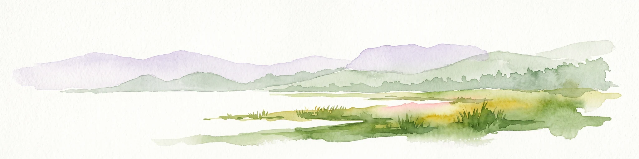
A watercolor painting showing a wide, panoramic view of a lake shore with marshy green grasses in the foreground and soft purple hills in the background.
Protected areaZomba District
About 41 km away#1 closest

East

Lake Chilwa Protected Area: Geography, Map, and Seasonal Wetland Landscape Analysis

Understanding the endorheic basin and floodplain dynamics in Malawi.

Lake Chilwa stands as a significant protected area and Ramsar wetland in Zomba District. This detail covers its unique closed-basin geography, the influence of seasonal rainfall on surface extent, and the distinct characteristics of its shallow open water and flooded grasslands. Explore the intersection of river inflows and basin drainage that defines this critical ecosystem.

Established
1996
Relief
Lowland
Scope
Terrestrial
Water
Water-dominated
Nature reserveChiradzulu District
About 42 km away#2 closest

South

Chiradzulu Mountain Forest Reserve: Geography and Protected Area Profile

A rugged mountain landmark in the Shire Highlands of southern Malawi

Located in the heart of Chiradzulu District, this nature reserve protects a prominent mountain massif known for its unique silhouette and ecological importance. The site provides a vital reference point for understanding the mountainous terrain, regional reforestation progress, and the broader natural landscapes of the Shire Highlands.

Area
7.74 km²
Established
1924
Relief
Mountain
Scope
Terrestrial
National parkSouthern Region
About 55 km away#3 closest

North

Liwonde National Park: National Park in Malawi's Southern Region

Mapped Protected Area Boundaries and Geographic Context

Liwonde National Park is a designated national park situated in Malawi's Southern Region. This entry provides detailed geographic information, focusing on the park's mapped boundaries and its role within the broader atlas of protected landscapes. Explore the unique regional geography and conservation context that defines this protected area.

Area
548 km²
Established
1973
Relief
Upland
Climate
Tropical
Digital illustration of a large mountain range with jagged peaks, rolling green foothills, a central valley, and a stylized sun in a soft pastel sky.
Nature reserveMalawi
About 70 km away#4 closest

South

Mulanje Mountain Forest Reserve: Protected Afromontane Landscapes in Southern Malawi

Geographic overview of the Mulanje Massif and its high-elevation plateau

This nature reserve covers an isolated mountain block in Malawi, rising sharply to 3,002 meters at Sapitwa Peak. The landscape features rugged granite cliffs, deeply carved valleys, and extensive Afromontane forests that provide sanctuary for numerous endemic species. Use this atlas resource to understand the massif's vertical relief, plateau characteristics, and its central role in the regional geography of southeastern Africa.

Area
563.17 km²
Established
1927
Relief
Mountain
Climate
Tropical
Wildlife reserveMalawi
About 93 km away#5 closest

Southwest

Majete Wildlife Reserve: Geographic Atlas and Protected Area Map of Southern Malawi

Savanna landscapes and Shire River valley ecology

Majete Wildlife Reserve represents a premier example of habitat restoration in the Shire River valley. Spanning 700 square kilometers of varied terrain, the reserve protects a mosaic of riparian forest and savanna that has been carefully managed to sustain Big Five wildlife. Gain insight into the regional geography, protected landscape boundaries, and conservation history of this essential Malawian wildlife sanctuary.

Area
700 km²
Established
1955
IUCN
IV
Visitors
7K annual
National parkMalawi
About 120 km away#6 closest

Southwest

Lengwe National Park: Malawi's Protected Landscape Atlas and Geographic Context

Mapped natural terrain and protected area boundaries in Malawi.

Lengwe National Park offers a focused look into Malawi's protected natural areas. As a designated national park, its geographic significance is highlighted through mapped boundaries and an understanding of the surrounding regional terrain. This entry provides essential context for exploring its identity as a protected landscape within southeastern Africa, contributing to a broader atlas of conservation areas.

Area
887 km²
Established
1970
IUCN
II
Climate
Tropical
National parkMalawi
About 120 km away#7 closest

North

Lake Malawi National Park: UNESCO Protected Landscape and Endemic Fish Habitat

Discover mapped terrain, island geography, and evolutionary wonders.

Lake Malawi National Park offers unparalleled insight into freshwater biodiversity and landscape dynamics within Malawi's Great Rift Valley. As a UNESCO World Heritage Site, it is celebrated for its spectacular evolutionary radiation of cichlid fish, a phenomenon studied globally. The park's protected territory includes the mountainous Nankumbu Peninsula and thirteen islands, providing a rich context for understanding the interplay between aquatic ecosystems, terrestrial terrain, and unique island geography.

Area
94 km²
Established
1980
IUCN
II
Relief
Mountain
Wildlife reserveNsanje District
About 152 km away#8 closest

South

Mwabvi Wildlife Reserve: Mapping the Protected Landscapes of the Nsanje District

Geography, woodland terrain, and regional biodiversity.

Located in the southernmost Nsanje District of Malawi, Mwabvi Wildlife Reserve encompasses a unique convergence of dry Brachystegia woodland, sandstone hills, and open savanna grasslands. This protected area offers a deep look into the varied topographies of the Lower Shire region, providing a comprehensive understanding of the reserve's historic ecological importance and its current role in regional conservation.

Area
135 km²
Established
1953
IUCN
IV
Relief
Upland

Common questions about visiting, size, designation, and location context for Zomba Plateau

Zomba Plateau FAQs for park facts, access, geography, and protected area context

Find quick answers about Zomba Plateau, including protected-area facts, park geography, trail and visitor context, and how the park fits into its surrounding country and regional landscape.
MoriAtlas Explorer

Continue Your Protected Areas Search Across the Global Atlas

Deepen your exploration by continuing the structured search for national parks and protected areas worldwide. Utilize the comprehensive filtering capabilities to compare different conservation landscapes and refine your understanding of global park geography. Discover more about the distribution and characteristics of protected natural areas.

Global natural geography