
Mori Atlas logo
Protected landscapeNaturpark Niederlausitzer Heidelandschaft

A vast protected area in southern Brandenburg shaped by ancient ice age geology and post mining restoration

Naturpark Niederlausitzer Heidelandschaft: Exploring the Glacial and Industrial Landscapes

Naturpark Niederlausitzer Heidelandschaft represents a sprawling 484 square kilometer mosaic of lowland forests, heathlands, and mires located in the southern regions of Brandenburg. This protected landscape documents a complex geological history where terminal moraines and sandar plains from the Saalian glaciation meet the dramatic scars of former lignite mining. Through intentional restoration, these industrial sites have transformed into secondary habitats, creating a layered terrain that highlights the interplay between natural post glacial legacy and human environmental intervention.

lowland glaciationheathlandssessile oak forestpost-mining landscapelignite miningwet meadows
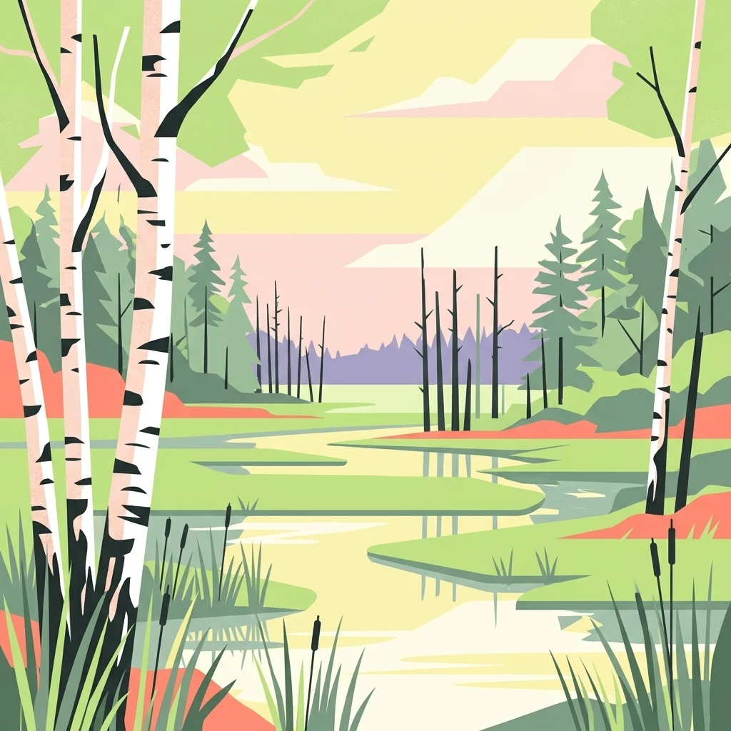
A flat, minimalist digital illustration showing a winding river through a wetland with birch trees in the foreground, pine trees in the background, and soft-colored clouds in the sky.

Naturpark Niederlausitzer Heidelandschaft

Protected landscape

Park overview

Structured park overview, official facts, and landscape profile for Naturpark Niederlausitzer Heidelandschaft

Naturpark Niederlausitzer Heidelandschaft park facts, protected area profile, and essential visitor context

Review the core facts for Naturpark Niederlausitzer Heidelandschaft, including designation, size, terrain, visitor scale, habitats, and operating context in one park-focused overview.

About Naturpark Niederlausitzer Heidelandschaft

Naturpark Niederlausitzer Heidelandschaft occupies the southernmost slice of Brandenburg, between the towns of Bad Liebenwerda and Finsterwalde, where the state's oldest natural landscape still preserves the imprint of the last glaciation. The underlying scenery is classic lowland glacial morphology: ground moraines and terminal moraine ridges alternate with the broad valley floor of the Niederlausitzer Urstromtal, into which the Schwarze Elster drains in the southern part of the park. Sandy plateaus in the north carry extensive, largely contiguous forest tracts, while the valley floor and post-mining basins hold most of the open water of the park, since the natural ice age lakes have long since silted over.

The defining human story of the park is lignite. Beneath the loose glacial sediments lie thick brown coal seams, some originally reaching the surface, and a century of digging for what old miners called "the black gold" left behind a patchwork of anthropogenic landforms. These were sometimes bizarre in appearance, but they also created new habitats for specialized species. Today, reclaimed post-mining water bodies (Tagebaurestgewässer) function both as local recreation areas and as nature reserves such as Grünhaus, managed by the NABU Stiftung Nationales Naturerbe.

Beyond mining, the park supports a strong network of nature reserves led by the Naturschutzgebiet Forsthaus Prösa, with its extensive sessile oak forests and unusual heath and silver grass openings shaped by decades of former military activity. Surrounding reserves add wet meadows with orchids near Kahla, the legendary Loben moor used for spa peat extraction, the Seewald, and the former munitions site at Hohenleipisch. Together, they form a multi-layered mosaic of heaths, moors, wet grassland, oak forest, and post-mining wilderness that defines the park's identity as a place where geology, industry, and ecological recovery are tightly intertwined.

Quick facts and research context for Naturpark Niederlausitzer Heidelandschaft

Naturpark Niederlausitzer Heidelandschaft covers approximately 484 square kilometers in southern Brandenburg and was designated on 24 May 1996. The park's land use is dominated by forest (about 42 percent) and agricultural land (about 42 percent), with smaller shares for settlements, post-mining landscapes, and waters and mires.

Within the park, thirteen nature reserves have been declared, covering roughly 94 square kilometers, alongside seven landscape protection areas of about 213 square kilometers and eleven natural monuments. The highest point is the Güterbank near Elsterwerda at 153 meters. Towns within or bordering the park include Bad Liebenwerda, Elsterwerda, Wahrenbrück, Doberlug-Kirchhain, Finsterwalde, and Lauchhammer, and the park lies roughly 70 kilometers from Dresden and Cottbus and about 100 kilometers from Berlin and Leipzig.

Protection and recognition

Documented terrestrial protection scope, designation year, and international recognition facts.

Naturpark Niederlausitzer Heidelandschaft Protection Status and Designation History

Terrestrial protection status for Naturpark Niederlausitzer Heidelandschaft reflects a documented designation history established in 2020. Recorded conservation metadata provides structured insight into management scope and international recognition frameworks.

Protection details

Protection scope
Terrestrial
Designated year
2020
Transboundary protection
No
Park context

Deeper park guide and search-rich context for Naturpark Niederlausitzer Heidelandschaft

Naturpark Niederlausitzer Heidelandschaft history, landscape, wildlife, and travel context

Explore Naturpark Niederlausitzer Heidelandschaft through its history, landscape character, ecosystems, wildlife, conservation priorities, cultural context, and seasonal travel timing in a structured park guide built for atlas discovery and search intent.

Why Naturpark Niederlausitzer Heidelandschaft stands out

The park is best known for the unusual coexistence of pristine post-glacial landscapes, such as large sessile oak forest, inland heath, and silver grass grassland, with extensive post-mining landscapes that have been reclaimed into valuable secondary habitats. Heathlands and open areas inside the core reserve Forsthaus Prösa, for example, originated from roughly thirty years of former military use, while former opencast lignite pits now host nature reserves managed by conservation groups such as NABU. It is also recognized for its strong tie between moors and human health: peat from the legend-shrouded Loben mire near Bad Liebenwerda has been used for medicinal spa treatments since 1904, and the rounded Geweihhügel, Fuchshügel and Lobenhügel that rise from the mire reflect the traces of small-scale historical clay extraction. The interplay of glacial geology, old mining scars, restored waters, and traditional orchards gives the park a layered identity that is unusual for a lowland Brandenburg nature park.
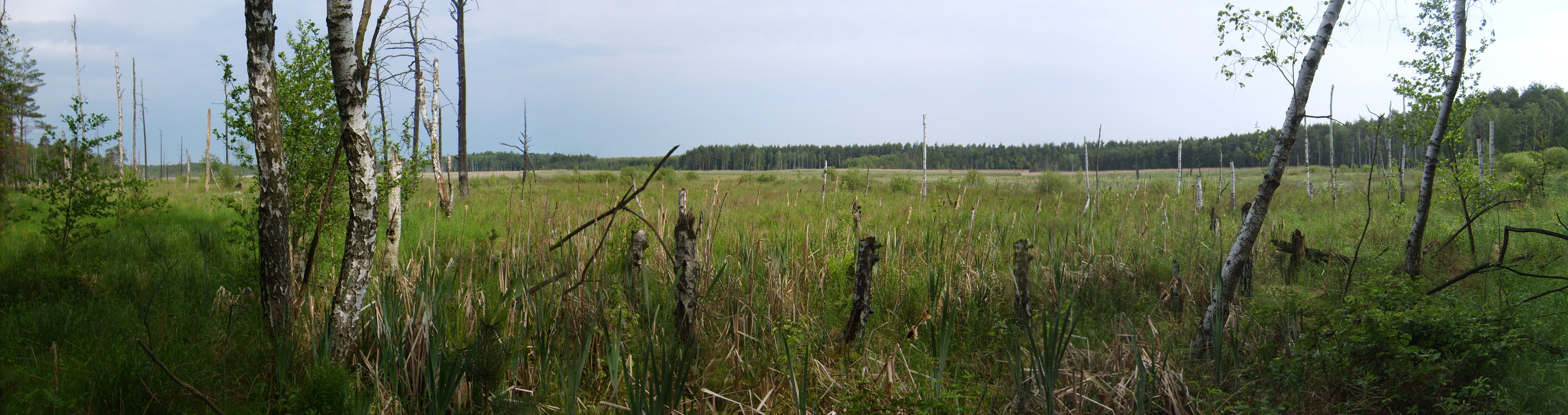
A panoramic landscape shot of an open wetland area in the Loben Nature Reserve, with scattered birch trees and a distant forest line under an overcast sky.
A wide panoramic view of the Loben Nature Reserve featuring wetlands and birch trees.

Naturpark Niederlausitzer Heidelandschaft history and protected-area timeline

The Naturpark was formally designated on 24 May 1996, marking an effort to organize and protect the mosaic of glacial, agricultural, and post-mining landscapes of southern Brandenburg under a single management framework. Its boundaries were drawn to encompass the residual moraine ridges, the Urstromtal of the Schwarze Elster, and the extensive sandy forest plateaus to the north.

The land itself carries a much longer human story. Small-scale clay mining once took place in the Prösa area for the local pottery trade, and peat cutting for the rheumatic spa clinic in Bad Liebenwerda has been documented in the Loben moor since 1904. The twentieth century brought a much heavier industrial intervention in the form of lignite mining, which in some places reached right up to the surface and left behind a generation of disturbed landscapes that are now being deliberately rewilded.

Since its establishment, the park has invested heavily in both conservation and identity-building. In 2020 it received the Qualitäts-Naturpark distinction from the Association of German Nature Parks, and since 1999 it has organized an annual Naturparkgemeinde des Jahres competition that recognizes villages practicing nature-friendly tourism and ecological land management. The current visitor center at Schloss Doberlug, which opened in 2018 as the erlebnisREICH Naturpark exhibition, earned the Red Dot Award: Communication Design in 2018 and the German Design Award in 2019.

Naturpark Niederlausitzer Heidelandschaft landscape and geographic character

The landscape of Naturpark Niederlausitzer Heidelandschaft is defined above all by its glacial inheritance. The southern Saalian glaciation left a jigsaw of ground moraines, low terminal moraine ridges, broad sandar plains, and the sweeping Niederlausitzer Urstromtal, an ancient ice age meltwater valley running roughly east-west through the park. The Schwarze Elster now flows gently through this valley floor, shaping the southern boundary of the protected area.

Because the natural kettle lakes and former glacial pools of the region have largely silted in, the waterscape of the park today is mostly artificial. Former opencast lignite pits have been reshaped into the Tagebaurestgewässer (post-mining residual waterbodies), some of them now nature reserves in their own right. In the north, sandy uplands support large, unbroken forest tracts of pine and oak, while the central and southern areas show a finer-grained mix of wet meadows, mires, and small kettle-like depressions. The highest point in the park is the modest Güterbank near Elsterwerda at 153 meters, giving the entire area a strongly lowland character with subtle, rolling relief rather than dramatic topography.
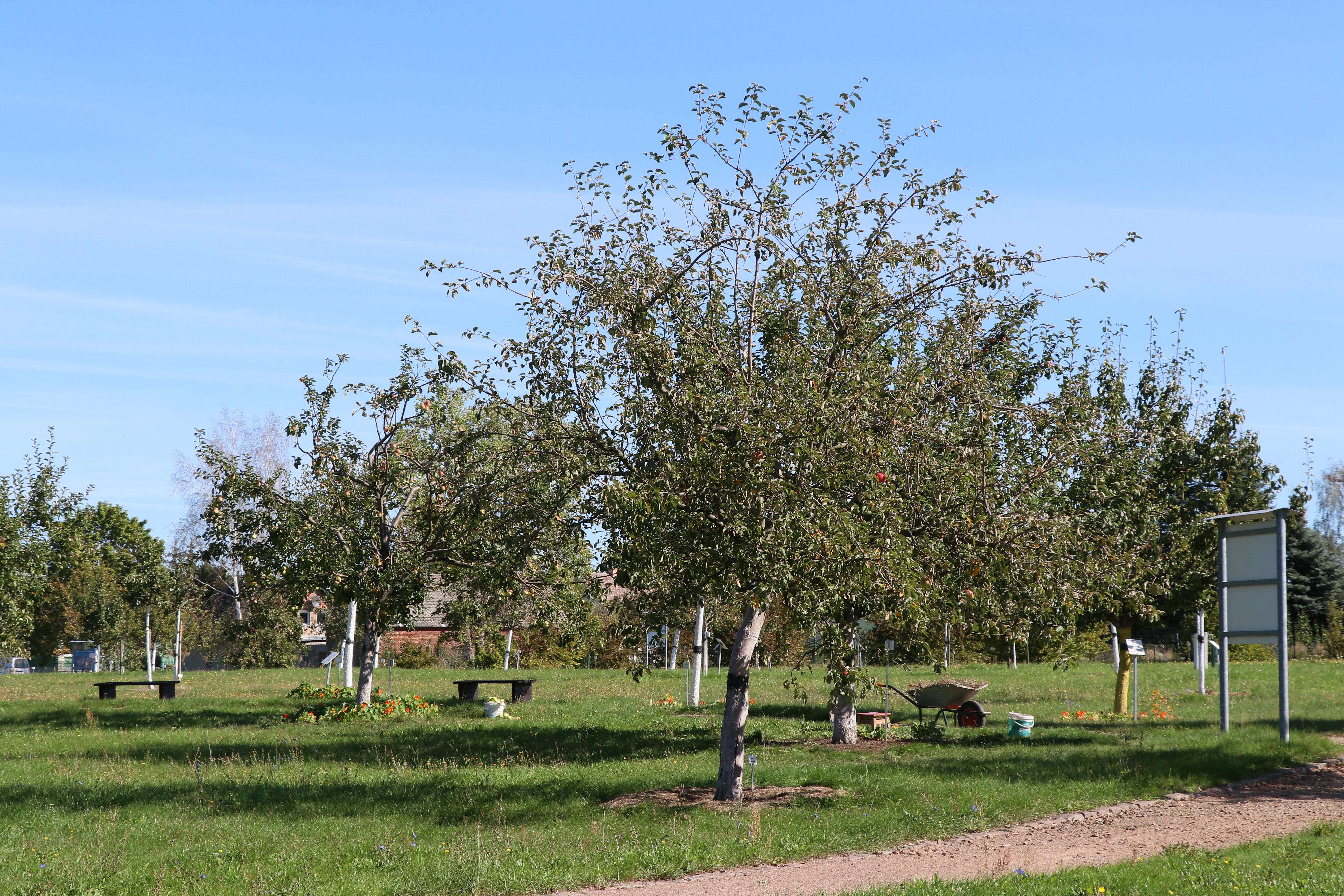
Several mature apple or pear trees standing in a grassy garden, with wooden benches and a signpost visible in the background.
Fruit trees in the Pomological Display and Teaching Garden in Döllingen.

Naturpark Niederlausitzer Heidelandschaft ecosystems, habitats, and plant life

Ecologically, the park is a textbook example of southern Brandenburg's sandy lowland habitats, anchored by the extensive sessile oak forests around the protected area Forsthaus Prösa. These oak woodlands form one of the most important forest complexes in the park and are accompanied by inland heaths (Callunaheiden) and silver grass grasslands (Silbergrasfluren) on the former military training areas, where decades of disturbance created open sandy habitats now maintained by managed conservation.

Along the valley floor and the edges of mires, the park protects a contrasting set of wet habitats. The Loben, a peatland steeped in local folklore, supports fen and bog vegetation, including the characteristic rounded mounds of Geweihhügel, Fuchshügel, and Lobenhügel that arose from small-scale historical clay and peat extraction. The Kleine Wiesen nature reserve near Kahla preserves a regionally rare complex of wet meadows with seepage springs and orchid populations, including the Lungen-Enzian and Geflecktes Knabenkraut, while the NSG Alte Röder and the Hohenleipisch site show how former military lands can transition into structured habitat mosaics.

Altogether, these habitats form a connected network of dry sandy forests and heaths, wet meadows, fens, and post-mining pioneer landscapes. The park's nature conservation strategy explicitly uses this diversity, pairing the protection of intact older ecosystems with the deliberate restoration of new ones in former mining areas.
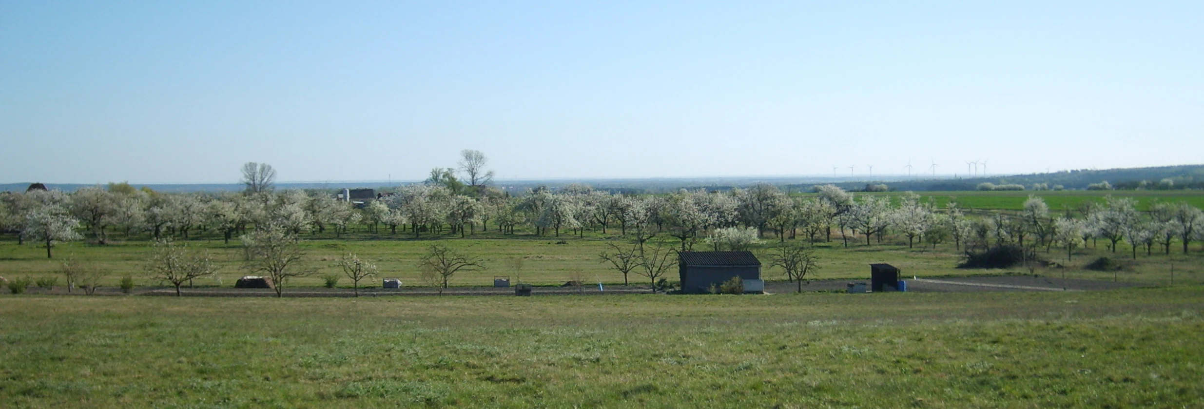
A wide view of an open meadow with scattered fruit trees in blossom, a small shed, and a distant horizon under a clear blue sky.
Meadow orchards in bloom near Hohenleipisch, reflecting the agricultural landscape of Naturpark Niederlausitzer Heidelandschaft.

Naturpark Niederlausitzer Heidelandschaft wildlife and species highlights

The wildlife profile of the park mirrors the diversity of its habitat mosaic. Open heath and silver grass areas of Forsthaus Prösa support specialized invertebrates and ground-nesting birds typical of inland sandy heath landscapes, while the moors and wet meadows sustain rich insect communities. The Kleine Wiesen reserve near Kahla has documented at least 29 breeding bird species, including the red-backed shrike (Neuntöter), which is listed on the IUCN Red List, alongside a notably diverse grasshopper, beetle, and butterfly fauna.

Wet meadows and fens across the park support characteristic meadow, mire, and reed species as well as orchids such as the Geflecktes Knabenkraut and the Lungen-Enzian, which are often taken as indicators for intact meadow communities. The Grünhaus post-mining reserve is known to host wildlife associated with regenerating open landscapes, and reclaimed post-mining waters across the park provide habitat for waterbirds, amphibians, and dragonflies. The integration of inactive military sites like Hohenleipisch into the conservation network further extends the variety of edge habitats and disturbance-tolerant species groups.

Naturpark Niederlausitzer Heidelandschaft conservation status and protection priorities

Naturpark Niederlausitzer Heidelandschaft is structured around a layered conservation framework of thirteen nature reserves, seven landscape protection areas, and eleven natural monuments that together cover the heart of the park. The core is the Naturschutzgebiet Forsthaus Prösa, which preserves the largest continuous tracts of sessile oak forest in the park as well as rare heath and silver grass habitats, several of which originated from the site's former military use and are now actively managed as conservation land.

Conservation in the park is unusual in that it explicitly embraces post-mining and post-military landscapes as habitat. Sites such as the Naturschutzgebiet Bergbaufolgelandschaft Grünhaus, managed by the NABU Stiftung Nationales Naturerbe, demonstrate how former opencast pits can be transformed into protected nature. Wetland reserves such as the Kleine Wiesen, the Loben, and the Alte Röder bei Prieschka serve as complementary refuges for meadow and mire specialists, while the Hohenleipisch reserve converts a former munitions site into a structured mosaic of forest, meadow, and open ground.

The park's profile was formally recognized in 2020 with the Qualitäts-Naturpark award under the Association of German Nature Parks' Qualitätsoffensive, underscoring both the quality of its nature reserve management and the strength of its visitor education, landscape development, and regional partnerships.

Naturpark Niederlausitzer Heidelandschaft cultural meaning and human context

The park sits in the Niederlausitz region of southern Brandenburg, where the historical economy wove together pottery, peat cutting, fruit growing, and later lignite mining. Local tradition runs through the landscape itself: peat from the Loben near Bad Liebenwerda has been used for medicinal spa treatments since 1904, and clay once quarried in the Prösa area fed a now-fragile local pottery craft. The Streuobstwiesen, traditional orchards of the Hohenleipisch and Döllingen area, are celebrated at the Pomologischer Schau- und Lehrgarten in Döllingen, a three-hectar living fruit museum with over 400 old and modern apple, pear, cherry, plum, nut, and peach varieties, maintained jointly by the park and the NABU working group on Streuobst.

Since 1999 the park has organized an annual Naturparkgemeinde des Jahres competition, with villages such as Grünewalde, Döllingen, Hohenleipisch, and Plessa receiving the title for nature-friendly tourism, ecological village renewal, support for regional products, and conservation of cultural and natural heritage. The training of villages through this competition has become a quiet but important cultural thread of the park. The park's main visitor hub, the 2018 erlebnisREICH Naturpark exhibition inside the historic Zisterzienserabtei of Schloss Doberlug, deliberately uses this layered history, presenting twelve themed trails that trace the transformation of the landscape from glacial times through mining to today's reclaimed nature.

Top sights and standout views in Naturpark Niederlausitzer Heidelandschaft

Naturpark Niederlausitzer Heidelandschaft centers on the contrast between seemingly untouched glacial landscapes and a deeply humanized, post-mining scenery. The Forsthaus Prösa reserve showcases the park's natural cornerstone, with extensive sessile oak forest surrounding heath openings once shaped by military activity. The Loben and other mires point to centuries of small-scale peat and clay extraction, while the Grünhaus reserve and other post-mining patches illustrate a deliberate, large-scale rewilding after lignite extraction.

Wet meadow reserves around Kahla and along the Alte Röder and the small moors provide botanically rich counterpoints, supporting orchids, sedges, and meadow specialties. The Pomologischer Schau- und Lehrgarten at Döllingen anchors the cultural landscape with over 400 traditional and modern fruit varieties. Visitor anchoring is provided by the multiple-award-winning erlebnisREICH Naturpark inside Schloss Doberlug, by the older Naturparkhaus in Bad Liebenwerda, and by the network of villages participating in the Naturparkgemeinde des Jahres contest.

Best time to visit Naturpark Niederlausitzer Heidelandschaft

The park is a lowland landscape, so seasonal variation is felt more in terms of flowering and color than in dramatic weather shifts. Spring is a particularly attractive time for traditional orchard meadows around Döllingen and Hohenleipisch, when the Streuobstwiesen bloom and create broad pink and white displays; the Pomologischer Schau- und Lehrgarten in Döllingen famously offers a full flowering calendar across different fruit varieties.

Summer offers the most access to the lakes and bathing waters of the reclaimed mining pits and to outdoor programs around Schloss Doberlug, while late summer and early autumn are good for observing the inland heaths of Forsthaus Prösa as the Calluna plants come into bloom. Mires such as the Loben are scenically and ecologically most interesting in the warmer months when their flora and insect life are at their peak, while cooler, quieter periods in spring and autumn are well suited to walking and cycling routes through the larger forest tracts.

Monthly climate preview

Long-term temperature ranges and monthly precipitation patterns across representative coordinates

Naturpark Niederlausitzer Heidelandschaft Climate Normals and Annual Weather Rhythm

Naturpark Niederlausitzer Heidelandschaft records documented temperature variations and consistent precipitation rates across twelve measured months. Detailed monthly climate normals provide broader analytical depth for evaluating long-term meteorological trends at a representative location.
Annual mean10 °C
-1 °C21 °C
Jan-1°
Feb
Mar
Apr
May14°
Jun18°
Jul21°
Aug20°
Sep15°
Oct10°
Nov
Dec
Warmest month
July

20.5 °C

Coolest month
January

-0.8 °C

Wettest month
July

2.6 mm/day

Driest month
April

1.2 mm/day

Park location guide

Geography guide, regional context, and park location map for Naturpark Niederlausitzer Heidelandschaft

Naturpark Niederlausitzer Heidelandschaft park geography, regions, and map view in Germany

Understand where Naturpark Niederlausitzer Heidelandschaft sits in Germany through a broader geographic reading of the surrounding landscape, nearby location context, and its mapped position within the national park landscape.

How Naturpark Niederlausitzer Heidelandschaft fits into Germany

Germany is a federal republic in Western and Central Europe with a population of over 83 million across sixteen constituent states. It is Europe's largest economy by nominal GDP and a major global exporter and importer. The capital is Berlin, and the country borders Denmark, Poland, Czech Republic, Austria, Switzerland, France, Luxembourg, Belgium, and the Netherlands.

Wider geography shaping Naturpark Niederlausitzer Heidelandschaft in Germany

Germany is located in Western and Central Europe, spanning 357,022 km². It borders Denmark to the north, Poland and the Czech Republic to the east, Austria and Switzerland to the south, and France, Luxembourg, Belgium, and the Netherlands to the west. The country has coastlines on the Baltic Sea and North Sea to the north, with the Alps located in the southern region.

Map view of Naturpark Niederlausitzer Heidelandschaft

Use this park location map to pinpoint Naturpark Niederlausitzer Heidelandschaft in Germany, understand its exact geographic position, and read its mapped placement within the surrounding landscape more clearly.

Pigeon | © OpenStreetMap contributors

Location context for Naturpark Niederlausitzer Heidelandschaft

Brandenburg

Visual exploration of post-glacial terrain, oak forests, and reclaimed habitats

Naturpark Niederlausitzer Heidelandschaft Photos and Landscape Scenery

Visual documentation of Naturpark Niederlausitzer Heidelandschaft reveals the intricate relationship between ancient glacial landforms and reclaimed post-mining terrain. Examining these protected habitats provides clearer insight into the unique lowland geography and diverse ecosystems preserved across Brandenburg.

A panoramic landscape shot of an open wetland area in the Loben Nature Reserve, with scattered birch trees and a distant forest line under an overcast sky.

A multi-story tan building with a red tile roof and a gated entrance on a paved street in Bad Liebenwerda, serving as a park visitor center.

Several mature apple or pear trees standing in a grassy garden, with wooden benches and a signpost visible in the background.

A wide view of an open meadow with scattered fruit trees in blossom, a small shed, and a distant horizon under a clear blue sky.

Park atlas

Compare surrounding lowland forests, post-mining reserves, and river valley protected areas.

Explore Parks Near Naturpark Niederlausitzer Heidelandschaft and Regional Protected Landscapes

Browsing other parks near Naturpark Niederlausitzer Heidelandschaft reveals a rich mosaic of post-glacial terrain and reclaimed conservation landscapes across the southern Brandenburg region. Continuing into adjacent protected areas provides valuable geographic context for understanding lowland ecosystems and post-mining habitats.
Nature reserveBrandenburg
About 11 km away#1 closest

East

Welkteich Nature Reserve: Brandenburg Industrial Legacy and Protected Habitat Mapping

Mapping a unique mosaic of post-mining terrain and historic pond systems

Located in the district of Oberspreewald-Lausitz, Welkteich represents a distinct example of how industrial-era mining scars and artificial ridges can evolve into protected nature reserves. The site serves as a vital ecological corridor, featuring a dense interspersion of aquatic basins, forest patches, and dry ground that provides a sanctuary for diverse species within the broader Brandenburg landscape.

Area
1.13 km²
Established
1981
IUCN
IV
Relief
Lowland
A horizontal watercolor painting showing a soft, atmospheric wetland scene with green meadows, tall grasses, distant tree lines, and a pale pink and yellow sky.
Nature reserveBrandenburg
About 11 km away#2 closest

Southwest

Kleine Röder Nature Reserve: Mapped Wetland Geography and Protected Landscape in Brandenburg

A vital Elbe-Mulde lowland corridor near Bad Liebenwerda

The Kleine Röder Nature Reserve functions as a major ecological link in northeastern Germany, protecting a 385 hectare mosaic of fens, wet meadows, and alluvial forests. This site is defined by its water-dominated terrain and its role as a habitat corridor in the Elbe-Mulde lowland, encompassing both rare wetland flora and the historic Kosilenzien Slavic ringwall within its official boundaries.

Area
3.65 km²
Established
2011
IUCN
IV
A soft watercolor painting depicting a pale, hazy landscape with green grassy fields, light green trees, and distant faint mountains under a pastel sky.
Protected areaSaxony
About 19 km away#3 closest

Southwest

Gohrischheide und Elbniederterrasse Zeithain: Geography and Protected Area Overview

Analyzing the inland dunes and dry heath landscape of the Elbe river terrace

Discover the unique geography of Gohrischheide und Elbniederterrasse Zeithain in Saxony, a protected area known for its expansive inland dunes and dry heath habitats. This region represents a rare combination of post-glacial sand landscapes and semi-open forest mosaics that reflect long-term ecological evolution and distinct regional environmental conditions.

Area
28.47 km²
Established
2011
Relief
Lowland
Climate
Temperate
Nature reserveBrandenburg
About 20 km away#4 closest

North

Lehmannsteich Nature Reserve: Geographic Atlas of Brandenburg Protected Lowlands

Atlantic wet heath and bog-hollow conservation landscapes.

Discover the complex landscape of Lehmannsteich, a 140-hectare nature reserve in Brandenburg. This protected area showcases a distinctive transition from wet heath and peat-filled sloughs to surrounding pine woodland, illustrating the rare inland habitat types found within the Elbe-Elster region.

Area
1.405 km²
Established
1981
IUCN
IV
Nature reserveBrandenburg
About 25 km away#5 closest

Northwest

Alte Elster und Rieke: Protected Floodplain and River Geography in Brandenburg

Nature reserve featuring old river arms and wetland mosaics.

The Alte Elster und Rieke nature reserve represents one of the few surviving near-natural floodplain remnants along the Schwarze Elster river. This area supports a rich network of ponds, reed beds, and wet meadows that serve as a crucial refuge for wetland plants and wildlife within the otherwise heavily regulated Elbe-Elster lowland landscape.

Area
1.756 km²
Established
1981
IUCN
IV
Relief
Lowland
Protected landscapeBrandenburg
About 30 km away#6 closest

Northeast

Naturpark Niederlausitzer Landrücken: A Protected Landscape in Brandenburg, Germany

Mapped terrain, post-mining wetlands, and glacial moraine features.

Located in the Lower Lusatia region of Brandenburg, Naturpark Niederlausitzer Landrücken showcases a remarkable geological and ecological narrative. The area contrasts traditional farmsteads and the forested Rochauer Heide with a vast, water-filled mosaic of opencast mining pits. This park serves as a primary site for understanding how industrial legacies evolve into significant wildlife habitats and protected natural terrain within the German state.

Area
587 km²
Established
1997
Relief
Upland
Climate
Temperate
A horizontal watercolor painting showing a soft, impressionistic landscape with a winding stream, surrounding marshy vegetation, trees, and distant rolling hills in pale green and pink tones.
Nature reserveBrandenburg
About 34 km away#7 closest

North

Borcheltsbusch und Brandkieten: Nature Reserve and Protected Landscape in Brandenburg

Wetland and forest mosaic on the Lower Lusatian land ridge.

Borcheltsbusch und Brandkieten is a nature reserve in Brandenburg, preserving critical moorland and forest habitats. Its geography includes the Berste river corridor and a connection to nearby protected forest zones. This site provides a clear view into the region's managed peatland and lowland forest ecosystems and their long-term conservation importance.

Area
1.42 km²
Established
1981
IUCN
IV
Scope
Terrestrial
A soft, light-toned watercolor painting of a low, rolling landscape with green hills, sparse vegetation, and a suggestion of wetland or pond in the foreground.
Nature reserveSachsen
About 34 km away#8 closest

South

Seußlitzer und Gauernitzer Gründe: Protected Nature Reserve Map and Landscape Overview

Regional geography and habitat boundaries in the Sachsen Elbe valley.

Spanning steep slopes and narrow brook valleys on both sides of the Elbe, Seußlitzer und Gauernitzer Gründe is a defining nature reserve in Sachsen. This protected area supports a diverse mix of dry herbaceous vegetation and mature deciduous forest, serving as a critical component of the local ecological network within the broader Upper Elbe landscape.

Area
3.57 km²
Established
2013
IUCN
IV
Relief
Upland

Common questions about visiting, size, designation, and location context for Naturpark Niederlausitzer Heidelandschaft

Naturpark Niederlausitzer Heidelandschaft FAQs for park facts, access, geography, and protected area context

Find quick answers about Naturpark Niederlausitzer Heidelandschaft, including protected-area facts, park geography, trail and visitor context, and how the park fits into its surrounding country and regional landscape.
MoriAtlas Explorer

Continue Your Protected Areas Search Across the Global Atlas

Deepen your exploration by continuing the structured search for national parks and protected areas worldwide. Utilize the comprehensive filtering capabilities to compare different conservation landscapes and refine your understanding of global park geography. Discover more about the distribution and characteristics of protected natural areas.

Global natural geography