
Mori Atlas logo
National parkOrango National Park

Discover the mapped geography and protected area context of this national park.

Orango National Park: Guinea-Bissau National Park Atlas and Protected Landscape Explorer

Orango National Park represents a key protected landscape within Guinea-Bissau, offering a unique vantage point for exploring West African geography. This national park entity serves as a focal point for understanding mapped boundaries and the regional natural landscape context. Engage with detailed geographic information that situates Orango National Park within its country and continent, facilitating structured discovery and atlas-based navigation of protected areas.

islandsmangrovesmarine protected areaIUCN Category IIWest Africacoastal ecosystems

Orango National Park

National park

Park overview

Structured park overview, official facts, and landscape profile for Orango National Park

Orango National Park park facts, protected area profile, and essential visitor context

Review the core facts for Orango National Park, including designation, size, terrain, visitor scale, habitats, and operating context in one park-focused overview.

About Orango National Park

Orango National Park occupies the southern portion of the Bissagos Archipelago along Guinea-Bissau's Atlantic coast. The protected area spans five primary islands: Orango, Orangozinho, Meneque, Canogo, and Imbone, along with their surrounding marine waters, forming a mixed terrestrial and marine protected area. The park's establishment in December 2000 marked an important step in Guinea-Bissau's conservation framework, designated under IUCN Category II as a national park. The marine component, comprising waters up to 30 meters deep, supports coastal and nearshore ecosystems that connect with the islands' wetland areas. The mangroves that fringe these islands represent one of the most ecologically significant features, providing vital habitat for numerous marine species while also protecting the islands' coastlines from erosion. On the island interiors, oil palm trees dominate the landscape alongside savanna shrubs and sandy shores, creating a mosaic of habitats that support diverse wildlife.

Quick facts and research context for Orango National Park

Orango National Park is located in the Bissagos Archipelago off the coast of Guinea-Bissau. The park covers 1,582 square kilometers spanning five islands and surrounding marine waters. It was established on December 1, 2000 as an IUCN Category II protected area. Approximately 160 square kilometers of the park consists of mangroves, which play a crucial ecological role in supporting marine species reproduction including fish, molluscs, and sea turtles. The marine component extends into waters no deeper than 30 meters. The park supports palm savanna vegetation and is the main habitat for the endangered African gray parrot in the subregion.

Protection and recognition

Documenting the mixed protection scope and regional designation framework established in 2000.

Orango National Park Protection Status and Conservation Designation History

Map the legal parameters and historical background of Orango National Park by analyzing its mixed protection status and established registration details. Formal designation timelines and protection records assist researchers in verifying the preservation status of unique ecological habitats.

Protection details

Protection scope
Mixed
Designated year
2000
Park context

Deeper park guide and search-rich context for Orango National Park

Orango National Park history, landscape, wildlife, and travel context

Explore Orango National Park through its history, landscape character, ecosystems, wildlife, conservation priorities, cultural context, and seasonal travel timing in a structured park guide built for atlas discovery and search intent.

Why Orango National Park stands out

Orango National Park is particularly notable for its extensive mangrove forests, which cover approximately 160 square kilometers and serve as critical breeding and nursery grounds for marine life including fish, molluscs, and sea turtles. The park is also significant as the primary habitat for the endangered African gray parrot in the Guinea-Bissau region, making it an important site for conservation of this threatened species. The combination of island ecosystems with coastal mangroves creates a distinctive protected area in West Africa.

Orango National Park history and protected-area timeline

Orango National Park was officially established on December 1, 2000, representing Guinea-Bissau's commitment to preserving its island biodiversity and coastal marine environments. The park was created as part of the country's efforts to establish a comprehensive protected areas network following independence. Administration falls to the Instituto da Biodiversidade e das Áreas Protegidas da Guiné-Bissau, the national body responsible for managing Guinea-Bissau's protected areas. The establishment of the park recognized the ecological significance of the Bissagos Archipelago's islands and the need to protect the critical mangrove ecosystems that support both marine and terrestrial biodiversity in this coastal region.

Orango National Park landscape and geographic character

The park encompasses a diverse island landscape characterized by coastal wetlands, extensive mangrove forests, and savanna habitats interspersed with sandy shores. The islands feature a mix of low-lying terrain with swampy wetlands and drier upland areas. Mangrove forests dominate the coastal zones, creating a intricate network of waterways and tidal channels that penetrate deep into the islands' interiors. The surrounding marine environment features shallow coastal waters typical of West Africa's Atlantic coastline, with the 30-meter depth limit defining the marine boundary. This combination of island terrain, mangrove swamps, and shallow marine waters creates a distinctive coastal landscape unlike the more typical continental protected areas found in the region.

Orango National Park ecosystems, habitats, and plant life

The park's ecological character is defined by its mangrove-dominated coastal ecosystems, which cover approximately 160 square kilometers and represent one of the most extensive mangrove systems in the region. These mangrove forests play a crucial role in the park's ecology, supporting complex food webs and serving as critical breeding and nursery areas for numerous marine species. Beyond the mangroves, the island interiors support palm savanna characterized by oil palm trees (Elaeis guineensis), savanna shrubs, and areas of sandy coastline. This habitat mosaic creates diverse ecological niches across the islands, supporting both terrestrial and coastal species. The marine component of the park, with its shallow waters up to 30 meters deep, supports coastal and pelagic fish species, molluscs, and sea turtles that depend on the productive mangrove-influenced waters.

Orango National Park wildlife and species highlights

Orango National Park provides crucial habitat for the endangered African gray parrot (Psittacus erithacus), which is otherwise considered endangered throughout its range in the subregion. The park represents one of the most important remaining strongholds for this threatened species. The extensive mangrove systems support rich marine biodiversity, serving as essential breeding grounds for fish species, molluscs, and sea turtles. The coastal and island habitats also support various other bird species, while the marine waters contain diverse fish populations. The combination of protected island forests, mangrove swamps, and marine waters creates a continuum of habitat that supports multiple wildlife species across different ecological zones.

Orango National Park conservation status and protection priorities

The park holds significant conservation importance for several reasons. The mangrove ecosystems, covering approximately 160 square kilometers, are recognized for their critical role in supporting marine biodiversity, particularly for fish, molluscs, and sea turtles. These mangroves also provide important ecosystem services including coastal protection and carbon sequestration. The park's designation as an IUCN Category II protected area reflects its significance for preserving both terrestrial and marine biodiversity. The protection of the African gray parrot habitat represents a particularly important conservation priority, as this species faces significant threats throughout its range. The park's mixed terrestrial-marine character makes it valuable for protecting interconnected coastal and island ecosystems that would otherwise face development pressures.

Orango National Park cultural meaning and human context

The Bissagos Archipelago has historically been home to traditional island communities whose lives are closely tied to the marine and coastal environment. The park's mangroves and surrounding waters have historically supported fishing communities and traditional resource use. The islands hold cultural significance in the region's history, though detailed information about indigenous communities within the park boundaries is limited in available sources.

Top sights and standout views in Orango National Park

Orango National Park stands out for its combination of island and marine protected landscapes, extensive mangrove forests critical for marine species reproduction, and status as primary habitat for the endangered African gray parrot. The park encompasses five islands with their surrounding waters, creating one of West Africa's most ecologically diverse protected areas. Its designation in 2000 represents Guinea-Bissau's commitment to preserving its unique coastal and island biodiversity.

Best time to visit Orango National Park

The optimal visiting period generally spans from November to April, coinciding with the dry season when conditions are more favorable for wildlife viewing and outdoor exploration. During this period, reduced rainfall provides easier access to island areas and better visibility for observing wildlife, particularly the African gray parrot. The wet season from May to October brings heavier rainfall that can affect travel logistics and wildlife visibility, though the mangroves are at their most lush during this time.

Monthly climate preview

Charting long term temperature normals and extreme rainfall variations in Orango

Orango National Park Climate and Weather by Month in Guinea-Bissau

Long term climatology from a representative low elevation coordinate indicates stable warm temperatures year round paired with a highly concentrated wet season. Accessing the complete meteorological profile reveals the dramatic monthly transition from near zero precipitation up to peak rainfall averages in August.
Annual mean26 °C
25 °C28 °C
Jan25°
Feb25°
Mar26°
Apr26°
May27°
Jun27°
Jul27°
Aug27°
Sep27°
Oct28°
Nov28°
Dec26°
Warmest month
November

27.9 °C

Coolest month
January

24.6 °C

Wettest month
August

16.5 mm/day

Driest month
February

0 mm/day

Park location guide

Geography guide, regional context, and park location map for Orango National Park

Orango National Park park geography, regions, and map view in Guinea-Bissau

Understand where Orango National Park sits in Guinea-Bissau through a broader geographic reading of the surrounding landscape, nearby location context, and its mapped position within the national park landscape.

How Orango National Park fits into Guinea-Bissau

Guinea-Bissau is a West African nation that gained independence from Portugal in 1974. The country covers 36,125 km² along the Atlantic coast, bordered by Senegal and Guinea. Its capital is Bissau. The nation is characterized by ethnic diversity, with Balanta and Fula being the largest groups, and Portuguese as its official language. Guinea-Bissau has experienced political instability since independence and remains one of the poorest countries globally.

Wider geography shaping Orango National Park in Guinea-Bissau

Guinea-Bissau is located in West Africa along the Atlantic Ocean. It borders Senegal to the north and Guinea to the southeast. The country consists of low-lying coastal plains with inland hills and forests. The Geba River basin dominates the interior landscape.

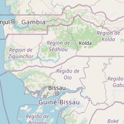
Map view of Orango National Park

Use this park location map to pinpoint Orango National Park in Guinea-Bissau, understand its exact geographic position, and read its mapped placement within the surrounding landscape more clearly.

Pigeon | © OpenStreetMap contributors

Location context for Orango National Park

Bissagos Archipelago
Park atlas

Explore the Regional Geography and Coastal Protected Landscapes Adjacent to Orango National Park's Marine Ecosystem

Discover Nearby Protected Areas and National Parks Surrounding Orango National Park

Explore other national parks and protected areas situated within or near the coastal and island geography surrounding Orango National Park, tracing a wider network of West African conservation landscapes. Comparing these mapped protected areas provides rich geographic context, revealing similar marine environments, mangrove ecosystems, and critical bird habitats across the region.
Marine protected areaBolama Region
About 74 km away#1 closest

Southeast

João Vieira and Poilão Marine National Park: Mapped Marine Protected Area in Bolama Region

Explore protected marine boundaries and regional geography.

João Vieira and Poilão Marine National Park is identified as a crucial marine protected area within the Bolama Region. This atlas-focused entry details its geographic scope and protected status, offering a clear view of its mapped landscape. It serves as a primary reference for understanding the park's specific marine environment and its place within the broader regional geography.

Area
495 km²
Established
2000
IUCN
II
Relief
Lowland
Protected landscapeGuinea-Bissau
About 75 km away#2 closest

North

Cacheu River Mangroves Natural Park: A Protected Landscape of Tidal Wetlands and Mangrove Forests

Explore Guinea-Bissau's largest contiguous mangrove ecosystem and its mapped geographic context.

This natural park protects a unique tidal landscape in Guinea-Bissau, dominated by one of West Africa's most substantial mangrove forests covering 68% of its 886 square kilometer area. The park's intricate network of waterways and mudflats, shaped by the Cacheu River's estuary meeting the Atlantic, offers crucial habitat and coastal protection. Its designation as a Ramsar site underscores its international importance as a wetland, providing a distinct focus for atlas-driven geographic discovery.

Area
886 km²
Established
2000
IUCN
II
Relief
Lowland
National parkGuinea-Bissau
About 103 km away#3 closest

East

Cufada National Park: Guinea-Bissau's National Park Protected Landscape Identity

Mapped geography and protected area context for exploration.

Discover the geographic setting and protected landscape of Cufada National Park, a designated national park in Guinea-Bissau. This destination offers insights into the park's mapped boundaries and its role within the nation's natural terrain, providing valuable context for anyone exploring West African protected areas and regional geography through an atlas lens.

Protected areaGuinea-Bissau
About 103 km away#4 closest

East

Lagoas Cufada Natural Park: Explore Guinea-Bissau's Protected Area Geography and Mapped Landscape

Regional geographic context and protected landscape identity.

Lagoas Cufada Natural Park represents a key protected area within Guinea-Bissau, contributing to the nation's conservation landscape. This entry focuses on its geographic identity, providing users with mapped boundary information and an understanding of its place within the regional geography. It serves as a foundation for exploring the park's specific natural landscape characteristics and its atlas-based significance.

National parkGuinea-Bissau
About 109 km away#5 closest

East

Cantanhez Forests National Park: A Protected Landscape within Guinea-Bissau's Geography

Explore mapped boundaries and regional landscape context.

Cantanhez Forests National Park stands as a notable protected area, providing a specific lens through which to understand the natural geography of Guinea-Bissau. This entry facilitates an atlas-style examination of the park's identity, focusing on its landscape character and its position within the regional geographic framework of West Africa. Delve into the structured information to appreciate the unique protected-area context that Cantanhez Forests National Park contributes to the country's mapped natural heritage.

IUCN
II
Scope
Terrestrial
National parkZiguinchor Region
About 118 km away#6 closest

Northwest

Basse Casamance National Park: National Park with Mapped Boundaries in Ziguinchor Region

Detailed protected landscape and regional geography context.

Basse Casamance National Park serves as a critical protected area, offering users a clear view of its national park designation and its specific geographic location within Senegal. This entity is vital for understanding conservation landscapes and mapped terrain in the Ziguinchor Region. The platform provides structured data on its protected boundaries, allowing for focused atlas exploration and a deeper appreciation of its regional geographic significance without leaving the core park identity.

Area
50 km²
Established
1970
IUCN
II
Climate
Tropical
Nature reserveBoke Region
About 195 km away#7 closest

Southeast

Rio Kapatchez Managed Nature Reserve: Coastal Estuarine Mapping and Protected Area Overview

Tidal wetland geography within the Boke region of Guinea

Examine the protected coastal landscapes of Rio Kapatchez Managed Nature Reserve, a significant wetland system where freshwater river flow merges with Atlantic tidal influences. This reserve provides an essential geographic look at mangrove-rich estuarine environments and the sediment-driven topography of the western Guinean coastline.

Area
200 km²
Established
1992
Relief
Lowland
Scope
Mixed
National parkGambia
About 209 km away#8 closest

North

Kiang West National Park: National Park Detail and Protected Landscape Geography

Explore mapped boundaries and regional context in The Gambia.

Kiang West National Park serves as a crucial point for understanding protected natural areas within The Gambia, West Africa. This national park's identity is rooted in its geographic setting along the Gambia River, offering a distinct landscape context and mapped territory. Users can explore its boundaries and place within the nation's conservation network, contributing to a structured understanding of regional geography and protected lands.

Area
115 km²
Established
1987
IUCN
II
Relief
Lowland

Common questions about visiting, size, designation, and location context for Orango National Park

Orango National Park FAQs for park facts, access, geography, and protected area context

Find quick answers about Orango National Park, including protected-area facts, park geography, trail and visitor context, and how the park fits into its surrounding country and regional landscape.
MoriAtlas Explorer

Continue Your Protected Areas Search Across the Global Atlas

Deepen your exploration by continuing the structured search for national parks and protected areas worldwide. Utilize the comprehensive filtering capabilities to compare different conservation landscapes and refine your understanding of global park geography. Discover more about the distribution and characteristics of protected natural areas.

Global natural geography

