Why Orango National Park stands out
Orango National Park is particularly notable for its extensive mangrove forests, which cover approximately 160 square kilometers and serve as critical breeding and nursery grounds for marine life including fish, molluscs, and sea turtles. The park is also significant as the primary habitat for the endangered African gray parrot in the Guinea-Bissau region, making it an important site for conservation of this threatened species. The combination of island ecosystems with coastal mangroves creates a distinctive protected area in West Africa.
Orango National Park history and protected-area timeline
Orango National Park was officially established on December 1, 2000, representing Guinea-Bissau's commitment to preserving its island biodiversity and coastal marine environments. The park was created as part of the country's efforts to establish a comprehensive protected areas network following independence. Administration falls to the Instituto da Biodiversidade e das Áreas Protegidas da Guiné-Bissau, the national body responsible for managing Guinea-Bissau's protected areas. The establishment of the park recognized the ecological significance of the Bissagos Archipelago's islands and the need to protect the critical mangrove ecosystems that support both marine and terrestrial biodiversity in this coastal region.
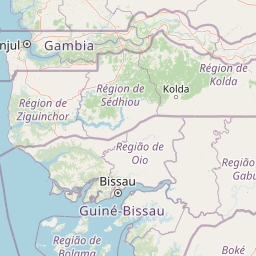
Orango National Park landscape and geographic character
The park encompasses a diverse island landscape characterized by coastal wetlands, extensive mangrove forests, and savanna habitats interspersed with sandy shores. The islands feature a mix of low-lying terrain with swampy wetlands and drier upland areas. Mangrove forests dominate the coastal zones, creating a intricate network of waterways and tidal channels that penetrate deep into the islands' interiors. The surrounding marine environment features shallow coastal waters typical of West Africa's Atlantic coastline, with the 30-meter depth limit defining the marine boundary. This combination of island terrain, mangrove swamps, and shallow marine waters creates a distinctive coastal landscape unlike the more typical continental protected areas found in the region.
Orango National Park ecosystems, habitats, and plant life
The park's ecological character is defined by its mangrove-dominated coastal ecosystems, which cover approximately 160 square kilometers and represent one of the most extensive mangrove systems in the region. These mangrove forests play a crucial role in the park's ecology, supporting complex food webs and serving as critical breeding and nursery areas for numerous marine species. Beyond the mangroves, the island interiors support palm savanna characterized by oil palm trees (Elaeis guineensis), savanna shrubs, and areas of sandy coastline. This habitat mosaic creates diverse ecological niches across the islands, supporting both terrestrial and coastal species. The marine component of the park, with its shallow waters up to 30 meters deep, supports coastal and pelagic fish species, molluscs, and sea turtles that depend on the productive mangrove-influenced waters.
Orango National Park wildlife and species highlights
Orango National Park provides crucial habitat for the endangered African gray parrot (Psittacus erithacus), which is otherwise considered endangered throughout its range in the subregion. The park represents one of the most important remaining strongholds for this threatened species. The extensive mangrove systems support rich marine biodiversity, serving as essential breeding grounds for fish species, molluscs, and sea turtles. The coastal and island habitats also support various other bird species, while the marine waters contain diverse fish populations. The combination of protected island forests, mangrove swamps, and marine waters creates a continuum of habitat that supports multiple wildlife species across different ecological zones.
Orango National Park conservation status and protection priorities
The park holds significant conservation importance for several reasons. The mangrove ecosystems, covering approximately 160 square kilometers, are recognized for their critical role in supporting marine biodiversity, particularly for fish, molluscs, and sea turtles. These mangroves also provide important ecosystem services including coastal protection and carbon sequestration. The park's designation as an IUCN Category II protected area reflects its significance for preserving both terrestrial and marine biodiversity. The protection of the African gray parrot habitat represents a particularly important conservation priority, as this species faces significant threats throughout its range. The park's mixed terrestrial-marine character makes it valuable for protecting interconnected coastal and island ecosystems that would otherwise face development pressures.
Orango National Park cultural meaning and human context
The Bissagos Archipelago has historically been home to traditional island communities whose lives are closely tied to the marine and coastal environment. The park's mangroves and surrounding waters have historically supported fishing communities and traditional resource use. The islands hold cultural significance in the region's history, though detailed information about indigenous communities within the park boundaries is limited in available sources.
Top sights and standout views in Orango National Park
Orango National Park stands out for its combination of island and marine protected landscapes, extensive mangrove forests critical for marine species reproduction, and status as primary habitat for the endangered African gray parrot. The park encompasses five islands with their surrounding waters, creating one of West Africa's most ecologically diverse protected areas. Its designation in 2000 represents Guinea-Bissau's commitment to preserving its unique coastal and island biodiversity.
Best time to visit Orango National Park
The optimal visiting period generally spans from November to April, coinciding with the dry season when conditions are more favorable for wildlife viewing and outdoor exploration. During this period, reduced rainfall provides easier access to island areas and better visibility for observing wildlife, particularly the African gray parrot. The wet season from May to October brings heavier rainfall that can affect travel logistics and wildlife visibility, though the mangroves are at their most lush during this time.