
Rivers
Park geography
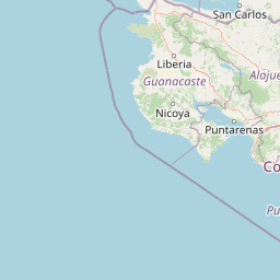
Mapped boundaries, lowland terrain, and regional environmental landscape features.
Comprehensive Geographic Profile of Palo Verde National Park in Guanacaste Province
Examine the detailed geographic structure of Palo Verde National Park within Guanacaste Province. This profile details the 184 square kilometer recorded boundary, the lowland relief, and the interconnected riverine and marsh ecosystems including the Río Tempisque and local peaks.
Related tags
Tropical Dry ForestWetlandsBirdwatchingRamsar SiteMigratory Birds
Central America's last refuge of tropical dry rainforest
Palo Verde National Park
Palo Verde National Park is a protected area in Guanacaste Province, northwestern Costa Rica, situated approximately 30 kilometers west of Cañas. The park encompasses 18,400 hectares of critical habitat within the Tempisque River valley, making it one of the most ecologically significant protected areas in Central America. Established originally as a wildlife refuge in the 1970s and formally designated a national park in 1978, Palo Verde protects what remains of the tropical dry rainforest ecosystem that once dominated the region. This ecosystem is considered the most endangered in the tropics, with less than 0.1 percent of its original extent still intact. The park serves as a vital refuge for migratory waterfowl and supports extraordinary bird diversity, earning recognition as an Important Bird Area by BirdLife International and designation as a Ramsar Wetland of international importance in 1991.
- Location
- Costa Rica
- Park type
- National park
- Established
- 1978
- Area
- 184 km²
Location overview
Regional placement and administrative context in Guanacaste Province
Geographic Setting of Palo Verde National Park within Costa Rica
Palo Verde National Park is situated within Guanacaste Province in northwestern Costa Rica. As a domestic, inland protected area, it contains no marine, coastal, island, or transboundary territory.
- Countries
- Costa Rica
- Regions
- Guanacaste Province
- Primary location
- Costa Rica
- Geographic setting
- Inland
Boundary and coordinates
Palo Verde National Park’s outline covers 184 km²
Palo Verde National Park mapped boundary and 184 km² area
Palo Verde National Park has stored geometry outlining its recorded 184 km² protected footprint on the map. The extent is represented by a combined area, without separate land and marine measurements or a perimeter.
- Boundary area
- 182.5 km²
- Boundary perimeter
- 120.4 km
- Northernmost point
- 10.4475° N
- Southernmost point
- 10.2527° N
- Easternmost point
- 85.2035° W
- Westernmost point
- 85.4106° W
- Geographic centre
- 10.3438° N, 85.3085° W
- North–south span
- 21.5 km
- East–west span
- 22.7 km
Terrain and natural features
Stored lowland classifications and mapped regional features
Palo Verde National Park Terrain and Named Natural Features
Recorded lowland relief classifications encompass multiple rivers, peaks, and viewpoints located within protected boundaries. Linked feature cards provide names, types, measurements, and spatial relationships where recorded.
Selected named natural features
Rivers
Río Cabuya
Viewpoints
La Roca
53 m
Peaks
Cerro La Carreta
132 m
Bays
Gulf of Nicoya
Peninsulas
Nicoya Peninsula
Environmental setting
Tropical lowland relief, major water presence, and partial forest cover
Palo Verde National Park Environmental Classifications and Physical Settings
Stored classifications combine lowland relief, tropical climate parameters, and major water features into a unified profile. Recorded categories connect directly to corresponding protected-area designations within the regional atlas database.
- Relief
- Lowland
- Climate
- Tropical
- Water
- Major water bodies
- Forest cover
- Partial forest
Landscape features
Forest · Wetland · Rivers · Marsh
Habitat types
Temperate broadleaf forest · Wetland · Riverine habitat
Park atlas
Trace Costa Rica's regional park geography; compare other protected areas and wetlands near Palo Verde National Park.
Explore Costa Rica's Protected Areas: Find More National Parks Near Palo Verde National Park
Browse national parks and protected areas geographically connected to Palo Verde National Park, tracing vital wetland ecosystems and tropical dry forests within Costa Rica's Guanacaste Province. A focused view helps you compare diverse conservation landscapes, understand regional ecological spread, and discover adjacent protected habitats in greater detail.
National parkCosta Rica
8.5 km away#1 closest
South

Barra Honda National Park: Costa Rican Protected Landscape and Geographic Atlas
Mapped boundaries and regional park geography.
Barra Honda National Park stands as a notable protected area, offering a distinct geographic profile within Costa Rica. Its designation as a national park underscores its importance for landscape conservation and atlas exploration. This entry details the park's mapped terrain and its contribution to understanding the regional geography, providing a focused view for those interested in protected land distribution and natural context.
- Area
- 23 km²
- Established
- 1974
- IUCN
- II
- Relief
- Mountain
National parkGuanacaste Province
About 28 km away#2 closest
Southwest
Diriá National Park: Protected Landscape Atlas within Guanacaste Province
National Park geographic context and mapped terrain.
Examine Diriá National Park as a distinct protected area within Guanacaste Province. This detailed entry focuses on its geographic identity, mapped boundaries, and natural landscape characteristics. Understand how this national park contributes to the regional atlas, offering a clear view of its protected status and natural terrain features for focused discovery.
- Area
- 28 km²
- Established
- 1991
- IUCN
- II
- Relief
- Mountain
National parkCosta Rica
33 km away#3 closest
Northeast
Miravalles Jorge Manuel Dengo National Park: Costa Rica National Park Geographic Context
Mapped protected landscape and regional park geography.
Miravalles Jorge Manuel Dengo National Park offers a focused lens for understanding protected natural areas within Costa Rica. Explore its specific geographic footprint and the surrounding regional context to appreciate its significance as a mapped protected landscape. This detailed view supports a structured discovery of the park's identity, helping users grasp its place within the national atlas.
- Area
- 43 km²
- Established
- 2019
- IUCN
- II
- Relief
- Mountain
National parkCosta Rica
36 km away#4 closest
Northeast
Tenorio Volcano National Park: National Park Geographic Context in Costa Rica
Map exploration of its volcanic terrain and protected area boundaries.
Delve into Tenorio Volcano National Park, a key national park entity situated within Costa Rica's vibrant geography. This page provides detailed atlas-style information, focusing on the park's mapped boundaries, its characteristic volcanic landscape, and its role in understanding the broader distribution of protected areas across the country. Understand the park's specific geographic identity and its contribution to the nation's natural heritage.
- Area
- 129 km²
- Established
- 1976
- IUCN
- II
- Relief
- Mountain
National parkCosta Rica
41 km away#5 closest
East
Arenal Volcano National Park: Costa Rica National Park Atlas and Mapped Terrain
Detailed geography and protected landscape context for a Costa Rican national park.
Gain a structured understanding of Arenal Volcano National Park, a protected natural area situated in Costa Rica. This page provides detailed geographic information, focusing on its mapped boundaries and landscape characteristics. It serves as a key resource for exploring the park's specific regional context and its role within the country's network of protected lands.
- Area
- 121.24 km²
- Established
- 1991
- IUCN
- II
- Relief
- Mountain
National parkGuanacaste Province
About 43 km away#6 closest
North
Rincón de la Vieja National Park: Costa Rican National Park Atlas Entry
Mapped protected landscape and regional geography.
Gain a structured understanding of Rincón de la Vieja National Park as a key protected area within Guanacaste Province. This detail page offers an atlas-focused perspective, highlighting its mapped boundaries and regional geographic significance. Explore how this national park contributes to the protected landscapes of Costa Rica, providing essential context for geographic discovery.
- Area
- 141.61 km²
- Established
- 1973
- IUCN
- II
- Climate
- Tropical
National parkGuanacaste Province
45 km away#7 closest
Northwest
Santa Rosa National Park: Guanacaste Province National Park Protected Area
Mapped natural landscape and regional geography.
Santa Rosa National Park is a vital protected area within Costa Rica's Guanacaste Province. This detail page offers an atlas-focused view of the park, highlighting its geographic setting and mapped boundaries. It serves as a primary resource for understanding the park's protected landscape identity and its contribution to regional conservation geography, supporting structured exploration for users interested in natural areas.
- Area
- 815.31 km²
- Established
- 1966
- IUCN
- II
- Climate
- Tropical
National parkGuanacaste Province
45 km away#8 closest
West
Las Baulas Marine National Park: Protected Marine Landscape Atlas in Guanacaste Province
Explore its mapped boundaries and regional geographic context.
Las Baulas Marine National Park represents a vital protected marine territory within Costa Rica. This entry offers an atlas-oriented perspective, detailing the park's geographic scope and its specific mapped boundaries. Users can explore its significance as a protected landscape, understand its relationship to the broader regional geography of Guanacaste Province, and utilize this information for structured natural landscape discovery.
- Area
- 175 km²
- Established
- 1991
- IUCN
- II
- Relief
- Mixed relief
MoriAtlas Explorer
Continue Exploring Palo Verde National Park's Mapped Boundaries and Regional Geography
Deepen your understanding of Palo Verde National Park by examining its precise geographic scope and mapped landscape. This focused exploration reveals the park's protected-area identity and its relationship to the surrounding natural terrain within Costa Rica. By analyzing its spatial attributes, you can build a more comprehensive picture of the park's role in the regional geography and its significance as a mapped natural asset.
Browse next
Global natural geography
Explore related park routes
Explore MoriAtlas Global ParksBrowse All MoriAtlas ParksGlobal Park Map DiscoveryMoriAtlas: Browse All CountriesBrowse All MoriAtlas ContinentsNational Park Environment AtlasGrand Canyon National Park AtlasYellowstone National Park AtlasYosemite National Park Atlas and GeographySerengeti National Park AtlasGalápagos National Park Protected LandscapeBanff National Park Geography and AtlasKruger National Park Atlas EntryUluṟu-Kata Tjuṯa National Park AtlasExplore Uluru-Kata Tjuta National Park GeographyPlitvice Lakes National Park AtlasFiordland National Park Protected LandscapeGreat Smoky Mountains National Park AtlasAfghanistan National Parks and Protected AreasAlbania National Parks and Protected AreasAlgeria National Parks and Protected AreasAmerican Samoa National Parks and Protected AreasAndorra National Parks and Protected AreasAngola National Parks and Protected AreasAntarctica National Parks and Protected AreasAntigua and Barbuda Park List