Mori Atlas logo
National parkPapikonda National Park

Discover the mapped boundaries and regional landscape context of this significant protected area.

Papikonda National Park: Andhra Pradesh's National Park Protected Area and Geographic Atlas

Papikonda National Park represents a distinct national park entity within the Andhra Pradesh region, offering a valuable point for atlas-driven geographic discovery. This page details the protected landscape of Papikonda National Park, providing insight into its location and mapped boundaries. Users can begin to understand its place within the regional geography and explore the structured data that defines this protected area as part of a broader map-based exploration.

Eastern GhatsWildlife ConservationNational ParkRiparian EcosystemDeciduous ForestTiger Habitat

Papikonda National Park

National park

Park overview

Structured park overview, official facts, and landscape profile for Papikonda National Park

Papikonda National Park park facts, protected area profile, and essential visitor context

Review the core facts for Papikonda National Park, including designation, size, terrain, visitor scale, habitats, and operating context in one park-focused overview.

About Papikonda National Park

Papikonda National Park occupies a significant position in India's protected area network, representing the ecological diversity of the Eastern Ghats in Andhra Pradesh. The park is situated in the Papi Hills, a series of forested ridges that rise from the Godavari River valley, creating a complex terrain of hills, ravines, and riverine corridors. Following the completion of the Polavaram Dam project, all portions of the park now fall within East and West Godavari districts, fundamentally altering the regional geography and hydrology. The park's location along the Godavari River makes it ecologically significant as a riparian corridor connecting different habitat types. The vegetation ranges from moist deciduous forests in the lower elevations to dry deciduous formations on the drier slopes, supporting a remarkable diversity of plant and animal species. This combination of geographic position, habitat diversity, and species richness makes Papikonda a key conservation area in peninsular India.

Quick facts and research context for Papikonda National Park

Papikonda National Park is located in Andhra Pradesh, India, near the city of Rajamahendravaram. The park covers 1,012.86 square kilometers and was established as a wildlife sanctuary in 1978, gaining national park status in 2008. It lies in the Papi Hills within the Eastern Ghats, with altitude ranging from 20 to 850 meters. The Godavari River flows through the park, which receives approximately 1,168 millimeters of annual rainfall. The park is classified as IUCN Category II and serves as an Important Bird and Biodiversity Area.

Protection and recognition

Documenting the terrestrial management scope and 2008 conservation designation history

Papikonda National Park Protection Status and Official Designation History

Regional protection parameters highlight the terrestrial conservation status established for Papikonda National Park during its designation in 2008. Accessing verified geographic designation details helps geographers trace the official conservation boundaries and legal frameworks of regional forest reserves.

Protection details

Protection scope
Terrestrial
Designated year
2008
Park context

Deeper park guide and search-rich context for Papikonda National Park

Papikonda National Park history, landscape, wildlife, and travel context

Explore Papikonda National Park through its history, landscape character, ecosystems, wildlife, conservation priorities, cultural context, and seasonal travel timing in a structured park guide built for atlas discovery and search intent.

Why Papikonda National Park stands out

Papikonda National Park is best known for its remarkable biodiversity concentrated along the Godavari River basin in the Eastern Ghats. The park provides habitat for Bengal tigers, Indian leopards, and several endangered species of flora and fauna. Its designation as an Important Bird and Biodiversity Area reflects the presence of numerous bird species, including the black-bellied tern, pale-capped pigeon, and yellow-throated bulbul. The Papi Hills themselves form a distinctive landscape of forested ridges and valleys that create diverse microhabitats within the park boundaries.

Papikonda National Park history and protected-area timeline

Papikonda Wildlife Sanctuary was established in 1978, initially protecting the forested hills and wildlife of the Papi Hills region. The area was recognized for its ecological importance and the presence of significant wildlife populations, including large mammals. In 2008, the protected area was upgraded from wildlife sanctuary to national park status, reflecting the growing recognition of its conservation value and providing stronger legal protections. This designation came after years of wildlife survey and documentation work that confirmed the presence of species such as Bengal tigers and other endangered fauna. The park's boundaries were further affected by the construction of the Polavaram Dam, which reshaped the regional landscape and necessitated administrative realignment of the protected area.

Papikonda National Park landscape and geographic character

The landscape of Papikonda National Park is characterized by the rolling hills of the Eastern Ghats, with elevations ranging from 20 meters in the river valleys to 850 meters on the higher ridges. The Godavari River flows through the park, creating a major riparian corridor that influences the distribution of habitats and wildlife. The terrain includes steep slopes, rocky outcrops, and forested valleys that provide diverse microclimates and ecological niches. The annual rainfall of approximately 1,168 millimeters supports the forest ecosystems that cover most of the park area. The Papi Hills form a visually distinctive landscape, with densely forested slopes descending toward the Godavari floodplain.

Papikonda National Park ecosystems, habitats, and plant life

The ecological character of Papikonda National Park is defined by its position in the Eastern Ghats and the presence of the Godavari River. The vegetation consists of moist deciduous and dry deciduous forest types, with tree species including Pterocarpus marsupium, Terminalia elliptica, Terminalia arjuna, Adina cordifolia, Sterculia urens, Mangifera indica, and Anogeissus latifolia. These forest types support complex ecological communities and provide crucial habitat for both forest-dwelling and migratory species. The combination of forest habitats and the river corridor creates a mosaic of ecosystems that supports high biodiversity. The park's designation as an Important Bird and Biodiversity Area acknowledges the significance of these habitats for bird populations.

Papikonda National Park wildlife and species highlights

Papikonda National Park supports a diverse mammalian fauna that includes several species of conservation concern. Large predators present in the park include Bengal tigers and Indian leopards, while smaller carnivores include the rusty-spotted cat, jungle cat, leopard cat, sloth bear, and various civet species. The ungulate community includes spotted deer, sambar deer, Indian muntjac, Indian spotted chevrotain, gaur, nilgai, and four-horned antelope. The park is notable for supporting populations of both rhesus macaques, typically found north of the Godavari, and bonnet macaques, usually found south of the river, making it a zone of ecological overlap. Bird diversity is highlighted by the park's Important Bird and Biodiversity Area status, with species including the black-bellied tern, pale-capped pigeon, yellow-throated bulbul, Oriental darter, and Malabar pied hornbill. Reptiles include the Indian golden gecko, endemic to the Eastern Ghats, and king cobras.

Papikonda National Park conservation status and protection priorities

Papikonda National Park serves as a critical conservation area within the Eastern Ghats, one of India's major mountain ranges and a biodiversity hotspot. The park's designation as an Important Bird and Biodiversity Area recognizes its global significance for bird conservation. It protects habitat for endangered species including Bengal tigers and provides connectivity between forest patches in the Godavari region. However, the park faces significant threats from poaching, forest fires, and agricultural encroachment. The construction of the Polavaram Dam has fundamentally altered the hydrology and ecology of the region, creating ongoing challenges for conservation management. The presence of both rhesus and bonnet macaques suggests the park may serve as a biogeographic transition zone of particular evolutionary significance.

Top sights and standout views in Papikonda National Park

The Papi Hills landscape, the Godavari River corridor, the presence of Bengal tigers and Indian leopards, the Important Bird and Biodiversity Area designation, the mix of moist and dry deciduous forests, the biogeographic overlap zone for primate species, and the endemic Indian golden gecko represent the standout features of Papikonda National Park.

Best time to visit Papikonda National Park

The ideal time to visit Papikonda National Park is during the cooler, dry months from October through March when weather conditions are most comfortable for outdoor exploration. The post-monsoon period from October to November offers lush green landscapes following the seasonal rains, while the winter months provide comfortable temperatures for wildlife viewing. The summer months from April to June can be extremely hot and may limit outdoor activities, though this period may offer better opportunities for spotting wildlife near remaining water sources.

Monthly climate preview

Monthly temperature ranges and precipitation patterns recorded across representative coordinates

Papikonda National Park Climate Normals, Long-Term Temperature and Precipitation

Representative coordinate records show average monthly temperatures ranging from 21.6 °C to 33.21 °C alongside distinct seasonal precipitation shifts throughout the year. Reviewing the complete twelve-month climate profile provides deeper context for long-term meteorological patterns across the park geography.
Annual mean27 °C
22 °C33 °C
Jan23°
Feb26°
Mar30°
Apr33°
May33°
Jun30°
Jul27°
Aug26°
Sep26°
Oct26°
Nov23°
Dec22°
Warmest month
May

33.2 °C

Coolest month
December

21.6 °C

Wettest month
July

7.8 mm/day

Driest month
January

0.3 mm/day

Park location guide

Geography guide, regional context, and park location map for Papikonda National Park

Papikonda National Park park geography, regions, and map view in India

Understand where Papikonda National Park sits in India through a broader geographic reading of the surrounding landscape, nearby location context, and its mapped position within the national park landscape.

How Papikonda National Park fits into India

India is a South Asian country bordered by the Indian Ocean, Arabian Sea, and Bay of Bengal. It shares land borders with Pakistan, China, Nepal, Bhutan, Bangladesh, and Myanmar. The country has a population of over 1.4 billion people and operates as a federal parliamentary republic with its capital in New Delhi.

Wider geography shaping Papikonda National Park in India

India occupies the Indian subcontinent in South Asia, bordered by the Arabian Sea to the southwest, the Bay of Bengal to the southeast, and the Indian Ocean to the south. It shares land borders with Pakistan to the west, China, Nepal, and Bhutan to the north, and Bangladesh and Myanmar to the east. The territory also includes the Andaman and Nicobar Islands in the Indian Ocean.

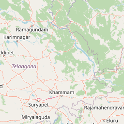
Map view of Papikonda National Park

Use this park location map to pinpoint Papikonda National Park in India, understand its exact geographic position, and read its mapped placement within the surrounding landscape more clearly.

Pigeon | © OpenStreetMap contributors

Location context for Papikonda National Park

Andhra Pradesh
Park atlas

Map the regional geography, connected conservation landscapes, and ecological spread across the Eastern Ghats.

Discover National Parks and Protected Areas Near Papikonda National Park

Explore additional national parks and protected areas located geographically near Papikonda National Park, examining diverse conservation landscapes and ecological corridors. Broaden your understanding of regional park distribution and compare specific features across the Eastern Ghats terrain and Godavari River basin.
Wildlife reserveAndhra Pradesh
About 101 km away#1 closest

South

Kolleru Bird Sanctuary Wildlife Reserve: Protected Wetland and Basin Geography Atlas

Mapped freshwater wetlands in Andhra Pradesh

Kolleru Bird Sanctuary represents an essential protected freshwater basin situated in the deltaic plains of Andhra Pradesh. The area supports a dynamic habitat of open water and reedbed environments that transition through the seasons. This record provides a clear geographic view of the sanctuary, highlighting its role as a key Ramsar-recognized wetland within the regional landscape context.

Area
673 km²
Established
1999
IUCN
IV
Relief
Lowland
Wildlife reserveAndhra Pradesh
About 116 km away#2 closest

Southeast

Coringa Wildlife Sanctuary: Mapping Protected Mangrove Wetlands in Andhra Pradesh

Coastal delta geography and estuarine tidal landscape exploration

Coringa Wildlife Sanctuary represents one of the largest continuous stretches of mangrove forests in India. This protected area along the Godavari Estuary offers a rich study in coastal geography, where complex tidal channels, backwater systems, and deltaic landforms create a unique, sediment-rich wetland environment essential for local avian and aquatic life.

Area
235.7 km²
Established
1978
IUCN
IV
Relief
Lowland
National parkIndia
About 152 km away#3 closest

North

Kanger Ghati National Park: National Park Atlas and Mapped Landscape Identity

Explore Kanger Ghati National Park's protected boundaries and regional geography.

Kanger Ghati National Park stands as a key protected national park entity within India, offering insights into its specific geographic setting and conservation landscape. This page details the park's mapped outlines and its role within the broader atlas of South Asia. Understand the natural terrain and regional context that define this protected area, providing a factual foundation for geographic discovery and landscape appreciation.

Area
200 km²
Established
1982
Relief
Mountain
Climate
Tropical
National parkBijapur district
About 197 km away#4 closest

North

Indravati National Park: National Park Status and Geographic Landscape Context

Explore mapped boundaries and regional geography in Bijapur district.

Indravati National Park represents a significant protected natural area, classified as a national park within India. This entry offers detailed insights into its geographic placement within Bijapur district, emphasizing its mapped protected landscape and its role in regional geography. It serves as a vital point for structured discovery of natural areas and their environmental context.

Area
1,258.37 km²
Established
1981
IUCN
II
Relief
Highland
Wildlife reserveAndhra Pradesh
About 197 km away#5 closest

East

Kambalakonda Wildlife Sanctuary: Mapped Geography and Protected Forest Landscapes

A diverse wildlife reserve in the Eastern Ghats foothills of Andhra Pradesh.

Kambalakonda Wildlife Sanctuary protects an essential patch of East Deccan dry evergreen forest near Visakhapatnam. The hilly topography and varied scrub-meadow ecosystems offer a distinct look at the region's biodiversity within the Eastern Ghats, serving as a primary site for conservation education and ecological study in southern India.

Area
70.7 km²
Established
1970
IUCN
IV
Relief
Upland
Wildlife reserveAndhra Pradesh
About 198 km away#6 closest

South

Krishna Wildlife Sanctuary: Coastal Mangrove Landscapes in the Krishna River Delta

Protected estuarine geography in Andhra Pradesh

Discover the geographic extent and habitat composition of Krishna Wildlife Sanctuary. This protected area features dense mangrove forests and intricate tidal waterways across deltaic islands, serving as an important ecological corridor along the Bay of Bengal coast in Andhra Pradesh.

Area
194.81 km²
IUCN
IV
Relief
Lowland
Scope
Terrestrial
National parkTelangana
About 287 km away#7 closest

West

Mahavir Harina Vanasthali National Park: Detailed Protected Landscape Atlas

Mapped boundaries and regional geographic context in Telangana.

Mahavir Harina Vanasthali National Park offers a unique perspective on protected landscapes within Telangana, India. This entry provides detailed information on the park's mapped boundaries and its significant role in the regional geography of the Deccan Plateau. Engage with structured data to understand its protected-area identity and its contribution to the atlas of South India's natural heritage.

Area
14.59 km²
Established
1975
IUCN
II
Relief
Upland
National parkTelangana
About 326 km away#8 closest

West

Kasu Brahmananda Reddy National Park: Telangana National Park Geographic Atlas

Mapped protected landscapes and regional context in India.

This detail entry for Kasu Brahmananda Reddy National Park provides essential context for understanding its protected landscape identity within Telangana. Explore its mapped boundaries, regional geographic setting on the Deccan Plateau, and discover how this national park contributes to the atlas of protected areas in South India, offering a grounded perspective for geographic exploration.

Area
1.6 km²
Established
1998
Climate
Tropical
Access
Easy access

Common questions about visiting, size, designation, and location context for Papikonda National Park

Papikonda National Park FAQs for park facts, access, geography, and protected area context

Find quick answers about Papikonda National Park, including protected-area facts, park geography, trail and visitor context, and how the park fits into its surrounding country and regional landscape.
MoriAtlas Explorer

Continue Your Protected Areas Search Across the Global Atlas

Deepen your exploration by continuing the structured search for national parks and protected areas worldwide. Utilize the comprehensive filtering capabilities to compare different conservation landscapes and refine your understanding of global park geography. Discover more about the distribution and characteristics of protected natural areas.

Global natural geography