Mori Atlas logo
National parkIndravati National Park

Discover the geographic context and protected landscape of Indravati National Park within Bijapur district.

Indravati National Park: Protected National Park Geography and Mapped Boundaries

(Indravati Tiger Reserve)

Indravati National Park stands as a key protected natural area within India's geography, situated in the Bijapur district. This page provides an atlas-focused exploration of its status as a national park, detailing its mapped boundaries and surrounding landscape context. Understand how Indravati National Park fits into the regional geography, offering a distinct natural area for discovery and geographic study.

tiger reservenational parkwild water buffaloProject Tigertropical deciduous forestcentral India

Indravati National Park

National park

Park overview

Structured park overview, official facts, and landscape profile for Indravati National Park

Indravati National Park park facts, protected area profile, and essential visitor context
Review the core facts for Indravati National Park, including designation, size, terrain, visitor scale, habitats, and operating context in one park-focused overview.

About Indravati National Park

Indravati National Park is located in the Bijapur district of Chhattisgarh, a state in central India that has emerged as an important conservation landscape. The park covers an area of approximately 1,258 square kilometers and derives its name from the Indravati River, which flows from east to west and establishes the park's northern boundary adjacent to Maharashtra state. The terrain is characterized by undulating hilly terrain with moderate elevations, creating a varied landscape of ridges, valleys, and forested slopes. The park was designated as a national park in 1981 and subsequently recognized as a tiger reserve in 1983 under India's Project Tiger initiative, making it one of the earliest tiger reserves in the region. As of 2022, the park has faced challenges related to naxalite activity in the region, which has affected management and access. The park's ecological significance stems from its position in a biogeographic zone that supports tropical deciduous forests and its role as a corridor for wildlife movement between protected areas in central India. The combination of forest types, water resources, and relatively intact habitat makes Indravati an important area for maintaining biodiversity in Chhattisgarh.

Quick facts and research context for Indravati National Park

Indravati National Park is situated in Bijapur district, Chhattisgarh, India, with Jagdalpur as the nearest major city. The park was established as a national park in 1981 and designated as a tiger reserve in 1983. The terrain consists of rolling hills with the Indravati River marking the northern boundary. Vegetation is primarily tropical moist deciduous and dry deciduous forest, with bamboo, sal, and teak as dominant species. The park contains one of the last wild water buffalo populations in India and supports populations of tigers, Asian elephants, gaurs, and numerous other wildlife species.

Park context

Deeper park guide and search-rich context for Indravati National Park

Indravati National Park history, landscape, wildlife, and travel context
Explore Indravati National Park through its history, landscape character, ecosystems, wildlife, conservation priorities, cultural context, and seasonal travel timing in a structured park guide built for atlas discovery and search intent.

Why Indravati National Park stands out

Indravati National Park is best known for protecting one of the last remaining populations of the endangered wild water buffalo, a species that has become increasingly rare across its historic range. The park is also renowned as a Project Tiger reserve, supporting a viable tiger population in the forests of central India. Its combination of tropical deciduous forests, grassland patches, and the Indravati River corridor creates a diverse habitat that supports both large mammals and smaller wildlife species. The park represents one of the most significant conservation areas in Chhattisgarh and serves as a critical stronghold for several threatened species.

Indravati National Park history and protected-area timeline

Indravati National Park was established as a national park in 1981, formalizing the protection of this forested landscape in central India. In 1983, the area was designated as a tiger reserve under Project Tiger, India's flagship conservation program for protecting endangered tigers and their habitats. This dual designation elevated the park's conservation status and brought additional resources for wildlife management and protection. The park became part of a network of protected areas in Chhattisgarh that also includes Udanti-sitanadi Tiger Reserve, creating a connected conservation landscape in the state. Over the years, Indravati has faced various management challenges including security concerns related to naxalite activity in the region, which has periodically affected park operations and accessibility. Despite these challenges, the park has maintained its status as an important conservation area for central India's wildlife.

Indravati National Park landscape and geographic character

The landscape of Indravati National Park is characterized by undulating hilly terrain with elevations ranging from 177 to 599 meters above sea level. The terrain creates a varied topography of rolling hills, valleys, and slopes that drain into the Indravati River and its tributaries. The Indravati River flows from east to west along the park's northern boundary, creating a natural demarcation with the state of Maharashtra and providing important water resources for wildlife. The park's forest cover alternates with grassy clearings and meadows that provide habitat for large herbivores. The overall landscape presents a mosaic of forested ridges and open valleys that characterize the biogeographic region of central India.

Indravati National Park ecosystems, habitats, and plant life

The vegetation of Indravati National Park consists primarily of tropical moist deciduous and dry deciduous forest types. Bamboo dominates significant portions of the forest, creating dense stands that provide cover for numerous species. The park also contains extensive areas of sal forest, along with teak as a prominent tree species. Other notable tree species include lendia, salai, mahua, tendu, semal, haldu, boir, and jamun. The forest structure supports a diverse ecological community, while patches of grassland within the forest matrix provide important foraging habitat for large herbivores including wild water buffalo, chital, barking deer, nilgai, and gaur. The combination of forest types and grassland openings creates a heterogeneous habitat that supports considerable biodiversity.

Indravati National Park wildlife and species highlights

Indravati National Park is home to a remarkable diversity of wildlife, with particular significance attached to its population of wild water buffalo, one of the last remaining populations of this endangered species in India. Large mammals inhabiting the park include the Asian elephant, gaur, nilgai, blackbuck, chausingha, sambar, chital, Indian muntjac, Indian spotted chevrotain, and wild boar. Predatory species include the tiger, leopard, sloth bear, and dhole. Smaller mammals found in the park comprise flying squirrels, porcupines, pangolins, rhesus macaque, and various langur species. The park's diverse mammal community reflects the quality of its habitats and its importance as a conservation area in central India.

Indravati National Park conservation status and protection priorities

Indravati National Park holds significant conservation importance as one of India's Project Tiger reserves and as a critical habitat for the endangered wild water buffalo. The park's designation as a tiger reserve has brought focused attention and resources for protecting large predators and their prey base. The wild water buffalo population represents a conservation priority, as this species has declined dramatically across its historic range and now exists in only a few isolated populations in India. The park's combination of forest habitats, grassland areas, and the Indravati River corridor creates conditions that support viable populations of multiple threatened species. Conservation efforts at Indravati face challenges from regional security issues, but the park continues to function as an important protected area for central India's wildlife.

Indravati National Park cultural meaning and human context

Indravati National Park is located in Bijapur district of Chhattisgarh, a region with indigenous communities whose traditional lands overlap with the protected area. The forest landscape has historically supported local communities who have depended on forest resources for their livelihoods. While the Wikipedia source provides limited detail on specific cultural aspects, the park's location in a region with rich tribal heritage suggests there are historical connections between local communities and the forest landscape. The park's establishment as a protected area has shaped land use in the region and created interfaces between conservation objectives and traditional land use practices.

Top sights and standout views in Indravati National Park

Indravati National Park stands out for protecting one of the last wild water buffalo populations in India, making it internationally significant for this endangered species. As a Project Tiger reserve, it plays a crucial role in tiger conservation in central India. The park's tropical deciduous forests, bamboo groves, and grassland patches create diverse habitats supporting elephants, gaurs, and numerous other species. The Indravati River adds aquatic habitat value and forms a natural boundary feature. The park represents one of the most significant conservation areas in Chhattisgarh and contributes to India's network of protected areas targeting endangered wildlife.

Best time to visit Indravati National Park

The best time to visit Indravati National Park is during the winter months from October through March when temperatures are moderate and wildlife viewing opportunities are favorable. The post-monsoon period brings lush vegetation and improved visibility as the dry season progresses. Summer months from April to June can be extremely hot, making wildlife sightings more difficult as animals seek shade and water sources. The monsoon season from July to September brings heavy rainfall to the region, which can limit access to some areas of the park. Visitors interested in wildlife viewing should plan their trip during the cooler winter months for the most comfortable and productive experience.
Park location guide

Geography guide, regional context, and park location map for Indravati National Park

Indravati National Park park geography, regions, and map view in India
Understand where Indravati National Park sits in India through a broader geographic reading of the surrounding landscape, nearby location context, and its mapped position within the national park landscape.

How Indravati National Park fits into India

India is a South Asian country bordered by the Indian Ocean, Arabian Sea, and Bay of Bengal. It shares land borders with Pakistan, China, Nepal, Bhutan, Bangladesh, and Myanmar. The country has a population of over 1.4 billion people and operates as a federal parliamentary republic with its capital in New Delhi.

Wider geography shaping Indravati National Park in India

India occupies the Indian subcontinent in South Asia, bordered by the Arabian Sea to the southwest, the Bay of Bengal to the southeast, and the Indian Ocean to the south. It shares land borders with Pakistan to the west, China, Nepal, and Bhutan to the north, and Bangladesh and Myanmar to the east. The territory also includes the Andaman and Nicobar Islands in the Indian Ocean.

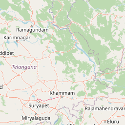
Map view of Indravati National Park

Use this park location map to pinpoint Indravati National Park in India, understand its exact geographic position, and read its mapped placement within the surrounding landscape more clearly.

Pigeon | © OpenStreetMap contributors

Location context for Indravati National Park

Bijapur districtChhattisgarh
Park atlas

Map India's central protected areas, comparing landscapes surrounding Indravati National Park.

Compare Other National Parks and Protected Areas Surrounding Indravati National Park
Continue your exploration of India's protected areas by browsing other national parks and wildlife reserves that share similar central Indian landscapes and conservation goals, expanding beyond Indravati National Park. Compare their mapped geography, regional spread, and diverse ecosystems to trace the full context of protected landscapes in this important biogeographic region.
National parkChandrapur district

Tadoba Andhari Tiger Reserve National Park: Mapped Protected Landscape Discovery

Geographic context within Chandrapur district, India.

Investigate Tadoba Andhari Tiger Reserve as a national park, focusing on its distinct protected landscape characteristics. This detail page provides structured insights into its mapped boundaries and its position within the regional geography of Chandrapur district, essential for a comprehensive understanding of India's protected natural areas.

Area
1,727.59 km²
Established
1955
IUCN
II
Relief
Highland
National parkMaharashtra

Navegaon National Park: Maharashtra's Designated National Park for Atlas Exploration

Mapped protected area and regional landscape context.

Navegaon National Park is a designated national park offering rich opportunities for geographic discovery. Users can delve into its mapped boundaries and understand its protected landscape character within Maharashtra. This page provides structured data for exploring the park's role as a conservation area and its contribution to the natural geography of the region, ideal for atlas-based research.

Area
1,894.94 km²
Established
1975
IUCN
II
Visitors
50K annual
National parkTelangana

Mahavir Harina Vanasthali National Park: Detailed Protected Landscape Atlas

Mapped boundaries and regional geographic context in Telangana.

Mahavir Harina Vanasthali National Park offers a unique perspective on protected landscapes within Telangana, India. This entry provides detailed information on the park's mapped boundaries and its significant role in the regional geography of the Deccan Plateau. Engage with structured data to understand its protected-area identity and its contribution to the atlas of South India's natural heritage.

Area
14.59 km²
Established
1975
IUCN
II
Relief
Upland
National parkMadhya Pradesh

Pench National Park: Madhya Pradesh National Park Protected Landscape Overview

Mapped geographic context and protected area boundaries

Pench National Park is a designated national park situated in Madhya Pradesh, India, offering a distinct protected landscape for geographic study. This entry provides detailed insights into its mapped terrain, allowing for an atlas-style exploration of its protected boundaries and its significance within the regional geography. Understand the park's place in the landscape and its value for conservation-focused map exploration.

Area
292.85 km²
Established
1983
IUCN
II
Relief
Upland
National parkTelangana

Kasu Brahmananda Reddy National Park: Telangana National Park Geographic Atlas

Mapped protected landscapes and regional context in India.

This detail entry for Kasu Brahmananda Reddy National Park provides essential context for understanding its protected landscape identity within Telangana. Explore its mapped boundaries, regional geographic setting on the Deccan Plateau, and discover how this national park contributes to the atlas of protected areas in South India, offering a grounded perspective for geographic exploration.

Area
1.6 km²
Established
1998
Climate
Tropical
Access
Easy access
National parkMadhya Pradesh

Kanha National Park: A Madhya Pradesh Protected Landscape for Atlas Exploration

Mapped park boundaries and regional geographic context.

Kanha National Park serves as a vital protected area, offering critical insights into India's natural geography. This entry facilitates detailed atlas-style exploration of its mapped landscape and protected territory within Madhya Pradesh. Understand the park's geographic definition and its role within the broader context of India's conservation lands, providing a foundation for structured geographic discovery.

Area
940 km²
Established
1955
IUCN
II
Visitors
213.8K annual
National parkTelangana

Mrugavani National Park: Telangana's Protected Area within the Deccan Plateau's Natural Landscape

Explore undulating terrain and tropical dry forest ecosystems.

Mrugavani National Park represents a significant protected landscape within Telangana, India, characterized by its characteristic Deccan Plateau geography. Covering 1,211 acres, this national park features a terrain of rocky outcrops and undulating topography supporting a tropical dry deciduous forest ecosystem. It serves as a critical refuge for native flora and fauna, including a notable population of spotted deer, and offers a valuable case study in regional conservation and mapped protected areas near urban centers.

Area
4.9 km²
Established
1994
IUCN
II
Relief
Upland
National parkMadhya Pradesh

Ghughua Fossil Park National Park: Mapped Geography and Protected Area Context in Madhya Pradesh

Explore the mapped boundaries and regional landscape of Ghughua Fossil Park.

Ghughua Fossil Park stands as a designated national park within the expansive geography of Madhya Pradesh, India. This resource facilitates a detailed exploration of its protected landscape, offering insights into its geographic setting and the significance of its mapped boundaries. Understand the park's place within the regional atlas and its role as a key conservation territory.

Area
0.3 km²
Established
1983
IUCN
II
Access
Access unknown

Common questions about visiting, size, designation, and location context for Indravati National Park

Indravati National Park FAQs for park facts, access, geography, and protected area context
Find quick answers about Indravati National Park, including protected-area facts, park geography, trail and visitor context, and how the park fits into its surrounding country and regional landscape.
MoriAtlas Explorer

Continue Your Protected Areas Search Across the Global Atlas

Deepen your exploration by continuing the structured search for national parks and protected areas worldwide. Utilize the comprehensive filtering capabilities to compare different conservation landscapes and refine your understanding of global park geography. Discover more about the distribution and characteristics of protected natural areas.

Global natural geography