
Mori Atlas logo
National parkParc national de la Pendjari

A critical transboundary protected area defined by sandstone plains, quartzite ridges, and riparian riverine corridors.

Parc national de la Pendjari: Mapping Protected Savanna Landscapes and Atacora Mountain Geography

Parc national de la Pendjari serves as a centerpiece of the W-Arly-Pendjari transboundary complex, encompassing a vast Sudano-Sahelian ecosystem within the Atacora Department. This protected landscape is shaped by the permanent Pendjari River and the dramatic southern quartzite ridges of the Atacora Mountains, creating a distinct mosaic of savanna, gallery forests, and seasonally flooded marshlands. The mapped geography highlights a region where flat sandstone peneplains intersect with complex riparian networks, providing a vital habitat structure for West African savanna wildlife.

West AfricaBeninnational parksavannaSudano-Sahelian ecosystemswildlife reserve

Parc national de la Pendjari

National park

Park overview

Structured park overview, official facts, and landscape profile for Pendjari National Park

Pendjari National Park park facts, protected area profile, and essential visitor context

Review the core facts for Pendjari National Park, including designation, size, terrain, visitor scale, habitats, and operating context in one park-focused overview.

About Pendjari National Park

Pendjari National Park is the premier wildlife reserve of Benin and one of the most important conservation areas in West and Central Africa. Located in the country’s extreme northwest, in the Atacora department, it spans the communes of Tanguiéta, Matéri and Kérou and runs along the frontier with Burkina Faso. From this position it anchors the larger W-Arly-Pendjari (WAP) transfrontier conservation landscape, which links protected areas in Benin, Burkina Faso, Niger and Togo into a single ecological continuum covering tens of thousands of square kilometers. Within that landscape, Pendjari serves as the Benin core area of a UNESCO Biosphere Reserve first designated in 1986 and a UNESCO World Heritage Site since 2017.

The park’s geography gives it a strong sense of place. Most of its surface is a flat sandstone and shale peneplain between about 105 and 200 meters in elevation, but to the south the land rises sharply into the quartzite ridges of the Atacora chain, which reach around 400 to 513 meters, with a subsidiary ridge, the Buem, running inside the park itself. Because the underlying rocks are largely impermeable, much of the plain becomes waterlogged in the rainy season and dotted with permanent and seasonal pools. The Pendjari River, which crosses the park for roughly 200 of its 300 kilometers, is the only truly permanent watercourse; it regularly dries up in sections during the dry months, except for a handful of year-round pools, of which Mare Bali, lying in open savanna at the center of the park, is the most celebrated for wildlife viewing.

Ecologically, Pendjari encompasses Sudano-Sahelian savanna in unusually good condition. Some 241 plant species distributed across 53 families have been recorded, arranged in a mosaic of riverine forest, gallery forest, dry dense forest, open woodland, various savanna types, and marshy savanna. Characteristic trees along the river and the Atacora escarpment include African baobab, African birch (Anogeissus leiocarpus), shea (Vitellaria paradoxa) and néré (Parkia biglobosa), some of which signal long-standing human presence in the landscape prior to the creation of the reserve.

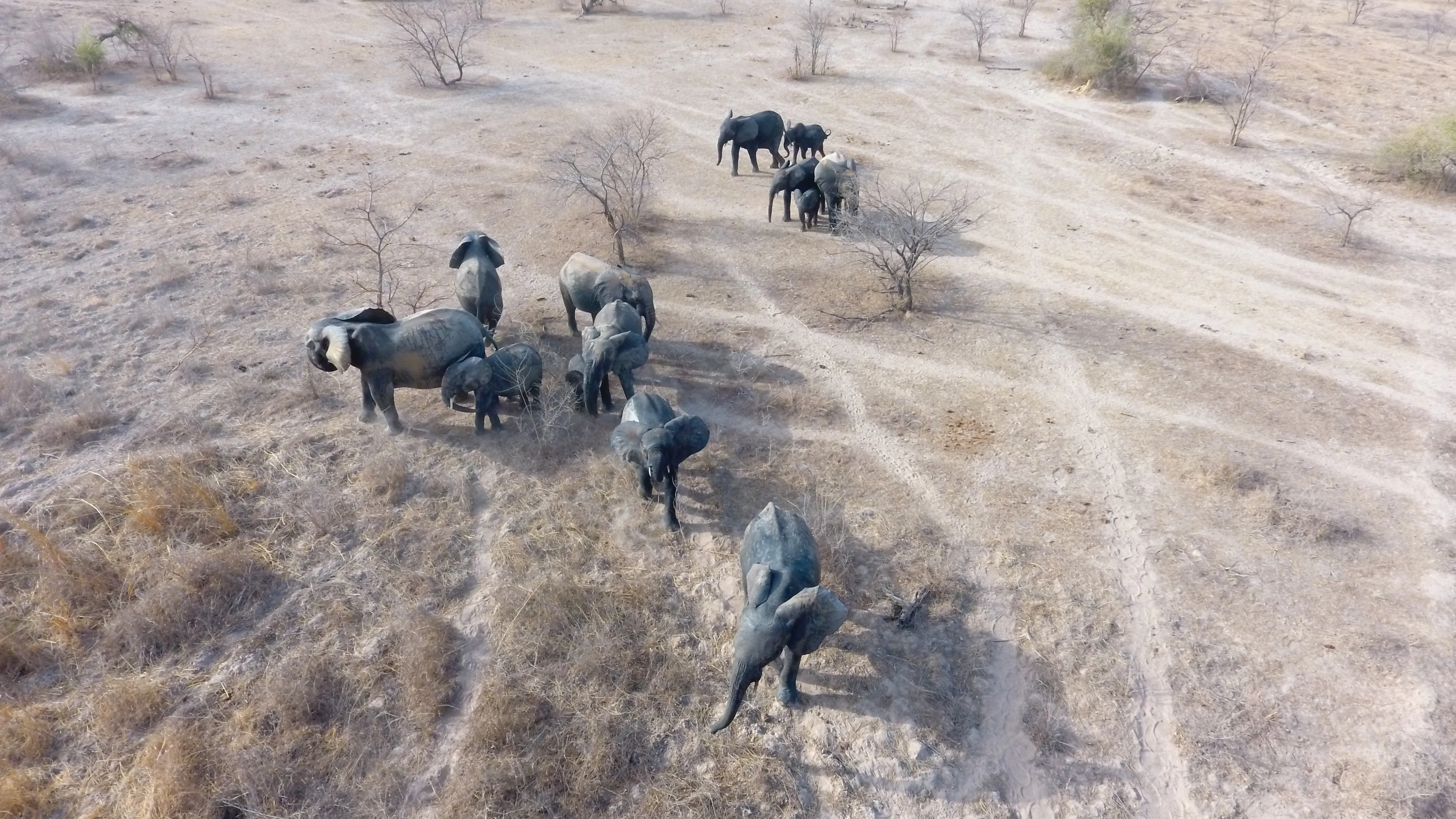
The park’s wildlife profile is what gives Pendjari its international reputation. Healthy populations of African elephants and hippopotamus are present, alongside large herds of African buffalo and a rich assemblage of antelopes including topi (damalisque), roan antelope, Buffon’s kob, Defassa waterbuck, hartebeest and various smaller species. Carnivores are well represented: lions, leopards, spotted hyenas, jackals and African wild dogs, with cheetahs inhabiting the more open grasslands along the Pendjari River; the cheetah is emblematic of the park and Pendjari’s lions are notable for males that often lack full manes. Birdlife includes raptors such as bateleurs, tawny eagles and hooded vultures, large waders such as the goliath heron, and many smaller passerines and kingfishers associated with the wetlands and river. Reptiles, amphibians and a wide insect fauna complete one of the most balanced savanna ecosystems remaining in West Africa.

Quick facts and research context for Pendjari National Park

Pendjari National Park lies in northwestern Benin within the communes of Tanguiéta, Matéri and Kérou, in the Atacora department, directly along the border with Burkina Faso. It is the core of the Pendjari Biosphere Reserve and the larger W-Arly-Pendjari (WAP) transboundary complex, which also includes reserves in Burkina Faso, Niger and Togo, together covering roughly 50,000 square kilometers. The park itself covers several thousand square kilometers and has been managed in partnership with African Parks since 2017. It is a UNESCO Biosphere Reserve since 1986 and a World Heritage Site since 2017, recognized under natural criteria (ix) and (x), meaning its ecological processes and biodiversity are considered outstanding at a global level.

Protection and recognition

Examine terrestrial protection scope, designation year, and formal recognition records.

Parc national de la Pendjari Protection Status and Mapped Designation History

Terrestrial protection status for Parc national de la Pendjari covers documented designation records established in 2017. Official protection history provides essential context for analyzing regional conservation frameworks and management scopes.

Protection details

Protection scope
Terrestrial
Designated year
2017
Transboundary protection
No
WDPA ID
597
Park context

Deeper park guide and search-rich context for Pendjari National Park

Pendjari National Park history, landscape, wildlife, and travel context

Explore Pendjari National Park through its history, landscape character, ecosystems, wildlife, conservation priorities, cultural context, and seasonal travel timing in a structured park guide built for atlas discovery and search intent.

Why Pendjari National Park stands out

Pendjari is best known as one of the last and largest strongholds of West African savanna wildlife, especially for its viable populations of elephants, hippopotamus, buffalo and lions, and above all for its cheetahs, which are the park’s emblem species and are relatively easy to observe in the open grasslands along the Pendjari River. It is equally known for being part of the W-Arly-Pendjari complex, the single most important transfrontier protected landscape in West Africa, and for its dramatic scenery where flat sandstone plains meet the quartzite ridges of the Atacora Mountains and the permanent waters of the Pendjari River.
Pendjari National Park history and protected-area timeline

The history of Pendjari National Park dates back to the colonial era, when the area was first used as a hunting ground by the French administration. In 1954 it was given formal protection as a partial fauna reserve in the Pendjari loop, then upgraded to a total fauna reserve the following year; the Pendjari and Atacora game zones were created in 1959. In 1961 the reserve became Pendjari National Park, the foundation of the present-day protected area.

A new layer of recognition came in 1986, when UNESCO designated the Pendjari Biosphere Reserve under its Man and the Biosphere programme. The biosphere reserve encompasses the park itself as well as surrounding hunting zones and a buffer zone, and later became the foundation for a much larger transfrontier initiative. In 1996 Benin established the Centre National de Gestion des Réserves de Faune (CENAGREF) to manage both the Pendjari and W protected areas, accompanied at the same time by the creation of village associations (AVIGREF) that link surrounding communities to reserve management.

In 2007 the Pendjari River valley was recognized as a wetland of international importance under the Ramsar Convention. In 2009 Benin formally submitted a candidacy file to UNESCO for World Heritage status, which was ultimately successful on 7 July 2017, when the park was inscribed as part of the W-Arly-Pendjari transnational World Heritage Site, acknowledging the area’s outstanding ecological processes and biodiversity under natural criteria (ix) and (x). In October 2020 the Pendjari Biosphere Reserve merged with neighbouring biosphere reserves in Burkina Faso and Niger to create the WAP transboundary biosphere reserve, covering more than 94,000 square kilometers.

A particularly important chapter began in 2017, when the government of Benin signed a partnership with African Parks to rehabilitate Pendjari, with the stated aim of roughly doubling wildlife populations within a decade, developing responsible tourism, strengthening the park’s profile as a destination, and delivering conservation-linked economic and social benefits to local communities. A major funding partnership of about 23 million US dollars was announced in January 2018, bringing in supporters such as the Wyss Foundation, National Geographic Partners and the Wildcat Foundation. The park was also affected by regional insecurity: on 1 May 2019 two French tourists were kidnapped inside the park by a jihadist group, after which the French foreign ministry formally advised against travel to the area, classifying the park as a red zone.

Pendjari National Park landscape and geographic character

The landscape of Pendjari is defined by a striking contrast between flat plains and abrupt mountain edges. Most of the park sits on a sandstone and shale peneplain whose elevation varies between roughly 105 and 200 meters; because the bedrock is largely impermeable, the plain becomes heavily waterlogged in the rainy season and remains dotted with pools and marshes well into the dry period. To the south, the plain is bounded by the quartzite chain of the Atacora, which climbs to between approximately 400 and 513 meters and gives the landscape its dramatic southern skyline. A second, smaller ridge called the Buem runs roughly parallel to the Atacora within the park itself, adding further vertical relief.

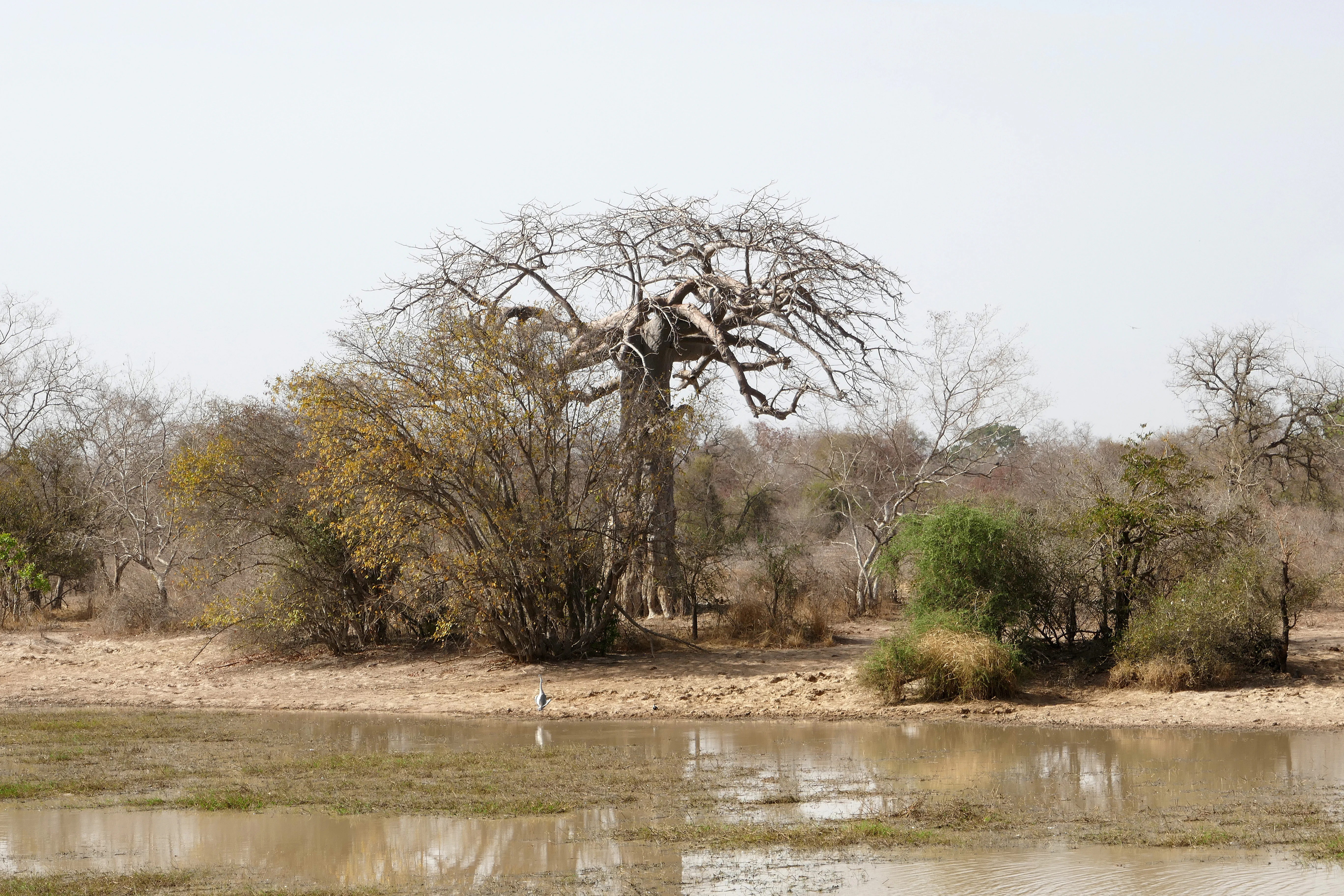
Water shapes the scenery at least as much as the rocks do. The Pendjari River, the only permanent surface water in the park, flows through the area for around 200 of its roughly 300 kilometers, carving the landscape along the northern and eastern boundaries. During the dry season it breaks into a series of pools, but several key waterbodies remain wet year round. Among these, Mare Bali in the central savanna is the most important for wildlife viewing; other notable pools and marshes include Mare Sacrée, Yangouali, Tiabiga, and Diwouni. Together with the gallery forests that follow the river and the seasonal flooding on the plain, these wetlands create a park that feels greener and more dynamic than the surrounding Sahel.
Pendjari National Park ecosystems, habitats, and plant life

Pendjari protects a remarkably intact mosaic of Sudano-Sahelian vegetation. Around 241 species of vascular plants in 53 families have been recorded on the site, distributed across seven to nine main vegetation formations depending on classification. These include riverine forests dominated by species such as Parinari congensis and Pterocarpus santalinoides, gallery forests of Khaya senegalensis and Vitex chrysocarpa along the waterways, dry dense forests of Anogeissus leiocarpus and Diospyros mespiliformis, open woodlands with Daniellia oliveri, wooded savanna rich in Combretum and Pterocarpus erinaceus, and various open savanna types ranging from tree savanna down to shrub and saxicolous savanna. Seasonally flooded marshy savanna, often featuring Terminalia macroptera, Mitragyna inermis and Acacia sieberiana, occupies the lowest, wettest areas of the plain.

Beyond its native vegetation, the landscape carries traces of older human use. Along the Pendjari River and the Atacora cliffs, mature specimens of African baobab (Adansonia digitata), African birch (Anogeissus leiocarpus), shea (Vitellaria paradoxa) and néré (Parkia biglobosa) indicate sites of former villages and fields, predating the reserve and lending the park a subtle cultural-vegetation overlap with the surrounding Atacora region. The combination of permanent water, varied soils and a wide gradient from valley bottom to rocky ridge gives Pendjari an unusually complete spectrum of West African Sudano-Sahelian habitats within a single protected landscape.
Pendjari National Park wildlife and species highlights

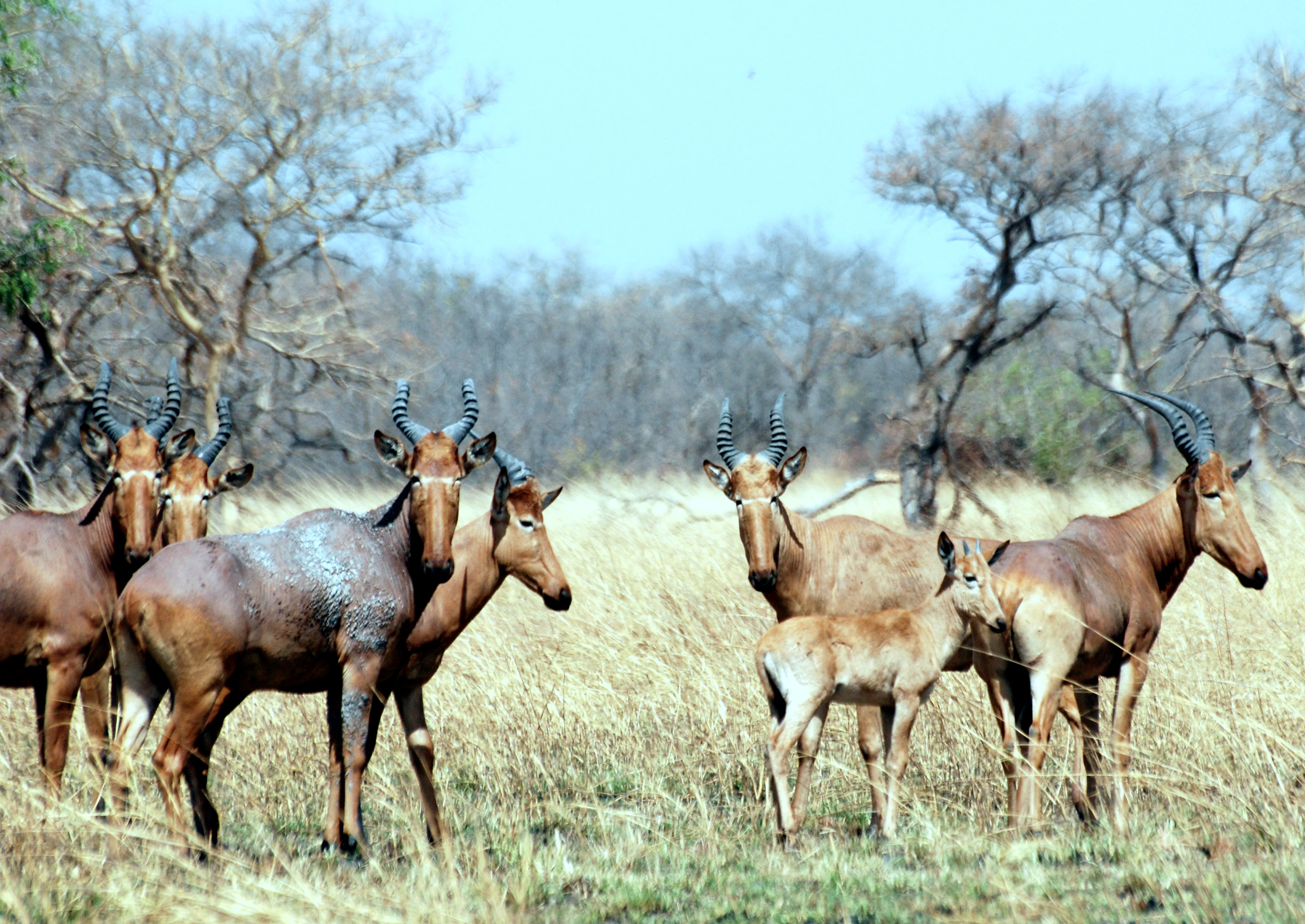
The wildlife of Pendjari is what distinguishes it from most other protected areas in West Africa. Among the large herbivores, African elephants are a major attraction, representing the West African savanna elephant, whose tusks tend to be slightly shorter than those of East African populations. Hippopotamus are abundant in the river and larger pools, while African buffalo form large herds, especially around the permanent marshes. The antelope community is exceptionally rich: topi (often called damalisque in French sources), roan antelope, Buffon’s kob, Defassa waterbuck (also called sing-sing), hartebeest and various smaller species occupy different combinations of savanna and wetland.

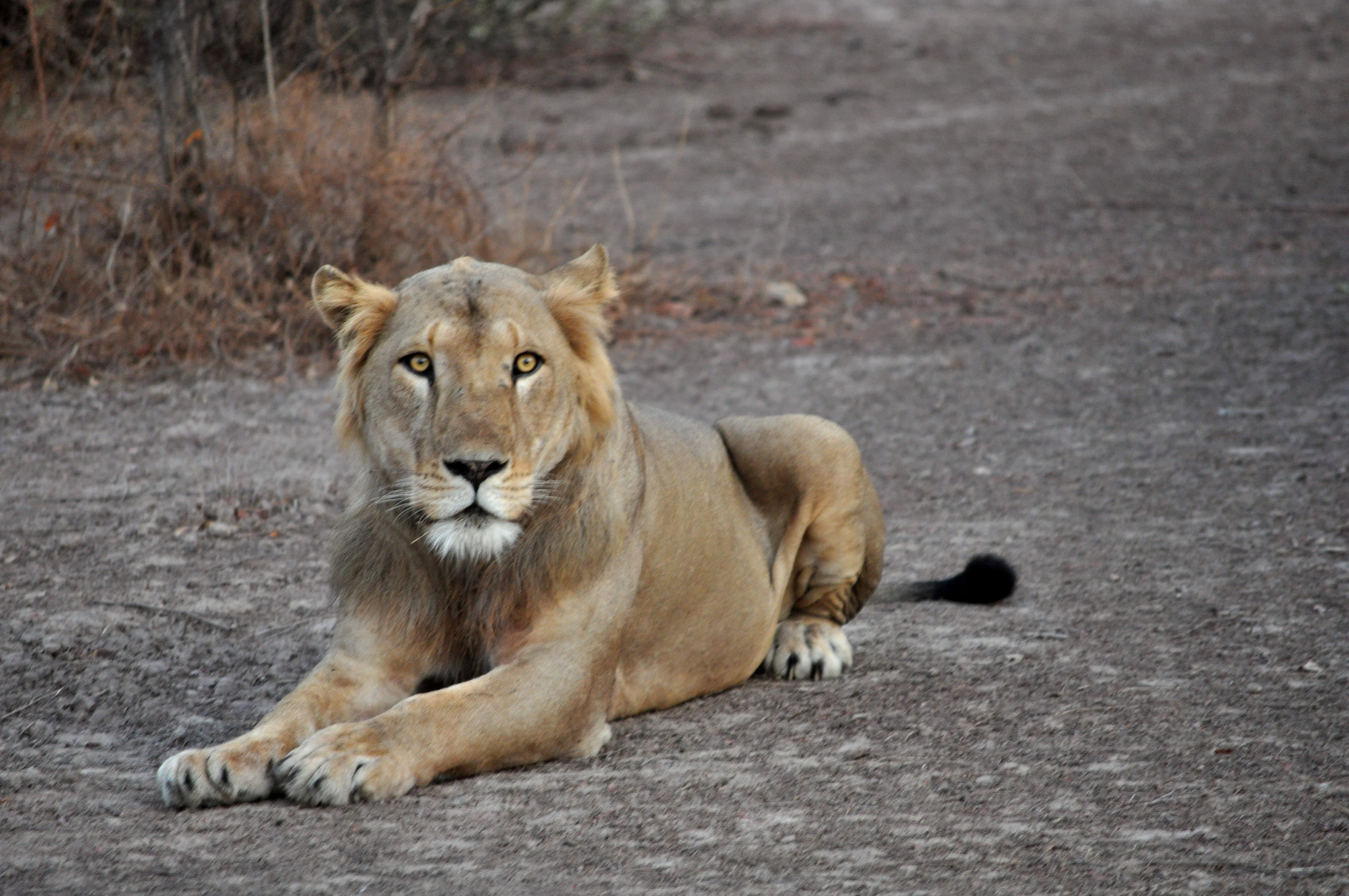
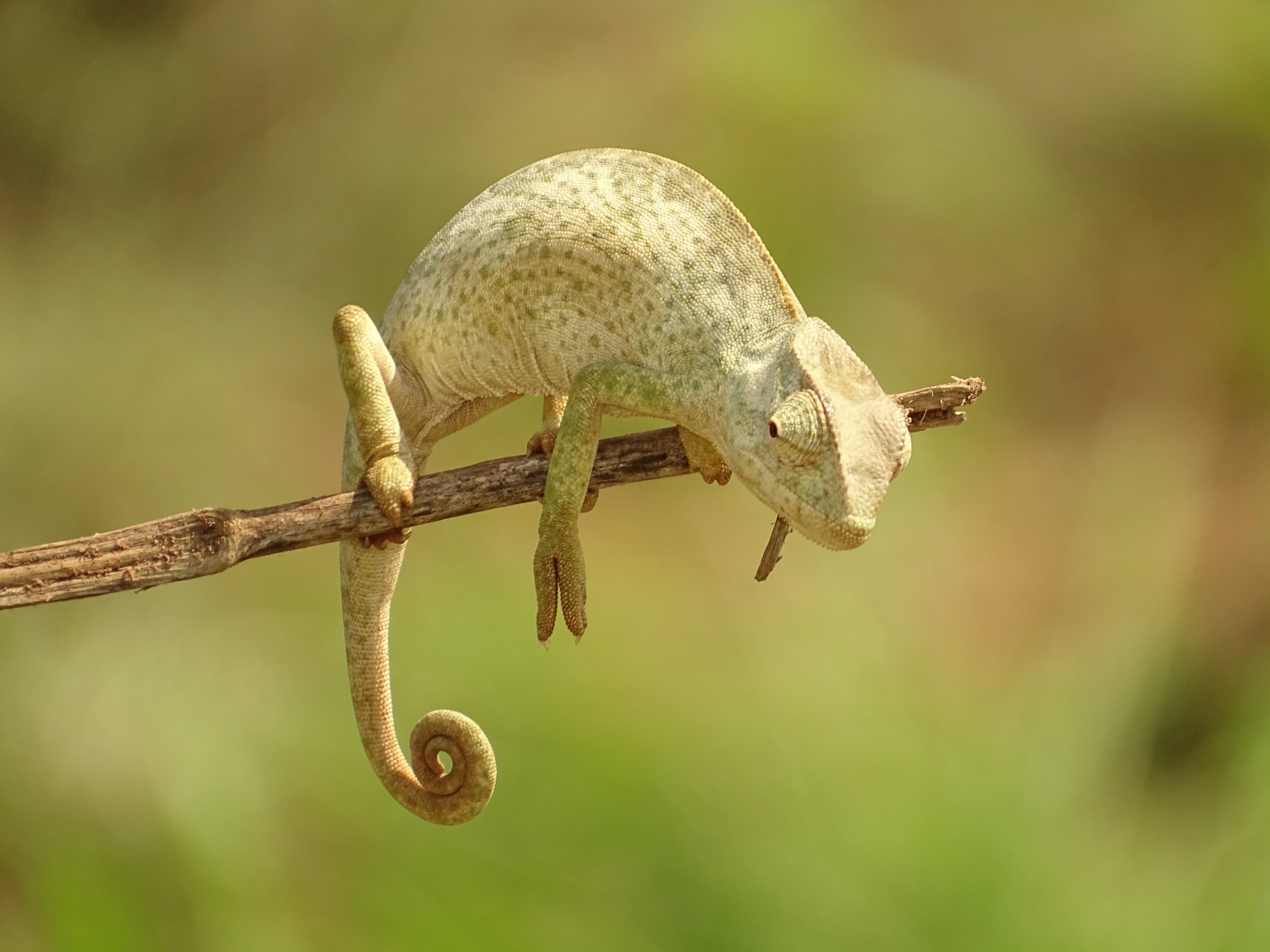
Carnivores are equally well represented. Lions are present in smaller numbers than in some East African parks, with roughly fifty individuals, which is thought to reflect competition from a large suite of other predators. Pendjari’s lions are notable among West African populations for the near absence of manes in adult males. Leopards, spotted hyenas, jackals and African wild dogs share the landscape with the cheetah, which is the park’s emblem species and is most often seen in the open grasslands along the Pendjari River. Reptiles are diverse, with Nile crocodiles, Nile monitors, Senegalese chameleons and agama lizards recorded, alongside a range of frogs and toads associated with the seasonal pools.

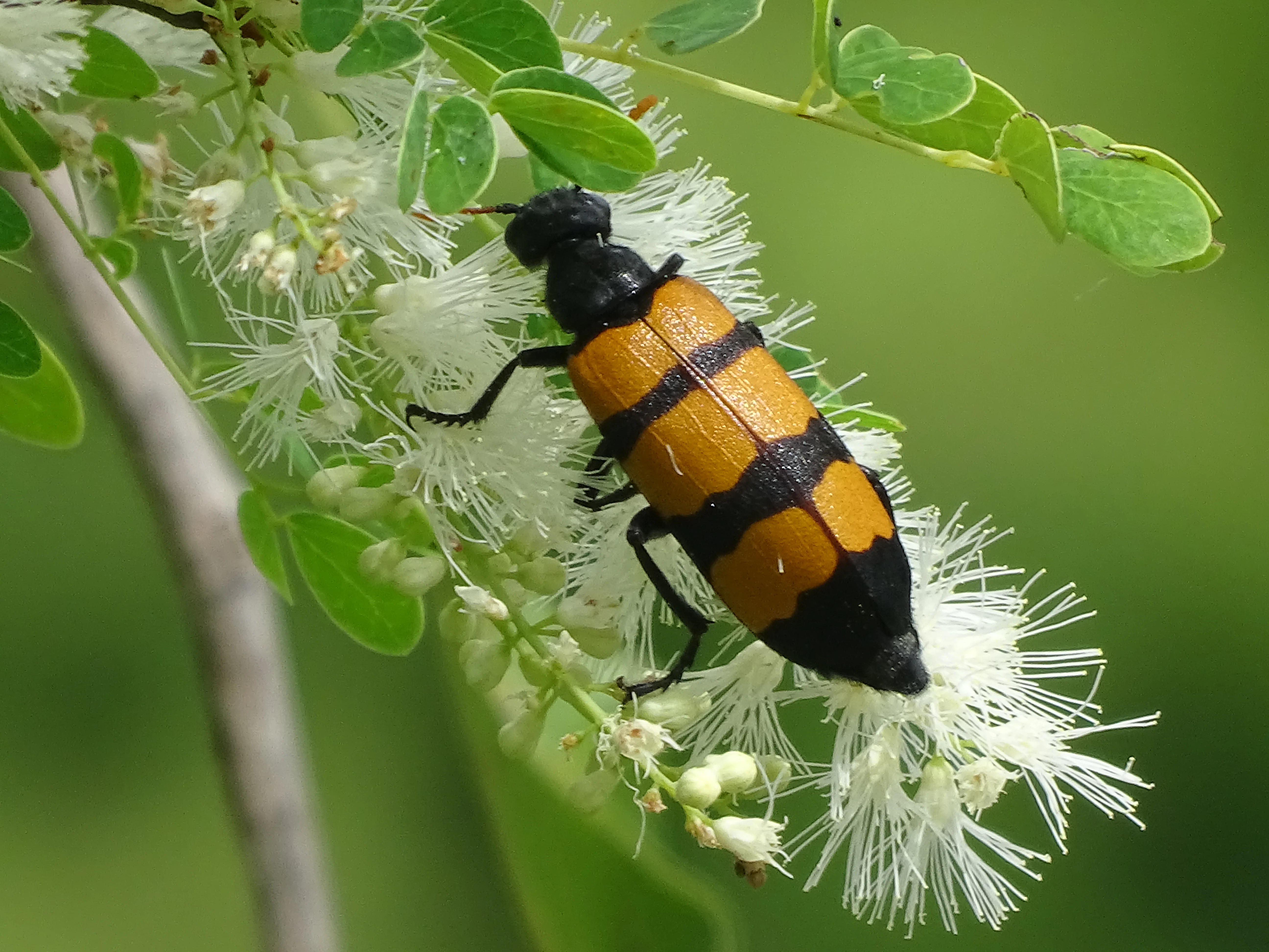
Birdlife is rich and varied. The mix of open savanna, riverine forest and permanent wetlands supports raptors such as bateleurs, tawny eagles and hooded vultures, large wading birds including goliath herons, as well as Abdim’s storks, pied kingfishers and small finches such as the red-cheeked cordon-bleu. Pollinators and other insects, including butterflies such as Cyligramma latona and Acraea caecilia, round out one of the most complete and least-degraded savanna faunas left in West Africa.
Pendjari National Park conservation status and protection priorities

Pendjari stands at the heart of one of West Africa’s most ambitious conservation stories. It is the core of the Pendjari Biosphere Reserve, designated by UNESCO in 1986, and since 2017 it has been part of the W-Arly-Pendjari World Heritage Site, recognized for both its ecological processes (criterion ix) and its outstanding biodiversity (criterion x). In 2020 the Pendjari biosphere reserve merged with neighbouring reserves in Burkina Faso and Niger to form the WAP transboundary biosphere reserve, a single conservation landscape of more than 94,000 square kilometers.

On the ground, CENAGREF, created in 1996, has long managed the park alongside the W reserve and has worked with village associations (AVIGREF) to involve local communities in protection. Assessments by CENAGREF describe Pendjari and its hunting zones as the least-degraded of Benin’s protected areas, with flora still intact and a fauna that, while reduced, is not yet critically threatened. The park’s relatively low human population density and low demographic pressure have helped keep the ecosystem resilient.

Since 2017, the government of Benin and African Parks have run a partnership rehabilitation program aimed roughly at doubling wildlife populations within a decade, restoring key species, developing responsible tourism and channeling conservation benefits to surrounding communities. Major partners include the Wyss Foundation, National Geographic Partners and the Wildcat Foundation, with a roughly 23 million US dollar support package announced in 2018. By the end of 2020, GPS collars were being fitted to elephants and antelopes with UNESCO support to track movements and reduce human-wildlife conflict. At the same time, the park faces external pressures: agricultural and pastoral encroachment at its edges, poaching in the surrounding hunting zone, and regional insecurity, exemplified by the 2019 kidnapping of two French tourists, which has periodically affected the climate for tourism and visitor access.

Pendjari National Park cultural meaning and human context

While Pendjari is primarily a natural protected area, its landscape carries a long human history. Mature baobabs, shea trees, néré and other useful species along the Pendjari River and the Atacora cliffs mark the sites of former villages and cultivated fields, showing that the area was inhabited and used before the colonial-era hunting reserve was established. Today, local communities in Tanguiéta, Matéri and Kérou continue to live around the park, and the 1996 creation of AVIGREF, the village associations for reserve management, reflects a long-standing effort to integrate the surrounding rural population into conservation decision-making rather than exclude it. The park is also an important symbol of Beninese and West African regional identity, representing the country’s strongest remaining natural heritage landscape and a cornerstone of transboundary cooperation with Burkina Faso and Niger.
Top sights and standout views in Pendjari National Park

Pendjari’s principal highlight is its sheer quality as a West African savanna reserve: large concentrations of elephants, hippopotamus and buffalo, a full carnivore guild with cheetah as the emblem species, and unusually intact Sudano-Sahelian vegetation within a single protected landscape. The dramatic geography, with flat sandstone plains abruptly meeting the Atacora quartzite ridges and the permanent waters of the Pendjari River and pools such as Mare Bali, gives the park a striking visual character unusual in the region. Combined with its status as part of a UNESCO World Heritage Site and Biosphere Reserve and its transboundary role at the heart of the W-Arly-Pendjari complex, Pendjari offers one of the most complete and ecologically significant wildlife experiences still possible in West Africa.
Best time to visit Pendjari National Park

Park conditions follow a clear three-season rhythm. The rainy season runs from around mid-May to October and brings annual rainfall of roughly 1,000 to 1,100 millimeters, turning the plain into a mosaic of flooded grasslands and filled pools; access can be more difficult but the landscape is at its greenest. From November to February a cool, dry season dominated by the harmattan brings clearer days and easier travel, while March to mid-May is hotter and drier, with temperatures sometimes reaching up to 40 °C, when wildlife concentrates progressively around the remaining water sources. For general viewing, the early dry season offers a balance of good access, milder temperatures and reliable concentrations of animals at permanent water, while the later dry months concentrate wildlife even more tightly but bring greater heat and dust.

Monthly climate preview

Long term temperature and precipitation patterns across twelve months

Parc national de la Pendjari Climate Normals and Weather by Month

Representative coordinates record distinct monthly variations in average temperature and precipitation across the protected landscape. Examining the full twelve month climate profile reveals complete seasonal weather patterns and long term atmospheric normals.
Annual mean27 °C
25 °C31 °C
Jan25°
Feb28°
Mar31°
Apr31°
May30°
Jun28°
Jul26°
Aug26°
Sep26°
Oct27°
Nov27°
Dec25°
Warmest month
April

31.4 °C

Coolest month
December

24.9 °C

Wettest month
August

8.8 mm/day

Driest month
December

0 mm/day

Park location guide

Geography guide, regional context, and park location map for Pendjari National Park

Pendjari National Park park geography, regions, and map view in Benin

Understand where Pendjari National Park sits in Benin through a broader geographic reading of the surrounding landscape, nearby location context, and its mapped position within the national park landscape.

How Pendjari National Park fits into Benin

Benin is a West African nation formerly known as Dahomey. It gained independence from France in 1960 and operates as a unitary presidential republic. The country is known for its coastal location along the Bight of Benin, its historical kingdom of Dahomey, and its agricultural economy centered on palm oil and cotton exports.

Wider geography shaping Pendjari National Park in Benin

Benin is located in West Africa, bordered by Togo to the west, Nigeria to the east, Burkina Faso to the northwest, and Niger to the northeast. The country occupies the southern coastline of the Bight of Benin, which is part of the Gulf of Guinea in the northernmost tropical portion of the Atlantic Ocean. The terrain ranges from coastal plains to hilly uplands in the north.

Map view of Pendjari National Park

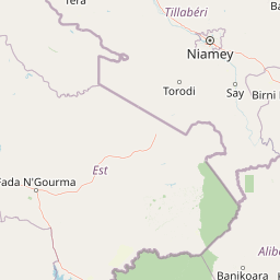
Use this park location map to pinpoint Pendjari National Park in Benin, understand its exact geographic position, and read its mapped placement within the surrounding landscape more clearly.

Pigeon | © OpenStreetMap contributors

Location context for Pendjari National Park

Atacora Department
Park atlas

Compare regional savanna reserves and transboundary conservation areas across West Africa

Parks Near Parc national de la Pendjari and Surrounding Protected Landscapes

Visitors exploring Parc national de la Pendjari can browse adjacent savanna reserves and connected protected areas across the Atacora region. Extending the geographic scope allows researchers and travelers to compare regional park boundaries and wetland ecosystems.
National parkBenin
Park boundaries overlap#1 closest

South

Pendjari National Park: Mapping Benin's Primary Protected Savanna Ecosystem and Wilderness

Located in northwestern Benin, bordering the WAP transboundary complex.

Pendjari National Park represents a significant conservation landscape in West Africa, featuring a complex geography of river-fed riparian forests, sprawling savanna plains, and the high-elevation cliffs of the Atakora mountain range. This protected area offers a look into an intact savanna wilderness, serving as a vital sanctuary for large mammals and diverse bird species within its clearly defined boundaries.

Area
2,755 km²
IUCN
II
Relief
Highland
Climate
Subtropical
National parkNiger
Park boundaries overlap#2 closest

Northeast

W National Park: Niger National Park, UNESCO World Heritage Site & Ramsar Wetland

Transborder savanna ecosystem and dramatic Niger River landscape.

W National Park in Niger offers a unique atlas view of a vast protected landscape defined by the Niger River's iconic W-shaped bend. As a UNESCO World Heritage Site and Ramsar Wetland, it protects crucial savanna plains, extensive floodplains, and rocky outcrops. This transborder conservation area is a vital habitat for West African wildlife, providing a rich context for geographic discovery and landscape exploration.

Area
10,000 km²
Established
1954
IUCN
II
Relief
Mixed relief
National parkTapoa Province
About 11 km away#3 closest

North

Arli National Park National Park: Mapped Protected Landscape in Tapoa Province

Explore its geographic context and boundaries.

Arli National Park stands as a critical protected area, identified as a national park within Tapoa Province. This detail page serves as an atlas-focused entry point to understanding the park's unique landscape characteristics and its precise geographic location. Users can investigate its mapped boundaries and explore how it fits into the regional geography, offering a foundational understanding for protected-area discovery.

Area
760 km²
Established
1954
IUCN
IV
Relief
Upland
National parkBenin
About 39 km away#4 closest

East

Parc national du W du Benin: Regional Geography and Protected Savanna Landscapes

Northern Benin flagship protected area and transboundary conservation hub.

Located in northern Benin, Parc national du W du Benin provides a unique window into the Sudano-Sahelian zone. The park features a mosaic of riverine gallery forests along the Mékrou and Alibori rivers, stretching across open Sudanian savannas to meet the rugged edges of the Atacora mountains. This protected area stands as a central pillar in the WAP complex, offering a clear map of interconnected wildlife habitats and significant ecological corridors in West Africa.

Area
5,632.8 km²
Established
1950
IUCN
II
Relief
Upland
Protected areaBenin
About 42 km away#5 closest

East

Complexe W-Arly-Pendjari: Regional Geography and Transboundary Protected Landscapes

Sudano-Sahelian savanna and riverine conservation corridors.

As a massive transboundary conservation area, the Complexe W-Arly-Pendjari protects nearly 1.5 million hectares of savanna, woodland, and rocky terrain. The complex links national parks across three countries to maintain a continuous habitat for West African megafauna. Its distinctive landscape transitions from lush gallery forests along river systems to open, dry plains, representing an essential geographic gradient for regional biodiversity.

Area
14,948.3 km²
Established
1996
Water
Major water bodies
Protected areaKompienga Province
About 55 km away#6 closest

West

Lac de la Kompienga: Geography and Mapped Protected Landscapes in Kompienga Province

A landmark hydroelectric reservoir and wetland habitat

Lac de la Kompienga constitutes a primary water resource and ecological site within the dry savanna of Burkina Faso. This artificial reservoir creates a vital wetland mosaic, supporting diverse aquatic birdlife and fisheries while functioning as a critical component of the regional Volta Basin hydrology. The site captures the transition between engineered water management and the natural dry woodland ecosystems characteristic of the Est Region.

Area
175.45 km²
Established
1988
Relief
Lowland
Scope
Terrestrial
National parkKara Region
About 117 km away#7 closest

Southwest

Oti-Kéran National Park: Togo's Vast Protected Savanna Ecosystem and Regional Geography

Explore the mapped terrain and protected landscape of this key national park.

Delve into the geography of Oti-Kéran National Park, Togo's largest national park situated in the Kara Region. This protected savanna landscape, recognized as a Ramsar site, offers insights into its unique sudanian zone terrain, important bird habitats, and its function as a wildlife migration corridor. Understanding its mapped boundaries and ecological significance provides a core piece of the West African protected areas atlas.

Area
690 km²
Established
1950
IUCN
II
Relief
Lowland
National parkSavanes Region
About 119 km away#8 closest

West

Fosse aux Lions National Park: National Park Exploration in Togo's Savanes Region

Mapped protected area geography and landscape context.

Fosse aux Lions National Park represents a distinct protected landscape within the Savanes Region of Togo. This entry focuses on its identity as a national park, providing structured information on its geographic placement and mapped boundaries. It serves as a core element for understanding the distribution of protected areas and the specific natural terrain within this region of Togo, aiding in comprehensive atlas-style exploration.

Area
16.5 km²
Established
1954
IUCN
II
Relief
Lowland

Common questions about visiting, size, designation, and location context for Pendjari National Park

Pendjari National Park FAQs for park facts, access, geography, and protected area context

Find quick answers about Pendjari National Park, including protected-area facts, park geography, trail and visitor context, and how the park fits into its surrounding country and regional landscape.
MoriAtlas Explorer

Continue Your Protected Areas Search Across the Global Atlas

Deepen your exploration by continuing the structured search for national parks and protected areas worldwide. Utilize the comprehensive filtering capabilities to compare different conservation landscapes and refine your understanding of global park geography. Discover more about the distribution and characteristics of protected natural areas.

Global natural geography
Parc national de la Pendjari: Protected Savanna Landscape in Atacora Department