
Ridges
Park geography
Examining the administrative boundaries, mountain terrain, and environmental features of the protected landscape.
Podocarpus National Park: A Comprehensive Geographic Profile and Mapped Landscape Analysis
Podocarpus National Park spans 1462.8 square kilometers across the Loja Province and Zamora Chinchipe in Ecuador. This geographic profile details the park's mountain terrain, which ranges from 1000 to 3500 meters in elevation, and includes its complex network of rivers, peaks, and forest habitats.
Related tags
Andean mountainsCloud forestsParamo ecosystemsBiodiversity hotspotEndemic species
Andean-Amazon biodiversity sanctuary where four ecological systems converge
Podocarpus National Park
Podocarpus National Park is a protected area in southeastern Ecuador, spanning the transition zone between the Andes Mountains and the Amazon Basin. Established in 1982, the park covers 1,462.8 square kilometres across the provinces of Zamora Chinchipe and Loja, with approximately 85 percent of its territory lying within Zamora Chinchipe. The park occupies a remarkable biogeographic position where four distinct ecological systems meet: the Northern Andes, Southern Andes, Amazonian, and Pacific regions. This confluence creates exceptional ecological diversity and has earned the area recognition as a megadiverse zone with a high concentration of endemic species. The park's elevation range stretches from lower montane rain forests at around 1,000 metres to high-elevation elfin forests at 3,000 metres, with paramo and subparamo vegetation dominating above 3,000 metres where more than 100 lagoons are scattered throughout the landscape.
- Location
- Ecuador
- Park type
- National park
- Established
- 1982
- Area
- 1,462.8 km²
- Highest point
- 3,500 m
Location overview
Regional placement across Loja and Zamora Chinchipe provinces
Geographic Position of Podocarpus National Park within Ecuador
Podocarpus National Park lies within Ecuador, spanning Loja Province and Zamora Chinchipe. Geographic data confirms its status as an inland, non-transboundary protected area with no marine boundaries.
- Countries
- Ecuador
- Regions
- Loja Province, Zamora Chinchipe
- Primary location
- Ecuador
- Geographic setting
- Inland
Boundary and coordinates
Interactive boundary geometry, land area, and coordinate limits
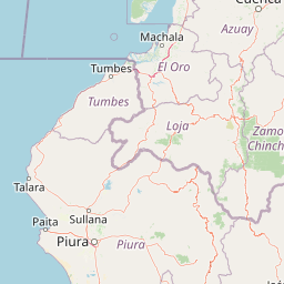
Podocarpus National Park Boundary Map and Spatial Extent
Mapped park outlines provide precise spatial context for analyzing protected territory. Accompanying measurements detail total area coverage, geographic span, and coordinate extents.
- Boundary area
- 1,395.1 km²
- Boundary perimeter
- 268.1 km
- Northernmost point
- 3.9772° S
- Southernmost point
- 4.5413° S
- Easternmost point
- 78.7807° W
- Westernmost point
- 79.179° W
- Geographic centre
- 4.2743° S, 79.0083° W
- North–south span
- 62.4 km
- East–west span
- 44.2 km
Elevation and terrain
Mountain topography spanning ridges, lakes, and rivers
Podocarpus National Park Terrain and Elevation Range Profile
Recorded elevation ranges span from 1000 meters to 3500 meters across mountain terrain. Associated feature records detail named ridges, lakes, and rivers situated within boundaries.
- Minimum elevation
- 1,000 m
- Maximum elevation
- 3,500 m
- Highest point
- 3,500 m
Selected named natural features
Lakes
Laguna de los Compadres
Lakes
Laguna Guadalupe
Rivers
Rio Nangaritza
Rivers
Quebrada Honda
Lakes
Laguna Forestales
Environmental setting
Interpreting recorded tropical relief, forest cover, and habitat types
Podocarpus National Park Environmental Settings and Landscape Classifications
Recorded landscape features, montane forest habitats, and seasonal tropical climate zones frame the physical setting of Podocarpus National Park. Linked classifications connect these stored environmental categories directly to related atlas destinations.
- Relief
- Mountain
- Climate
- Tropical
- Water
- Major water bodies
- Forest cover
- Mostly forested
- Seasonality
- Seasonal
Landscape features
Mountains · Valleys · Lakes · Rivers · Waterfalls · Forest · Wetland · Grassland
Habitat types
Tropical forest · Montane forest · Alpine meadow · Grassland · Wetland · Lacustrine habitat · Riverine habitat
Park atlas
Browse complementary protected areas and trace geographic connections across Ecuador's Andean and Amazonian landscapes.
Discover Nearby National Parks and Protected Areas Beyond Podocarpus National Park
Browse a curated list of national parks and protected areas situated near Podocarpus National Park, spanning Ecuador's diverse Andean mountains, cloud forests, and Amazonian lowlands. Continue your atlas-style discovery to compare these protected landscapes, tracing ecological connections and understanding the broader regional conservation efforts and distinct terrains.
National parkZamora Chinchipe
4.8 km away#1 closest
Southwest

Yacurí National Park: Protected Andean Lakes and Volcanic Landscape in Zamora Chinchipe
Discover highland geography and the ancient Inca Trail.
Yacurí National Park is a key protected landscape in Ecuador's southern Andes, celebrated for its remarkable collection of over 46 high-altitude lakes set within dramatic volcanic terrain. Situated in Zamora Chinchipe province, the park preserves a vital stretch of the Inca Trail, complete with archaeological sites. This national park offers a rich exploration of Andean geography, páramo ecosystems, and significant cultural heritage, making it a cornerstone of the region's protected areas.
- Area
- 431 km²
- Established
- 2009
- IUCN
- II
- Relief
- Mountain
Nature reserveZamora Chinchipe
8.2 km away#2 closest
Southeast
Reserva Biológica Cerro Plateado: Andean and Amazonian Landscape and Protected Area Context
Vertical gradient and mountain forest geography in Zamora Chinchipe
Spanning elevations from 840 to 3,120 meters, Reserva Biológica Cerro Plateado represents a significant conservation effort within the Zamora Chinchipe province. The reserve preserves intact montane cloud forests and paramo, serving as a vital link between the eastern Andean slopes and the Nangaritza watershed in southeastern Ecuador.
- Area
- 307.607 km²
- Established
- 2010
- IUCN
- Ia
- Relief
- Mountain
Wildlife reserveZamora Chinchipe
49 km away#3 closest
Northeast
Refugio de vida silvestre El Zarza: Mapping Protected Lands in Zamora Chinchipe
Andean-Amazonian transition and sandstone tepuy habitats
Refugio de vida silvestre El Zarza serves as a critical conservation zone where the volcanic and metamorphic rocks of the Andes meet the sandstone formations of the Amazonian fringe. Explore the varied morphology of this wildlife refuge, which encompasses rounded ridges, steep river canyons, and pale, stratified farallones that define the eastern sector of the Cordillera del Condor.
- Area
- 36.96 km²
- Established
- 2006
- IUCN
- Ia
- Relief
- Mountain
Nature reserveMorona Santiago
89 km away#4 closest
Northeast
Reserva biologica El Quimi: Protected Andean Watersheds and Cordillera del Condor Geography
A rugged nature reserve defined by complex metamorphic and volcanic mountain terrain.
Reserva biologica El Quimi guards the headwaters of the Quimi River along a strategically positioned watershed divide. Located in the province of Morona Santiago, this reserve features steep forested slopes and high plateau edges. Its varied geological foundation contributes to the broader regional ecological network, serving as a sanctuary for diverse mammal species including the Andean bear and jaguar.
- Area
- 90.24 km²
- Established
- 2006
- Relief
- Mountain
- Climate
- Subtropical
National parkPeru
110 km away#5 closest
West

Cerros de Amotape National Park: Peru's Protected Pacific Tropical Forest Atlas
Explore mapped boundaries and diverse terrain of this unique landscape.
Cerros de Amotape National Park stands as a significant protected area within Peru, meticulously preserving remnants of the Tumbes-Piura dry forests and Pacific tropical forests. Situated within the Cordillera de los Amotapes, the park features a dynamic landscape from riverine habitats to elevated mountain terrain. This park detail page offers an atlas-style view, focusing on its geographic context, mapped protected boundaries, and its importance as a conservation corridor for unique biodiversity.
- Area
- 1,515.61 km²
- Established
- 1975
- IUCN
- II
- Relief
- Mountain
Nature reserveWestern Sahara
114 km away#6 closest
Northwest

Reserva ecológica Arenillas Nature Reserve: Geographic Landscape and Protected Area Context
Examining dry forest ecosystems and coastal habitat boundaries
Reserva ecológica Arenillas is a significant nature reserve, distinguished by its intact dry forest and coastal mangrove systems. The area serves as a key benchmark for regional conservation efforts, offering a detailed look at the interface between tropical shrubland and maritime environments through a protected geographic lens.
- Area
- 131.65 km²
- Established
- 2001
- Relief
- Lowland
- Climate
- Tropical

National parkAzuay
114 km away#7 closest
North
Parque nacional Cajas: Mapping the Glacial Lakes and Paramo of the Ecuadorian Andes
Geographic analysis of high-elevation protected lands
Parque nacional Cajas encompasses a rugged, glacial-sculpted plateau characterized by cushion vegetation, boggy wetlands, and frequent fog. This protected area offers deep insight into the highland Andean geography of Azuay, where water bodies and mountain ridges intersect to form an essential ecological and cultural corridor for the region.
- Area
- 293.89 km²
- Established
- 1977
- IUCN
- II
- Visitors
- 53K annual
National parkPeru
About 119 km away#8 closest
Northeast
Ichigkat Muja, Cordillera del Cóndor National Park: Peru's National Park Geography and Mapped Boundaries
Explore its protected landscape and regional geographic context.
This detail entry focuses on Ichigkat Muja, Cordillera del Cóndor National Park, a designated national park in Peru. It provides essential information for understanding the park's geography, its protected landscape features, and its mapped extent. Users can explore this park's unique geographic identity and its place within the broader atlas of Peru's natural protected areas, offering a factual foundation for geographic research.
- Area
- 884.77 km²
- Established
- 2007
- Relief
- Mountain
- Climate
- Tropical
MoriAtlas Explorer
Continue exploring the geographic context and mapped protected landscape of Podocarpus National Park
Delve deeper into the atlas-driven discovery of Podocarpus National Park to understand its role as a vital protected area and its unique position within Ecuador's geography. Examine the mapped boundaries and diverse terrain that define this significant natural landscape, uncovering the rich biological and geographical context essential for comprehensive protected-area exploration.
Browse next
Global natural geography
Explore related park routes
Explore MoriAtlas Global ParksBrowse All MoriAtlas ParksGlobal Park Map DiscoveryMoriAtlas: Browse All CountriesBrowse All MoriAtlas ContinentsNational Park Environment AtlasGrand Canyon National Park AtlasYellowstone National Park AtlasYosemite National Park Atlas and GeographySerengeti National Park AtlasGalápagos National Park Protected LandscapeBanff National Park Geography and AtlasKruger National Park Atlas EntryUluṟu-Kata Tjuṯa National Park AtlasExplore Uluru-Kata Tjuta National Park GeographyPlitvice Lakes National Park AtlasFiordland National Park Protected LandscapeGreat Smoky Mountains National Park AtlasAfghanistan National Parks and Protected AreasAlbania National Parks and Protected AreasAlgeria National Parks and Protected AreasAmerican Samoa National Parks and Protected AreasAndorra National Parks and Protected AreasAngola National Parks and Protected AreasAntarctica National Parks and Protected AreasAntigua and Barbuda Park List