Mori Atlas logo
Park earthquake history

Explore an indexed collection of historical seismic events mapped by proximity to coastal Howe Sound landscapes.

Recorded Earthquake History and Seismic Catalogue for Porteau Cove Provincial Park, British Columbia

This historical catalogue provides a systematic overview of recorded earthquakes associated with the geographic location of Porteau Cove Provincial Park. Each entry includes event dates, magnitude ratings, and epicentre distances calculated from park coordinates, offering a transparent view of the regional seismic record. Use these records to understand historical activity patterns across the Howe Sound coastline and the surrounding Sea to Sky corridor.

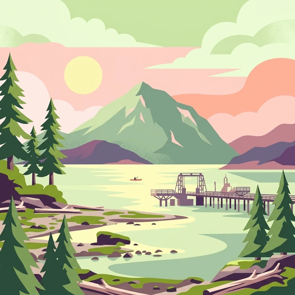
A flat vector illustration of Porteau Cove in British Columbia, featuring a wooden wharf extending into the calm waters of Howe Sound with mountainous terrain in the distance and pine trees in the foreground.

A compact coastal park on Howe Sound, best known for shoreline camping and shore diving at artificial reefs.

Porteau Cove Provincial Park

Porteau Cove Provincial Park is a small seaside protected area on the eastern shore of Howe Sound in British Columbia, Canada. Set against the forested slopes of the Sea to Sky corridor, the park preserves a stretch of saltwater shoreline where mountain scenery meets a working marine recreational landscape. It is one of the few day-use and overnight destinations along the busy Sea to Sky Highway where travelers can step directly from their vehicle onto a beach. The park is most recognized for its accessible scuba diving, supported by deliberate underwater features including two deliberately sunk vessels that have formed artificial reefs. Above the waterline, the protected shoreline combines pebble beach, low bluffs, and evergreen coastal forest, with views across the Sound toward the surrounding peaks. Managed by BC Parks, the park balances heavy recreational use with simple conservation rules intended to keep the intertidal zone intact. Although modest in size, Porteau Cove plays an outsized role as a gateway experience to the larger Howe Sound region. Its combination of camping, day-use facilities, an emergency ferry dock, and dive-friendly shoreline makes it a notable node within the dense network of coastal parks and recreation sites along southern British Columbia's fjord-like coastline.

Location
Canada
Park type
State or regional park
Established
1981
Area
0.5 km²
Porteau Cove Provincial Park Geography

Navigate Porteau Cove Provincial Park events by distance

Browse recorded earthquakes near Porteau Cove Provincial Park

Explore historical seismic records near Porteau Cove Provincial Park, a 0.5 km² mixed-scope Canadian park dominated by water; Event coordinates and park distance are shown with date, magnitude, depth, locality, and source details. The page uses the park as a geographic reference only and does not claim epicentres within its boundary, effects on its coast and reefs, current danger, or future events.

Sort by
Magnitude
Location

This page describes catalogued earthquakes associated with the park by epicentre location and distance. It does not establish causation, assess current danger, or predict future earthquakes.

No earthquake records match the current filters

Park atlas

Continue from Howe Sound's camping shore and dive reefs

Continue protected-place discovery beyond Porteau Cove Provincial Park

Porteau Cove Provincial Park ties earthquake history to a compact British Columbia coast known for shoreline camping and artificial-reef diving. Destinations introduced next are unrelated profiles and do not indicate shared cove scenery, provincial designation, geology, seismic record, proximity, risk, or comparable sources.
State or regional parkBritish Columbia
About 23 km away#1 closest

Southwest

Plumper Cove Marine Provincial Park: Protected Marine Geography and Coastal Landscapes in Howe Sound

Exploring the forested trails and sheltered marine anchorages of Keats Island.

Plumper Cove Marine Provincial Park represents a vital protected landscape on the coast of British Columbia, defined by its blend of upland coastal forest and intimate, boat-accessed marine anchorages. This geography-focused profile traces the park's terrain, including its rocky shorelines, forest-covered bluffs, and the trail networks that connect visitors to the broader Howe Sound maritime environment.

Area
0.66 km²
Established
1960
IUCN
II
Relief
Upland
A horizontal watercolor painting depicting a light, airy landscape with distant snow-capped mountains, rolling green hills, and coniferous forest edges.
State or regional parkBritish Columbia
24 km away#2 closest

Northeast

Garibaldi Provincial Park: An Atlas of Volcanic and Glacial Terrain in British Columbia

Protected wilderness in the Garibaldi Volcanic Belt

Garibaldi Provincial Park preserves a massive expanse of mountainous wilderness, defined by iconic landmarks such as The Black Tusk and Garibaldi Lake. The park represents a crucial study in vertical zonation, transitioning from temperate coastal forests to vast alpine meadows, glaciers, and jagged volcanic summits. Analyze the geological history and mapped protected boundaries that shape this significant British Columbia conservation area.

Area
1,950 km²
Established
1920
IUCN
II
Visitors
136K annual
A watercolor illustration of a mountain landscape featuring soft rolling hills, evergreen trees, and low-lying vegetation on a white background.
State or regional parkBritish Columbia
24 km away#3 closest

East

Pinecone Burke Provincial Park: Coast Mountain Wilderness and Protected Terrain Geography

Mapping a vast ecological corridor in British Columbia

Spanning over 38,000 hectares, Pinecone Burke Provincial Park represents a dramatic transition from the urban proximity of Coquitlam to the remote interiors of the southern Coast Mountains. The landscape is defined by its rugged relief, featuring subalpine meadows, deep freshwater systems, and historically significant forested slopes. This park provides a critical look at the complex topography of the Pacific Northwest, serving as a sanctuary for wildlife and a foundational piece of regional conservation.

Area
380 km²
Established
1995
IUCN
II
Relief
Mountain
A watercolor painting showing a soft-focus landscape with rolling green hills, distant mountains, and a central river or water feature.
State or regional parkBritish Columbia
47 km away#4 closest

East

Golden Ears Provincial Park: Geographic Atlas and Protected Landscape Overview

Coast Mountains terrain and protected wilderness boundaries

Golden Ears Provincial Park is a major protected wilderness in British Columbia, defined by the twin peaks of the Golden Ears massif and vast glacial lake systems like Alouette and Pitt. This site serves as a vital ecological corridor where lowland forests meet high subalpine ridges. Explore the park through its mapped boundaries and diverse ecological zones within the Pacific Northwest mountain landscape.

Area
609 km²
Established
1967
IUCN
II
Visitors
956.5K annual
A minimalist watercolor illustration showing rolling hills in the background and soft foliage in the foreground on a white background.
State or regional parkBritish Columbia
About 67 km away#5 closest

Southwest

Petroglyph Provincial Park: Protected Indigenous Heritage and Coastal Geography

Cultural landscape and bedrock carvings in British Columbia

Petroglyph Provincial Park preserves a remarkable concentration of ancient carvings etched into the sandstone bedrock of the Nanaimo River estuary. This protected area on Vancouver Island provides a rare look at how Indigenous traditions integrated with powerful natural features, offering a unique geographic context for studying historical rock art in the Pacific Northwest.

Area
0.02 km²
Established
1948
IUCN
III
Relief
Lowland
A watercolor painting showing a horizontal landscape with a green forest in the foreground and soft pink, layered rolling hills in the background.
State or regional parkBritish Columbia
68 km away#6 closest

Southwest

Morden Colliery Historic Provincial Park: Heritage Infrastructure and Regional Coal Mining History

Industrial landscape and historic rail corridor in British Columbia

Located near Nanaimo, this heritage site preserves the substantial concrete remains of the Morden Colliery. The park serves as a physical archive of southern Vancouver Island industrial life, contrasting engineering landmarks with local forest environments and interpretive trails along former coal railway alignments.

Area
0.04 km²
Established
1972
Relief
Lowland
Scope
Terrestrial
Watercolor painting of a tranquil body of water with gentle hills in the background and a cluster of trees on the right shore.
State or regional parkBritish Columbia
68 km away#7 closest

West

Jedediah Island Marine Provincial Park: Coastal Terrain and Regional Protected Area Map

Mapping island boundaries and sheltered maritime ecosystems

Jedediah Island Marine Provincial Park offers a unique study in coastal geography, featuring a complex shoreline of pebble beaches and indented bays. Located within the Strait of Georgia, the park serves as a protected landmass that blends maritime forest ecosystems with open water corridors. Its boat-only access ensures the landscape remains a quiet, preserved example of Gulf Islands terrain.

Area
6.03 km²
Established
1995
IUCN
II
Relief
Lowland
A horizontal watercolor painting depicting a soft-toned landscape with green trees, rolling hills, a calm body of water, and distant pale mountains.
State or regional parkBritish Columbia
70 km away#8 closest

Southeast

Peace Arch Park: Mapped Geography and Protected Landscapes of the Canada and US Border

Coastal binational protected area in British Columbia

Peace Arch Park is a notable protected landscape positioned directly on the international border. This site acts as a continuous green space between Canada and the United States, offering an unusual study of territorial boundaries and coastal geography. Spanning manicured terrain and historic monument grounds, the park provides an essential vantage point for understanding land-based connectivity in the Pacific Northwest region.

Area
0.17 km²
Established
1939
Visitors
500K annual
Access
Easy access
MoriAtlas Explorer

Explore the Geographic Boundaries of Porteau Cove Provincial Park

Deepen your understanding of Porteau Cove Provincial Park through structured map context and protected landscape data. Use MoriAtlas to examine how this coastal site integrates into the broader geography of the Howe Sound corridor and British Columbia's extensive network of marine-focused protected areas.