Mori Atlas logo
Park earthquake history

Review documented seismic events and epicenter proximities within this Andean reserve landscape

Recorded Earthquake History for Reserva nacional de fauna andina Eduardo Abaroa in Potosí

This collection presents a catalogue of historical earthquakes recorded near the Reserva nacional de fauna andina Eduardo Abaroa. Each entry includes specific details regarding event dates, magnitude, focal depth, and calculated distance from the protected boundaries of this high-altitude Altiplano region. These records provide a transparent overview of local seismic history derived from regional monitoring data to assist with geographic study.

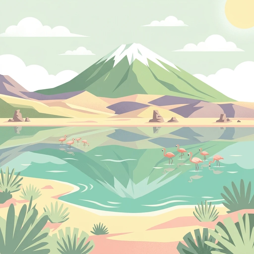
A flat vector illustration showing a snow capped mountain reflecting in a turquoise lagoon with a group of pink flamingos wading in the foreground.

A high-altitude Bolivian reserve protecting flamingo-filled lagoons, volcanic peaks, and surreal desert in the southwestern Altiplano.

Eduardo Abaroa Andean Fauna National Reserve

The Eduardo Abaroa Andean Fauna National Reserve is a vast protected area in the far southwestern corner of Bolivia, within the Sud Lípez province of the Potosí Department. Straddling the high Andean Altiplano between roughly 4200 and 6000 meters above sea level, the reserve protects one of the most extreme and visually striking high-altitude landscapes in South America. Its territory combines a chain of volcanic peaks along the Cordillera Occidental with broad arid plains, geothermal fields, and a remarkable system of colored high-altitude lagoons including Laguna Colorada, Laguna Verde, and Laguna Blanca. These shallow mineral-rich waters support breeding populations of three species of Andean flamingos, making the reserve one of the most important sites in the world for these rare birds. Established in 1973 and administered by Bolivia's national protected areas service, SERNAP, the reserve is the country's most visited protected area. It draws travelers for its surreal combination of flamingo-rich wetlands, geyser fields, volcanic scenery, and otherworldly desert formations such as the Árbol de Piedra and the Salvador Dalí Desert.

Location
Bolivia
Park type
Wildlife reserve
Established
1973
Area
7,147.5 km²
Highest point
5,981 m
Reserva nacional de fauna andina Eduardo Abaroa Park Atlas

Explore Reserva nacional de fauna andina Eduardo Abaroa records by distance

Review earthquakes near Reserva nacional de fauna andina Eduardo Abaroa

Eduardo Abaroa’s 7,147.45 km² Bolivian reserve spans alpine mountains, plateau, volcano, desert, wetlands, lakes, rivers, and grassland between 4,200 and 6,000 metres. Its earthquake records provide regional temporal and spatial evidence, not proof that seismicity affected the high-altitude ecosystems, arose from a particular volcano, or predicts future conditions.

Sort by
Magnitude
Location

This page describes catalogued earthquakes associated with the park by epicentre location and distance. It does not establish causation, assess current danger, or predict future earthquakes.

No earthquake records match the current filters

Park atlas

Beyond Reserva nacional de fauna andina Eduardo Abaroa earthquake data

More parks after Reserva nacional de fauna andina Eduardo Abaroa

Reserva nacional de fauna andina Eduardo Abaroa earthquake data leads to a separate protected-place selection. These links do not imply shared Andean terrain, wildlife status, geology, seismic records, proximity, hazards, risk, or equivalent source detail.
Protected areaPotosí
About 153 km away#1 closest

East

Pampa Tholar de las Vicuñas: Protected Andean Puna Landscapes and Geographic Overview

Integrated management area and high-altitude habitat in Potosí, Bolivia.

Pampa Tholar de las Vicuñas covers nearly 60,000 hectares of arid puna in the municipality of Villazón, representing a key intersection of biodiversity and local pastoral traditions. The area features a complex mosaic of piedmont slopes, rolling foothills, and seasonal water networks that provide essential habitat for the Andean condor and large vicuña populations. This protected landscape offers a unique look at high-altitude land management in the transitional zone between the Altiplano and the Eastern Cordillera.

Area
584.8 km²
Established
2018
Relief
Highland
Climate
Arid
A soft watercolor painting depicting gentle, rolling hills and plains in muted shades of green, yellow, and violet.
Natural monumentSud Chichas
About 168 km away#2 closest

Northeast

Área protegida municipal Ecoparque Encantado: Geographic Atlas and Natural Monument Overview

Mapped canyon landscapes and dry valley geography in the Sud Chichas province.

Analyze the topographic features of Área protegida municipal Ecoparque Encantado, a protected municipal monument in southern Bolivia. This area captures the dramatic transition between high-altitude puna grasslands and warm inter-Andean dry valleys. Learn about the geological history of the Tupiza Formation, the preservation of endemic vegetation, and the specific terrain dynamics that define this unique canyon-rich protected landscape.

Area
38.2 km²
Established
2015
IUCN
III
Relief
Mountain
National parkAntofagasta Region
202 km away#3 closest

South

Llullaillaco National Park: Mapped Volcanic Terrain and Protected Andean Landscape

Explore the high-altitude desert ecosystem and national park boundaries.

Llullaillaco National Park is a significant protected area in the Antofagasta Region, characterized by its striking volcanic landscape and high-altitude desert environment. The park's geography includes the towering Llullaillaco volcano, ancient ravines, and expansive semi-desert plains, forming a unique segment of the Central Andean dry puna ecoregion. Discover the mapped terrain and protected area context of this remarkable Chilean national park, offering insights into its arid-adapted biodiversity and geological significance.

Area
2,687 km²
IUCN
II
Relief
Mountain
Climate
Arid
Protected areaChile
About 205 km away#4 closest

Northwest

Salar del Huasco National Park: Chile's Unique Protected Landscape and Geographic Context

Explore its mapped terrain and protected area boundaries.

Salar del Huasco National Park represents a significant protected area within the geography of Chile. This destination provides detailed context for its mapped landscape and protected boundaries, offering insights into its regional geographic importance. It serves as a valuable entry for understanding specific protected lands and their contribution to the broader South American atlas.

Wildlife reserveTarija Department
About 212 km away#5 closest

East

Tajzara Wildlife Reserve: Geographic and Landscape Overview of the Tarija Basin

High-altitude wetlands and saline lagoons in the Bolivian Andes

Tajzara Wildlife Reserve stands as a critical high-altitude wetland complex within the Tarija Department. This protected landscape sustains life across saline lake beds, seasonal pools, and marshy margins, functioning as a vital refuge for migratory waders and flamingo populations in the harsh, arid climate of the Bolivian Altiplano.

Area
13 km²
Established
1999
Relief
Highland
Climate
Alpine
A watercolor painting of a simplified, abstract landscape with rolling hills in shades of green, yellow, and muted pink against a white background.
Protected landscapeTarija
212 km away#6 closest

Northeast

Parque natural y área de manejo integrado El Cardón: Geography and Protected Area Atlas

High-altitude puna landscapes and cactus diversity in Tarija, Bolivia.

Spanning the high-altitude plateaus of southern Bolivia, this protected area features a unique mosaic of arid terrain, specialized cactus ecosystems, and vital wildlife corridors. The landscape provides a deep look into the puna and pre-puna geography of the Tarija department, including significant archaeological sites and thriving populations of wild vicuñas within a dramatic, high-elevation Andean environment.

Area
300.56 km²
Established
2003
Relief
Mountain
Climate
Arid
National parkArgentina
224 km away#7 closest

East

Baritú National Park National Park: Mapped Protected Landscapes in Argentina's Geography

Understand the natural terrain and geographic setting of this Argentinian park.

Baritú National Park represents a distinct national park entity within Argentina, crucial for understanding the country's protected landscapes and regional geography. This page provides specific atlas-level detail on its mapped boundaries and the surrounding natural terrain. Explore Baritú National Park as a key geographic feature contributing to the broader understanding of conservation areas across South America, grounded in factual, map-oriented discovery.

Area
720 km²
Established
1974
IUCN
II
Relief
Mountain
Watercolor illustration showing a pale green rural landscape with rolling hills, scattered trees, a winding path or stream, and small buildings in the distance
Biosphere reserveBolivia
About 232 km away#8 closest

East

Reserva Biológica de la Cordillera de Sama: Protected Mountain Landscapes of Southern Bolivia

High-Andean biosphere reserve featuring lagoons, dunes, and ancient pathways.

Reserva Biológica de la Cordillera de Sama encompasses a vast elevation range from dry inter-Andean valleys to the 4,700-meter peaks of the Cordillera Oriental. This reserve protects the endorheic Tajzara basin, where seasonal lagoons and sand dunes contrast with relict forests and steep mountain ravines. Its geography offers a complex mosaic of ecosystems, providing essential water sources and specialized habitat for endemic fauna within the southern Bolivian highlands.

Area
1,085 km²
Established
1991
Relief
Mountain
Climate
Alpine
MoriAtlas Explorer

Explore the Geography and Protected Landscapes of Reserva nacional de fauna andina Eduardo Abaroa

MoriAtlas offers an in-depth look at the unique volcanic and wetland geography found within Bolivia's Eduardo Abaroa reserve. Continue to study the high-altitude terrain, protected area boundaries, and environmental features that define this iconic site in the Potosí department.