
Mori Atlas logo
Nature reserveRéserve naturelle régionale des étangs de Belval-en-Argonne

Understanding the mapped boundaries and historical hydrological terrain within France's Argonne region.

Réserve naturelle régionale des étangs de Belval-en-Argonne: Protected Wetland Landscapes and Geographic Atlas

(Réserve naturelle régionale des étangs de Belval-en-Argonne (RNR250))

The Réserve naturelle régionale des étangs de Belval-en-Argonne represents a major wetland system in northeastern France, characterized by a series of five interconnected ponds within the Marne department. This protected landscape preserves centuries-old hydraulic infrastructure alongside diverse aquatic habitats including reedbeds, wet meadows, and riparian woodlands. The site provides a critical geographic record of the Champagne humide wetland environment, offering insights into its specific terrain, pond distribution, and long-standing conservation value.

regional nature reservefreshwater wetlandspond networkArgonneChampagne humideMarne department
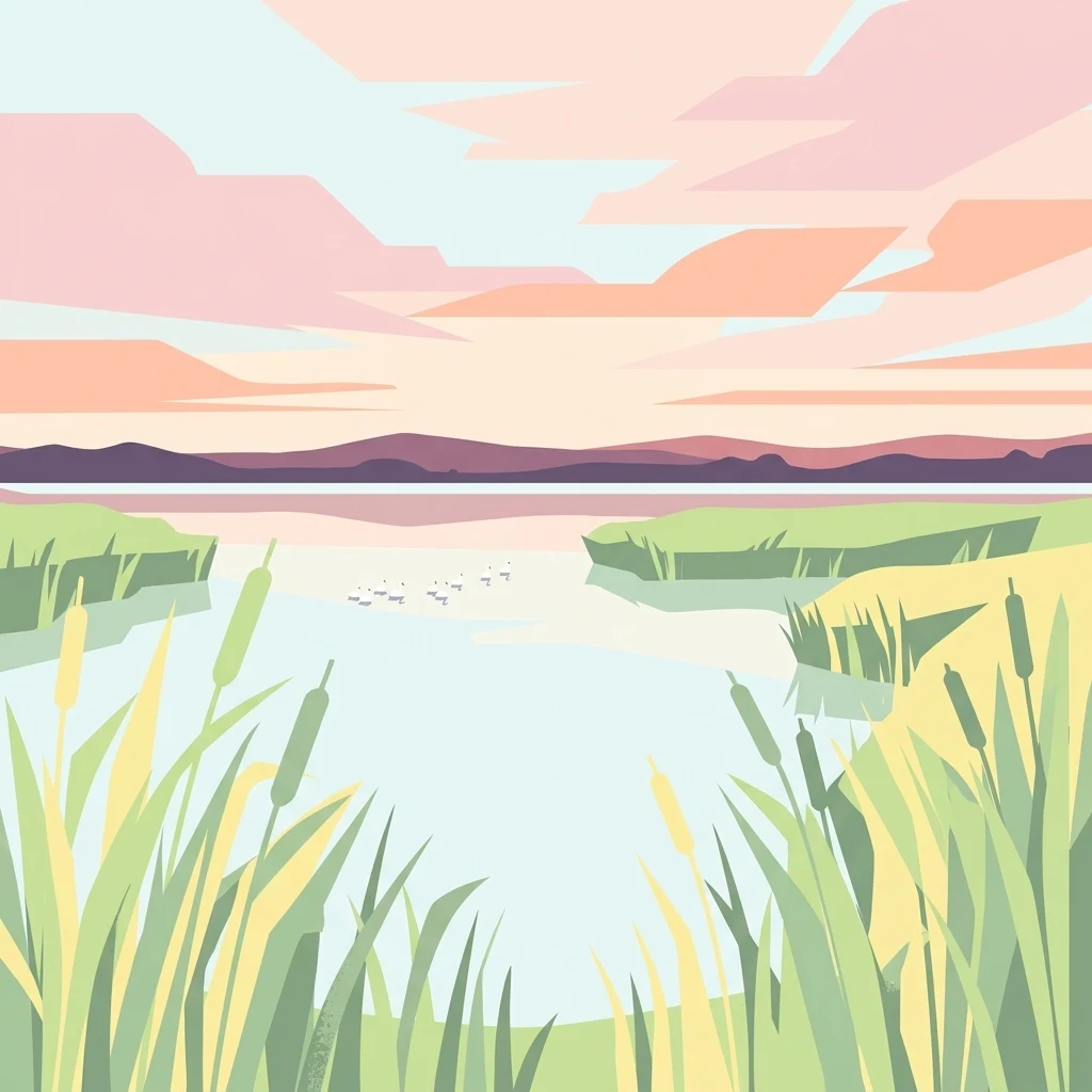
A flat, stylized graphic illustration of a wetland pond at sunset, with reeds and cattails in the foreground and a flock of birds flying over calm water towards distant hills.

Réserve naturelle régionale des étangs de Belval-en-Argonne

Nature reserve

Park overview

Structured park overview, official facts, and landscape profile for Réserve naturelle régionale des étangs de Belval-en-Argonne

Réserve naturelle régionale des étangs de Belval-en-Argonne park facts, protected area profile, and essential visitor context

Review the core facts for Réserve naturelle régionale des étangs de Belval-en-Argonne, including designation, size, terrain, visitor scale, habitats, and operating context in one park-focused overview.

About Réserve naturelle régionale des étangs de Belval-en-Argonne

The Réserve naturelle régionale des étangs de Belval-en-Argonne sits in the Argonne countryside of the Marne department, not far from the village of Belval-en-Argonne. Its roughly 204 hectares are organized around a chain of five named ponds: the Petit and Grand Normand in the north, the Étang du Bas in the east, the Étang du Praillon in the southwest, and the Étang du Haut in the west. Although they are frequently referred to collectively as the single 'étang de Belval', they actually constitute a historic compound wetland, divided by dikes and water-control structures in the eighteenth century.

The ponds lie within the Champagne humide, a broad lowland area characterized by lakes, flooded forests, and slow-moving rivers that has long been recognized for its wetland biodiversity. This broader landscape was designated under the Ramsar Convention in 1991, and the Belval ponds are part of several overlapping ecological and avifauna zones, including the ZICO 'Etangs d'Argonne', a Natura 2000 Site of Community Importance, a Special Protection Zone for birds, and the ZNIEFF areas 'Massif forestier et étang de Belval' and 'Etangs de Belval et d'Étoges'.

The reserve exists both to safeguard waterbird habitat and to protect a complex of reedbeds, wet woodlands, wet meadows, and fallow land that surrounds the open water. The mosaic of habitats creates environmental gradients from drowned vegetation at the water's edge to drier zones inland. This range of ecological conditions is what allows the site to support such diverse groups as aquatic plants, breeding and migratory birds, dragonflies, amphibians, and rare marsh-dwelling butterflies.

Local accessibility is modest but real: the secondary road D354 runs along the northeastern edge of the main pond, providing viewpoints, and a picnic area with interpretive panels is set up beside the road. The visitor experience is intentionally low-key, reflecting the reserve's focus on quiet ecological management rather than mass tourism.

Quick facts and research context for Réserve naturelle régionale des étangs de Belval-en-Argonne

The Belval-en-Argonne ponds reserve is a regional nature reserve (réserve naturelle régionale) in the Marne department, in the Grand Est region of France. With roughly 204 hectares, it groups five ponds (Petit and Grand Normand, Étang du Bas, Étang du Praillon, and Étang du Haut) that are among the largest in the Marne.

It was classified on 9 July 2012 and is co-managed by the Conservatoire d'espaces naturels de Champagne-Ardenne and the Ligue pour la protection des oiseaux (LPO). The ponds lie within the Champagne humide Ramsar zone designated in 1991, and the site carries several overlapping protection labels including ZNIEFF, ZICO, Natura 2000 Special Area of Conservation, and a Special Protection Zone (ZPS) for birds.

Protection and recognition

Documented terrestrial protection history and designated management records

Réserve naturelle régionale des étangs de Belval-en-Argonne Protection Status

Terrestrial protection status for Réserve naturelle régionale des étangs de Belval-en-Argonne establishes a formal baseline for conservation monitoring. Designated records outline management scope and official establishment timelines established in two thousand twelve.

Protection details

Protection scope
Terrestrial
Designated year
2012
Transboundary protection
No
WDPA ID
555559573
Park context

Deeper park guide and search-rich context for Réserve naturelle régionale des étangs de Belval-en-Argonne

Réserve naturelle régionale des étangs de Belval-en-Argonne history, landscape, wildlife, and travel context

Explore Réserve naturelle régionale des étangs de Belval-en-Argonne through its history, landscape character, ecosystems, wildlife, conservation priorities, cultural context, and seasonal travel timing in a structured park guide built for atlas discovery and search intent.

Why Réserve naturelle régionale des étangs de Belval-en-Argonne stands out

The reserve is especially known as a stronghold for wetland birds in the Argonne, including nationally protected species such as the Marsh Harrier, Eurasian Bittern, Little Bittern, Spotted Crake, and Common Crane. The ponds also host rare dragonflies such as the Large Hawker and the Green Hawker, and butterflies like the Large Copper of marshes. Beyond individual species, the site is valued for its continuity as an old, multi-pond wetland system within the larger Champagne humide. The combination of open water, reedbeds, wet woodland, and hydrological management heritage gives it an ecological profile distinct from newer or single-basin reserves in the region.
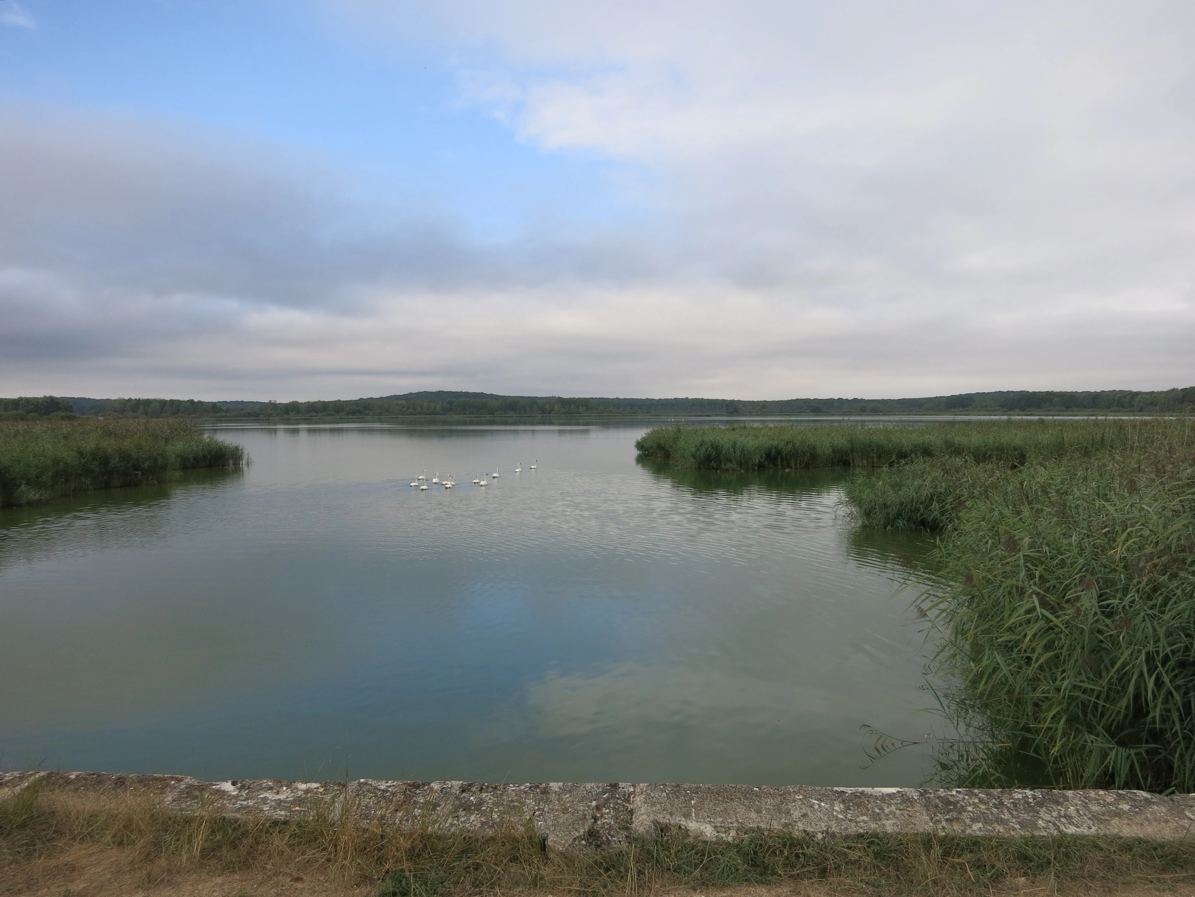
A wide, calm pond surrounded by tall reeds under a cloudy sky.
A view of the ponds at Réserve naturelle régionale des étangs de Belval-en-Argonne.

Réserve naturelle régionale des étangs de Belval-en-Argonne history and protected-area timeline

The waterbodies at Belval are among the oldest documented ponds in the Marne department, with origins going back at least to the thirteenth century. For centuries they functioned as a single large étang de Belval, supplying fish and serving the local agrarian economy.

In the eighteenth century, drainage and dike construction split this original body into the five ponds visible today. This engineering gave each basin its own character and hydrology, while keeping them within a single managed system.

The modern history of the site is closely tied to a conservation campaign. In 2007 a farmer purchased the property and, seeking to put the land into production, drained most of the ponds and cleared the surrounding reedbeds and wet woodland in order to plant maize. The commune of Belval-en-Argonne and local nature-protection associations objected strongly, and the farmer eventually withdrew and sold the land.

On 7 July 2009 the ponds were reacquired for conservation, at a price of approximately 2.67 million euros. The purchase was financed through a mix of partners: the Agence de l'eau Seine-Normandie contributed 60%, the former Champagne-Ardenne region 14%, and the French state 10%, with the remaining 15% shared between the Belgian association Natuurpunt, the LPO, the Conservatoire du patrimoine naturel de Champagne-Ardenne, and the commune itself, who became co-owners under a system of indivision.

The formal classement as a regional nature reserve followed on 9 July 2012. The reserve was then placed under joint management by the Conservatoire d'espaces naturels de Champagne-Ardenne and the LPO, which began implementing a management plan covering the 2012 to 2016 period.

Réserve naturelle régionale des étangs de Belval-en-Argonne landscape and geographic character

The reserve's landscape is shaped by a relatively gentle plateau terrain typical of the Argonne, in which shallow depressions have been dammed and managed for centuries to create a connected system of ponds. The five basins, named Petit Normand, Grand Normand, Étang du Bas, Étang du Praillon, and Étang du Haut, differ in size and orientation, giving the site a varied shoreline and a correspondingly diverse set of ecological edges.

The transition from open water to land is the defining visual feature of the area. Away from the banks, the surrounding terrain includes wet meadows, reedbed margins, willow and alder stands, and patches of fallow land. Together, these create a soft, water-rich tableau that contrasts with the drier, forested Argonne hills elsewhere in the region.

Hydraulic infrastructure is part of the scenery itself: the dikes built in the eighteenth century, later lock gates, and channels connecting the ponds are still visible and continue to influence water levels. The D354 road traces the northeastern flank of the principal pond, providing long views across open water and reedbeds.

Réserve naturelle régionale des étangs de Belval-en-Argonne ecosystems, habitats, and plant life

The ecological identity of Belval-en-Argonne is that of a mature, multi-basin freshwater wetland embedded in a wider lowland wet landscape. Sites like this in the Argonne have long been recognized by naturalists for their particular avifaunal value, and the ponds of Belval are no exception.

At the heart of the habitat is a fragmented mosaic of open water, reedbeds, wet woodland, wet meadows, and fallow land. Each of these supports different groups of species: the open water and submerged vegetation for aquatic plants and invertebrates; the reedbeds for nesting marsh birds; the wet woodland for amphibians and forest-edge birds; and the meadows and fallows for grassland flora and pollinators.

Flora records from the site note roughly 273 plant taxa, including species considered very rare in the broader Champagne-Ardenne region, such as Catabrosa aquatica, certain sedges, Rumex palustris, Eleocharis acicularis, and Utricularia vulgaris. The presence of these rarities underlines the conservation value of the hydrological regime that the reserve maintains.

Réserve naturelle régionale des étangs de Belval-en-Argonne wildlife and species highlights

The reserve's fauna has been studied primarily through its birds, which are the most prominent reason for protections at multiple levels. Nationally protected breeding species recorded here include the Marsh Harrier, the Eurasian Bittern, the Little Bittern, the Spotted Crake, and the Common Crane. The latter's presence connects Belval to a broader crane migration and wintering corridor across the Champagne humide.

The invertebrate fauna is also of conservation interest. The site hosts at least four remarkable dragonfly species, including the Large Hawker, the Green Hawker, the Northern Damselfly, and the Two-spotted Skimmer. Among butterflies, the Large Copper of marshes is a notable inhabitant of the wet meadows and reedbed margins.

Amphibians include the Great Crested Newt and the Northern Smooth Newt, both sensitive indicators of pond quality. Taken together, the combination of protected birds, rare dragonflies, marshland butterflies, and newts gives the site a layered faunal profile that supports its inclusion in Natura 2000, ZICO, and Special Protection Zone designations.

Réserve naturelle régionale des étangs de Belval-en-Argonne conservation status and protection priorities

From a conservation perspective, Belval-en-Argonne is significant both for what it protects and for the recovery story behind it. The site's current protected status is the direct outcome of a campaign to reverse a serious habitat loss: the drainage of the ponds and the clearance of reedbeds and wet woodland in 2007 had been halted and partially undone through coordinated acquisition in 2009.

That reacquisition was followed by formal protection as a regional nature reserve in 2012, with management entrusted to two experienced conservation NGOs. The site's importance is reinforced by its membership in a network of overlapping designations: it lies within the Champagne humide Ramsar zone, forms part of Natura 2000 and ZICO zones, and falls under a Préfecture biotope protection order. ZNIEFF inventories further recognize both the broader forested massif and the two principal pond basins of Belval and the neighboring Étoges pond.

The reserve's value therefore extends beyond its surface area. By protecting an ancient, hydrologically engineered multi-pond system embedded in a larger wet landscape, it preserves breeding and stopover habitat for several nationally protected bird species, rare aquatic plants, dragonflies, and butterflies, while reconnecting wetlands that had briefly been converted to cropland.

Réserve naturelle régionale des étangs de Belval-en-Argonne cultural meaning and human context

The ponds of Belval have been part of the rural landscape of the Argonne for more than seven centuries, and their long history of human management continues to shape the site today. The eighteenth-century division of the original étang and the visible dike infrastructure reflect a long tradition of working waterbodies for fish production and flood control.

In the contemporary period, the local commune of Belval-en-Argonne has taken an active role in protecting the ponds, including co-financing their purchase and being a co-owner of the land alongside conservation NGOs. The Belgian nature association Natuurpunt also participated in the acquisition, illustrating how a site in rural Marne came to be valued by conservation actors well beyond its immediate region.

The reserve integrates unobtrusive visitor infrastructure along the D354 road, with a picnic area and interpretative panels, suggesting an intent to share the site's natural and historical identity with passing visitors without compromising its quiet, rural character.

Top sights and standout views in Réserve naturelle régionale des étangs de Belval-en-Argonne

One of the Marne department's oldest and largest pond complexes, organized as a five-basin wetland system within the Champagne humide.

Home to nationally protected waterbird species such as the Marsh Harrier, Eurasian Bittern, Little Bittern, Spotted Crake, and Common Crane.

Notable for rare dragonflies, the marshland butterfly Large Copper, and sensitive amphibians including the Great Crested Newt.

Recognized at multiple protection levels, from ZNIEFF and ZICO to Natura 2000, Special Protection Zone, biotope protection order, and Ramsar through Champagne humide.

A model of conservation acquisition: the ponds were saved from agricultural drainage in 2009 through a coalition of water agencies, regional government, the LPO, Natuurpunt, and the local commune.

Best time to visit Réserve naturelle régionale des étangs de Belval-en-Argonne

The ponds and their surroundings change character with the seasons in ways that are typical of temperate lowland wetlands. Late spring and early summer are particularly rewarding for waterbirds, when reedbeds fill with breeding activity and dragonflies emerge over the open water and meadows.

Late summer and early autumn bring different rhythms: reed and meadow plants mature, marshland butterflies are most active, and the first migratory birds begin to use the basins as stopover or feeding habitat. In winter, the ponds can attract overwintering and migrating waterfowl, and frost can transform the open water into a quiet, reflective setting.

Because the reserve is small and visitor infrastructure is limited to viewpoints along the D354 and a picnic area beside the road, visits tend to be short and focused on observation rather than extensive walking. Calmer daylight hours generally offer the best wildlife-watching conditions across these seasons.

Monthly climate preview

Long-term representative temperature ranges and precipitation patterns across the year

Réserve naturelle régionale des étangs de Belval-en-Argonne Climate and Monthly Normals

Representative coordinates record measured monthly temperature swings and precipitation averages across the protected landscape from 1991 to 2020. Examining the complete twelve-month climatology profile reveals detailed annual cycles and long-term environmental trends for this location.
Annual mean10 °C
1 °C19 °C
Jan
Feb
Mar
Apr
May13°
Jun17°
Jul19°
Aug19°
Sep15°
Oct10°
Nov
Dec
Warmest month
July

19.1 °C

Coolest month
January

1.4 °C

Wettest month
December

2.8 mm/day

Driest month
April

1.7 mm/day

Park location guide

Geography guide, regional context, and park location map for Réserve naturelle régionale des étangs de Belval-en-Argonne

Réserve naturelle régionale des étangs de Belval-en-Argonne park geography, regions, and map view in France

Understand where Réserve naturelle régionale des étangs de Belval-en-Argonne sits in France through a broader geographic reading of the surrounding landscape, nearby location context, and its mapped position within the national park landscape.

How Réserve naturelle régionale des étangs de Belval-en-Argonne fits into France

France is a unitary semi-presidential republic and one of the world's largest economies. It borders Belgium, Luxembourg, Germany, Switzerland, Italy, Monaco, Andorra, and Spain, with a maritime border to the United Kingdom. The country is known for its cultural influence, art, cuisine, and political history spanning centuries.

Wider geography shaping Réserve naturelle régionale des étangs de Belval-en-Argonne in France

France is located in Western Europe. Metropolitan France extends from the Rhine to the Atlantic Ocean and from the Mediterranean Sea to the English Channel and North Sea. The country borders Belgium, Luxembourg, Germany, Switzerland, Italy, Monaco, Andorra, Spain, and has a maritime border with the United Kingdom.

Map view of Réserve naturelle régionale des étangs de Belval-en-Argonne

Use this park location map to pinpoint Réserve naturelle régionale des étangs de Belval-en-Argonne in France, understand its exact geographic position, and read its mapped placement within the surrounding landscape more clearly.

Pigeon | © OpenStreetMap contributors

Visualizing the wetland habitats, water networks, and protected landscapes of the reserve

Réserve naturelle régionale des étangs de Belval-en-Argonne Photos and Scenery

Photographic records reveal the interconnected pond networks, reedbed margins, and wetland habitats that define the reserve. Visual documentation captures the aquatic terrain and conservation landscape across the Argonne region.

A wide, calm pond surrounded by tall reeds under a cloudy sky.

A stone walkway leading to a traditional wooden and metal sluice gate mechanism on a pond in a natural area.

Park atlas

Compare adjacent wetland habitats and protected landscapes across the Champagne humide region.

Parks Near Réserve Naturelle Régionale des Étangs de Belval-en-Argonne and Regional Wetlands

Browsing adjacent protected areas helps connect the freshwater pond networks and wetland habitats surrounding Réserve naturelle régionale des étangs de Belval-en-Argonne. Analyzing regional terrain variations expands conservation awareness across similar lowland reserves and valley landscapes.
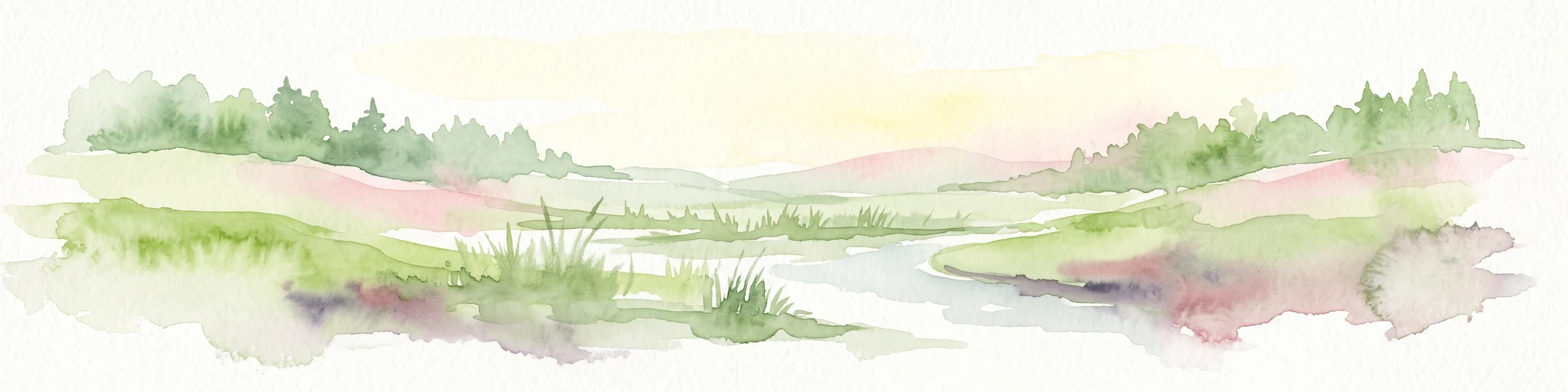
A horizontal watercolor illustration featuring a soft green and yellow landscape of a pond and wetland area with shrubs and meadow grass.
Nature reserveGrand Est
About 39 km away#1 closest

Southwest

Réserve naturelle régionale de l'étang et prairie humide des Paquis: Regional Nature Reserve Geography

Wetland habitat mapping in the Marne department of Grand Est, France

This regional nature reserve encompasses a compact 8.31 hectare wetland complex comprising an étang and a surrounding prairie humide. Its significance lies in its role as a concentrated biodiversity node amidst the open agricultural landscape of the Champagne region, managed primarily for habitat conservation and avian protection.

Area
0.083 km²
Established
2014
IUCN
IV
Nature reserveGrand Est
About 41 km away#2 closest

West

Réserve naturelle régionale du Savart de la Folie: Regional Protected Landscape Analysis

Tracing the dry grassland ecosystems of the Grand Est region

Deep dive into the geography of the Réserve naturelle régionale du Savart de la Folie in France. This site highlights the preservation of steppe-like savart habitats within the Champagne region, showcasing the importance of regional nature reserves in protecting specific dry, chalky grasslands.

Area
0.636 km²
Established
2026
IUCN
IV
Scope
Terrestrial
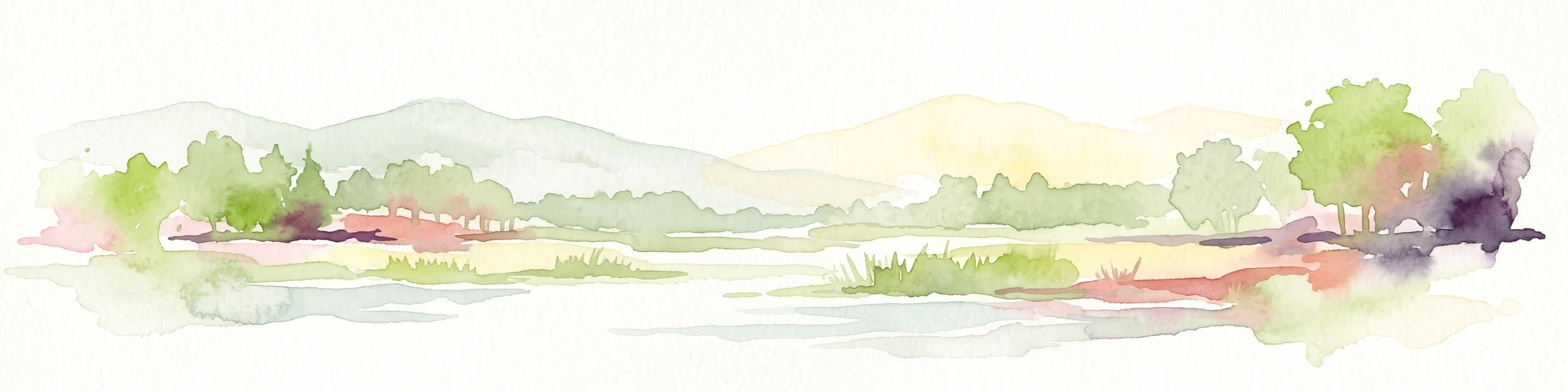
A soft watercolor painting of a wide, peaceful pond surrounded by gentle hills, trees, and marshy wetlands in a muted color palette.
Nature reserveGrand Est
About 59 km away#3 closest

Northeast

Réserve naturelle régionale de l'étang d'Amel: Protected Wetland Geography in Grand Est

Exploring the landscape and habitat history of France's first regional nature reserve

Spanning 147 hectares in the Meuse department, Réserve naturelle régionale de l'étang d'Amel provides a detailed look at a traditional Lorraine pond ecosystem. The site features a mix of reedbeds, marshes, and meadows that offer a sanctuary for protected bird and amphibian species. As a foundational project for French regional conservation, the reserve remains a vital case study in maintaining natural wetland structure within a managed agricultural landscape.

Area
1.47 km²
Established
2006
IUCN
IV
A watercolor painting showing a soft, panoramic view of a marshland with a winding stream, a small island of reeds, and distant trees on a pale background.
Nature reserveGrand Est
About 61 km away#4 closest

East

Réserve naturelle régionale de Lachaussée: Geography, Wetlands, and Protected Map Data

Protected landscape and historic pond geography in the Meuse department

Focusing on the Étang de Lachaussée, this entry maps the protected boundaries and wetland terrain of a significant regional nature reserve in northeastern France. Observe the intersection of medieval engineering and contemporary ecological conservation through a detailed look at the pond, reedbeds, and surrounding mosaic of habitats that define the Woëvre plain landscape.

Area
6.072 km²
Established
2009
IUCN
IV
Relief
Lowland
A minimalist watercolor painting showing rolling green hills and a gentle landscape under a light sky.
Nature reserveGrand Est
About 70 km away#5 closest

Southeast

Réserve naturelle régionale des éboulis et pelouses calcaires de Pagny-la-Blanche-Côte et Champougny Landscape Overview

Geographic protected area in the Meuse department

Analyze the limestone scree and calcareous grassland habitats of this 49-hectare reserve. The site provides a focused look at the unique Jurassic-age formations and open-terrain conservation efforts managed within the Grand Est region, offering a clear map of its protected perimeter.

Area
0.493 km²
Established
2021
IUCN
IV
Watercolor illustration of a landscape with rolling hills, a river, and green vegetation
Protected areaProvince of Luxembourg
About 71 km away#6 closest

Northeast

Gaume Natural Park: A Protected Area Defining the Landscape of Province of Luxembourg

Explore its mapped natural landscape and geographic context.

Gaume Natural Park is a protected area offering a unique perspective on the natural landscapes found within Belgium's Province of Luxembourg. As a key geographic entity, it provides a vital component for atlas exploration, showcasing distinct mapped boundaries and regional terrain. Understand its significance as a protected natural space contributing to the Ardennes region's extensive geography, making it an essential point for structured discovery of protected lands.

Area
581.04 km²
Established
2014
IUCN
V
Relief
Lowland
A horizontal watercolor illustration showing a serene wetland landscape with a winding stream, soft green grassy banks, and distant tree lines in light pastels.
Nature reserveGrand Est
About 72 km away#7 closest

Northwest

Réserve naturelle régionale du marais « Les trous de Leu » Protected Area Map

Wetland geography and alluvial habitats in Grand Est, France

Investigate the layered terrain and diverse marshland habitats of Réserve naturelle régionale du marais « Les trous de Leu ». This regional reserve showcases the importance of base-rich alkaline peatlands and alluvial woodlands situated between the Vesle river and the historic Aisne-à-la-Marne canal.

Area
0.33 km²
Established
2014
IUCN
IV
A horizontal watercolor illustration showing a pond with green trees, reeds, and low hills in the background against a white backdrop.
Nature reserveGrand Est
About 72 km away#8 closest

South

Réserve naturelle régionale de l'étang de Ramerupt: Geography and Protected Wetland Atlas

Mapping the historic Champagne humide pond landscape in Grand Est

Examine the dense wetland mosaic of Réserve naturelle régionale de l'étang de Ramerupt, a 33-hectare sanctuary in the Aube department. This resource traces the pond edges, reedbed structures, and wet woodland terrain that comprise this essential regional nature reserve, highlighting the intersection of human water management and natural marshland succession in the French countryside.

Area
0.336 km²
Established
2010
IUCN
IV
Relief
Lowland

Common questions about visiting, size, designation, and location context for Réserve naturelle régionale des étangs de Belval-en-Argonne

Réserve naturelle régionale des étangs de Belval-en-Argonne FAQs for park facts, access, geography, and protected area context

Find quick answers about Réserve naturelle régionale des étangs de Belval-en-Argonne, including protected-area facts, park geography, trail and visitor context, and how the park fits into its surrounding country and regional landscape.
MoriAtlas Explorer

Continue Your Protected Areas Search Across the Global Atlas

Deepen your exploration by continuing the structured search for national parks and protected areas worldwide. Utilize the comprehensive filtering capabilities to compare different conservation landscapes and refine your understanding of global park geography. Discover more about the distribution and characteristics of protected natural areas.

Global natural geography