
Mori Atlas logo
Nature reserveRéserve naturelle régionale de l'étang de Ramerupt

Analyzing the mapped boundaries and geographic features of this historic Champagne humide pond reserve

Réserve naturelle régionale de l'étang de Ramerupt: A Protected Wetland Landscape in Grand Est

The Réserve naturelle régionale de l'étang de Ramerupt represents a significant protected area within the Grand Est region of France, centered on a historic fish pond that anchors the Champagne humide ecosystem. Spanning roughly 33 hectares of reedbeds, sedge meadows, and wet woodlands, the site provides a structured look at the complex hydrological management and traditional land use patterns that define this regional landscape. This detailed atlas entry maps the specific ecological zones, from open water to forest margins, that sustain the varied birdlife and vascular plant populations within this preserved lowland refuge.

wetlandpondregional nature reserveChampagne humidereedbedbirdwatching
A flat, vector-style illustration of a peaceful pond surrounded by trees and reeds, with a cliff face in the background.

Réserve naturelle régionale de l'étang de Ramerupt

Nature reserve

Park overview

Structured park overview, official facts, and landscape profile for Réserve naturelle régionale de l'étang de Ramerupt

Réserve naturelle régionale de l'étang de Ramerupt park facts, protected area profile, and essential visitor context

Review the core facts for Réserve naturelle régionale de l'étang de Ramerupt, including designation, size, terrain, visitor scale, habitats, and operating context in one park-focused overview.

About Réserve naturelle régionale de l'étang de Ramerupt

The Réserve naturelle régionale de l'étang de Ramerupt is a compact but ecologically rich wetland reserve in north-central France, situated in the Aube department of the Grand Est region. It lies in the commune of Petit-Mesnil, just outside the boundaries of the much larger Parc naturel régional de la Forêt d'Orient, and is part of the broader Champagne humide, a historical region of ponds, wet meadows, and forests shaped over centuries by aquaculture and seasonal water management. Though small in extent, the reserve captures the essence of this vanishing landscape and preserves a functioning example of how traditional Champagne ponds and their surroundings continue to support biodiversity.

At its heart is the Étang de Ramerupt itself, a sizable pond sitting on clay-rich, impermeable terrain that has historically favored the creation of artificial fish-bearing water bodies. The reserve's 33 hectares encompass the pond and a range of associated wetland and woodland habitats. The mosaic includes floating aquatic plant beds, pondweed communities, extensive reedbeds, sedge-dominated marshland, and riparian forests of willows, alders, and ashes, as well as stands of oak. Together, these habitats form a near-complete ecological gradient from open water to forested wetland margin.

What distinguishes the reserve is both the density of its biodiversity and its role within a larger regional conservation framework. It functions as a refuge for waterbirds in a landscape that has otherwise experienced significant drainage and agricultural conversion. The site's protected status, layered through regional reserve designation, a prefectural biotope protection order, and ZNIEFF recognition, reflects the importance attached to preserving one of the few remaining intact examples of the region's historic pond heritage.

Quick facts and research context for Réserve naturelle régionale de l'étang de Ramerupt

The reserve is located in the commune of Petit-Mesnil in the Aube department, on the edge of the Parc naturel régional de la Forêt d'Orient, within the broader Champagne humide wetland region. It was officially classified as a regional nature reserve on 15 February 2010 and covers approximately 33.56 hectares, with IUCN Category IV management designation.

The site is administered by the Conservatoire d'espaces naturels de Champagne-Ardenne and is included within the ZNIEFF type I inventory under the designation "L'Etang de Ramerupt et ses annexes." The pond itself benefits from a complementary prefectural biotope protection order, adding an extra layer of legal protection to the wetland.

Protection and recognition

Documented protection scope and official designations for this protected area

Protection Status and International Recognition for Réserve naturelle régionale de l'étang de Ramerupt

Terrestrial protection status and designation records for Réserve naturelle régionale de l'étang de Ramerupt establish its formal standing within the global protected area network. Official data sources supply verified baseline facts regarding management scope and recognition history without assumptions.

Protection details

Protection scope
Terrestrial
Transboundary protection
No
WDPA ID
555514362
Park context

Deeper park guide and search-rich context for Réserve naturelle régionale de l'étang de Ramerupt

Réserve naturelle régionale de l'étang de Ramerupt history, landscape, wildlife, and travel context

Explore Réserve naturelle régionale de l'étang de Ramerupt through its history, landscape character, ecosystems, wildlife, conservation priorities, cultural context, and seasonal travel timing in a structured park guide built for atlas discovery and search intent.

Why Réserve naturelle régionale de l'étang de Ramerupt stands out

The reserve is best known for protecting one of the last well-preserved historic fish ponds of the Champagne humide, with an exceptional concentration of wetland habitats for its small size. Its combination of open water, reedbeds, floating aquatic vegetation, and surrounding wet woodland makes it a strong refuge for waterbirds and marshland species. It is also recognized as a regional stronghold for species tied to reedbed and pond habitats, including various ducks, grebes, herons, and secretive marshland birds such as bitterns and crakes, especially during winter when many wildfowl use the site as a refuge.
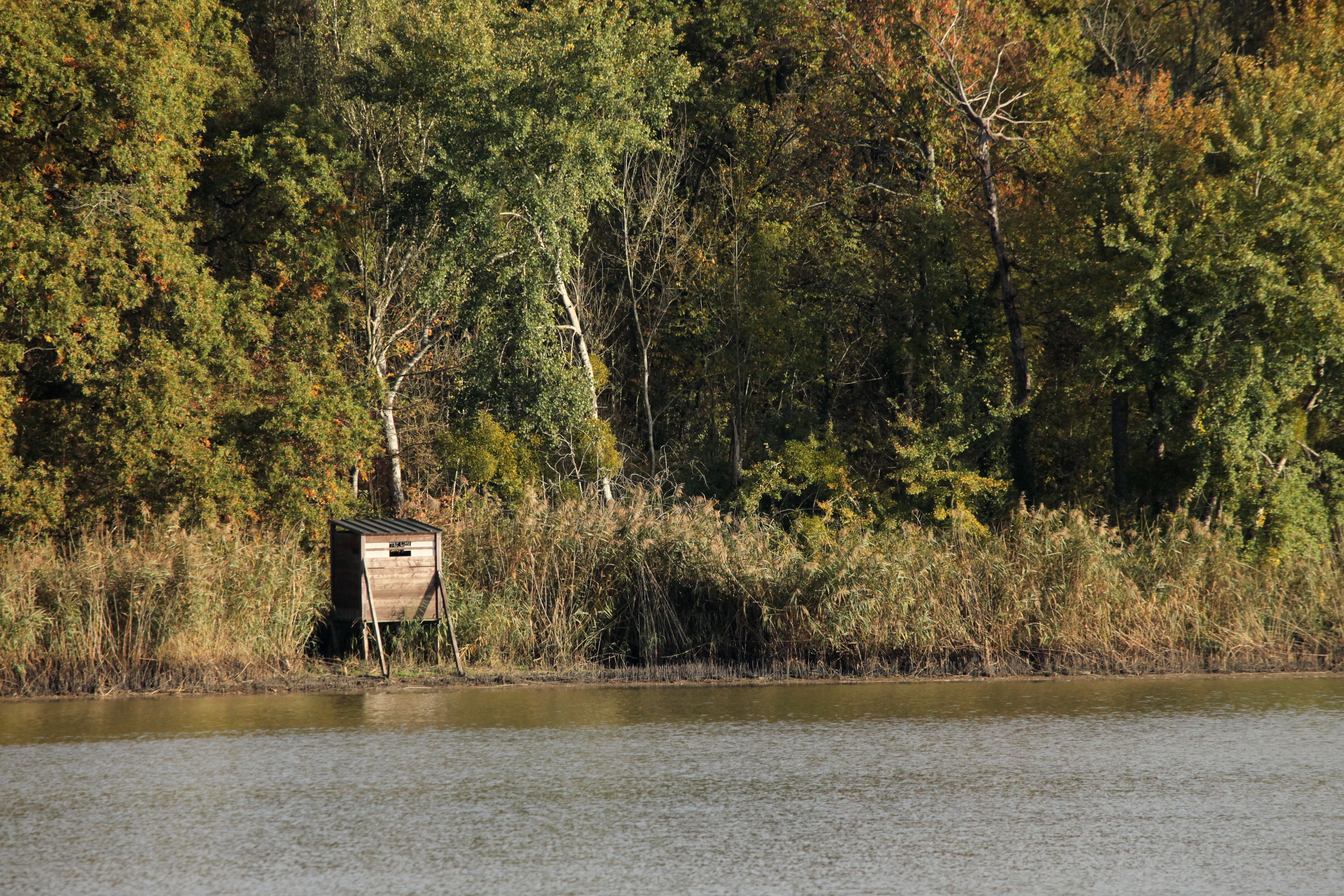
A small wooden, elevated observation hide stands on the muddy shore of a pond, surrounded by tall reeds and a dense, autumnal forest.
A wooden wildlife observation hide positioned along the edge of the Etang de Ramerupt.

Réserve naturelle régionale de l'étang de Ramerupt history and protected-area timeline

Like many ponds in the Aube, the Étang de Ramerupt has deep historical roots, with records of its existence reaching back to the twelfth century. The pond, together with the nearby Étang de la Horre, ranks among the largest historical fish ponds of the department. For centuries, these water bodies were managed as fishing estate ponds, a traditional use that shaped their hydrology, banks, and surrounding land use.

Modern legal protection came relatively recently. Following the broader French movement toward regional nature reserves in the early twenty-first century, the site was classified through a regional council deliberation on 15 February 2010. Since then, the Conservatoire d'espaces naturels de Champagne-Ardenne has overseen its management. The reserve's creation came amid growing concern about the disappearance of traditional Champagne humide pond landscapes, and it now serves as a protected reference site for the regional pond heritage that had existed largely uninterrupted for centuries.

Réserve naturelle régionale de l'étang de Ramerupt landscape and geographic character

The reserve's landscape is defined by the Étang de Ramerupt itself, a broad, calm body of standing water set within the flat, low-lying terrain characteristic of the Champagne humide. Its banks are gentle, fringed in many places by reedbeds and sedge marshes that soften the transition between water and dry ground. The surrounding topography is subtle, with the pond resting on clay-marl substrate that prevents water from draining quickly, preserving the wetland conditions that have defined the site for centuries.

Around the water, the landscape shifts from wet meadow and marshy fringes into forested borders. Dense willow stands occur close to the water's edge, with alder and ash communities in transitional zones and oak woodland occupying the drier peripheral areas. A public boardwalk trail along the western shore and a path running along the pond's dike structure allow visitors to experience this layered landscape, with observation hides positioned to reveal both the open water and the sheltered reedbed margins. The result is a quiet, essentially flat, water-dominated landscape whose visual interest lies in its textures, reflections, and ecological transitions rather than dramatic relief.
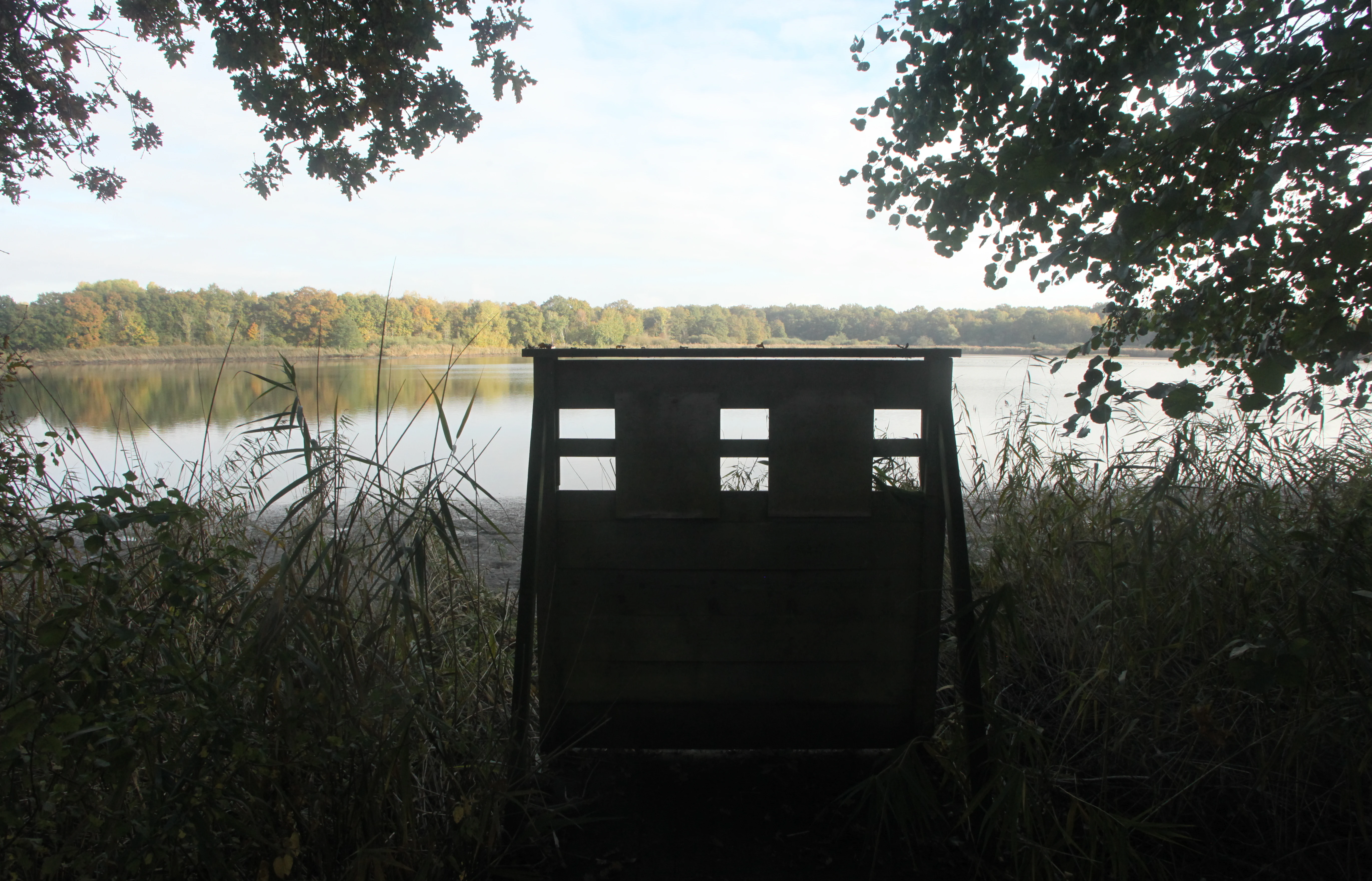
A wooden wildlife observation hide framed by trees, looking out over a calm pond at the Ramerupt nature reserve.
A bird observation hide overlooking the pond at Ramerupt.

Réserve naturelle régionale de l'étang de Ramerupt ecosystems, habitats, and plant life

Ecologically, the Étang de Ramerupt reserve is a textbook example of a lowland European pond complex. Out of sixteen habitat types inventoried on the site, thirteen are wetland habitats, giving the reserve an unusually high proportion of water-dependent ecosystems for its size. These include floating herb communities, pondweed beds, reedbeds, sedge marshes, and wet woodland communities such as willow carrs and alder-ash forests.

The flora reflects this habitat diversity. More than 150 plant species have been recorded, including notable aquatic and marshland plants such as reed sweet-grass, yellow flag iris, least water-lily, greater spearwort, water chestnut, blunt-leaved pondweed, and various sedges. Together, these plants form the structural and ecological basis of the pond ecosystem, providing food and cover for invertebrates, fish, amphibians, and birds across all seasons.

The site's substantive ecological value lies in how intact and interconnected these habitats remain. Rather than presenting fragmented or degraded wetland patches, the reserve preserves a continuous gradient between aquatic, marsh, and wet woodland environments. This continuity is what allows the pond to support such a complete community of wetland-dependent species, and it is also what makes the reserve particularly meaningful from a conservation standpoint, given the wider decline of such landscapes across the Champagne humide.
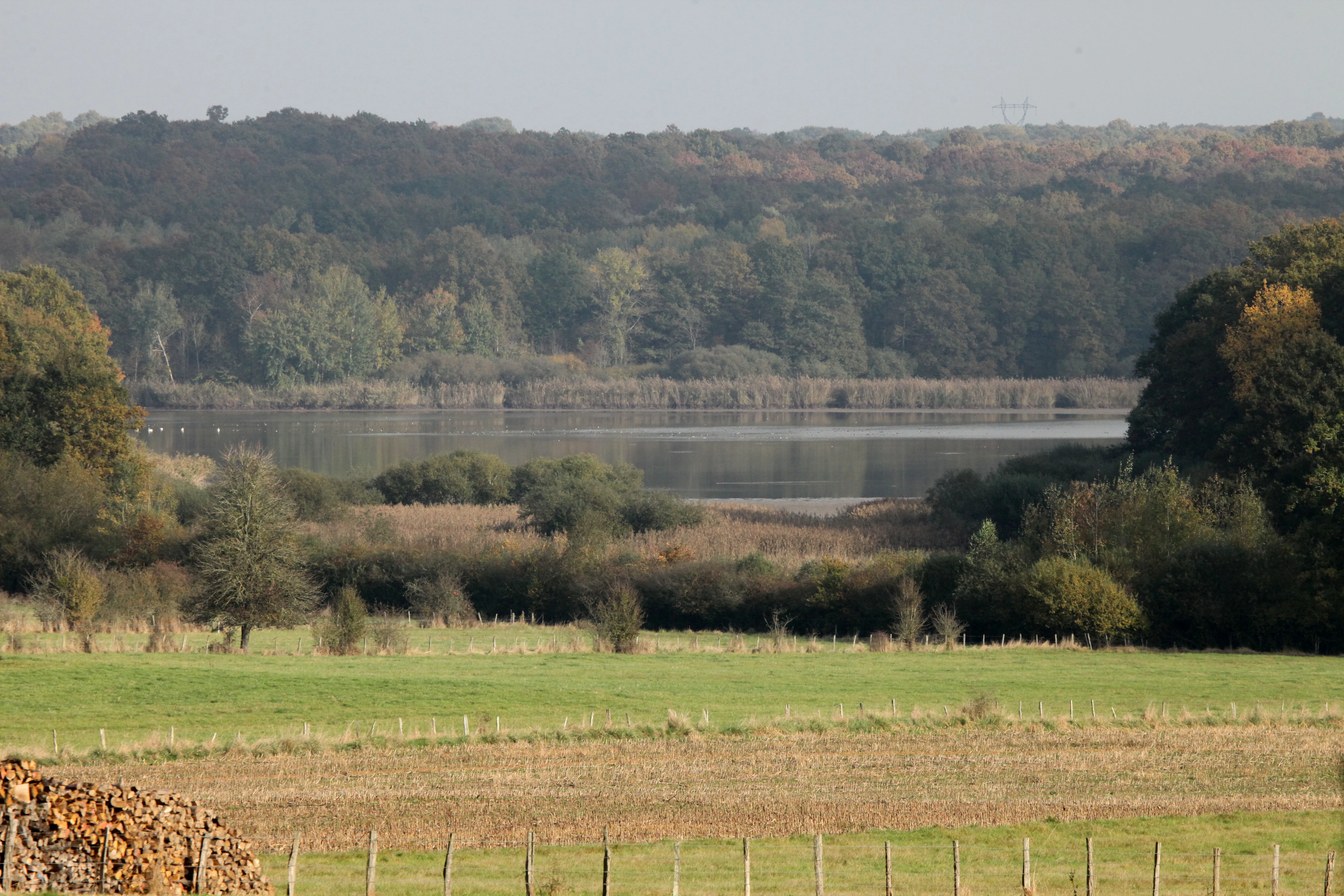
A peaceful landscape view of a calm pond surrounded by dense forest and marshland with green fields in the foreground.
A view of the Étang de Ramerupt pond surrounded by wetlands and forest in the Grand Est region.

Réserve naturelle régionale de l'étang de Ramerupt wildlife and species highlights

Wildlife is the reserve's most visible asset. The pond and its reedbeds have supported 141 recorded bird species, making it an important site for waterbirds within the region. Reedbed and waterside warblers are a regular presence, alongside great crested and little grebes, Eurasian coots, and various wetland-specialist herons. The site also hosts more elusive marshland species such as little bitterns, Eurasian bitterns, purple herons, spotted crakes, water rails, and lapwings, reflecting the quality of the reedbed habitat.

In winter, the reserve becomes a refuge for waterfowl. Several duck species use the pond seasonally, including garganey, shoveler, Eurasian wigeon, gadwall, and mallard, together with diving ducks such as common pochard. Black terns have also been recorded. Beyond birds, the site supports notable mammals including European polecats and Nathusius' pipistrelle bats, along with amphibians such as fire salamanders, alpine newts, and palmate newts. Their presence underscores the broader biodiversity value of the wetland mosaic beyond its avian richness.
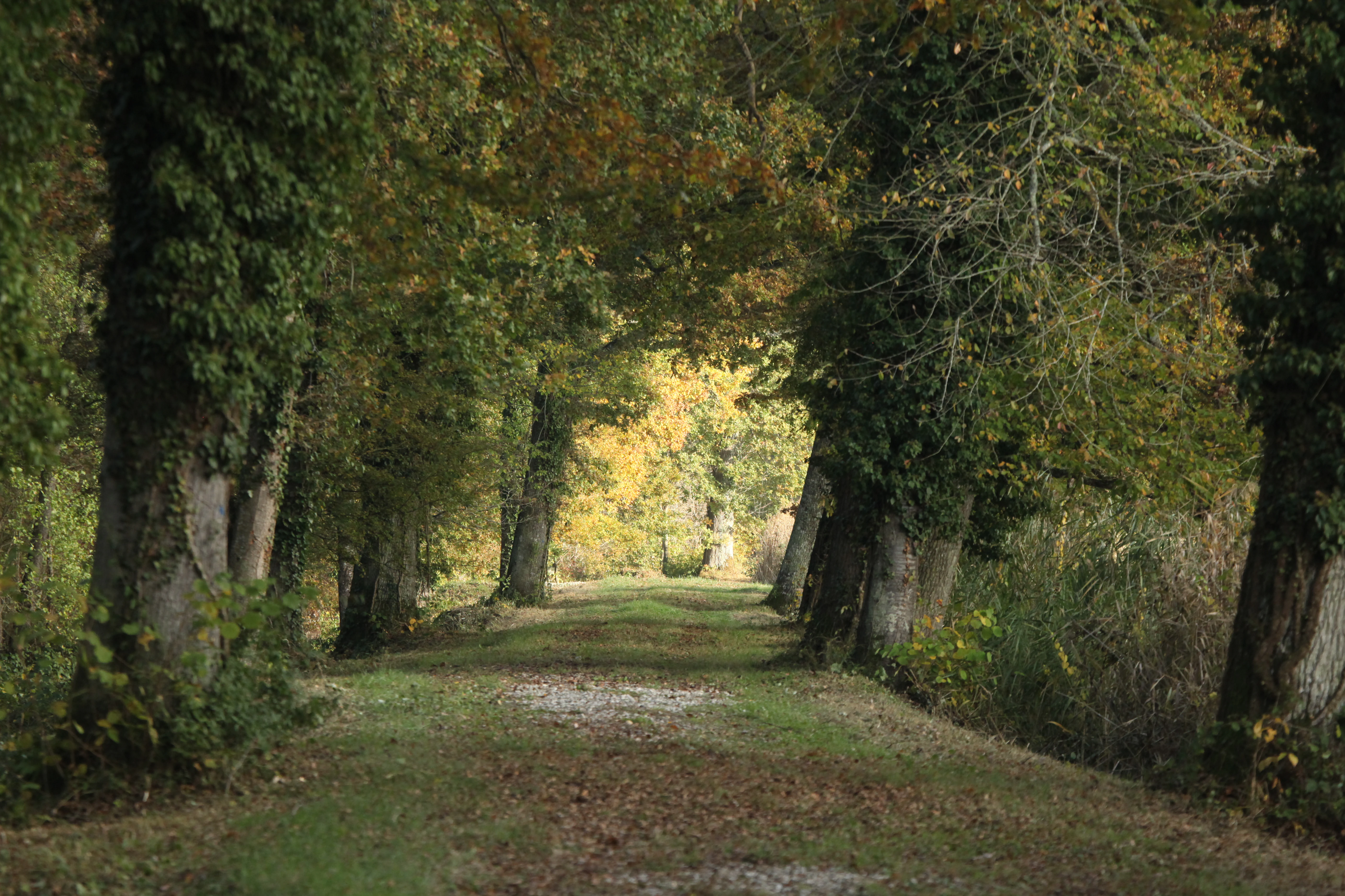
A dirt path bordered by tall mature trees leading into a bright, leafy background, suggesting an autumnal forest setting.
A tree-lined trail path within the Réserve naturelle régionale de l'étang de Ramerupt.

Réserve naturelle régionale de l'étang de Ramerupt conservation status and protection priorities

The reserve's main conservation importance lies in its role as a protected fragment of the Champagne humide, a regional wetland landscape that has been heavily reduced by drainage and agricultural intensification over recent decades. By safeguarding one of the few remaining well-preserved pond complexes of the Aube, the reserve helps maintain ecological processes and species populations that would otherwise have little refugial habitat in the surrounding countryside.

The layered protection regime enhances this significance. Beyond its regional nature reserve status, the pond is covered by a prefectural biotope protection order, and the broader area is recognized as a ZNIEFF type I site. This means the site benefits from overlapping legal and scientific designations, each reinforcing the protection of its habitats and species. Management by the Conservatoire d'espaces naturels de Champagne-Ardenne adds an institutional framework focused on long-term habitat conservation, species monitoring, and ecological restoration.

In a wider context, the reserve functions as both a local biodiversity reservoir and a reference site for the traditional fish-pond landscapes of northern Champagne. Its continued protection contributes to maintaining ecological connectivity in a region where wetlands are scarce, and to preserving a working example of how human-made ponds, when managed sensitively, can remain biodiversity-rich habitats centuries after their creation.

Réserve naturelle régionale de l'étang de Ramerupt cultural meaning and human context

The Étang de Ramerupt sits within a landscape shaped by centuries of human management. The pond itself has been documented since the twelfth century and has long served as a fish-farming pond, a use that defines much of the Champagne humide region's cultural and economic heritage. Together with the Étang de la Horre, it represents a continuity of traditional pond stewardship that has marked the Aube countryside for nearly a millennium.

This long-standing human relationship with the water continues to inform the site's character today. The pond's banks, its dike infrastructure, and the surrounding land-use patterns all reflect the influence of historical pond management, even as the reserve's designation recognizes the ecological value those management practices inadvertently preserved. The site therefore stands as a tangible example of how traditional rural land use and biodiversity conservation can align, particularly in landscapes where centuries of careful water management have produced habitat mosaics of high ecological value.
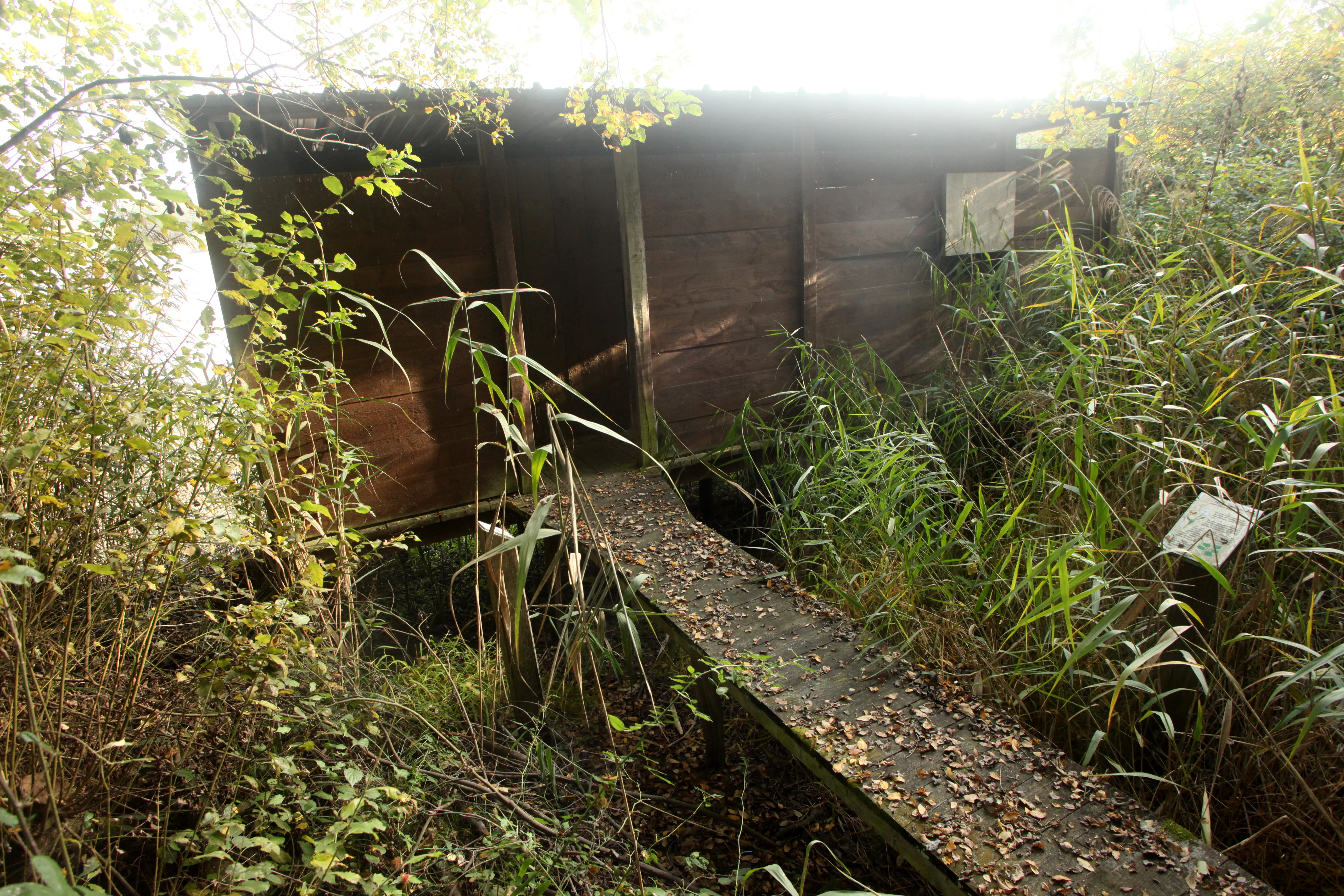
A weathered wooden bird observatory structure accessed by a narrow boardwalk, surrounded by tall reeds and dense vegetation.
A wooden wildlife observation hide located within the Réserve naturelle régionale de l'étang de Ramerupt.

Top sights and standout views in Réserve naturelle régionale de l'étang de Ramerupt

The reserve's highlights include its extraordinary concentration of wetland habitats within a compact 33-hectare footprint, with thirteen of sixteen habitats tied to wet conditions and more than 150 plant species recorded. Its bird list of 141 species, including secretive marshland specialists and seasonal gatherings of wildfowl, places it among the more significant small wetland sites in the Champagne humide.

Equally notable is the layered protection status of the site, combining regional reserve designation, prefectural biotope protection, and ZNIEFF recognition, all under the management of an experienced regional conservatory. For visitors, the boardwalk trail, observation hides, and interpretive signage along the western shore provide an accessible way to experience this rich but otherwise delicate wetland landscape.

Best time to visit Réserve naturelle régionale de l'étang de Ramerupt

The reserve's character shifts with the seasons, offering different attractions throughout the year. Spring brings active breeding behavior among reedbed warblers, grebes, and various wetland birds, along with the fresh growth of aquatic and marsh vegetation. Summer showcases the pond at its most vegetative, when floating plant beds, pondweeds, and reedbeds are fully developed and amphibian activity around the margins increases.

Autumn and winter are particularly rewarding for birdwatching, as the pond becomes a gathering site for wildfowl including shovelers, wigeons, gadwalls, mallards, and diving ducks, with open water becoming easier to observe as reed cover thins. Cooler months also tend to bring quieter visiting conditions and crisper views across the open water. Whatever the season, the boardwalk trail and observation hides allow low-impact viewing of the site's seasonal transitions.
Monthly climate preview

Long-term monthly temperature averages and precipitation measurements for the protected area

Réserve naturelle régionale de l'étang de Ramerupt Climate and Annual Weather Patterns

Representative coordinates record measured monthly temperature ranges alongside steady precipitation rates throughout the annual cycle. Detailed monthly climate normals provide deeper reference data for studying long-term meteorological patterns across the protected landscape.
Annual mean11 °C
2 °C20 °C
Jan
Feb
Mar
Apr10°
May14°
Jun18°
Jul20°
Aug20°
Sep16°
Oct11°
Nov
Dec
Warmest month
July

20.2 °C

Coolest month
January

2.1 °C

Wettest month
December

2.4 mm/day

Driest month
March

1.7 mm/day

Park location guide

Geography guide, regional context, and park location map for Réserve naturelle régionale de l'étang de Ramerupt

Réserve naturelle régionale de l'étang de Ramerupt park geography, regions, and map view in France

Understand where Réserve naturelle régionale de l'étang de Ramerupt sits in France through a broader geographic reading of the surrounding landscape, nearby location context, and its mapped position within the national park landscape.

How Réserve naturelle régionale de l'étang de Ramerupt fits into France

France is a unitary semi-presidential republic and one of the world's largest economies. It borders Belgium, Luxembourg, Germany, Switzerland, Italy, Monaco, Andorra, and Spain, with a maritime border to the United Kingdom. The country is known for its cultural influence, art, cuisine, and political history spanning centuries.

Wider geography shaping Réserve naturelle régionale de l'étang de Ramerupt in France

France is located in Western Europe. Metropolitan France extends from the Rhine to the Atlantic Ocean and from the Mediterranean Sea to the English Channel and North Sea. The country borders Belgium, Luxembourg, Germany, Switzerland, Italy, Monaco, Andorra, Spain, and has a maritime border with the United Kingdom.

Map view of Réserve naturelle régionale de l'étang de Ramerupt

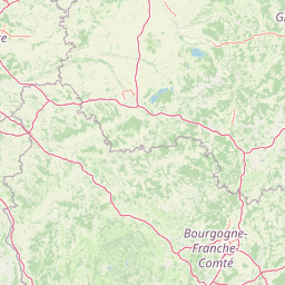
Use this park location map to pinpoint Réserve naturelle régionale de l'étang de Ramerupt in France, understand its exact geographic position, and read its mapped placement within the surrounding landscape more clearly.

Pigeon | © OpenStreetMap contributors

Location context for Réserve naturelle régionale de l'étang de Ramerupt

Grand Est

Visual exploration of wetland habitats, reedbeds, and preserved pond scenery in Champagne humide.

Réserve naturelle régionale de l'étang de Ramerupt Photos and Wetland Landscapes

Visual documentation reveals the intricate lowland terrain and permanent open waters defining Réserve naturelle régionale de l'étang de Ramerupt. Photographic records capture local reedbeds, marshy fringes, and wet woodland habitats characteristic of protected French reserves.

A small wooden, elevated observation hide stands on the muddy shore of a pond, surrounded by tall reeds and a dense, autumnal forest.

A weathered wooden boardwalk path covered in scattered fallen leaves and moss, surrounded by dense marsh vegetation and trees, leading into the distance under a bright backlit sky.

A wooden wildlife observation hide framed by trees, looking out over a calm pond at the Ramerupt nature reserve.

A peaceful landscape view of a calm pond surrounded by dense forest and marshland with green fields in the foreground.

A dirt path bordered by tall mature trees leading into a bright, leafy background, suggesting an autumnal forest setting.

A wide view across a pond with many small ducks swimming, backed by reeds and a dark treeline, partially obscured by out-of-focus branches in the foreground.

A weathered wooden bird observatory structure accessed by a narrow boardwalk, surrounded by tall reeds and dense vegetation.

Park atlas

Compare surrounding wetland reserves and regional conservation landscapes

Other Protected Areas and Parks Near Réserve naturelle régionale de l'étang de Ramerupt

Browsing other protected areas near Réserve naturelle régionale de l'étang de Ramerupt reveals broader regional wetland networks and lowland habitats. Comparing adjacent reserves helps contextualize local waterbird populations and lowland topography across the surrounding countryside.
Watercolor painting of an open, undulating rural landscape with patches of green vegetation, trees, and golden fields under a soft white sky.
Nature reserveGrand Est
About 12 km away#1 closest

South

Réserve naturelle régionale de la pelouse de la côte de l'étang: Regional Nature Reserve Geography

Calcareous grassland protected area in the Grand Est region of France

Discover the geographic character of Réserve naturelle régionale de la pelouse de la côte de l'étang. This reserve showcases a specialized dry grassland landscape on a sun-drenched slope, providing a critical haven for rare flora and fauna in the heart of the Barrois champenois territory.

Area
0.108 km²
Established
2010
IUCN
IV
Relief
Upland
A soft watercolor painting of a calm lake scene featuring small grassy islands with trees, surrounded by marshy vegetation under a light, hazy sky.
Nature reserveGrand Est
About 18 km away#2 closest

West

Réserve naturelle nationale de la forêt d'Orient: Protected Landscapes and Wetland Mapping

Key protected area in the Grand Est region of France

Investigate the geographic structure of Réserve naturelle nationale de la forêt d'Orient, a reserve shaped by reservoir-driven water cycles. This protected area features a diverse arrangement of lake-edge mudflats, expansive reedbeds, and temperate forest cover. Gain insight into the regional importance of these habitats as a node for migratory bird pathways and native terrestrial biodiversity in eastern France.

Area
15.6 km²
Established
2002
IUCN
IV
Relief
Lowland
Nature reserveGrand Est
About 31 km away#3 closest

West

Réserve naturelle régionale des prairies humides de Courteranges: Protected Landscape Map

Barse Valley wetlands and meadow mosaic in Grand Est

This protected area preserves an intricate network of humid grasslands and traditional hay meadows along the Barse river. Its geography showcases a rare mosaic of wetland vegetation and managed habitats that provide critical ecological continuity within the Grand Est natural network.

Area
0.277 km²
Established
2010
IUCN
IV
Relief
Lowland
A horizontal watercolor illustration featuring a soft green and yellow landscape of a pond and wetland area with shrubs and meadow grass.
Nature reserveGrand Est
About 34 km away#4 closest

North

Réserve naturelle régionale de l'étang et prairie humide des Paquis: Regional Nature Reserve Geography

Wetland habitat mapping in the Marne department of Grand Est, France

This regional nature reserve encompasses a compact 8.31 hectare wetland complex comprising an étang and a surrounding prairie humide. Its significance lies in its role as a concentrated biodiversity node amidst the open agricultural landscape of the Champagne region, managed primarily for habitat conservation and avian protection.

Area
0.083 km²
Established
2014
IUCN
IV
Watercolor illustration of a forested landscape with rolling hills, distant mountains, and a sky with soft pastel colors
National parkFrance
About 41 km away#5 closest

South

Forêts National Park: A Protected Landscape of Lowland Deciduous Forests

Explore its unique geography and protected forest ecosystems.

Delve into Forêts National Park, a significant protected area in northeastern France dedicated to preserving lowland deciduous forests and their associated biodiversity. This park represents a unique atlas entry for understanding mapped protected lands, featuring extensive broad-leaved forest tracts, diverse wetlands, and limestone grasslands across the Grand Est and Bourgogne-Franche-Comté regions. Discover the geographic identity of this conservation landscape and its role within the Paris Basin's terrain.

Area
560 km²
Established
2019
IUCN
II
Relief
Lowland
Nature reserveHaute-Marne
About 62 km away#6 closest

Tufière de Rolampont Nature Reserve: Travertine Cascades and Geological Heritage in Haute-Marne

A rare living limestone formation in the Grand Est region of France

Tufière de Rolampont offers a window into the evolution of calcareous wetland ecosystems within the Champagne plateau. Visitors observe a process of natural stone creation where mineral-rich water encrusts living mosses, resulting in the stepped terraces that define this protected landscape. This site serves as a vital laboratory for understanding the intersection of hydrological heritage and unique botanical habitats.

Area
0.126 km²
Established
1982
Relief
Lowland
Climate
Temperate
A soft, horizontal watercolor painting depicting a calm wetland landscape with grassy banks, distant forested hills, and a pale, misty sky.
Nature reserveFrance
About 72 km away#7 closest

North

Réserve naturelle régionale des étangs de Belval-en-Argonne: Protected Area and Wetland Geography

Mapped pond systems in the Marne department of France.

This protected area features a unique mosaic of five historic pond basins set within a gentle plateau landscape. The site is a cornerstone of the Champagne humide wetland system, defined by its interconnected open water, reedbed margins, and wet woodland habitats that support diverse waterbird and amphibian populations across the Argonne region.

Area
2.037 km²
Established
2012
Relief
Lowland
Climate
Temperate
Nature reserveGrand Est
About 73 km away#8 closest

North

Réserve naturelle régionale du Savart de la Folie: Regional Protected Landscape Analysis

Tracing the dry grassland ecosystems of the Grand Est region

Deep dive into the geography of the Réserve naturelle régionale du Savart de la Folie in France. This site highlights the preservation of steppe-like savart habitats within the Champagne region, showcasing the importance of regional nature reserves in protecting specific dry, chalky grasslands.

Area
0.636 km²
Established
2026
IUCN
IV
Scope
Terrestrial

Common questions about visiting, size, designation, and location context for Réserve naturelle régionale de l'étang de Ramerupt

Réserve naturelle régionale de l'étang de Ramerupt FAQs for park facts, access, geography, and protected area context

Find quick answers about Réserve naturelle régionale de l'étang de Ramerupt, including protected-area facts, park geography, trail and visitor context, and how the park fits into its surrounding country and regional landscape.
MoriAtlas Explorer

Continue Your Protected Areas Search Across the Global Atlas

Deepen your exploration by continuing the structured search for national parks and protected areas worldwide. Utilize the comprehensive filtering capabilities to compare different conservation landscapes and refine your understanding of global park geography. Discover more about the distribution and characteristics of protected natural areas.

Global natural geography