
Mori Atlas logo
National parkForêts National Park

Discover mapped park boundaries and unique regional geography across two French regions.

Forêts National Park: France's Protected Lowland Deciduous Forest Landscape

(Parc national de forêts)

Forêts National Park, established in 2019, stands as France's pioneering national park focused on lowland deciduous forest ecosystems. Occupying parts of Haute-Marne and Côte-d'Or in northeastern metropolitan France, this protected landscape spans approximately 560 square kilometers of predominantly public forestland across the Grand Est and Bourgogne-Franche-Comté regions. Explore its mapped boundaries and understand its distinctive contribution to France's protected areas atlas, characterized by extensive unmanaged broad-leaved forests, vital wetlands, and rare limestone grassland habitats.

Broadleaf ForestsLowland ForestsDeciduous ForestsWetlandsMarshesNew National Park
Stylized illustration of a mountainous landscape with forests, a river, and wildflowers

Forêts National Park

National park

Park overview

Structured park overview, official facts, and landscape profile for Forêts National Park

Forêts National Park park facts, protected area profile, and essential visitor context

Review the core facts for Forêts National Park, including designation, size, terrain, visitor scale, habitats, and operating context in one park-focused overview.

About Forêts National Park

Forêts National Park represents a landmark in French conservation as the first national park specifically designed to protect lowland deciduous forests of the Paris Basin. The park's territory stretches across the border between two departments and two regions, making it unique in France's protected area network. The landscape is characterized by extensive forested plateaus, river valleys, and interspersed wetlands that create a mosaic of habitats supporting remarkable biodiversity. Unlike most French national parks situated in mountainous or coastal regions, Forêts operates at relatively modest elevations not exceeding 500 meters, making it exceptionally accessible while providing critical habitat for species dependent on old-growth forest conditions. The park's governance involves a complex arrangement including a board of administrators, a scientific council, an economic and cultural council, and notably a unique Conference of Mayors bringing together representatives from all 127 communes within the optimal adhesion area.

Quick facts and research context for Forêts National Park

Forêts National Park covers roughly 560 square kilometres across 110 communes in Haute-Marne and Côte-d'Or departments. The park reaches its highest point at the Haut de Baissey at 523 meters, representing the culmination of the Langres plateau. The core protected zone is 95 percent forested, with the park containing over 694 kilometres of watercourses and numerous springs and wetlands including tuffeau marshes. A 3,087-hectare integral reserve was created in 2021, representing one of France's strictest protected forest areas. The park is governed by Parcs nationaux de France and operates under a charter that emphasizes forest naturality, sustainable agriculture, and local economic development.

Protection and recognition

Documented geographic boundary scope and conservation classification for terrestrial landscapes

Protection Status and Land Designation of Forêts National Park

Verifying the formal protection status of Forêts National Park provides key insights into the terrestrial management scope and geographic boundaries of the ecological zone. Structured conservation records detail the baseline designations that define how the preserved forest lands are categorized within regional datasets.

Protection details

Protection scope
Terrestrial
Transboundary protection
No
Park context

Deeper park guide and search-rich context for Forêts National Park

Forêts National Park history, landscape, wildlife, and travel context

Explore Forêts National Park through its history, landscape character, ecosystems, wildlife, conservation priorities, cultural context, and seasonal travel timing in a structured park guide built for atlas discovery and search intent.

Why Forêts National Park stands out

Forêts National Park is especially known for its extensive tracts of unmanaged broad-leaved forest and the protection of the black stork, which serves as the park's emblematic species and hosts approximately 20 percent of France's total population within its boundaries. The park also protects remarkable biodiversity in its wetlands, limestone grasslands, and ancient forests, including rare orchid species such as the Lady's slipper and spring snowflake. Its cultural significance is underscored by important archaeological discoveries, notably the Vix Crater, one of the largest Greek vases ever found, and well-preserved medieval villages that bear the imprint of the Templar Order.
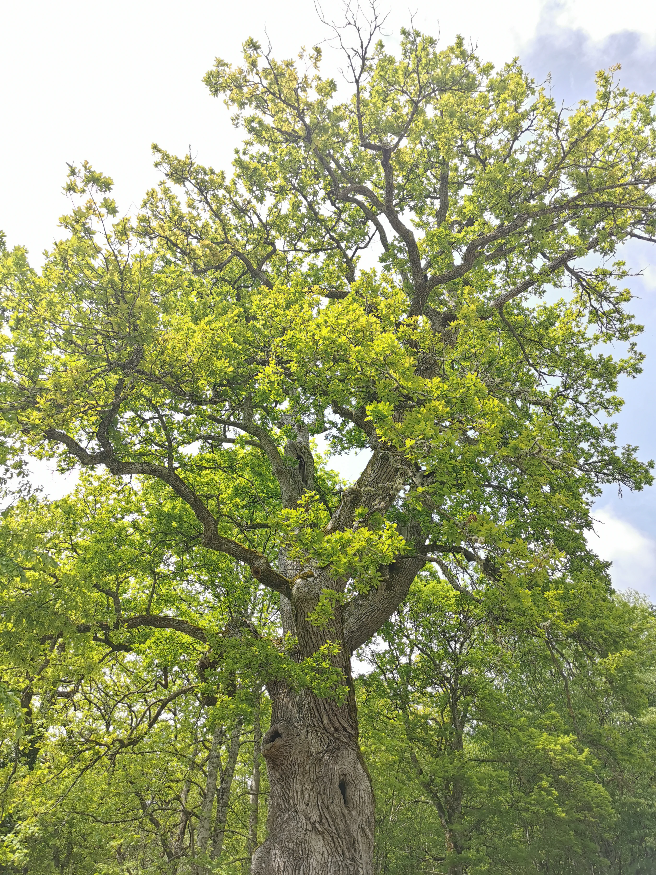
A large oak tree with dense green foliage in a forested area
Large oak tree in Forêts National Park

Forêts National Park history and protected-area timeline

The concept for Forêts National Park emerged from the 2009 Grenelle de l'Environnement process, when Prime Minister François Fillon announced plans for France's first national park dedicated to plain deciduous forests. Over the following decade, extensive working groups conducted studies to identify the park's strengths, weaknesses, and appropriate boundaries. A public inquiry held from November to December 2018 produced a favorable recommendation with five proposals, and the park was formally established through a decree published in the Journal Officiel de la République Française on November 7, 2019. The creation process involved a public interest grouping that brought together over 200 members representing the state, local authorities, and civil society. In December 2021, an integral reserve of 3,087 hectares was created within the park, representing the strictest level of protection.

Forêts National Park landscape and geographic character

The park occupies the southeastern portion of the Paris Basin's forested plateau, a landscape of gentle relief characterized by broad wooded expanses interspersed with river valleys, springs, and wetlands. The terrain reaches its highest point at the Haut de Baissey at 523 meters above sea level, which also marks the highest point of the Langres plateau and the department of Haute-Marne. The landscape is dominated by extensive deciduous forests growing on limestone substrates, with the forest cover being predominantly publicly owned, either state-managed or communally held. Water features are notably present throughout the park, with over 694 kilometres of streams and rivers and numerous tuffeau marshes—wetlands formed from limestone deposits that support specialized plant communities. The region historically supported extensive medieval forests including the forests of Châtillon, Arc-en-Barrois, and Auberive.
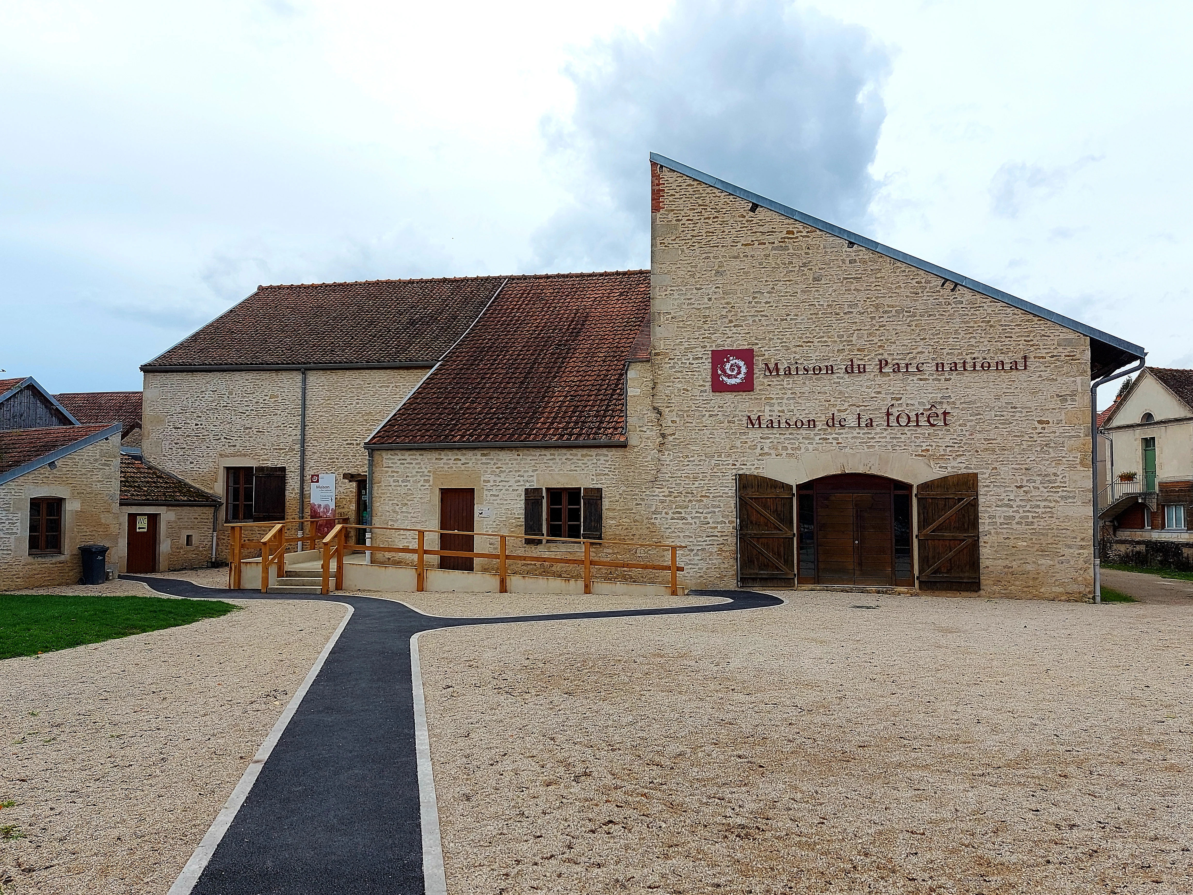
Stone building with brown roof and red circular emblem, labeled 'Maison du Parc national de forêts' and 'Maison de la Forêt,' with gravel courtyard and paved pathway
Maison du Parc national de forêts visitor center building

Forêts National Park ecosystems, habitats, and plant life

The ecological character of Forêts National Park centers on its extensive broad-leaved forest ecosystems, which represent some of the most significant lowland deciduous forests in Western Europe. The core zone maintains approximately 95 percent forest cover, with tree species including oak, maple, lime, ash, alder, birch, aspen, and service tree. The park's ecological diversity extends beyond its forests to include tuffeau marshes, limestone grasslands, and meadows that support rare plant communities. Notable species include the Lady's slipper orchid, spring snowflake, and Martagon lily. The tuffeau marshlands of the Châtillonnais region represent particularly important habitats supporting specialized flora. The forest management history, while intensive, has created a landscape that supports substantial populations of large ungulates including red deer, wild boar, and roe deer.
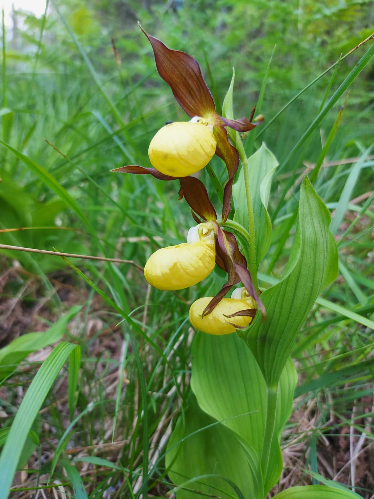
Yellow and brown Venus slipper orchids with green leaves in a grassy field
Yellow Venus slipper orchids in Forêts National Park

Forêts National Park wildlife and species highlights

Forêts National Park supports significant populations of large ungulates resulting from centuries of forest management oriented toward hunting. The park is particularly notable for its black stork population, with approximately 20 percent of France's total breeding population found within the park's boundaries—this species serves as the park's emblem. Other rare species include the European wildcat and the Damier du Frêne (white-spotted black butterfly), a threatened species whose fortunes are tied to old-growth forest habitats. The park supports remarkable invertebrate diversity, particularly wood-feeding insects that depend on decaying wood and veteran trees. The watercourses and wetlands host additional species assemblages, while the mosaic of forest, grassland, and wetland habitats creates conditions supporting a rich overall biodiversity.

Forêts National Park conservation status and protection priorities

The park's conservation approach emphasizes increasing forest naturality through the creation of woodland islands allowing longer rotation cycles, free forest evolution in core areas, and the preservation of trees bearing microhabitats such as hollows and crevices. This naturality framework aims to strengthen forest resilience against climate change pressures. Beyond forest conservation, the park addresses broader ecological connectivity and supports sustainable agricultural practices. The 2021 creation of a 3,087-hectare integral reserve provides the highest level of protection within the park, where natural processes proceed without direct human intervention. The park's conservation mission also encompasses public education through biodiversity atlases and educational nature areas, involving local communities in conservation work.

Forêts National Park cultural meaning and human context

The park territory contains significant cultural heritage reflecting centuries of human presence. Medieval villages such as Châteauvillain, designated as a Petites Cité de Caractère, preserve traditional architecture and urban fabric. The region bears the distinct imprint of the Templar Order, visible in architectural and archaeological remains. The park contains exceptional archaeological significance, most notably the Vix Crater—a massive Greek bronze vessel standing 1.64 meters tall and weighing 208.6 kilograms, representing the largest Greek vase ever discovered. Historical metallurgy and forest-dependent crafts including charcoal production, woodworking, and barrel-making shaped the region's cultural landscape. Contemporary cultural initiatives include art installations in forests and programs promoting the territory's heritage.

Top sights and standout views in Forêts National Park

Forêts National Park offers visitors the opportunity to experience extensive lowland deciduous forests with relatively easy accessibility compared to mountain parks. The annual deer rut in September provides a particularly memorable wildlife observation opportunity. The network of park houses at Châteauvillain, Leuglay, and Auberive provides visitor information and educational programming. The annual Nuits des Forests festival in June celebrates the forest nighttime environment. The park's art programs, including the open-air La Belle Balade circuit in the Arc-Châteauvillain state forest, integrate contemporary artistic expression with the forest setting.

Best time to visit Forêts National Park

The park can be visited year-round, though each season offers distinct experiences. Spring brings wildflower displays in the forests and grasslands, while autumn provides spectacular foliage colors and mushroom seasons—the park permits collecting certain edible species including morels, chanterelles, and boletes. September coincides with the red deer rut, offering opportunities to hear the characteristic roar of stags. Summer months allow full access to the extensive hiking and cycling trail networks. Winter provides a different perspective on the forest landscape, though some trails may be less accessible. The black stork nesting season in spring and early summer represents a particularly sensitive period when certain areas may have access restrictions.
Monthly climate preview

Trace the annual cycle of temperature and precipitation from long-term regional observations

Long-Term Climate and Monthly Weather Normals for Forêts National Park

Long-term data from a representative elevation of 322 meters reveals a climate with significant temperature variation alongside relatively steady year-round precipitation. Exploring the complete monthly breakdown helps researchers compare historical temperature extremes and average precipitation levels throughout each calendar month.
Annual mean10 °C
1 °C19 °C
Jan
Feb
Mar
Apr
May13°
Jun17°
Jul19°
Aug19°
Sep15°
Oct10°
Nov
Dec
Warmest month
July

18.8 °C

Coolest month
January

1.2 °C

Wettest month
December

2.6 mm/day

Driest month
March

1.8 mm/day

Park location guide

Geography guide, regional context, and park location map for Forêts National Park

Forêts National Park park geography, regions, and map view in France

Understand where Forêts National Park sits in France through a broader geographic reading of the surrounding landscape, nearby location context, and its mapped position within the national park landscape.

How Forêts National Park fits into France

France is a unitary semi-presidential republic and one of the world's largest economies. It borders Belgium, Luxembourg, Germany, Switzerland, Italy, Monaco, Andorra, and Spain, with a maritime border to the United Kingdom. The country is known for its cultural influence, art, cuisine, and political history spanning centuries.

Wider geography shaping Forêts National Park in France

France is located in Western Europe. Metropolitan France extends from the Rhine to the Atlantic Ocean and from the Mediterranean Sea to the English Channel and North Sea. The country borders Belgium, Luxembourg, Germany, Switzerland, Italy, Monaco, Andorra, Spain, and has a maritime border with the United Kingdom.

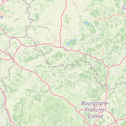
Map view of Forêts National Park

Use this park location map to pinpoint Forêts National Park in France, understand its exact geographic position, and read its mapped placement within the surrounding landscape more clearly.

Pigeon | © OpenStreetMap contributors

Location context for Forêts National Park

Côte-d'OrHaute-Marne
Natural feature types

Explore the Diverse Natural Landscape Features of Forêts National Park

Continue your geographic exploration by examining the specific natural landmarks and terrain types found within Forêts National Park. MoriAtlas provides a structured perspective on the forest, wetland, and plateau features that define this protected French region.
Recorded earthquake history

Consult the Historical Earthquake Records and Seismic Catalogue for Forêts National Park

Explore the documented history of seismic events recorded in the area surrounding Forêts National Park. MoriAtlas provides a structured catalogue of historical data, allowing for the review of recorded magnitudes and epicentre distances to understand the regional seismic context of these French protected landscapes.

Forêts National Park Earthquake History

Catalogued events

6 events

Strongest magnitude

Magnitude 3.9

Most recent event

Jul 4, 1991

This history includes earthquakes recorded inside the park or within 50 km of its borders

Explore the broadleaf forest scenery, diverse wetlands, and unique protected ecosystems of Forêts National Park in France.

Forêts National Park Photos: Visualizing France's Lowland Deciduous Forest Landscapes and Habitats

Browse comprehensive imagery of Forêts National Park to understand its distinctive lowland deciduous forests, expansive wetlands, and unique geological features across the Paris Basin plateau. These visual references offer essential insights into the park's characteristic terrain, diverse habitats, and overall protected-area identity, enabling deeper geographic comprehension.

A large oak tree with dense green foliage in a forested area

Sunlit forest scene with moss-covered rocks, green vegetation, yellow flowers, and tall trees with mossy branches

Stone building with brown roof and red circular emblem, labeled 'Maison du Parc national de forêts' and 'Maison de la Forêt,' with gravel courtyard and paved pathway

Yellow and brown Venus slipper orchids with green leaves in a grassy field

Park atlas

Explore the regional spread of protected landscapes across the Paris Basin plateau and beyond

Discover More Protected Areas and National Parks Near Forêts National Park

After exploring Forêts National Park, continue your geographic discovery by browsing other protected areas and national parks in the surrounding region. Trace the distribution of lowland deciduous forests, wetlands, and unique limestone grasslands across related conservation landscapes.
A watercolor painting of a rolling rural landscape with grassy hills, woodlands, and a winding stream, rendered in soft pastel greens, yellows, and pinks.
Nature reserveGrand Est
About 4.3 km away#1 closest

Southeast

Réserve naturelle régionale des pelouses et bois de Villemoron: Protected Area and Map

Regional nature reserve in the Grand Est, France

This protected area provides a rare glimpse into the limestone-based geography of the Haute-Marne department. Featuring a structured mix of oak forests and open calcareous grasslands, the reserve serves as an essential habitat refuge within the larger landscape of the Grand Est region. Use our mapped data to trace the boundaries and features of this uniquely managed natural environment.

Area
0.87 km²
Established
2015
IUCN
IV
Relief
Upland
Nature reserveHaute-Marne
10 km away#2 closest

Tufière de Rolampont Nature Reserve: Travertine Cascades and Geological Heritage in Haute-Marne

A rare living limestone formation in the Grand Est region of France

Tufière de Rolampont offers a window into the evolution of calcareous wetland ecosystems within the Champagne plateau. Visitors observe a process of natural stone creation where mineral-rich water encrusts living mosses, resulting in the stepped terraces that define this protected landscape. This site serves as a vital laboratory for understanding the intersection of hydrological heritage and unique botanical habitats.

Area
0.126 km²
Established
1982
Relief
Lowland
Climate
Temperate
Nature reserveBourgogne-Franche-Comté
About 25 km away#3 closest

South

Réserve naturelle régionale du Peuptu de la Combe Chaignay: Regional Nature Reserve Profile

Protected calcareous habitats in the Burgundy limestone uplands.

Spanning 36.6 hectares in the Côte-d'Or, this reserve protects a characteristic combe landform carved into Jurassic limestone plateaus. It serves as a vital example of site-specific conservation within the Bourgogne-Franche-Comté region, focusing on the management of habitats essential to the northern French countryside.

Area
0.366 km²
Established
2025
IUCN
IV
Relief
Mixed relief
A watercolor painting of a pastoral landscape featuring a calm river winding through green fields and forests with rolling mountains in the background, set against a soft sunset sky.
Nature reserveBourgogne-Franche-Comté
About 29 km away#4 closest

South

Réserve naturelle régionale du Val-Suzon: Protected Landscape and Geographic Atlas

Wooded limestone valleys in the Bourgogne-Franche-Comté region

Spanning the meandering Suzon river, this large regional nature reserve provides a essential look at the limestone plateaus and deciduous woodlands of Côte-d'Or. The area serves as a primary reference for regional biodiversity, containing dry grasslands, rocky slopes, and sensitive tufa springs protected within its defined borders. This resource outlines the physical terrain and conservation significance of the territory for those mapping the natural landscape of eastern France.

Area
29.806 km²
Established
2011
Relief
Upland
Climate
Temperate
Watercolor painting of an open, undulating rural landscape with patches of green vegetation, trees, and golden fields under a soft white sky.
Nature reserveGrand Est
About 32 km away#5 closest

North

Réserve naturelle régionale de la pelouse de la côte de l'étang: Regional Nature Reserve Geography

Calcareous grassland protected area in the Grand Est region of France

Discover the geographic character of Réserve naturelle régionale de la pelouse de la côte de l'étang. This reserve showcases a specialized dry grassland landscape on a sun-drenched slope, providing a critical haven for rare flora and fauna in the heart of the Barrois champenois territory.

Area
0.108 km²
Established
2010
IUCN
IV
Relief
Upland
Nature reserveBourgogne-Franche-Comté
About 39 km away#6 closest

South

Réserve naturelle régionale de la grotte du Contard: Protected Karst and Cave Geography

Regional natural reserve in the Bourgogne-Franche-Comté landscape

Located near Dijon, the Réserve naturelle régionale de la grotte du Contard is a protected area focused on preserving the karst features and geological heritage of the Côte-d'Or. This site serves as a vital example of subterranean habitat conservation, showcasing the unique interaction between water-sculpted limestone cavities and the surrounding plateau terrain. Explore the geographic extent of this reserve and understand its role within the regional natural reserve network.

Area
0.259 km²
Established
2025
IUCN
IV
Climate
Temperate
A horizontal watercolor illustration showing a pond with green trees, reeds, and low hills in the background against a white backdrop.
Nature reserveGrand Est
About 41 km away#7 closest

North

Réserve naturelle régionale de l'étang de Ramerupt: Geography and Protected Wetland Atlas

Mapping the historic Champagne humide pond landscape in Grand Est

Examine the dense wetland mosaic of Réserve naturelle régionale de l'étang de Ramerupt, a 33-hectare sanctuary in the Aube department. This resource traces the pond edges, reedbed structures, and wet woodland terrain that comprise this essential regional nature reserve, highlighting the intersection of human water management and natural marshland succession in the French countryside.

Area
0.336 km²
Established
2010
IUCN
IV
Relief
Lowland
A soft watercolor painting of a calm lake scene featuring small grassy islands with trees, surrounded by marshy vegetation under a light, hazy sky.
Nature reserveGrand Est
About 51 km away#8 closest

Northwest

Réserve naturelle nationale de la forêt d'Orient: Protected Landscapes and Wetland Mapping

Key protected area in the Grand Est region of France

Investigate the geographic structure of Réserve naturelle nationale de la forêt d'Orient, a reserve shaped by reservoir-driven water cycles. This protected area features a diverse arrangement of lake-edge mudflats, expansive reedbeds, and temperate forest cover. Gain insight into the regional importance of these habitats as a node for migratory bird pathways and native terrestrial biodiversity in eastern France.

Area
15.6 km²
Established
2002
IUCN
IV
Relief
Lowland

Common questions about visiting, size, designation, and location context for Forêts National Park

Forêts National Park FAQs for park facts, access, geography, and protected area context

Find quick answers about Forêts National Park, including protected-area facts, park geography, trail and visitor context, and how the park fits into its surrounding country and regional landscape.
MoriAtlas Explorer

Continue Your Protected Areas Search Across the Global Atlas

Deepen your exploration by continuing the structured search for national parks and protected areas worldwide. Utilize the comprehensive filtering capabilities to compare different conservation landscapes and refine your understanding of global park geography. Discover more about the distribution and characteristics of protected natural areas.

Global natural geography