
Why Tufière de Rolampont stands out
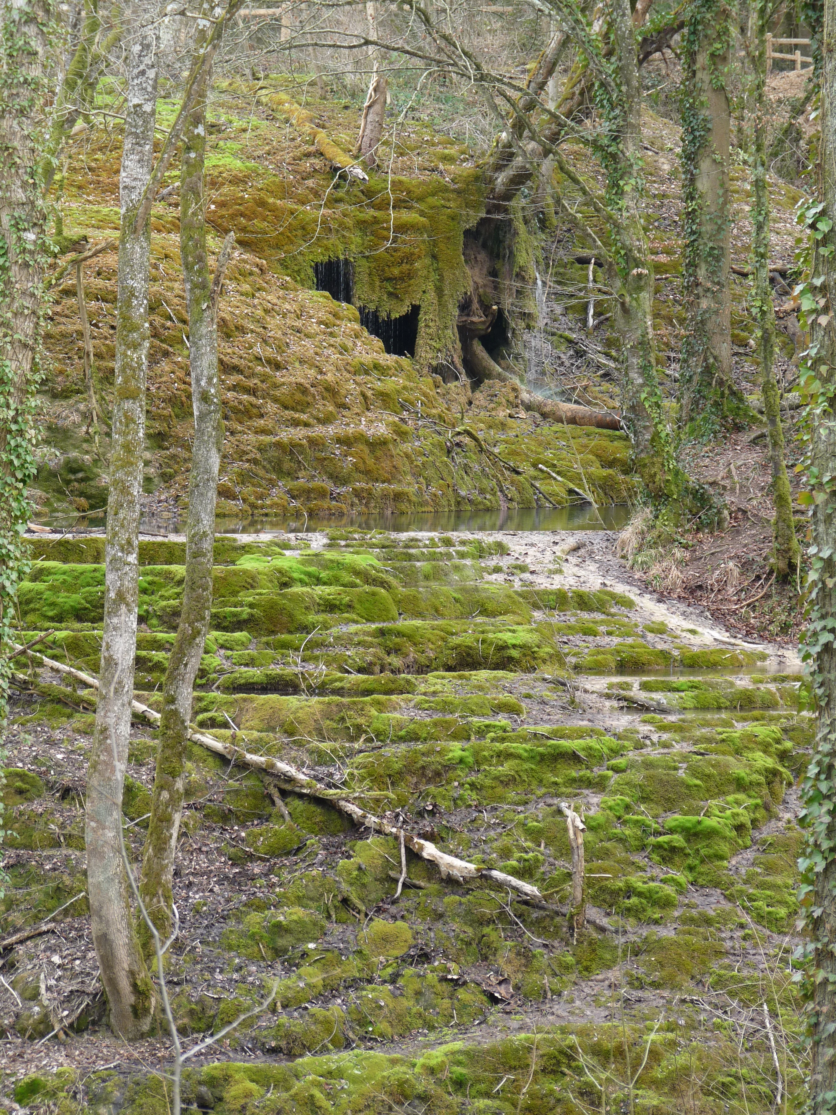
The Tufière de Rolampont is best known for being a rare, still-active calcareous tufa formation. Calcium-rich spring water flows through bryophyte colonies, particularly species such as Palustriella commutata, Eucladium verticillatum, and Gymnostomum calcareum, gradually encrusting the mosses in limestone and producing the stepped basins and natural stone staircases that define the landscape. The site is equally valued for showing both stages of this process side by side: active zones where tufa is still being deposited, and older, fossilized formations that have petrified completely. Historically, the solidified tufa was so durable that it was quarried locally as a building material, leaving visible traces of past extraction on the site today. This combination of a living geological process, rare bryophyte habitat, and visible cultural heritage gives the site a strongly distinctive identity within the regional natural heritage of Champagne.
Tufière de Rolampont history and protected-area timeline
The Tufière de Rolampont has been shaped by a long interplay between natural processes and human use. Geologically, the formation has been built up over thousands of years through the gradual deposition of calcium carbonate from calcareous spring water flowing over mosses along the Vaubrien stream. While the process is still active today, much of the visible tufa body is fossilized, having accumulated long before any modern records were kept.
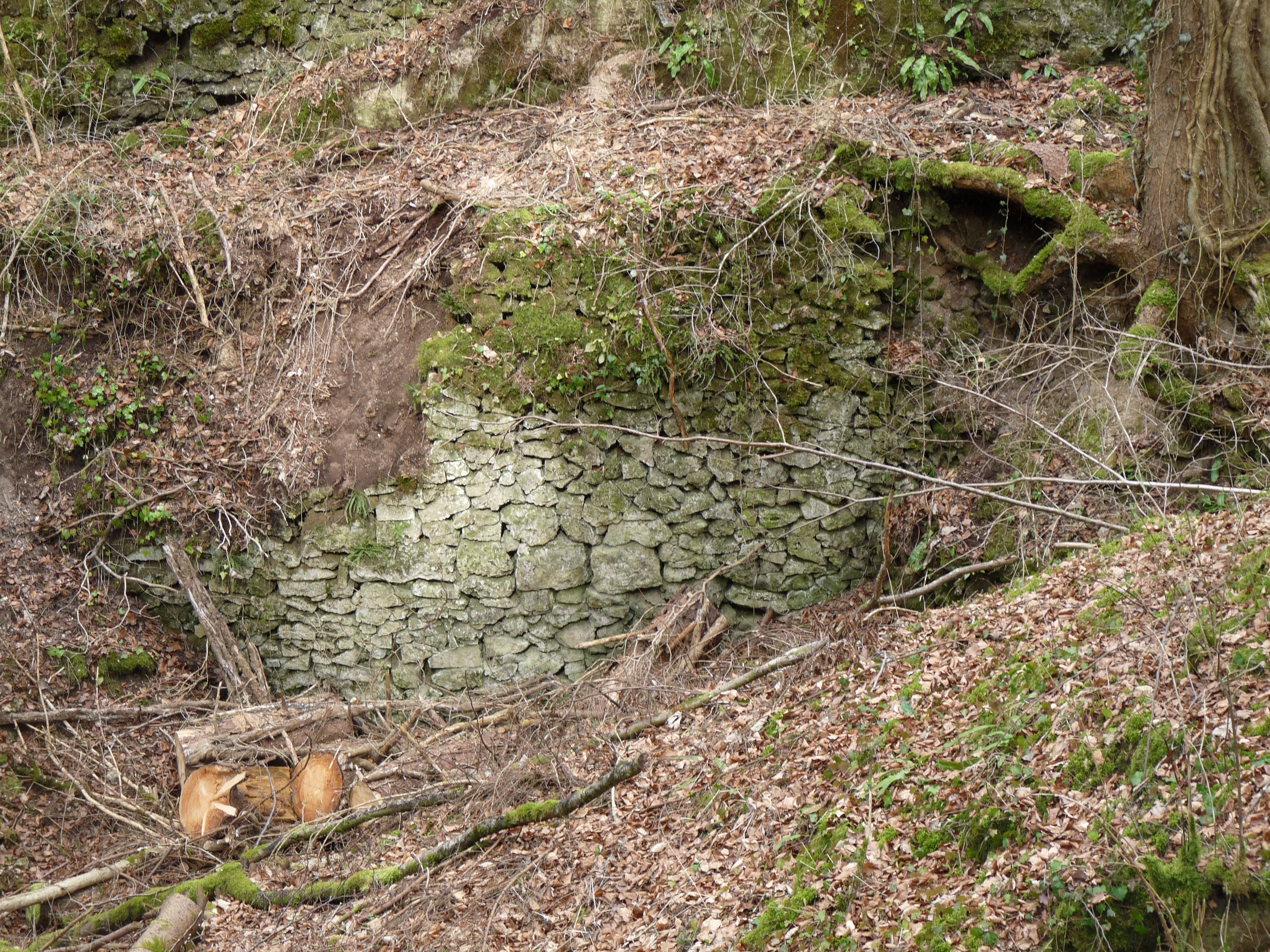
For local communities, the significance of the site long predates any formal protection. "Cascades" of this type were widely known across the Champagne countryside, and the solidified tufa was valued as a sturdy, easily worked building material. This led to historical extraction at Rolampont, the traces of which remain visible in old quarries and the ruins of a quarryman's shelter on the site. Although the deposits appear massive and inert, the formations are in fact a biological deposit, and over-harvesting can disrupt the fragile seepage system that maintains them.
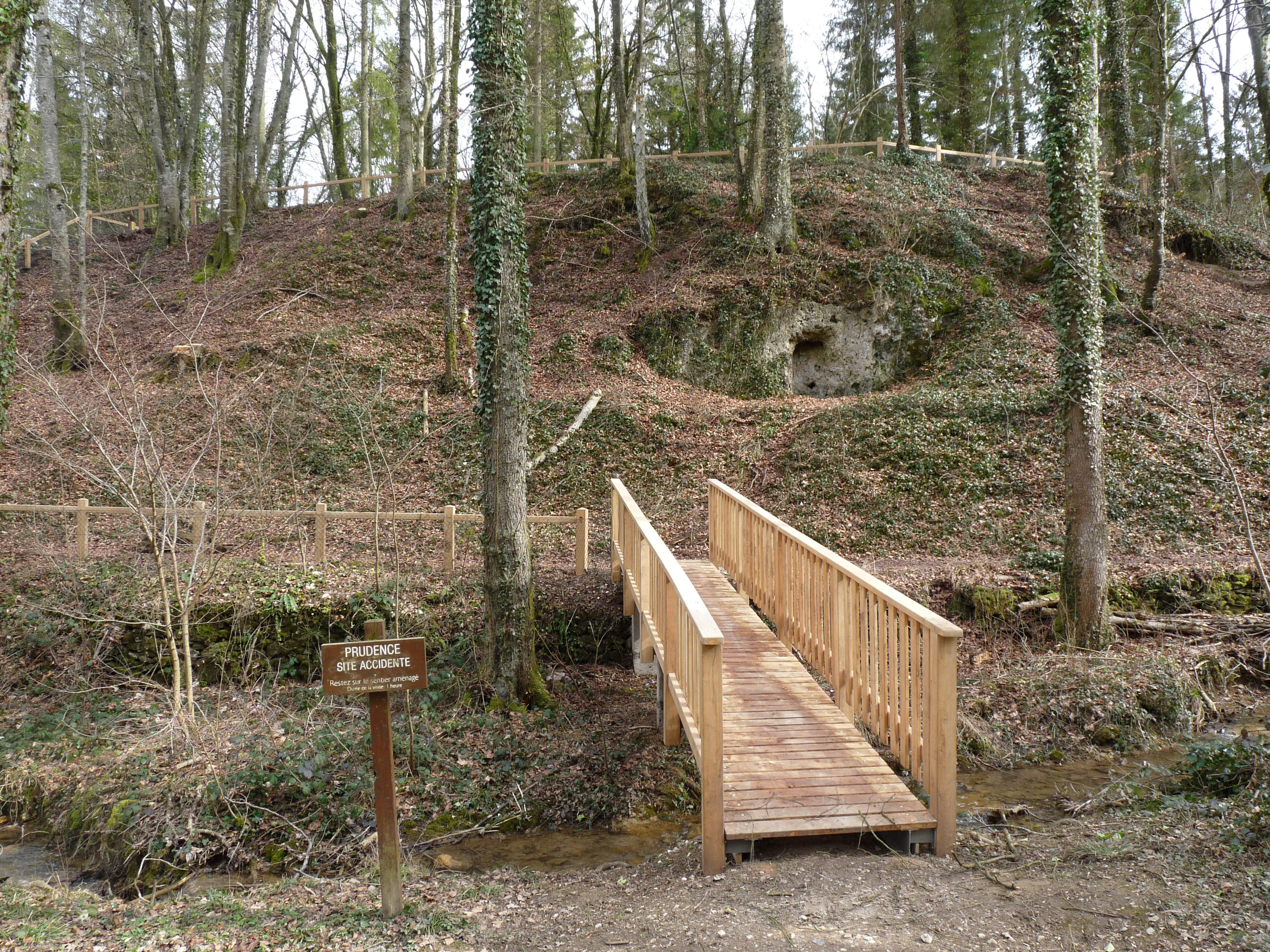
Modern protection of the site began with improvements to its surroundings in 1972 and 1973, when fencing, wooden bridges, stairs, and benches were installed to make the area accessible while limiting erosion and trampling. On July 23, 1982, the site was officially classified as a natural site by ministerial decree, an early and durable form of French heritage protection. It has since been incorporated into the Natura 2000 ecological network and identified as a ZNIEFF, or zone of ecological, faunistic, and floristic interest, reflecting its recognized importance for European biodiversity and for the conservation of calcareous seepage habitats.
Tufière de Rolampont landscape and geographic character
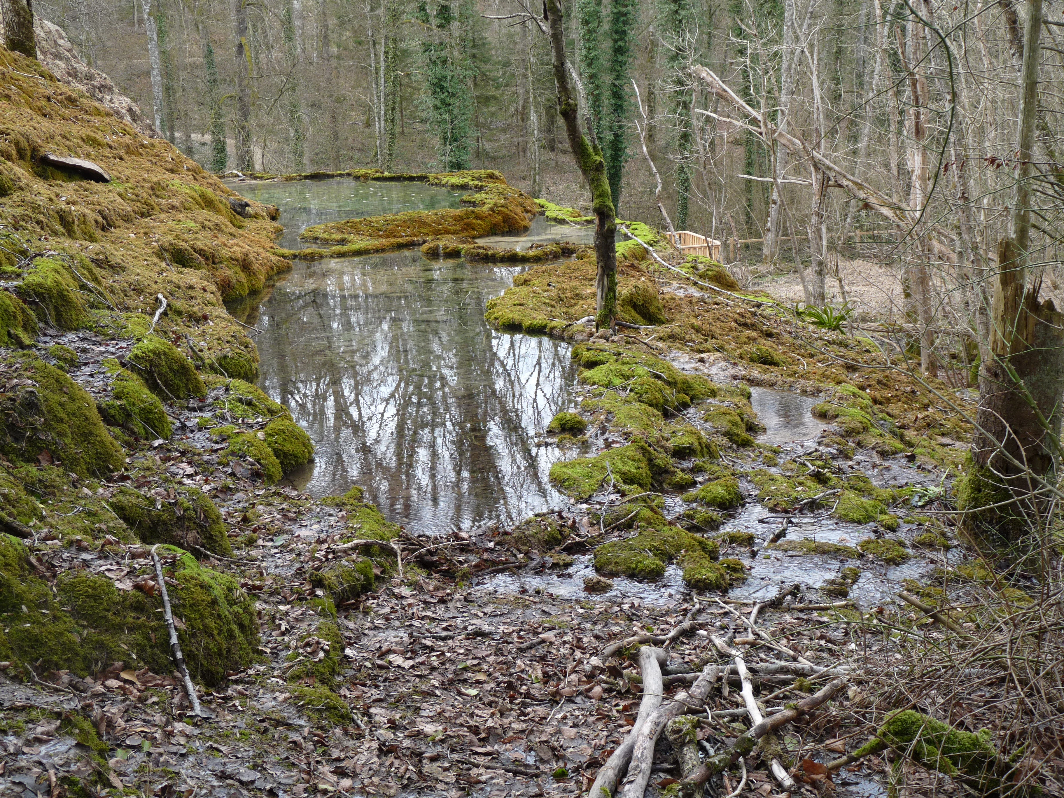
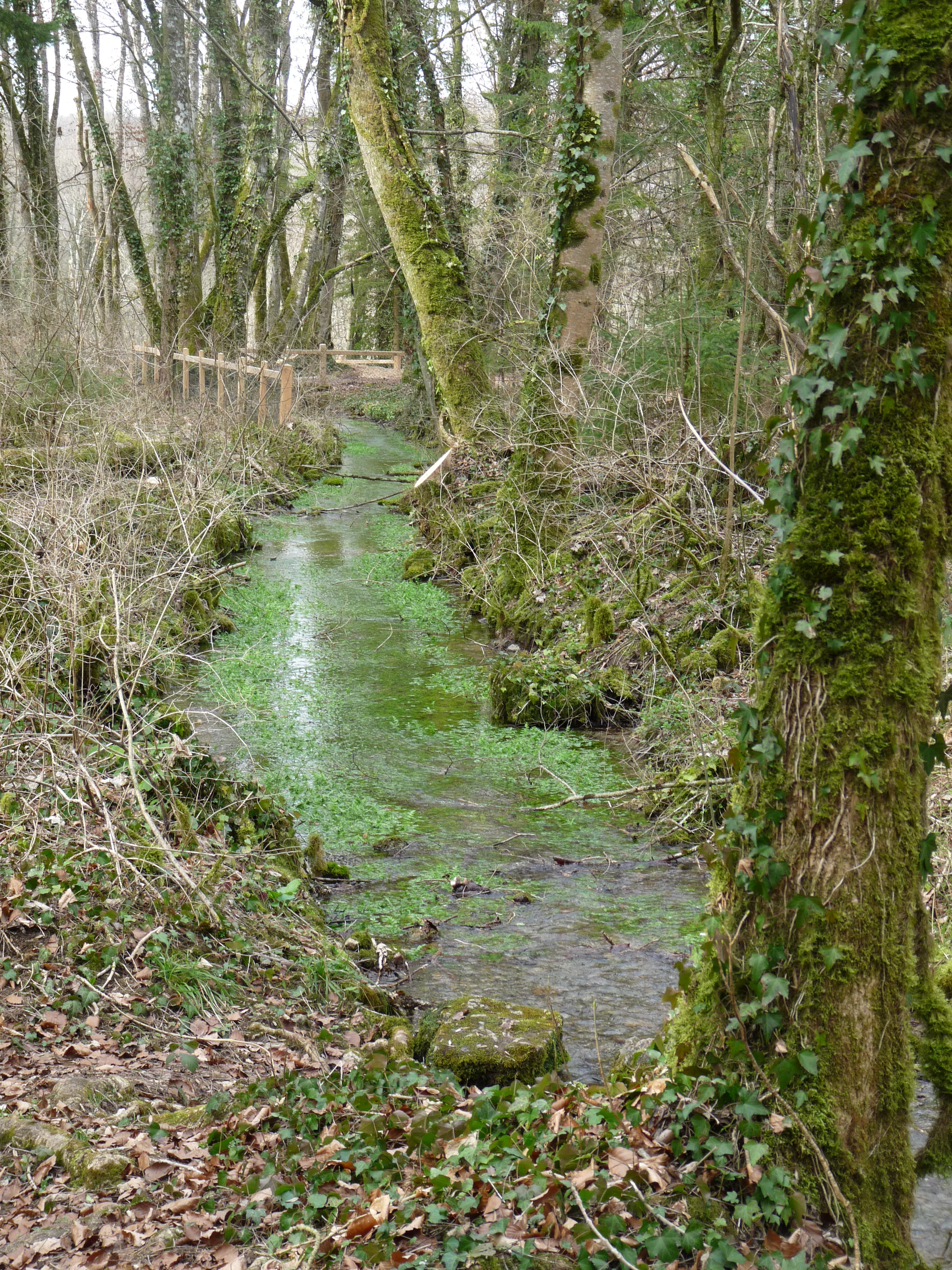
The landscape of the Tufière de Rolampont is defined by a relatively short but visually striking slope along the Vaubrien stream. Across roughly 200 meters of length and 20 meters of elevation, the hillside is transformed by tufa deposition into a series of terraced basins, natural stone dams, and petrified cascades. The impression is of a frozen waterfall: white to pale-grey stone steps and basins that retain the rounded shapes of the moss colonies around which the calcite was deposited.
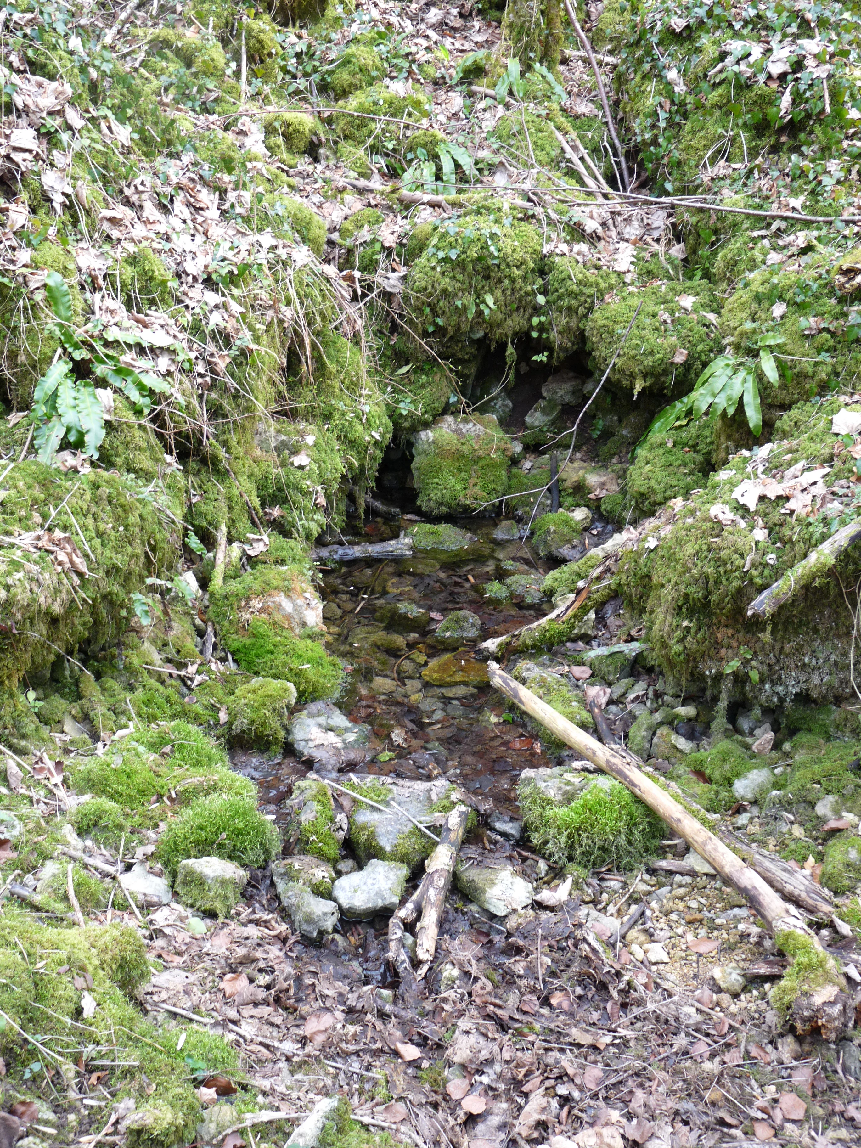
At the head of the formation, a calcareous spring delivers the water that drives the whole system. From there, the Vaubrien flows downhill through the tufa body before continuing as an ordinary stream toward the Marne. Because the source is constant and the surrounding limestone is rich in dissolved carbonate, deposition continues year-round, and the upper, active zones of the site look fresh and pale, while the older, lower zones appear more weathered and integrated into the hillside.
The broader setting is typical of the Champagne plateau in Haute-Marne: gently rolling limestone country, mixed woodland, and small agricultural valleys. The tufa formation contrasts sharply with this wider landscape, both in color and in texture, and it is this local concentration of an unusual hydrological and biological phenomenon within an otherwise ordinary rural setting that gives the site its strong visual identity.
Tufière de Rolampont ecosystems, habitats, and plant life
Ecologically, the Tufière de Rolampont is best understood as a calcareous seepage, or travertine, habitat, a rare environment built wherever mineral-rich spring water flows over vegetation. The deposition of calcium carbonate depends on a continuous covering of bryophytes, particularly calcareous mosses that thrive in the constant humidity and high pH of the water. As the mosses grow, the water coats them in calcite, gradually turning soft, living tissue into stony replicas of itself. Without these moss colonies, the tufa-building process would not occur in the same way.
Because the habitat depends on stable water chemistry, undisturbed flow, and intact vegetation cover, the community it supports is considered ecologically fragile. The Tufière de Rolampont is recognized for this unusual combination of conditions, and the site is included in the Natura 2000 network, with its calcareous seepage habitats designated as a habitat type of European conservation interest. The same conditions also support other moisture-loving plants and invertebrates associated with continuously wet, mineral-rich substrates.
In the wider landscape, the tufa site sits within the mosaic of woodland, meadow, and small valley habitats of the Haute-Marne countryside. The contrast between the rugged, mineral tufa slopes and the softer agricultural surroundings helps reinforce the ecological value of the protected area, as the site preserves a habitat type that is underrepresented at the regional scale.
Tufière de Rolampont wildlife and species highlights
The wildlife profile of the Tufière de Rolampont is closely tied to its character as a calcareous wetland habitat. Because the site is small and highly specialized, it is particularly noted for its bryophyte communities rather than for large or charismatic fauna. Among the bryophyte species documented as actively involved in tufa deposition at the site are Palustriella commutata, Eucladium verticillatum, and Gymnostomum calcareum, all mosses adapted to living in permanently wet, calcareous conditions.
The stable, mineral-rich, and humid environment also supports a range of invertebrates, mollusks, and microorganisms associated with cold spring-fed seepages, although detailed faunal inventories are limited in the public-facing sources. The site's protected status as a ZNIEFF and its inclusion in the Natura 2000 network reflect the broader recognition that the habitat as a whole holds ecological value, rather than that any single species dominates its significance.
In practical terms, visitors to the site tend to encounter the wildlife dimension indirectly: through the visible moss colonies, the small aquatic life of the terraced pools, and the birdlife and insects of the surrounding woodland. The site is best framed as a custodian of a specialized habitat community rather than a destination for traditional large-animal or birdwatching tourism.
Tufière de Rolampont conservation status and protection priorities
The conservation significance of the Tufière de Rolampont lies in the rarity and fragility of its active calcareous tufa formation. Active tufa deposits of this volume and clarity are uncommon in eastern France, and the site is considered a particularly good example of the type. Because the formation depends on continuous spring discharge, on stable vegetation cover, and on undisturbed water chemistry, even small changes in land use, vegetation, or hydrology can interrupt or distort the deposition process.
Protection has been layered over time. The earliest formal recognition came on July 23, 1982, when the site was classified as a site naturel, a strong statutory protection under French heritage law that controls modification of the area. This was followed by its inclusion in the European Natura 2000 network, which recognizes the calcareous seepage habitat as a habitat type of conservation interest, and by its designation as a ZNIEFF, or zone of ecological, faunistic, and floristic interest, at the national level.
Active management at the site has focused on balancing public access with physical protection. Wooden boardwalks, stairs, and interpretive panels have been installed to keep visitors on durable paths and away from the most fragile moss carpets. Cyclists and horse riders are excluded from the core site to limit compaction and disturbance. These measures reflect a recognition that the conservation of an active tufa site requires both legal protection and careful on-the-ground management of visitor pressure.
Tufière de Rolampont cultural meaning and human context
The Tufière de Rolampont occupies a specific place in the regional identity of Haute-Marne and the wider Champagne countryside. Locally and historically, tufa formations of this type were often referred to as cascades, a vernacular term that captures the visual resemblance between the stepped tufa pools and a frozen waterfall. This regional naming reflects how strongly the phenomenon was embedded in everyday rural awareness before formal environmental protection existed.
There is also a long-standing practical relationship between local communities and the site. Solidified tufa from formations like Rolampont was traditionally extracted as a building material, and traces of old quarries and a former quarryman's shelter remain within the protected area. These archaeological and industrial traces are an integral part of how the site is understood today, linking its scientific interest to the region's rural and craft heritage.
The site is also tied to nearby cultural attractions through marked walking routes. An 11-kilometer hiking loop connects the tufa site to the Gallo-Roman mausoleum of Faverolles, about four kilometers away, weaving the natural monument into a broader heritage trail that spans geological time, ancient history, and contemporary rural landscape.
Top sights and standout views in Tufière de Rolampont
The Tufière de Rolampont's most distinctive highlight is the contrast it offers between an active tufa formation and a fossilized one within a single short walk. Visitors can see pale, freshly deposited stone still building up around living moss colonies in the upper parts of the slope, then move down into areas where the process has long since finished and the stone is rigid, quarriable, and visually static.
A second highlight is the visual character of the stepped basins themselves, locally known as cascades. The repetitive geometry of natural stone pools and dams, combined with the bright, almost chalky color of fresh tufa, makes the landscape unusual within the otherwise gently rolling limestone countryside of Haute-Marne.
Finally, the site stands out for the layered protection it carries, combining an early 1982 classification as a site naturel with Natura 2000 and ZNIEFF recognition, and for the quiet, low-key way these protections have been translated into physical infrastructure: wooden bridges, interpretive signs, and a roughly one-hour walking loop that lets visitors experience the phenomenon without damaging it.
Best time to visit Tufière de Rolampont
The Tufière de Rolampont can be visited comfortably across much of the year, since the spring water feeding the formation flows continuously and the site's interest is largely geological and botanical rather than seasonal. Spring and early summer tend to be especially rewarding because the moss colonies are at their most active and the fresh tufa is most visibly contrasted against the older formations. Cool, damp conditions also favor an unhurried walk along the trail and reduce stress on both visitor and habitat.
Late summer and autumn can also be pleasant, with sharper contrasts between the pale tufa and the surrounding vegetation, though very dry periods may temporarily reduce surface flow and dull the visual liveliness of the active zones. Winter visits are feasible but can be less comfortable due to cold, wet conditions on the boardwalks, even though the site itself continues to function.
For most visitors, the key consideration is the mild weather: the short walking loop and the exposed wooden boardwalks are best enjoyed in stable, dry conditions, while heavy frost or intense rain can make the path slippery. The site is closed to cyclists and horse riders, and the recommended route is the roughly one-hour pedestrian circuit.