
Mori Atlas logo
Nature reserveRéserve naturelle régionale du Val-Suzon

Mapped boundaries and diverse limestone terrain across the Suzon river valley landscape

Réserve naturelle régionale du Val-Suzon: A Detailed Geographic Atlas of Protected Woodlands

The Réserve naturelle régionale du Val-Suzon protects nearly 3,000 hectares of deciduous forest and calcareous habitats in eastern France. This detailed geographic record tracks the reserve as it spans the Suzon river valley, featuring limestone ridges, scree slopes, and rare tufa springs. Providing a clear look at the topography and protected boundaries, the data highlights how the reserve bridges the Burgundian uplands through a complex mosaic of botanical and biological diversity.

regional nature reserveforestdeciduous woodlandBourgogne-Franche-ComtéCôte-d'OrSuzon valley
A flat vector-style digital illustration of a valley featuring a waterfall cascading into a river, surrounded by rocky cliffs and stylized forest vegetation.

Réserve naturelle régionale du Val-Suzon

Nature reserve

Park overview

Structured park overview, official facts, and landscape profile for Réserve naturelle régionale du Val-Suzon

Réserve naturelle régionale du Val-Suzon park facts, protected area profile, and essential visitor context

Review the core facts for Réserve naturelle régionale du Val-Suzon, including designation, size, terrain, visitor scale, habitats, and operating context in one park-focused overview.

About Réserve naturelle régionale du Val-Suzon

The Réserve naturelle régionale du Val-Suzon is one of the flagship regional nature reserves of eastern France. It protects a sizeable portion of the forested landscape that rises north of Dijon, between the famous côtes viticoles to the south and the wooded uplands of the Châtillonnais to the north. From an administrative standpoint, it is classified as a Réserve naturelle régionale, recognized under IUCN Category IV, and recorded in the World Database on Protected Areas as entry 555514327.

Geographically, the reserve occupies parts of four communes in the Côte-d'Or department: Darois, Messigny-et-Vantoux, Étaules, and the commune that gives the valley its name, Val-Suzon. The protected area follows the valley of the Suzon river, a small watercourse that has long supplied drinking water to Dijon and whose meanders, locally incised into the limestone plateau, shape much of the reserve's character. Elevations span roughly 300 to 550 meters, and the resulting variation in exposure, slope, and soil type contributes to the landscape's ecological richness.

The area has long been valued as a natural heritage site. It was classified under France's 1930 landscape protection law by decree in 1989 and inscribed in the inventory of natural monuments and sites of Côte-d'Or in 1992, before being elevated to regional nature reserve status in 2011. Forest dominates the territory: national forest account for about 69% of the surface, communal forests for about 28%, and private holdings make up the remainder. Within this wooded setting, open and semi-open habitats such as dry calcareous grasslands, scree slopes, and tufa springs create ecological transitions that support rare botanical and faunal communities.

For visitors and naturalists, the reserve functions both as a protected ecological site and as a cultural landscape. It is freely accessible along existing paths, allowing low-impact discovery of the woodland and valley scenery. The management of the reserve is led by the Office national des forêts Bourgogne Est, which operates under successive multi-year management plans. The current plan, covering 2020–2029, was approved in March 2021, and the reserve's achievements in conservation governance were recognized when it became the first French regional nature reserve to be admitted to the IUCN Green List in April 2024.

Quick facts and research context for Réserve naturelle régionale du Val-Suzon

The Réserve naturelle régionale du Val-Suzon (registry code RNR232) is situated in Bourgogne-Franche-Comté, in the Côte-d'Or department north of Dijon. It was created by deliberation on 27 June 2011 and is managed by the Office national des forêts (ONF), specifically the ONF Bourgogne Est unit since November 2011.

Its roughly 2,980 hectares combine a national forest (about 69% of the surface), five communal forests (about 28%), and a smaller share of private holdings. The reserve lies within the ZNIEFF-type I area known as the Vallée du Suzon and partially overlaps a Natura 2000 Special Protection Area. It was classified under the 1930 law by decree in 1989 and inscribed as a natural monument site in 1992, before obtaining its current regional nature reserve status.

Protection and recognition

Terrestrial conservation framework, designation year, and official protected-area records

Réserve naturelle régionale du Val-Suzon Protection Status and Designated History

Réserve naturelle régionale du Val-Suzon maintains documented terrestrial protection status established in the year 2011. Official records compile the designated history, management scope, and verified database identifiers for this regional protected landscape.

Protection details

Protection scope
Terrestrial
Designated year
2011
Transboundary protection
No
WDPA ID
555514327
Park context

Deeper park guide and search-rich context for Réserve naturelle régionale du Val-Suzon

Réserve naturelle régionale du Val-Suzon history, landscape, wildlife, and travel context

Explore Réserve naturelle régionale du Val-Suzon through its history, landscape character, ecosystems, wildlife, conservation priorities, cultural context, and seasonal travel timing in a structured park guide built for atlas discovery and search intent.

Why Réserve naturelle régionale du Val-Suzon stands out

The reserve is especially known for the exceptional diversity of its forested and semi-open habitats along the Suzon valley, where calcareous substrates support dry grasslands, scree slopes, and rare tufa-spring wetlands embedded within extensive deciduous woodlands. Its botanical richness includes more than 500 vascular plant species, with a significant proportion considered threatened at the regional level in Bourgogne. It is also recognized for its strong faunal value, particularly birds of European conservation interest such as the Peregrine Falcon, European Nightjar, Bonelli's Warbler, and Grey-headed Woodpecker, and for hosting an unusually rich bat community within a restricted area. The combination of ancient landscape, varied geology, and overlapping protection designations has made it a reference site for naturalists in the region for more than a century.
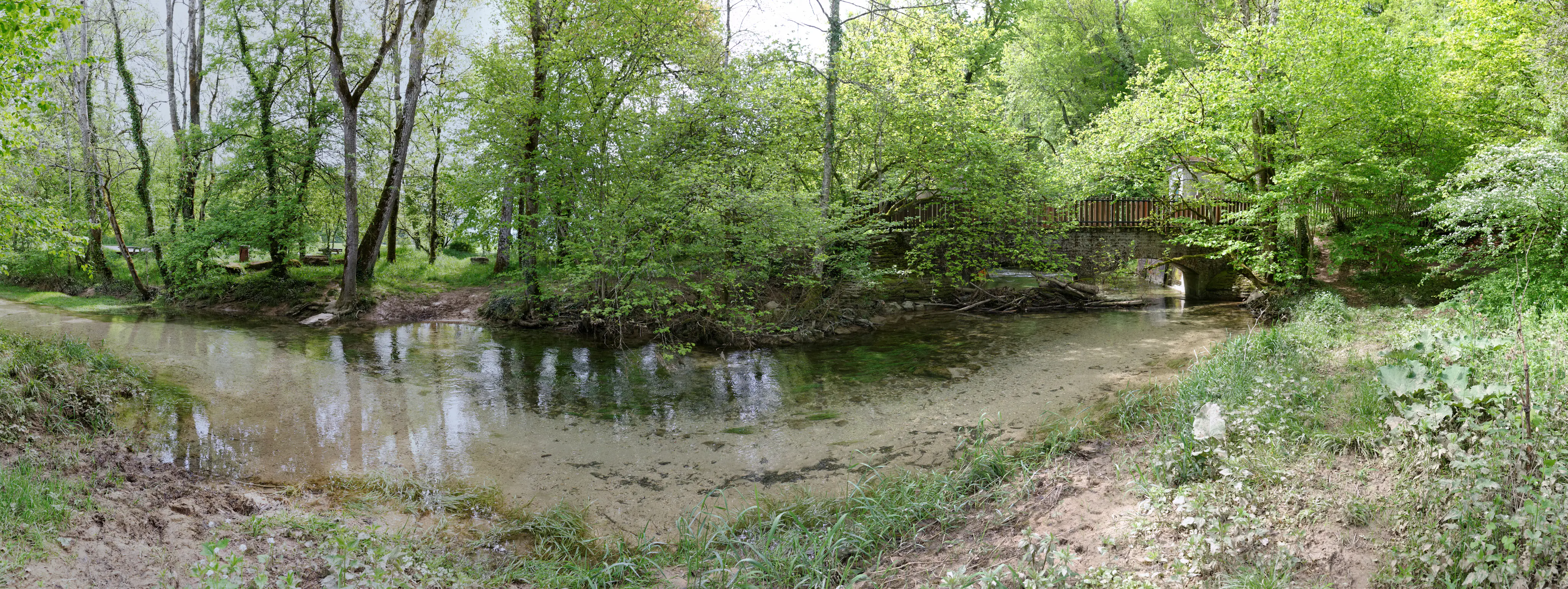
A wide panoramic view of a narrow river curving through a lush green forest, with a stone bridge visible on the right side.
The Suzon river flowing through a forested area of the Val-Suzon Regional Nature Reserve, with a small bridge visible in the distance.

Réserve naturelle régionale du Val-Suzon history and protected-area timeline

Human presence in the Val-Suzon valley goes back to the Neolithic period. The hilltop site known as the Châtelet d'Étaules features a barred spur fortification dating to around 3000 BCE, attesting to early occupation and the long use of these wooded uplands. Over centuries, the valley provided timber, firewood, and trade goods, and supplied drinking water to the city of Dijon, linking the landscape to regional economic life.

In the twentieth century, the area transitioned into an outdoor leisure space while also gaining recognition for its remarkable natural heritage, attracting naturalists from across France for more than a century. Formal protection began with classification under the loi du 2 mai 1930 by decree on 28 July 1989, followed by inscription in the inventory of natural monuments and sites of Côte-d'Or on 25 February 1992. These steps highlighted the site as a landscape of national interest.

The site was then elevated to its current status as a Réserve naturelle régionale by regional deliberation on 27 June 2011, giving rise to the regional nature reserve registry code RNR232. Management became the responsibility of the Office national des forêts Bourgogne Est from November 2011. A first management plan covered the period 2014–2018, while the second plan, running 2020–2029, was approved on 5 March 2021. In October 2016 the site received the Forêt d'Exception label, and on 24 April 2024 the reserve became the first French regional nature reserve to be entered on the IUCN Green List, marking growing international recognition of its conservation governance.

Réserve naturelle régionale du Val-Suzon landscape and geographic character

The Val-Suzon reserve sits on the limestone plateau that rises north of Dijon, between the vine-growing slopes of the côte dijonnaise to the south and the forested uplands of the montagne châtillonnaise to the north. The Suzon river cuts a winding valley through this plateau, producing a meandering watercourse flanked by slopes that range from gentle benches to sharper limestone cliffs. This varied relief is a defining feature of the protected area.

Altitudes in the reserve range from about 300 meters along the valley floor to roughly 550 meters on the surrounding ridges. The combination of elevations, exposures, and soil types generates a patchwork of habitats. Open areas include dry calcareous grasslands, rocky scree, and clearings on thin soils, while the wooded slopes and plateau support extensive deciduous forest, dominated by beech, oak, and other broadleaf species typical of the Burgundian uplands.

Within this mosaic, tufa springs emerge where calcareous groundwater reaches the surface, creating small but ecologically distinctive wetland patches surrounded by forest. These spring areas, together with the dramatic meanders of the Suzon visible in the upstream reaches, give the reserve both its hydrological identity and many of its most characteristic micro-landscapes.

Réserve naturelle régionale du Val-Suzon ecosystems, habitats, and plant life

Ecologically, the Val-Suzon reserve occupies a transitional zone between the limestone and vineyard côte dijonnaise and the montagne châtillonnaise. The meeting of oceanic, southern, and continental climatic influences over this varied terrain has produced a habitat mosaic unusually rich for a site of its size: dry calcareous grasslands, rocky scree, tufa-spring wetlands, and a wide spectrum of forest types, all in close proximity.

Forest is the dominant land cover, with woodlands accounting for roughly 96% of the reserve. Even within this forested matrix, the gradient from valley bottoms to plateau ridges and the alternation between deeper soils and thin rocky substrates create ecologically different conditions that host diverse plant communities. The tufa-spring complexes are among the most distinctive habitats, supporting moisture-loving species within an otherwise dry limestone landscape.

Inventories have documented more than 2,800 species of animals and plants on the site, including more than 500 vascular plant species. Eleven protected plant species are recorded, and more than 10% of the vascular flora is considered threatened in Bourgogne. This botanical richness underpins much of the reserve's ecological identity and gives the site particular importance for plant conservation in the region.

Réserve naturelle régionale du Val-Suzon wildlife and species highlights

The fauna of the Val-Suzon reserve reflects the diversity of its habitats and the long continuity of forest cover. Avifauna is particularly well documented, with more than 76 bird species recorded, including 11 of European conservation interest. Notable species include the Peregrine Falcon, the European Nightjar, the Bonelli's Warbler, and the Grey-headed Woodpecker, all of which depend on the combination of cliffs, open ground, and mature woodland that the reserve provides.

Herpetofauna is also significant: eight amphibian species and eight reptile species have been inventoried, with snakes represented by three species of colubrids. The varied geology and presence of water along the Suzon corridor support both pond-breeding amphibians and reptile communities that rely on rocky outcrops, scree, and dry grassland edges.

Bats are one of the most distinctive features of the reserve. With 14 known species, the site hosts an exceptionally diverse chiropteran community within a compact area, reflecting the availability of old trees, cliffs, caves, and stable underground shelters. This bat richness gives the reserve considerable importance for the conservation of nocturnal fauna in Bourgogne.

Réserve naturelle régionale du Val-Suzon conservation status and protection priorities

The Val-Suzon reserve protects a sizeable forested area at the doorstep of a major urban center, securing ecological continuity and landscape quality in a region traditionally shaped by agriculture, viticulture, and forestry. Its designation under IUCN Category IV recognizes the reserve's role in safeguarding specific habitats and species rather than functioning as a strict wilderness area, which is consistent with its long history of human use for water, timber, and recreation.

Ecologically, the reserve is layered with other protection instruments. It overlaps fully or partially with a ZNIEFF type I area covering the Vallée du Suzon, a ZNIEFF type II area covering the montagne dijonnaise from the Ignona valley to the Ouche valley, and a Natura 2000 Birds Directive zone focused on the forests, grasslands, and dry slopes of the Suzon valley. These overlapping designations reinforce the conservation value of a site whose flora includes a substantial share of regionally threatened species and whose fauna includes species of European interest.

The site has also received formal recognition of its governance quality. In October 2016 it was awarded the Forêt d'Exception label, and on 24 April 2024 the reserve became the first French regional nature reserve to be admitted to the IUCN Green List. These milestones reflect both the ecological value of the site and the quality of its long-term management under successive plans, the most recent of which covers the period 2020–2029.

Réserve naturelle régionale du Val-Suzon cultural meaning and human context

The Val-Suzon valley carries a deep cultural imprint, beginning with Neolithic occupation and the ancient barred-spur fortification at the Châtelet d'Étaules. Over centuries, the landscape sustained local communities through its timber, firewood, and trade, while also supplying drinking water to the city of Dijon, embedding the valley in the everyday life of the regional capital.

The transition from a working forest to a recreational and naturalist space during the twentieth century added a new cultural layer. The reserve is associated with more than a century of naturalist exploration, and this heritage of observation, documentation, and amateur scientific engagement continues to shape how the site is perceived locally. The Forêt d'Exception label, awarded in 2016, also reflects a cultural recognition of the forest as a shared regional heritage, beyond its strictly ecological functions.

Top sights and standout views in Réserve naturelle régionale du Val-Suzon

The Val-Suzon reserve combines the unusually large size of a regional nature reserve in France with a high concentration of habitat types within easy reach of Dijon. Its principal highlights include extensive deciduous forest on calcareous soils, dry grasslands and scree slopes, and rare tufa-spring wetlands, all set within the meandering valley of the Suzon river.

Equally noteworthy is the reserve's biological richness: more than 2,800 inventoried species, a vascular flora of more than 500 species of which more than 10% are regionally threatened, an avifauna including several European-interest species, and a bat community of 14 species. The reserve's layered protection status and its international recognition through the IUCN Green List round out a profile that places it among the leading regional nature reserves in France.

Best time to visit Réserve naturelle régionale du Val-Suzon

The Val-Suzon reserve offers different seasonal perspectives throughout the year. Spring is generally favorable for observing woodland flora, the activity of amphibians near the Suzon and its wet zones, and returning birdlife. Summer brings warmer, drier conditions in the open calcareous grasslands and the chance to encounter species such as the European Nightjar at dusk, while the leafy forest canopy is at its fullest.

Autumn shifts attention to fruiting vegetation, migrating birds, and the changing colors of the broadleaf forest, while winter can reveal the structure of the woodland and makes the meanders of the Suzon particularly visible in the leafless landscape. Because the reserve is freely accessible along its existing paths, low-impact visits during any of these seasons are the standard way to experience the site, whatever the chosen period.
Monthly climate preview

Long-term representative point measurements tracking monthly temperature ranges and precipitation patterns

Réserve naturelle régionale du Val-Suzon Climate Normals and Annual Temperature Rhythm

Representative coordinate records show average monthly temperatures spanning from 1.1 °C to 18.86 °C alongside steady year-round precipitation rates between 1.7 and 2.59 mm per day. Examining the complete twelve-month climatology data provides a comprehensive baseline for evaluating long-term environmental patterns across the protected landscape.
Annual mean10 °C
1 °C19 °C
Jan
Feb
Mar
Apr
May13°
Jun17°
Jul19°
Aug19°
Sep15°
Oct10°
Nov
Dec
Warmest month
July

18.9 °C

Coolest month
January

1.1 °C

Wettest month
November

2.6 mm/day

Driest month
March

1.7 mm/day

Park location guide

Geography guide, regional context, and park location map for Réserve naturelle régionale du Val-Suzon

Réserve naturelle régionale du Val-Suzon park geography, regions, and map view in France

Understand where Réserve naturelle régionale du Val-Suzon sits in France through a broader geographic reading of the surrounding landscape, nearby location context, and its mapped position within the national park landscape.

How Réserve naturelle régionale du Val-Suzon fits into France

France is a unitary semi-presidential republic and one of the world's largest economies. It borders Belgium, Luxembourg, Germany, Switzerland, Italy, Monaco, Andorra, and Spain, with a maritime border to the United Kingdom. The country is known for its cultural influence, art, cuisine, and political history spanning centuries.

Wider geography shaping Réserve naturelle régionale du Val-Suzon in France

France is located in Western Europe. Metropolitan France extends from the Rhine to the Atlantic Ocean and from the Mediterranean Sea to the English Channel and North Sea. The country borders Belgium, Luxembourg, Germany, Switzerland, Italy, Monaco, Andorra, Spain, and has a maritime border with the United Kingdom.

Map view of Réserve naturelle régionale du Val-Suzon

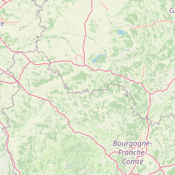
Use this park location map to pinpoint Réserve naturelle régionale du Val-Suzon in France, understand its exact geographic position, and read its mapped placement within the surrounding landscape more clearly.

Pigeon | © OpenStreetMap contributors

Location context for Réserve naturelle régionale du Val-Suzon

Bourgogne-Franche-Comté

Explore photographic records of limestone terrain, river valleys, and forest habitats.

Visualizing Réserve naturelle régionale du Val-Suzon: Landscapes and Scenery

Photographic documentation of Réserve naturelle régionale du Val-Suzon reveals the intricate topography of the Suzon valley and surrounding limestone plateaus. Visual archives capture deciduous woodlands, dry grasslands, and protected habitats that define the character of the reserve.

A wide panoramic view of a narrow river curving through a lush green forest, with a stone bridge visible on the right side.

Park atlas

Compare nearby regional nature reserves, forested uplands, and connected limestone landscapes.

Other Parks Near Réserve naturelle régionale du Val-Suzon and Surrounding Protected Areas

Continue exploring regional protected areas by comparing other reserves located near Réserve naturelle régionale du Val-Suzon. Analyzing adjacent forest ecosystems and limestone plateau habitats provides broader geographic context for eastern French natural reserves.
Nature reserveBourgogne-Franche-Comté
About 6.7 km away#1 closest

Northeast

Réserve naturelle régionale du Peuptu de la Combe Chaignay: Regional Nature Reserve Profile

Protected calcareous habitats in the Burgundy limestone uplands.

Spanning 36.6 hectares in the Côte-d'Or, this reserve protects a characteristic combe landform carved into Jurassic limestone plateaus. It serves as a vital example of site-specific conservation within the Bourgogne-Franche-Comté region, focusing on the management of habitats essential to the northern French countryside.

Area
0.366 km²
Established
2025
IUCN
IV
Relief
Mixed relief
Nature reserveBourgogne-Franche-Comté
About 10 km away#2 closest

South

Réserve naturelle régionale de la grotte du Contard: Protected Karst and Cave Geography

Regional natural reserve in the Bourgogne-Franche-Comté landscape

Located near Dijon, the Réserve naturelle régionale de la grotte du Contard is a protected area focused on preserving the karst features and geological heritage of the Côte-d'Or. This site serves as a vital example of subterranean habitat conservation, showcasing the unique interaction between water-sculpted limestone cavities and the surrounding plateau terrain. Explore the geographic extent of this reserve and understand its role within the regional natural reserve network.

Area
0.259 km²
Established
2025
IUCN
IV
Climate
Temperate
Watercolor painting of a green, rolling landscape showing forested hills in varying shades of light green and soft earth tones against a white background.
Nature reserveBourgogne-Franche-Comté
About 24 km away#3 closest

South

Réserve naturelle nationale de la combe Lavaux-Jean Roland Protected Area Geography

Limestone cliff landscapes in Bourgogne-Franche-Comté

Spanning over 400 hectares, this nature reserve showcases a dramatic interplay of steep limestone walls and scree slopes. The geographic profile highlights the contrast between north-facing forest and sunlit grasslands, creating a vital corridor for endemic species within the Burgundy landscape.

Area
4.87 km²
Established
2004
IUCN
IV
Relief
Upland
A watercolor painting of a rolling rural landscape with grassy hills, woodlands, and a winding stream, rendered in soft pastel greens, yellows, and pinks.
Nature reserveGrand Est
About 28 km away#4 closest

North

Réserve naturelle régionale des pelouses et bois de Villemoron: Protected Area and Map

Regional nature reserve in the Grand Est, France

This protected area provides a rare glimpse into the limestone-based geography of the Haute-Marne department. Featuring a structured mix of oak forests and open calcareous grasslands, the reserve serves as an essential habitat refuge within the larger landscape of the Grand Est region. Use our mapped data to trace the boundaries and features of this uniquely managed natural environment.

Area
0.87 km²
Established
2015
IUCN
IV
Relief
Upland
Watercolor illustration of a forested landscape with rolling hills, distant mountains, and a sky with soft pastel colors
National parkFrance
About 29 km away#5 closest

North

Forêts National Park: A Protected Landscape of Lowland Deciduous Forests

Explore its unique geography and protected forest ecosystems.

Delve into Forêts National Park, a significant protected area in northeastern France dedicated to preserving lowland deciduous forests and their associated biodiversity. This park represents a unique atlas entry for understanding mapped protected lands, featuring extensive broad-leaved forest tracts, diverse wetlands, and limestone grasslands across the Grand Est and Bourgogne-Franche-Comté regions. Discover the geographic identity of this conservation landscape and its role within the Paris Basin's terrain.

Area
560 km²
Established
2019
IUCN
II
Relief
Lowland
Nature reserveHaute-Marne
About 61 km away#6 closest

Tufière de Rolampont Nature Reserve: Travertine Cascades and Geological Heritage in Haute-Marne

A rare living limestone formation in the Grand Est region of France

Tufière de Rolampont offers a window into the evolution of calcareous wetland ecosystems within the Champagne plateau. Visitors observe a process of natural stone creation where mineral-rich water encrusts living mosses, resulting in the stepped terraces that define this protected landscape. This site serves as a vital laboratory for understanding the intersection of hydrological heritage and unique botanical habitats.

Area
0.126 km²
Established
1982
Relief
Lowland
Climate
Temperate
Nature reserveBourgogne-Franche-Comté
About 68 km away#7 closest

East

Réserve naturelle régionale de la grotte de Beaumotte: Protected Karst and Cave Landscapes

A regional nature reserve focused on subterranean conservation.

Located in the Haute-Saône department, this regional nature reserve protects a critical limestone cave system that supports complex subterranean ecosystems and bat species of regional concern. The site occupies a modest surface area on the edge of the Monts de Gy massif, yet provides significant geological and ecological value through its horizontal gallery network and captured springs.

Area
0.088 km²
Established
2015
IUCN
IV
Relief
Upland
A soft watercolor painting of a green, hilly landscape with small groups of trees, set against a white background.
Nature reserveBourgogne-Franche-Comté
About 72 km away#8 closest

East

Réserve naturelle régionale du vallon de Fontenelay: Protected Area Atlas and Map

High-density marly grasslands and wetland seepage slopes

Situated in the Haute-Saône department, this nature reserve features a distinct valley landscape formed by marly soil and limestone. Explore the site's rich biodiversity including alkaline marshes and its significant role in the regional conservation network for northeastern France.

Area
0.416 km²
Established
2010
IUCN
IV
Relief
Upland

Common questions about visiting, size, designation, and location context for Réserve naturelle régionale du Val-Suzon

Réserve naturelle régionale du Val-Suzon FAQs for park facts, access, geography, and protected area context

Find quick answers about Réserve naturelle régionale du Val-Suzon, including protected-area facts, park geography, trail and visitor context, and how the park fits into its surrounding country and regional landscape.
MoriAtlas Explorer

Continue Your Protected Areas Search Across the Global Atlas

Deepen your exploration by continuing the structured search for national parks and protected areas worldwide. Utilize the comprehensive filtering capabilities to compare different conservation landscapes and refine your understanding of global park geography. Discover more about the distribution and characteristics of protected natural areas.

Global natural geography