Mori Atlas logo
National parkForêts National Park

Discover mapped park boundaries and unique regional geography across two French regions.

Forêts National Park: France's Protected Lowland Deciduous Forest Landscape

(Parc national de forêts)

Forêts National Park, established in 2019, stands as France's pioneering national park focused on lowland deciduous forest ecosystems. Occupying parts of Haute-Marne and Côte-d'Or in northeastern metropolitan France, this protected landscape spans approximately 560 square kilometers of predominantly public forestland across the Grand Est and Bourgogne-Franche-Comté regions. Explore its mapped boundaries and understand its distinctive contribution to France's protected areas atlas, characterized by extensive unmanaged broad-leaved forests, vital wetlands, and rare limestone grassland habitats.

Broadleaf ForestsLowland ForestsDeciduous ForestsWetlandsMarshesNew National Park

Forêts National Park

National park

Park overview

Structured park overview, official facts, and landscape profile for Forêts National Park

Forêts National Park park facts, protected area profile, and essential visitor context
Review the core facts for Forêts National Park, including designation, size, terrain, visitor scale, habitats, and operating context in one park-focused overview.

About Forêts National Park

Forêts National Park represents a landmark in French conservation as the first national park specifically designed to protect lowland deciduous forests of the Paris Basin. The park's territory stretches across the border between two departments and two regions, making it unique in France's protected area network. The landscape is characterized by extensive forested plateaus, river valleys, and interspersed wetlands that create a mosaic of habitats supporting remarkable biodiversity. Unlike most French national parks situated in mountainous or coastal regions, Forêts operates at relatively modest elevations not exceeding 500 meters, making it exceptionally accessible while providing critical habitat for species dependent on old-growth forest conditions. The park's governance involves a complex arrangement including a board of administrators, a scientific council, an economic and cultural council, and notably a unique Conference of Mayors bringing together representatives from all 127 communes within the optimal adhesion area.

Quick facts and research context for Forêts National Park

Forêts National Park covers roughly 560 square kilometres across 110 communes in Haute-Marne and Côte-d'Or departments. The park reaches its highest point at the Haut de Baissey at 523 meters, representing the culmination of the Langres plateau. The core protected zone is 95 percent forested, with the park containing over 694 kilometres of watercourses and numerous springs and wetlands including tuffeau marshes. A 3,087-hectare integral reserve was created in 2021, representing one of France's strictest protected forest areas. The park is governed by Parcs nationaux de France and operates under a charter that emphasizes forest naturality, sustainable agriculture, and local economic development.

Park context

Deeper park guide and search-rich context for Forêts National Park

Forêts National Park history, landscape, wildlife, and travel context
Explore Forêts National Park through its history, landscape character, ecosystems, wildlife, conservation priorities, cultural context, and seasonal travel timing in a structured park guide built for atlas discovery and search intent.

Why Forêts National Park stands out

Forêts National Park is especially known for its extensive tracts of unmanaged broad-leaved forest and the protection of the black stork, which serves as the park's emblematic species and hosts approximately 20 percent of France's total population within its boundaries. The park also protects remarkable biodiversity in its wetlands, limestone grasslands, and ancient forests, including rare orchid species such as the Lady's slipper and spring snowflake. Its cultural significance is underscored by important archaeological discoveries, notably the Vix Crater, one of the largest Greek vases ever found, and well-preserved medieval villages that bear the imprint of the Templar Order.

Forêts National Park history and protected-area timeline

The concept for Forêts National Park emerged from the 2009 Grenelle de l'Environnement process, when Prime Minister François Fillon announced plans for France's first national park dedicated to plain deciduous forests. Over the following decade, extensive working groups conducted studies to identify the park's strengths, weaknesses, and appropriate boundaries. A public inquiry held from November to December 2018 produced a favorable recommendation with five proposals, and the park was formally established through a decree published in the Journal Officiel de la République Française on November 7, 2019. The creation process involved a public interest grouping that brought together over 200 members representing the state, local authorities, and civil society. In December 2021, an integral reserve of 3,087 hectares was created within the park, representing the strictest level of protection.

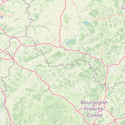
Forêts National Park landscape and geographic character

The park occupies the southeastern portion of the Paris Basin's forested plateau, a landscape of gentle relief characterized by broad wooded expanses interspersed with river valleys, springs, and wetlands. The terrain reaches its highest point at the Haut de Baissey at 523 meters above sea level, which also marks the highest point of the Langres plateau and the department of Haute-Marne. The landscape is dominated by extensive deciduous forests growing on limestone substrates, with the forest cover being predominantly publicly owned, either state-managed or communally held. Water features are notably present throughout the park, with over 694 kilometres of streams and rivers and numerous tuffeau marshes—wetlands formed from limestone deposits that support specialized plant communities. The region historically supported extensive medieval forests including the forests of Châtillon, Arc-en-Barrois, and Auberive.

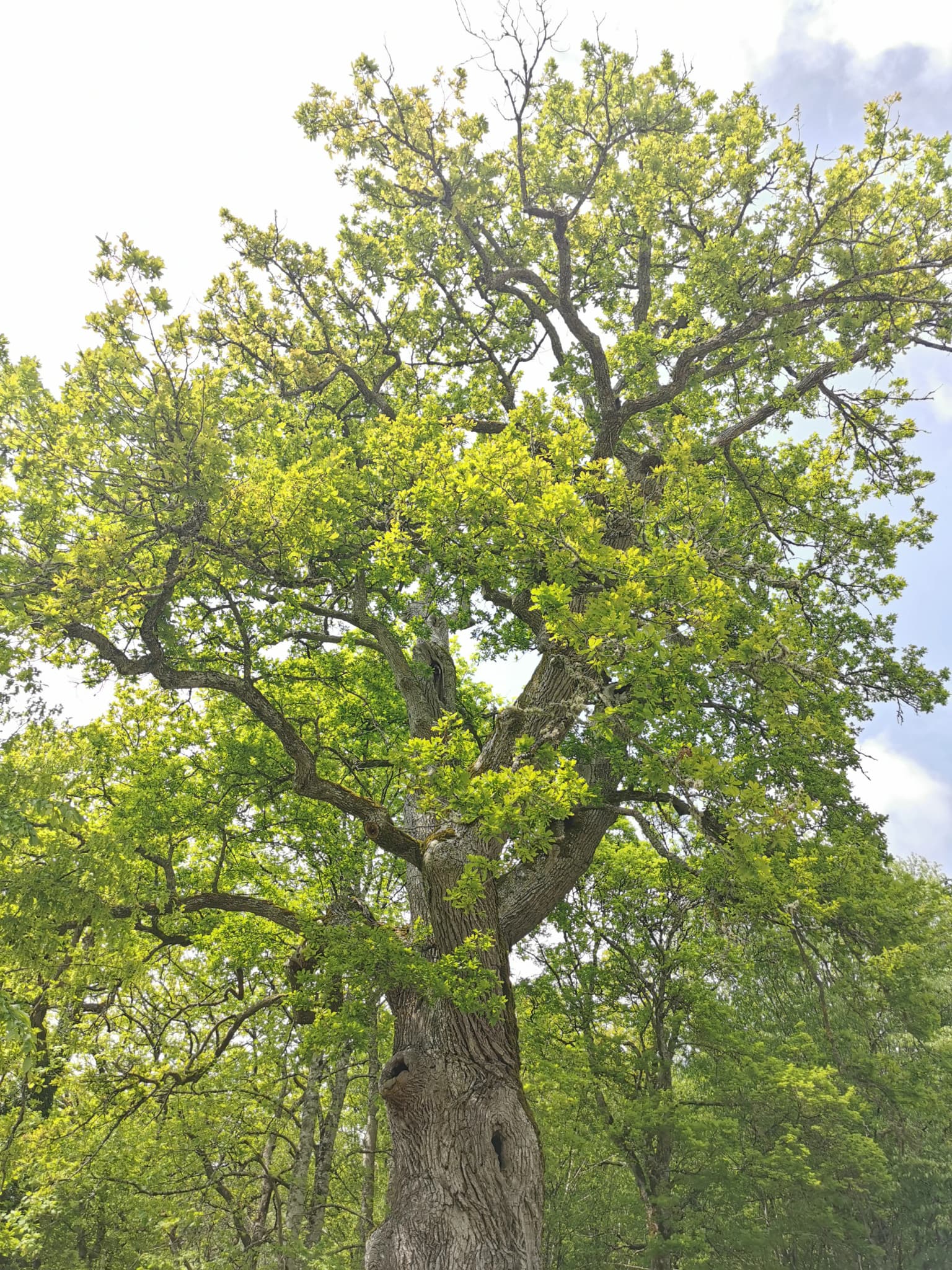
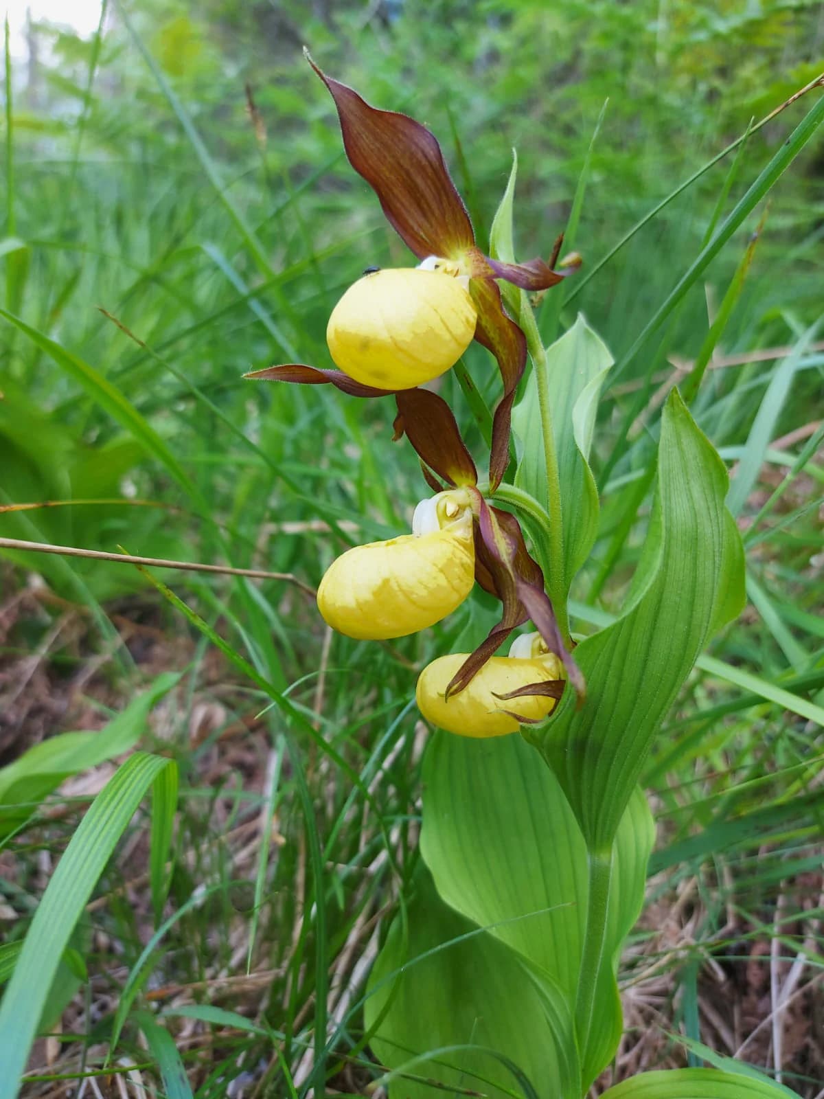
Forêts National Park ecosystems, habitats, and plant life

The ecological character of Forêts National Park centers on its extensive broad-leaved forest ecosystems, which represent some of the most significant lowland deciduous forests in Western Europe. The core zone maintains approximately 95 percent forest cover, with tree species including oak, maple, lime, ash, alder, birch, aspen, and service tree. The park's ecological diversity extends beyond its forests to include tuffeau marshes, limestone grasslands, and meadows that support rare plant communities. Notable species include the Lady's slipper orchid, spring snowflake, and Martagon lily. The tuffeau marshlands of the Châtillonnais region represent particularly important habitats supporting specialized flora. The forest management history, while intensive, has created a landscape that supports substantial populations of large ungulates including red deer, wild boar, and roe deer.

Forêts National Park wildlife and species highlights

Forêts National Park supports significant populations of large ungulates resulting from centuries of forest management oriented toward hunting. The park is particularly notable for its black stork population, with approximately 20 percent of France's total breeding population found within the park's boundaries—this species serves as the park's emblem. Other rare species include the European wildcat and the Damier du Frêne (white-spotted black butterfly), a threatened species whose fortunes are tied to old-growth forest habitats. The park supports remarkable invertebrate diversity, particularly wood-feeding insects that depend on decaying wood and veteran trees. The watercourses and wetlands host additional species assemblages, while the mosaic of forest, grassland, and wetland habitats creates conditions supporting a rich overall biodiversity.

Forêts National Park conservation status and protection priorities

The park's conservation approach emphasizes increasing forest naturality through the creation of woodland islands allowing longer rotation cycles, free forest evolution in core areas, and the preservation of trees bearing microhabitats such as hollows and crevices. This naturality framework aims to strengthen forest resilience against climate change pressures. Beyond forest conservation, the park addresses broader ecological connectivity and supports sustainable agricultural practices. The 2021 creation of a 3,087-hectare integral reserve provides the highest level of protection within the park, where natural processes proceed without direct human intervention. The park's conservation mission also encompasses public education through biodiversity atlases and educational nature areas, involving local communities in conservation work.

Forêts National Park cultural meaning and human context

The park territory contains significant cultural heritage reflecting centuries of human presence. Medieval villages such as Châteauvillain, designated as a Petites Cité de Caractère, preserve traditional architecture and urban fabric. The region bears the distinct imprint of the Templar Order, visible in architectural and archaeological remains. The park contains exceptional archaeological significance, most notably the Vix Crater—a massive Greek bronze vessel standing 1.64 meters tall and weighing 208.6 kilograms, representing the largest Greek vase ever discovered. Historical metallurgy and forest-dependent crafts including charcoal production, woodworking, and barrel-making shaped the region's cultural landscape. Contemporary cultural initiatives include art installations in forests and programs promoting the territory's heritage.

Top sights and standout views in Forêts National Park

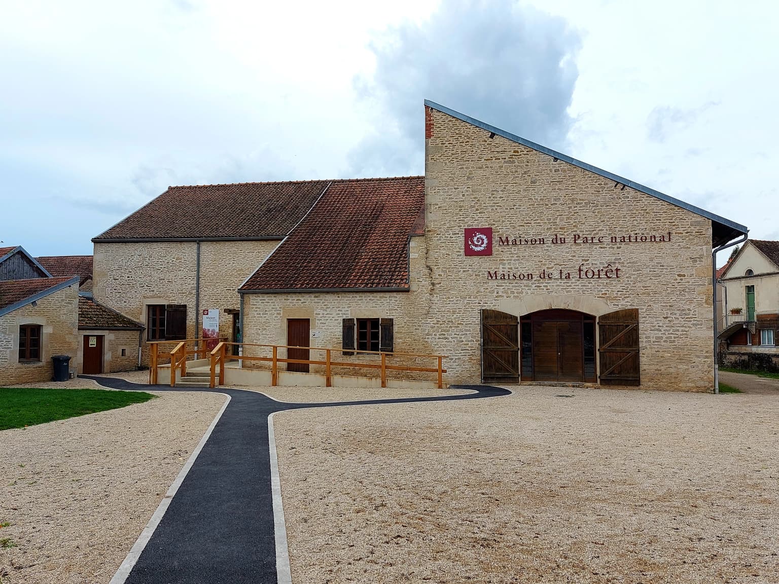
Forêts National Park offers visitors the opportunity to experience extensive lowland deciduous forests with relatively easy accessibility compared to mountain parks. The annual deer rut in September provides a particularly memorable wildlife observation opportunity. The network of park houses at Châteauvillain, Leuglay, and Auberive provides visitor information and educational programming. The annual Nuits des Forests festival in June celebrates the forest nighttime environment. The park's art programs, including the open-air La Belle Balade circuit in the Arc-Châteauvillain state forest, integrate contemporary artistic expression with the forest setting.

Best time to visit Forêts National Park

The park can be visited year-round, though each season offers distinct experiences. Spring brings wildflower displays in the forests and grasslands, while autumn provides spectacular foliage colors and mushroom seasons—the park permits collecting certain edible species including morels, chanterelles, and boletes. September coincides with the red deer rut, offering opportunities to hear the characteristic roar of stags. Summer months allow full access to the extensive hiking and cycling trail networks. Winter provides a different perspective on the forest landscape, though some trails may be less accessible. The black stork nesting season in spring and early summer represents a particularly sensitive period when certain areas may have access restrictions.

Park location guide

Geography guide, regional context, and park location map for Forêts National Park

Forêts National Park park geography, regions, and map view in France
Understand where Forêts National Park sits in France through a broader geographic reading of the surrounding landscape, nearby location context, and its mapped position within the national park landscape.

How Forêts National Park fits into France

France is a unitary semi-presidential republic and one of the world's largest economies. It borders Belgium, Luxembourg, Germany, Switzerland, Italy, Monaco, Andorra, and Spain, with a maritime border to the United Kingdom. The country is known for its cultural influence, art, cuisine, and political history spanning centuries.

Wider geography shaping Forêts National Park in France

France is located in Western Europe. Metropolitan France extends from the Rhine to the Atlantic Ocean and from the Mediterranean Sea to the English Channel and North Sea. The country borders Belgium, Luxembourg, Germany, Switzerland, Italy, Monaco, Andorra, Spain, and has a maritime border with the United Kingdom.

Map view of Forêts National Park

Use this park location map to pinpoint Forêts National Park in France, understand its exact geographic position, and read its mapped placement within the surrounding landscape more clearly.

Pigeon | © OpenStreetMap contributors

Location context for Forêts National Park

Côte-d'OrHaute-Marne
Park atlas

Explore the regional spread of protected landscapes across the Paris Basin plateau and beyond

Discover More Protected Areas and National Parks Near Forêts National Park
After exploring Forêts National Park, continue your geographic discovery by browsing other protected areas and national parks in the surrounding region. Trace the distribution of lowland deciduous forests, wetlands, and unique limestone grasslands across related conservation landscapes.
Watercolor illustration of a landscape with rolling hills, a river, and green vegetation
Protected areaProvince of Luxembourg

Gaume Natural Park: A Protected Area Defining the Landscape of Province of Luxembourg

Explore its mapped natural landscape and geographic context.

Gaume Natural Park is a protected area offering a unique perspective on the natural landscapes found within Belgium's Province of Luxembourg. As a key geographic entity, it provides a vital component for atlas exploration, showcasing distinct mapped boundaries and regional terrain. Understand its significance as a protected natural space contributing to the Ardennes region's extensive geography, making it an essential point for structured discovery of protected lands.

Area
581.04 km²
Established
2014
Relief
Lowland
Scope
Terrestrial
National parkBaden-Württemberg

Black Forest National Park: Baden-Württemberg National Park Geography and Mapped Protected Areas

Explore the mapped boundaries and landscape context of this protected area.

Black Forest National Park serves as a focal point for understanding protected landscapes in Baden-Württemberg. This detailed view highlights its specific geographic identity, mapped boundaries, and its position within the regional atlas. Examine the natural terrain and conservation context that define this important national park.

Area
100.62 km²
Established
2014
IUCN
II
Relief
Mountain
Protected areaBelgium

Burdinale Protected Area: Explore its Mapped Landscape and Geographic Context in Belgium

Mapped protected area discovery within Belgium's geography.

Burdinale Protected Area serves as a key point for understanding Belgium's protected lands from an atlas perspective. This page details the park's specific geographic setting and mapped natural landscape, providing essential context for regional geography exploration. Discover the protected boundaries and terrain features that define Burdinale, contributing to a structured overview of conservation areas.

Scope
Mixed
Water
Major water bodies
National parkSavoie

Vanoise National Park: Explore France's Original National Park in the Savoie Alps

Mapped Alpine geography, glacial terrain, and protected landscape.

Vanoise National Park is France's pioneering national park, a protected landscape of immense alpine beauty situated in the Savoie department. Renowned for its dramatic glacial terrain, over 100 peaks above 3,000 meters, and the iconic Alpine ibex, this park offers a profound geographic context. Explore its mapped boundaries and discover the unique atlas-level insights into France's mountainous protected areas and their ecological significance.

Area
534 km²
Established
1963
IUCN
II
Relief
Mountain
Watercolor illustration of rolling green hills and meadows with patches of pink and yellow flowers
National parkNorth Rhine-Westphalia

Eifel National Park: North Rhine-Westphalia Protected Area Atlas

Explore mapped boundaries and regional geography.

Gain a structured understanding of Eifel National Park, a key protected area within Germany's North Rhine-Westphalia region. This page focuses on its geographic identity, detailing mapped boundaries and offering context within the state's broader natural landscapes. MoriAtlas enhances your exploration by presenting Eifel National Park as a distinct entity within a larger geographic framework, ideal for atlas-based research and understanding protected land distribution.

Area
107 km²
Established
2004
IUCN
II
Relief
Upland
Watercolor illustration depicting green valleys, forests, and distant mountain peaks
National park

Gran Paradiso National Park: Italy's National Park Protected Landscape Atlas

Mapped boundaries and regional geography for a key Italian protected area.

Gran Paradiso National Park is a distinct national park entity within Italy, offering rich potential for atlas-driven geographic discovery. This MoriAtlas profile focuses on its protected landscape identity, providing essential context for understanding its mapped boundaries and its role within the regional geography of Italy. Explore the structured geographic details that make Gran Paradiso National Park a valuable component of any mapped landscape analysis.

Area
703 km²
Established
1922
IUCN
II
Relief
Mountain
Watercolor illustration showing green mountains, forests, a river, and snow-capped peaks in the distance
National parkPiedmont

Val Grande National Park: National Park Protected Landscape in Piedmont

Explore its mapped boundaries and regional geographic context.

Val Grande National Park represents a key protected landscape within the Piedmont region of northwest Italy. This canonical page offers detailed insights into the park's designated status as a national park, its specific geographic placement, and its mapped protected boundaries. Users can navigate its atlas-level details to understand its role in the regional geography and conservation landscape, providing a structured foundation for further discovery of Italy's natural protected areas.

Area
170.21 km²
Established
1992
IUCN
II
Relief
Mountain
National parkLimburg

Hoge Kempen National Park: National Park Protected Landscape and Limburg Geographic Context

Explore mapped boundaries within the Limburg region.

Gain a comprehensive understanding of Hoge Kempen National Park as a distinct protected national park. This resource provides critical insights into its geographic setting within the Limburg region, detailing its mapped boundaries and overall landscape context. It serves as an essential point for atlas exploration, allowing users to appreciate the park's role as a protected natural area and its place within the regional geography of Belgium.

Area
67 km²
Established
2006
IUCN
II

Common questions about visiting, size, designation, and location context for Forêts National Park

Forêts National Park FAQs for park facts, access, geography, and protected area context
Find quick answers about Forêts National Park, including protected-area facts, park geography, trail and visitor context, and how the park fits into its surrounding country and regional landscape.
MoriAtlas Explorer

Continue Your Protected Areas Search Across the Global Atlas

Deepen your exploration by continuing the structured search for national parks and protected areas worldwide. Utilize the comprehensive filtering capabilities to compare different conservation landscapes and refine your understanding of global park geography. Discover more about the distribution and characteristics of protected natural areas.

Global natural geography