Mori Atlas logo
National parkBlack Forest National Park

Discover the protected landscape context and mapped terrain of this Baden-Württemberg national park.

Black Forest National Park: Baden-Württemberg National Park Geographic Atlas and Mapped Boundaries

(Nationalpark Schwarzwald)

Black Forest National Park represents a significant protected landscape within Germany's Baden-Württemberg region. This MoriAtlas entry provides detailed geographic context, focusing on the park's mapped boundaries and its place within the broader regional atlas. Explore the natural terrain and protected land distribution to understand its unique geographical identity.

national parkGermanyBaden-WürttembergNorthern Black Forestmountain forestgrinde terrain

Black Forest National Park

National park

Park overview

Structured park overview, official facts, and landscape profile for Black Forest National Park

Black Forest National Park park facts, protected area profile, and essential visitor context
Review the core facts for Black Forest National Park, including designation, size, terrain, visitor scale, habitats, and operating context in one park-focused overview.

About Black Forest National Park

Black Forest National Park occupies a significant position in Germany's protected area network as the first national park in Baden-Württemberg. The park straddles the main crest of the Northern Black Forest, one of Germany's most recognizable and historically important forest regions. The landscape is defined by the contrast between the exposed, windswept grinde plateau with its characteristic open terrain and the deeper forested valleys that cut into the ancient crystalline bedrock. The two primary sections of the park, separated by roughly 3.5 kilometers around the Forbach parish of Hundsbach, encompass some of the highest and most ecologically distinctive terrain in the northern Black Forest. The park lies within the larger Central/North Black Forest Nature Park, connecting local conservation efforts with broader regional protection strategies.

Quick facts and research context for Black Forest National Park

The park is located in the Northern Black Forest region of Baden-Württemberg, with the nearest cities being Baden-Baden and Freudenstadt. It was officially established on January 1, 2014, and opened to the public on May 3, 2014. The highest point reaches approximately 1,150 meters near Hornisgrinde, while the lowest valleys drop to around 500 meters. The park features several mountain lakes known as tarns, including Huzenbacher See, Wildsee, and Buhlbachsee, as well as the All Saints Waterfalls on its western edge.

Park context

Deeper park guide and search-rich context for Black Forest National Park

Black Forest National Park history, landscape, wildlife, and travel context
Explore Black Forest National Park through its history, landscape character, ecosystems, wildlife, conservation priorities, cultural context, and seasonal travel timing in a structured park guide built for atlas discovery and search intent.

Why Black Forest National Park stands out

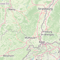
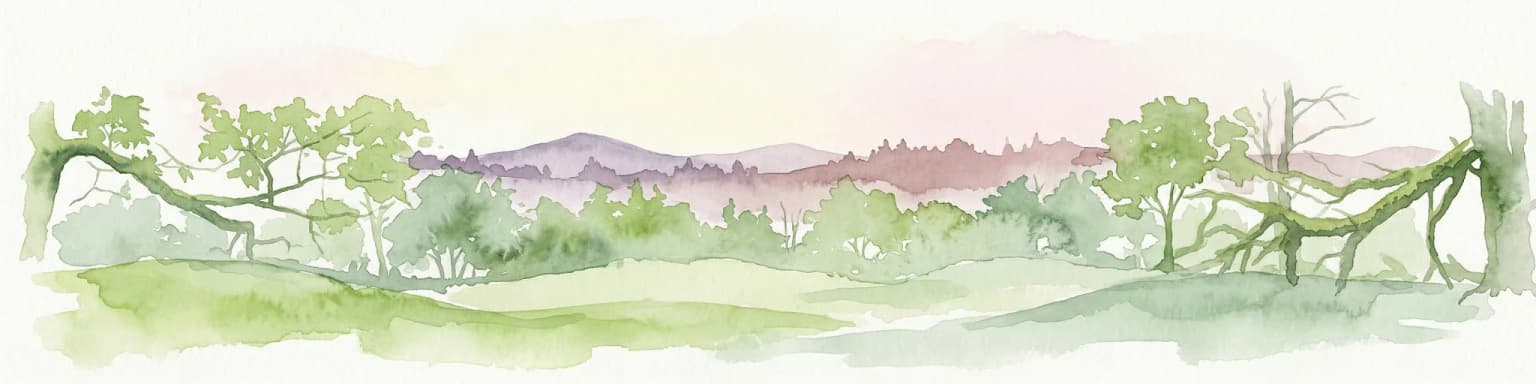
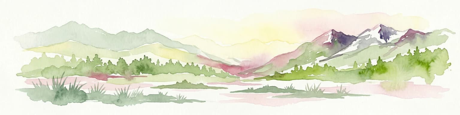
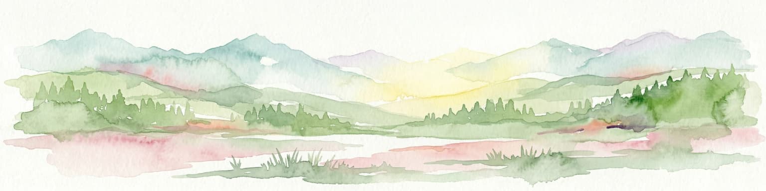
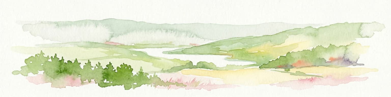
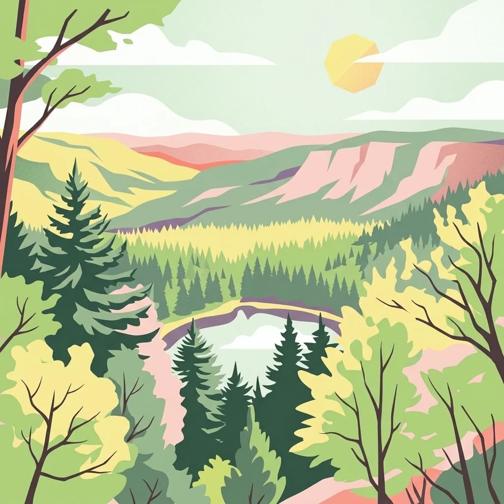
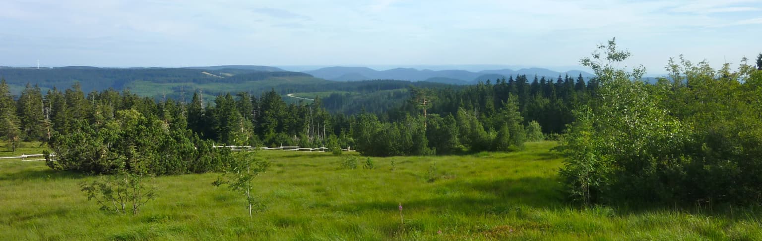
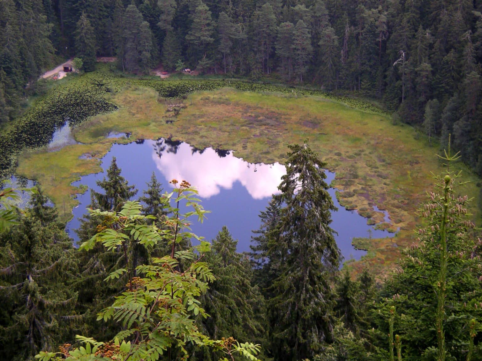
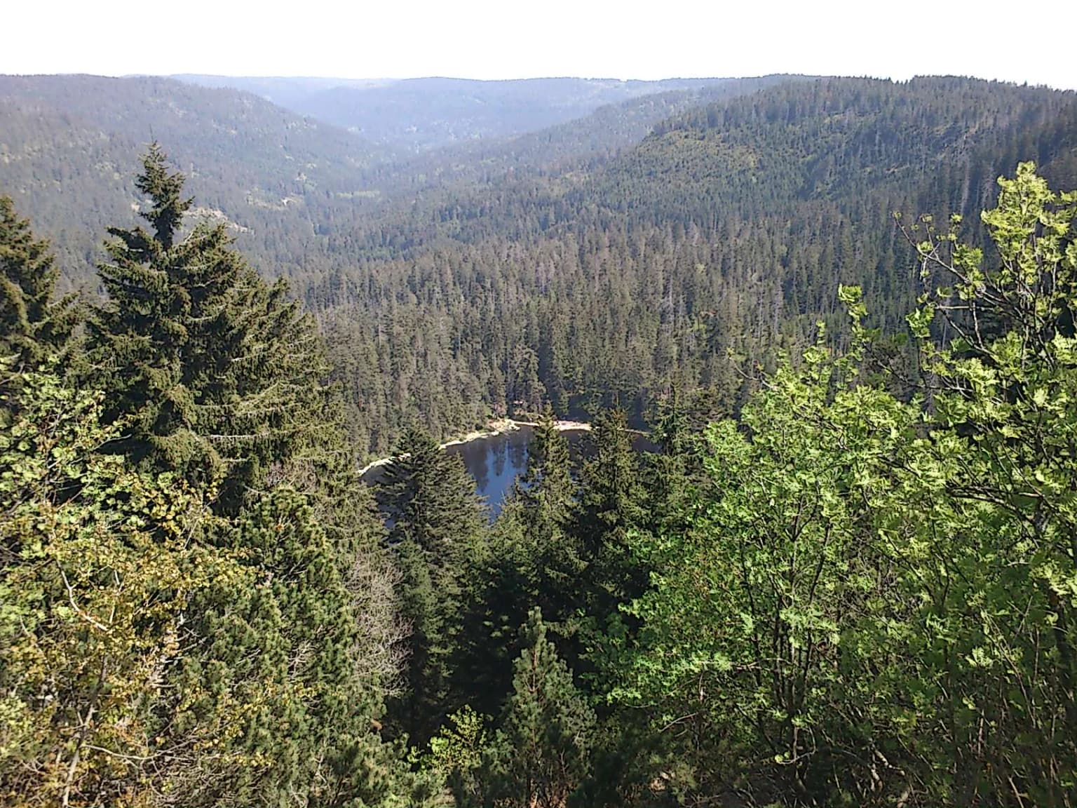
Black Forest National Park is best known for its protection of the Northern Black Forest's distinctive highland landscape, characterized by open grinde terrain, forested slopes, and dramatic valleys. The park preserves one of Germany's last remaining large areas of near-natural mountain forest ecosystems. Its tarn lakes, including the scenic Huzenbacher See, represent rare aquatic habitats in this upland environment. The area between the Black Forest High Road and the Murg valley offers some of the most scenic highland terrain in the entire Black Forest region.

Black Forest National Park history and protected-area timeline

The creation of Black Forest National Park represents a landmark moment in German conservation history. After decades of debate about establishing a national park in Baden-Württemberg, the state parliament voted to approve the park's creation on November 28, 2013, and it officially came into existence on January 1, 2014. The establishment was politically contentious, facing opposition from the CDU and FDP parties, representatives of the timber industry, and segments of the local population. Support came from the SPD, the Greens party, conservation associations, and portions of the Northern Black Forest communities. In 2021, the state announced plans to expand the park and eventually connect its two separate sections, reflecting growing commitment to wilderness conservation in this historically managed forest landscape.

Black Forest National Park landscape and geographic character

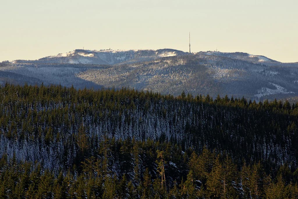
The physical landscape of Black Forest National Park is characterized by the distinctive geology and topography of the Northern Black Forest highlands. The terrain reaches approximately 1,150 meters above sea level near Hornisgrinde, the highest mountain in the northern Black Forest, with other notable summits including the Mehliskopf at 1,008 meters and the Badener Höhe at 1,003 meters. The park encompasses the upper valleys of several streams, including the Schwarzenbach, the Schönmünz, and the headwaters of the Murg river system. The signature grinde terrain, with its open, heath-covered slopes, dominates the higher elevations, while steeper valleys and forested slopes characterize the lower terrain. The park also contains several remarkable tarn lakes, formed in glacial cirques, which add significant scenic and ecological value to the landscape.

Black Forest National Park ecosystems, habitats, and plant life

The ecological character of Black Forest National Park centers on the restoration and protection of natural forest ecosystems in a region historically shaped by intensive forestry. The park encompasses a gradient from lower-elevation forests through subalpine zones, supporting diverse plant communities adapted to the cool, humid conditions of this highland environment. The grinde areas support distinctive heath communities and acidic grasslands that represent rare semi-natural habitats in central Europe. The tarn lakes and stream systems provide important aquatic habitats, while the mosaic of forest types creates diverse ecological niches across the park's elevation range.

Black Forest National Park wildlife and species highlights

The wildlife community of Black Forest National Park reflects the forested highland environment of the Northern Black Forest. The diverse forest structure, ranging from mature stands to open grinde areas, supports various mammal and bird species typical of central European mountain forests. The protection of large, interconnected forest habitat creates favorable conditions for species requiring extensive territories or natural forest conditions. The tarn lakes and streams provide habitat for aquatic organisms adapted to these unique highland water bodies.

Black Forest National Park conservation status and protection priorities

Black Forest National Park represents a significant addition to Germany's national park system, addressing the notable absence of formal protected status in Baden-Württemberg's forest landscapes. The park's conservation goals focus on allowing natural forest dynamics to proceed without active management, creating a reference area for understanding forest ecosystem evolution in this environmental setting. The designation connects with broader European conservation frameworks and contributes to the ecological connectivity of the Black Forest region. The 2021 expansion plans demonstrate evolving commitment to increasing wilderness area in this historically heavily managed forest landscape.

Black Forest National Park cultural meaning and human context

The Black Forest region has a long history of human interaction, with forest management, agriculture, and tourism shaping the landscape over centuries. The area within the park contains remnants of traditional land use, including historic forest boundaries and valley settlements. The Black Forest High Road, which passes along the western edge of the park, represents the long tradition of tourism and scenic appreciation in this mountainous region. The park's establishment required navigating complex relationships between conservation goals and existing land uses, including forestry and recreation.

Top sights and standout views in Black Forest National Park

The park offers visitors access to some of the Northern Black Forest's most spectacular highland terrain, including the dramatic views from the Schliffkopf area across the grinde landscape toward the central Black Forest. The tarn lakes, particularly the Huzenbacher See, represent scenic jewels of the protected area. The proximity to the Black Forest High Road provides convenient access to this previously unprotected landscape. As Germany's newest national park, it represents a pioneering commitment to wilderness conservation in a region where forest ecosystems have been intensively managed for generations.

Best time to visit Black Forest National Park

The Black Forest National Park can be enjoyed throughout the year, with each season offering distinct experiences. Summer months provide the most accessible conditions for hiking the highland trails and exploring the tarn lakes, while the grinde terrain displays its characteristic open character under long daylight hours. Autumn brings the seasonal color change to the forest and reduced visitor numbers, offering a more contemplative experience of the landscape. Winter transforms the high terrain into a skiing and winter recreation zone, particularly around the Ruhestein area, though some trails may be closed or snowbound.

Park location guide

Geography guide, regional context, and park location map for Black Forest National Park

Black Forest National Park park geography, regions, and map view in Germany
Understand where Black Forest National Park sits in Germany through a broader geographic reading of the surrounding landscape, nearby location context, and its mapped position within the national park landscape.

How Black Forest National Park fits into Germany

Germany is a federal republic in Western and Central Europe with a population of over 83 million across sixteen constituent states. It is Europe's largest economy by nominal GDP and a major global exporter and importer. The capital is Berlin, and the country borders Denmark, Poland, Czech Republic, Austria, Switzerland, France, Luxembourg, Belgium, and the Netherlands.

Wider geography shaping Black Forest National Park in Germany

Germany is located in Western and Central Europe, spanning 357,022 km². It borders Denmark to the north, Poland and the Czech Republic to the east, Austria and Switzerland to the south, and France, Luxembourg, Belgium, and the Netherlands to the west. The country has coastlines on the Baltic Sea and North Sea to the north, with the Alps located in the southern region.

Map view of Black Forest National Park

Use this park location map to pinpoint Black Forest National Park in Germany, understand its exact geographic position, and read its mapped placement within the surrounding landscape more clearly.

Pigeon | © OpenStreetMap contributors

Location context for Black Forest National Park

Baden-Württemberg
Park atlas

Compare additional protected areas and natural landscapes across the Baden-Württemberg region and surrounding German states.

Explore Related Protected Landscapes Near Black Forest National Park in Baden-Württemberg
Explore a curated list of national parks and other protected areas situated near Black Forest National Park, tracing their geographic distribution and distinct landscape features. This contextual view allows for direct comparison of mountain forests, grinde terrain, and other conservation landscapes across Baden-Württemberg and neighboring regions.
Watercolor illustration of a landscape with rolling hills, a river, and green vegetation
Protected areaProvince of Luxembourg

Gaume Natural Park: A Protected Area Defining the Landscape of Province of Luxembourg

Explore its mapped natural landscape and geographic context.

Gaume Natural Park is a protected area offering a unique perspective on the natural landscapes found within Belgium's Province of Luxembourg. As a key geographic entity, it provides a vital component for atlas exploration, showcasing distinct mapped boundaries and regional terrain. Understand its significance as a protected natural space contributing to the Ardennes region's extensive geography, making it an essential point for structured discovery of protected lands.

Area
581.04 km²
Established
2014
Relief
Lowland
Scope
Terrestrial
National park

Forêts National Park: A Protected Landscape of Lowland Deciduous Forests

Explore its unique geography and protected forest ecosystems.

Delve into Forêts National Park, a significant protected area in northeastern France dedicated to preserving lowland deciduous forests and their associated biodiversity. This park represents a unique atlas entry for understanding mapped protected lands, featuring extensive broad-leaved forest tracts, diverse wetlands, and limestone grasslands across the Grand Est and Bourgogne-Franche-Comté regions. Discover the geographic identity of this conservation landscape and its role within the Paris Basin's terrain.

Area
560 km²
Established
2019
IUCN
II
Relief
Lowland
Watercolor illustration of rolling green hills and meadows with patches of pink and yellow flowers
National parkNorth Rhine-Westphalia

Eifel National Park: North Rhine-Westphalia Protected Area Atlas

Explore mapped boundaries and regional geography.

Gain a structured understanding of Eifel National Park, a key protected area within Germany's North Rhine-Westphalia region. This page focuses on its geographic identity, detailing mapped boundaries and offering context within the state's broader natural landscapes. MoriAtlas enhances your exploration by presenting Eifel National Park as a distinct entity within a larger geographic framework, ideal for atlas-based research and understanding protected land distribution.

Area
107 km²
Established
2004
IUCN
II
Relief
Upland
Watercolor illustration showing green mountains, forests, a river, and snow-capped peaks in the distance
National parkPiedmont

Val Grande National Park: National Park Protected Landscape in Piedmont

Explore its mapped boundaries and regional geographic context.

Val Grande National Park represents a key protected landscape within the Piedmont region of northwest Italy. This canonical page offers detailed insights into the park's designated status as a national park, its specific geographic placement, and its mapped protected boundaries. Users can navigate its atlas-level details to understand its role in the regional geography and conservation landscape, providing a structured foundation for further discovery of Italy's natural protected areas.

Area
170.21 km²
Established
1992
IUCN
II
Relief
Mountain
National parkTrentino-Alto Adige/Südtirol

Stelvio National Park National Park: Protected Landscape and Regional Geographic Context

Explore its mapped boundaries and natural terrain.

Navigate Stelvio National Park, a designated national park in Italy's Trentino-Alto Adige/Südtirol region, through a map-centric lens. This page provides critical context for understanding the park's protected landscape, its geographic position within the Alps, and its mapped terrain. Utilize MoriAtlas to grasp the park's boundaries and its place in regional geography for structured natural landscape discovery.

Established
1935
IUCN
II
Relief
Mountain
Scope
Terrestrial
Watercolor painting showing a landscape with hills, forest, and a body of water
National parkHesse

Kellerwald-Edersee National Park: Hesse's Protected Landscape Exploration

Mapped boundaries and geographic context for this German national park.

Navigate the protected landscape of Kellerwald-Edersee National Park, a key national park situated in the German state of Hesse. This atlas entry focuses on its precise geographic definition, mapped terrain features, and the broader regional context it occupies within central Germany. Gain structured insights into the park's conservation significance and its place in the mapped landscape.

Area
76.88 km²
Established
2004
Relief
Highland
Climate
Temperate
Protected areaBelgium

Burdinale Protected Area: Explore its Mapped Landscape and Geographic Context in Belgium

Mapped protected area discovery within Belgium's geography.

Burdinale Protected Area serves as a key point for understanding Belgium's protected lands from an atlas perspective. This page details the park's specific geographic setting and mapped natural landscape, providing essential context for regional geography exploration. Discover the protected boundaries and terrain features that define Burdinale, contributing to a structured overview of conservation areas.

Scope
Mixed
Water
Major water bodies
Watercolor illustration of a landscape featuring green fields, trees, a river, and distant hills under a pale sky
National parkThuringia

Hainich National Park: Protected Landscape in Thuringia's Regional Geography

Mapped protected area boundaries and geographic context.

Hainich National Park stands as a protected national park, offering a detailed study in landscape and geography. This entry focuses on its specific mapped boundaries and its placement within the Thuringia region, providing users with clear geographic context. Discover the natural terrain and protected status of Hainich National Park, essential for understanding Germany's mapped conservation areas.

Area
75 km²
Established
1997
Climate
Temperate
Scope
Terrestrial

Common questions about visiting, size, designation, and location context for Black Forest National Park

Black Forest National Park FAQs for park facts, access, geography, and protected area context
Find quick answers about Black Forest National Park, including protected-area facts, park geography, trail and visitor context, and how the park fits into its surrounding country and regional landscape.
MoriAtlas Explorer

Continue Your Protected Areas Search Across the Global Atlas

Deepen your exploration by continuing the structured search for national parks and protected areas worldwide. Utilize the comprehensive filtering capabilities to compare different conservation landscapes and refine your understanding of global park geography. Discover more about the distribution and characteristics of protected natural areas.

Global natural geography