Mori Atlas logo
Nature reserveRéserve naturelle régionale des prairies humides de Courteranges

Mapping the meadow mosaic and Barse valley habitats in the Grand Est regional network

Réserve naturelle régionale des prairies humides de Courteranges: Protected Wetlands Geography

(Réserve naturelle régionale des prairies humides de Courteranges (RNR220))

Discover the geographic layout of Réserve naturelle régionale des prairies humides de Courteranges, a vital nature reserve in the Aube department of France. This protected site features a complex mosaic of humid hay meadows, molinia swards, and riparian scrubland nestled within the Barse valley. Its landscape context serves as an essential link for wetland flora and fauna within the broader Lac d'Orient hydraulic network.

regional nature reservewet meadowsprairies humideswetland conservationBarse valleyAube department

Réserve naturelle régionale des prairies humides de Courteranges

Nature reserve

Park overview

Structured park overview, official facts, and landscape profile for Réserve naturelle régionale des prairies humides de Courteranges

Réserve naturelle régionale des prairies humides de Courteranges park facts, protected area profile, and essential visitor context

Review the core facts for Réserve naturelle régionale des prairies humides de Courteranges, including designation, size, terrain, visitor scale, habitats, and operating context in one park-focused overview.

About Réserve naturelle régionale des prairies humides de Courteranges

The Réserve naturelle régionale des prairies humides de Courteranges is a compact but ecologically distinctive protected area in north-central France. Situated in the valley of the Barse, a small river that feeds into the Lac d'Orient reservoir, the reserve is composed of two parcels of land stretching on either side of the water restitution canal of the lake. This landscape setting places the reserve within the broader network of the Parc naturel régional de la Forêt d'Orient, a region long defined by its extensive forest and wetland mosaic in the Champagne-Ardenne part of France.

At roughly 28 hectares, the reserve is modest in size. Yet the area it covers is ecologically dense, combining traditional hay meadows with finer-grained wetland communities. These include molinia-dominated meadows, tall sedge formations known as magnocariçaies, and wet willow scrub or saulaies marécageuses. This habitat diversity supports a high concentration of plant species for such a small area, including species that are nationally protected in France and others of strong regional conservation interest.

The reserve is not primarily designed as a visitor attraction. Access is restricted in order to protect the fragile grassland habitats, and much of the learning about the site is intended to happen through planned interpretation trails rather than open walking routes. Despite this, the area plays an important role in regional conservation strategy, sitting at the meeting point between agricultural heritage, wetland biodiversity, and the larger protected complex of the Forêt d'Orient.

Quick facts and research context for Réserve naturelle régionale des prairies humides de Courteranges

The reserve is located in the communes of Courteranges and Lusigny-sur-Barse, in the Aube department of the Grand Est region, on the margins of the Lac d'Orient reservoir system. It was officially created by deliberation on 8 March 2010 and is classified as a Réserve naturelle régionale (regional nature reserve) under the French protected-area framework, with IUCN Category IV designation.

Administratively, it is jointly managed by the Parc naturel régional de la Forêt d'Orient and the Conservatoire d'espaces naturels de Champagne-Ardenne. The site is also referenced within ZNIEFF inventories, a Natura 2000 site and Ramsar wetlands context, reinforcing its standing as a small but ecologically significant protected wetland.

Protection and recognition

Documented terrestrial protection scope and conservation records for Réserve naturelle régionale des prairies humides de Courteranges

Protection Status and International Recognition for Réserve naturelle régionale des prairies humides de Courteranges

Terrestrial protection status and designation records for Réserve naturelle régionale des prairies humides de Courteranges provide structured conservation data. Official management parameters and administrative database metrics offer a clear factual overview for this protected area.

Protection details

Protection scope
Terrestrial
WDPA ID
555514363
Park context

Deeper park guide and search-rich context for Réserve naturelle régionale des prairies humides de Courteranges

Réserve naturelle régionale des prairies humides de Courteranges history, landscape, wildlife, and travel context

Explore Réserve naturelle régionale des prairies humides de Courteranges through its history, landscape character, ecosystems, wildlife, conservation priorities, cultural context, and seasonal travel timing in a structured park guide built for atlas discovery and search intent.

Why Réserve naturelle régionale des prairies humides de Courteranges stands out

The reserve is best known for its concentration of wet meadow habitats in the Barse valley, particularly traditional hay meadows (prairies de fauche) that have been shaped by human activity for centuries. Within these meadows and the surrounding marshland habitats, the site hosts an unusually rich flora for such a small area, including several nationally protected plant species. The reserve is also recognized for its birdlife, especially meadow- and wetland-associated species such as the Black Kite, Red-backed Shrike, Northern Lapwing and Sedge Warbler, as well as its contribution to the broader wetland network surrounding the Lac d'Orient.
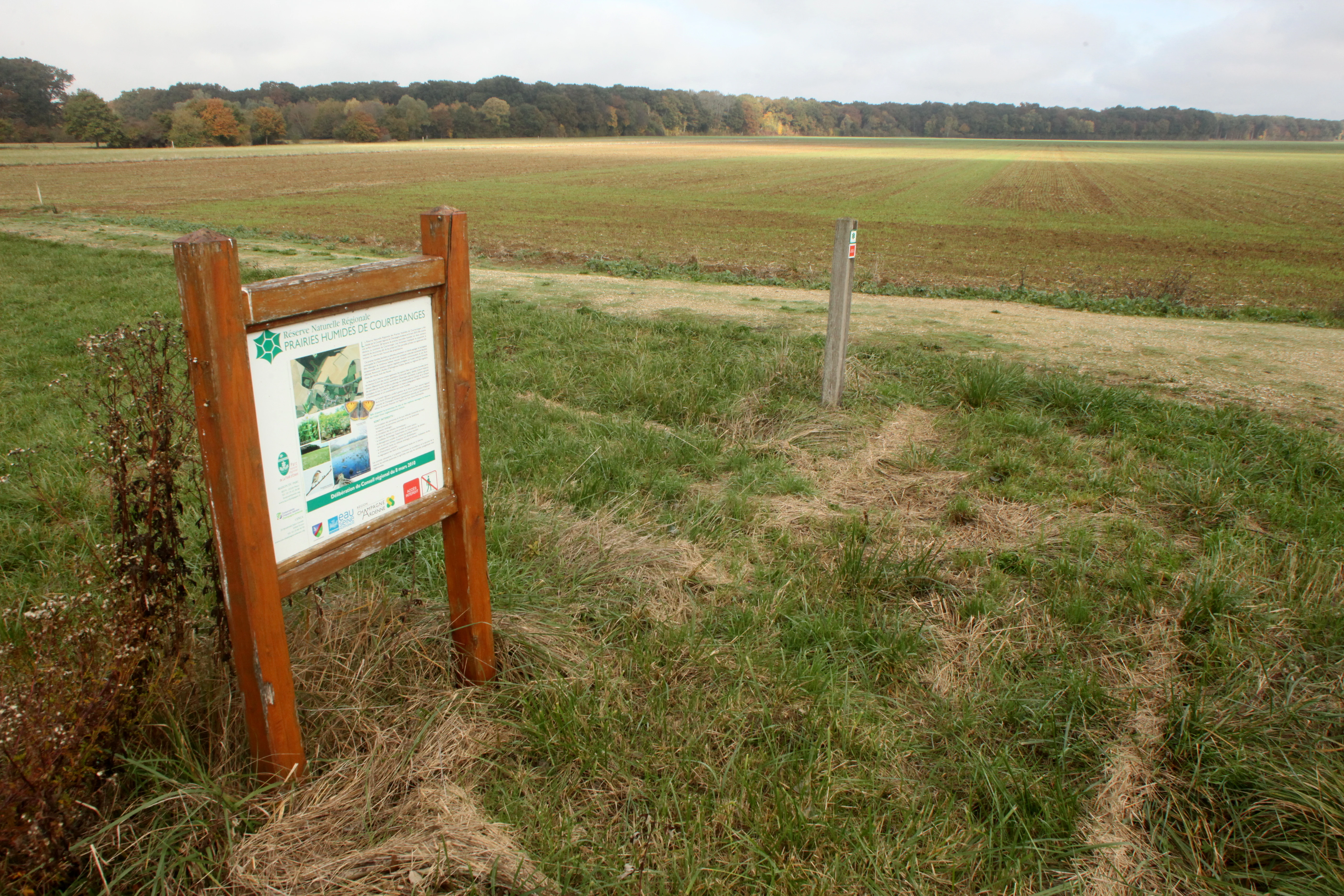
An informational sign on a wooden frame stands in a grassy field with a wide, flat meadow landscape in the background.
Information signage at the entrance of the Courteranges Wet Meadows Regional Nature Reserve.

Réserve naturelle régionale des prairies humides de Courteranges history and protected-area timeline

The hay meadows of the Barse valley have a long history of human use, with traditional mowing practices documented as far back as the tenth century. Over the centuries, this continuity of low-intensity land use helped sustain a habitat type that became increasingly rare elsewhere in the French agricultural landscape, particularly as more intensive farming practices spread through lowland France.

The recognition that these meadows remained unusually rich both culturally and ecologically led to formal protection efforts in the early twenty-first century. On 8 March 2010, the regional authorities formally classed the area as a Réserve naturelle régionale, creating the present-day Courteranges reserve and confirming its standing within the broader French network of regional nature reserves.

Since its creation, the reserve has been managed jointly by the Parc naturel régional de la Forêt d'Orient and the Conservatoire d'espaces naturels de Champagne-Ardenne. Management has emphasized maintaining the open, meadow-dominated character of the site, including the continued use of Konik Polski horses for grazing, which helps prevent the encroachment of shrubs and trees that would otherwise alter the wetland meadow balance.

Réserve naturelle régionale des prairies humides de Courteranges landscape and geographic character

The reserve sits in a low-lying valley landscape shaped by the Barse river system within the larger Lac d'Orient hydraulic complex. Topographically, it is flat to gently undulating, with the terrain dominated by wet grassland rather than dramatic relief. The two parts of the reserve are separated by the water restitution canal that drains the lake, giving the site a linear, edge-of-water character in places.

Vegetation pattern is the real landscape signature of the site. Open hay meadows give way to denser molinia-dominated swards, taller sedge formations and patches of swampy willow scrub. The contrast between maintained open grassland and the encroaching wet woodland vegetation gives the reserve a layered, mosaic quality. This mosaic is actively shaped by ongoing management, with grazing acting as the main tool to maintain the open meadow character.

Réserve naturelle régionale des prairies humides de Courteranges ecosystems, habitats, and plant life

Ecologically, the reserve is dominated by wet meadow and marsh communities that together form a coherent wetland habitat complex. The core of the site is made up of extensively managed hay meadows that have retained their traditional floristic composition; around and between them, the reserve includes more specialized habitats such as molinia meadows, magnocariçaies dominated by tall sedges, and saulaies marécageuses or wet willow thickets.

The botanists' inventory identifies 23 species considered to be of heritage or patrimonial value. Three of these receive national-level protection in France: Gratiola officinalis (Graceful Hedge-hyssop), the tall or elevated violet (Viola elatior), and Ranunculus ophioglossifolius, a buttercup species closely tied to seasonally flooded Mediterranean-influenced grasslands. Additional notable species include Allium angulosum, Inula britannica, Teucrium scordium, Caltha palustris and flowering-rush.

These plant communities are not isolated, but connect to a wider ecological framework that includes ZNIEFF inventories, a designated Natura 2000 site and a Ramsar wetlands context, situating the Courteranges meadow complex within the larger wetland heritage of the Champagne wetlands and the Lac d'Orient area.

Réserve naturelle régionale des prairies humides de Courteranges wildlife and species highlights

Wildlife at the reserve reflects the value of the meadow-mosaic landscape for species that depend on open, humid grassland and nearby water features. The reserve's bird list includes species listed on Annex I of the EU Birds Directive, including the Black Kite (Milvus migrans) and the Red-backed Shrike (Lanius collurio). Other bird species recorded on the regional red list include the Eurasian Wryneck, the Lesser Whitethroat, the Sedge Warbler and the Northern Lapwing, while the Common Snipe and the Eurasian Reed Warbler have also been documented.

Amphibian interest is centered on the Yellow-bellied Toad (Bombina variegata), listed on Annex II of the EU Habitats Directive, alongside regionally red-listed species such as the Common Frog and the Agile Frog. Invertebrate life adds another layer of importance, with the Scarlet Dragonfly and the Large Copper Butterfly (Lycaena dispar) noted as characteristic wetland species of conservation concern.

Taken together, the bird, amphibian and invertebrate communities reinforce the wider picture of the reserve as a small but ecologically rich wetland refuge embedded in a heavily modified agricultural landscape.

Réserve naturelle régionale des prairies humides de Courteranges conservation status and protection priorities

The conservation significance of the reserve lies in its role as one of the last strongholds of traditionally managed wet meadows in the Barse valley. By formalizing protection of these small meadows, the reserve safeguards not only the habitat itself but the continuity of low-intensity agricultural practices that have shaped it. The use of Konik Polski horses for grazing is part of this strategy, helping maintain open conditions that favor the characteristic meadow flora.

The reserve's significance is amplified by its integration into a multi-layered protection framework. It overlaps with several ZNIEFF inventories, a Natura 2000 site focused on the Courteranges meadows, and the broader Ramsar wetland designation associated with the Champagne wetlands. These overlapping statuses help buffer the reserve against external pressures and align its management with broader regional biodiversity goals.

At a national level, the reserve plays a small but real role in the French network of regional nature reserves, contributing to the conservation of nationally protected plant species and species listed under both the Birds Directive and the Habitats Directive. Its joint management by the regional natural park and the local conservatoire reflects a model in which habitat protection, agricultural heritage and regional biodiversity strategy meet in a single small landscape.

Réserve naturelle régionale des prairies humides de Courteranges cultural meaning and human context

The meadows of the Barse valley reflect a long tradition of hay-making in the Champagne countryside, with documented use of these grasslands stretching back to at least the tenth century. The continuation of this agricultural rhythm, alongside the more recent introduction of conservation grazing with Konik Polski horses, gives the reserve a strong sense of continuity between historic rural land use and contemporary conservation practice.

Within the wider region, the reserve is part of the identity of the Forêt d'Orient area, a region where lake, forest and meadow form a coherent cultural-natural landscape. This broader regional identity shapes how the site is perceived and managed, situating a small wetland meadow reserve within a much larger narrative of Champagne landscape heritage.

Top sights and standout views in Réserve naturelle régionale des prairies humides de Courteranges

Among the reserve's strongest points of distinction are the professionally recognized botanical richness packed into a small area, marked by 23 heritage species of which three are nationally protected, and the unusually well-preserved traditional hay meadow character rooted in centuries of rural use.

The reserve also stands out for the way it connects to a larger wetland network through the Lac d'Orient system, and for its integration of cultural-heritage management, biodiversity conservation and ecological monitoring within a single small site.

Best time to visit Réserve naturelle régionale des prairies humides de Courteranges

Because the site is not generally open to the public and access is limited, traditional seasonal visiting advice is less relevant than for a typical visitor park. For ecological and scenic context, late spring and early summer typically bring the richest display of meadow flora in wet grasslands of this type, while summer supports the highest levels of insect and bird activity. Autumn generally marks the end of the hay-making season and can offer quieter conditions and softer light across the open meadows.
Monthly climate preview

Long-term monthly climate measurements and temperature variations across the protected landscape

Annual Temperature and Precipitation Normals for Réserve naturelle régionale des prairies humides de Courteranges

Long-term NASA Power climatology data records monthly mean temperatures ranging from 2.09 °C to 20.23 °C alongside steady precipitation rates throughout the year at the representative coordinate. Examining the complete twelve-month climate profile reveals detailed temperature minimums and maximums across all seasons.
Annual mean11 °C
2 °C20 °C
Jan
Feb
Mar
Apr10°
May14°
Jun18°
Jul20°
Aug20°
Sep16°
Oct11°
Nov
Dec
Warmest month
July

20.2 °C

Coolest month
January

2.1 °C

Wettest month
December

2.4 mm/day

Driest month
March

1.7 mm/day

Park location guide

Geography guide, regional context, and park location map for Réserve naturelle régionale des prairies humides de Courteranges

Réserve naturelle régionale des prairies humides de Courteranges park geography, regions, and map view in France

Understand where Réserve naturelle régionale des prairies humides de Courteranges sits in France through a broader geographic reading of the surrounding landscape, nearby location context, and its mapped position within the national park landscape.

How Réserve naturelle régionale des prairies humides de Courteranges fits into France

France is a unitary semi-presidential republic and one of the world's largest economies. It borders Belgium, Luxembourg, Germany, Switzerland, Italy, Monaco, Andorra, and Spain, with a maritime border to the United Kingdom. The country is known for its cultural influence, art, cuisine, and political history spanning centuries.

Wider geography shaping Réserve naturelle régionale des prairies humides de Courteranges in France

France is located in Western Europe. Metropolitan France extends from the Rhine to the Atlantic Ocean and from the Mediterranean Sea to the English Channel and North Sea. The country borders Belgium, Luxembourg, Germany, Switzerland, Italy, Monaco, Andorra, Spain, and has a maritime border with the United Kingdom.

Map view of Réserve naturelle régionale des prairies humides de Courteranges

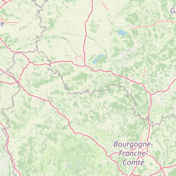
Use this park location map to pinpoint Réserve naturelle régionale des prairies humides de Courteranges in France, understand its exact geographic position, and read its mapped placement within the surrounding landscape more clearly.

Pigeon | © OpenStreetMap contributors

Location context for Réserve naturelle régionale des prairies humides de Courteranges

Grand Est

Visualizing the wet meadows, Barse valley habitats, and protected terrain of the reserve

Réserve naturelle régionale des prairies humides de Courteranges Photos and Landscape Scenery

Photographic records reveal the distinct mosaic of wet meadows, sedge beds, and willow scrub defining the Barse valley environment. Visual documentation allows researchers to study the protected terrain, habitat patterns, and ecological character of the reserve more closely.

An informational sign on a wooden frame stands in a grassy field with a wide, flat meadow landscape in the background.

Park atlas

Compare adjacent wetland reserves and regional protected landscapes across the surrounding region

Parks Near Réserve Naturelle Régionale des Prairies Humides de Courteranges

Browse other protected areas and wetland habitats situated within the broader river valleys of the regional network. Comparing adjacent natural reserves helps place local meadow conservation into wider geographic perspective.
A soft watercolor painting of a calm lake scene featuring small grassy islands with trees, surrounded by marshy vegetation under a light, hazy sky.
Nature reserveGrand Est
About 13 km away#1 closest

Northeast

Réserve naturelle nationale de la forêt d'Orient: Protected Landscapes and Wetland Mapping

Key protected area in the Grand Est region of France

Investigate the geographic structure of Réserve naturelle nationale de la forêt d'Orient, a reserve shaped by reservoir-driven water cycles. This protected area features a diverse arrangement of lake-edge mudflats, expansive reedbeds, and temperate forest cover. Gain insight into the regional importance of these habitats as a node for migratory bird pathways and native terrestrial biodiversity in eastern France.

Area
15.6 km²
Established
2002
IUCN
IV
Relief
Lowland
Watercolor painting of an open, undulating rural landscape with patches of green vegetation, trees, and golden fields under a soft white sky.
Nature reserveGrand Est
About 30 km away#2 closest

East

Réserve naturelle régionale de la pelouse de la côte de l'étang: Regional Nature Reserve Geography

Calcareous grassland protected area in the Grand Est region of France

Discover the geographic character of Réserve naturelle régionale de la pelouse de la côte de l'étang. This reserve showcases a specialized dry grassland landscape on a sun-drenched slope, providing a critical haven for rare flora and fauna in the heart of the Barrois champenois territory.

Area
0.108 km²
Established
2010
IUCN
IV
Relief
Upland
A horizontal watercolor illustration showing a pond with green trees, reeds, and low hills in the background against a white backdrop.
Nature reserveGrand Est
About 31 km away#3 closest

East

Réserve naturelle régionale de l'étang de Ramerupt: Geography and Protected Wetland Atlas

Mapping the historic Champagne humide pond landscape in Grand Est

Examine the dense wetland mosaic of Réserve naturelle régionale de l'étang de Ramerupt, a 33-hectare sanctuary in the Aube department. This resource traces the pond edges, reedbed structures, and wet woodland terrain that comprise this essential regional nature reserve, highlighting the intersection of human water management and natural marshland succession in the French countryside.

Area
0.336 km²
Established
2010
IUCN
IV
Relief
Lowland
A horizontal watercolor illustration featuring a soft green and yellow landscape of a pond and wetland area with shrubs and meadow grass.
Nature reserveGrand Est
About 55 km away#4 closest

Northeast

Réserve naturelle régionale de l'étang et prairie humide des Paquis: Regional Nature Reserve Geography

Wetland habitat mapping in the Marne department of Grand Est, France

This regional nature reserve encompasses a compact 8.31 hectare wetland complex comprising an étang and a surrounding prairie humide. Its significance lies in its role as a concentrated biodiversity node amidst the open agricultural landscape of the Champagne region, managed primarily for habitat conservation and avian protection.

Area
0.083 km²
Established
2014
IUCN
IV
Watercolor illustration of a forested landscape with rolling hills, distant mountains, and a sky with soft pastel colors
National parkFrance
About 55 km away#5 closest

Southeast

Forêts National Park: A Protected Landscape of Lowland Deciduous Forests

Explore its unique geography and protected forest ecosystems.

Delve into Forêts National Park, a significant protected area in northeastern France dedicated to preserving lowland deciduous forests and their associated biodiversity. This park represents a unique atlas entry for understanding mapped protected lands, featuring extensive broad-leaved forest tracts, diverse wetlands, and limestone grasslands across the Grand Est and Bourgogne-Franche-Comté regions. Discover the geographic identity of this conservation landscape and its role within the Paris Basin's terrain.

Area
560 km²
Established
2019
IUCN
II
Relief
Lowland
A soft watercolor illustration of a wetland scene with a small pool of water in the foreground, grassy meadows, and distant hills and trees in the background.
Nature reserveGrand Est
About 67 km away#6 closest

Northwest

Réserve naturelle régionale du marais de Reuves: Protected Wetland and Geography

A vital ecological enclave within the Grand Est region of France.

The Réserve naturelle régionale du marais de Reuves provides a detailed look at the hydrology and terrain of the Marais de Saint-Gond. This nature reserve protects varied habitats including open ponds, peatlands, and alluvial forests. Understanding its boundaries reveals how localized conservation efforts preserve essential wetland character against surrounding intensive agricultural development.

Area
0.64 km²
Established
2008
IUCN
IV
Relief
Lowland
Nature reserveGrand Est
About 80 km away#7 closest

North

Réserve naturelle régionale du Savart de la Folie: Regional Protected Landscape Analysis

Tracing the dry grassland ecosystems of the Grand Est region

Deep dive into the geography of the Réserve naturelle régionale du Savart de la Folie in France. This site highlights the preservation of steppe-like savart habitats within the Champagne region, showcasing the importance of regional nature reserves in protecting specific dry, chalky grasslands.

Area
0.636 km²
Established
2026
IUCN
IV
Scope
Terrestrial
Nature reserveHaute-Marne
About 84 km away#8 closest

Tufière de Rolampont Nature Reserve: Travertine Cascades and Geological Heritage in Haute-Marne

A rare living limestone formation in the Grand Est region of France

Tufière de Rolampont offers a window into the evolution of calcareous wetland ecosystems within the Champagne plateau. Visitors observe a process of natural stone creation where mineral-rich water encrusts living mosses, resulting in the stepped terraces that define this protected landscape. This site serves as a vital laboratory for understanding the intersection of hydrological heritage and unique botanical habitats.

Area
0.126 km²
Established
1982
Relief
Lowland
Climate
Temperate

Common questions about visiting, size, designation, and location context for Réserve naturelle régionale des prairies humides de Courteranges

Réserve naturelle régionale des prairies humides de Courteranges FAQs for park facts, access, geography, and protected area context

Find quick answers about Réserve naturelle régionale des prairies humides de Courteranges, including protected-area facts, park geography, trail and visitor context, and how the park fits into its surrounding country and regional landscape.
MoriAtlas Explorer

Continue Your Protected Areas Search Across the Global Atlas

Deepen your exploration by continuing the structured search for national parks and protected areas worldwide. Utilize the comprehensive filtering capabilities to compare different conservation landscapes and refine your understanding of global park geography. Discover more about the distribution and characteristics of protected natural areas.

Global natural geography