Mori Atlas logo
Park earthquake history

Review documented historical event data, epicentre distances, and magnitude records for the region.

Recorded Earthquake History and Seismic Records for Réserve naturelle régionale du lac d'Aiguebelette

This collection presents a catalogue of seismic events recorded in the vicinity of the Réserve naturelle régionale du lac d'Aiguebelette, located in the Savoie department of the Auvergne-Rhône-Alpes region. By associating historical earthquake records with the park geography, the data provides a clear view of local seismic history through event dates, calculated epicentre distances, and recorded magnitudes. This resource offers structured access to observational data for geographic and historical context.

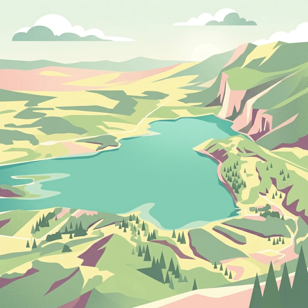
A stylized digital illustration showing an aerial, high-angle view of a turquoise lake surrounded by rolling hills, forest patches, and steep mountain slopes.

A regional nature reserve protecting Lake Aiguebelette and the wooded slopes of the Montagne de l'Épine in Savoie.

Réserve naturelle régionale du lac d'Aiguebelette

The Réserve naturelle régionale du lac d'Aiguebelette is a regional nature reserve located in the Savoie department of the Auvergne-Rhône-Alpes region in eastern France. Classified on 6 March 2015 by the Regional Council, it covers approximately 844 hectares and protects Lake Aiguebelette together with part of the Montagne de l'Épine, the forested ridge that rises above the lake on its western side. The reserve lies within the territory of several communes around the lake, including Aiguebelette-le-Lac, Lépin-le-Lac, Nances, Novalaise, and Saint-Alban-de-Montbel. It is administered by the Communauté de communes du Lac d'Aiguebelette and is recognized under the IUCN's Category IV for habitat and species management. Its purpose is to safeguard a landscape shaped by a glacial lake and the surrounding wooded uplands that together form one of the more distinctive natural settings in the northern French Prealps.

Location
France
Park type
Nature reserve
Established
2015
Area
8.4 km²
Réserve naturelle régionale du lac d'Aiguebelette Protected Area

Examine Réserve naturelle régionale du lac d'Aiguebelette records by distance

Study earthquakes near Réserve naturelle régionale du lac d'Aiguebelette

Réserve naturelle régionale du lac d'Aiguebelette protects 8.442 km² of French mountains and lakes with major water presence. Examine linked earthquakes through their own source details and spatial separation rather than assuming lake effects, an event inside the reserve, or a current warning.

Sort by
Magnitude
Location

This page describes catalogued earthquakes associated with the park by epicentre location and distance. It does not establish causation, assess current danger, or predict future earthquakes.

No earthquake records match the current filters

Park atlas

Beyond Réserve naturelle régionale du lac d'Aiguebelette earthquake records

More parks after Réserve naturelle régionale du lac d'Aiguebelette

A distinct range of protected destinations follows the Réserve naturelle régionale du lac d'Aiguebelette earthquake records. Appearance here does not indicate similar lakes, reserve designation, geologic history, seismic patterns, proximity, hazard conditions, risk, or matching source quality.
A soft watercolor painting depicting a wide river flowing through a lush green landscape with distant rolling purple hills in the background.
Nature reserveAuvergne-Rhône-Alpes
About 13 km away#1 closest

Northwest

Rhône du Pont de Groslée à Murs-et-Gélignieux: Alluvial Nature Reserve & River Geography

Protected riparian habitat in Auvergne-Rhône-Alpes, France.

Analyze the complex fluvial dynamics of the Rhône du Pont de Groslée à Murs-et-Gélignieux nature reserve. This site features a well-preserved landscape of alder and ash floodplain forests, isolated side channels, and marshy meadows that provide an essential ecological corridor through the Rhône river valley.

Area
21.05 km²
Relief
Lowland
Scope
Terrestrial
Water
Water-dominated
Nature reserveAuvergne-Rhône-Alpes
About 32 km away#2 closest

Northwest

Réserve naturelle régionale des étangs de Mépieu: Atlas and Geographic Protected Area Overview

Wetlands, peatlands, and dry grasslands in northern Isère

The Réserve naturelle régionale des étangs de Mépieu offers a striking study in ecological contrast. This protected landscape contains a dense mosaic of five ponds and marshy terrain set directly against sun-exposed dry grasslands and heathland slopes. The site serves as a vital corridor for migratory birds and rare flora within the rolling countryside of the Auvergne-Rhône-Alpes region.

Area
1.618 km²
Established
2008
IUCN
IV
Relief
Lowland
A horizontal watercolor painting depicting a gentle mountain silhouette behind a forested shoreline sloping toward the water.
Nature reserveFrance
About 41 km away#3 closest

Northeast

Roc de Chère Nature Reserve: Mapping the Botanical Diversity and Geological Features of Haute-Savoie

A protected alpine promontory bordering Lake Annecy

Roc de Chère stands as a distinct geological landmark where limestone and sandstone soils create sharp microclimate contrasts. This protected reserve provides a critical habitat for diverse plant species and rare dragonflies within a small, defined area of the French Alps. The site acts as a key element of the Lake Annecy landscape, offering insight into the post-glacial environmental history of the Savoie region through its protected cliffs and hollows.

Area
0.69 km²
Established
1977
Relief
Mountain
Climate
Temperate
A pale, soft watercolor illustration showing a horizontal landscape of a pond and wetlands bordered by trees, with faint mountain silhouettes in the distance.
Nature reserveIsère
46 km away#4 closest

South

Réserve naturelle régionale de l'étang de Haute-Jarrie, Isère Protected Wetland Landscape

Regional nature reserve and migratory bird sanctuary

Situated on the Plateau de Champagnier in Isère, this regional nature reserve offers a concentrated example of glacial pond ecology and wetland biodiversity. Covering 11 hectares, it acts as a critical stopover within the Grésivaudan valley migratory corridor. This protected site features diverse habitats, including reedbeds and wet meadows, that support hundreds of recorded bird species and a variety of dragonflies and amphibians, making it a significant area for ecological study.

Area
0.11 km²
Established
2008
IUCN
IV
Relief
Upland
A soft watercolor painting of a wetland landscape featuring a central pond, surrounding reeds, and distant rolling hills in pale green and pink hues.
Nature reserveAuvergne-Rhône-Alpes
About 47 km away#5 closest

West

Réserve naturelle régionale de l'étang de Saint-Bonnet: Wetland Atlas and Map Discovery

Examining protected wetland geography in the Isère department

This protected area centers on the étang de Saint-Bonnet, a wetland habitat defined by dense reedbeds and pond-centered ecosystems. It provides a distinct example of nature conservation situated between major urban corridors, showcasing how amphibians and diverse bird communities thrive within a small, managed lowland basin.

Area
0.514 km²
Established
1987
IUCN
IV
Relief
Lowland
A soft watercolor painting depicting a winding river through a lush green valley with distant hills in the background.
Nature reserveAuvergne-Rhône-Alpes
About 49 km away#6 closest

South

Réserve naturelle régionale des Isles du Drac: Braided River Landscape and Regional Map Context

A vital riverine conservation corridor in the Auvergne-Rhône-Alpes region of France

The Réserve naturelle régionale des Isles du Drac occupies an expansive alluvial floodplain where the river transitions into a braided system. This reserve preserves dynamic gravel bars and woodland habitats that support exceptional biodiversity within the northern Alpine landscape. It offers a detailed look at how riverine corridors persist alongside significant hydroelectric and industrial infrastructure in the Grenoble area.

Area
8.048 km²
Established
2009
IUCN
IV
Relief
Lowland
Watercolor painting of a soft green alpine landscape with rolling hills, a central body of water, and evergreen trees against a light mountain background.
Nature reserveSavoie
About 59 km away#7 closest

Northeast

Réserve naturelle régionale de la tourbière des Saisies - Beaufortain - Val d'Arly Protected Area Map

High-altitude peatland geography in the Savoie department.

Investigate the complex topography and conservation significance of the Réserve naturelle régionale de la tourbière des Saisies - Beaufortain - Val d'Arly. This protected area stands as a unique alpine landmark, recognized for its subalpine boreal vegetation, rich bird populations, and critical role as a regional peatland sanctuary within the Savoie mountain range.

Area
2.93 km²
Established
2013
IUCN
IV
Watercolor illustration showing mountains, a winding river, and pine trees in a landscape
National parkFrance
63 km away#8 closest

Southeast

Écrins National Park: Alpine Glaciated Terrain and Protected Landscape Details

Mapped boundaries and regional geography of a major French National Park.

Delve into Écrins National Park, a defining national park within the French Alps. This page provides a comprehensive overview of its protected landscape, focusing on its dramatic glaciated terrain, significant peaks such as the Barre des Écrins, and its position within the regional geographic context. Explore the mapped extent and understand the unique alpine environment of this protected area.

Area
925 km²
Established
1973
IUCN
II
Visitors
800K annual
MoriAtlas Explorer

Examine the Geography of Réserve naturelle régionale du lac d'Aiguebelette

Investigate the unique topographical features and protected boundaries of this Savoie nature reserve. MoriAtlas provides a clear look at the intersection of lake basins and forested mountain ridges, aiding your understanding of this significant landscape in the Auvergne-Rhône-Alpes region.