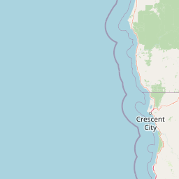
Mountain saddles
Téel Gap
1,538 m

Analyzing regional terrain, protected forest habitats, and stream networks
This geographic profile details the physical scope and environmental characteristics of Rogue River–Siskiyou National Forest. Covering over 6973 square kilometers, the area features mountainous terrain and extensive forest cover spread across Oregon and California. Discover the structured data regarding its diverse riparian systems, habitat zones, and spatial distribution within the Mediterranean climate region.
A merged national forest linking the Cascade Range, Siskiyou Mountains, and southern Oregon Coast Range.
Rogue River–Siskiyou National Forest is a large United States national forest that spans southwestern Oregon and northwestern California, covering almost 7,300 square kilometers of rugged Pacific Northwest terrain. It was formed in 2004 through the administrative merger of two long-established national forests: the Rogue River and the Siskiyou, each with its own nineteenth- and early-twentieth-century origins. The forest stretches from the crest of the Cascade Range westward into the Siskiyou Mountains and parts of the Southern Oregon Coast Range, creating a transition zone between volcanic alpine peaks, ancient uplifted mountains, and forested coastal drainages. Rivers such as the Rogue, Illinois, Chetco, and Elk shape the landscape and support the forest's diverse ecosystems. The area is also notable for scattered old-growth stands, rare plant communities, and a series of Congressionally designated wilderness areas that protect large tracts of relatively untouched terrain. Beyond its ecological value, the Rogue River–Siskiyou National Forest is a significant recreation and cultural landmark in the region, with ranger districts serving as gateways to hiking, fishing, river-running, and backcountry exploration.
Mapped territorial distribution across California and Oregon
Explore mapped boundaries, geographic coordinates, and area measurements.
Catalog of recorded streams and terrain classifications within the park
Mountain saddles
1,538 m
Mountain saddles
1,267 m
Mountain saddles
1,937.3 m
Mountain saddles
1,052 m
Mountain saddles
2,100 m
Mountain saddles
1,301 m
Temperate and Mediterranean forest zones across mountain terrain
Mountains · Forest · Rivers
Temperate coniferous forest · Mediterranean forest · Montane forest
Compare regional mountain ranges, forested river valleys, and connected Pacific Northwest wilderness areas.
Northeast

Explore mapped boundaries and unique caldera geography.
Crater Lake National Park represents a significant protected area within Oregon, defined by the dramatic volcanic caldera it contains. This national park is celebrated for its exceptionally deep, clear blue lake, formed by the collapse of Mount Mazama, offering a unique subject for geographic and landscape study. Users can explore its mapped boundaries and understand its position within the broader atlas of protected lands and mountainous terrain of the Cascade Range.
North
Botanical richness and dramatic canyon terrain in the Klamath Mountains
Kalmiopsis Wilderness preserves a dramatic landscape of steep ridges and river-cut valleys across 180,000 acres in southwestern Oregon. Known for its distinct serpentine soils and high botanical diversity, the wilderness area offers a look at complex mountain ecology and significant Wild and Scenic River headwaters within the Rogue River-Siskiyou National Forest.
East
A rugged wilderness reserve straddling California and Oregon
Red Buttes Wilderness preserves a complex mountainous terrain shaped by ancient metamorphic rocks and glacial history. The area features high ridgelines, alpine lakes, and specialized botanical habitats, providing a vital window into the ecological and geological diversity of the broader Klamath and Siskiyou mountain landscapes.
Northeast
High-country wilderness area in southwestern Oregon
Rogue-Umpqua Divide Wilderness preserves a dense, high-elevation ridge environment that separates the Rogue and Umpqua river drainages. Featuring a complex mix of volcanic and sedimentary rock outcrops within a continuous conifer canopy, the area offers a unique look at forest ecology in the Klamath Mountains. The geography provides extensive views across both watersheds and stands as a primary example of protected montane forest terrain within the Oregon landscape.
South
A regional protected area spanning California river systems
Six Rivers National Forest defines much of the rugged landscape in northwestern California. Named for the six major river drainages within its borders, the area features a unique combination of coastal forests, deep river canyons, and high-country ridges that offer significant insight into the region's broader geographic and ecological character.
South
Watershed geography and rugged mountain terrain in northwestern California
Located in the heart of the Klamath Mountains, Smith River National Recreation Area represents a critical protected watershed in northern California. The area is defined by its deep, forested canyons and the clean, wild waters of the Smith River, which serve as a primary link between coastal redwood ecosystems and mountainous inland terrain. Users can study the park boundaries and regional landscape characteristics that sustain this remote environment.
East
Mapping the volcanic cirques and square boundaries of the southern Cascades.
Mountain Lakes Wilderness serves as a primary geographic anchor in the southern Cascades, where shield volcanoes meet glacially carved basins. This protected area contains over twenty lakes situated in high-altitude cirques near the summits of volcanic peaks like Aspen Butte. The area is defined by its distinctive square survey-township boundary, providing a clear footprint of wilderness conservation within the larger Fremont-Winema National Forest terrain.
Northeast
Southern Cascade Range mountain and forest geography
Mount Thielsen Wilderness offers a compact yet dramatic study of southern Cascade topography. Dominated by its signature lightning-struck volcanic peak, the area encompasses a complex network of glacial cirques, deep valleys, and high-altitude forest zones. This map-rich entry point provides a closer look at the protected boundaries and natural geological features that define this significant segment of Oregon wilderness.
Navigate the complex terrain and protected landscapes of the Rogue River–Siskiyou National Forest through the MoriAtlas platform. Gain deeper insight into this unique Pacific Northwest intersection of mountain systems and river-carved wilderness areas.