
Mori Atlas logo
Park earthquake history

A historical catalogue of regional seismic events associated with this floodplain landscape

Recorded Earthquake History and Seismic Records Near Siegaue und Siegmündung Nature Reserve

This historical record documents earthquakes identified by their epicentre distance from the Siegaue und Siegmündung nature reserve. The collection provides transparent access to regional seismic data, including event dates, magnitude ratings, and focal depths. By mapping historical occurrences in the Rhine-Sieg-Kreis area, this catalogue offers geographic context for recorded earth movements within the vicinity of the Sieg and Rhine confluence.

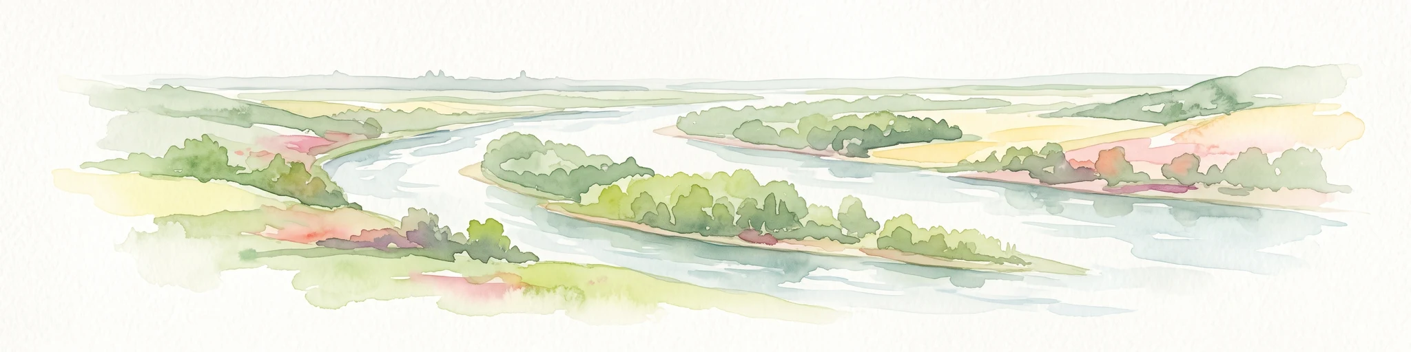
A flat-style digital illustration depicting a winding river flowing through a lush floodplain with agricultural fields, trees, and distant hills under a soft sun.

A combined floodplain and river-mouth nature reserve along the lower Sieg, where oxbows, softwood forest, and gravel banks meet the Rhine.

Siegaue und Siegmündung

Siegaue und Siegmündung is a German nature reserve (Naturschutzgebiet) that protects a continuous stretch of the lower Sieg River where it joins the Rhine, just north of Bonn. The reserve combines two adjacent designated areas: the larger Sieg floodplain (Siegaue) around Niederkassel and the smaller Sieg river-mouth area (Siegmündung) on Bonn city territory. The landscape is a structurally rich lowland floodplain, dominated by meadows, scattered woodlands, remnants of softwood alluvial forest, and side channels cut off from the main river. Wide gravel banks with pioneer willow shrub fringe the Sieg and the Rhine shoreline, while a flood-protection dike carries species-rich dry grassland of conservation value. The reserve is most notable for its birdlife, particularly wintering and migratory waterfowl and waders, and for its rare habitat types of the Cologne-Bonn Rhine plain, several of which qualify as protected Habitats Directive (FFH) features.

Location
Germany
Park type
Nature reserve
Established
1985
Siegaue und Siegmündung Protected Area Atlas

Compare Siegaue und Siegmündung events by date and distance

Review past earthquake observations near Siegaue und Siegmündung

Past earthquake observations near Siegaue und Siegmündung are connected to the protected place by epicentre and calculated distance, not presumed to fall within it. Review dates, magnitudes, depths, locality descriptions, distance figures, and references without attributing seismic causes to floodplain or river features, rating current risk, or anticipating later earthquakes.

Sort by
Magnitude
Location

This page describes catalogued earthquakes associated with the park by epicentre location and distance. It does not establish causation, assess current danger, or predict future earthquakes.

No earthquake records match the current filters

Park atlas

Continue beyond Siegaue und Siegmündung earthquake data

Explore further protected places after Siegaue und Siegmündung

Siegaue und Siegmündung earthquake data transitions to a distinct collection of protected destinations elsewhere in the atlas. These links imply no common floodplain or river setting, legal designation, biodiversity, geology, seismic patterns, proximity, hazards, risk, or matching source coverage.
A horizontal watercolor painting depicting a gentle, hazy green landscape with rolling hills, a line of trees, and a foreground meadow.
Protected landscapeNorth Rhine-Westphalia
0.8 km away#1 closest

West

Naturpark Rheinland: Geography and Protected Area Overview in North Rhine-Westphalia

A complex metropolitan nature park and lake district

Naturpark Rheinland represents a distinct convergence of reclaimed lignite mining landscapes, quiet lowland forests, and floodplain wetlands. Its mapped boundaries reveal a diverse terrain of ridges and river valleys that define the environmental character of the Cologne-Bonn metropolitan region.

Area
1,045 km²
Established
1959
Relief
Upland
Climate
Temperate
A soft watercolor painting showing a winding river with a lush green island in the middle, surrounded by soft-toned riverbanks and trees.
Nature reserveNorth Rhine-Westphalia
About 2.5 km away#2 closest

Northwest

Herseler Werth Nature Reserve: Geographic Overview of the Rhine River Island Landscape

A strictly protected riverine refuge in North Rhine-Westphalia

Herseler Werth represents a unique study in protected geography as the only non-publicly accessible Rhine island within North Rhine-Westphalia. Spanning 14.8 hectares, this long, narrow river island serves as a critical, human-excluded sanctuary that protects endangered species from industrial and urban disturbance. Its mapped boundaries and poplar-covered terrain illustrate the complex interaction between historical river hydrology and modern conservation efforts along the busy Bonn-Cologne corridor.

Area
0.148 km²
Established
1993
Relief
Lowland
Climate
Temperate
Nature reserveNorth Rhine-Westphalia
About 5.4 km away#3 closest

South

Melbtal Nature Reserve in North Rhine-Westphalia: Map, Terrain, and Geographic Context

Deep-cut forested valley with unique geological instability

Melbtal stands as a protected nature reserve in Bonn, Germany, defined by its steep wooded slopes and the meandering Melbbach. This geographic entity offers a study in earth-science dynamics, featuring active landslides and a distinct cold-air flow that persists within a dense urban setting. Use this atlas perspective to understand the boundaries, terrain, and layered cultural history of one of the region's most prominent green corridors.

Area
0.2 km²
Established
2013
IUCN
IV
Relief
Upland
A soft watercolor illustration showing a peaceful landscape with gentle hills, trees, and small ponds reflecting light.
Nature reserveNordrhein-Westfalen
About 6.6 km away#4 closest

West

Quarzsandgrube Nature Reserve: Geographic Profile and Protected Landscape Context

Protected mosaic of pioneer habitats in the Rhein-Sieg-Kreis

Located on the terrace slopes of the Rhein-Sieg-Kreis, Quarzsandgrube represents a significant refuge for early successional flora and fauna. The site features an uneven terrain of exposed sandy soils and water-filled hollows, providing a vital habitat corridor alongside adjacent protected areas. This detailed geographic profile maps the environmental conditions that define its current status as a protected nature reserve.

Area
0.29 km²
Established
1994
IUCN
IV
Nature reserveCologne
About 7.8 km away#5 closest

North

Kiesgruben Paulsmaar Nature Reserve: Landscape and Geography in the Cologne Urban Fringe

A managed mosaic of post-industrial gravel pits and wetland habitats.

Kiesgruben Paulsmaar represents a distinct example of urban-edge habitat restoration in western Germany. Located near the border of Cologne, this 24-hectare nature reserve consists of three interconnected water bodies, floodplain forests, and calcareous grasslands. It serves as a regional refuge for biodiversity while documenting the conversion of former industrial land into a functioning wetland ecosystem.

Area
0.247 km²
Established
1991
Relief
Lowland
Climate
Temperate
Nature reserveNorth Rhine-Westphalia
About 8.5 km away#6 closest

North

Kiesgrube Wahn Nature Reserve: Mapped Geography and Protected Area Context

Protected landscape within the Bergische Heideterrasse of North Rhine-Westphalia

Kiesgrube Wahn provides a compact, high-value ecological mosaic in Cologne, Germany. This former gravel pit has transitioned into a protected nature reserve, hosting a range of aquatic and woodland environments that support rare plant and animal communities within the regional gravel-pit network.

Area
0.054 km²
Established
1988
Relief
Lowland
Access
Highly restricted
A soft watercolor painting depicting a panoramic landscape with rolling green hills, patches of forest, and gentle terrain.
Nature reserveNordrhein-Westfalen
About 10 km away#7 closest

South

Kottenforst-Waldville Nature Reserve: Protected Landscape Geography and Forest Mapping

A significant oak-hornbeam woodland complex within Nordrhein-Westfalen.

Kottenforst-Waldville comprises extensive, interconnected forest blocks defined by their high-value oak-hornbeam stands and rare woodland pools known as Maare. This protected area supports a dense regional network of spring brooks and floodplain woodlands, serving as a critical refuge for woodpecker populations and raptors within the anthropogenically shaped landscape of the Rhine valley.

Area
35.853 km²
Established
2004
Watercolor landscape illustration showing a pale river curving through green trees with soft hills in the distance.
Nature reserveNorth Rhine-Westphalia
About 10 km away#8 closest

Northwest

Langeler Auwald: A Protected Floodplain Forest in the North Rhine-Westphalia Rhine Corridor

Examining fluvial landscape patterns and riparian forest boundaries

Langeler Auwald functions as a significant nature reserve on the right bank of the Rhine in Cologne, preserving a rare mosaic of willow-poplar floodplain forest. The terrain encompasses periodically flooded gravel shores, nutrient-poor grasslands on flood dikes, and transitional orchard habitats that support a high density of protected species within the urbanized landscape of North Rhine-Westphalia.

Area
0.224 km²
Relief
Lowland
Climate
Temperate
Scope
Terrestrial
MoriAtlas Explorer

Navigate the Siegaue und Siegmündung Protected Nature Reserve Map

Deepen your understanding of the Sieg River confluence through a detailed map of this protected floodplain area. Discover the diverse terrain and conservation significance of the Siegaue und Siegmündung reserve as featured in the MoriAtlas database.