
Mori Atlas logo
Nature reserveSiegaue und Siegmündung

Mapping the river-mouth ecosystems and floodplain dynamics of the Rhein-Sieg-Kreis region

Siegaue und Siegmündung Protected Landscape: An Atlas of the Lower Sieg River Floodplain

(Naturschutzgebiet Siegaue und Siegmündung)

Siegaue und Siegmündung stands as a vital nature reserve and protected river landscape at the confluence of the Sieg and Rhine rivers. This lowland floodplain preserves rare alluvial forest remnants, expansive gravel banks, and diverse wetland habitats that support migrating waterfowl. By examining the geographic boundaries and terrain features, you gain insight into this unique river-mouth ecosystem located within the broader Rhein-Sieg-Kreis district.

floodplainriver-mouthalluvial forestsoftwood forestoxbow lakesgravel banks
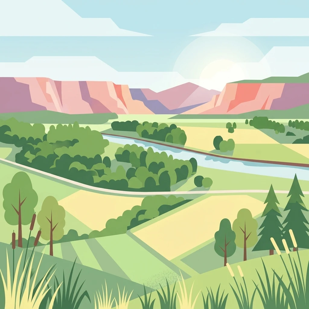
A flat-style digital illustration depicting a winding river flowing through a lush floodplain with agricultural fields, trees, and distant hills under a soft sun.

Siegaue und Siegmündung

Nature reserve

Park overview

Structured park overview, official facts, and landscape profile for Siegaue und Siegmündung

Siegaue und Siegmündung park facts, protected area profile, and essential visitor context

Review the core facts for Siegaue und Siegmündung, including designation, size, terrain, visitor scale, habitats, and operating context in one park-focused overview.

About Siegaue und Siegmündung

Siegaue und Siegmündung sits in the Cologne-Bonn Rhine plain, in the lower reach of the Sieg River where it empties into the Rhine. The reserve is administered as a German Naturschutzgebiet and combines two adjacent protection zones: a larger floodplain area along the Sieg around Niederkassel, and a smaller river-mouth sector lying within the Bonn city boundary.

Although the surrounding region is densely populated and close to major urban centers, the area has retained a working floodplain mosaic of meadows, riparian woodland, dead-channel complexes, gravel banks, and dike-side grasslands. The reserve plays an important role in preserving habitats that have become rare in the broader Rhine plain and in connecting the Sieg valley to the Rhine floodplain ecosystem.

For visitors interested in wetland birdwatching, river-mouth geomorphology, or examples of European Habitats Directive floodplain habitats close to a major metropolitan area, Siegaue und Siegmündung offers a compact, scientifically relevant, and recognizable nature reserve.

Quick facts and research context for Siegaue und Siegmündung

Siegaue und Siegmündung is a federally recognized nature reserve in North Rhine-Westphalia, located between Bonn, Sankt Augustin, Troisdorf, and Niederkassel in the Rhein-Sieg-Kreis region. The combined protected area includes the 1983-designated Sieg river-mouth reserve (about 151 hectares) on Bonn city land and the adjacent 1985 Sieg floodplain reserve (about 535 hectares).

Most of the area has been part of the Natura 2000 network under the designation DE-5208-301 since 2004, with the FFH zone covering around 564 hectares. The reserve preserves one of the best-developed natural river mouths of the middle Rhine valley, complete with near-natural flood dynamics, oxbow lakes, softwood and hardwood floodplain forest remnants, and described Habitat Directive habitat types.

Protection and recognition

Documented terrestrial protection history and Natura 2000 designation records

Siegaue und Siegmündung Protection Status and Official International Recognition

Siegaue und Siegmündung features documented terrestrial protection status established in 2004 alongside official Natura 2000 recognition records. Structured conservation data outlines the registered management scope and designated geographic boundaries for this protected area.

International recognition

Protection details

Protection scope
Terrestrial
Designated year
2004
Transboundary protection
No
WDPA ID
555520535
Park context

Deeper park guide and search-rich context for Siegaue und Siegmündung

Siegaue und Siegmündung history, landscape, wildlife, and travel context

Explore Siegaue und Siegmündung through its history, landscape character, ecosystems, wildlife, conservation priorities, cultural context, and seasonal travel timing in a structured park guide built for atlas discovery and search intent.

Why Siegaue und Siegmündung stands out

The reserve is best known as one of the most important inland sites in North Rhine-Westphalia for waterfowl and waders, especially as a wintering and stopover area for threatened species. It is also valued for its rare floodplain forest remnants, oxbow lakes, and its status as the most naturally formed river-mouth landscape of the middle Rhine valley. These qualities place it alongside a small number of large lowland floodplain reserves in the Cologne-Bonn region that retain functioning seasonal flooding and Habitat Directive features of the Rhine plain.
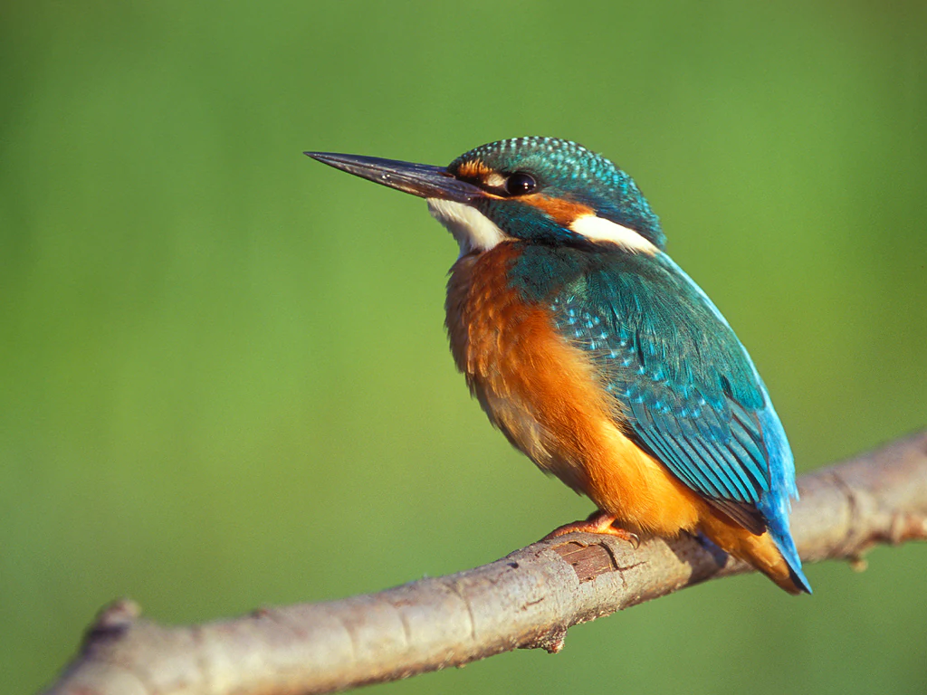
A vibrant common kingfisher with iridescent blue feathers and a bright orange breast, perched on a thin brown branch against a soft-focus green background.
A common kingfisher perched on a branch, showcasing its vibrant blue and orange plumage, which is a characteristic species of the Siegaue und Siegmündung nature reserve.

Siegaue und Siegmündung history and protected-area timeline

The protected area at the mouth of the Sieg grew out of a long-standing local tradition of regulated fishing. The Fischerei-Bruderschaft zu Bergheim an der Sieg has practiced sustainable fisheries with its own boundary stones since 987 AD, anchoring the cultural and ecological history of the site well before formal nature protection.

Modern protection came in two stages. The smaller Sieg river-mouth reserve on Bonn city territory was legally designated in 1983, covering about 151 hectares. The larger adjacent Sieg floodplain reserve around Niederkassel followed in 1985 with roughly 535 hectares. The combined area was integrated into the European Natura 2000 network in 2004 under site code DE-5208-301, adding international conservation status on top of national designation.

The regional fishing museum (Fischereimuseum Bergheim) has presented exhibitions on the brotherhood, the fishery, and the nature reserve since its reopening in 2010, helping link the reserve's industrial-cultural and natural heritage.

Siegaue und Siegmündung landscape and geographic character

The reserve's landscape is shaped by the Sieg River as it nears its confluence with the Rhine. The floodplain is dominated by grassland, much of it still in agricultural use, but the character of the area is defined by the river itself and by the small-scale features that surround it.

Kleingehölze (small groves), poplar plantings, and remnants of softwood alluvial forest break up the open grassland, while abandoned river arms (Altarme) trace former courses of the Sieg through the reserve. At the river's mouth, broad gravel banks appear, colonized by pioneer stands of white willow and basket willow, together with reed grass (Rohrglanzgras) beds along the Rhine bank.

A flood-protection dike runs through the landscape, and on top of it species-rich dry grassland (Magerrasen) creates an unexpectedly dry, meadow-like habitat in an otherwise wet floodplain. Geomorphologically, the Siegmündung is considered the best-developed natural river-mouth landscape of the middle Rhine valley, with near-natural flooding dynamics still reaching the floodplain.
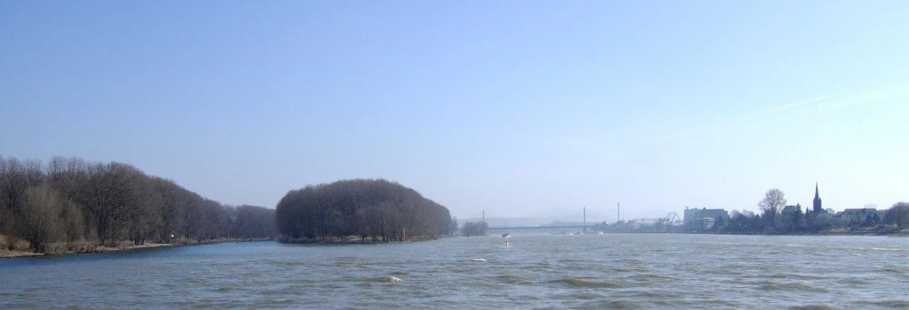
A wide view of a river meeting another river under a clear blue sky, with a dense forest island in the center and urban buildings on the far right bank.
The confluence of the Sieg river with the Rhine, featuring the wooded Kemper Werth island.

Siegaue und Siegmündung ecosystems, habitats, and plant life

Ecologically, the reserve belongs to the Rhine plain natural region of Cologne-Bonn, and is defined by its mosaic of lowland floodplain habitats. The mixed structure of grassland, small woodlands, oxbow lakes, gravel banks, and dike-side dry grassland creates a sharp change in habitat conditions over very short distances.

Among the protected habitat types recorded here are river courses with mud banks and annual pioneer vegetation, lowland hay meadows, alder-ash and softwood floodplain forests, hardwood floodplain forests, tall herb communities, natural eutrophic lakes including old river arms, and river channels with submerged vegetation. Several of these habitat types correspond to Habitats Directive features that have become rare in the broader Rhine plain.

The seasonal flooding of the Sieg continues to shape the area, allowing pioneer vegetation to regenerate on freshly disturbed gravel banks and supporting the structural diversity that makes the floodplain ecologically distinctive. The nearby Sieglarer See further enriches the area for water-dependent wildlife.
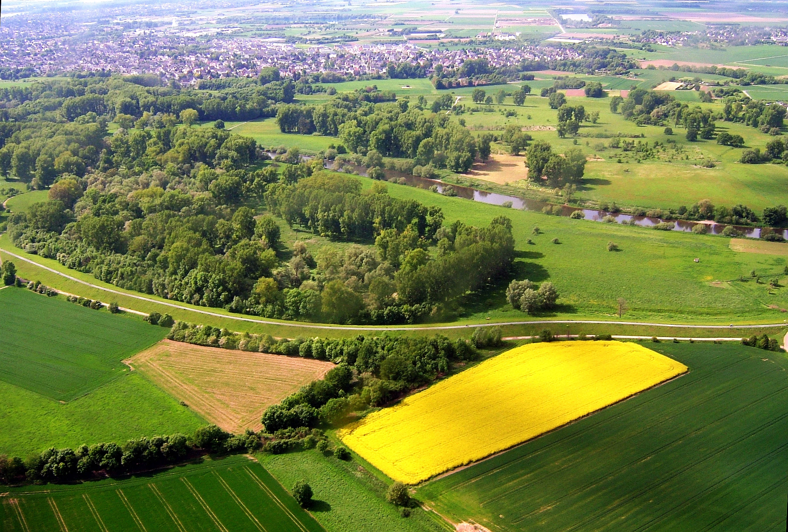
Aerial perspective of a green river valley and floodplain with a winding river, forested areas, and a distinct bright yellow field in the foreground, bordered by a levee.
Aerial view of the Sieg river, the Siegaue floodplain, and surrounding agricultural land near Müllekoven.

Siegaue und Siegmündung wildlife and species highlights

Siegaue und Siegmündung is recognized as being of statewide importance for waterfowl and waders. The floodplain oxbows, softwood forest remnants, and gravel-fringed river channels support breeding, migrating, and wintering bird populations, including species that have declined elsewhere in North Rhine-Westphalia.

Documented birdlife includes the common kingfisher (Eisvogel), smew (Zwergsäger), and black kite (Schwarzmilan), while more generally the area functions as a resting and wintering site for threatened species. Conservation attention has focused on species sensitive to disturbance, including little owl, common nightingale, and the melodious warbler, all of which have been affected by illegal recreation pressure.

The river and oxbow systems also host notable fish species of the Habitats Directive, including river lamprey, brook lamprey, sea lamprey, bullhead, bitterling, Atlantic salmon, and spined loach, giving the reserve a strong aquatic fauna component alongside its bird interest.
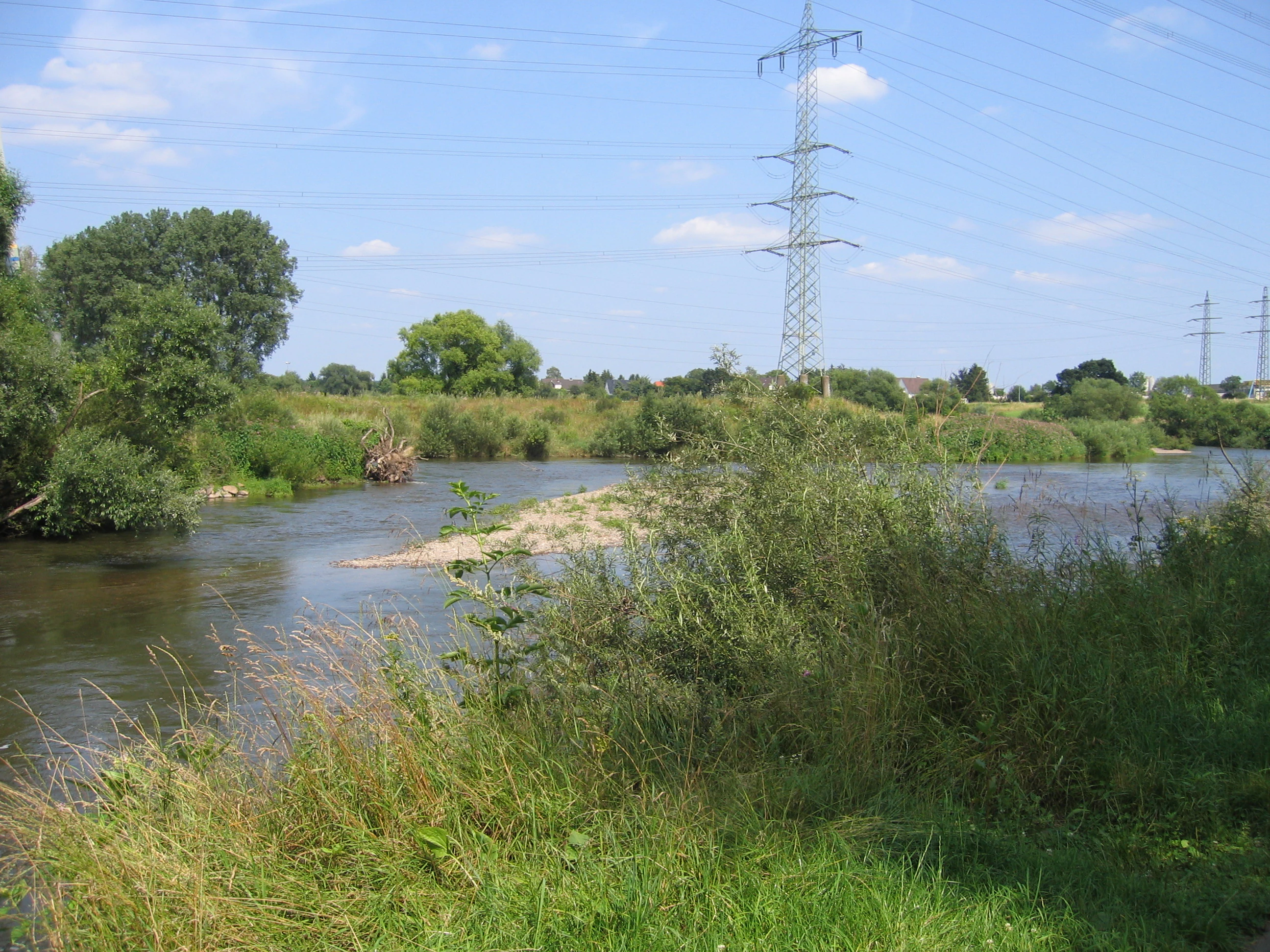
A wide view of the Sieg river with a small gravel island in the center, surrounded by green riparian vegetation and bushes, under a clear blue sky with a tall metal electrical pylon in the background.
A view of the Sieg river flowing through the floodplain landscape, with electricity pylons visible in the background.

Siegaue und Siegmündung conservation status and protection priorities

The conservation profile of Siegaue und Siegmündung is unusually layered. It is protected at the national level as a Naturschutzgebiet and at the European level as part of the Natura 2000 network, with site code DE-5208-301 covering about 564 hectares since 2004. The integration of the national designation with the Habitats Directive framework places the reserve among the more strongly protected floodplain sites in the Cologne-Bonn region.

The area is significant for preserving Habitats Directive habitats of the Rhine plain that have become rare overall, including softwood alluvial forest remnants and eutrophic oxbow lakes. It also supports Habitats Directive fish species such as lampreys, bullhead, and bitterling, lending the reserve an aquatic conservation value to match its importance for waterbirds.

At the same time, the reserve faces ongoing conservation pressures from visitors. Illegal off-trail walking, unleashed dogs, unlawful angling, summer swimming and camping, and boat access in restricted zones have been linked to declines or local losses of disturbance-sensitive bird species, making visitor management an active part of the conservation picture.

Siegaue und Siegmündung cultural meaning and human context

The cultural history of the reserve is closely tied to the long, documented tradition of regulated fishing at the mouth of the Sieg. The Fischerei-Bruderschaft zu Bergheim an der Sieg has maintained a fisheries code with its own boundary stones since 987 AD, making the area one of the older continuously managed river sites in the region.

That heritage is interpreted locally through the Fischereimuseum Bergheim, which has presented permanent exhibitions on the brotherhood, the fishery, and the nature reserve since its 2010 reopening, providing a tangible cultural anchor alongside the ecological story of the floodplain.

Top sights and standout views in Siegaue und Siegmündung

The reserve's key features include a structurally intact lowland floodplain with remnants of softwood alluvial forest, a near-natural river-mouth at the Sieg into the Rhine, broad gravel banks of pioneer willows, oxbow lakes, and Habitats Directive habitats that are now rare in the broader Cologne-Bonn Rhine plain.

It also stands out for its statewide importance for wintering and migrating waterfowl and waders, its Habitats Directive fish fauna including lampreys and bitterling, and the unusual contrast between wet floodplain habitats and the species-rich dry grasslands on top of the Sieg dike.

Best time to visit Siegaue und Siegmündung

The floodplain changes character with the seasons in ways that suit different kinds of visits. Spring and early summer bring active breeding birds, fresh green meadows, and visible wildflower display in the dike-side grasslands, while autumn highlights passage migrants moving along the Rhine and Sieg corridors.

Winter is generally the most distinctive period ornithologically, with frozen or partially unfrozen oxbows, gravel banks, and lakes attracting waterfowl and waders, while the absence of dense vegetation makes birds easier to observe. High-water events on the Sieg at any time of year reshape the gravel banks and pioneer willow stands, giving the landscape a dynamic quality that varies visit to visit.


Monthly climate preview

Long-term monthly temperature averages and precipitation measurements for Rhein-Sieg-Kreis

Siegaue und Siegmündung Climate Normals and Annual Temperature Rhythm

Representative point records outline the measured annual temperature progression and monthly precipitation rates across Siegaue und Siegmündung. Examining the complete twelve-month climate profile reveals detailed long-term averages for every recorded period.
Annual mean10 °C
1 °C19 °C
Jan
Feb
Mar
Apr
May13°
Jun17°
Jul19°
Aug19°
Sep15°
Oct10°
Nov
Dec
Warmest month
July

19.2 °C

Coolest month
January

1.3 °C

Wettest month
December

2.6 mm/day

Driest month
April

1.6 mm/day

Park location guide

Geography guide, regional context, and park location map for Siegaue und Siegmündung

Siegaue und Siegmündung park geography, regions, and map view in Germany

Understand where Siegaue und Siegmündung sits in Germany through a broader geographic reading of the surrounding landscape, nearby location context, and its mapped position within the national park landscape.

How Siegaue und Siegmündung fits into Germany

Germany is a federal republic in Western and Central Europe with a population of over 83 million across sixteen constituent states. It is Europe's largest economy by nominal GDP and a major global exporter and importer. The capital is Berlin, and the country borders Denmark, Poland, Czech Republic, Austria, Switzerland, France, Luxembourg, Belgium, and the Netherlands.

Wider geography shaping Siegaue und Siegmündung in Germany

Germany is located in Western and Central Europe, spanning 357,022 km². It borders Denmark to the north, Poland and the Czech Republic to the east, Austria and Switzerland to the south, and France, Luxembourg, Belgium, and the Netherlands to the west. The country has coastlines on the Baltic Sea and North Sea to the north, with the Alps located in the southern region.

Map view of Siegaue und Siegmündung

Use this park location map to pinpoint Siegaue und Siegmündung in Germany, understand its exact geographic position, and read its mapped placement within the surrounding landscape more clearly.

Pigeon | © OpenStreetMap contributors

Location context for Siegaue und Siegmündung

Rhein-Sieg-Kreis
Recorded earthquake history

Explore Historical Earthquake Records Associated with Siegaue und Siegmündung

Discover a detailed collection of recorded seismic events identified by location within the Rhine-Sieg region. This MoriAtlas resource provides historical event data and geographic context for earth movements near the Siegaue und Siegmündung nature reserve.

Siegaue und Siegmündung Earthquake History

Catalogued events

25 events

Strongest magnitude

Magnitude 5.2

Most recent event

Apr 11, 2010

This history includes earthquakes recorded inside the park or within 50 km of its borders

Visual exploration of alluvial floodplain forests, gravel banks, and river-mouth habitats

Siegaue und Siegmündung Landscape Photos, Scenery, and Protected River Plain Views

Photographic records reveal the distinct lowland terrain, meandering oxbow channels, and gravel riverbanks that define the protected nature reserve. Visual documentation helps observers understand seasonal flooding dynamics, rare alluvial habitats, and the regional character of the lower Sieg River valley.

A vibrant common kingfisher with iridescent blue feathers and a bright orange breast, perched on a thin brown branch against a soft-focus green background.

A small reaction ferry tethered to a cable crossing the slow moving Sieg River, surrounded by lush green floodplain trees and sandy banks.

A wide view of a river meeting another river under a clear blue sky, with a dense forest island in the center and urban buildings on the far right bank.

Aerial perspective of a green river valley and floodplain with a winding river, forested areas, and a distinct bright yellow field in the foreground, bordered by a levee.

A wide view of the Sieg river with a small gravel island in the center, surrounded by green riparian vegetation and bushes, under a clear blue sky with a tall metal electrical pylon in the background.

Park atlas

Compare adjacent lowland floodplains and connected river valley reserves

Other Parks and Protected Areas Near Siegaue und Siegmündung

Browse protected areas and natural reserves located near Siegaue und Siegmündung to compare regional river ecosystems. Exploring adjacent lowland floodplains provides broader geographic context for the middle Rhine valley landscape.
A horizontal watercolor painting depicting a gentle, hazy green landscape with rolling hills, a line of trees, and a foreground meadow.
Protected landscapeNorth Rhine-Westphalia
0.8 km away#1 closest

West

Naturpark Rheinland: Geography and Protected Area Overview in North Rhine-Westphalia

A complex metropolitan nature park and lake district

Naturpark Rheinland represents a distinct convergence of reclaimed lignite mining landscapes, quiet lowland forests, and floodplain wetlands. Its mapped boundaries reveal a diverse terrain of ridges and river valleys that define the environmental character of the Cologne-Bonn metropolitan region.

Area
1,045 km²
Established
1959
Relief
Upland
Climate
Temperate
A soft watercolor painting showing a winding river with a lush green island in the middle, surrounded by soft-toned riverbanks and trees.
Nature reserveNorth Rhine-Westphalia
About 2.5 km away#2 closest

Northwest

Herseler Werth Nature Reserve: Geographic Overview of the Rhine River Island Landscape

A strictly protected riverine refuge in North Rhine-Westphalia

Herseler Werth represents a unique study in protected geography as the only non-publicly accessible Rhine island within North Rhine-Westphalia. Spanning 14.8 hectares, this long, narrow river island serves as a critical, human-excluded sanctuary that protects endangered species from industrial and urban disturbance. Its mapped boundaries and poplar-covered terrain illustrate the complex interaction between historical river hydrology and modern conservation efforts along the busy Bonn-Cologne corridor.

Area
0.148 km²
Established
1993
Relief
Lowland
Climate
Temperate
Nature reserveNorth Rhine-Westphalia
About 5.4 km away#3 closest

South

Melbtal Nature Reserve in North Rhine-Westphalia: Map, Terrain, and Geographic Context

Deep-cut forested valley with unique geological instability

Melbtal stands as a protected nature reserve in Bonn, Germany, defined by its steep wooded slopes and the meandering Melbbach. This geographic entity offers a study in earth-science dynamics, featuring active landslides and a distinct cold-air flow that persists within a dense urban setting. Use this atlas perspective to understand the boundaries, terrain, and layered cultural history of one of the region's most prominent green corridors.

Area
0.2 km²
Established
2013
IUCN
IV
Relief
Upland
A soft watercolor illustration showing a peaceful landscape with gentle hills, trees, and small ponds reflecting light.
Nature reserveNordrhein-Westfalen
About 6.6 km away#4 closest

West

Quarzsandgrube Nature Reserve: Geographic Profile and Protected Landscape Context

Protected mosaic of pioneer habitats in the Rhein-Sieg-Kreis

Located on the terrace slopes of the Rhein-Sieg-Kreis, Quarzsandgrube represents a significant refuge for early successional flora and fauna. The site features an uneven terrain of exposed sandy soils and water-filled hollows, providing a vital habitat corridor alongside adjacent protected areas. This detailed geographic profile maps the environmental conditions that define its current status as a protected nature reserve.

Area
0.29 km²
Established
1994
IUCN
IV
Nature reserveCologne
About 7.8 km away#5 closest

North

Kiesgruben Paulsmaar Nature Reserve: Landscape and Geography in the Cologne Urban Fringe

A managed mosaic of post-industrial gravel pits and wetland habitats.

Kiesgruben Paulsmaar represents a distinct example of urban-edge habitat restoration in western Germany. Located near the border of Cologne, this 24-hectare nature reserve consists of three interconnected water bodies, floodplain forests, and calcareous grasslands. It serves as a regional refuge for biodiversity while documenting the conversion of former industrial land into a functioning wetland ecosystem.

Area
0.247 km²
Established
1991
Relief
Lowland
Climate
Temperate
Nature reserveNorth Rhine-Westphalia
About 8.5 km away#6 closest

North

Kiesgrube Wahn Nature Reserve: Mapped Geography and Protected Area Context

Protected landscape within the Bergische Heideterrasse of North Rhine-Westphalia

Kiesgrube Wahn provides a compact, high-value ecological mosaic in Cologne, Germany. This former gravel pit has transitioned into a protected nature reserve, hosting a range of aquatic and woodland environments that support rare plant and animal communities within the regional gravel-pit network.

Area
0.054 km²
Established
1988
Relief
Lowland
Access
Highly restricted
A soft watercolor painting depicting a panoramic landscape with rolling green hills, patches of forest, and gentle terrain.
Nature reserveNordrhein-Westfalen
About 10 km away#7 closest

South

Kottenforst-Waldville Nature Reserve: Protected Landscape Geography and Forest Mapping

A significant oak-hornbeam woodland complex within Nordrhein-Westfalen.

Kottenforst-Waldville comprises extensive, interconnected forest blocks defined by their high-value oak-hornbeam stands and rare woodland pools known as Maare. This protected area supports a dense regional network of spring brooks and floodplain woodlands, serving as a critical refuge for woodpecker populations and raptors within the anthropogenically shaped landscape of the Rhine valley.

Area
35.853 km²
Established
2004
Watercolor landscape illustration showing a pale river curving through green trees with soft hills in the distance.
Nature reserveNorth Rhine-Westphalia
About 10 km away#8 closest

Northwest

Langeler Auwald: A Protected Floodplain Forest in the North Rhine-Westphalia Rhine Corridor

Examining fluvial landscape patterns and riparian forest boundaries

Langeler Auwald functions as a significant nature reserve on the right bank of the Rhine in Cologne, preserving a rare mosaic of willow-poplar floodplain forest. The terrain encompasses periodically flooded gravel shores, nutrient-poor grasslands on flood dikes, and transitional orchard habitats that support a high density of protected species within the urbanized landscape of North Rhine-Westphalia.

Area
0.224 km²
Relief
Lowland
Climate
Temperate
Scope
Terrestrial

Common questions about visiting, size, designation, and location context for Siegaue und Siegmündung

Siegaue und Siegmündung FAQs for park facts, access, geography, and protected area context

Find quick answers about Siegaue und Siegmündung, including protected-area facts, park geography, trail and visitor context, and how the park fits into its surrounding country and regional landscape.
MoriAtlas Explorer

Continue Your Protected Areas Search Across the Global Atlas

Deepen your exploration by continuing the structured search for national parks and protected areas worldwide. Utilize the comprehensive filtering capabilities to compare different conservation landscapes and refine your understanding of global park geography. Discover more about the distribution and characteristics of protected natural areas.

Global natural geography