Mori Atlas logo
Biosphere reserveSierra del Abra-Tanchipa

Analyzing the rugged sierra terrain, tropical forest cover, and ecological boundaries of the Huasteca Potosina region.

Sierra del Abra-Tanchipa Biosphere Reserve: Mapping the Protected Landscapes of Eastern San Luis Potosí

(Reserva de la Biosfera Sierra del Abra Tanchipa)

The Sierra del Abra-Tanchipa Biosphere Reserve represents a critical expanse of protected land in the Huasteca Potosina of Mexico, characterized by its rugged karst topography and dense tropical forest ecosystems. This atlas entry details the geographic scope and regional setting of the reserve, which spans over 21,000 hectares along the eastern flank of the Sierra Madre Oriental. By examining the continuous natural habitat of this biosphere reserve, researchers and explorers can better understand the transition between the arid northern highlands and the humid Gulf lowlands of eastern San Luis Potosí.

biosphere reserveSierra Madre OrientalHuasteca Potosinatropical forestrugged sierrakarst landscape

Sierra del Abra-Tanchipa

Biosphere reserve

Park overview

Structured park overview, official facts, and landscape profile for Sierra del Abra-Tanchipa

Sierra del Abra-Tanchipa park facts, protected area profile, and essential visitor context

Review the core facts for Sierra del Abra-Tanchipa, including designation, size, terrain, visitor scale, habitats, and operating context in one park-focused overview.

About Sierra del Abra-Tanchipa

Sierra del Abra-Tanchipa is a Mexican natural protected area designated as a biosphere reserve and located in the Huasteca Potosina region of eastern San Luis Potosí. The reserve sits near the eastern edge of the state, close to the border with Tamaulipas, and lies in the vicinity of Ciudad Valles and Tamuín, the two principal municipalities in which its territory is distributed. Its position places it within a transitional geographic belt where the Sierra Madre Oriental meets the warmer lowlands of the Gulf coastal plain, giving the area a complex topography of hills, ridges, and steep forested slopes.

The protected area covers approximately 21,464 hectares, making it a medium-sized biosphere reserve by Mexican standards. Around 90% of this surface lies within the municipality of Ciudad Valles, while the remaining 10% sits in Tamuín. Because the core polygon was uninhabited at the moment of the reserve's creation, the protected landscape forms a relatively continuous natural block, free of the dense settlement patterns that often complicate conservation in more populated regions of Mexico.

Administratively, Sierra del Abra-Tanchipa falls under the Comisión Nacional de Áreas Naturales Protegidas (CONANP), the federal agency responsible for managing Mexico's system of natural protected areas. The designation as a biosphere reserve reflects both the ecological value of the local flora and fauna and the geological character of the sierra itself, with the reserve intended to safeguard a representative sample of the natural heritage of the Huasteca Potosina for future generations. Surrounding the reserve is a network of ejidos and rural communities whose lands adjoin the protected polygon, including localities such as Laguna del Mante, Estación Guerrero, Las Palmas, Gustavo Garmendia, Los Sabinos, Montecillos, León García, Cañón del Taninul, and Tanculpaya.

The park occupies a meaningful place within Mexico's broader system of biosphere reserves, serving as one of the formal protected-area anchors for conservation and ecological study in northeastern Mexico. Its combination of elevation, vegetation cover, climate, and relative isolation from urban centers makes it a notable reference site for understanding the natural systems of the eastern Sierra Madre and the Huasteca region.

Quick facts and research context for Sierra del Abra-Tanchipa

Sierra del Abra-Tanchipa is a federal biosphere reserve in eastern San Luis Potosí, Mexico, in the Huasteca Potosina near the city of Ciudad Valles and the town of Tamuín. The reserve was created by presidential decree on 6 June 1994, during the administration of Carlos Salinas de Gortari, and is managed by CONANP, Mexico's national commission for protected natural areas. Its total area is around 21,464 hectares, distributed across two municipalities, with roughly 90% lying in Ciudad Valles and about 10% in Tamuín. At the time of its establishment, no human settlements existed within the core zone of the protected polygon.

Protection and recognition

Analysis of terrestrial protected area designation and recognition records

Sierra del Abra-Tanchipa Protection Status and Documented Conservation

Sierra del Abra-Tanchipa maintains a documented terrestrial protection scope within the regional conservation network. Structured records outline the official designation framework and available international recognition details for the protected landscape.

Protection details

Protection scope
Terrestrial
Park context

Deeper park guide and search-rich context for Sierra del Abra-Tanchipa

Sierra del Abra-Tanchipa history, landscape, wildlife, and travel context

Explore Sierra del Abra-Tanchipa through its history, landscape character, ecosystems, wildlife, conservation priorities, cultural context, and seasonal travel timing in a structured park guide built for atlas discovery and search intent.

Why Sierra del Abra-Tanchipa stands out

The reserve is best known for protecting a continuous block of rugged sierra terrain and tropical forest in the Huasteca Potosina, one of Mexico's most ecologically and culturally distinctive regions. Its protected polygon is notable for being essentially uninhabited at the moment of its declaration, allowing a sizeable natural area to be set aside without the complication of relocating communities. The reserve also represents an important example of Mexico's biosphere reserve network in the transition zone between the dry interior north and the more humid Gulf lowlands.

Sierra del Abra-Tanchipa history and protected-area timeline

The history of Sierra del Abra-Tanchipa as a protected area began on 6 June 1994, when the Mexican federal government issued a decree declaring its territory a natural protected area with the character of a biosphere reserve. The decree was published in the Diario Oficial de la Federación and signed during the presidency of Carlos Salinas de Gortari. At the time of the declaration, the core zone of the reserve had no permanent human settlements, which simplified the establishment of the protected polygon.

The reserve was created as part of a broader Mexican effort during the 1990s to expand the country's network of biosphere reserves under the framework of the Man and the Biosphere Programme and national environmental legislation. Its designation drew on recognition of the ecological importance of the sierra landscape and its function as a refuge for native flora and fauna in the Huasteca Potosina. Since its establishment, the area has been administered by the Comisión Nacional de Áreas Naturales Protegidas, which oversees Mexico's federal system of natural protected areas and implements the management framework for the reserve.

Sierra del Abra-Tanchipa landscape and geographic character

Sierra del Abra-Tanchipa encompasses a stretch of rugged sierra terrain characteristic of the eastern flank of the Sierra Madre Oriental, where folded limestone-like ridges give way to steep slopes and forested valleys. The topography is marked by abrupt changes in elevation, with rocky outcrops, ridges, and canyon-like formations defining much of the visual character of the reserve. The transition between the higher rugged interior and the lower-lying terrain of the Huasteca lowlands produces a varied profile across the protected area.

Geographically, the reserve lies between roughly 22°04'38" and 22°23'56" north latitude and between 98°53'07" and 99°00'44" west longitude, placing it firmly in the warm subtropical climatic zone of eastern Mexico. The karst-influenced geology typical of the Sierra Madre Oriental shapes much of the protected zone, producing the kind of rocky, broken terrain that supports distinctive vegetation patterns and scattered seasonal water features. Surrounding landscapes include the agricultural lowlands of the Huasteca Potosina and the river valleys that define the regional geography near Ciudad Valles and Tamuín.

Sierra del Abra-Tanchipa ecosystems, habitats, and plant life

Ecologically, Sierra del Abra-Tanchipa occupies a transitional position between the drier environments of northern Mexico and the more humid tropical systems of the Gulf coast. This biogeographic situation makes the reserve interesting for the study of species that reach their distributional limits within its borders, as well as for the protection of the regional tropical forest that characterizes much of the Huasteca Potosina. The combination of elevation, rugged terrain, and warm climate supports a diversity of vegetation associations, ranging from tropical forest formations on lower slopes to more open and rocky communities at higher elevations within the reserve.

Because the core of the protected area was uninhabited at the moment of its declaration, the vegetation cover of the reserve is relatively continuous, with limited fragmentation from agriculture or settlements inside its boundaries. The surrounding ejidos and adjacent lands add a mosaic of agricultural and secondary vegetation to the broader landscape, while the reserve itself functions as a refuge for the natural vegetation patterns of the region. This makes the area a useful reference site for understanding the ecological character of the eastern Sierra Madre and the Huasteca region.

Sierra del Abra-Tanchipa wildlife and species highlights

Although detailed fauna information is limited in the source material, Sierra del Abra-Tanchipa is recognized as an important refuge for the wildlife typical of the Huasteca Potosina and the eastern Sierra Madre Oriental. Its combination of tropical forest cover, rugged topography, and relative absence of human settlement within its core zone gives it value as habitat for the native animal species of the region. As part of Mexico's biosphere reserve network, the area is intended to support conservation of the regional fauna alongside the protection of the landscape and vegetation.

Sierra del Abra-Tanchipa conservation status and protection priorities

The principal conservation importance of Sierra del Abra-Tanchipa lies in its status as one of the few formal biosphere reserves in the Huasteca Potosina region, established to safeguard a representative sample of the natural heritage of eastern San Luis Potosí. By protecting approximately 21,464 hectares of rugged sierra and tropical forest, the reserve contributes to the connectivity of natural habitat in northeastern Mexico, where pressure from agriculture, livestock, and expanding settlements is a constant concern.

Its designation under the biosphere reserve category reflects the intention to balance ecological preservation with regional development objectives, consistent with Mexico's national approach to managing protected areas through CONANP. The fact that the core zone was uninhabited at the moment of the reserve's creation in 1994 has allowed the protected polygon to retain a relatively continuous natural cover, increasing its value for long-term conservation, ecological research, and the protection of regional biodiversity.

Sierra del Abra-Tanchipa cultural meaning and human context

The reserve sits within the Huasteca Potosina, a region of Mexico with a strong and distinctive cultural identity rooted in the historic Huastec region and shaped by centuries of interaction between indigenous heritage, colonial influences, and rural mestizo communities. Surrounding the protected area are numerous ejidos such as Laguna del Mante, Estación Guerrero, Las Palmas, Gustavo Garmendia, Los Sabinos, Montecillos, León García, Cañón del Taninul, and Tanculpaya, which reflect the traditional pattern of communal land tenure that characterizes much of rural San Luis Potosí.

While the reserve itself does not contain settlements in its core zone, its setting within the Huasteca gives it a regional cultural context in which the natural landscape is closely tied to the identity of the surrounding communities. The proximity of the reserve to Ciudad Valles and Tamuín, two important population centers of the Huasteca Potosina, also links the protected area to the broader cultural and economic life of the region.

Top sights and standout views in Sierra del Abra-Tanchipa

Sierra del Abra-Tanchipa stands out for its combination of rugged Sierra Madre Oriental topography, tropical forest cover, and location within the culturally rich Huasteca Potosina. As a federally decreed biosphere reserve created in 1994, it represents an important institutional commitment to conserving the natural heritage of eastern San Luis Potosí. Its relatively large and continuous protected polygon, free of settlements within the core zone, gives it particular value for ecological preservation and for understanding the transition between arid northern Mexico and the humid Gulf lowlands.
Monthly climate preview

Long-term temperature ranges and monthly precipitation distributions for San Luis Potosí

Sierra del Abra-Tanchipa Climate Normals and Annual Weather Patterns

Representative coordinate records outline the measured annual temperature rhythm and monthly precipitation distribution across Sierra del Abra-Tanchipa. Detailed twelve-month climatology data profiles illustrate complete historical averages for thermal variations and rainfall amounts.
Annual mean25 °C
19 °C29 °C
Jan19°
Feb21°
Mar24°
Apr27°
May29°
Jun29°
Jul28°
Aug28°
Sep26°
Oct24°
Nov21°
Dec19°
Warmest month
May

29.2 °C

Coolest month
January

18.6 °C

Wettest month
September

7.5 mm/day

Driest month
February

0.7 mm/day

Park location guide

Geography guide, regional context, and park location map for Sierra del Abra-Tanchipa

Sierra del Abra-Tanchipa park geography, regions, and map view in Mexico

Understand where Sierra del Abra-Tanchipa sits in Mexico through a broader geographic reading of the surrounding landscape, nearby location context, and its mapped position within the national park landscape.

How Sierra del Abra-Tanchipa fits into Mexico

Mexico, officially the United Mexican States, is a country in North America spanning the Sierra Madre mountain ranges, coastal plains, and tropical regions. It borders the United States to the north, Guatemala and Belize to the southeast, and has coastlines along the Pacific Ocean, Gulf of Mexico, and Caribbean Sea. With a population exceeding 130 million, Mexico is home to one of the world's most significant concentrations of Indigenous languages alongside Spanish.

Wider geography shaping Sierra del Abra-Tanchipa in Mexico

Mexico occupies a land area of 1,972,550 km2, making it the thirteenth-largest country in the world. The terrain is highly diverse, featuring the Sierra Madre Occidental and Sierra Madre Oriental mountain ranges, the Mexican Plateau, coastal lowlands along the Pacific and Gulf/Caribbean margins, and the Yucatan Peninsula. The country spans multiple climate zones from desert in the north to tropical rainforest in the south.

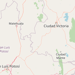
Map view of Sierra del Abra-Tanchipa

Use this park location map to pinpoint Sierra del Abra-Tanchipa in Mexico, understand its exact geographic position, and read its mapped placement within the surrounding landscape more clearly.

Pigeon | © OpenStreetMap contributors

Location context for Sierra del Abra-Tanchipa

San Luis Potosí
Park atlas

Compare surrounding regional geography and connected conservation areas

Explore Parks Near Sierra del Abra-Tanchipa and Related Protected Landscapes

Browse other parks near Sierra del Abra-Tanchipa to evaluate similar rugged sierra topography and tropical forest ecosystems across the Huasteca Potosina. Comparing adjacent protected areas reveals broader regional conservation patterns and transitional landscapes in northeastern Mexico.
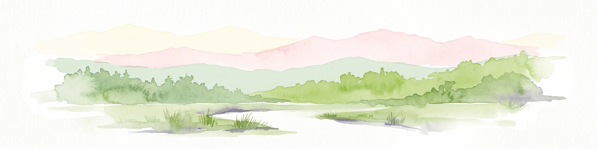
Watercolor illustration showing a river flowing through green forest with pink mountains in the background on a white background
Protected areaTamaulipas
About 124 km away#1 closest

Northeast

Sierra de Tamaulipas Protected Area: Geography, Karst Terrain, and Sky Island Ecosystems

Mapping the natural features of a remote Mexican mountain massif.

The Sierra de Tamaulipas offers a unique study in vertical geography and isolated ecosystems. Rising dramatically above the plains of Tamaulipas, this protected area features a complex mosaic of tropical deciduous forests and pine-oak summits. The range also hosts notable karst features, including the world's deepest water-filled sinkhole, El Zacatón, set within a landscape of immense historical and biological value.

Area
3,339 km²
Established
2016
Relief
Mountain
Climate
Subtropical
National parkSan Luis Potosí
About 150 km away#2 closest

West

El Potosí National Park: Detailed Protected Area Geography and Landscape Context

Explore its mapped boundaries within San Luis Potosí.

Uncover the protected landscape of El Potosí National Park, a designated national park situated in San Luis Potosí, Mexico. This entry offers a detailed perspective on its geographic significance, providing insights into its mapped boundaries and regional natural terrain. Understand how this protected area contributes to the broader atlas of natural landscapes in Mexico, ideal for geographic discovery.

Area
20 km²
Established
1936
IUCN
II
Relief
Mountain
National parkMexico
About 155 km away#3 closest

South

Los Mármoles National Park: Detailed Protected Landscape within Mexico's National Park Atlas

Explore the mapped boundaries and regional geography of this unique protected area.

Understand Los Mármoles National Park as a distinct protected landscape, integral to Mexico's atlas of natural areas. This park offers a unique geographic context, with its mapped boundaries providing a clear reference for its protected status. Delve into the regional landscape and discover the importance of this national park for conservation and geographic study.

IUCN
II
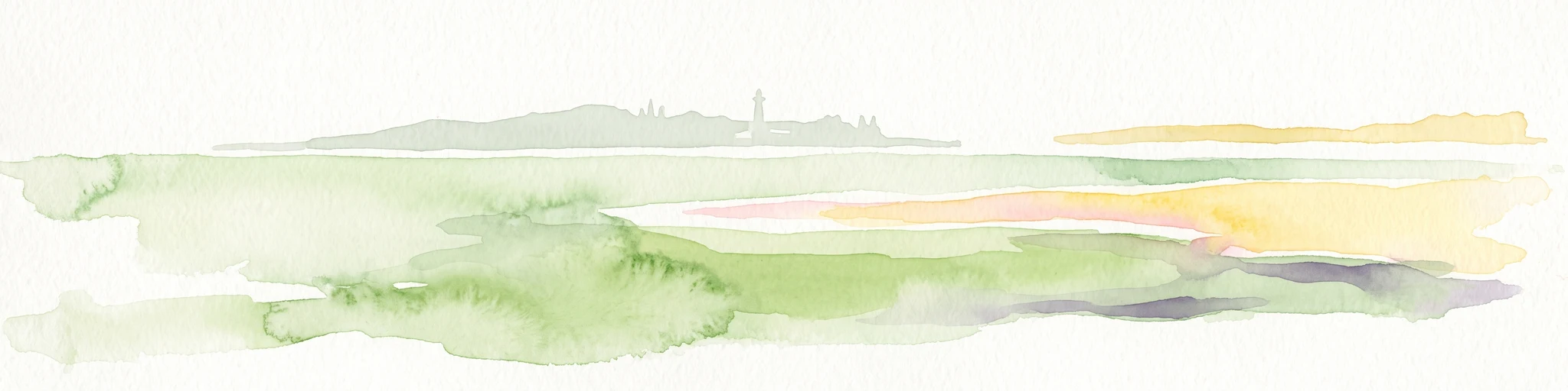
Watercolor painting of a coastal reef landscape with muted green and yellow tones against a white background, showing a distant island or reef structure with a lighthouse or tower silhouette.
Marine protected areaVeracruz
About 215 km away#4 closest

Southeast

Sistema Arrecifal Lobos-Tuxpan: Protected Marine Landscape and Regional Reef Geography

Mapping the northernmost coral reef system of the Mexican Gulf Coast.

The Sistema Arrecifal Lobos-Tuxpan marine protected area spans roughly 30,000 hectares of diverse underwater terrain off the coast of Veracruz. This complex includes the Lobos and Tuxpan polygons, which host extensive reef formations and a rare sandy cay habitat that supports significant nesting activity for marine turtles. The system remains a key focal point for understanding the limits of coral growth in the Gulf of Mexico and the broader ecological structure of the Mexican coastline.

Area
305.71 km²
Established
2009
Relief
Lowland
Climate
Tropical
National parkMexico
About 218 km away#5 closest

West

El Gogorrón National Park: National Park Protected Landscape and Geography

Mapped boundaries and regional atlas context in Mexico

El Gogorrón National Park is a protected natural area designated as a National Park within Mexico. This entry provides essential details for understanding its geographic significance, mapped boundaries, and its role in the country's conservation landscape. Discover the park's contribution to regional geography and its structured representation within the MoriAtlas exploration platform.

Area
250 km²
Established
1936
IUCN
II
Relief
Mountain
National parkHidalgo
About 227 km away#6 closest

South

El Chico National Park: National Park Boundaries and Regional Geography in Hidalgo

Explore the mapped protected landscape and terrain of this national park.

El Chico National Park is a distinct protected area offering insight into Mexico's regional geography and conservation landscapes. This page details its specific geographic footprint, the character of its natural terrain, and its place within Hidalgo's broader protected areas atlas. Users can examine mapped boundaries and understand the park's unique environmental context.

Area
27.39 km²
Established
1982
IUCN
II
Relief
Mountain
National parkMexico
About 239 km away#7 closest

Southwest

Cerro de Las Campanas National Park: Detailed Protected Landscape and Geographic Context

Explore mapped boundaries and regional atlas information for this Mexican national park.

Cerro de Las Campanas National Park is a protected national park in Mexico, offering a specific focus for geographic discovery. Users can investigate its mapped boundaries and understand how this protected area fits into the larger atlas of Mexico's natural landscapes. This page serves as an authoritative entry point for appreciating the park's unique geographic identity and its significance as a protected natural entity within the country's conservation framework.

IUCN
II
National parkQuerétaro
About 241 km away#8 closest

Southwest

El Cimatario National Park: National Park Protected Landscape in Querétaro Region

Explore mapped boundaries and regional geography.

Investigate El Cimatario National Park, a protected national park located in Querétaro, Mexico. This entry offers detailed atlas-style insights into the park's protected landscape, its geographic setting within the region, and its clearly mapped boundaries. It serves as a focused point for understanding this specific natural area's place in broader geographic and conservation mapping.

Area
24.48 km²
Established
1982
IUCN
II
Relief
Mountain

Common questions about visiting, size, designation, and location context for Sierra del Abra-Tanchipa

Sierra del Abra-Tanchipa FAQs for park facts, access, geography, and protected area context

Find quick answers about Sierra del Abra-Tanchipa, including protected-area facts, park geography, trail and visitor context, and how the park fits into its surrounding country and regional landscape.
MoriAtlas Explorer

Continue Your Protected Areas Search Across the Global Atlas

Deepen your exploration by continuing the structured search for national parks and protected areas worldwide. Utilize the comprehensive filtering capabilities to compare different conservation landscapes and refine your understanding of global park geography. Discover more about the distribution and characteristics of protected natural areas.

Global natural geography