Mori Atlas logo
National parkEl Chico National Park

Trace the mapped boundaries and understand the regional natural terrain of El Chico National Park.

El Chico National Park: National Park Geography and Protected Landscape Exploration in Hidalgo

(Parque Nacional El Chico)

El Chico National Park represents a significant protected landscape within the state of Hidalgo, Mexico. As a designated national park, it offers valuable context for understanding regional geography and mapped natural terrain. This page facilitates detailed exploration of its protected boundaries and the surrounding landscape, providing a foundation for atlas-based discovery of Mexico's conservation areas.

National ParksConifer ForestsVolcanic Rock FormationsMountain EcosystemsAncient Protected AreasGeoparks

El Chico National Park

National park

Park overview

Structured park overview, official facts, and landscape profile for El Chico National Park

El Chico National Park park facts, protected area profile, and essential visitor context
Review the core facts for El Chico National Park, including designation, size, terrain, visitor scale, habitats, and operating context in one park-focused overview.

About El Chico National Park

El Chico National Park occupies a significant position in Mexico's system of natural protected areas, representing a remarkable convergence of geological, ecological, and historical values. Located in the central portion of Hidalgo state, the park encompasses the western extreme of the Sierra de Pachuca, a mountain range of volcanic origin that forms part of the boundary between the Valley of Mexico and the more northerly regions of the country. The protection of this area began in 1898 when President Porfirio Díaz issued a decree establishing Monte Vedado del Mineral del Chico as a national forest, making it one of the first areas in Mexico to receive formal protection. Subsequent decrees in 1915 and 1922 reinforced this protection, and the area was finally designated as a national park in 1982 with an official area of 2,739 hectares. The park is administered by Mexico's National Commission of Natural Protected Areas in coordination with the Hidalgo state government, and it forms part of the larger Geoparque Comarca Minera, a UNESCO Global Geopark recognized for its exceptional geological heritage.

Quick facts and research context for El Chico National Park

El Chico National Park is located in central Mexico within Hidalgo state, spanning the municipalities of Mineral del Chico, Pachuca de Soto, and Mineral del Monte. The protected area was officially designated as a national park in 1982 but has been protected since 1898, making it one of Mexico's earliest conservation efforts. The park features elevations between 2,320 and 3,090 meters in the Sierra de Pachuca, with prominent rock formations including Las Ventanas (the highest point at 3,090 m), Peña del Cuervo, La Muela, Los Enamorados, and La Fortaleza. The area belongs to the Pánuco River hydrological basin and contains the El Cedral reservoir. It forms part of the UNESCO-designated Geoparque Comarca Minera, highlighting its geological significance.

Park context

Deeper park guide and search-rich context for El Chico National Park

El Chico National Park history, landscape, wildlife, and travel context
Explore El Chico National Park through its history, landscape character, ecosystems, wildlife, conservation priorities, cultural context, and seasonal travel timing in a structured park guide built for atlas discovery and search intent.

Why El Chico National Park stands out

El Chico National Park is best known for its exceptionally well-preserved ancient conifer forests, which represent some of the finest examples of Mexican highland woodland remaining in the country. The park's dramatic landscape features towering volcanic rock formations and steep cliffs that create a distinctive and visually striking mountainous environment. Its status as one of Mexico's oldest protected areas, with continuous forest protection since 1898, distinguishes it from many other national parks in the region. The park is also renowned for its ecological diversity, supporting significant populations of endemic plant species and serving as a critical habitat within the Sierra de Pachuca mountain system.

El Chico National Park history and protected-area timeline

The conservation history of El Chico National Park spans more than 125 years, beginning in the late 19th century when the region faced severe deforestation pressure from mining activities. During the second half of the 16th century, the mining boom in the region created enormous demand for timber to support and fortify mine workings. By the 19th century, intensive mining expansion threatened to deplete the local forests entirely. The Scientific Commission of Pachuca, which included notable figures such as Ignacio Ramírez as Minister of Development in 1861, warned of the critical situation. In response, President Porfirio Díaz issued a decree on May 10, 1898 (published June 22, 1898) establishing Monte Vedado del Mineral del Chico as a National Forest, the first such designation for the area. This protection was driven by Mexican civil engineer and botanist Miguel Ángel de Quevedo. Subsequent legal developments included a 1915 request for ejido restitution, a 1916 revocation ordering return to the town, a 1922 presidential agreement declaring it a National Forest Reserve, a 1937 declaration as a Protective Zone for Pachuca City by President Lázaro Cárdenas, a 1941 designation as a Protected Forest Zone by President Manuel Ávila Camacho, and finally the 1982 national park designation.

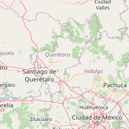
El Chico National Park landscape and geographic character

The landscape of El Chico National Park is defined by its dramatic mountainous terrain of volcanic origin, characterized by steep ridges, deep barrancas (canyons), and remarkable rock formations that create one of the most visually distinctive environments in central Mexico. The park sits at the western terminus of the Sierra de Pachuca, where the range meets the Trans-Mexican Volcanic Belt, and elevations range from 2,320 meters in the northern portions to 3,090 meters at Las Ventanas in the south. The volcanic geology produces dramatic formations including Las Ventanas, Peña del Cuervo, La Peña del Sumate, La Muela, Los Enamorados, La Fortaleza, Las Monjas, and numerous others. Large valleys such as La Orozca, Los Conejos, Las Papas, Diego Mateo, Tlaxcalita, and Las Milpas interrupt the mountainous terrain. The area is crossed by numerous springs, streams, and tributaries that form the El Milagro River system, with associated waterfalls. The hydrological basin is part of the Pánuco River system, specifically within the Moctezuma River basin.

El Chico National Park ecosystems, habitats, and plant life

The ecological character of El Chico National Park centers on extensive conifer forest ecosystems that represent some of the best-preserved examples of Mexican highland woodland. The park lies within the Province of the Meridional Serranias of the Mesoamerican Mountain Region, corresponding to the Holarctic Kingdom, and contains multiple vegetation formations including oak-fir forest, pine forest, pine-oak forest, cedar forest, and juniper thickets. The oyamel (Abies religiosa) forest covers approximately 62.9% of the park's area, distributed between 2,600 and 3,086 meters elevation and characterized by conical trees reaching 20 to 40 meters in height. The park supports significant biodiversity with more than 1,420 recorded species of plants and animals, including 52 species listed under some category of risk in Mexico's official environmental norms and 46 exotic species. Endemic species and those uncommon in Mexican forests, particularly certain Cupressus species, are notable features of the park's ecological profile.

El Chico National Park wildlife and species highlights

The wildlife community of El Chico National Park reflects the temperate humid forest environments characteristic of the Mexican highlands. Mammal diversity includes small mammals such as mice, bats, pocket gophers, rats, rabbits, and squirrels, while medium-sized mammals present include the gray fox (Urocyon cinereoargenteus), coyote (Canis latrans), cacomixtle (Bassariscus astutus), armadillo, and skunk. The gray fox is one of the most abundant mammals in the park, distributed throughout the protected area. The park's bird fauna includes species such as the golden-crowned warbler (Basileuterus belli), American robin (Turdus migratorius), towhee (Pipilo erythrophthalmus), yellow-eyed junco (Junco phaeonotus), and both western and green warblers (Dendroica occidentalis and Dendroica virens). The herpetofauna is particularly notable, with 14 amphibian and reptile species categorized under risk categories, including salamanders, frogs, the axolotl (Ambystoma Velasci), and various snakes and lizards.

El Chico National Park conservation status and protection priorities

El Chico National Park represents a conservation legacy spanning more than a century, making it one of the most enduring protected areas in Mexico and Latin America. The park's designation as part of IUCN Category II (National Park) reflects its primary objective of ecosystem conservation. Its significance extends beyond biological protection to geological importance, as it forms one of 31 geositios within the Geoparque Comarca Minera, which received UNESCO Global Geopark designation in 2017. The four geositios within the park boundaries are Las Ventanas, Peña del Cedral, and volcanic deposits. The park's ancient forests have been preserved from the widespread deforestation affecting other regions of Mexico, demonstrating the effectiveness of its long-standing protection status. The area also serves as a protective zone for the city of Pachuca, contributing to watershed protection and soil conservation in the mountainous terrain.

El Chico National Park cultural meaning and human context

El Chico National Park is situated within the cultural and geographical region of Hidalgo known as the Comarca Minera (Mining Region), historically shaped by intensive mining activity from the 16th century onward. The park's territory spans the municipalities of Mineral del Chico, Pachuca de Soto, and Mineral del Monte, each with deep ties to mining heritage. The town of Mineral del Chico, which lies within the park's boundaries, was designated as a Pueblo Mágico (Magical Town) in 2011, recognizing its cultural significance. The mining economy that once dominated the region created the original pressure that led to forest protection, as timber was essential for supporting and fortifying mine workings. Following the decline of mining in the first half of the 20th century, the local economy shifted toward alternative activities, including the traditional trade of carrying flowers to Pachuca on foot along the "Camino de las Floreras" trail.

Top sights and standout views in El Chico National Park

El Chico National Park offers a remarkable combination of ancient forest conservation, dramatic volcanic landscapes, and recreational opportunities within one of Mexico's longest-protected natural areas. The prominent rock formation of Las Ventanas stands as the park's highest point, offering panoramic views from its 3,090-meter summit. The Peña del Cuervo viewpoint provides another spectacular vantage point accessible by stone staircases. The park supports excellent conditions for rock climbing, hiking, mountain biking, and camping, with developed visitor facilities including the Visitor Center, the Alpine Hostel Miguel Hidalgo, and multiple campsites. The El Cedral reservoir provides opportunities for sport fishing and boating. The diverse forest types, particularly the extensive oyamel forests, represent ecological treasures that have been protected since the late 19th century.

Best time to visit El Chico National Park

El Chico National Park can be visited throughout the year, though each season offers distinct experiences. The summer months from June to September bring the rainy season, with the highest precipitation (up to 324 mm in September) creating lush, verdant landscapes and full waterfalls, though afternoon rains are common. Spring temperatures from March to May can be warm, with maximum averages reaching 24.5°C in April, though the park's high elevation provides relief. Winter months from December to February bring colder conditions, with minimum temperatures sometimes dropping below freezing and occasional snowfall or freezing rain, creating dramatic winter scenes. The subhumid climate means fog is common, occurring up to 20 days per month during the wet season. For most visitors, the period from October to May offers the most comfortable conditions for outdoor activities, though the park's natural beauty is apparent in every season.

Park location guide

Geography guide, regional context, and park location map for El Chico National Park

El Chico National Park park geography, regions, and map view in Mexico
Understand where El Chico National Park sits in Mexico through a broader geographic reading of the surrounding landscape, nearby location context, and its mapped position within the national park landscape.

How El Chico National Park fits into Mexico

Mexico, officially the United Mexican States, is a country in North America spanning the Sierra Madre mountain ranges, coastal plains, and tropical regions. It borders the United States to the north, Guatemala and Belize to the southeast, and has coastlines along the Pacific Ocean, Gulf of Mexico, and Caribbean Sea. With a population exceeding 130 million, Mexico is home to one of the world's most significant concentrations of Indigenous languages alongside Spanish.

Wider geography shaping El Chico National Park in Mexico

Mexico occupies a land area of 1,972,550 km2, making it the thirteenth-largest country in the world. The terrain is highly diverse, featuring the Sierra Madre Occidental and Sierra Madre Oriental mountain ranges, the Mexican Plateau, coastal lowlands along the Pacific and Gulf/Caribbean margins, and the Yucatan Peninsula. The country spans multiple climate zones from desert in the north to tropical rainforest in the south.

Map view of El Chico National Park

Use this park location map to pinpoint El Chico National Park in Mexico, understand its exact geographic position, and read its mapped placement within the surrounding landscape more clearly.

Pigeon | © OpenStreetMap contributors

Location context for El Chico National Park

Hidalgo
Park atlas

Browse the Mapped Geography and Connected Protected Landscapes Across Mexico's Highland Regions

Discover More National Parks and Protected Areas Surrounding El Chico National Park
Continue your park exploration by comparing other national parks and protected areas near El Chico National Park, extending your view across Mexico's central highlands. Trace the geographic spread of distinct conservation landscapes, from ancient conifer forests to dramatic volcanic terrains within the Sierra Madre Oriental region.
National parkMexico State

Los Remedios National Park: Protected Landscape and Historical Geography of Mexico State

Mapped terrain and cultural heritage within this unique national park.

Delve into the protected landscape of Los Remedios National Park, a national park situated in Mexico State. This page provides detailed geographic context, focusing on its volcanic terrain, mapped boundaries, and the convergence of pre-Hispanic and colonial heritage. Understand its role as a protected area within the western Valley of Mexico and explore the mapped elements that define its cultural and natural identity.

Area
4 km²
Established
1938
IUCN
II
Relief
Mountain
National parkMexico

Iztaccíhuatl, Popocatépetl National Park: Mexico's National Park Protected Area

Mapped boundaries and regional geographic context.

Iztaccíhuatl, Popocatépetl National Park is a protected natural landscape offering insight into Mexico's geography. This atlas entry focuses on the park's defined boundaries and its role within the national protected areas framework. Explore the unique geographic character and mapped extent of this significant park, understanding its position within the country's natural landscape atlas.

Area
398.19 km²
Established
1935
IUCN
II
Relief
Mountain
National parkMexico

Fuentes Brotantes de Tlalpan National Park: National Park Geographic Atlas and Terrain Exploration

Explore protected land boundaries and mapped natural landscapes.

Delve into the geographic specifics of Fuentes Brotantes de Tlalpan National Park, a protected national park situated within Mexico. This detailed view highlights the park's mapped terrain and its significance as a distinct natural landscape. Understand its role in the country's protected area network and its contribution to the broader atlas of natural geography.

Area
0.08 km²
Established
1936
IUCN
II
Relief
Upland
National parkMexico City

Desierto de los Leones National Park: Protected National Park and its Geographic Setting

Explore mapped boundaries and regional landscape context near Mexico City.

Delve into the specifics of Desierto de los Leones National Park, a designated national park recognized for its protected landscape. This MoriAtlas entry focuses on its geographic presence within the Mexico City region, providing clear insights into its mapped boundaries and the surrounding natural terrain. Understand the park's importance as a conservation area and its contribution to the regional geography through dedicated atlas data.

Area
18.67 km²
Established
1917
IUCN
II
Visitors
205K annual
National parkMexico

Cumbres del Ajusco National Park: Exploring Mexico's National Park Protected Landscape

Discover mapped boundaries and regional geography.

Cumbres del Ajusco National Park is an important national park offering rich opportunities for geographic exploration. This detailed profile focuses on its identity as a protected landscape within Mexico, providing essential context for map-based discovery. Understand the park's specific location, its mapped territory, and its role within the nation's network of conservation areas, facilitating a structured atlas view.

Area
9.2 km²
Established
1936
IUCN
II
Relief
Mountain
National parkState of Mexico

Lagunas de Zempoala National Park: Protected Landscape and Geographic Atlas Entry

Explore mapped boundaries and natural terrain context.

Lagunas de Zempoala National Park is a dedicated protected area within the State of Mexico, serving as a vital point for understanding national park geography and landscape mapping. This entry provides foundational atlas data on its protected boundaries and its specific natural terrain. It is designed for users seeking structured information on the park's geographic scope and its importance as a mapped natural landscape for regional context.

Area
47.9 km²
Established
1936
IUCN
II
Relief
Mountain
National parkMorelos

El Tepozteco National Park: Protected National Park in Morelos

Explore the mapped geography and protected landscape of this Mexican national park.

Delve into El Tepozteco National Park, a key protected area designated as a national park within the Morelos region of Mexico. This profile provides detailed insight into its mapped boundaries and its significance within the broader regional geography. It serves as a resource for understanding the park's protected landscape and its context for atlas-based geographic exploration.

Area
232.587 km²
Established
1937
IUCN
II
Relief
Mountain
National parkQuerétaro

El Cimatario National Park: National Park Protected Landscape in Querétaro Region

Explore mapped boundaries and regional geography.

Investigate El Cimatario National Park, a protected national park located in Querétaro, Mexico. This entry offers detailed atlas-style insights into the park's protected landscape, its geographic setting within the region, and its clearly mapped boundaries. It serves as a focused point for understanding this specific natural area's place in broader geographic and conservation mapping.

Area
24.48 km²
Established
1982
IUCN
II
Relief
Mountain

Common questions about visiting, size, designation, and location context for El Chico National Park

El Chico National Park FAQs for park facts, access, geography, and protected area context
Find quick answers about El Chico National Park, including protected-area facts, park geography, trail and visitor context, and how the park fits into its surrounding country and regional landscape.
MoriAtlas Explorer

Continue Your Protected Areas Search Across the Global Atlas

Deepen your exploration by continuing the structured search for national parks and protected areas worldwide. Utilize the comprehensive filtering capabilities to compare different conservation landscapes and refine your understanding of global park geography. Discover more about the distribution and characteristics of protected natural areas.

Global natural geography