

Mori Atlas logo
National parkMolino de Flores Nezahualcóyotl National Park

Discover the mapped boundaries and natural terrain of this national park in the State of Mexico.

Molino de Flores Nezahualcóyotl National Park: Protected Landscape Atlas and Geographic Context

(Parque Nacional Molino de Flores Nezahualcóyotl)

Molino de Flores Nezahualcóyotl National Park stands as a protected natural area within the State of Mexico, offering a unique landscape for geographic exploration. This dedicated page provides an atlas-style view, focusing on the park's mapped boundaries, its position within the regional geography, and the specific natural terrain it encompasses. Understand the park's identity as a conservation landscape and its significance for detailed map-based discovery.

Colonial HeritageHistoric RuinsCultural ParkFilm LocationValley of MexicoState of Mexico

Molino de Flores Nezahualcóyotl National Park

National park

Park overview

Structured park overview, official facts, and landscape profile for Molino de Flores Nezahualcóyotl National Park

Molino de Flores Nezahualcóyotl National Park park facts, protected area profile, and essential visitor context

Review the core facts for Molino de Flores Nezahualcóyotl National Park, including designation, size, terrain, visitor scale, habitats, and operating context in one park-focused overview.

About Molino de Flores Nezahualcóyotl National Park

Molino de Flores Nezahualcóyotl National Park occupies a scenic position in the eastern portion of the Valley of Mexico, within the Municipality of Texcoco. The protected area was established primarily to preserve the historic Hacienda Molino de Flores, an agricultural estate that played a significant role in the region's colonial economy. The hacienda complex includes several key structures: the main residence, the Church of San Joaquin, and the Chapel of Señor de la Presa, which stands out for its integration with the natural rock formation. The property was developed and constructed by Miguel de Cervantes and his spouse during the colonial period, establishing the architectural foundation that remains the park's central focus. Beyond its built heritage, the park encompasses surrounding agricultural lands and natural features, including the Cuxcahuaco watercourse that crosses the property. The designation as a national park in 1937 reflected Mexico's growing interest in preserving sites of historical and cultural significance alongside natural landscapes.

Quick facts and research context for Molino de Flores Nezahualcóyotl National Park

Located in the State of Mexico, east of Mexico City, this national park protects the historic Hacienda Molino de Flores and its surrounding lands. The property was developed in the colonial period by Miguel de Cervantes and his wife, reaching its peak production in the late 19th and early 20th centuries before declining after the Mexican Revolution. The hacienda was officially declared a national park in 1937, preserving its architectural heritage including the Church of San Joaquin and the rock-cut Chapel of Señor de la Presa. The park's landscape features natural springs and the Cuxcahuaco watercourse.

Protection and recognition

Verifying the terrestrial protection scope and official environmental framework.

Documented Protection Status of Molino de Flores Nezahualcóyotl National Park

National park atlas records track the terrestrial protection scope and designation history for Molino de Flores Nezahualcóyotl National Park. Reviewing documented conservation frameworks helps researchers and explorers understand regional land preservation boundaries and international recognition data.

Protection details

Protection scope
Terrestrial
Transboundary protection
No
Park context

Deeper park guide and search-rich context for Molino de Flores Nezahualcóyotl National Park

Molino de Flores Nezahualcóyotl National Park history, landscape, wildlife, and travel context

Explore Molino de Flores Nezahualcóyotl National Park through its history, landscape character, ecosystems, wildlife, conservation priorities, cultural context, and seasonal travel timing in a structured park guide built for atlas discovery and search intent.

Why Molino de Flores Nezahualcóyotl National Park stands out

The park is best known for its atmospheric colonial hacienda ruins and the distinctive Chapel of Señor de la Presa, which is built into a natural rockface. The site holds religious significance according to tradition, as the chapel was named for an apparition of Christ that reportedly occurred on the rocks bordering the Cuxcahuaco stream. The hacienda's unique architectural character and preserved state have made it a frequently used filming location for both Mexican and international films.

Molino de Flores Nezahualcóyotl National Park history and protected-area timeline

The history of Molino de Flores traces to the colonial era when the property was established as a functioning hacienda producing pulque, a traditional Mexican alcoholic beverage, as well as various grain crops. The core buildings on the site, including the main residence and the religious structures, were constructed under the direction of Miguel de Cervantes and his wife. The Chapel of Señor de la Presa holds particular historical and religious significance, named according to tradition for an apparition of Christ that allegedly appeared on the rocks along the Cuxcahuaco stream that passes through the property. The hacienda reached its period of greatest prosperity and productivity during the late 19th and early 20th centuries. Following the Mexican Revolution, the estate experienced decline and abandonment, leading to deterioration of the buildings. In 1937, President Lázaro Cárdenas declared the property a national park, recognizing its historical and cultural value. The site's distinctive architectural character, combining colonial design with its natural setting, has resulted in its use as a filming location for numerous Mexican and foreign productions.

Molino de Flores Nezahualcóyotl National Park landscape and geographic character

The park is situated in the transitional landscape between the urbanized Valley of Mexico and the surrounding volcanic highland terrain. The property encompasses the historic hacienda complex set within gently rolling hills characteristic of the eastern State of Mexico. Natural water features including the Cuxcahuaco stream traverse the property, providing moisture that historically supported agricultural production. The landscape around the built structures includes areas of former cultivated land that now form part of the protected park territory. The rock formation at the Chapel of Señor de la Presa represents a notable geological feature within the park, with the chapel constructed directly into the natural cliff face in a style that echoes pre-Hispanic architectural traditions seen at sites like Malinalco.

Molino de Flores Nezahualcóyotl National Park ecosystems, habitats, and plant life

The park's natural environment reflects the modified agricultural landscape of the Valley of Mexico region, characterized by temperate conditions and historically extensive cultivation. The presence of the Cuxcahuaco stream and associated moisture zones supports riparian vegetation along the watercourse. The surrounding lands, once part of the hacienda's agricultural operations, now exist in a semi-natural state that reflects both historical land use and subsequent ecological succession. While not primarily designated for biodiversity protection, the park provides habitat for common bird species and small wildlife typical of the central Mexican highland environment.

Molino de Flores Nezahualcóyotl National Park wildlife and species highlights

Wildlife presence within the park reflects the temperate agricultural and semi-urban landscape of the State of Mexico region. Common bird species found in the area include various passerines adapted to modified habitats, while small mammals such as rodents and rabbits inhabit the surrounding terrain. The riparian zone along the Cuxcahuaco stream provides habitat for waterfowl and other bird species associated with wetland edges. The park's proximity to both agricultural lands and natural areas supports a moderate diversity of species typical of central Mexican foothills.

Molino de Flores Nezahualcóyotl National Park conservation status and protection priorities

Molino de Flores Nezahualcóyotl was established as a national park primarily to protect its significant colonial architectural heritage rather than specific ecological values. The 1937 designation by President Lázaro Cárdenas reflected Mexico's emerging approach to preserving sites of combined historical and natural significance. The park represents one of the earlier examples of heritage conservation within Mexico's protected area system, recognizing that cultural landscapes warrant protection alongside pristine natural environments. Ongoing conservation efforts focus on maintaining the structural integrity of the historic buildings while allowing public access to appreciate the site's cultural and historical value.

Molino de Flores Nezahualcóyotl National Park cultural meaning and human context

The park is deeply connected to the colonial history of the State of Mexico and the broader Valley of Mexico region. The hacienda system represented a key institution in colonial-era agriculture, and Molino de Flores exemplifies this economic and social structure through its production of pulque and grains. The religious architecture on site, particularly the Church of San Joaquin and the rock-cut Chapel of Señor de la Presa, reflects the fusion of Catholic institutional presence with local traditions and natural settings. The naming of the chapel after a reported Christ apparition demonstrates the religious significance the site held for local communities. The subsequent use of the hacienda as a film set has created an additional layer of cultural association, with the atmospheric ruins serving as a backdrop for Mexican cinema.

Top sights and standout views in Molino de Flores Nezahualcóyotl National Park

The historic hacienda ruins, including the Church of San Joaquin and the rock-built Chapel of Señor de la Presa; the colonial architectural character that has made the site a popular filming location; the traditional pulque-producing estate with roots in the colonial period; the scenic setting in the eastern Valley of Mexico near Texcoco; and the 1937 presidential declaration establishing the protected area. The park offers a distinctive combination of cultural heritage and natural setting that distinguishes it from Mexico's primarily ecological national parks.

Best time to visit Molino de Flores Nezahualcóyotl National Park

The park can be visited year-round given its location in the temperate climate of central Mexico. The dry season from November through April generally offers more comfortable conditions for exploring the outdoor site, with lower chances of rainfall affecting visibility or access to outdoor areas. The spring months often bring favorable conditions with mild temperatures, though the summer rainy season from June through September can add visual interest to the landscape with lush vegetation along the stream and surrounding areas. Visitors interested in the film heritage of the site may find the dry season more suitable for extended exploration of the grounds.
Monthly climate preview

Long-term temperature ranges and precipitation patterns recorded at high elevation

Molino de Flores Nezahualcóyotl National Park Climate Normals and Weather by Month

Representative coordinates document measured long-term temperature swings and monthly precipitation rhythms across the protected terrain. Access the full twelve-month climate profile to examine complete temperature averages and detailed precipitation records for Molino de Flores Nezahualcóyotl National Park.
Annual mean13 °C
10 °C17 °C
Jan10°
Feb12°
Mar14°
Apr16°
May17°
Jun16°
Jul15°
Aug14°
Sep14°
Oct13°
Nov11°
Dec10°
Warmest month
May

16.8 °C

Coolest month
January

10.1 °C

Wettest month
September

5.8 mm/day

Driest month
December

0.4 mm/day

Park location guide

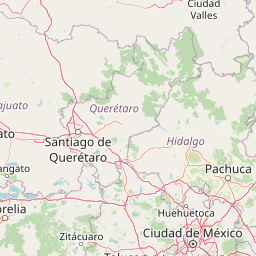
Geography guide, regional context, and park location map for Molino de Flores Nezahualcóyotl National Park

Molino de Flores Nezahualcóyotl National Park park geography, regions, and map view in Mexico

Understand where Molino de Flores Nezahualcóyotl National Park sits in Mexico through a broader geographic reading of the surrounding landscape, nearby location context, and its mapped position within the national park landscape.

How Molino de Flores Nezahualcóyotl National Park fits into Mexico

Mexico, officially the United Mexican States, is a country in North America spanning the Sierra Madre mountain ranges, coastal plains, and tropical regions. It borders the United States to the north, Guatemala and Belize to the southeast, and has coastlines along the Pacific Ocean, Gulf of Mexico, and Caribbean Sea. With a population exceeding 130 million, Mexico is home to one of the world's most significant concentrations of Indigenous languages alongside Spanish.

Wider geography shaping Molino de Flores Nezahualcóyotl National Park in Mexico

Mexico occupies a land area of 1,972,550 km2, making it the thirteenth-largest country in the world. The terrain is highly diverse, featuring the Sierra Madre Occidental and Sierra Madre Oriental mountain ranges, the Mexican Plateau, coastal lowlands along the Pacific and Gulf/Caribbean margins, and the Yucatan Peninsula. The country spans multiple climate zones from desert in the north to tropical rainforest in the south.

Map view of Molino de Flores Nezahualcóyotl National Park

Use this park location map to pinpoint Molino de Flores Nezahualcóyotl National Park in Mexico, understand its exact geographic position, and read its mapped placement within the surrounding landscape more clearly.

Pigeon | © OpenStreetMap contributors

Location context for Molino de Flores Nezahualcóyotl National Park

State of MexicoTexcoco Municipality
Park atlas

Discover other protected landscapes across the State of Mexico, tracing regional park geography.

Explore Nearby National Parks and Protected Areas Beyond Molino de Flores Nezahualcóyotl National Park

Explore national parks and protected areas geographically near Molino de Flores Nezahualcóyotl National Park, spanning diverse landscapes and cultural heritage sites within the State of Mexico. Compare their unique conservation characteristics, historical significance, and natural settings to gain broader insight into regional protected area geography.
Protected landscapeEstado de México
About 16 km away#1 closest

West

Parque Ecológico Lago de Texcoco: Mapped Protected Landscape and Regional Geography

A large-scale wetland and ecological restoration project in the Valley of Mexico.

Parque Ecológico Lago de Texcoco stands as a significant protected landscape, transforming a drained lacustrine basin into a vibrant mosaic of saline vegetation and water regulation zones. As an internationally recognized Ramsar wetland and Important Bird Area, the site offers a deep look into the ecological recovery of the Valley of Mexico. The terrain is defined by its flat basin character, ancient archaeological remnants on elevated hill areas, and a expansive network of restored water systems.

Area
140 km²
Established
2024
Relief
Lowland
Climate
Temperate
National parkMexico
About 28 km away#2 closest

West

El Tepeyac National Park: Protected National Park Landscape and Regional Geography

Explore mapped boundaries and the park's geographic context.

Gain a detailed understanding of El Tepeyac National Park, a protected national park situated within Mexico. This entry provides essential geographic context, focusing on its mapped boundaries and its role as a protected landscape. It is designed to support users interested in the atlas-level exploration of natural areas, offering foundational information about the park's identity and its position within the broader geographic framework of Mexico.

Area
15 km²
Established
1937
IUCN
VI
Relief
Upland
National parkMexico City
About 32 km away#3 closest

Southwest

Cerro de la Estrella National Park: Mapped Protected Landscape and Regional Geography

Explore the national park's mapped boundaries within Mexico City.

Cerro de la Estrella National Park represents a key protected area for geographic study and atlas exploration within the urban landscape of Mexico City. This entry provides detailed insight into the park's mapped boundaries and its role as a national park, highlighting its unique protected landscape character. Understand its position within the regional geography and explore what makes this park an important feature for mapped terrain and conservation awareness.

Area
1.5 km²
Established
1938
IUCN
II
Relief
Mixed relief
National parkMexico
About 36 km away#4 closest

Southeast

Iztaccíhuatl, Popocatépetl National Park: Mexico's National Park Protected Area

Mapped boundaries and regional geographic context.

Iztaccíhuatl, Popocatépetl National Park is a protected natural landscape offering insight into Mexico's geography. This atlas entry focuses on the park's defined boundaries and its role within the national protected areas framework. Explore the unique geographic character and mapped extent of this significant park, understanding its position within the country's natural landscape atlas.

Area
398.19 km²
Established
1935
IUCN
II
Relief
Mountain
National parkState of Mexico
About 43 km away#5 closest

South

Sacromonte National Park: National Park Atlas and Protected Landscape Exploration

Discover mapped boundaries and regional geographic context.

Investigate Sacromonte National Park as a key protected area within Mexico's State of Mexico. This detailed view provides insight into its designation as a national park, emphasizing its geographic setting and the characteristics of its protected landscape. Users interested in atlas-style discovery will find information that clarifies the park's physical presence and regional importance, facilitating a deeper understanding of its mapped terrain.

Area
0.44 km²
Established
1952
IUCN
II
Scope
Terrestrial
National parkMexico State
About 44 km away#6 closest

West

Los Remedios National Park: Protected Landscape and Historical Geography of Mexico State

Mapped terrain and cultural heritage within this unique national park.

Delve into the protected landscape of Los Remedios National Park, a national park situated in Mexico State. This page provides detailed geographic context, focusing on its volcanic terrain, mapped boundaries, and the convergence of pre-Hispanic and colonial heritage. Understand its role as a protected area within the western Valley of Mexico and explore the mapped elements that define its cultural and natural identity.

Area
4 km²
Established
1938
IUCN
II
Relief
Mountain
National parkMexico
About 44 km away#7 closest

Southwest

Fuentes Brotantes de Tlalpan National Park: National Park Geographic Atlas and Terrain Exploration

Explore protected land boundaries and mapped natural landscapes.

Delve into the geographic specifics of Fuentes Brotantes de Tlalpan National Park, a protected national park situated within Mexico. This detailed view highlights the park's mapped terrain and its significance as a distinct natural landscape. Understand its role in the country's protected area network and its contribution to the broader atlas of natural geography.

Area
0.08 km²
Established
1936
IUCN
II
Relief
Upland
National parkMexico City
About 54 km away#8 closest

Southwest

Desierto de los Leones National Park: Protected National Park and its Geographic Setting

Explore mapped boundaries and regional landscape context near Mexico City.

Delve into the specifics of Desierto de los Leones National Park, a designated national park recognized for its protected landscape. This MoriAtlas entry focuses on its geographic presence within the Mexico City region, providing clear insights into its mapped boundaries and the surrounding natural terrain. Understand the park's importance as a conservation area and its contribution to the regional geography through dedicated atlas data.

Area
18.67 km²
Established
1917
IUCN
II
Visitors
205K annual

Common questions about visiting, size, designation, and location context for Molino de Flores Nezahualcóyotl National Park

Molino de Flores Nezahualcóyotl National Park FAQs for park facts, access, geography, and protected area context

Find quick answers about Molino de Flores Nezahualcóyotl National Park, including protected-area facts, park geography, trail and visitor context, and how the park fits into its surrounding country and regional landscape.
MoriAtlas Explorer

Continue Your Protected Areas Search Across the Global Atlas

Deepen your exploration by continuing the structured search for national parks and protected areas worldwide. Utilize the comprehensive filtering capabilities to compare different conservation landscapes and refine your understanding of global park geography. Discover more about the distribution and characteristics of protected natural areas.

Global natural geography