
Mori Atlas logo
Protected areaZona Protectora Forestal Vedada Cuenca Hidrográfica del Río Necaxa

Explore the forested mountain watersheds, river canyons, and hydroelectric reservoirs of this Sierra Madre protected area.

Zona Protectora Forestal Vedada Cuenca Hidrográfica del Río Necaxa: Mapped Protected Geography

Zona Protectora Forestal Vedada Cuenca Hidrográfica del Río Necaxa encompasses a dramatic stretch of the Sierra Madre Oriental, defined by steep mountain slopes, narrow river canyons, and an integrated system of hydroelectric reservoirs. This protected area plays a crucial role in water capture and soil stability for central Mexico, balancing ecological conservation within high-altitude forests and vital renewable energy infrastructure. Through mapped terrain analysis and regional geographic context, users can trace the hydrological importance of this historic protected zone across its canyon-carved landscape.

protected watershedSierra Madre Orientalhydroelectric reservoirsforest protectionRamsar wetlandcloud forest
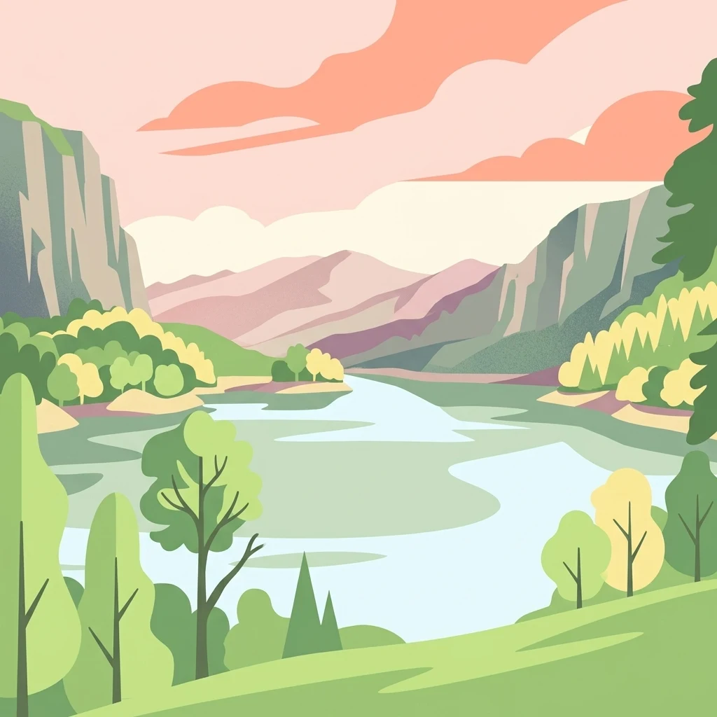
A colorful flat illustration showing a wide river winding through a forested valley flanked by rocky cliffs under a soft sunset sky.

Zona Protectora Forestal Vedada Cuenca Hidrográfica del Río Necaxa

Protected area

Park overview

Structured park overview, official facts, and landscape profile for Zona Protectora Forestal Vedada Cuenca Hidrográfica del Río Necaxa

Zona Protectora Forestal Vedada Cuenca Hidrográfica del Río Necaxa park facts, protected area profile, and essential visitor context

Review the core facts for Zona Protectora Forestal Vedada Cuenca Hidrográfica del Río Necaxa, including designation, size, terrain, visitor scale, habitats, and operating context in one park-focused overview.

About Zona Protectora Forestal Vedada Cuenca Hidrográfica del Río Necaxa

Zona Protectora Forestal Vedada Cuenca Hidrográfica del Río Necaxa is a forested watershed reserve in the Sierra Madre Oriental of eastern Mexico, focused on safeguarding the forests and water resources of the Necaxa River basin. Spanning parts of Hidalgo and Puebla, the protected area captures one of the most strategically important headwaters in central Mexico, supplying both ecological function and hydroelectric energy to the country's central region. The terrain is shaped by steep mountain ridges and deep canyons that have long made the area suitable for hydropower development.

The reserve evolved from an early conservation and energy strategy. First decreed in 1938 as a forest protection zone, its purpose was to preserve the basin's vegetative cover, stabilize soil, regulate river flow, and ensure reliable hydroelectric generation. By 2002 the area was reclassified as a natural resources protection area under modern Mexican environmental law, broadening its mandate beyond timber and water protection to include ecosystem and biodiversity conservation.

Ecologically, the watershed combines montane and cloud forest habitats with aquatic environments created by the series of dams constructed on the Necaxa River and its tributaries. The combination of intact forest cover, flowing mountain rivers, and reservoir wetlands supports rich birdlife and important amphibian populations, including the endemic Puebla frog. The area therefore functions simultaneously as a forest reserve, a water production zone, a hydroelectric asset, and a wetland of international significance.

Quick facts and research context for Zona Protectora Forestal Vedada Cuenca Hidrográfica del Río Necaxa

Zona Protectora Forestal Vedada Cuenca Hidrográfica del Río Necaxa lies in the Sierra Madre Oriental of eastern Mexico, straddling the states of Hidalgo and Puebla. It protects part of the Necaxa River basin, which gives rise to the Tecolutla River and ultimately drains into the Gulf of Mexico. The protected area covers approximately 421 square kilometers of forested mountain terrain and includes five artificial reservoirs used for hydroelectric generation.

The zone was first decreed as a protected forest area by President Lázaro Cárdenas in 1938 and later re-designated in 2002 as a natural resources protection area under Mexico's environmental framework. The five reservoirs within the basin were designated a Ramsar Wetland of International Importance in 2008, reflecting the area's significance for waterbirds and aquatic habitat. Administration falls under Mexico's National Commission of Natural Protected Areas.

Protection and recognition

Review the documented terrestrial protection scope and established designation year for this reserve.

Zona Protectora Forestal Vedada Cuenca Hidrográfica del Río Necaxa Protection Status and Designation History

Territorial protection status for Zona Protectora Forestal Vedada Cuenca Hidrográfica del Río Necaxa outlines a designated terrestrial scope established in 2002. Structured conservation records provide historical designation context without external international recognition sources.

Protection details

Protection scope
Terrestrial
Designated year
2002
Transboundary protection
No
Park context

Deeper park guide and search-rich context for Zona Protectora Forestal Vedada Cuenca Hidrográfica del Río Necaxa

Zona Protectora Forestal Vedada Cuenca Hidrográfica del Río Necaxa history, landscape, wildlife, and travel context

Explore Zona Protectora Forestal Vedada Cuenca Hidrográfica del Río Necaxa through its history, landscape character, ecosystems, wildlife, conservation priorities, cultural context, and seasonal travel timing in a structured park guide built for atlas discovery and search intent.

Why Zona Protectora Forestal Vedada Cuenca Hidrográfica del Río Necaxa stands out

The reserve is best known for protecting the forested upper watershed that feeds one of Mexico's most important hydroelectric reservoir systems. Its mosaic of cloud forest, pine forest, canyon rivers, and reservoir wetlands defines the ecological character of the protected zone. The site is also recognized for its international wetland designation, with the chain of reservoirs serving as habitat for herons, egrets, cormorants, and kingfishers. The combination of protected forests, river canyons, and large reservoirs gives the area a distinctive profile among Mexico's natural resources protection areas.
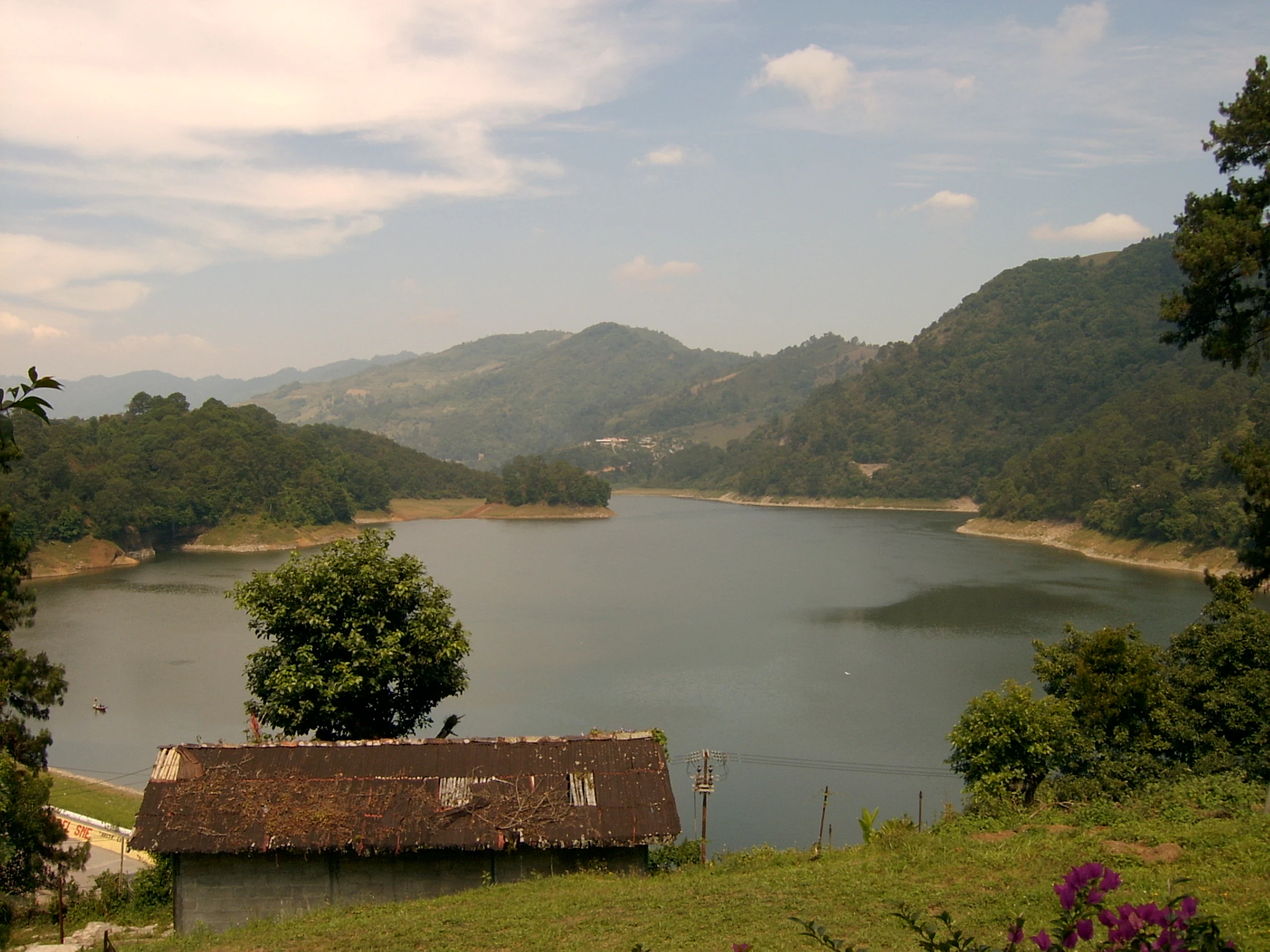
A wide shot showing a large reservoir created by the Necaxa River, surrounded by rolling, forest-covered mountains under a partly cloudy sky. A small, simple structure with a dark roof sits in the foreground.
A scenic view of the Necaxa River basin, highlighting the forested slopes and hydroelectric reservoir that define the area.

Zona Protectora Forestal Vedada Cuenca Hidrográfica del Río Necaxa history and protected-area timeline

The history of the Zona Protectora Forestal Vedada Cuenca Hidrográfica del Río Necaxa is closely tied to the development of hydroelectric power in central Mexico. The river's potential was recognized in the late nineteenth century, with major dam construction projects beginning around 1890. Over the following decades, a system of reservoirs was built across the Necaxa basin and its tributaries, including the Necaxa, El Tejocotal, Los Reyes, Nexapa, and Tenango dams, collectively storing large volumes of water for power generation.

On 20 October 1938, President Lázaro Cárdenas signed a decree establishing the Necaxa river basin in Hidalgo and Puebla as a protected forest zone. The decree aimed to preserve the basin's forests and microclimate, prevent soil erosion, regulate the rivers' flow, and ensure the long-term security of hydroelectric production. This made the Necaxa basin one of the earliest modern forest protection initiatives in Mexico, predating the country's broader environmental legislation.

In 2002, the Mexican government updated the area's designation, reclassifying it as a natural resources protection area with a more comprehensive conservation mandate. Then, on 2 February 2008, the five reservoirs within the basin were formally designated a Ramsar Wetland of International Importance, recognizing the basin's ecological and hydrological significance at a global scale.

Zona Protectora Forestal Vedada Cuenca Hidrográfica del Río Necaxa landscape and geographic character

The protected area occupies a dramatic section of the Sierra Madre Oriental, where the Necaxa River and its tributaries descend through high, forested mountains. The watershed is characterized by steep ridges, narrow canyons, and abrupt elevations that have shaped both the river's course and human use of the area. The river, which begins south of Huauchinango under the name Totolapa, drops into the deep ravines of the Sierra Norte de Puebla, producing waterfalls known as Salto Chico and Salto Grande.

Within these mountains, the landscape includes a network of artificial reservoirs created by the Necaxa hydroelectric system. These reservoirs interrupt the flow of the river, creating broad stretches of standing water surrounded by forested slopes. The combination of natural canyons, forested mountains, and engineered reservoirs gives the protected area a varied and visually striking profile, dominated by forested slopes rather than open peaks or plains.

Zona Protectora Forestal Vedada Cuenca Hidrográfica del Río Necaxa ecosystems, habitats, and plant life

The vegetation of the basin reflects the altitudinal and climatic gradients of the Sierra Madre Oriental. Lower montane forests, mid-elevation pine-oak stands, and humid cloud forest communities all contribute to the area's plant diversity. The watersheds are heavily forested, which is the very reason the area was originally protected: dense tree cover stabilizes the steep slopes, regulates runoff, filters water, and sustains the rivers that feed the reservoir system.

The Mexican tree fern Cyathea mexicana, an endangered species, occurs here, indicating the presence of humid and shaded microhabitats characteristic of cloud forest transitions. Aquatic and wetland habitats add a parallel ecological layer, with reservoir margins, inflowing streams, and riparian corridors supporting distinctive plant communities adapted to fluctuating water levels.

Zona Protectora Forestal Vedada Cuenca Hidrográfica del Río Necaxa wildlife and species highlights

The Necaxa basin is of particular importance for waterbirds, especially around the reservoirs and along the river corridors. The reservoir system is home to great egrets, snowy egrets, little blue herons, neotropic cormorants, ringed kingfishers, and green kingfishers, making the area a notable inland waterbird habitat in central Mexico. The combination of forested shore margins and open water provides feeding, resting, and nesting conditions for these species.

Among amphibians, the Puebla frog (Lithobates pueblae), an endangered species, inhabits the river and its basin. The continued presence of such range-restricted species underscores the role of protected forests and clean flowing water in supporting freshwater biodiversity. While the area is not primarily known for large mammals, the forested terrain provides habitat for typical Sierra Madre Oriental fauna, supporting regional ecological connectivity.

Zona Protectora Forestal Vedada Cuenca Hidrográfica del Río Necaxa conservation status and protection priorities

The conservation significance of this protected area lies in its role as a forested headwater landscape that secures water quantity and quality for a substantial part of central Mexico. Originally established to protect watershed function for hydroelectric generation, it has evolved into a broader conservation zone that recognizes forests, rivers, and reservoirs as a single integrated ecosystem. Maintaining forest cover on the steep slopes directly controls erosion and sedimentation in the reservoirs, which is essential to the long-term viability of the hydroelectric system.

The 2008 Ramsar designation of the reservoirs as a wetland of international importance gave the basin additional international visibility, acknowledging its importance for migratory and resident waterbirds and for wetland-dependent biodiversity. Today, the protected area is administered under the National Commission of Natural Protected Areas, and its conservation strategy links forest protection, sustainable resource use, biodiversity preservation, and energy infrastructure in one management framework.

Zona Protectora Forestal Vedada Cuenca Hidrográfica del Río Necaxa cultural meaning and human context

The Necaxa basin lies within the cultural landscape of the Sierra Norte de Puebla, a region historically inhabited by Nahua communities and characterized by deep connections to mountain watercourses. The rivers and waterfalls of the basin, including the famed Salto Chico and Salto Grande, are part of local identity and traditional knowledge, even though the modern reserve is primarily defined by its environmental and energy-related functions.

The hydroelectric development of the late nineteenth and twentieth centuries transformed the region economically and demographically, linking a remote mountain zone to the broader industrial and urban development of central Mexico. Today, the basins, dams, and forests form a shared regional heritage that blends indigenous landscape traditions with modern infrastructure and conservation policy.

Top sights and standout views in Zona Protectora Forestal Vedada Cuenca Hidrográfica del Río Necaxa

A protected mountain watershed at the headwaters of the Necaxa River, surrounded by steep canyons of the Sierra Madre Oriental.

Home to a chain of five hydroelectric reservoirs that are both engineering landmarks and internationally recognized wetlands.

One of Mexico's oldest forest protection initiatives, originally decreed in 1938 and refreshed in 2002.

Important habitat for waterbirds such as egrets, herons, kingfishers, and neotropic cormorants, as well as the endangered Puebla frog.

Best time to visit Zona Protectora Forestal Vedada Cuenca Hidrográfica del Río Necaxa

The ecological character of the protected area changes with the seasons in ways that affect both scenery and wildlife observation. The rainy season, generally from late spring through early autumn, brings higher water levels in the reservoirs and rivers, fuller waterfalls, and lush green forest cover. Cooler, drier months from late autumn into early spring offer clearer views of the canyon landscapes, more comfortable hiking conditions in the forested terrain, and excellent waterbird observation along the reservoir margins. Visiting during drier months can also make the network of dams and reservoirs easier to view as integrated landscape features.
Monthly climate preview

Long-term temperature and monthly precipitation patterns for Puebla

Zona Protectora Forestal Vedada Cuenca Hidrográfica del Río Necaxa Climate Normals

Historical climate records for Zona Protectora Forestal Vedada Cuenca Hidrográfica del Río Necaxa indicate distinct annual temperature ranges and varying monthly precipitation averages across the protected terrain. Analyzing the full twelve-month dataset provides a comprehensive climate profile for this regional conservation zone in Puebla.
Annual mean15 °C
11 °C18 °C
Jan11°
Feb13°
Mar15°
Apr18°
May18°
Jun18°
Jul16°
Aug16°
Sep16°
Oct14°
Nov12°
Dec12°
Warmest month
May

18.3 °C

Coolest month
January

11.1 °C

Wettest month
September

6.7 mm/day

Driest month
December

0.7 mm/day

Park location guide

Geography guide, regional context, and park location map for Zona Protectora Forestal Vedada Cuenca Hidrográfica del Río Necaxa

Zona Protectora Forestal Vedada Cuenca Hidrográfica del Río Necaxa park geography, regions, and map view in Mexico

Understand where Zona Protectora Forestal Vedada Cuenca Hidrográfica del Río Necaxa sits in Mexico through a broader geographic reading of the surrounding landscape, nearby location context, and its mapped position within the national park landscape.

How Zona Protectora Forestal Vedada Cuenca Hidrográfica del Río Necaxa fits into Mexico

Mexico, officially the United Mexican States, is a country in North America spanning the Sierra Madre mountain ranges, coastal plains, and tropical regions. It borders the United States to the north, Guatemala and Belize to the southeast, and has coastlines along the Pacific Ocean, Gulf of Mexico, and Caribbean Sea. With a population exceeding 130 million, Mexico is home to one of the world's most significant concentrations of Indigenous languages alongside Spanish.

Wider geography shaping Zona Protectora Forestal Vedada Cuenca Hidrográfica del Río Necaxa in Mexico

Mexico occupies a land area of 1,972,550 km2, making it the thirteenth-largest country in the world. The terrain is highly diverse, featuring the Sierra Madre Occidental and Sierra Madre Oriental mountain ranges, the Mexican Plateau, coastal lowlands along the Pacific and Gulf/Caribbean margins, and the Yucatan Peninsula. The country spans multiple climate zones from desert in the north to tropical rainforest in the south.

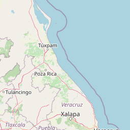
Map view of Zona Protectora Forestal Vedada Cuenca Hidrográfica del Río Necaxa

Use this park location map to pinpoint Zona Protectora Forestal Vedada Cuenca Hidrográfica del Río Necaxa in Mexico, understand its exact geographic position, and read its mapped placement within the surrounding landscape more clearly.

Pigeon | © OpenStreetMap contributors

Location context for Zona Protectora Forestal Vedada Cuenca Hidrográfica del Río Necaxa

HidalgoPuebla

Visual exploration of mountain forests, river canyons, and hydroelectric reservoirs.

Zona Protectora Forestal Vedada Cuenca Hidrografica del Rio Necaxa Photos and Landscape Views

Visual documentation captures the steep mountain slopes, cloud forest vegetation, and engineered reservoir networks defining the protected watershed. Photographic records reveal the dramatic topography of the Sierra Madre Oriental and the diverse habitats supporting regional wildlife.

A wide shot showing a large reservoir created by the Necaxa River, surrounded by rolling, forest-covered mountains under a partly cloudy sky. A small, simple structure with a dark roof sits in the foreground.

A wide shot of a large lake or reservoir surrounded by rolling green hills and dense forests under a cloudy sky, with a small building in the foreground.

Park atlas

Compare adjacent mountain reserves and protected watersheds in the surrounding region.

Parks Near Zona Protectora Forestal Vedada Cuenca Hidrográfica del Río Necaxa

Browsing other protected areas near Zona Protectora Forestal Vedada Cuenca Hidrográfica del Río Necaxa reveals related forest reserves and mountain ecosystems. Comparing adjacent watersheds provides broader geographic context for the natural features of the Sierra Madre Oriental.
National parkHidalgo
About 70 km away#1 closest

West

El Chico National Park: National Park Boundaries and Regional Geography in Hidalgo

Explore the mapped protected landscape and terrain of this national park.

El Chico National Park is a distinct protected area offering insight into Mexico's regional geography and conservation landscapes. This page details its specific geographic footprint, the character of its natural terrain, and its place within Hidalgo's broader protected areas atlas. Users can examine mapped boundaries and understand the park's unique environmental context.

Area
27.39 km²
Established
1982
IUCN
II
Relief
Mountain
National parkTlaxcala
About 104 km away#2 closest

South

La Malinche National Park: Protected Landscape and Regional Geography in Tlaxcala

Explore mapped boundaries and natural terrain.

La Malinche National Park is a vital protected landscape offering rich insights into regional geography and natural terrain. This canonical entry provides focused details on the park's protected area identity, its mapped geographic scope within Tlaxcala, and its place in the broader atlas of Mexican conservation lands. Understand the specific landscape characteristics and geographic context that define this significant national park.

Established
1938
IUCN
II
Relief
Mountain
Access
Moderate access
National parkState of Mexico
About 109 km away#3 closest

Southwest

Molino de Flores Nezahualcóyotl National Park: National Park Protected Landscape Exploration

Mapped geographic context within the State of Mexico.

Access structured details about Molino de Flores Nezahualcóyotl National Park, a significant protected area designated as a national park. This entry focuses on its role as a mapped landscape, providing essential geographic context for understanding its boundaries and natural terrain. Discover how this protected area contributes to the broader atlas of conservation lands in the region.

Area
0.49 km²
Established
1937
IUCN
II
Visitors
10K annual
National parkMexico
About 119 km away#4 closest

Southeast

Cofre de Perote National Park: A National Park within Mexico's Geographic Atlas

Explore its protected landscape and regional map context.

Cofre de Perote National Park is a vital protected area within Mexico, offering a unique national park designation. This entry focuses on its geographic significance, mapping its boundaries and situating it within the country's broader protected lands. Users can explore the park's landscape identity and its atlas-relevant features, providing a factual basis for understanding its role in Mexico's natural heritage.

Established
1937
IUCN
II
Relief
Mountain
Climate
Alpine
National parkMexico
About 120 km away#5 closest

Southwest

Iztaccíhuatl, Popocatépetl National Park: Mexico's National Park Protected Area

Mapped boundaries and regional geographic context.

Iztaccíhuatl, Popocatépetl National Park is a protected natural landscape offering insight into Mexico's geography. This atlas entry focuses on the park's defined boundaries and its role within the national protected areas framework. Explore the unique geographic character and mapped extent of this significant park, understanding its position within the country's natural landscape atlas.

Area
398.19 km²
Established
1935
IUCN
II
Relief
Mountain
Watercolor painting depicting a flat wetland landscape with green grasses in the foreground and soft purple and green rolling hills in the background under a pale sky.
Protected landscapeEstado de México
About 122 km away#6 closest

Southwest

Parque Ecológico Lago de Texcoco: Mapped Protected Landscape and Regional Geography

A large-scale wetland and ecological restoration project in the Valley of Mexico.

Parque Ecológico Lago de Texcoco stands as a significant protected landscape, transforming a drained lacustrine basin into a vibrant mosaic of saline vegetation and water regulation zones. As an internationally recognized Ramsar wetland and Important Bird Area, the site offers a deep look into the ecological recovery of the Valley of Mexico. The terrain is defined by its flat basin character, ancient archaeological remnants on elevated hill areas, and a expansive network of restored water systems.

Area
140 km²
Established
2024
Relief
Lowland
Climate
Temperate
National parkMexico
About 132 km away#7 closest

Southwest

El Tepeyac National Park: Protected National Park Landscape and Regional Geography

Explore mapped boundaries and the park's geographic context.

Gain a detailed understanding of El Tepeyac National Park, a protected national park situated within Mexico. This entry provides essential geographic context, focusing on its mapped boundaries and its role as a protected landscape. It is designed to support users interested in the atlas-level exploration of natural areas, offering foundational information about the park's identity and its position within the broader geographic framework of Mexico.

Area
15 km²
Established
1937
IUCN
VI
Relief
Upland
Watercolor painting of a coastal reef landscape with muted green and yellow tones against a white background, showing a distant island or reef structure with a lighthouse or tower silhouette.
Marine protected areaVeracruz
About 134 km away#8 closest

Northeast

Sistema Arrecifal Lobos-Tuxpan: Protected Marine Landscape and Regional Reef Geography

Mapping the northernmost coral reef system of the Mexican Gulf Coast.

The Sistema Arrecifal Lobos-Tuxpan marine protected area spans roughly 30,000 hectares of diverse underwater terrain off the coast of Veracruz. This complex includes the Lobos and Tuxpan polygons, which host extensive reef formations and a rare sandy cay habitat that supports significant nesting activity for marine turtles. The system remains a key focal point for understanding the limits of coral growth in the Gulf of Mexico and the broader ecological structure of the Mexican coastline.

Area
305.71 km²
Established
2009
Relief
Lowland
Climate
Tropical

Common questions about visiting, size, designation, and location context for Zona Protectora Forestal Vedada Cuenca Hidrográfica del Río Necaxa

Zona Protectora Forestal Vedada Cuenca Hidrográfica del Río Necaxa FAQs for park facts, access, geography, and protected area context

Find quick answers about Zona Protectora Forestal Vedada Cuenca Hidrográfica del Río Necaxa, including protected-area facts, park geography, trail and visitor context, and how the park fits into its surrounding country and regional landscape.
MoriAtlas Explorer

Continue Your Protected Areas Search Across the Global Atlas

Deepen your exploration by continuing the structured search for national parks and protected areas worldwide. Utilize the comprehensive filtering capabilities to compare different conservation landscapes and refine your understanding of global park geography. Discover more about the distribution and characteristics of protected natural areas.

Global natural geography